(Click on photos to see big.)
Day 1/4:
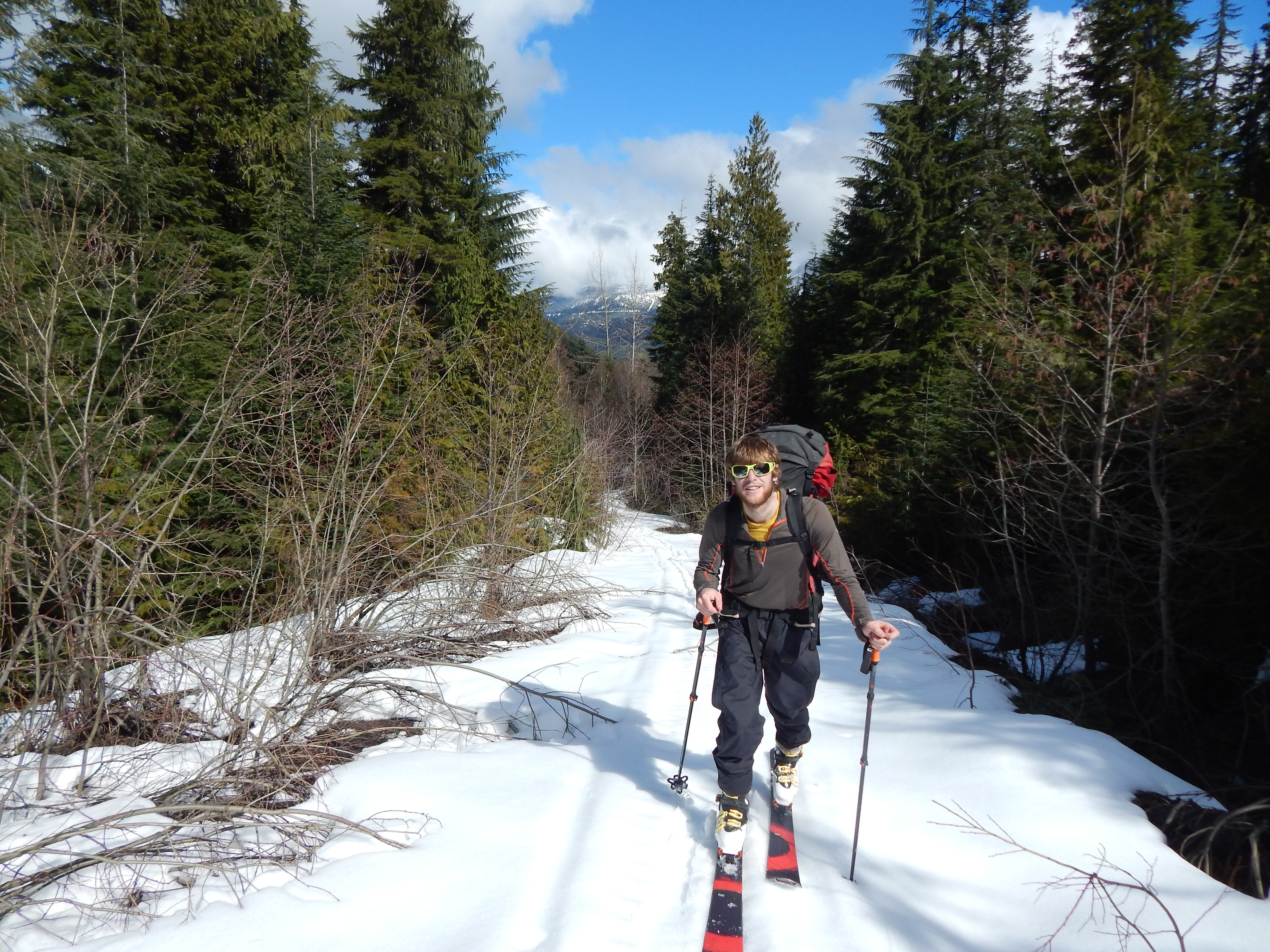
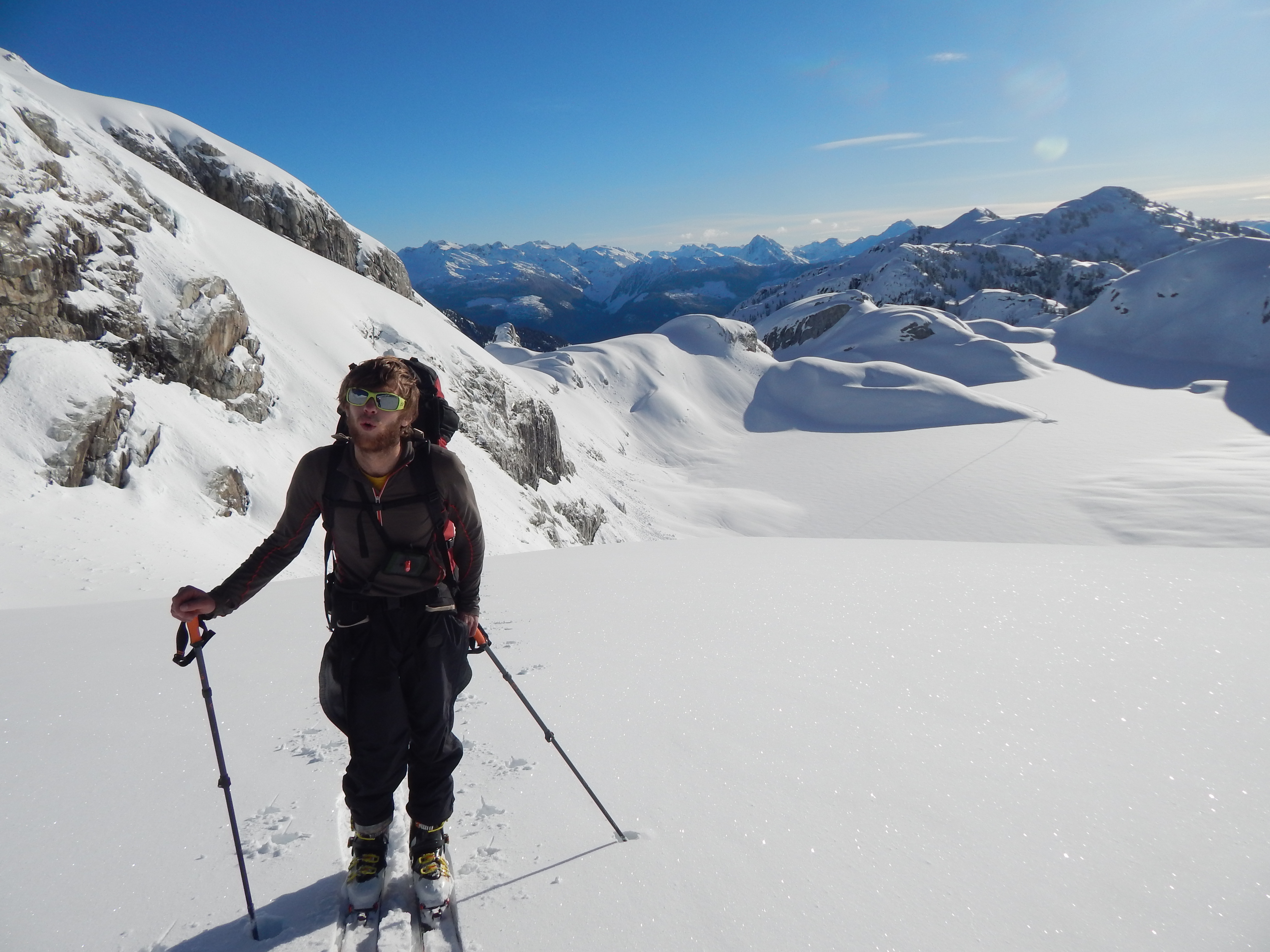
Five hours of slogging up a logging road through razed forest. My pack, I swear, is swelling. Perhaps Jabba the Hutt crawled inside it during lunch. At least we’ve made progress – it’s now 2.30 pm and we’ve reached the point we originally planned to start from. Shite and bollocks.
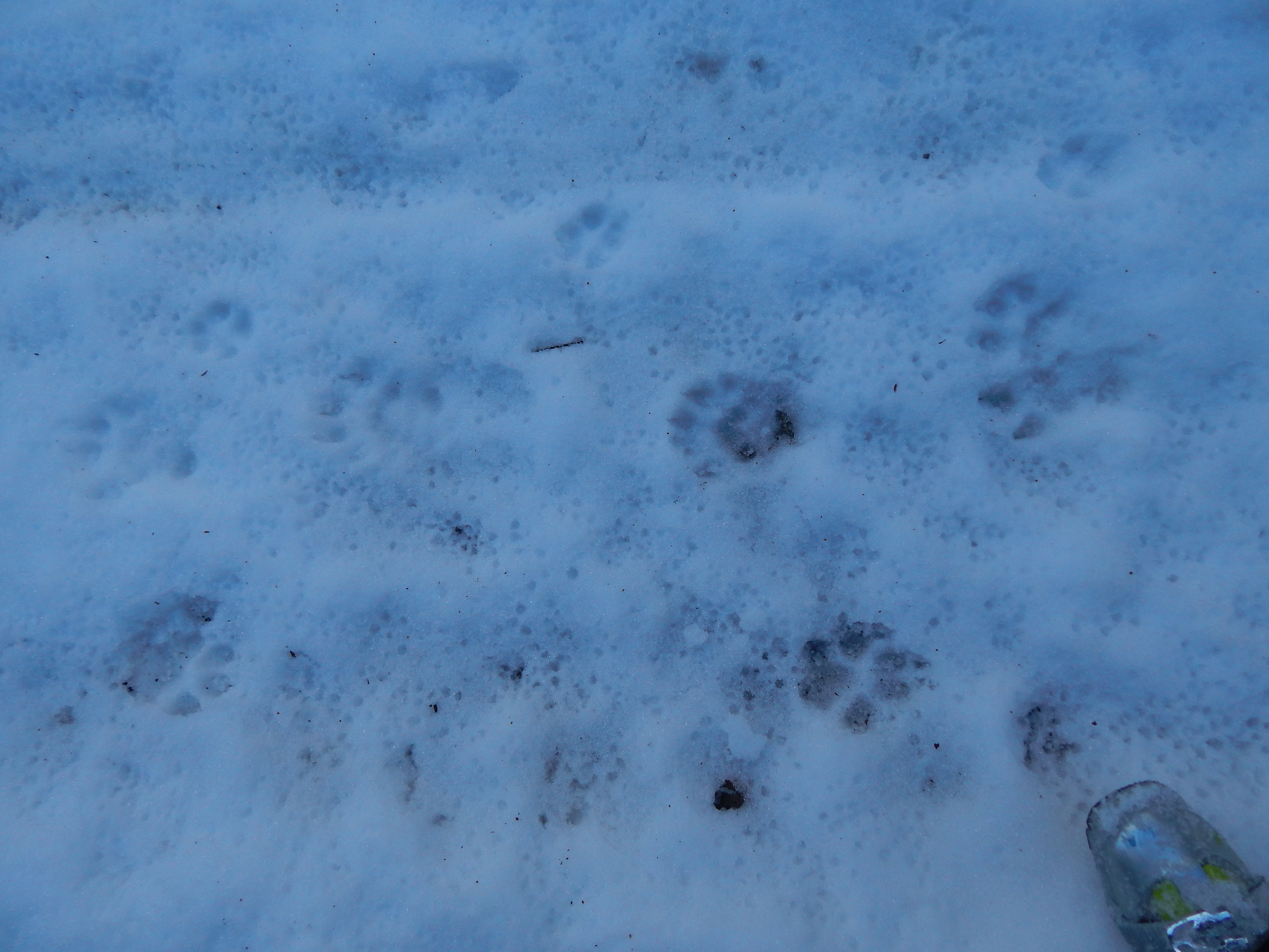
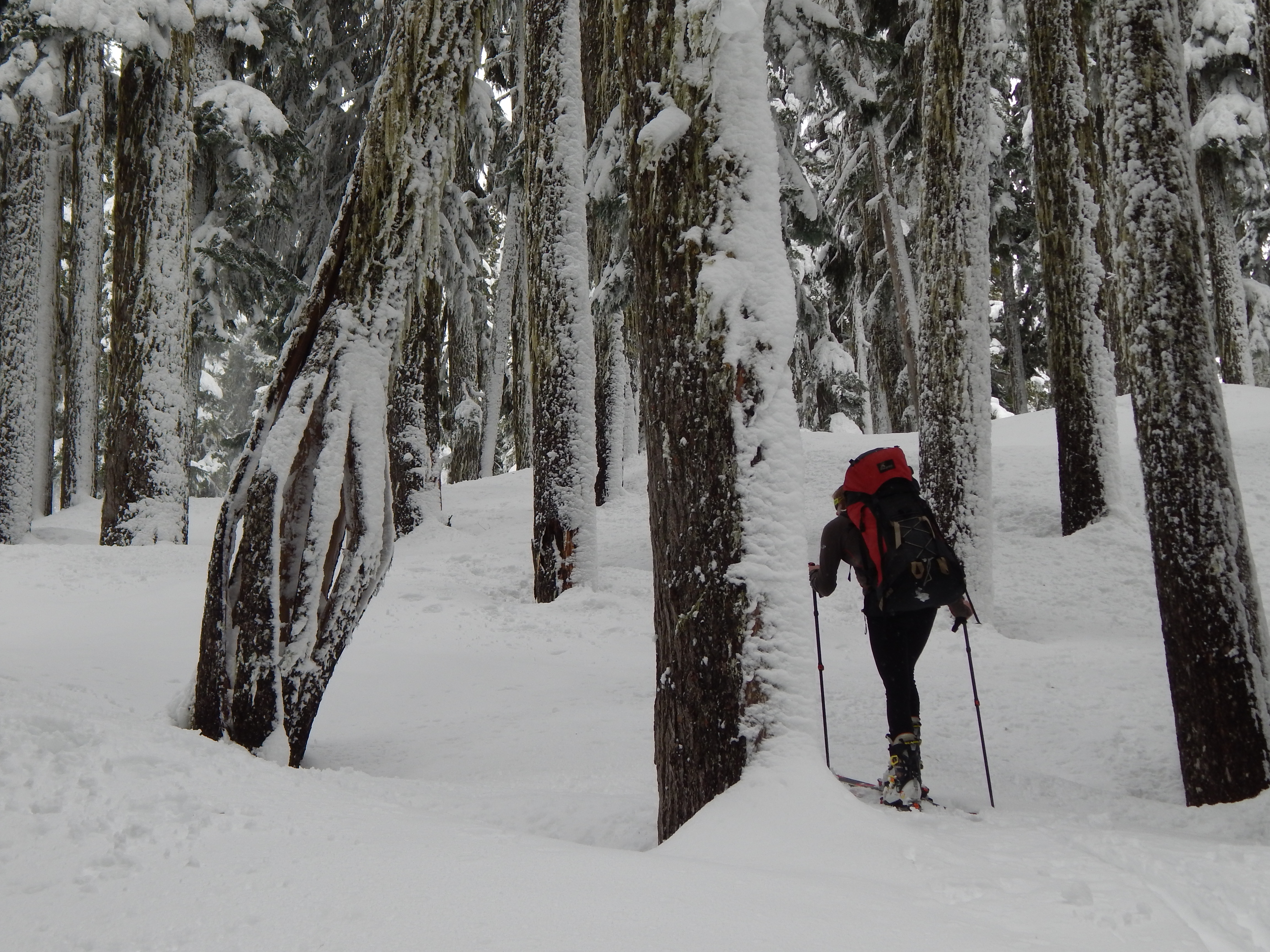
The snowpack is now relievingly consistent, lower down our skis were forced onto our backs a dozen times to cross bare patches of road and a river. The wolf, wolverine, coyote and hare tracks we were following didn’t seem to notice the terrain transitions. There’s no way we could have driven along this dodgey road as planned, even without the snow. Information on the BC logging road conditions is super hard to find.
A year prior, Joane and I found this out the hard way in our first attempt at an overland mission to Pitt River Hotsprings. We planned to follow the Crawford Creek logging road into the alpine then skip across a saddle and frolick down Pitt logging roads to the awaiting blissfull warm springs. The logging road was a thicket, so after two days of S&M (whipped by alders, spiked by devils club…) we had only made it half way and retreated with failing time.
Attempt 2016; a rejuvenated plan with spring, snow and skis. A new alpine route would keep us above the bushline to remedy our bush-bash woes. We planned to skin up the Pinecone Lake Trail, traverse the mellow rolling mountains (very naiive), passing Pinecone Peak, and bush bash the final 5 km to the hot springs. How hard can an 11km traverse be?
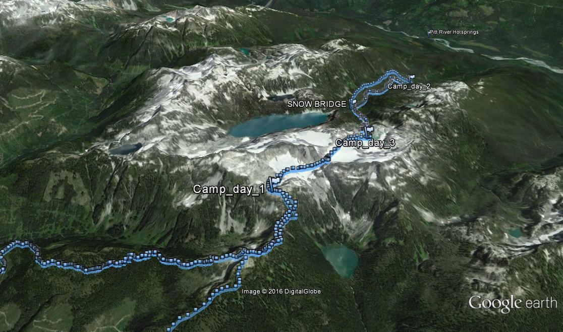
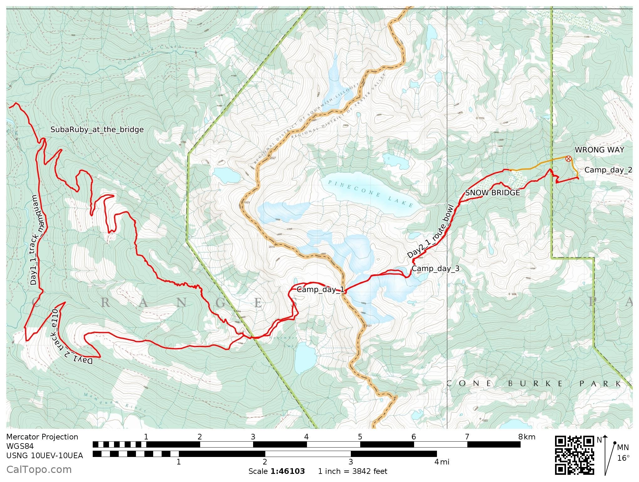
As the evening fell we penetrated the periphery of the Pinecone Burke Provincial Park. So close to Vancouver yet so very wild – this morning we saw a wolf. Ascending a treeless knob, portholes in the clouds revealed steep majestic cirques and gigantic 10m cornices. Our plans for rolling across mellow hills would have to change.
A final skin up the massively corniced ridge led us to the alpine proper. Following the ridge was tricky; it was covered by huge snowy waves made from wind streaming behind trees. Visibility disappeared completely as we approached Campo Uno. Our map showed we were on a flat plateau; but unable to see, we shuffled forward centimetres at a time. Some kind of edge half showed itself ahead, so we zagged back and camped near a nice flat spot. As the stars lifted the clouds from the earth, the edge was revealed as a 10m cornice over a steep bank. Glad to know all that zero vizz skiing at Whakapapa taught me something.
We had by fluke camped 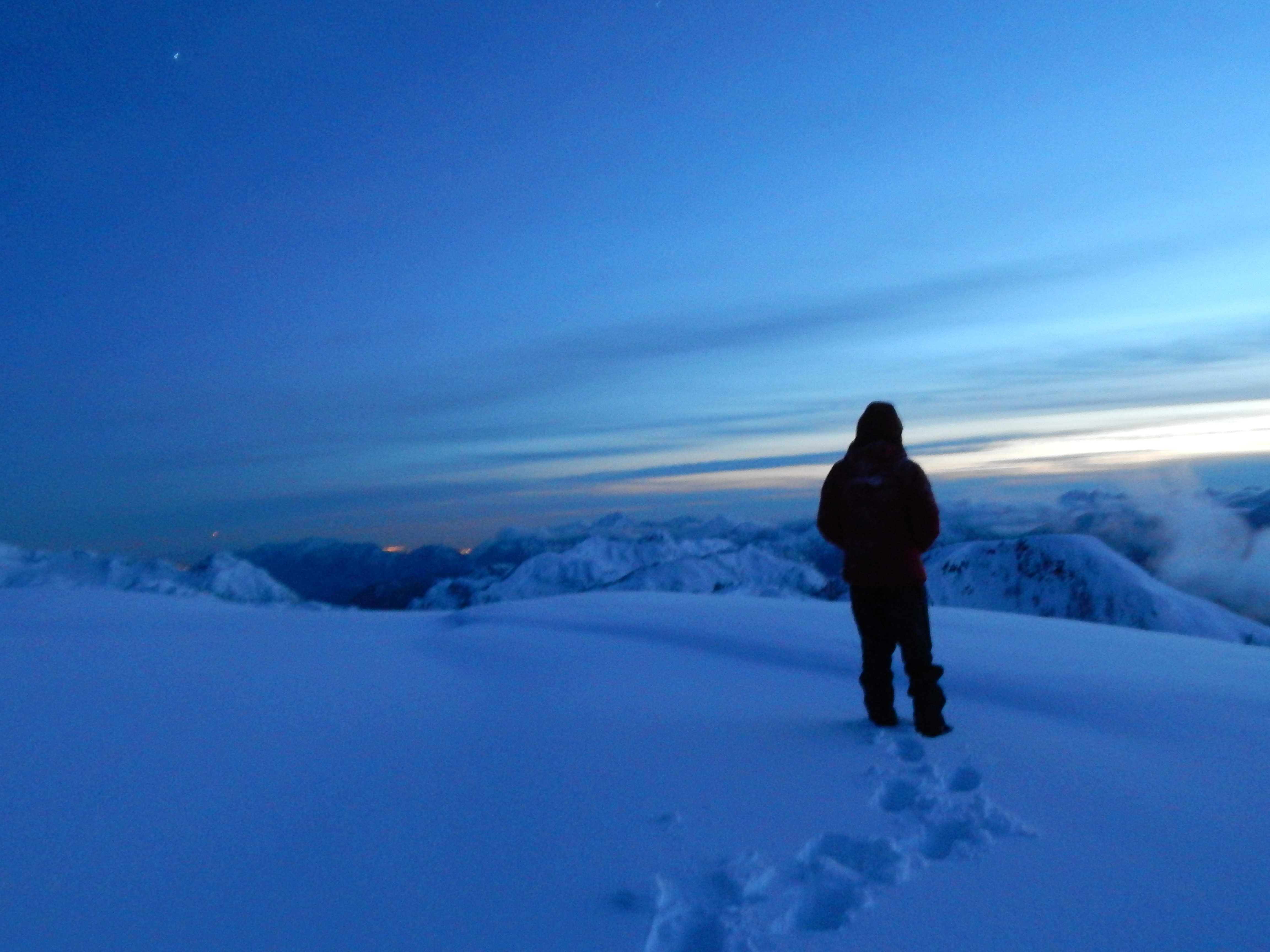 with a magnificent night time view across the Coast Mountains. Vancouver lights to the left, the orb of Mt Garabaldito the right, Skipilot dominating in front, and Tantalus searing behind. A soup and a coffee later, dawn broke and we swished down a bowl and slid up to a saddle. There we found ourselves with our FVE (First View East).
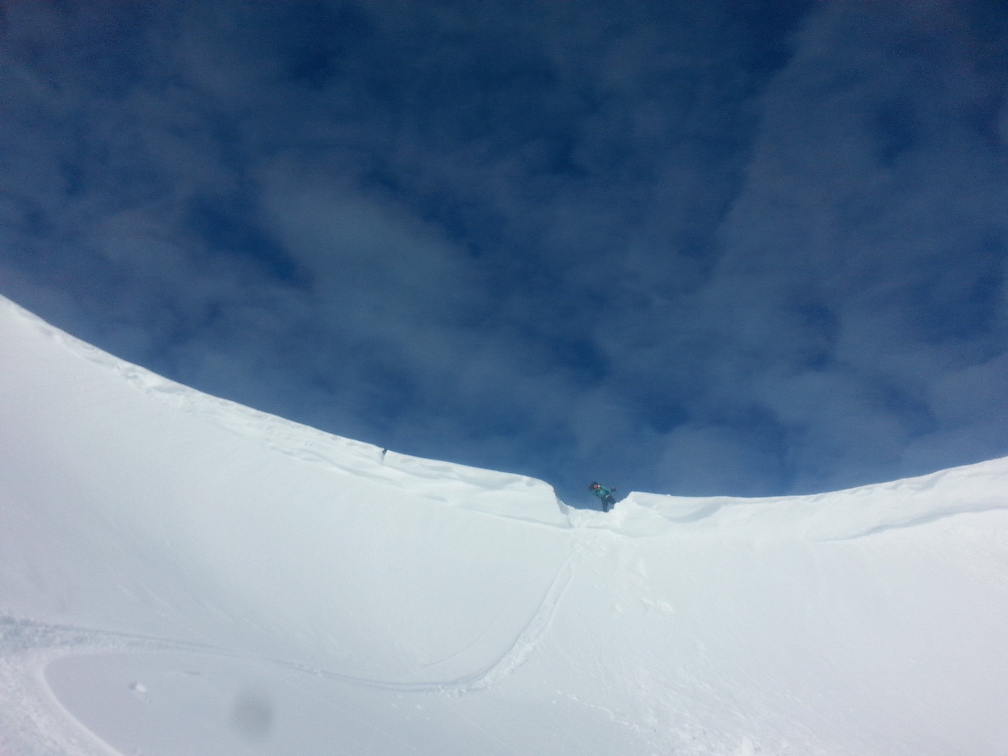
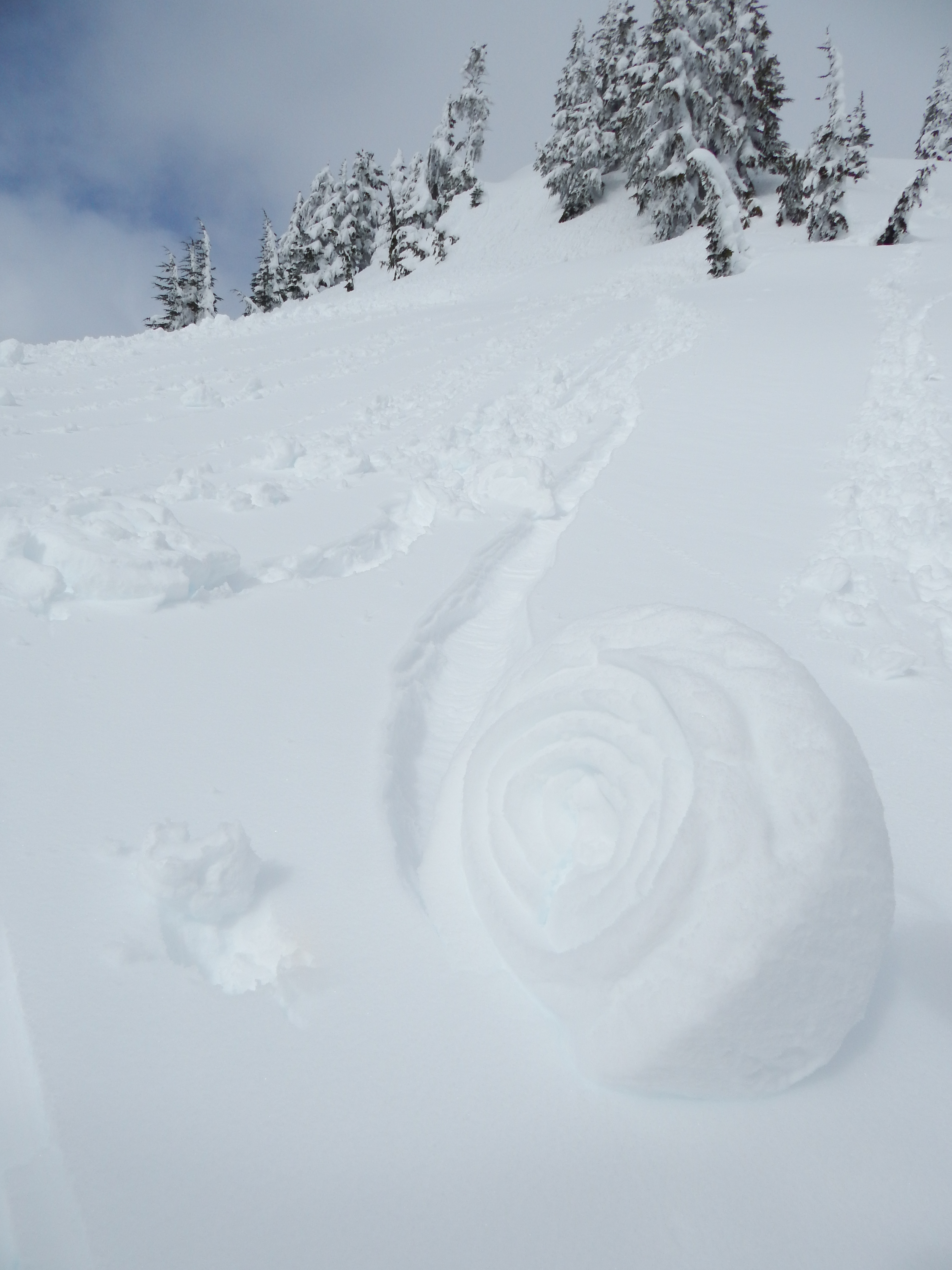
Flustered, I thought perhaps our end had come early. A large cornice blocked the slope beneath us. Yes, incredible view, but we would prefer to keep moving. The alternative routes, following the ridge north or south weren’t an option. After some discussion we were left with just one choice. Like naked mole rats we tunneled through the cornice, making a notch to side slip through. I’d never done this before, and it was much smoother than I expected.
East, the swamplands were our next goal. Remember, all is coated in 6m of BC powder, so a swamp is really a snowfield. From our cornice notch, gravity and ski wax did (almost) all the work for us. Mellow flowing glacial skiing led on to steep cirque walls. The route finding was challenging, most of the potential routes were too steep with fairly sun affected snow. Our final path swamp-ward had stunning turns, passing a Matterhorn-esque feature, then following long flowy meadowy ridges surrounded by majestic mountainous marshmellows of snow.
The Swamp: 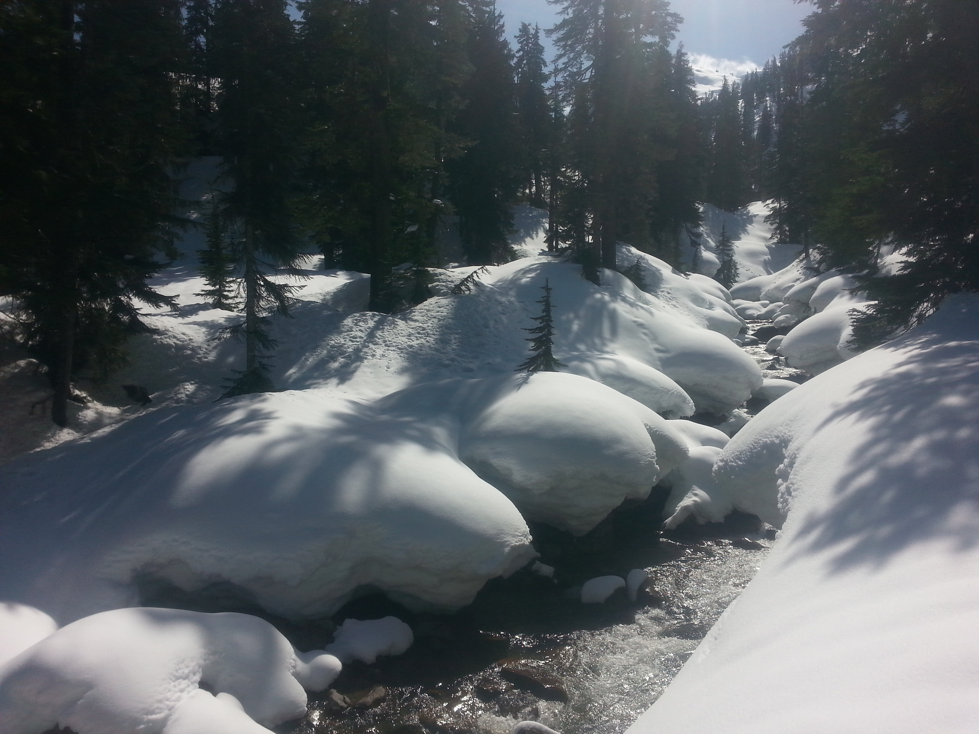 was flat. Our progress: excellent. All we had left to do was descend the forested river valley. Given the opportunity to stay left or right of the river we chose left – where far further below, the yellow brick logging roads were waiting to take us to the heavenly springs. This was a grave error. The river curved left forcing us up the steep bank of the valley, then fell sharply right down a granite gorge. The route ahead was wedged between two ravines in bluffy granite terrain. Searching up and down for a snow bridge to the friendly right-hand river banks led to nothing. It seemed too far to slog two hours back up the valley to a known snow-bridge at the start of the swamps. Instead we chose to pin-ball down between the two ravines, picking a path between the steep granite bluffs.
The first small jump off a mossy ledge into a pile 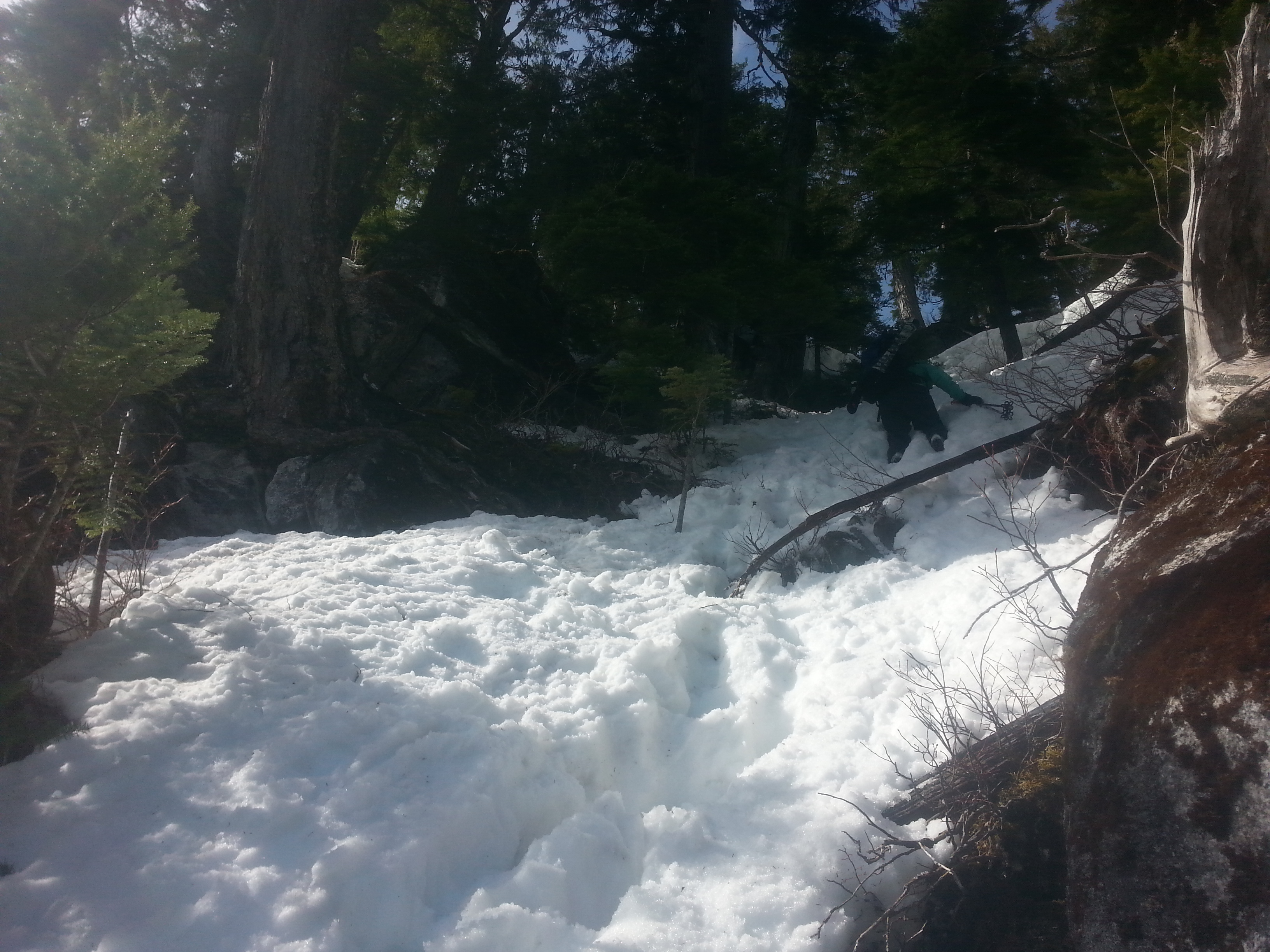 of slush left me waist deep and stuck. To free my feet I had to remove my pack for my shovel, digging out my trapped appendages. Joane followed and did the same. Slow down climbing and traversing led us to the valley floor. Two hours to travel 200m. At 16.00 we reached a luscious logging road, calling us sweetly to the hotsprings. However, a twisted knee affirmed this was our FPE (Furthest Point East). And so one arduous river crossing later we set up camp. One entire glove and dryness in one ski boot were sacrificed to the river god.
Our nights were incomparably less fun than the days. Old, mediocre sleeping bags kept us closer than any marriage counselor could. Easter eggs, whiskey and French lessons from a magazine about Rougegorge the robin kept morale high. All night long rain and snow pelted our tent. My guts tightened. How much snow was falling in the alpine? Heavy snowfall could block our route back by making slopes avalanche prone. With no alternative routes, we would then be forced to wait a day or two for the snowpack to stabilise. But would a delay in our return trigger a search party? Gosh, hoping for no snow.
Skinning back up the valley, 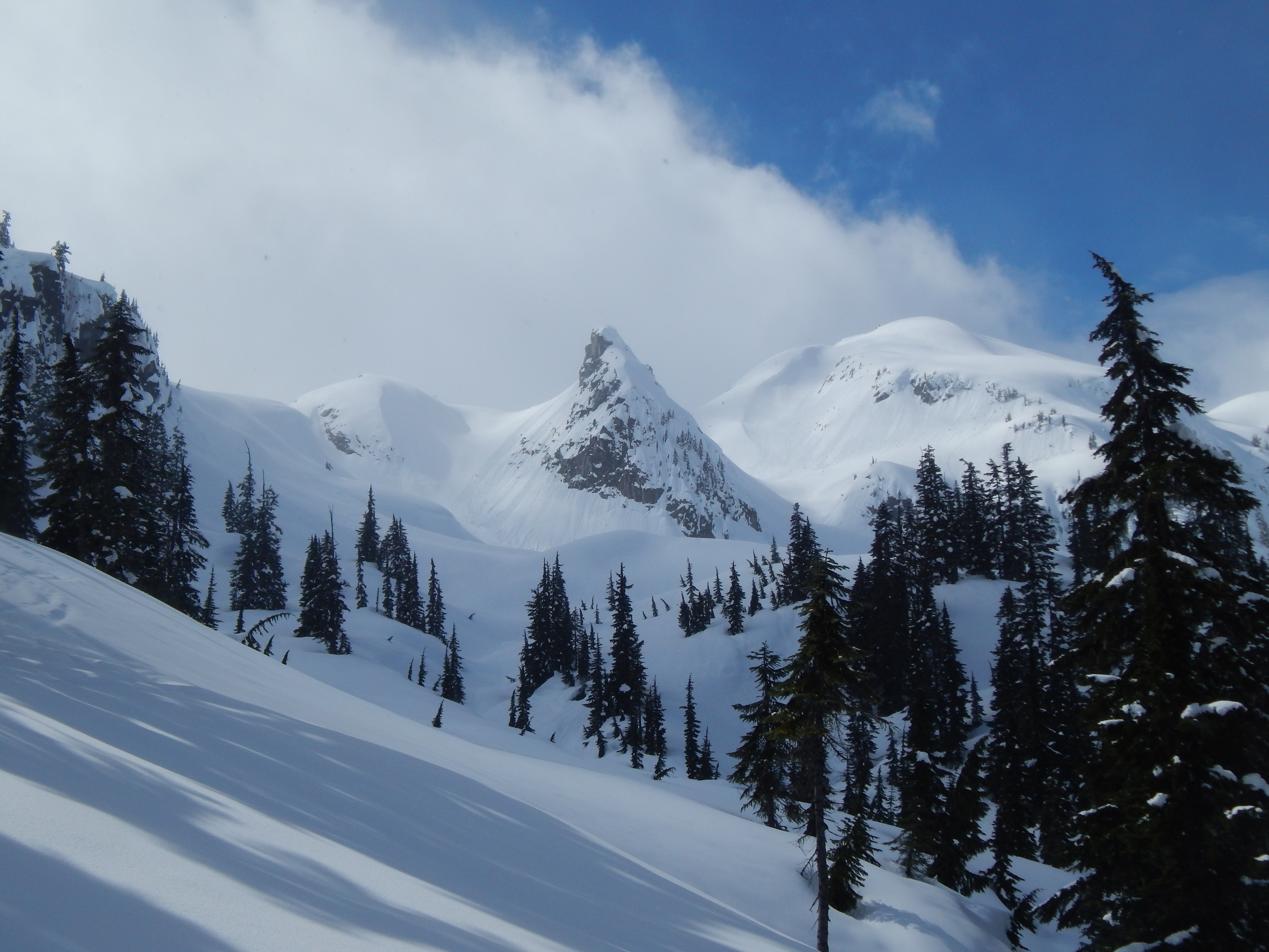 now on the true right of the river, was painfully easy. The bluffy region had been entirely unnecessary. Trying to avoid wallowing in faded hot spring dreams we made a pact to return next year and succeed. Nothing can go wrong now we know 80% of the route.
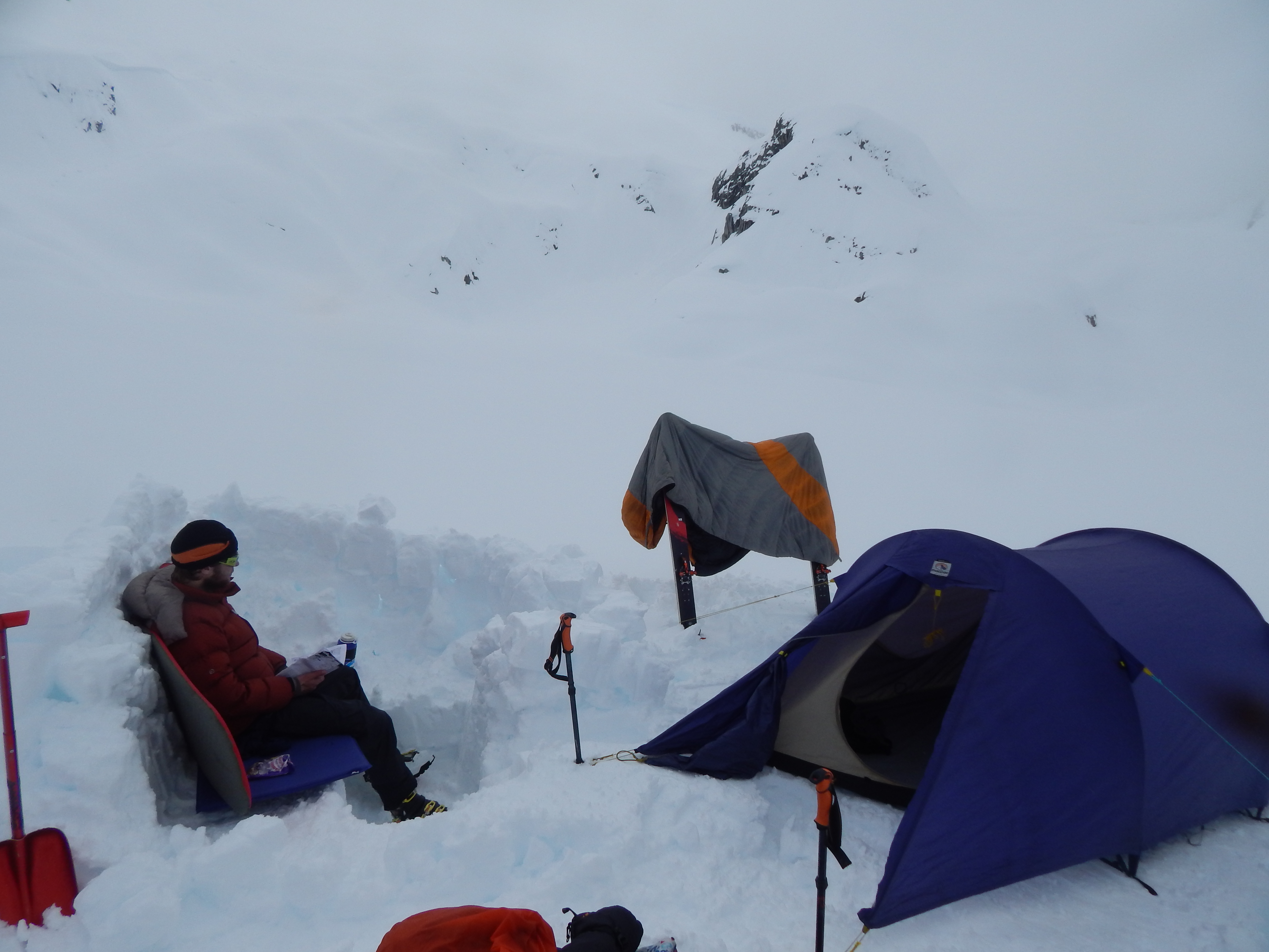
The swamplands flew by and we skinned skywards. Expecting a dump of snow, our plans were to camp before the steepest section and wait until the snowpack stabilised. Anxiously following our ski tracks into the alpine, the snow didn’t seem to thicken. In our favour, only 5 centimetres of fresh snow coated yesterday’s tracks. We quickly leapt up the steep section to make the most of the cold morning snow. Now safe and secure we set up camp on a stunning plateau in le Cirque de Joane, floating on Lac Arran. The 2pm sun glared, so our items were spread out to dry and an opulent snow kitchen was crafted. Having the time to soak in the magnificent mountainous landscape felt as glorious as freshly baked bread.
The night revealed frigid temperatures and a stunning sky full of stars. We would have certainly admired them if we hadn’t fallen asleep before sunset. Emerging from the frozen tent before dawn, the moon filled the arena as i melted snow for coffee.
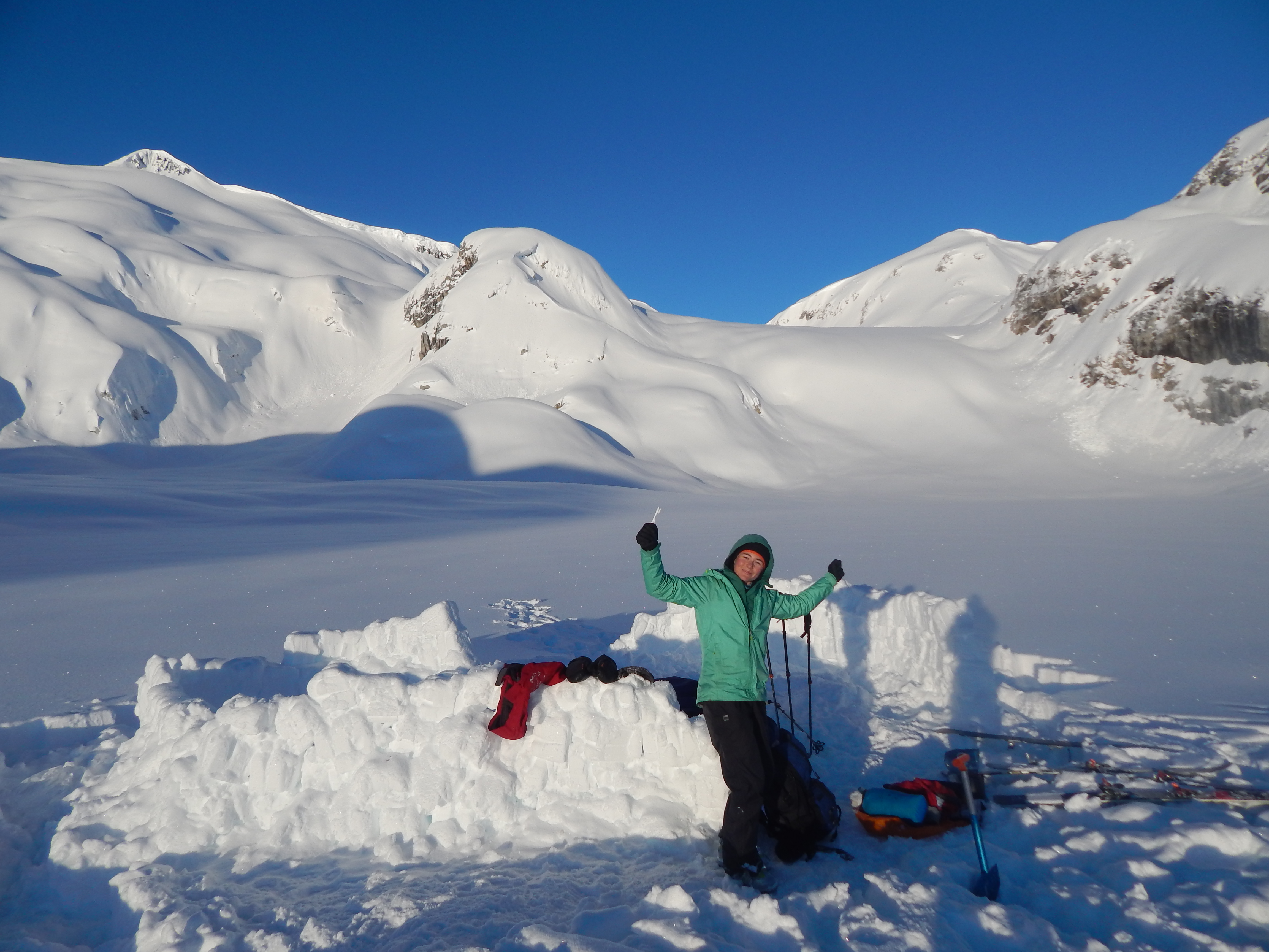
note the camp and tracks behind (click to expand)
Our final day returning had just one hiccup: The cornice gash we dug two days prior had healed completely. To make matters worse, the snow beneath the cornice was bulging with deposited windblown snow. Digging the cornice from below was not an option, forcing us to skin up a steep side wall. As I set a track, inching forward gently and carefully, loose snow threatened to peel away beneath my skins. Carefully balancing with every kickturn, zigging and zagging led slowly to the waiting safety of the saddle. As Joane ascended next I learnt some new french words I shouldn’t repeat. Euphoric at surmounting our final hurdle we savored some sublime turns towards our first camp. 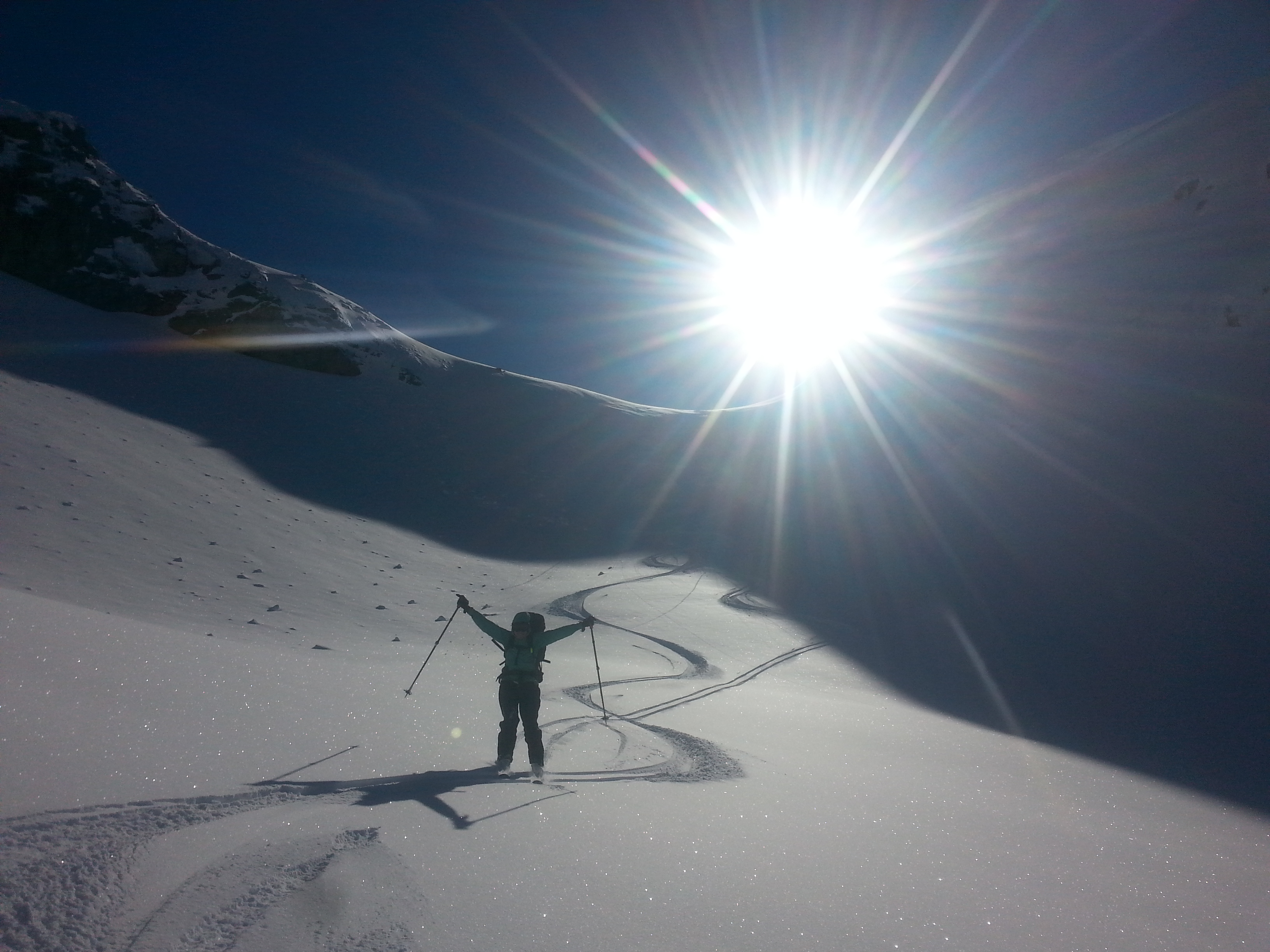
The sun was shining, the mountains were beaming, but the fat lady had yet to sing. Following down the ridge that bridges the park border was steep and tricky. How on earth had we skinned up here two days prior? The huge snow waves we had wobbled up were too tricky to ski down forcing us off the ridge where we picked a steep path traversing beneath some bluffs. Lumps of slush rolled slowly down the hill beneath us as we edged around. As soon as possible we regained the ridge, where the weather gave us perfect views to the surrounding untamed mountains. Most impressive was Meslilloet Mountain, closer to Vancouver but even more wild – an inspiring lengthy corniced ridge soaring above an icefield.

In an effort to avoid repeating the dreadful slog of the snowless logging road we gambled with a new route. The ‘M24’, maps claimed, descended directly to our car. We dropped down a small chute leading to a mellow ridge northwards. Eating lunch, we were confident the car was reachable. Our emergency spare food was probably just weighing us down, so we ate it as we applied suncream.
The new route side-hilled around a steep lump towards the M24. Skinning through the trees, sudden WHUMPF!!!!s would alarm us every few seconds as huge piles of melting snow would fall from above. Joane was splattered by a couple of these refreshing showers as she led the way. The trees gave way to elegantly gentle glades. The map suggested that these would lead directly to our M24, so we ripped skins and gracefully glided north. Hitting the M24, and zooming along it towards the next switchback, I thought of the many tedious ends to long trips: The endless slog of alpine valleys like the Matukituki or the grim grind of never-ending BC logging roads like Brew. Now the wind was in our hair as we hurtled towards the next zigzag!
But good times ended. The road, once resplendent, became repugnantly flat. We followed LARGE fresh bear prints for a few kilometres, shuffling forward and skating. A swift descent, the snowpack spluttered out about a kilometre from our destination. We were then greeted by our dearest friend: Dense, overgrown, slender springy alder. Biting bullets we marched to the car, getting the thorough whipping we had been seeking all along.
From the outset, this trip was really a reconnaissance mission for the 2017 Third and Final Pitt River Hot Springs Overland Traverse Attempt. We didn’t succeed in soaking in the holy waters, but prefered being whipped by alder anyway.
Arran
Neat trip! Every good destination needs a couple of attempts.