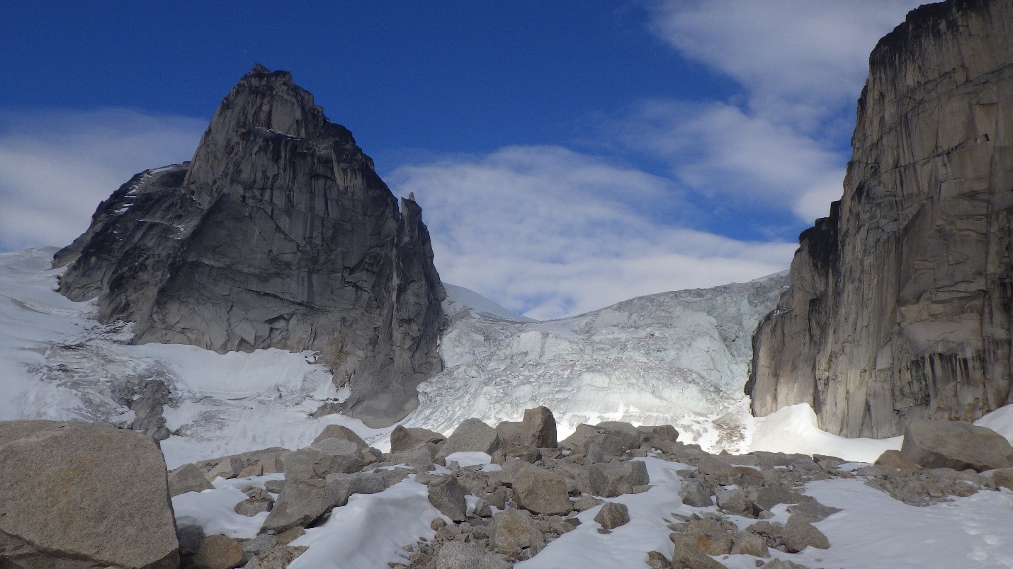
Bugaboo Provincial Park is located in the Purcell Mountains of southwestern British Columbia, and contains many granite peaks over 3000 meters and granite spires that entice climbers from around the world. Some classic routes are the West Ridge of Pigeon Spire (5.4), the Kain Route up Bugaboo Spire (5.6), and the classic 22-pitch Beckey-Chouinard route on South Howser Tower (5.10), but many other exciting routes exist on many peaks (Snowpatch Spire, Pigeon Spire, Bugaboo Spire, Crescent Spire, Eastpost Spire), including the recently established 5.14 finger crack on Snowpatch Spire established by Will Stanhope and Matt Segal (see “Boys in the Bugs”, Reel Rock 11). It is truly an awe-inspiring network of glaciers and mountains that will take your breath away! Many of the most famous routes require you to ascend the fairly steep Snowpatch-Bugaboo col, which can be exceedingly dangerous late in the season when not in condition. If the col is out, an alternative is to take Bugaboo Glacier up to Vowell Glacier, which takes much more time and can involve some fairly technical navigation across crevasses.
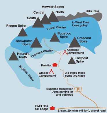
Map of Bugaboo Provincial Park (http://www.climbandmore.com/climbing,415,0,1,regions.html)
From August 20-26, 2016, Carly Peterson, Natalie Makepeace, Artem Babian, Jeff Taylor and I headed to the Bugaboos for a week of alpine exploration, with intentions of exploring Valhalla and other regions if time and weather permitted. Leading up to the trip, there were a few concerns amongst our group. The week before we arrived, a guide had been scrambling up the famous Pigeon Spire West Ridge route (5.4), and had a boulder fall off and crush his legs. Additionally, a professor from UBC had also been scrambling in the interior and had taken a fall, and did not survive. The risks were clearly outlined for us, making me more cautious than ever. On a more personal note, I had been nervous about whether I could still go on the trip given my knee injury from the beginning of June, and my re-injury of the knee while climbing on Quadra Island during the first weekend of August, but I decided to go for it anyway. Carly was also recovering from her recent shoulder dislocation, and had not been climbing over the summer leading up to the trip while she tried to prevent the threatening re-dislocation, making her and I almost one functional human being when combined.
The weather forecast for the entire region was not ideal, making back up plans (Valhalla, etc.) no more appealing than heading straight into the Bugaboos. Thus, we decided to go straight to the Bugaboos once we arrived and stay there as long as weather permitted. The forecast called for a heavy storm on Monday, but Sunday was supposed to be nice, and weather Tuesday onwards was changing every few hours, rendering the forecasts unreliable. We knew from others who had been going to the Bugaboos that this season was typified by afternoon storms nearly every day around 2:00 PM, and that we were not likely to get a string of good weather. We had been hoping to meet up with Nicole Barrette, who was already up there with her father, for a day of adventuring on Monday, but the weather forecast suggested that we might not succeed.
I was astonished that we managed to fit mountaineering gear for 5 people and 9 days in my vehicle, plus a guitar and ukulele. All packed up, we headed out from Vancouver early on Saturday morning (August 20th) and drove all the way to the Bugaboo Provincial Park parking lot, stopping for meals as needed. We arrived at 11 PM and decided to hike in at night while the temperatures were not too high. We had several friends who had gone earlier in the month and they suggested that doing the steep trail at 30’C or higher temperatures was extremely difficult and not something they recommended. Although the route to Kain Hut is only 4.5 km from the parking lot (and to Applebee Dome is 5.5 km from the parking lot), the first few kilometers are mostly flat, meaning that you gain nearly all of the 695 meters of elevation to the hut in the last few kilometers, and an additional 235 meters in the final kilometer to Applebee Dome (for a total of 930 meters elevation gain in 5.5 km total, most of which occurs in the last 3.5 kms). We left the parking lot at midnight and arrived at the famous Kain Hut just before 3:00 AM. Due to our exhaustion and the darkness, we decided to camp in the Boulders campsite (300 m beyond and bit beneath the Kain Hut) instead of Applebee on our first night instead of trying to navigate the final 1 km to Applebee on the often-hard-to-navigate trail. I was happy to report minimal pain from my knee and felt optimistic for the trip moving forward, but the trail was difficult!
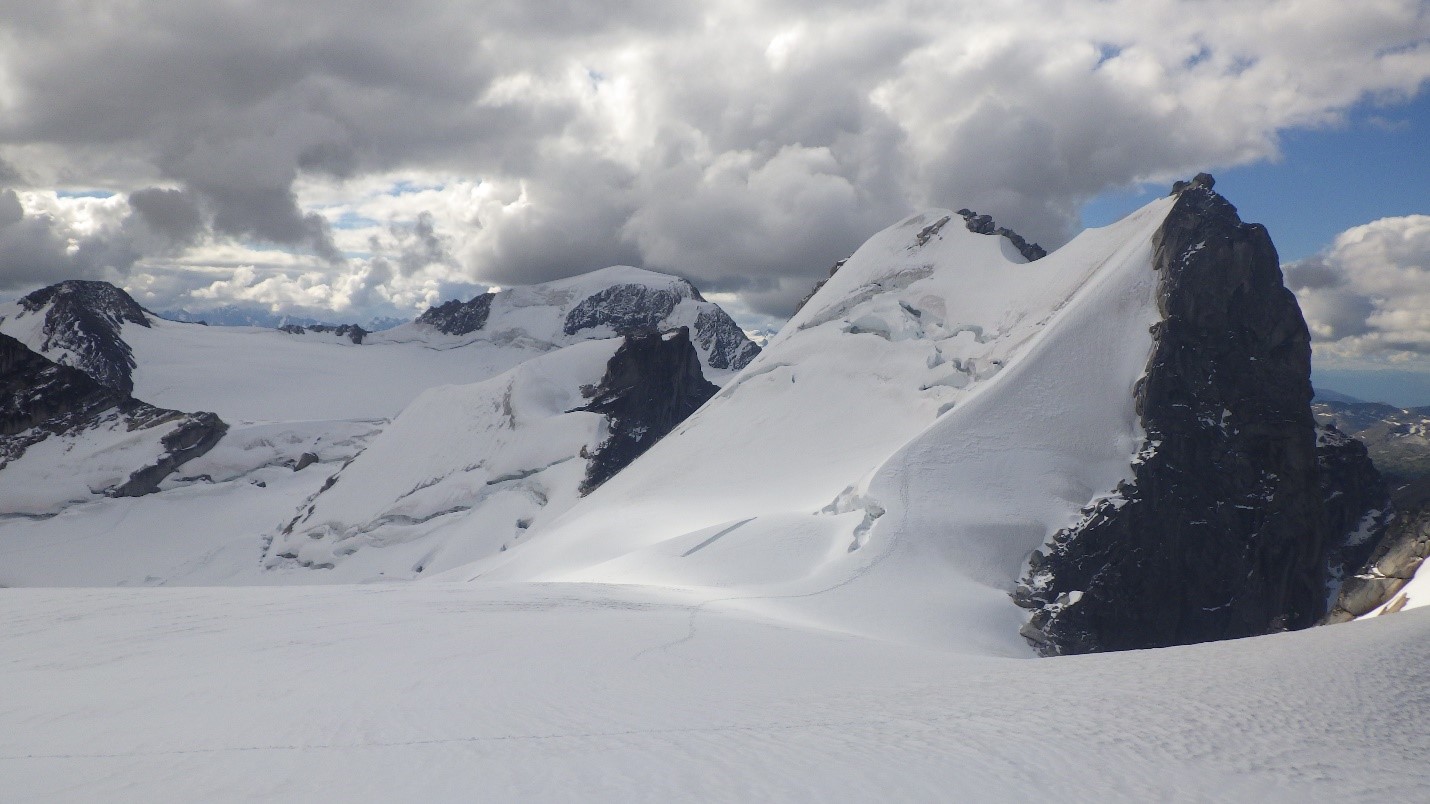
Carly and I woke up around 7 AM when the sun violently hit our tent. I opened my eyes abruptly, and was reminded of an eye injury I had incurred a few weeks before at a pool party where I fairly severely scratched my cornea. We ventured outside on 3.5 hours of sleep to view the glory of the Bugaboos for the first time, and it was a beautiful sight to see!
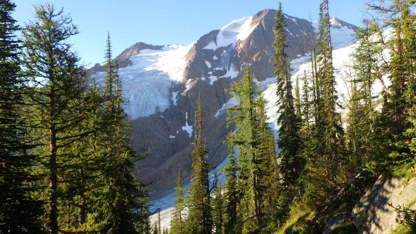
First views. Photo by Cora Skaien.

Kain Hut. Photo by Cora Skaien.
We went back to sleep and woke up with the others at 9 AM, my eye no longer causing me concern. We decided to head out for the day and inspect the col. If it was in good condition, we would go and do Pigeon Spire that day before the storms set in on Monday; we currently had a blue-bird sky kind of day. The first inspection of the col did not look great, but it also did not look awful. However, while we approached, giant rocks began to fall down the boot path that people had been taking up. We decided that the col was objectively too dangerous, and to do a different objective instead that day.
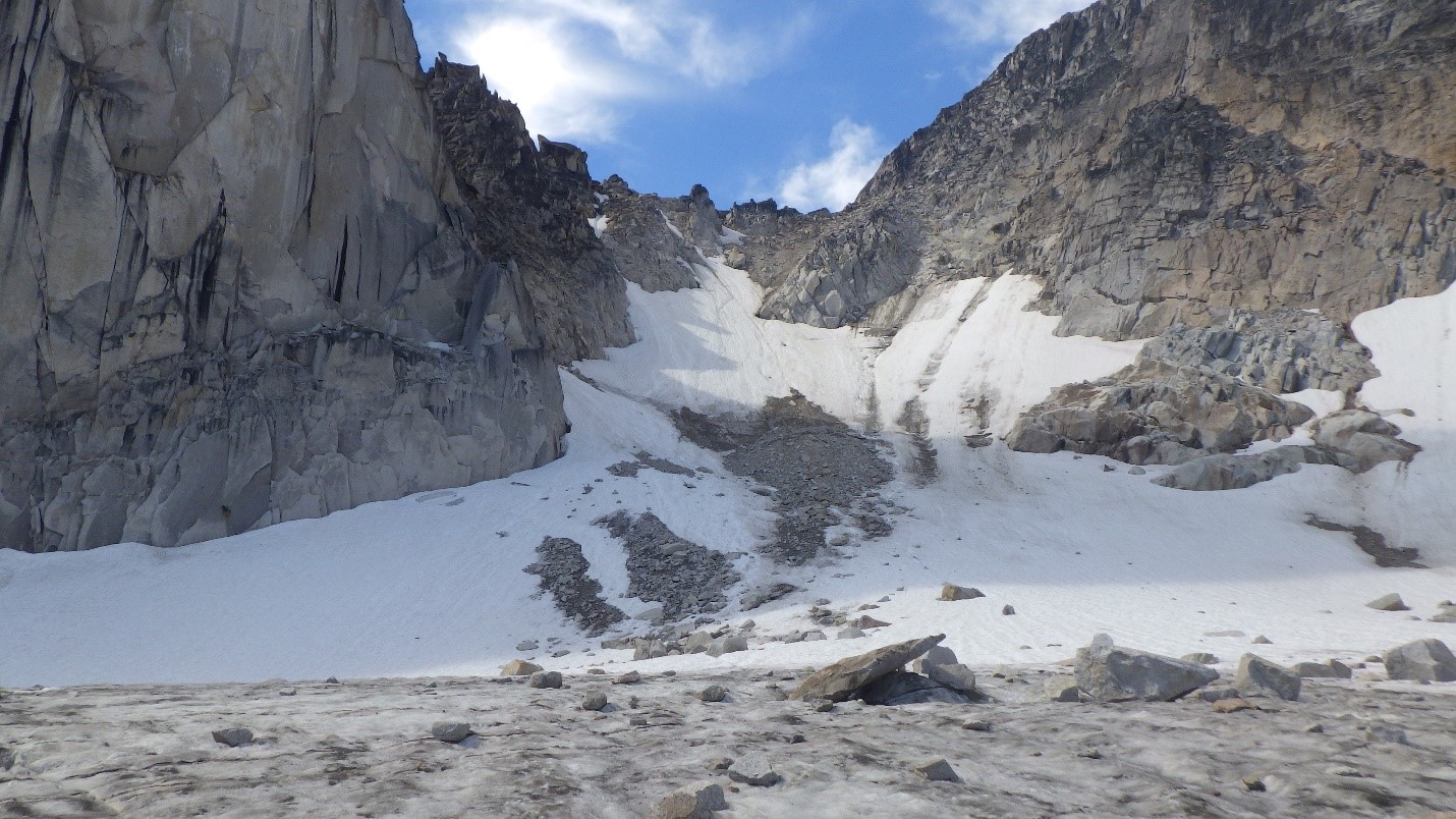
The Snowpatch-Bugaboo Col on August 21, 2016. Not ideal conditions. Photo by: Cora Skaien.
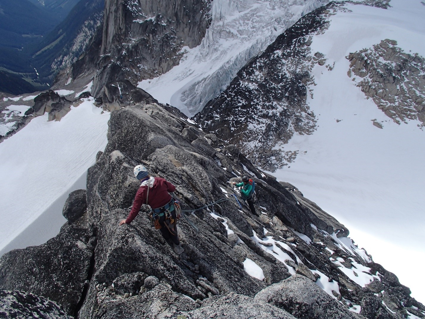
We sought alternative objectives with our late start, but did not have a guidebook with us. There appeared to be an easy route up the col between Bugaboo Spire and Crescent Spire that was about 80-90 meters high, and we decided to take that route despite not having any beta on it. From a distance, it looked very friendly. Once we arrived at the base, I instantly knew that I would not feel comfortable soloing the route, especially given my knee injury. Artem and Jeff were also a bit sketched out in their mountaineering boots at first, but decided to go for it anyway and proceeded with great skill. Carly and Natalie both gave the first few moves a go before deciding that it was a bit too sketchy for them to solo as well. We only had one 60 meter glacier rope between the three of us, but it was decided that pitching it out was the safest option, with Natalie and Carly tying in 5 meters apart from each other on one end and me leading the pitches (I was the individual with the most comfort trad leading at this time based on experience of trad leading most of the summer, which Carly and Natalie did not have that season due to injury, etc.). Because we had to double the glacier rope (30 meters total length now instead of 60 meters), this allowed for ~23 meter pitches. Furthermore, we only had brought 6 cams with us for the trip because our hardest potential objective was the Kain Route (5.6) and we wanted to minimize on weight. I soon realized I failed to account for the fact that I would want 3 cams per anchor, and that I therefore could only place nuts on each pitch unless I was slinging a boulder for the anchor. If attempting Kain Route, I would recommend more cams for sure.
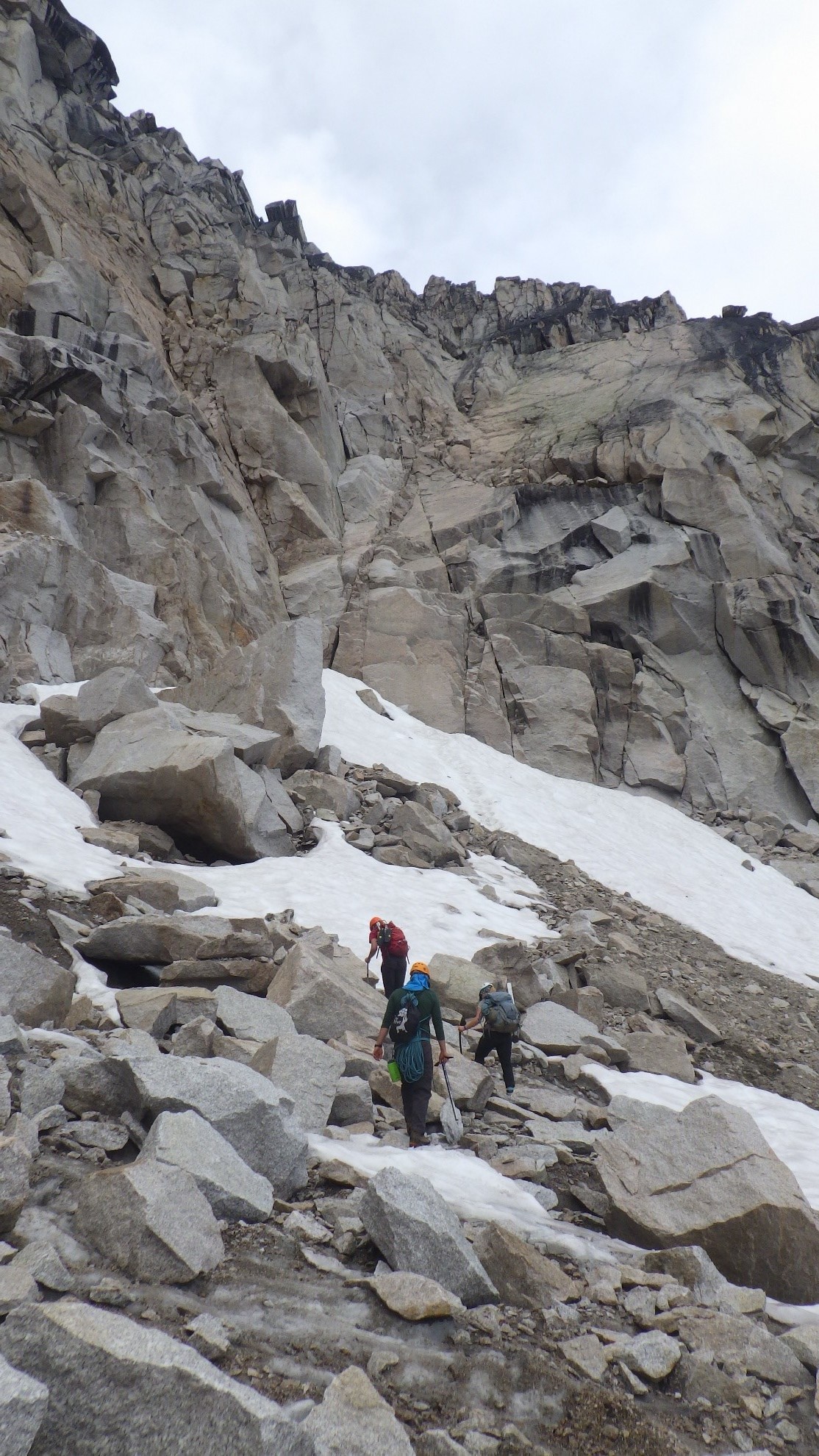
Bugaboo-Crescent Spire col. Photo by: Cora Skaien.
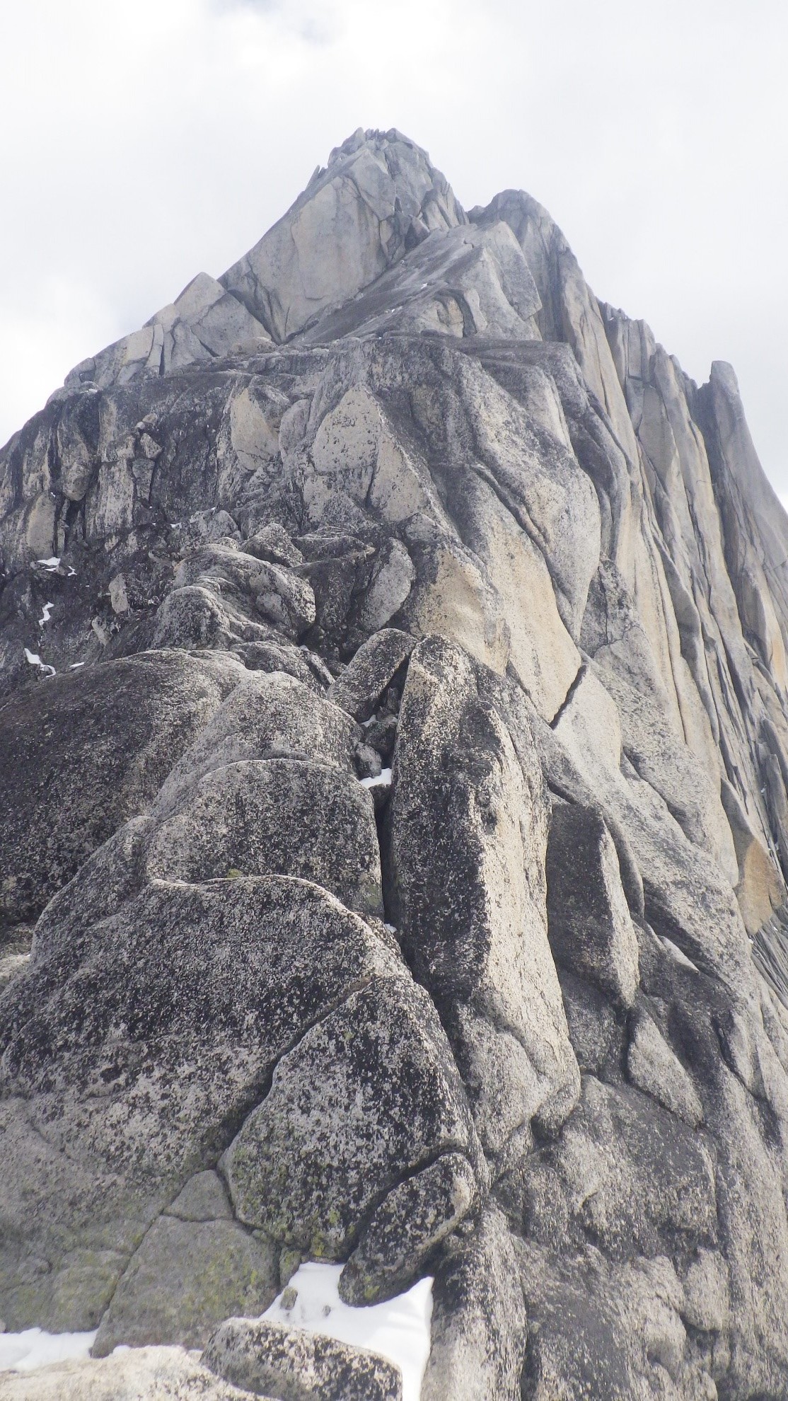
The climbing was easy, and I placed one piece of protection every pitch (about every 15 meters) and felt quite comfortable that I would not fall on the easy terrain. There was one point where I had clearly gone up the wrong crack system and encountered some 5.7-5.8 moves, which I was not super keen on given my limited gear placements. I traversed to the left, where the obviously easier route had been hiding from me, and had a scary moment while traversing slab where I knew that if I fell, it would be a ground fall. I made it across safely, built an anchor a few meters up and belayed up the others. It was clear that this was going to be a very slow process, but the exposure made us reluctant to solo the route, so we continued pitching it out. After one more pitch, Artem and Jeff had set a handline down for us with their 60 meter glacier rope from a bolted anchor at the top. We soloed a few meters to the handline and proceeded up with much better efficiency and then did the class 3 scramble to the top of Crescent Spire, where we first saw the beautiful views of Pigeon Spire and what lay beyond Snowpatch Spire. Later, we were to learn that the route we took up was in fact a 5.4, although it was commonly soloed. I felt less self conscious about not wanting to solo it after finding this information out. On our way down, the rain began to fall and Artem ran down to our camp to hide away our gear that was hanging near our tents (to protect from chewing wildlife), and ran passed Nicole and her father who we did not get to see the rest of the trip due to the storm that was rolling in at that moment. We would find out later that Nicole was almost taken out by one of the head sized rocks falling down the col, which was a moment for many climbers staying at Applebee to decide to no longer attempt the col for the rest of the season. When we talked to a few climbers later, they indicated that in the 5 days before we arrived, the col very quickly went from being safe to being very dangerous. We had just missed the window! Although, many people still did decide to do the col at their own risk.
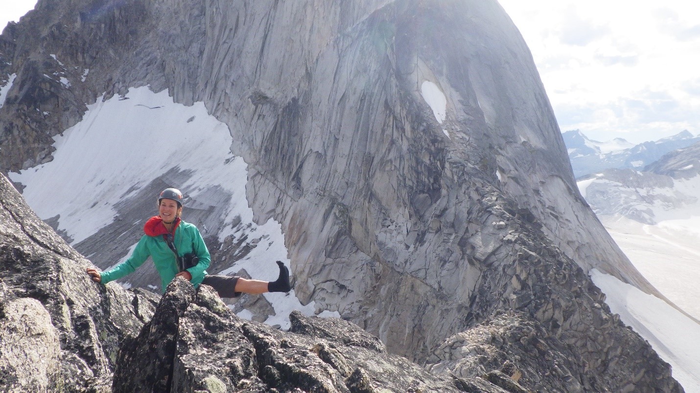
Selfie half way up to Crescent Spire. Photo by: Cora Skaien.
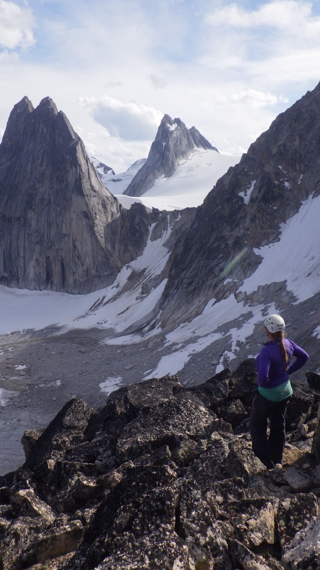
Natalie making her way t the top of Crescent Spire via the scramble. Photo by Cora Skaien.

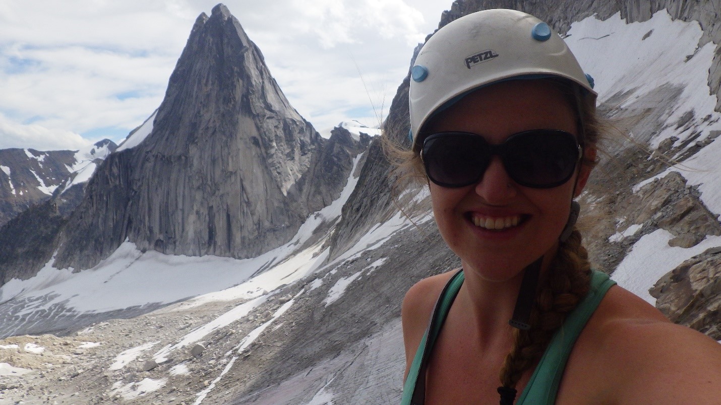
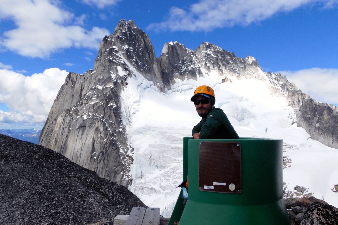
Cora enjoying the first views of Pigeon Spire (middle) with Snowpatch Spire on the left. Photo by: Carly Peterson.
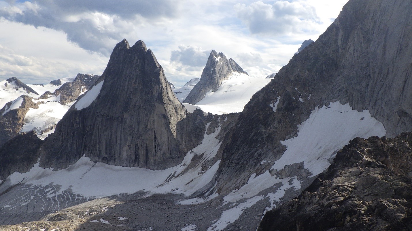
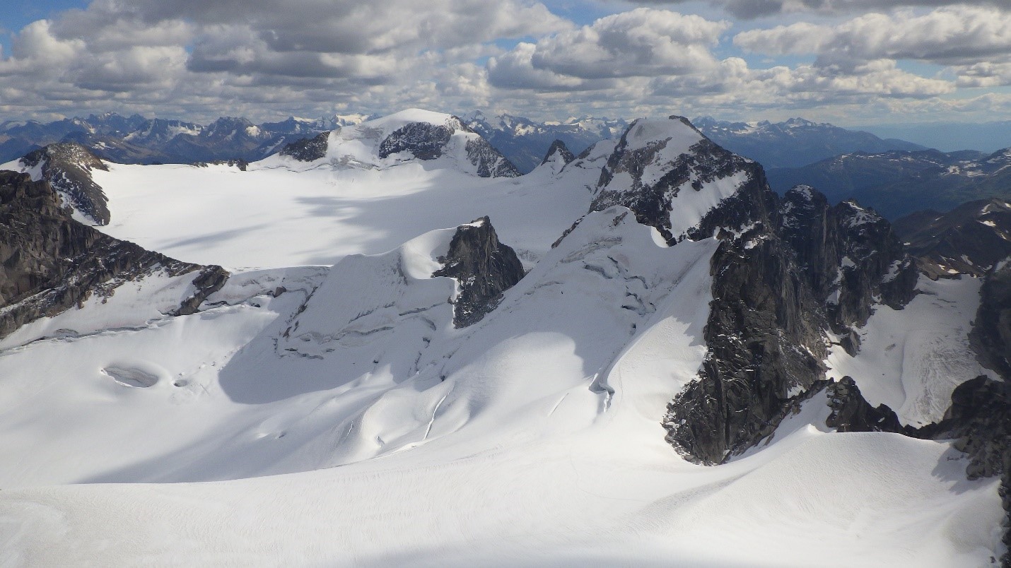
Snowpatch Spire, Pigeon Spire and little bit of Bugaboo Spire, from left to right. Photo by: Cora Skaien.

Carly enjoying the view. Photo by: Cora Skaien.
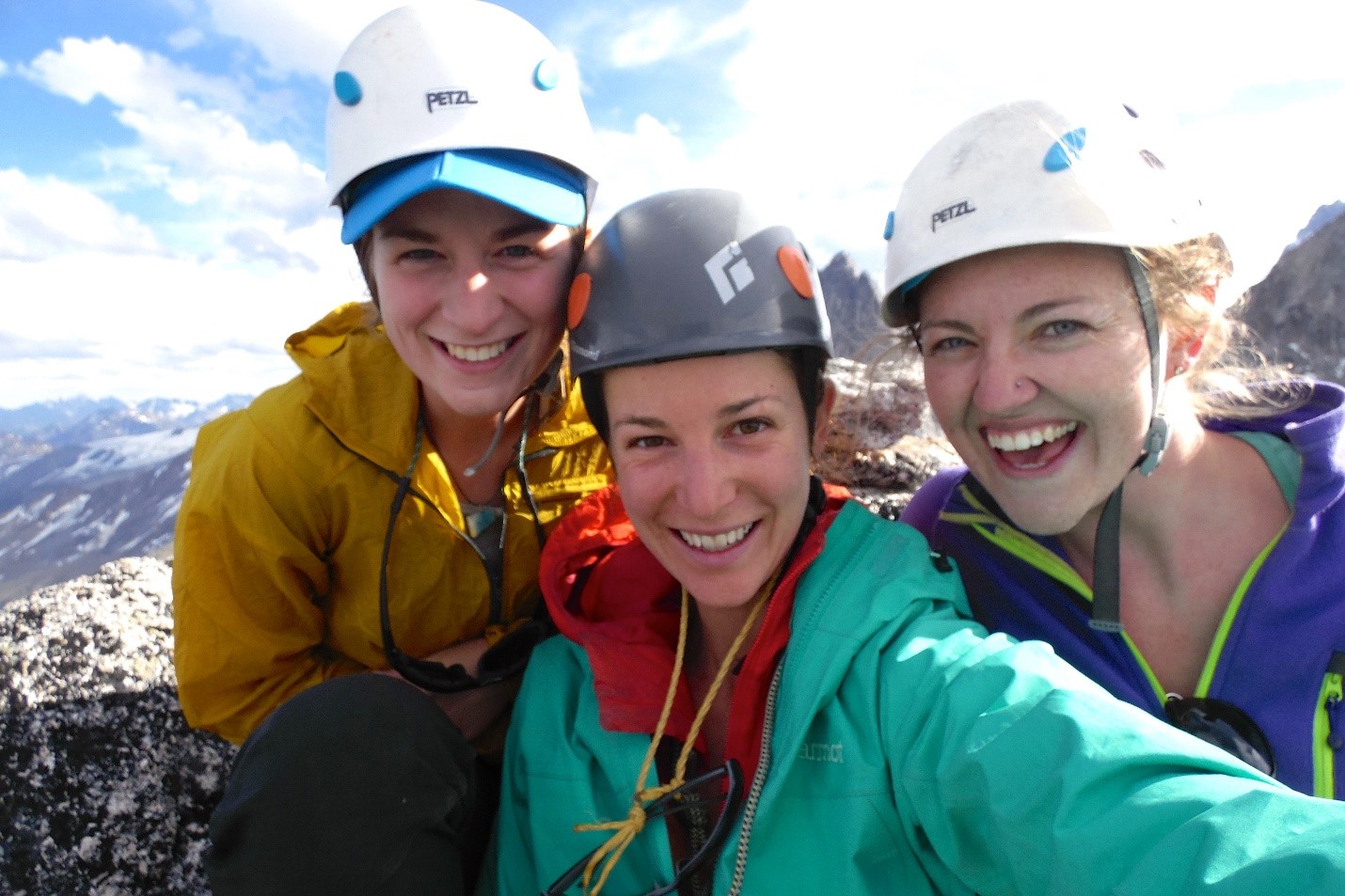
Girls summit shot. Photo by: Natalie Makepeace.
Returning to Applebee beneath Crescent Spire. Photo by: Cora Skaien.
We felt super jazzed about our first day out, and really excited to get on more objectives. Unfortunately, the weather was not in our favour and a snow/hail storm assaulted the area on Monday. We connected the vestibules of two of our tents so that we had an inter-vestibular space and our doors opened to each other. We spent an entire day, nearly 8-10 hours, playing guitar and learning the lyrics and chords to such classic hits as Flight of the Concords “Business Time”, and Simon and Garfunkel’s “Cecilia”. These two songs were frequently belted out over the course of the trip. We were happy to have stayed in the Boulders campsite, where we were relatively sheltered from the storm. On Applebee, climbers we met later reported being very cold and a fair amount of snow and hail.
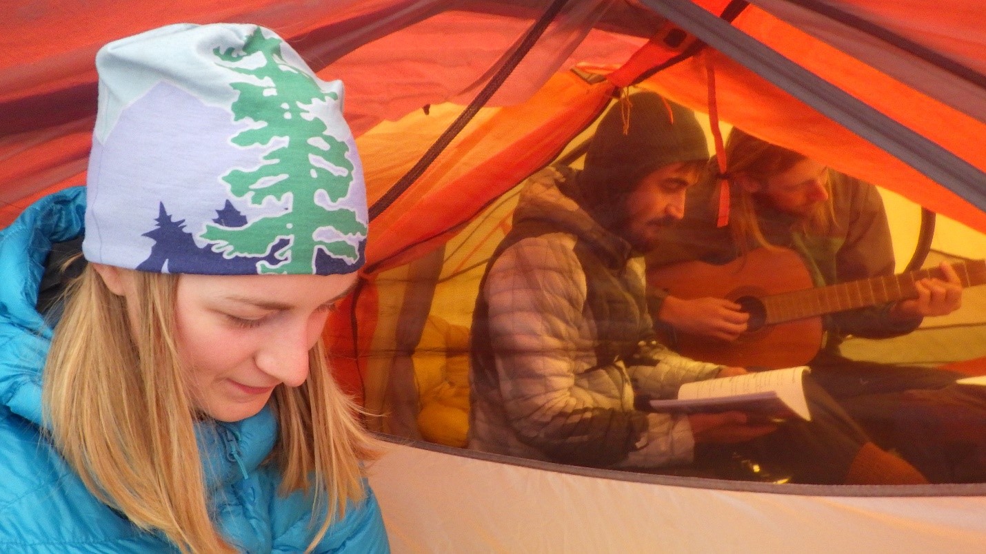
Playing guitar and singing in the tents. Photo by: Cora Skaien.
On Tuesday, the forecast was for off and on rain and things were pretty wet still, so we decided to relocate camp to Applebee and boulder around Applebee for the day. There were some fun crack and slab problems, and I sat around and played my ukulele.
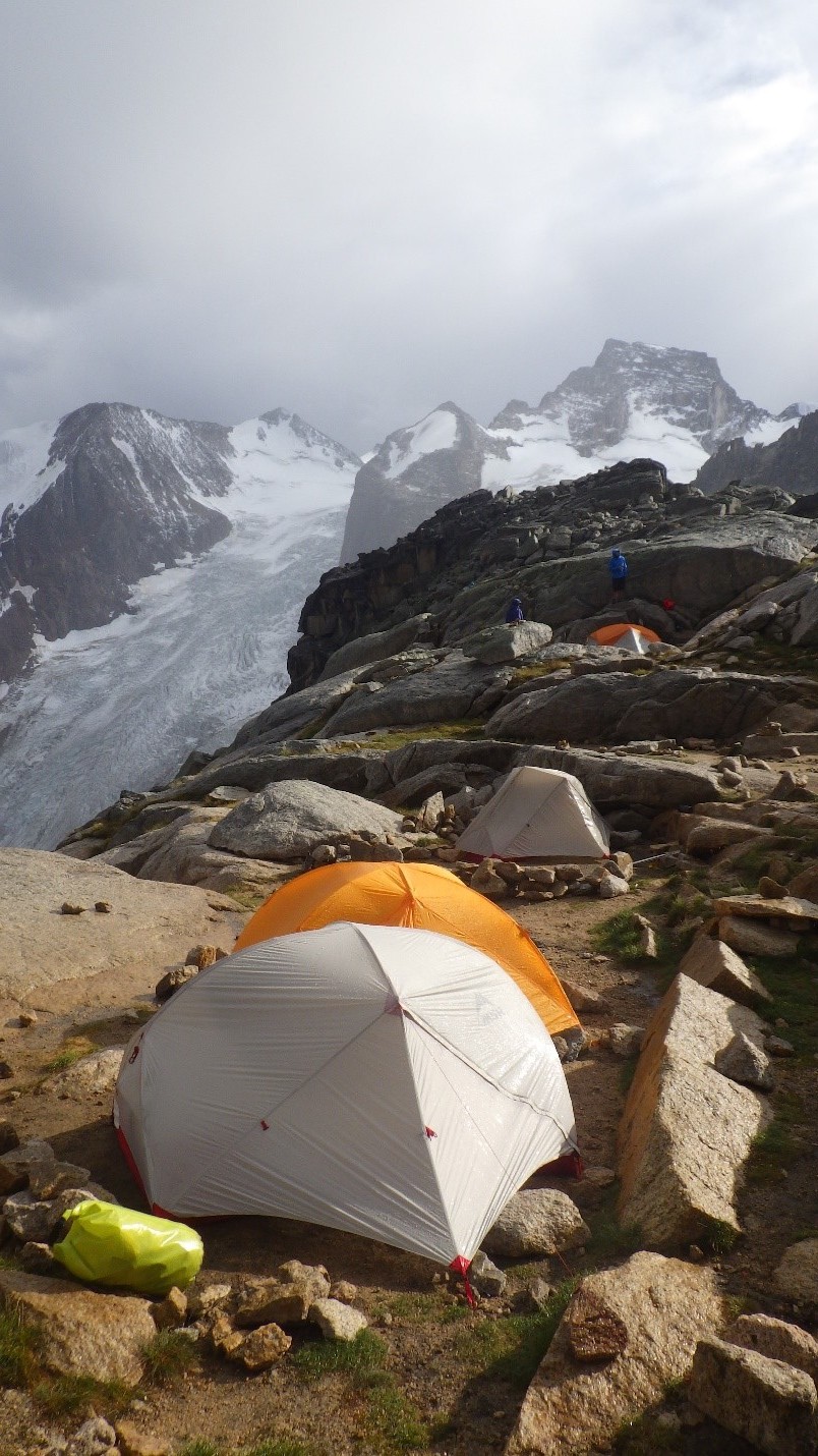
Our campsite at Applebee. Photo by: Cora Skaien.

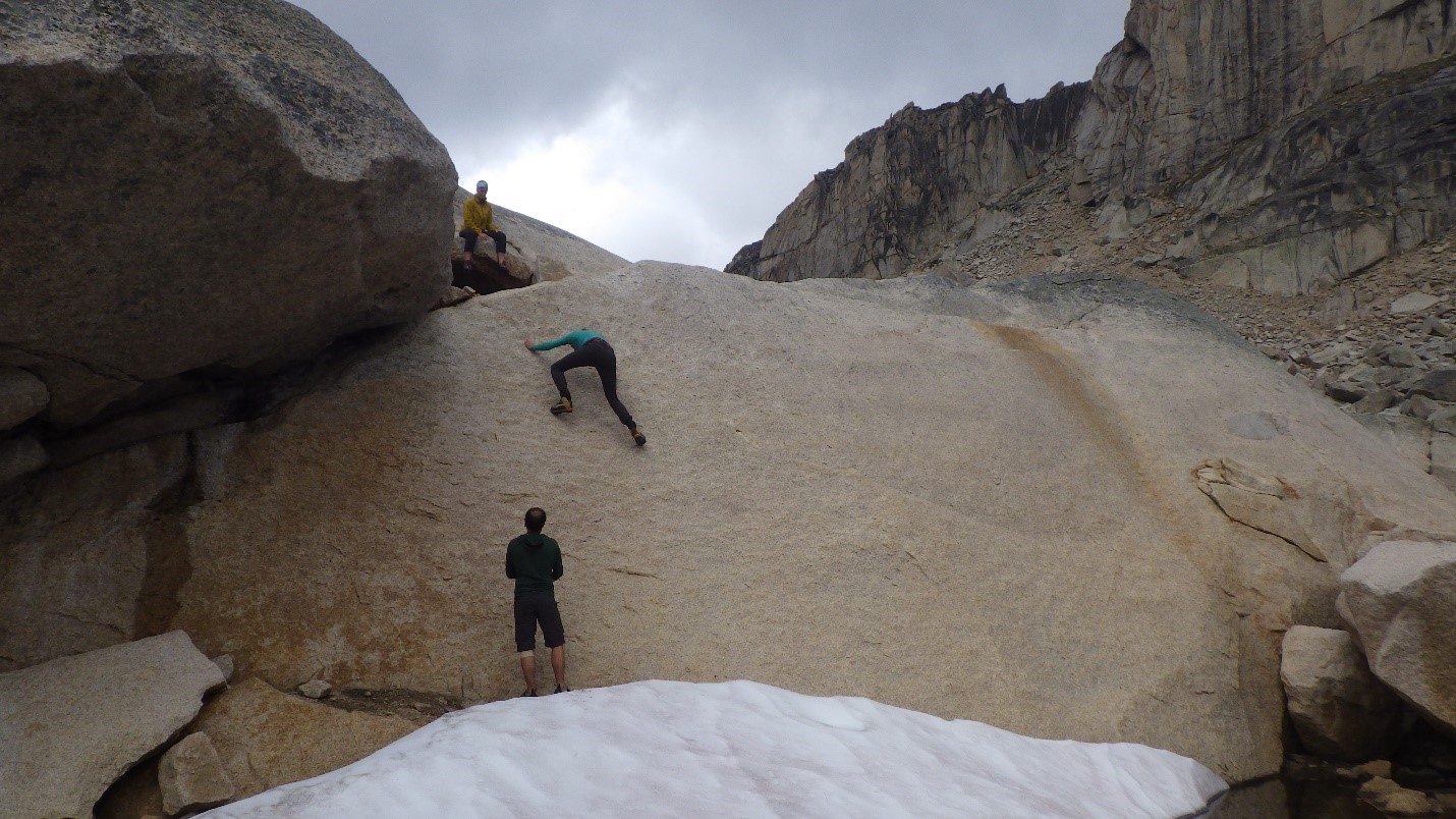
Jeff bouldering the highball slab problem. Photo by: Cora Skaien.

Carly bouldering the highball slab problem. Photo by: Cora Skaien.
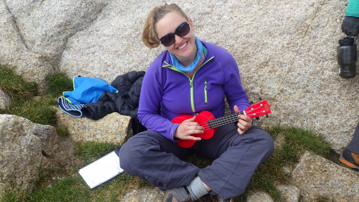
Cora playing ukulele. Photo by: Artem Babian
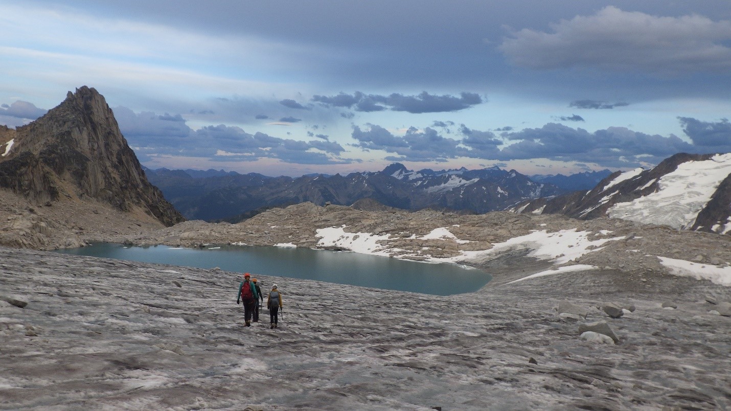
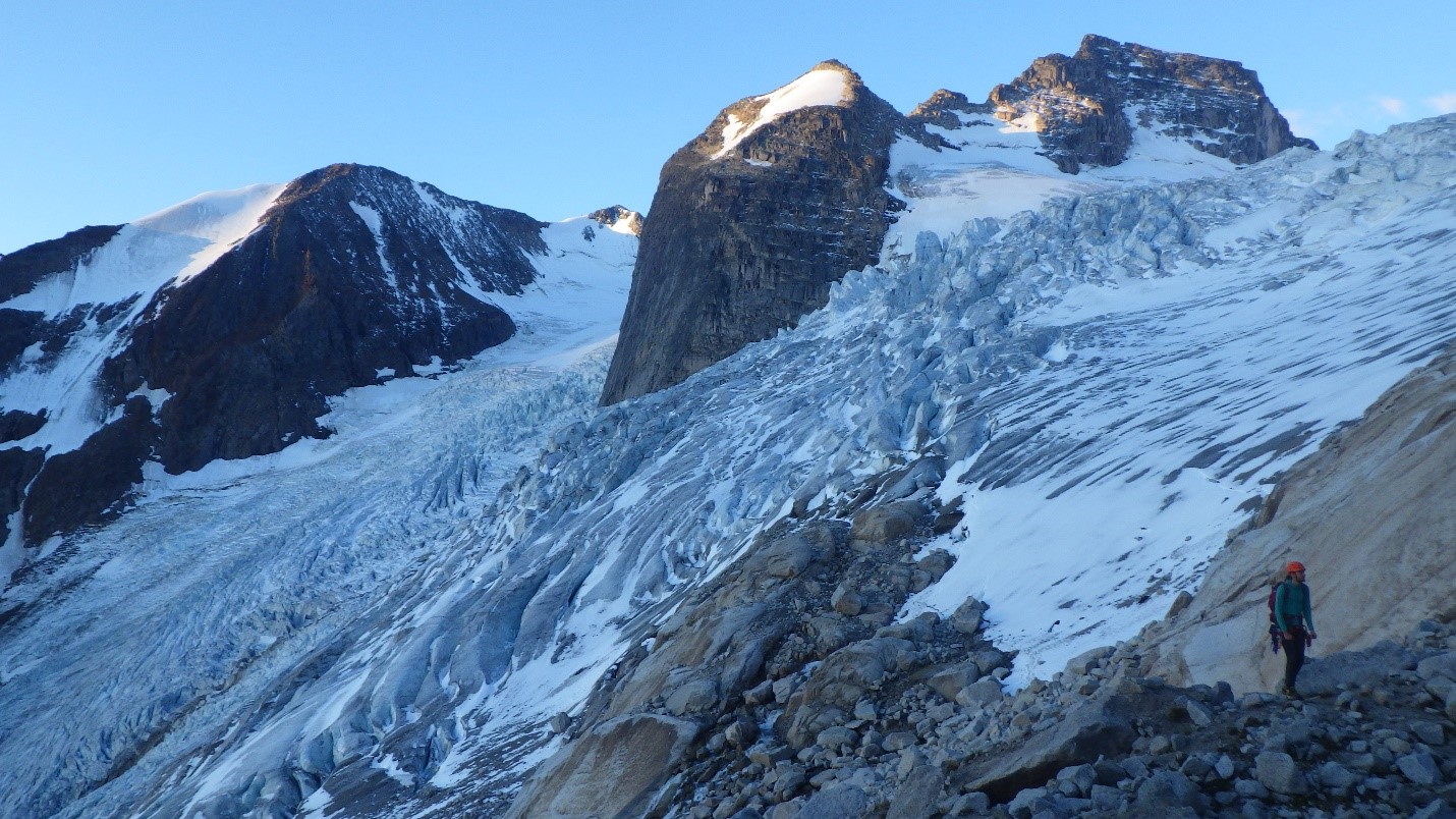
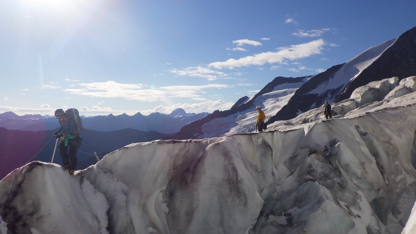
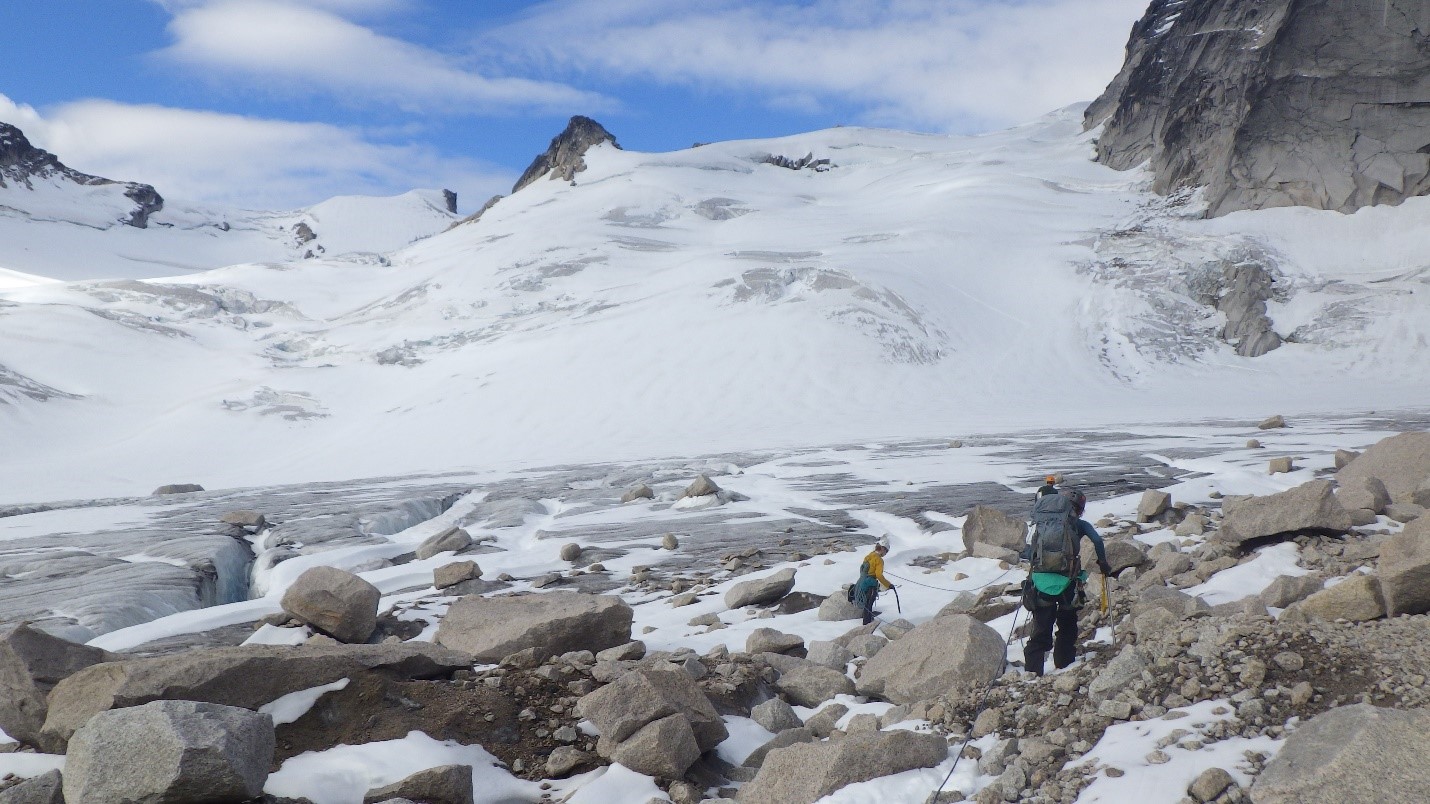
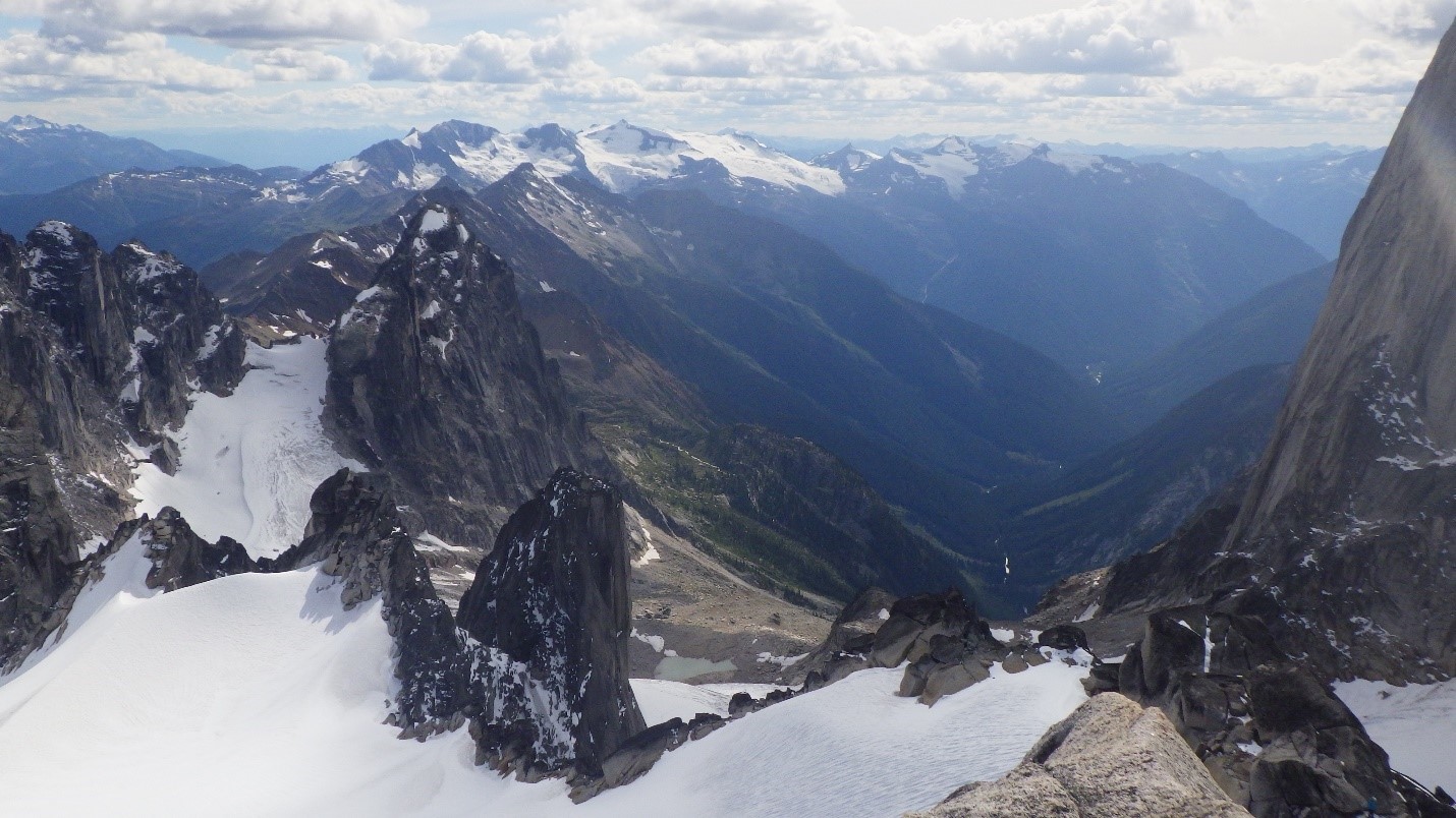
The forecast suggested that Wednesday was going to be a beautiful day, with the weather deteriorating in the days following. We decided to get our Alpine start and be out of camp shortly after 4 AM to cross the Bugaboo Glacier and make our attempt up Pigeon Spire (West Ridge, 5.4). We crossed the glacier as a rope team of 5, and then intended to be two independent groups up the route. Getting on to the glacier posed a few problems initially, and involved some class 4 scrambling. Shortly before we stepped on to the glacier, while crossing a boulder field, a rogue boulder decided to come down and crush Carly’s hand. We did not find out about this until a few hours later, when it was determined that her finger was in fact quite possibly broken, and that Carly was in a considerable amount of pain. Eventually she indicated that her finger hurt, and we found a “source” fruit bar in one of our bags to use as a finger splint, giving her a fruit bar finger. Once we were on the glacier, we also had a lot of fun placing protection (ice screws) as we descended onto an ice bridge in a crevasse and topped out on the other side. Crossing the glacier, and seeing all of the beautiful peaks around me was honestly the highlight of the trip! The beauty was awe-inspiring.
Approaching Bugaboo Glacier. Photo by: Cora Skaien.

Jeff looking over the glacier. Photo by: Cora Skaien.

Navigating the glacier. Photo by: Cora Skaien.
Navigating the descent into the crevasse. Photo by: Cora Skaien.
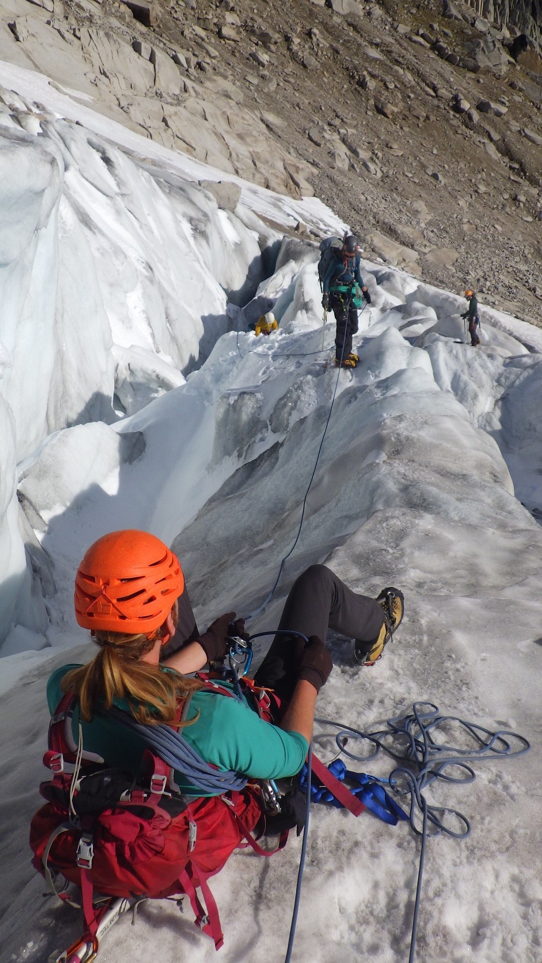
Jeff belaying the rest of the crew over. Photo by: Cora Skaien.
We reached the base of Pigeon Spire to do the West Ridge (5.4), found the “World’s most picturesque outhouse”, and began our journey up. Because of Carly’s extremely unfortunate finger injury, she realized that she would not be able to continue. We were very sad about this, as we knew how excited she was for this specific route. Most of the 5.4 route is class 4 and 5 scrambling, with a single pitch of 5.4. However, the exposure if very serious, and if you make a bad step and take a fall, you could easily fall hundreds of meters. I very quickly realized that the conservative mountaineer in me was not going to be comfortable soloing this route. Artem and Jeff were happy to solo and began on their journey safely, while Natalie and I weighed our options without Carly. We decided that we would pitch out the first steep section to feel out the route, and then solo or simul-climb afterwards. Because the moves were not very technical, I was quite happy to lead the routes, but was not comfortable soloing. The first pitch was a slabby face with a few cracks. Immediately after this into the next section is a squeeze chimney, which we decided to pitch out again after much discussion. I managed to have a full boob jam, with no hands or feet holding on, due to how tight the chimney is. I was foolishly wearing my rain jacket still, which now has large gashes from my escape while trying to get the chimney to relinquish me. Because we were unsure of the route, each transition was often accompanied by 30-45 minutes of discussion regarding whether or not to continue, or to head back. The squeeze chimney was definitely the hardest part of the portion of the route that we did, and the scrambling became much easier after this. We made it as far as we could before our turn around time of 2:00 PM with our painfully short 25 meter pitches (same 60 meter glacier rope, doubled up), shortly beneath the first false summit, which is where we also happened to meet up with Jeff and Artem on their descent. There were rap rings just above the squeeze chimney, and we tied two 60 meter ropes together to rappel nearly to the bottom of the slabby section with the cracks. Unfortunately, the rope got horrendously stuck. Natalie and I tried for a long time to loosen it, but could not. At this stage, I was very weak from lack of food and the cold, and did not have the coordination to safely get the rope un-stuck. Luckily, Jeff was able to climb up and free the rope (which required him to go all the way back to the top). There was no explanation for what the rope could have been stuck on… it simply did not want to budge.
Artem using the picturesque outhouse. Photo by: Natalie Makepeace.

Natalie using the picturesque outhouse. Photo by: Artem Babian.

Cora preparing to belay Natalie up. Photo by: Cora Skaien.

Natalie enjoying the journey. Photo by: Cora Skaien.
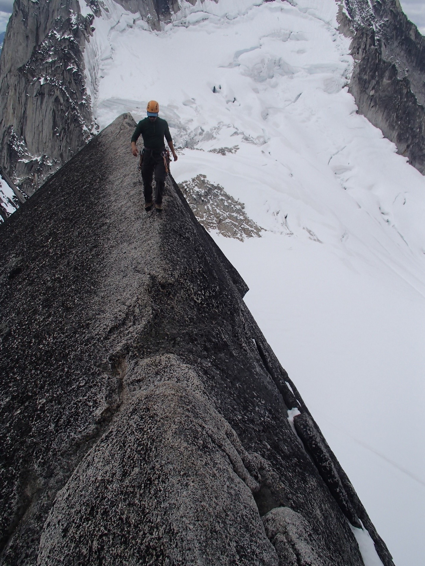
Artem walking across the classic ridge on the West Ridge of Pigeon Spire. Photo by: Jeff Taylor.
Jeff on Pigeon Spire. Photo by: Artem Babian.
Jeff approaching the summit. Photo by: Artem Babian.

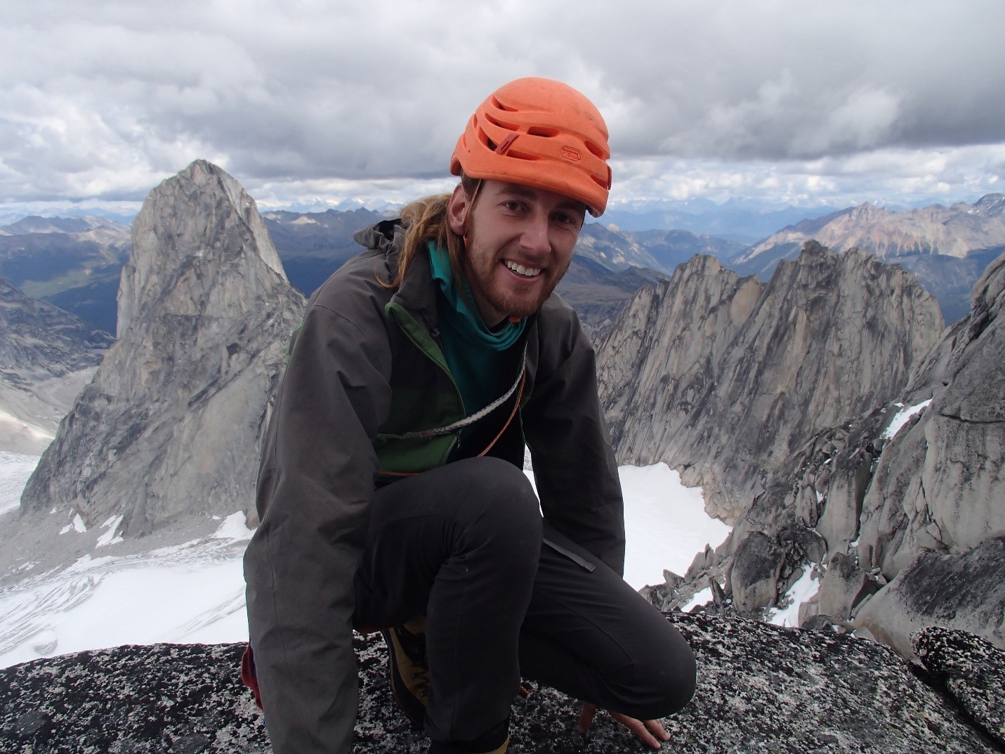
Artem at the top. Photo by: Jeff Taylor.

Jeff at the top. Photo by: Artem Babian.

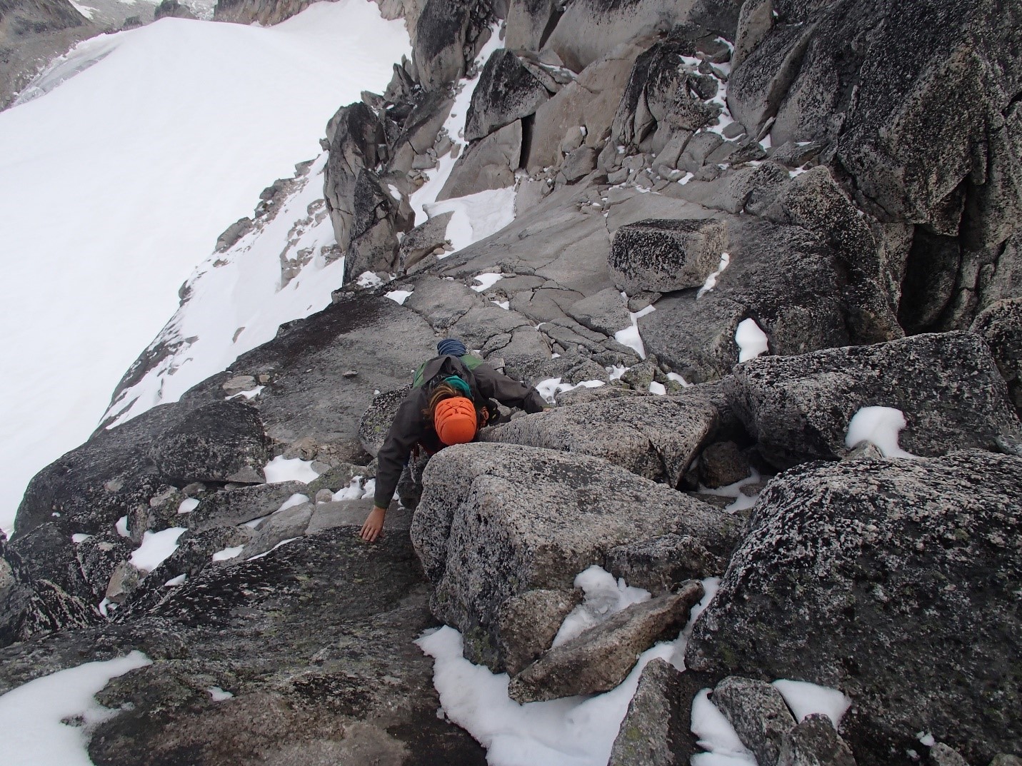
Artem down-climbing on the West Ridge. Photo by: Cora Skaien.
Cora down-climbing back to Natalie. Photo by: Artem Babian/Jeff Taylor.
We descended the glaciers as a group of 5, the same way we had come up. We had to place protection through the crevasse once again on our way down, and found a rap station for the section that we had to scramble up on our way in. We made it back to camp about 45 minutes after sunset, made a late dinner and went to bed. The next day, Artem and Jeff had plans to do McTech Arete (5.10a) if the weather cooperated, and us girls were going to consider going up Eastpost Spire via the class 4 scramble route given Carly’s finger injury.
Unexpectedly, I woke up at 4 AM (Wednesday) in a large amount of excruciating pain in my eyeball. I started popping ibuprofen, hoping it would dull the pain. I had noticed the day before that my SPF 60 sunscreen had sweated into my eyes while crossing the glacier, and it had irritated my eye, but I assumed that the pain would reduce while I was sleeping. Was I ever wrong! I made my way to the water faucet and tried to flush my eye with no success (Note: do not do this!! There could be amoebas in the water if not sterilized which can worsen the situation!). I then woke up Carly saying that I might need to go to the hospital. My eye was in a lot of pain and I had already lost 50% of my vision in that eye. Carly woke up and helped me sterilize water, and proceeded to flush my eye with the sterilized water. Soon after, some kind strangers offered some saline solution, and we alternated flushing and sterilizing my eye with the boiled (and subsequently cooled) water and saline solution. Two other nice strangers provided allergy eye drops. Eventually, we bandaged my eye with gauze and put sun glasses and a hat on me, and I accepted my fate of popping 400-600 mg of ibuprofen every 2-3 hours to simply dull the pain to a barely tolerable level while laying in the tent. Carly was also with me in the tent, due to her finger injury, and we convalesced while Natalie scrambled up Eastpost Spire, and Jeff and Artem explored some routes not in the guidebook (the weather was on and off rain, so they did not attempt McTech Arete in the end). Jeff and Artem ended up on some fairly interesting, loose routes, and decided to name them in Carly and my honour: Fruit Fingers (5.9) and Sunscreen in my Eye (5.6R). These climbs appeared to have some sketchy rock and pro, and sketchy rappels even with tat left behind.
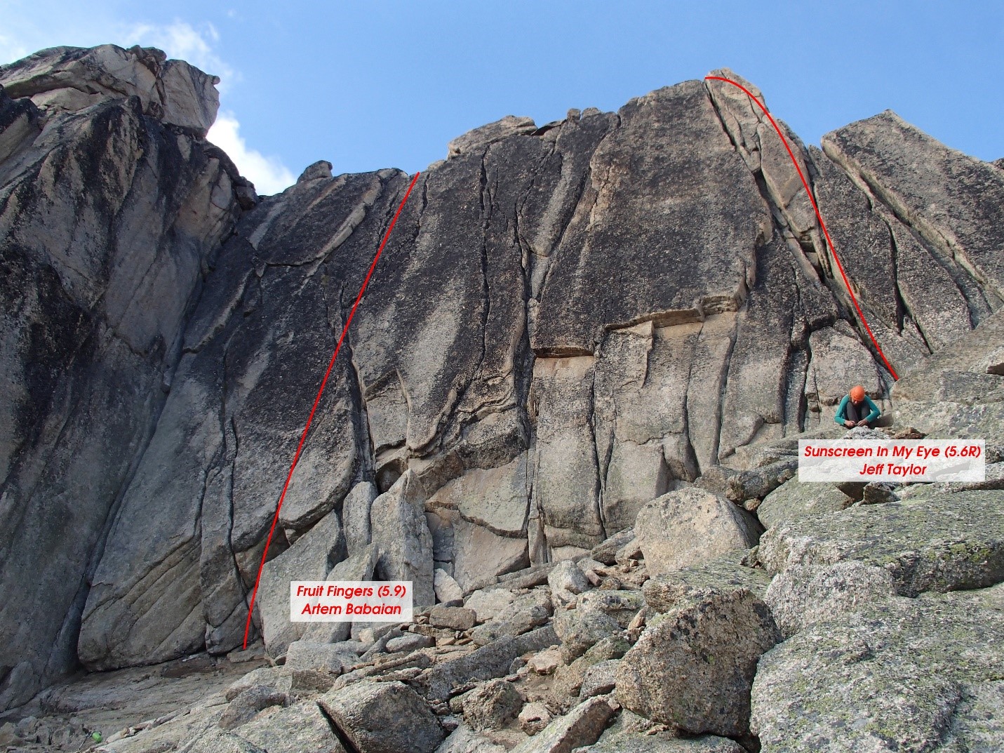
Photo by: Artem Babian.
I ventured out of my tent and was fortunate enough to come across a nice European couple who graciously donated some antibiotic eye drops to me that they had been carrying in case of eye infection. I began using these religiously, and 6-8 hours later, the pain began to subside. I was hopeful that the pain might reduce enough for me to hike out Thursday morning, and then we would head to the hospital. I was right! Carly and I headed down early since my eye was still bandaged and my depth perception was reduced. We made great time, and eventually everyone else met us in the parking lot and we headed out early to get me to the hospital in Golden. There, they were concerned that it might have been ocular herpes, an infliction that can lead to blindness. Therefore, we had to cut the trip short and drive all the way to Vancouver (the nearest ophthalmologist) to have my eye checked. I was dropped off at 3:30 AM at the hospital and was scheduled for an emergency appointment early the next day (Saturday). Good news in the end: not ocular herpes! And eventually the pain, swelling and redness subsided and my vision nearly fully recovered.

Cora’s bad eye. Photo by: Carly Peterson.
I was sad that I made my group leave early, and I was sad that Carly’s finger prevented her from additional adventures. However, I had such an amazing week in one of the most beautiful places I had ever seen, and had such a great time with the amazing company that the group was! I think we all had a fantastic time, and know that we have to return again in the future to conquer bigger objectives in less injured states.
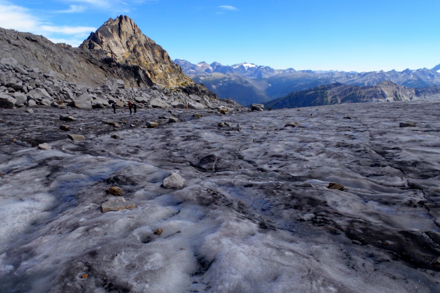
Photo by: Natalie Makepeace.
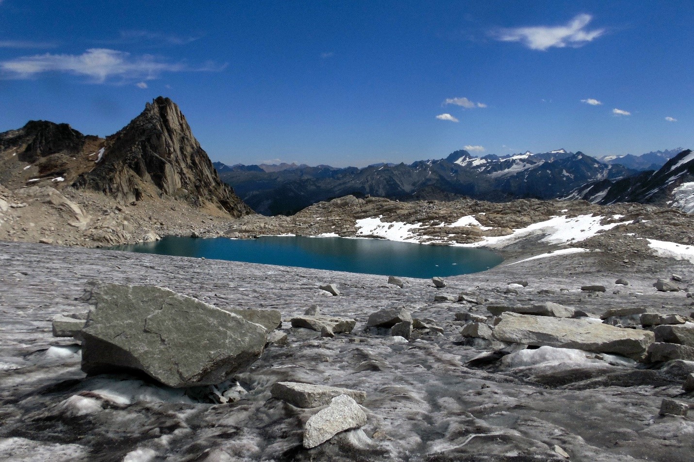
Photo by: Natalie Makepeace.

Photo by: Natalie Makepeace.

Photo by: Natalie Makepeace.
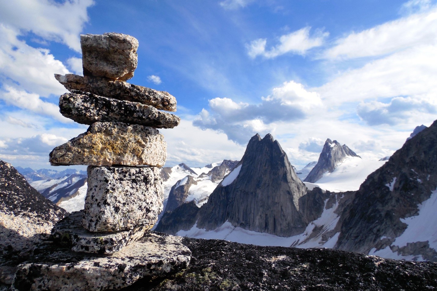
Photo by: Natalie Makepeace.
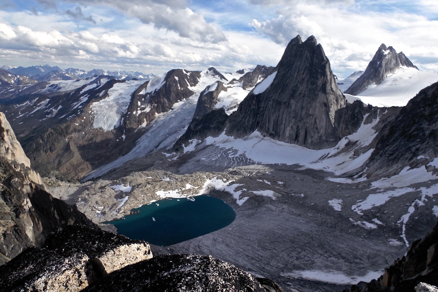
Photo by: Natalie Makepeace.

Photo by: Natalie Makepeace.

Carly and Cora at camp. Photo by: Natalie Makepeace.

Photo by: Natalie Makepeace.