Where is Mt. Pootlass? Why would one go there? Why were there three rodents?
A while back my son, Devlin, was given a copy of Ship’s Whistle by the cafeteria cashier while aboard one of the ferries to Vancouver. It’s printed on newsprint and is narrated by Captain Salty, a seagull wearing a captain’s cap, and has all sorts of facts about the ferries, seafaring and the ocean. It includes a list of ferries and their sizes, which is how Devlin learned about the Nimpkish, the smallest of the fleet, which only holds 12 cars. He immediately put riding the Nimpkish as the most important of his life’s goals. I thought this would pass in a few months, but it didn’t. While googling the Nimpkish we found out that it was going to be retired in 2018, which sealed my fate of attempting something this summer somewhere the Nimpkish services.
Nimpkish
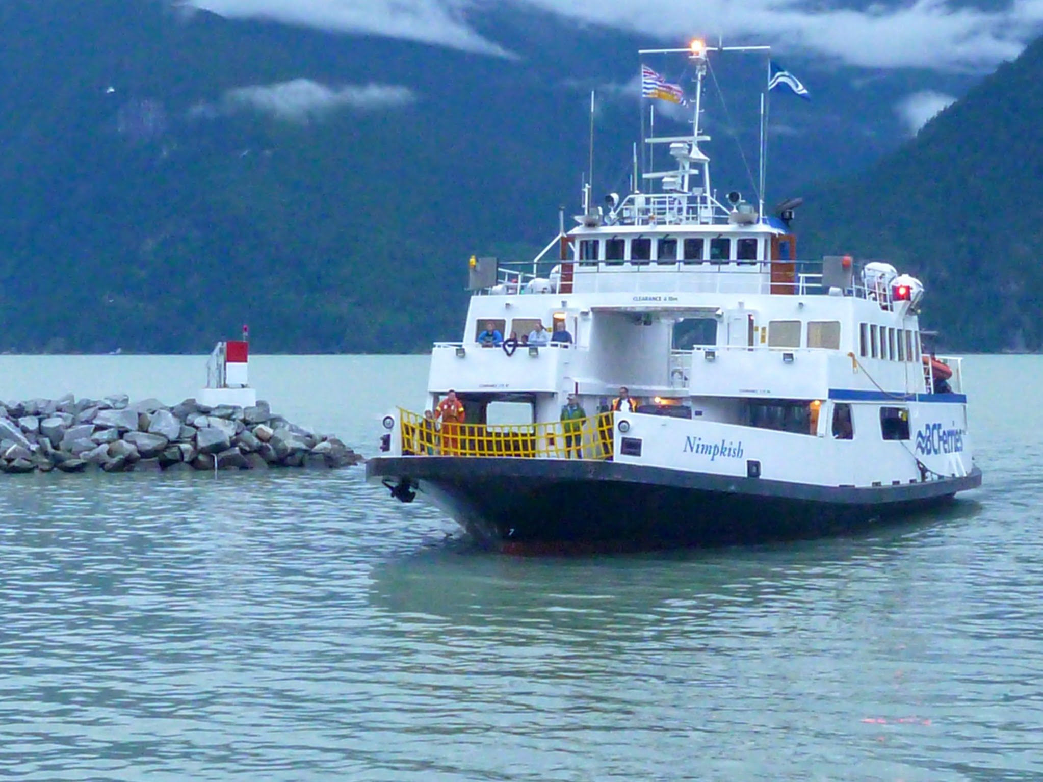
The Nimpkish sails to Bella Coola, Bella Bella, Shearwater and Ocean Falls, all fairly infrequently. It’s half a day from any of those locations to any other one, so each town sees the ferry once every few days, which makes trying to plan an extended weekend trip very difficult. Devlin wanted to do something with a kayak approach. Taking a vehicle aboard the Nimpkish costs a small fortune, it’s reservation only and all spots were full for any reasonable time, which left us with renting a kayak somewhere. With the vacation time I had remaining, the only thing that sort of worked was to fly to Bella Coola, rent a kayak, paddle somewhere over the Canada Day long weekend, and ride the Nimpkish away on July 2.
Partially because of Devlin’s preference of skiing over climbing and partially out of dumbness, I decided that the thing to do was to take a shot at climbing Mt. Pootlass and skiing the glaciers on top, so I paid for plane tickets to Bella Coola on June 28th and foot passenger ferry tickets from Bella Coola to Bella Bella and from Bella Bella to Port Hardy on July 2, as well Greyhound back to Nanaimo on the 3rd.
Now that I’d put the cart before the horse, I started trying to rent a kayak. Glacier Creek Outfitting, which is just outside of Bella Coola, had guided kayak tours, so they definitely had boats. I sent them an email asking for the rates and didn’t mention Devlin’s age. I got an email back from one of the proprietors at Glacier Creek, Kerry, who very politely and apologetically asked my to fill out this form describing my kayak experience and how old Devlin was, explaining that she needed to asses sea kayaking ability since the inflow winds were a concern on sunny days. I talked to Scott Webster about this, and he said that I had better not mention all of my kayak experience or I’d definitely get branded as way too dumb to rent a boat to. Many years ago, through a long progression of suboptimal decisions, I ended up in the middle of Howe Sound, at night, in January, in a snowstorm with fifty-knot winds and a hypothermic Veenstra in a tandem kayak. BC Ferries had the sense to cancel all sailings but not us. In another incident, after getting spanked on the sea cliffs opposite Britannia Beach, I lowered the kayak down from the cliff into the water, at night, in a different January, as the wind picked up. I rapped into the boat, pulled my rap line and then realized that the front of the kayak was still tied to a tree that I now would have no chance of getting to. The front of the kayak might have been a hundred miles away at that point, and my knife was stowed in a hatch, so I ended of using the paddle to push myself off the rocks while I hacked through my rope with an ice axe. I totally agreed that I had to conceal my dumbness, but the best evidence that I could deal with the wind was of course when I got myself into a pickle. I ended up providing a sanitized list of trips and admitting that Devlin is eight while pointing out that he does an awful lot of ski touring, has his AST1 and has a lot more sense in the backcountry than a lot of people that are his senior by a decade or two.

I’m a dumb guy.
To my relief Kerry wrote back and said that thought things sounded great and that she and her husband, Alex, did the same kind of stuff as what I’d admitted to with their three kids and sent a bunch of pictures. It also turned out that her sister’s family owns the Tallheo Cannery, which was a cannery many years ago but is now this rad super-rustic resort/museum-type place.
Our plan, for lack of a better word, was to arrive at the Bella Coola airport at noon, then kayak to Tallheo with the skis strapped to the deck and gain 1600 m bushwhacking that night, then skin up the glacier to the summit of Pootlass, maybe even summit Pootlass NW3 the second day and then thrash back down on the third day, ready to catch the Nimpkish at 7:00 the next morning. The people I’d talked to about it had their doubts, and frankly I did, too, but I’ve always preferred giving it my all and failing to reach the objective than doing something easy.
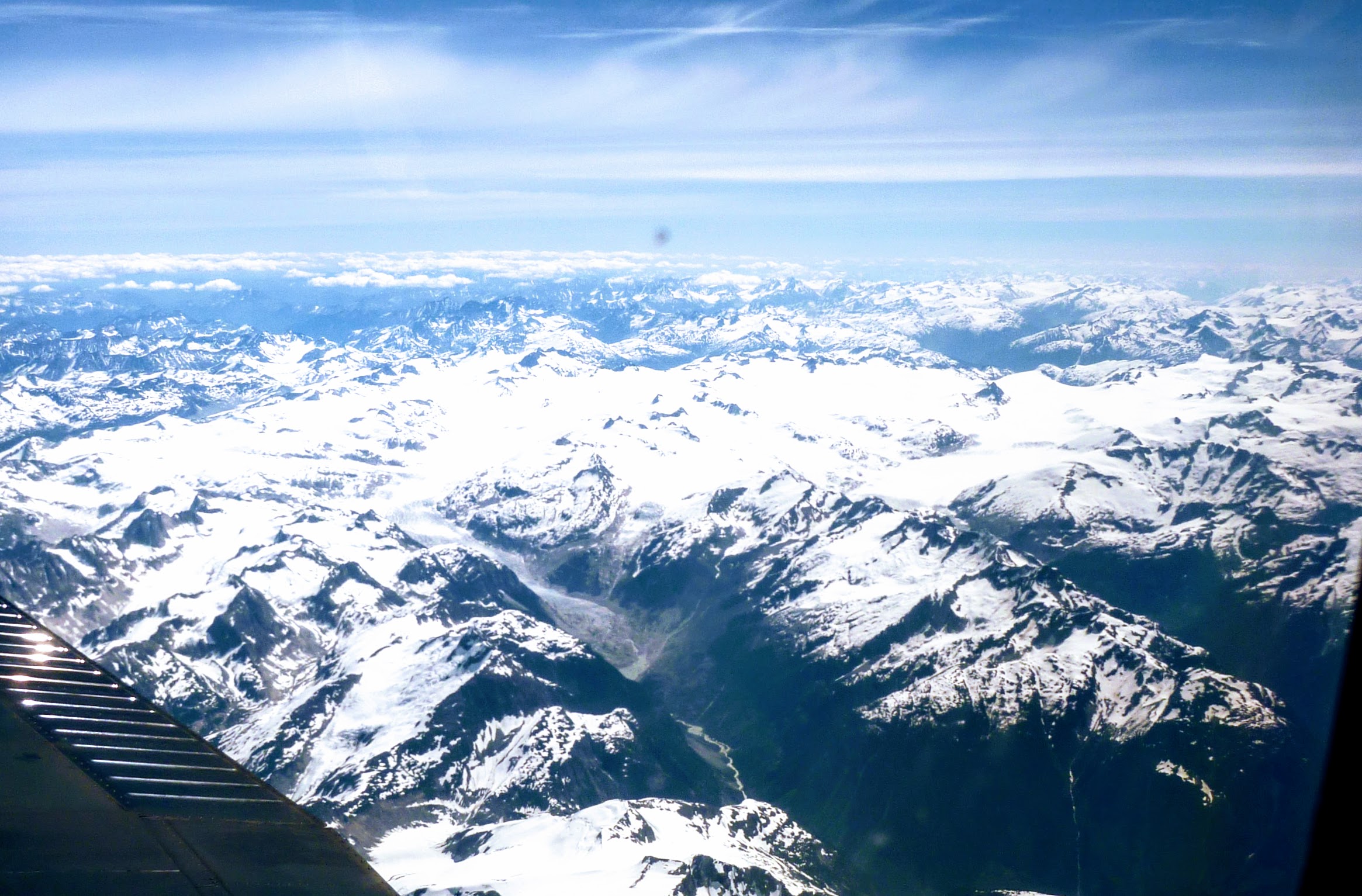
There was no assigned seating on the tiny plane we were on, and despite making an effort to be near the front of the lineup—a number of people pre-boarded because they had a kid old enough to not need pre-boarding or whatever, and this other dude just outright pushed to the front of the lineup because he’s a five-year-old with parents worse than my wife and me—we ended up with the wing of the airplane cutting out most of the view. Despite that, the flight in was beautiful. We got great views of Garibaldi, Tantalus, the Pemberton ice cap, Homathko icefield, Mt. Waddington and a zillion gnarly mountains I didn’t recognize nearer to Bella Coola. As we approached our destination the pilot warned that the winds were picking up, so the plane was going to get bounced around.
Homathko Icefields
Waddington

We were met at the airport by Kerry and Alex. They clearly had their doubts about whether heading off against the wind was a good idea, and were clearly worried about Devlin enough that they lent us a shorty wetsuit for free. Their guide season hadn’t quite started yet, so they both had day jobs to attend to, and there was a lull in the wind, so we ended up unsupervised with the kayak at the wharf. The wind was starting to pick up as we got ready, and got going some more out on the water, but the crossing wasn’t bad at all. The water was shockingly warm, and I only got one wave that really washed over the top of my head. Although Devlin is a fair bit shorter than me, his end of the boat rides a lot higher, and he didn’t even get one good wash-down.
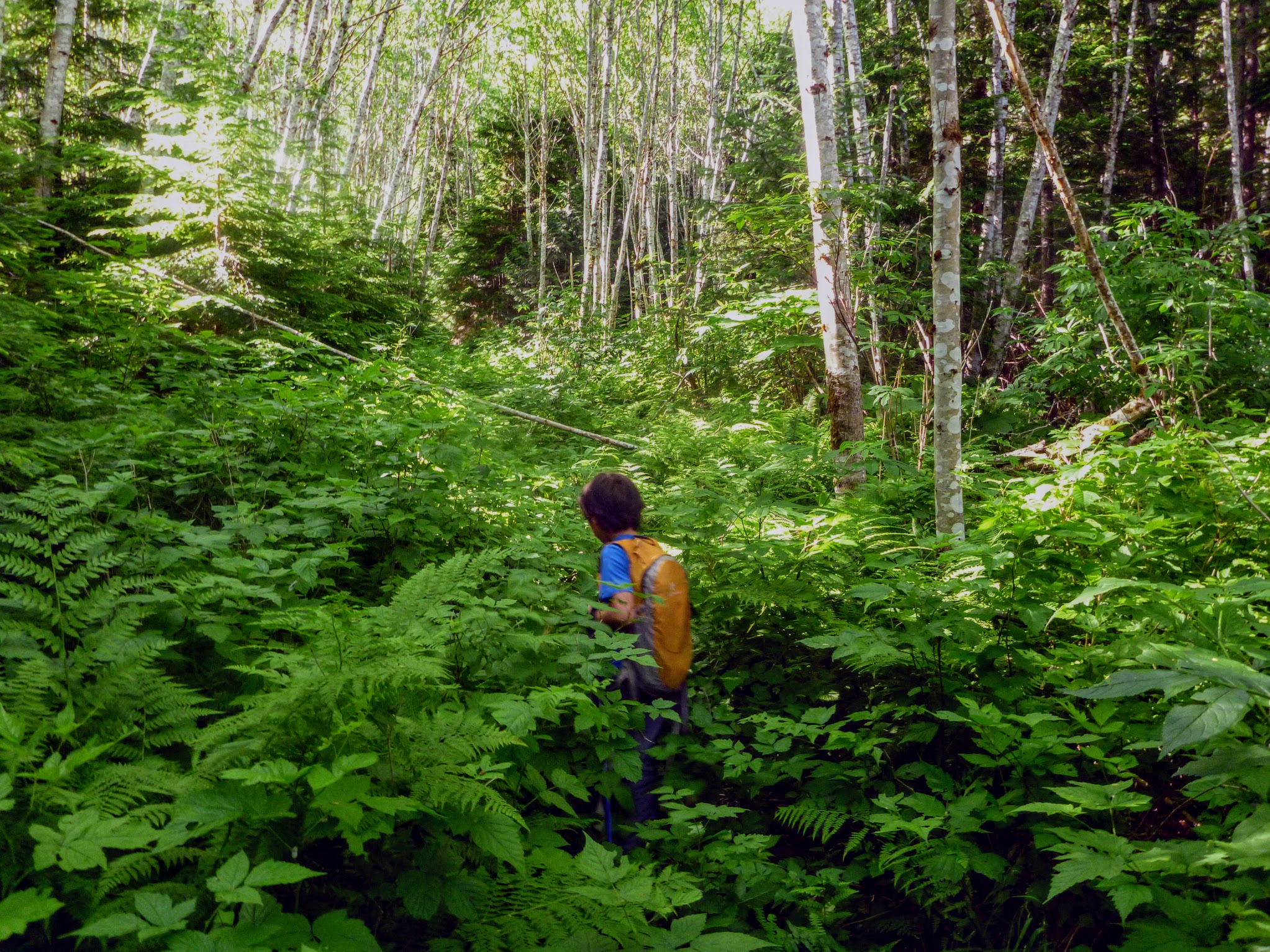
When we arrived at Tallheo, we were met by Garrett and two of his friends. He started telling stories of when John Baldwin and John Clark came through. Garrett had been a heli-ski guide for some years until he got avalanched and then concentrated on camp maintenance and I think being a raft guide, if I remember correctly. He thought we were rad, and the feeling was mutual. His friends didn’t seem particularly disturbed about the prospect of bushwhacking up the mountain with two pairs of skis on the pack but thought that hiking with AT boots was horrifying, so they were clearly not familiar with trees.
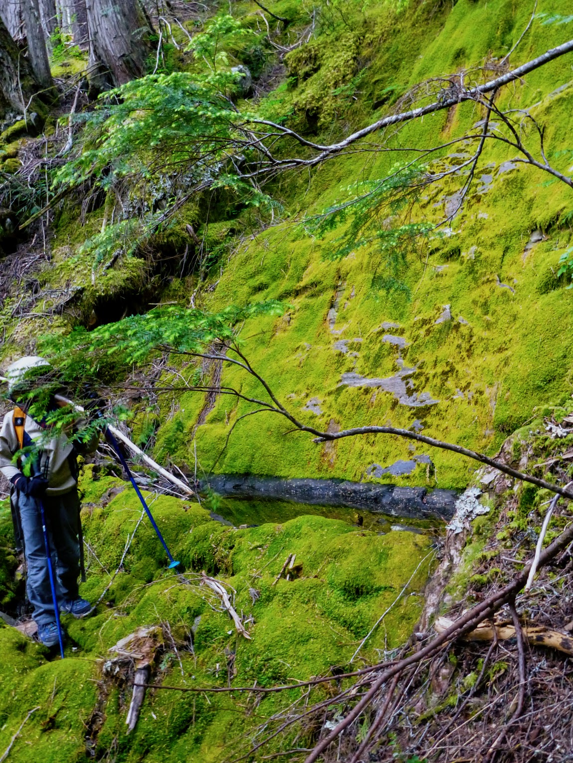
We’d had a significant faff at the wharf converting airplane-compatible packing into kayak-compatible packing, and then another faff at Tallheo converting again to hiking mode. We finally got heading up at 4:45. We headed up an old logging road that Garrett had brushed periodically until we got to mature forest and started bushwhacking up. We followed a very circuitous path to get around devil’s club and alder, so uphill progress was really slow. This was of course not particularly surprising but disappointing.
Bushwhacking
The biggest mistake I made on the trip was the amount of water I was carrying. My standard summer BC coastal water allotment is 2 L if it’s just me and 3 L if Devlin’s with me, which up till now had only been not enough once. We’d be hitting snow at 1500 m, if we made it there, and it seemed like there should be meltwater coming down somewhere. By 8:00, though, we were basically out of water—just a little bit reserved to wet our mouths the next morning—and I was totally parched. I was making sure that Devlin had enough and I was suffering for it. We realized that we were nowhere near snow and started investigating each devil’s club patch for any sort of pool of water, but didn’t find any before dark and went to bed pasty-mouthed. We didn’t have any water to cook oatmeal the next morning so we thrashed upwards for a couple hours. I was about an hour away from pulling the plug on it all and heading back to the creek at Tallheo when we found a little creek. It wasn’t much; it took a couple minutes to fill a water bottle but it was enough. I drank about three litres, we had our oatmeal and filled up all the water bottles. We started heading up again much happier.
Glorious water

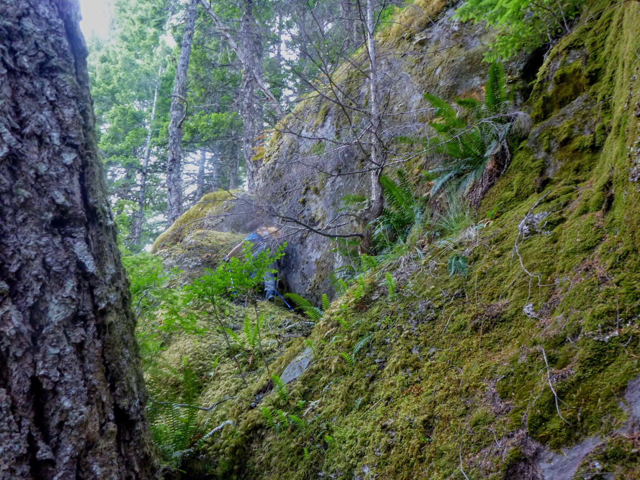
We started getting into the sub-alpine/treelineish area at about 3:00 and we were again running low on water. The terrain was getting steeper, so we ended up doing a fair bit of up-and-down to find a safe route. Time was certainly going forwards a lot quicker than we were. The mosquitos were getting much more excited as we got higher. At 4:45 we were under yet another bluff flanked by brush on both sides that was going to send us down and around again, and we still hadn’t found any snow, although we were looking down on the snow on the other side of either valley. We had a talk and agreed that we were getting into fiasco territory if we continued pushing ahead and if we were to be stuck in the bush and miss the ferry we’d be stranded in Bella Coola for a bunch of days.
Getting steeper
“I feel that we should have made it to the summit.”
“Because you think that we’re failures for not making it or because you think we put in a good enough effort?”
“I think with that much effort that we should be at the summit.”
“Well, as they say, the mountain will still be there.”
“What does that mean?”
“It means that you shouldn’t risk it to try to summit because you can always come back again another time.”
“If we come back in two years then that’ll be good.”
On the way down we dodged some of the nasty stuff we’d just come up by taking a line a bit more to the north. This seemed to work out great for a while, but after every drop of 50 m in pleasant terrain we were faced with another choice between going further north or going down something loose, steep and brushy. We ended up coming down a few kilometres up the valley from the ocean and got into a dicey spot, with a long stretch that alternated between high-angle thicket and steep, smooth moss-covered rock. Below us and to the north were a series of short bluffs that were all way too loose to responsibly down climb. It was getting late and we were at almost no water again.
Crossing a steep bit and totally missing a good chance to get water
“Dad, are you scared?”
“I’m just thinking about where to go.”
“Are we going to even get on the Nimpkish?”
Us getting to the Nimpkish was starting to look a touch more dubious, but my more pressing concern was whether or not we were going to have a terrible night. We weren’t able to move any direction at any sort of reasonable pace, it’d been ten hours since we’d seen water, and my mouth was starting to feel like it was coated with climbing skin glue. My heels were blistering up, I was a bit banged up from taking a slide into a tree, and the skis that I’d taken for a walk were now being a real pain. Since I was bending over and crawling all the time they weren’t staying put on my pack and were attacking. Devlin was running out of gas too and was expressing his doubts about whether we were going to get down in a non-epic manner. If we found water and found a place flat enough to put the tent up we could sort ourselves out and still have a mostly enjoyable outing. Another night of more severe desiccation followed by not finding water for a bunch more hours in the morning seemed decidedly not fun.
We had another talk and decided to head further north, not because it was a good idea but because it was less bad than going back up the mountain, over the bluffs or into the band of high-angle moss and scrub. It was starting to get darker but thankfully a little less parching, and we were able to get down a few layers of bluffs as we pushed north.
We couldn’t really see what we were doing on account of the brush and ended up at this place where we were at the cusp of a little drop-off, but the top of the cliff seemed to go up interminably whether we went north or south. I dropped my pack, told Devlin to wait and investigated down-climbing. There was this miraculous series of features; there were a series of ledges that dropped down, each one climber’s left of the one below and into this short chimney. It would have been a way dodgier thing than I’d have been willing to do except there were a correspondingly miraculous series of trees that gave good hand holds and provided a safety railing. I was able to comfortably pass the skis down one at a time, get my pack down and then spot Devlin.
From there our descent got easier and we made it to the old logging road just before twilight. For a bit it seemed like were were going to have no problem making it to the ocean by headlamp. There were fifteen-year-old trees growing out of the road, but it had only a few spots of brush and following it was easy. It wasn’t clear if we were on the part that Garrett maintained or not. There were some patches of devil’s club and other thorns and some blow-down, but it was not inconsistent with something that hadn’t been brushed for a couple years.
Just as it got really dark we hit a long section of genuinely heinous stuff that sealed the deal that we were on a portion that hadn’t been maintained since the dawn of time. It was reminiscent of the first logged area on the trail to the Harrison Hut before any trail work was done—lots of logs underfoot that you can’t see because of the undergrowth, a medley of thorns and a fall of unknown distance into thorns if you came off the logs. The bushwhack either side of the road looked terrible as well, so we hacked back to where a dry creek bed crossed the road, put on the headlamps and stumbled down the creek.
As we went down we got more and more devil’s club. The great thing about devil’s club (yes, thats how this sentence starts) is that a zesty swing of a ski pole will go right through it, so given sufficient gusto you can machete through it without a machete.
Devlin ran out of gas, but there was nowhere plausible to set up a tent and we still had no water. Given the increasing quantity of devil’s club I thought that there had to be water not too far down, so I told Devlin to wait, dropped my pack and kept thrashing down. I found some water about an inch deep, but after some digging I was able to fill the water bottles. I drank a bunch and then went back to Devlin and we found a place where a tree had fallen and ripped out a bunch of soil with the root ball. We were able to push dirt around enough to make a tent patch and got to bed well before midnight.
In the early morning it started to rain which I was okay with. Our ancient tent is pretty leaky but getting a little wet in exchange for not being cooked by the sun again seemed like a good deal. We got up, had breakfast, refilled the water and began our bushwhack south to the ocean. As we went we gained elevation because the valley bottom is a nasty place and so that we could meet the logging road again. Thankfully when we arrived at the road it was clearly the part where Garrett maintained it. There was this year’s growth of brush and the winter’s blowdowns, but it was anticlimactically easy.
Getting back to the logging road

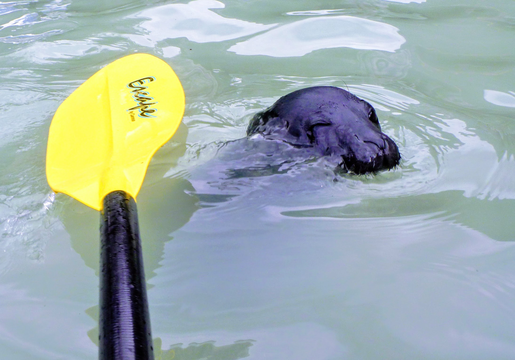
We paddled back with a light tailwind and made it back to the Bella Coola wharf without much effort, which is good, because we were pretty knackered. There was a festival of trailers at the boat launch when we arrived, so we killed time paddling around the wharf while the fiasco died down. By the ferry ramp we had a seal and a pup pop up right in front of the boat. We pulled the paddles up and I managed to get the camera out before we passed them. As we coasted by, the mother ducked down but the pup stayed up and just squinted as my paddle went over its head. We would definitely have been guilty of harassing marine mammals (that is a real crime in the books) if we’d gotten that close by approaching it, but it definitely took us by surprise, not the other way around.
Seal
By then the ramp had cleared, so we got out of the boat, got our stuff in a big pile and began loitering. Kerry showed up and collected the boat and rental fees. We told some stories and then she headed off and we loitered some more.
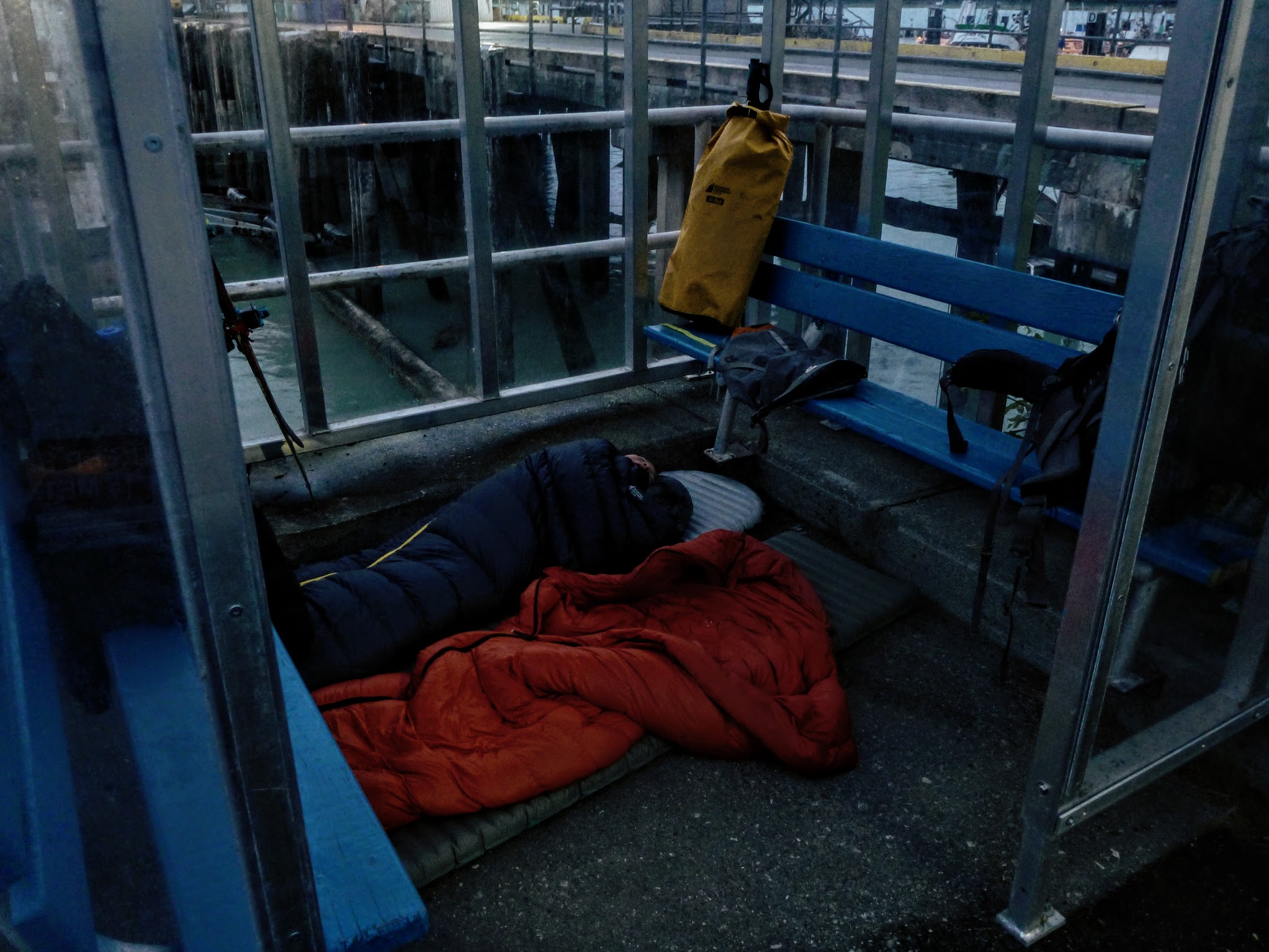
At 9:30 that night the Nimpkish showed up and we saw it unload. I really didn’t feel like walking down the highway until we found a place to camp and then back by 6:00 AM to board, so I asked one of the ferry dudes (the one guy who was on the dock waiting to receive the ferry, not any of the out-of-town staff) if it’d be okay to camp on the docks.
“Why would you want to camp in the rain when you could just put your sleeping bags in the shelter? I’d just wait until that white Silverado that says BC Ferries on the side leaves.”
That was totally the answer I was looking for. The dude gave us some pastries and we talked about bevelling edges on pipe in preparation for welding for a while which seemed to be enough of a non-sequitur to fit in well with the rest of the trip. He was rad and so was his beard.
During the night I opened my eyes and saw a mouse running towards my head. I lifted it to show that I was awake and the mouse did a 180. In the morning Devlin was telling me that he saw a rat.
“I saw that too, but it was little. It was definitely a mouse.”
“I saw two mice that were little and one that was this long.”
“Okay, then, it was two mice and a rat.”
“Why were there three rodents?”
I didn’t really have an answer for that. It’s just how many there were.
Camp of the Three Rodents
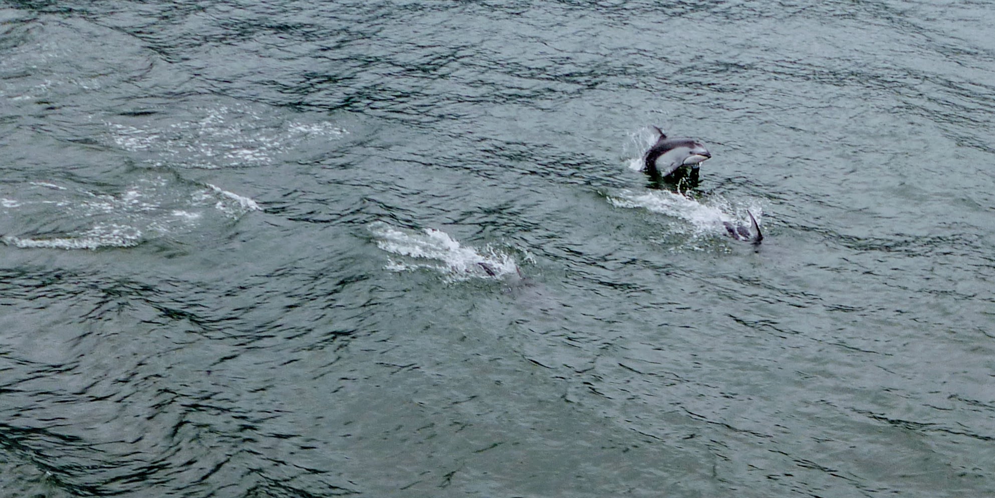
The ride on the Nimpkish didn’t start too auspiciously as the vessel was still cold and all the windows were fogged over with the rain on the outside and soggy passengers on the inside. As the boat warmed and weather cleared, things started to get awesome. The first leg of the journey, about five hours to Ocean Falls, was stupendously scenic. The captain would point out the whales, dolphins and porpoises and stop into little places to show us the Alex Mackenzie monument and First Nations art.
Alex Mackenzie Monument

I should say a word or two about Alex Mackenzie and his group: a cousin, two First Nations guides, six Voyageurs and a dog. They made it from Montreal up into the Arctic Ocean and then a couple years later from Montreal to Bella Coola. It was the first recorded crossing of North America anywhere north of Mexico, beating the much more famous Lewis and Clark expedition by twelve years, and was a much bushier, wetter and colder route. Much of the journey was bushwhacking. It was all done with 1700s gear, which I can’t even imagine. I’m assuming bearskin pants, cast-iron skis and water carried in an oak barrel. After going through Bella Coola, Mackenzie tried to make it out to the open ocean but was put on the run by Heiltsuk war canoes and retreated onto land, writing that he’d been there in vermillion and bear grease on the rock. That’s where the Alex Mackenzie monument stands, at the start of what must have been a truly hellish bushwhack back to Bella Coola, followed by a bit of a hike back to Montreal. Other points of radness include that his party’s dog appeared to be named “Our Dog” and that he named what is now the Mackenzie River “Disappointment River.”
Back to the Nimpkish: Devlin saw the humpback whales and I did not, but I’m fine with that. I’ve seen them before and what’s way more important is that I got to hear a captain of a ship say “Thar she blows!” There were lots of porpoises, and it’s been a some years since I saw them from that close.
Porpoises
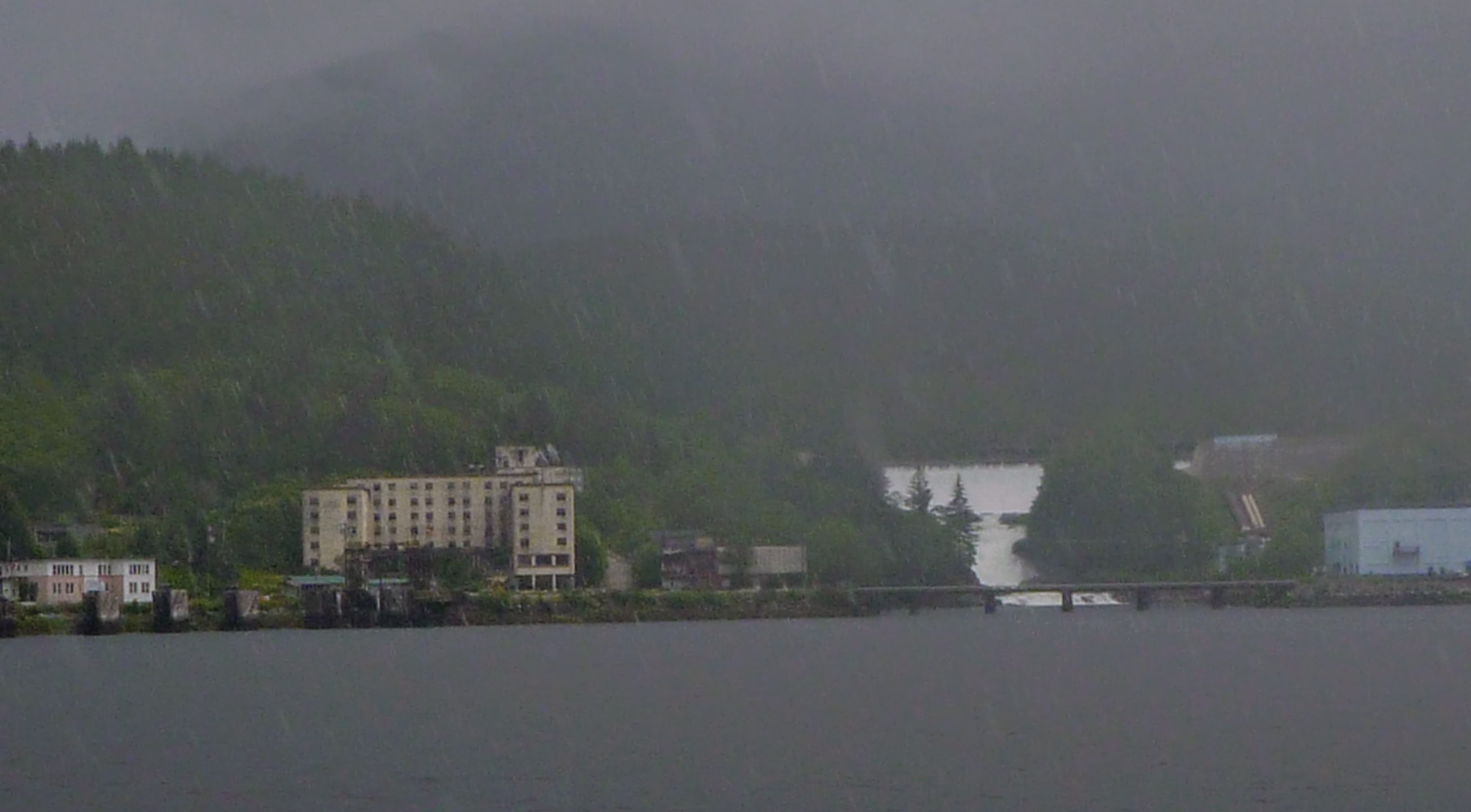
The interaction between Ocean Falls and the ferry is fascinating. Ocean Falls itself receives 4390 mm of rain a year. When we arrived it was raining, and the ferry staff didn’t seem shocked. The Nimpkish is not a symmetric ferry. It has one end with a draw bridge and the other end is a flat deck where the ferry ramp comes down onto it. Bella Bella and Bella Coola both connect to the drawbridge end, and Ocean Falls connects to the flat deck. One could imagine a bunch of cars driving on in Bella Coola, driving off in Ocean Falls, a different set of cars coming on in Ocean Falls and driving off in Bella Bella. Ocean Falls is damn near a ghost down because the pulp mill closed, so when we docked there all the cars drove off and drove on again pointing the other way. Most of the buildings are knocked down, and most of the remaining ones are in a Twelve Monkeys state. First thing you see is a 400-room hotel with trees growing out of it.
Ocean Falls
Back before we chose Mt. Pootlass, we were thinking of renting a kayak in Ocean Falls. I was kind of flabbergasted that no one in Ocean Falls seemed to rent any boats. Now Google’s failure to find me a kayak in Ocean Falls made a lot of sense.
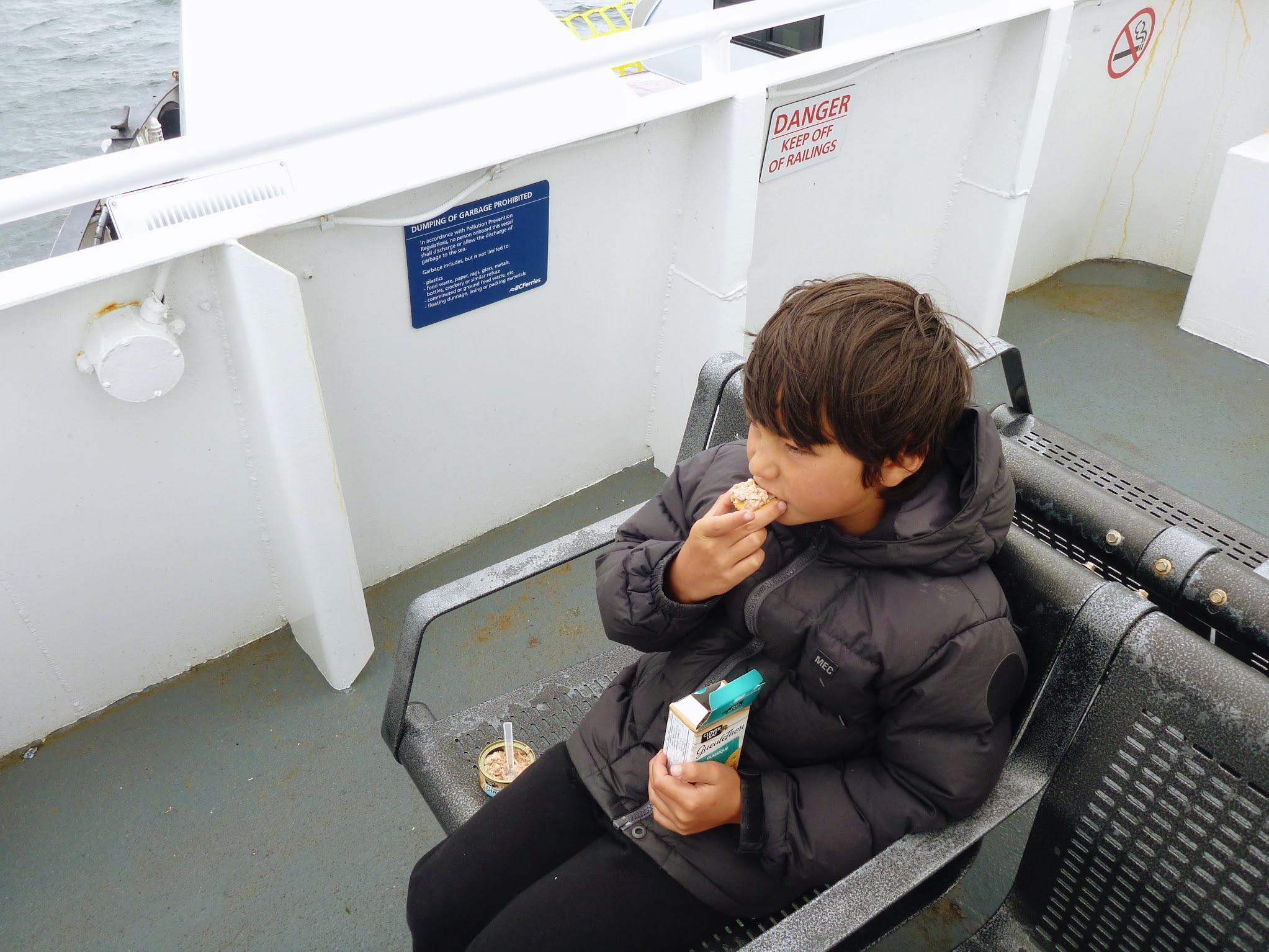
Ocean Falls to Bella Bella wasn’t nearly as scenic, so we spent most of the time eating green apples and Tuna Snacks.
Tuna Snacks
At Bella Bella we transferred to the Northern Expedition, which was a totally different experience. It’s a huge, relatively new vessel built after the Queen of the North sailed into Gil Island in the night and sank. The Northern Expedition is ludicrously plush—almost disturbingly so. I felt out of place covered in four days of filth and with a ponytail of dead bugs.
We pulled into Port Hardy at 11:30 PM and were pretty defunct. The next morning Devlin and I both agreed that it was well worth taking a crack it even if we got spanked. We’ll be back in two years to do essentially the same trip, except with more food, water and time. Full radness points for Glacier Creek Outfitting and the Tallheo Cannery.
You never
fail todisappoint me Jeff, another great trip report!Can’t edit unfortunately….Darn!
Fixed!
Never fail to disappoint?! Ouch.
You did make it far enough to leave a comment of some variety, though, so I’ll take that as some measure of success.
Whoops! Distracted while typing that and used double negative, I meant “never disappoint”!
Sorry about that, definitely did not mean to say that. You, your tr’s, and everything about you is world class!
Jeff: I hope you are compiling these TRs of yours into a book some day. I’d be the first one in line to purchase it.
What does Pootlass mean?