It took me way too long to publish this trip report, but since I keep being harassed about publishing it, I guess here it finally is (it was mostly written just after the trip). As with any trip involving bushwacking, there aren’t many photos of the miserable portions.
Participants: Lucy Buchanan-Parker, Alberto Contreras-Sanz, Vincent Hanlon, Birgit Rogalla
Date: July 1-3
Route: GPS file from Alberto.
The intention of this trip report is mainly to tell you not to go where we went. It was bushy. It was cliffy. It was unpleasant. You’ll be covered in scratches, bruises, and tear up your clothing. There are redeeming factors: lots of mountain goats and good company. If that wasn’t enough to convince you, it took us an entire day to travel roughly 6.5 km. Now, I realise that the VOC has many masochistic individuals to whom this may sound appealing, but although you can have a good time on a trip like this (we did), I still think there are plenty of great alternative options around.
The weekend started with a last minute plan to attempt a horseshoe traverse. The idea was to start up at Falls Lake, connect to the ridge coming from Yak Peak, go up Yak, continue along the ridge to Zopkios and down the 45 degree ski gully, and up to Zupjok, Llama, and Alpaca, following the Veenstra traverse route around Alpaca, up to Vicouna/Guanaco, and back down to the logging road via a flagged winter route. Sounds like a nice plan, right? Ian Johnston had warned us that we should start at Zupjok, but stubborn that we were, and intent to not do an out-and-back trip, we went for it anyway.
Day 1: Falls Lake –> Yak –> Zopkios ridge
It was full summer and the trailhead proved it: musquitos and tons of them. We trapped ourselves in the car while faffing and had the speediest car departure I’ve ever witnessed (similar on the return): it took one minute to start hiking.
Falls Lake is a very accessible area and seems to have undergone lots of recent development. There are new tent pads and camping areas. We contoured around the Lake and crossed through a field of boulders the size of small trucks. Eventually we left the rocks and followed a creek up towards some snow fields and the Zopkios ridge. We were left with unhappy options: follow a wet ledge above a cliff (option 2), traverse on steep snow above said cliff (option 3), or do a steep bush scramble up and around the cliff (option 1). With four people and three options, we all chose our own route and rejoined on top. Vincent and Lucy went for the wet ledge, Alberto went for the steep snow, and I chose the bush scramble as I regularly slip and slide around due to my worn out boots (or that’s what I like to blame it on). In hindsight, probably the best choice might’ve been a steeper snow gully just to the left of our cliff band, but the runout had some rocks.
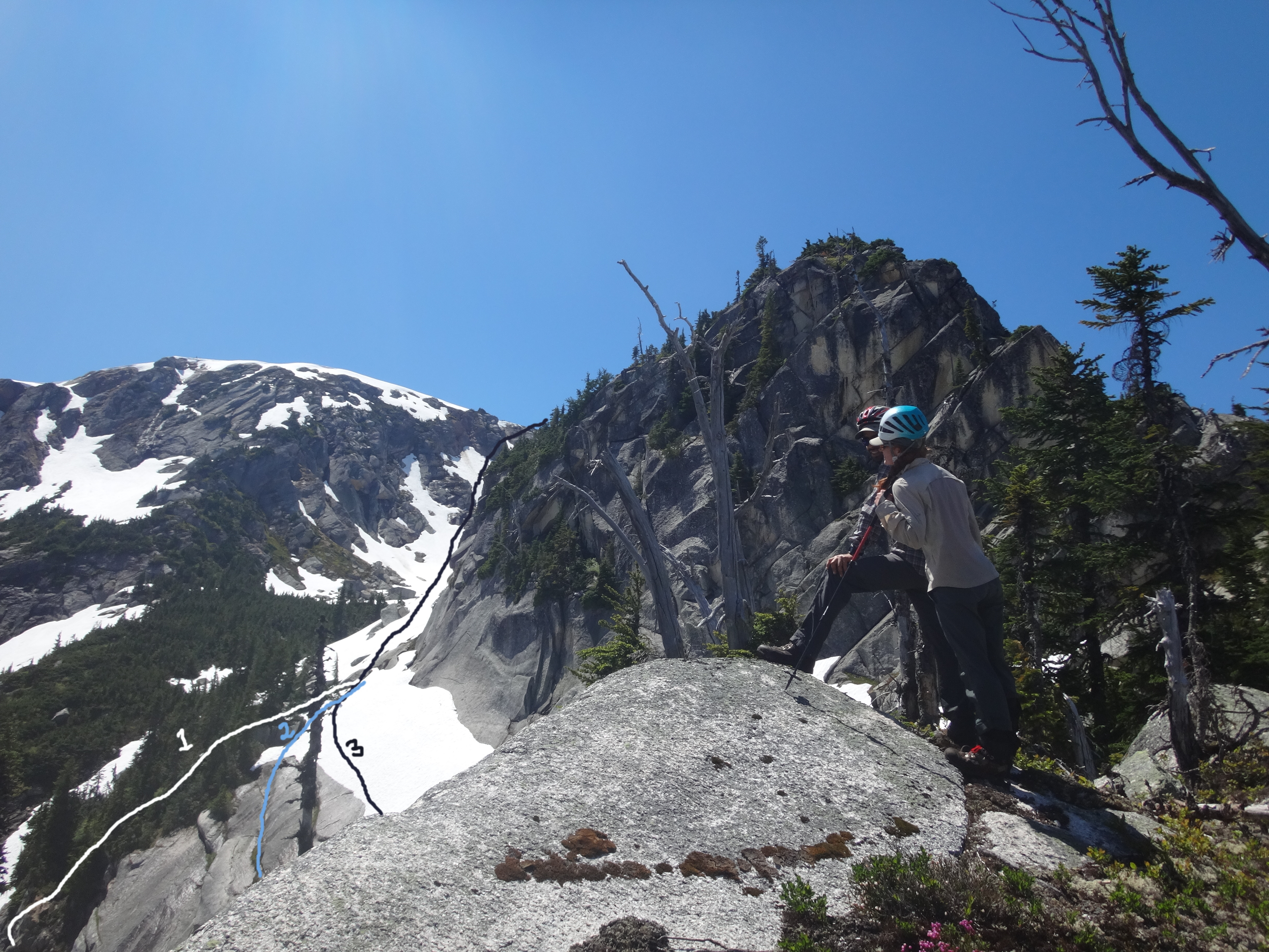
Route options up to Zopkios ridge.

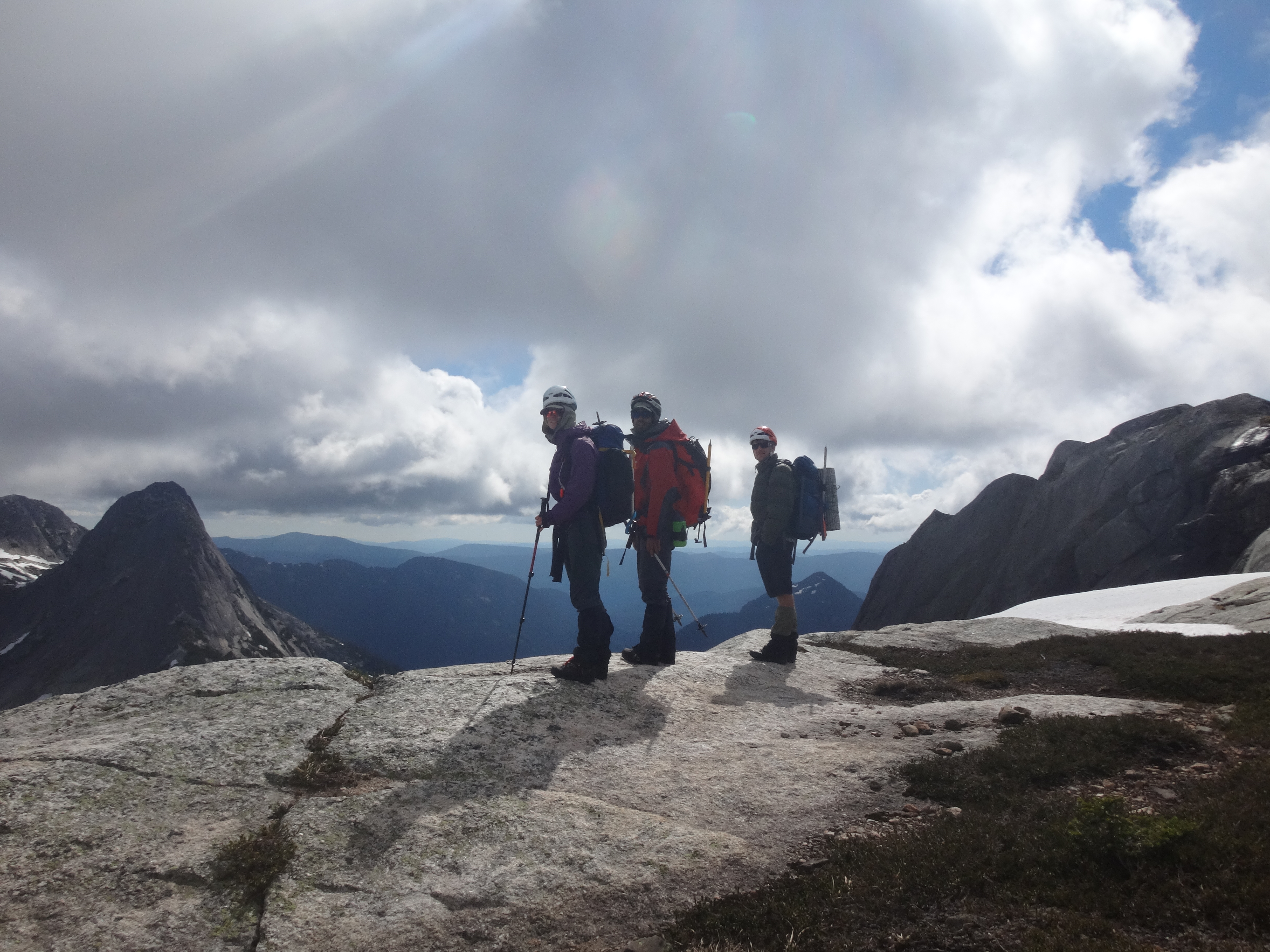
Lucy on the last bit to the Zopkios ridge.
From the ridge, Vincent and I decided to go up Yak peak from a somewhat unconventional route – the West side – while Lucy and Alberto enjoyed a break from the kids. The first part was straight forward as we followed snow slopes, squished through bushy ledges, and along some loose sand slopes. There were brief significantly exposed sections. Our route did not seem to continue up, so we traversed around the front of Yak (the part that is visible from the highway) and joined up with the normal route at the col just after the sub peak. The top was very anticlimactic – as with many peaks that look cool from a distance, they aren’t that special when you are on them. We both agreed: this was not worthwhile. The route down was easier as we avoided one of the exposed steps.
Upon rejoining Lucy and Alberto we continued along the ridge, blissfully unawares of what the ridge had in store for us. We had agreed to continue hiking until roughly 8 pm. There was some brief conversation of dropping down the ridge from Zopkios into the valley below and cutting across up to Zupjok, but it was hard to see if the drop down had any cliffs (from the other side it looked like that was a good choice), so we stayed our route. A notch and bump were ahead, but they couldn’t be that bad, right? Well, it took the rest of the evening to get there with many bush rappels (lowering yourself by clinging to branches/heather bushes). At one point, Lucy walked in front of me and as she turned around to warn me, I disappeared. You see, we were walking on branches, not the ground. The ground wasn’t visible because the bush was dense. I missed the branch I was supposed to step on and fell through the brush in between two boulders, with only my head and shoulders sticking out above the ground. Surprised and shocked, I crawled back out and learned that not even the ground can be trusted.
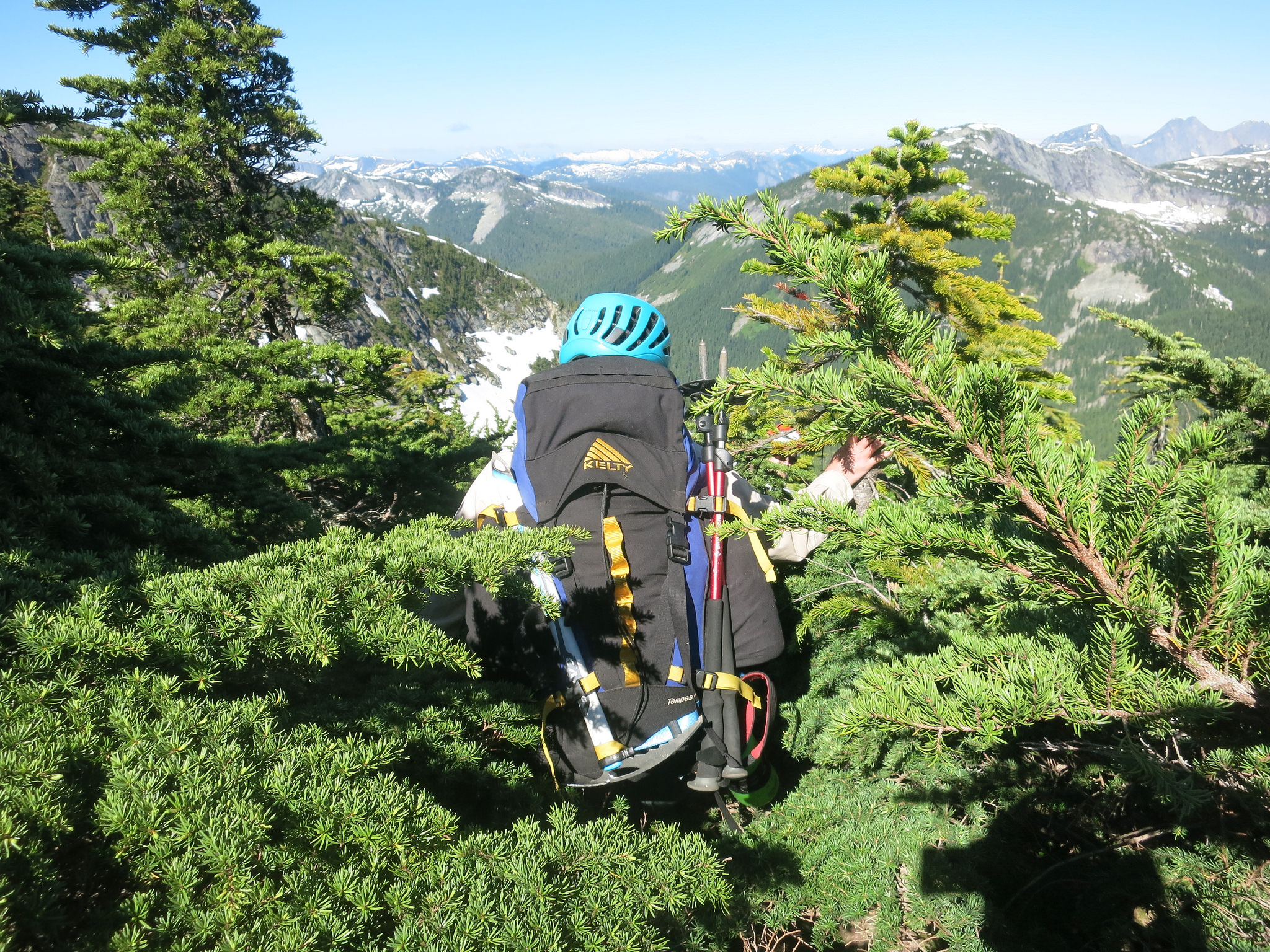
Disappearing in thick brush.
In our attempt at going light, we’d all left our tents at home, so we tried to find a flat patch out of the wind (it was windy most of the trip). As the sun was setting, we were treated by views of the mountain goats that roam this ridge. One mountain goat lit up in gold, while the rest of the snowpatch it stood on was dark from the shadow of the ridge. Their tracks appear all over it.
Day 2: the day we became intimate with the curriculum of Bush Safety Training Level 2.
We started the morning apprehensive of what was to come. As the day progressed we discussed the various components of Bush Safety Training and agreed that this must be at least BST level 2. There were too many cliffy / bushy sections to mention, so the going was slow. At one point we reached a narrowing in the ridge with a high boulder right in the middle. There were two options: go around left in head high steep bush and try to crawl our way back up, or follow the goat trail (there’s something slightly concerning when your preferred choice of route is to follow the mountain goats). Eventually we found another option: to crawl underneath the boulder.
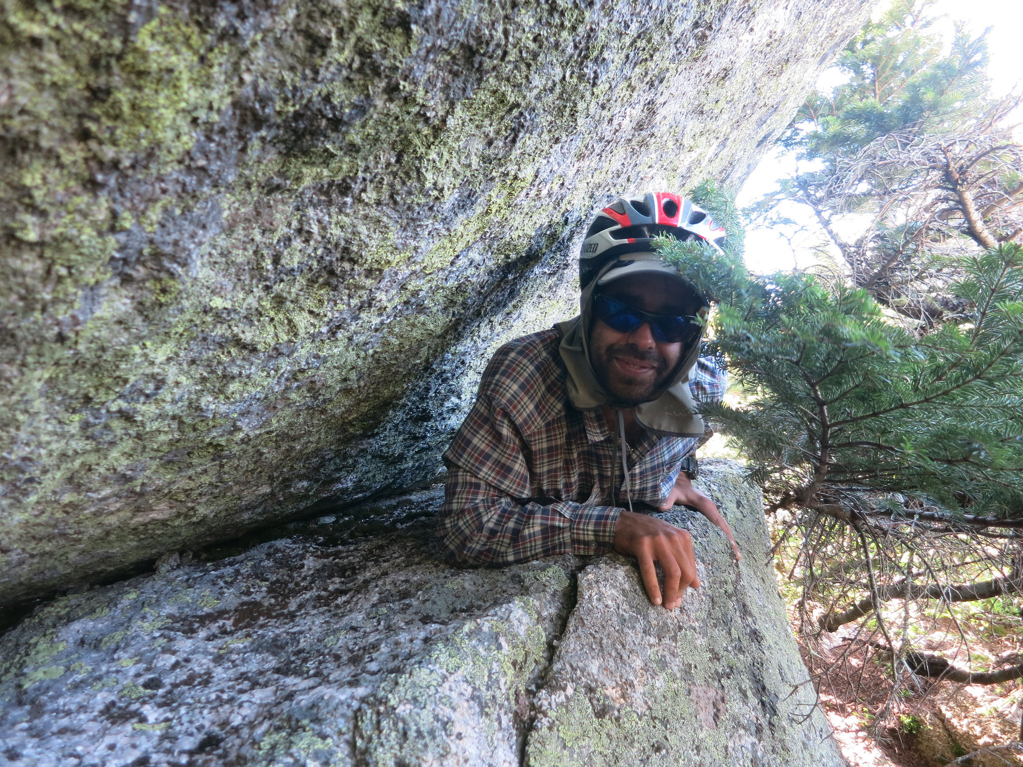
Alberto crawling underneath the boulder blocking the route.
Each gentle bump along the ridge filled us with dread of what was to be the other side. Would this be the time we’d have to turn back and retrace our steps along this horrendous ridge? The same procedure would unfold. We paced back and forth like hyena’s, dropped our packs, and looked for a route down the cliff bands. Eventually somebody would call out saying “I think I found something.” To which there were responses of relief (and doubt). We’d convene and look at the dubious route. “So, does it go?” “Well… it’s not the worst thing we’ve done this trip.” Sometimes that doesn’t mean much. Solutions varied from a steeper scramble that we lowered our backpacks down to bush rappels where really the only thing you are hanging from is branches. I wonder what force of nature formed this peculiar ridge. The east side of each bump was fine (if you ignore the brush), but the west side unfailingly consisted of rock bands and cliffs.
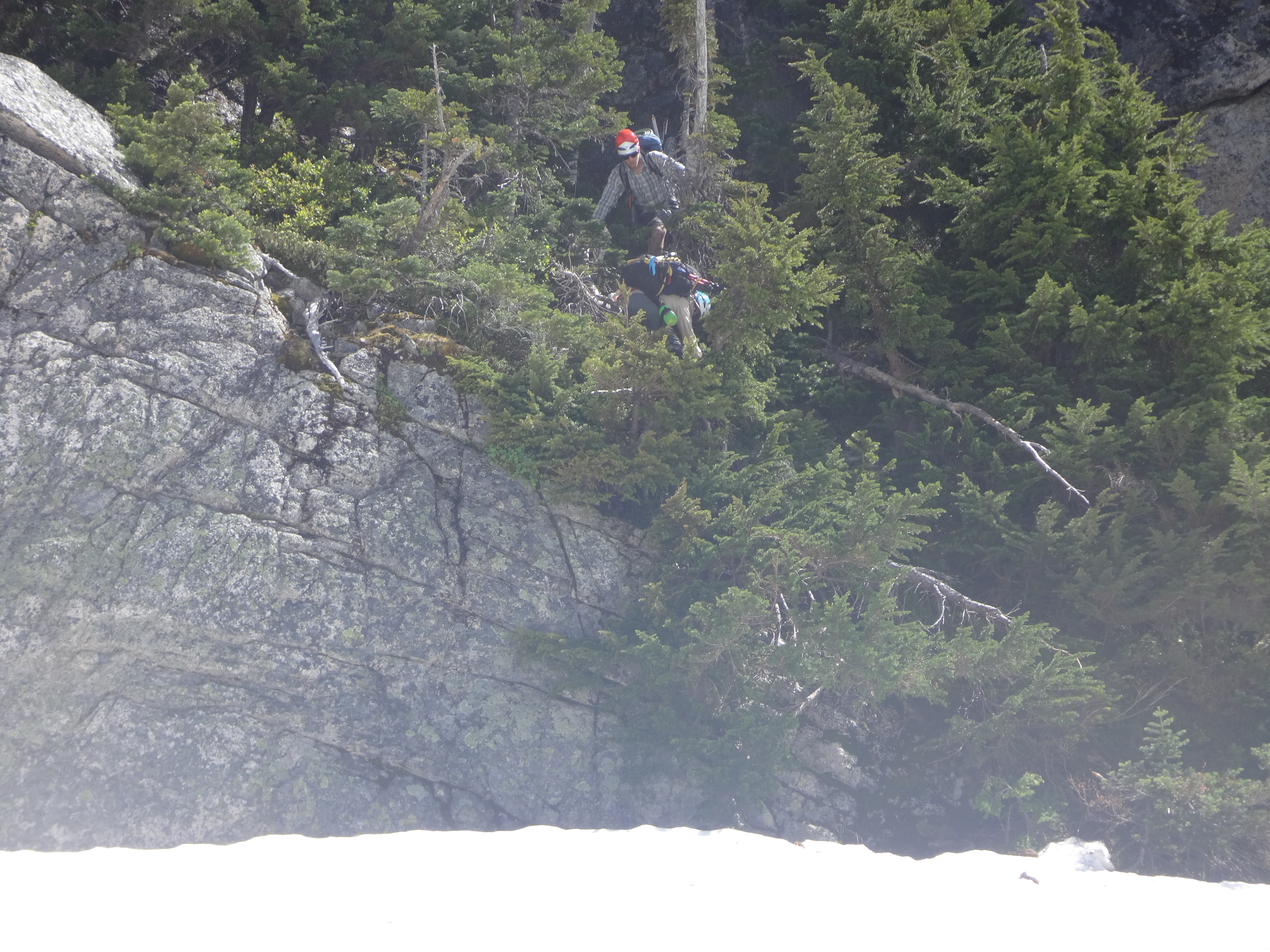
One of many bush rappels down cliffs.
Now for a slight detour from the story: how my water bottle is (was) doomed. First in an attempt to fill it with runoff I dropped it underneath a snow overhang and spent ten minutes trying to fish it out using my ice axe as hook. Having expended all the effort to gather it, I put it back in my pack and we continued. Not even an hour later, after a miscommunication while lowering packs down a scramble section, my water bottle went flying down the snow slope below. It tumbled, rolled, tumbled some more, hit a rock band, and kept rolling. Finally, after what felt like a minute, it stopped. A small speck on the field of snow that I couldn’t even see without my glasses. Luckily it wasn’t too difficult to retrieve (no littering), but it was now about as useful at holding water as a sieve – the bottom was smashed. This is the second bottle I broke this year, the first one mysteriously has a hole melted in it…
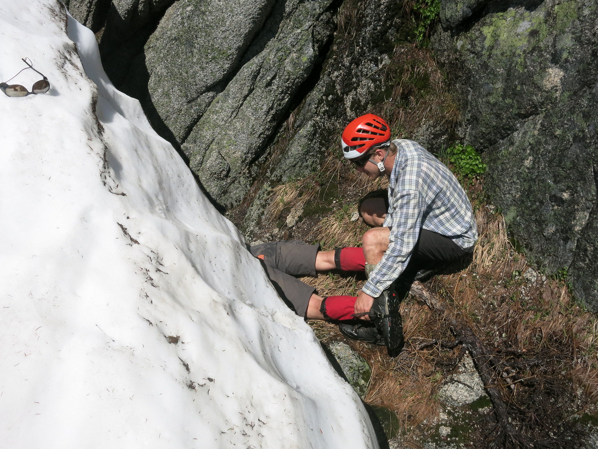
Fishing for my water bottle.
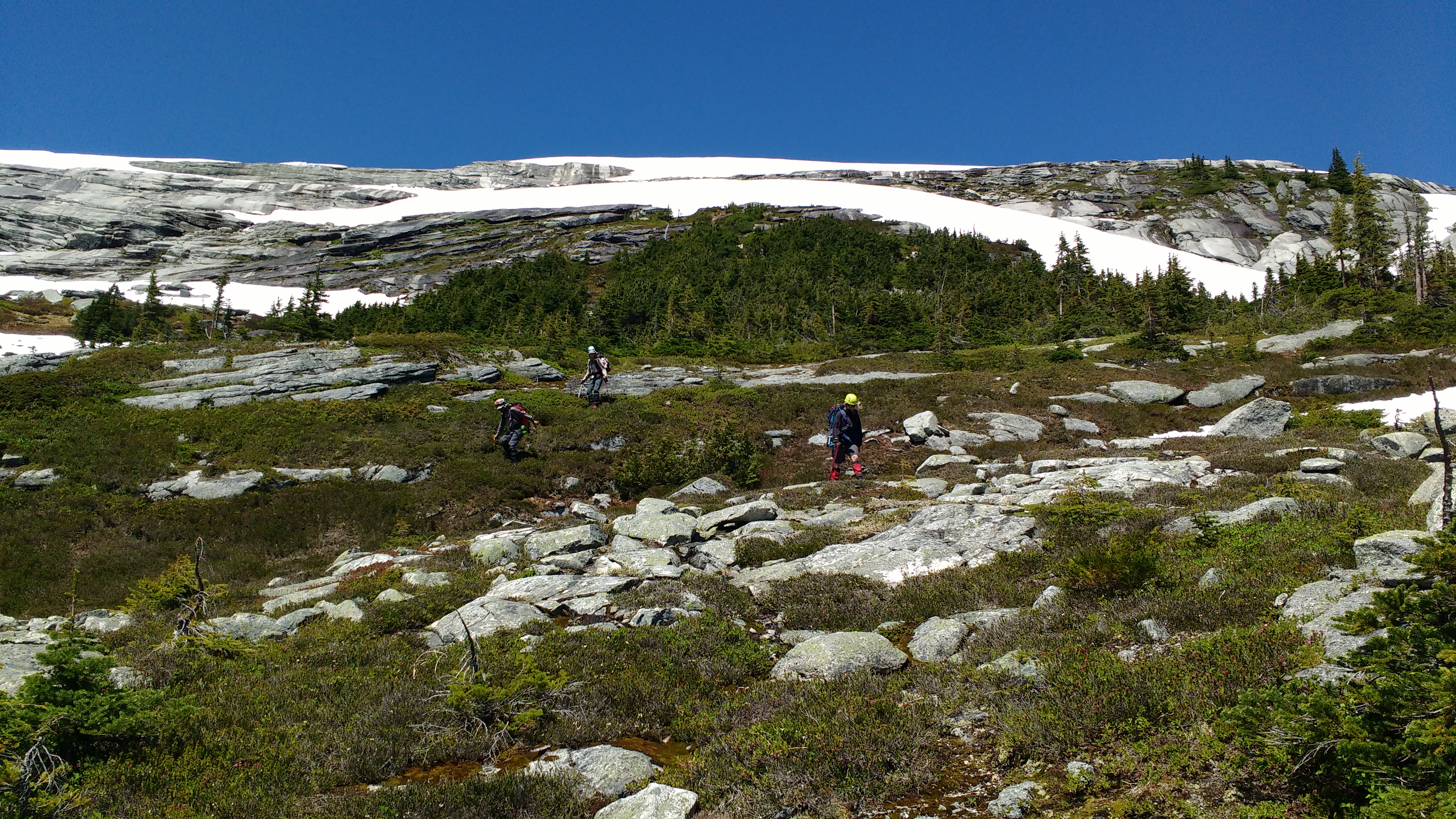
Surprisingly, our saviour for the day and fastest travel yet was a 45 degrees gully marked as a ski route on the Baldwin Coquihalla map. From there we made it to Zupjok without much trouble and camped.
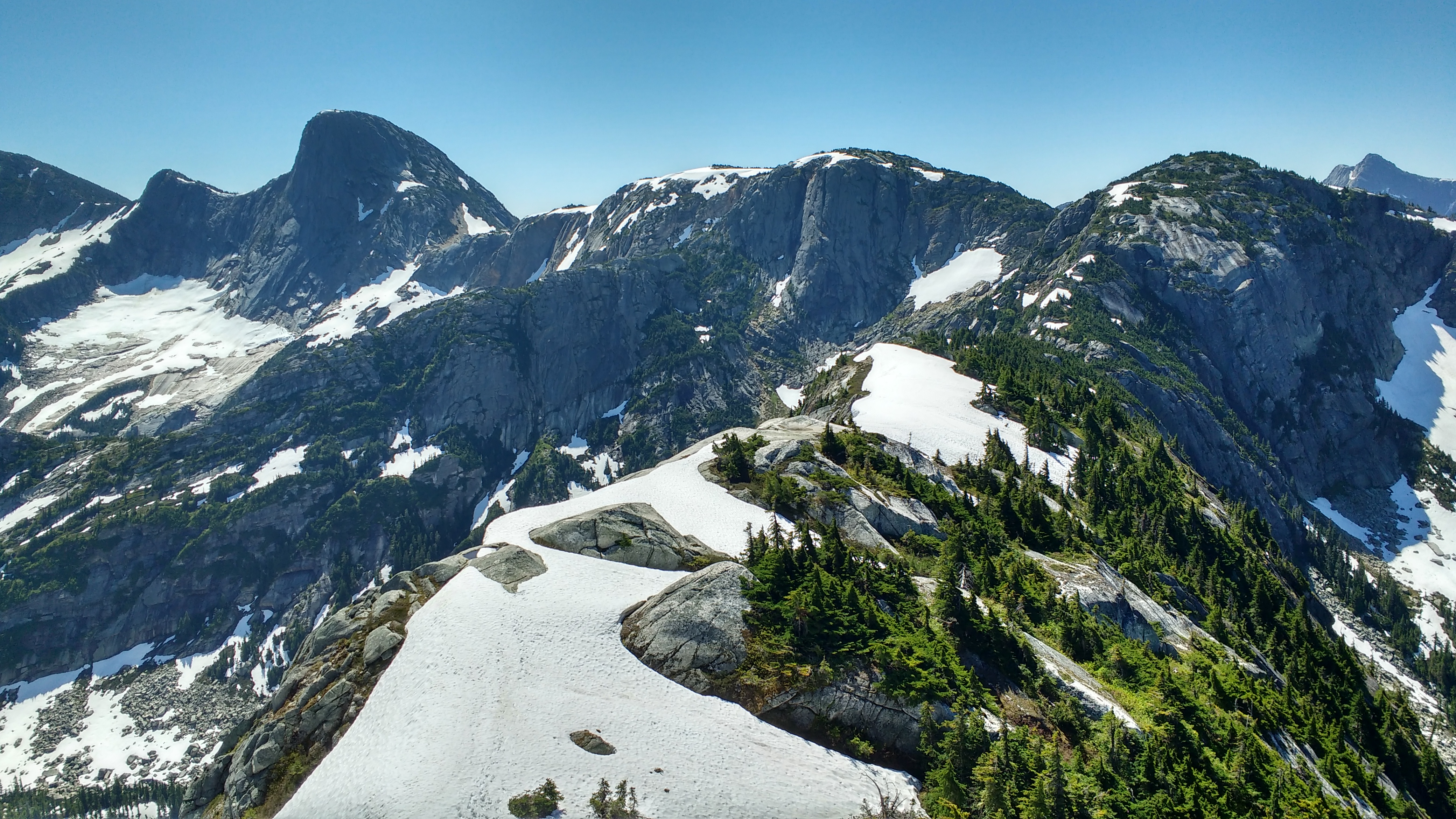
Looking back at our route along the ridge with Yak Peak in the background.
The 45 degree gully that provided some of the easiest travel yet.
Day 3: the escape from Alpaca’s ass
The third day started early, so that we could get back to the car at a reasonable time. The ridge from Zupjok to Alpaca felt like a highway (this is a common day trip route) and we were on top of Alpaca by 9.30 am. Cheerful from the easy travel and great views, we were eager to continue. We spent two hours in search of a good way down the back side of Alpaca (it would’ve helped to read about a route beforehand, but that’s less fun). We knew the route was class 3/4 and made it a majority of the way down, but kept ending up in sections that would require class 5 moves to continue, so we decided to turn around. Other times we might’ve been disappointed, but there wasn’t enough time left to go up the other peaks anyway and we’d seen enough rock bands for one trip. So, we returned to Llama and dropped down towards the valley bottom through beautiful meadows. Eventually we were reunited with cliff bands, wet slabs, and bush, but made our way down to the river. We followed the river, winding our way through the shrubbery while being pestered by mosquitoes. First we found a logging road from the 1980s, overgrown with alder. We met up with the main logging road and were back at the car within an hour. On the drive back we made a stop at a river to swim, and then at a grocery store in Hope. With a well-balanced meal of ice cream, chocolate milk, bread, beer, and dip, we hung out in the city park for a while, and hoped to escape the worst of the traffic heading back into Vancouver following Canada Day.

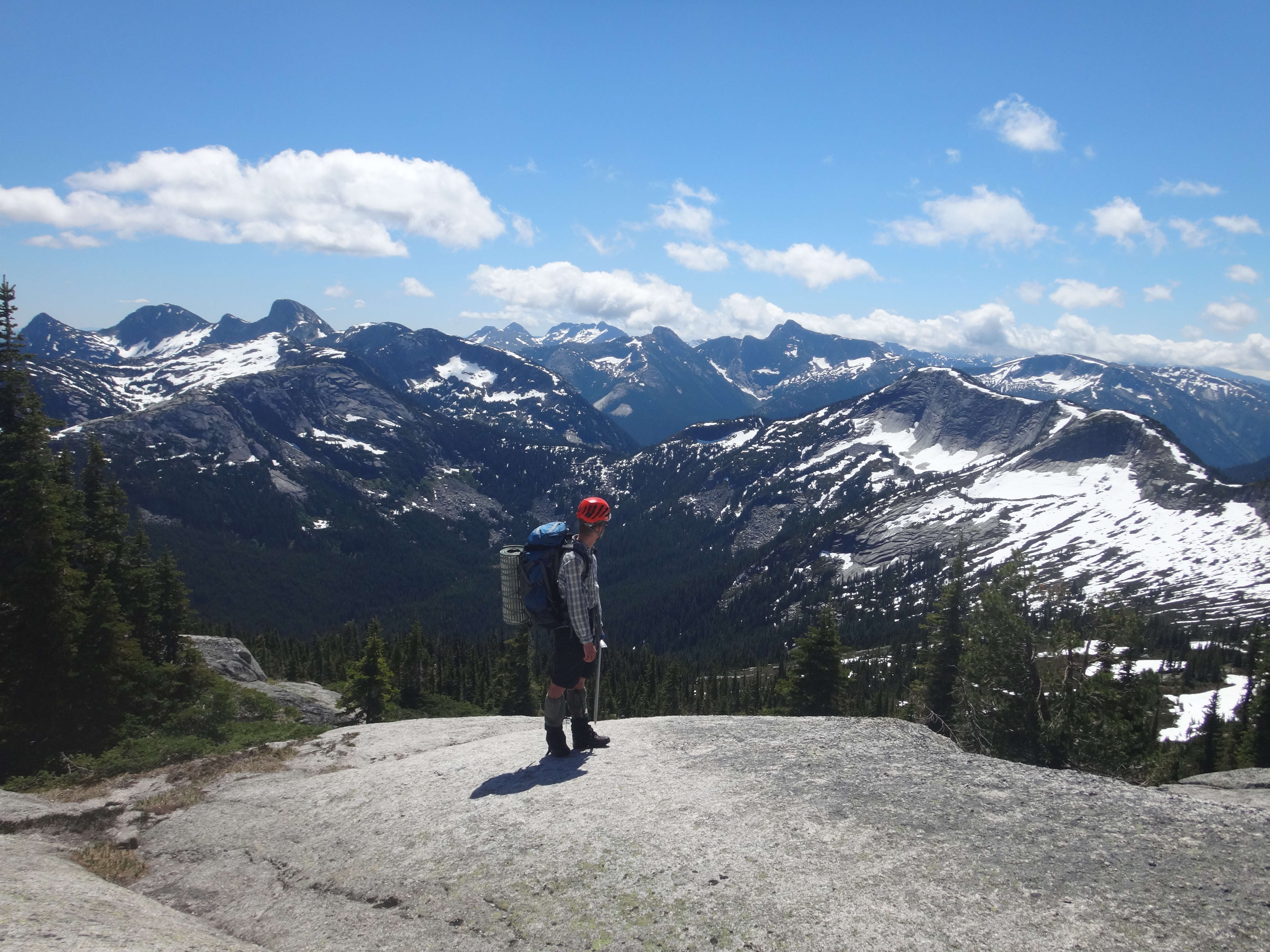
Looking ahead at Alpaca and Vicouna
Vincent looking back towards our route.
On top of Alpaca.
Escape back to the logging road with our tail between our legs.
No doubt it took so long to write! Brilliant work Birgit! Good memories indeed. Thanks for putting together