On June 3rd-10th, Lorin Jacot and I teamed up for a week-long tour around the Lillooet Headwaters. The plan came together somewhat suddenly on May 30th, when we noticed an unusually long window of clear weather in the forecast. Given that we each had extra days of availability, we decided to pivot away from a less-remote ski traverse in the Sea-to-Sky, and toward something a bit more ambitious. For me, the Lillooet Icefields were the next step toward the heart of Coast Mountains after exploring many of the ranges between there and Vancouver over the past several years. For Lorin, the goal was to experience some real Canadian WildernessTM before returning to the gondola- and hut-infested Swiss Alps later this month. Our route was based on my interpretations of some other trip reports (find links to those trips here, here, and here) in conjunction with the CalTopo slope angle map.
Day 0:
I drove up to Vancouver after a successful but exhausting trip to ski Tahoma the day before. I picked up Lorin in town around noon, and we secured supplies at Canadian Tire, NoFrills, and VPO before heading to Mamquam River Campground in Squamish (where Lorin had been living on-and-off since the end of spring term) to pick up the rest of his luggage, pack food, and build out some Krazy Karpet sleds. We made our way north to Pemberton, then up the entire 49 km of the Lillooet FSR, with the windows down and the heat cranked up to prevent my engine from overheating. Around midnight, we reached our ‘trailhead’ just above the hydro project at Keyhole Falls.
Day 1:
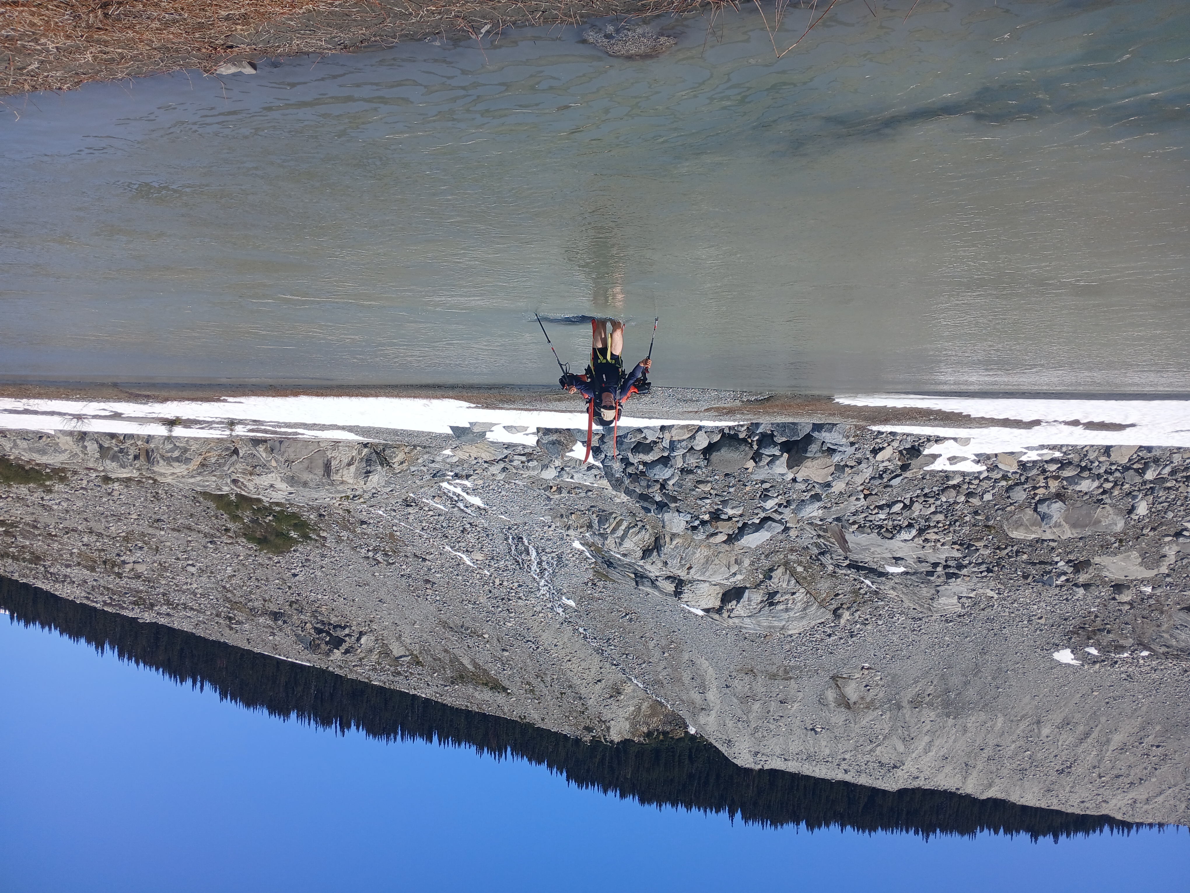
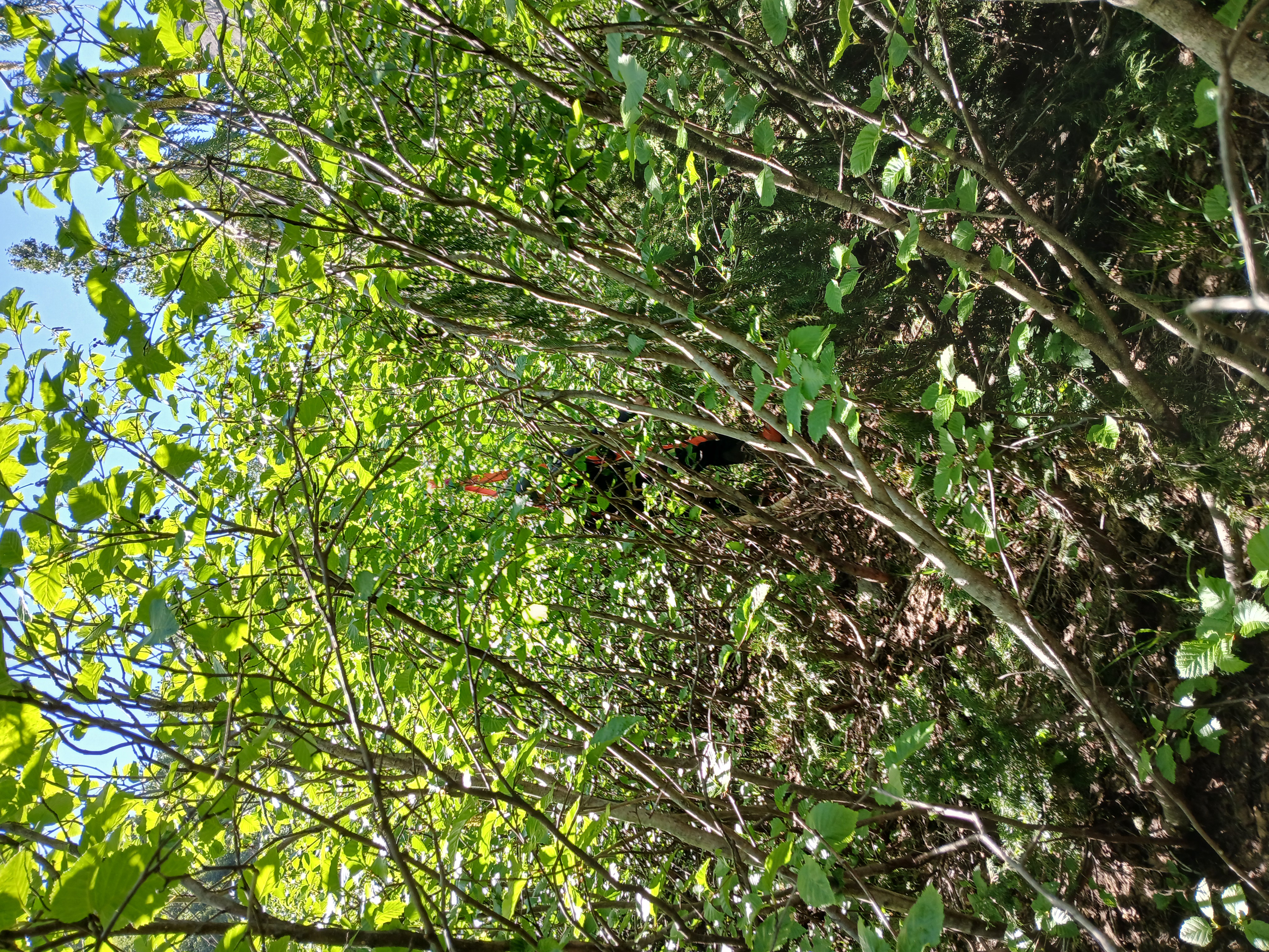
At 9:00am we shouldered our assembled packs. Mine was quite hard to lift but not too uncomfortable once on my back. Lorin impressively managed to cram everything into a 45L pack. The standard approach to the icefields north of Lillooet Headwaters is to follow Salal Creek via its W fork all the way up to the W shoulder of White Cross Mountain. This is a great strategy in early spring, but we were worried about bad bushwhacking and deep stream crossings in June. Instead, we planned to cross Salal Creek on an old FSR bridge right above where it flows into the Lillooet. About ten minutes into our day we learned that this particular bridge no longer exists. Fortunately, there was a nearby tyrolean cable which we found quite useful. On the far bank, we took stock of the damage: Lorin had a bruised thigh from a slip where he crucially did not fall into the river (we enjoyed watching the bruise turn a variety of colors over the subsequent days); I had sore abs from having to yank my ski tips through a logjam while hanging upside down from the cable. Somehow, it was still only 10:15am.
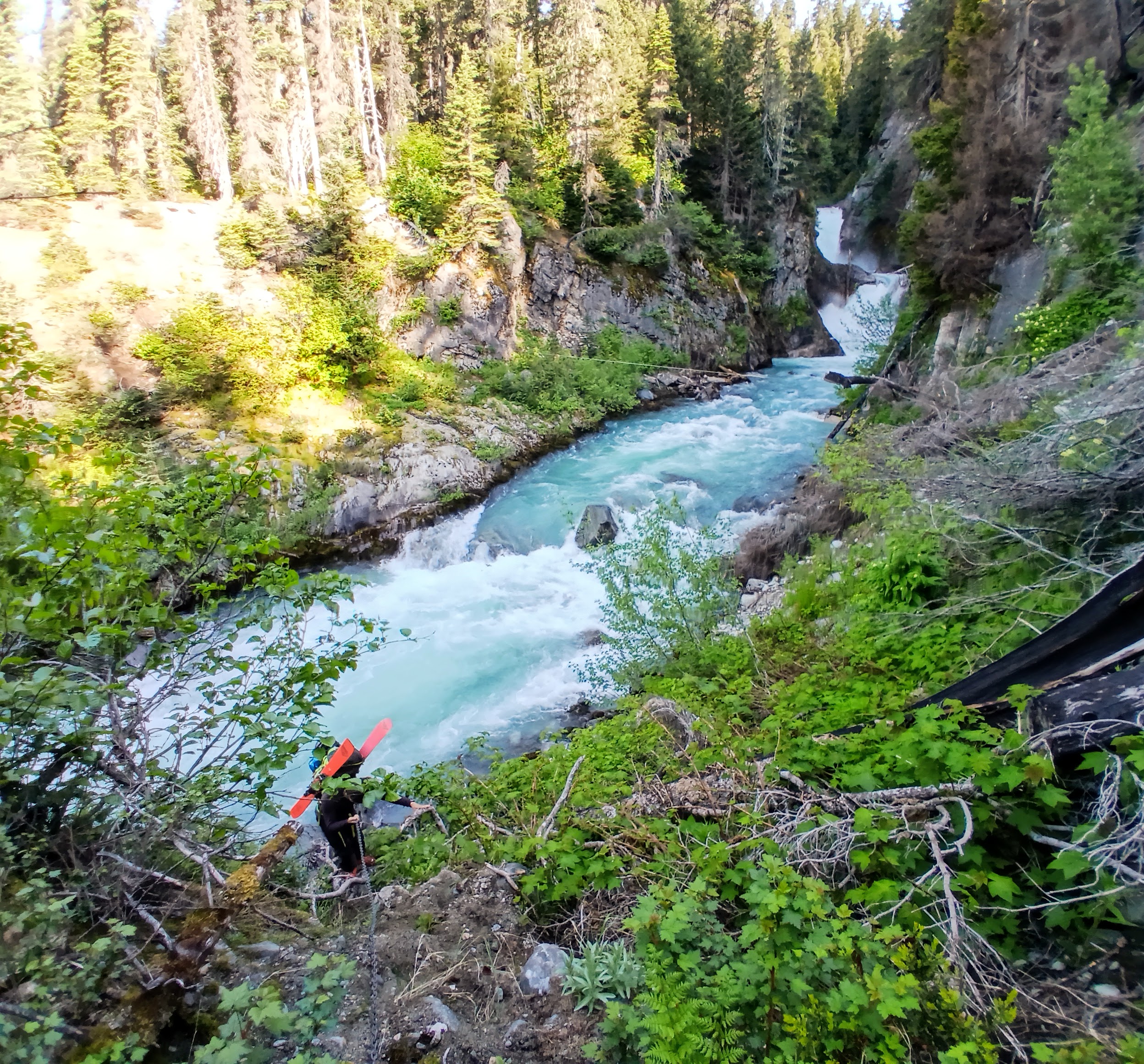
Approaching the Salal Creek tyrolean
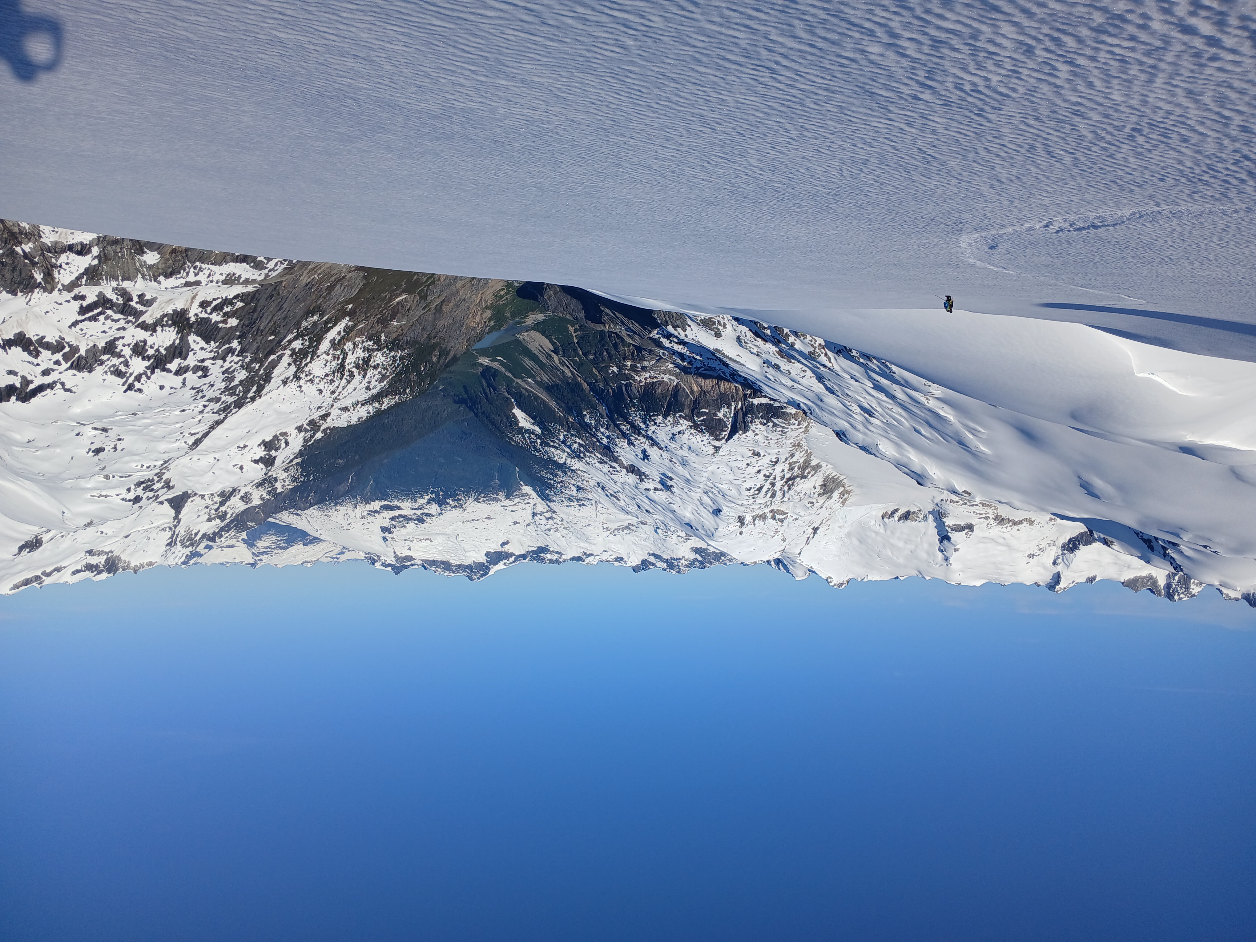
From the far side of Salal Creek we continued on the old road, which soon deteriorated into an alder bash. We promptly turned straight uphill, working through a cutblock and into the mostly-open forest above. The ascent from here was as pleasant as one could ask for, with a patchwork of game trails to follow, soft loam to kick steps into, and only occasional fir thickets to catch ski tips on. At 1400m we entered a recent burn, where the dearth of shade and surplus of charcoal combined to coat our hands and faces in alternating layers of sweat and soot. At 1700m and 2:30 pm we finally hit continuous snow and mellower slope angles. We took a long break to assemble sleds and revel in the sudden lack of mosquitoes. The upper Lillooet River meandered through the valley below us with Mount Meager rising dramatically on the other side, and Mount Athelstan with its very tall couloirs dominating the view to the east. We skinned for a couple of hours through the pleasant afternoon sunshine, until we found a partially-thawed tarn next to some day-old bear tracks where we decided to camp for the night. Lorin was in charge of dinner and I learned that green lentils are actually ‘cooked enough’ after five minutes and still taste awesome.
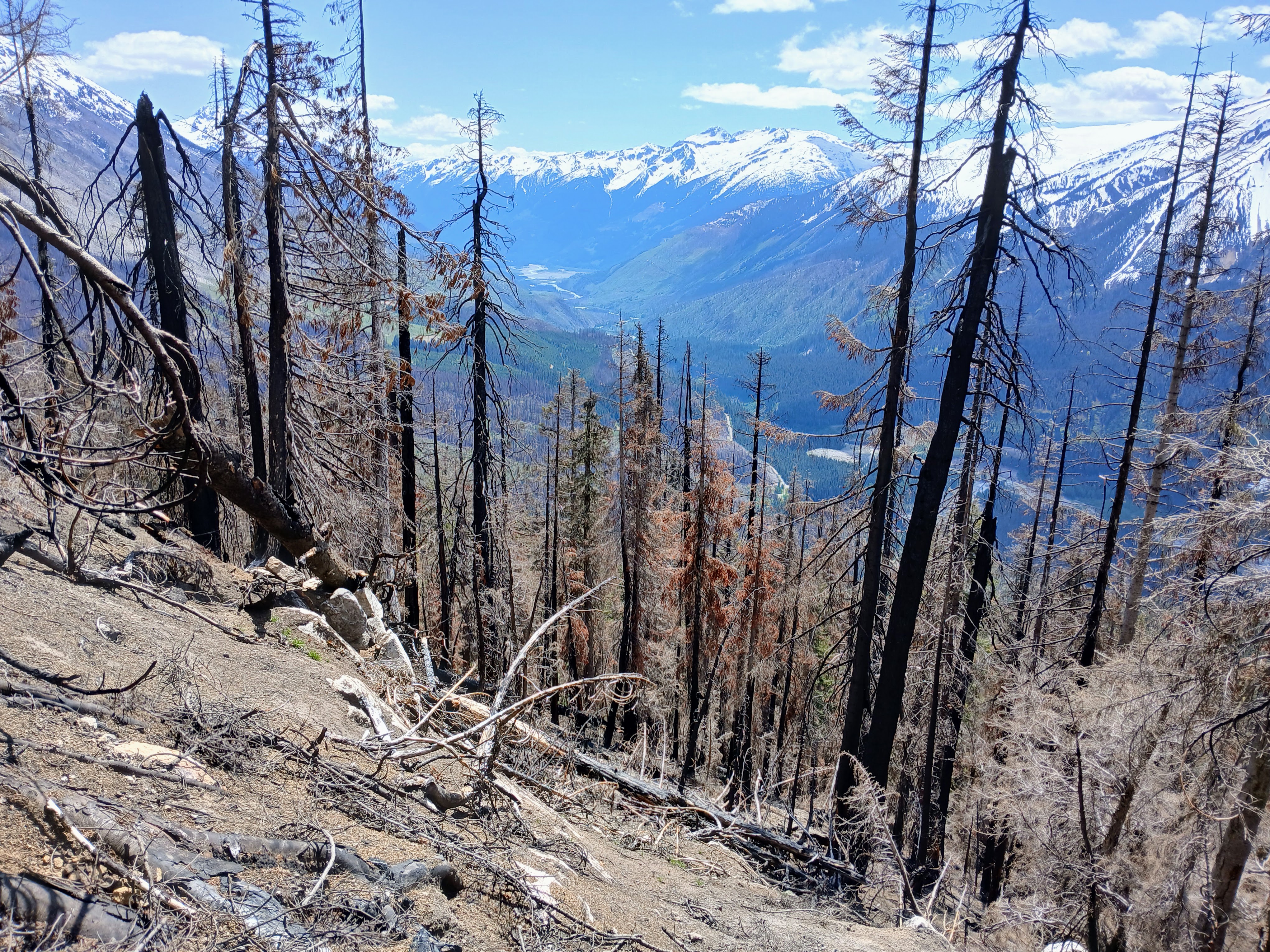
Burnt forest above Lillooet valley
Day 2:
A 5:00 am wakeup had us skinning again two hours later. I was in charge of breakfast, so Lorin learned the subtle art of mixing instant mashed potatoes with stale corn chips to achieve perfect textural symbiosis. Our route continued northwest across increasingly glaciated ridge bumps. For an hour or two we barely saw each other, since I tend to prefer the path-of-least-elevation-gain while Lorin prefers the contrasting path-of-least-sidehilling. We reconvened at 2200 m, on a broad glacier dome overlooking the toe of the Bridge Glacier. As mentioned in previous trip reports, the Bridge Glacier has been drastically affected by climate change: ‘Troubled Water Lake’ has continued to grow, and even now in early June the toe of the remaining glacier was showing plenty of bare ice. We ripped skins and descended 400 metres onto the main tongue of the Bridge, rediscovering the treachery of a) skiing with a sled in tow and b) skiing steep breakable crust. Actually, we needed the brief excitement of this descent to balance the monotony of the ensuing skin up the Bridge Glacier. We aimed for the rocky S face of Mount Stanley and plodded along, taking a break every 90 minutes or so to drink water and reapply sunscreen. While Lorin was breaking trail, I sang some folk and bluegrass songs to alleviate the boredom. Lorin for his part claimed to be incapable of carrying a tune, but politely tolerated my less-than-pure voice.
Toe of the Bridge Glacier
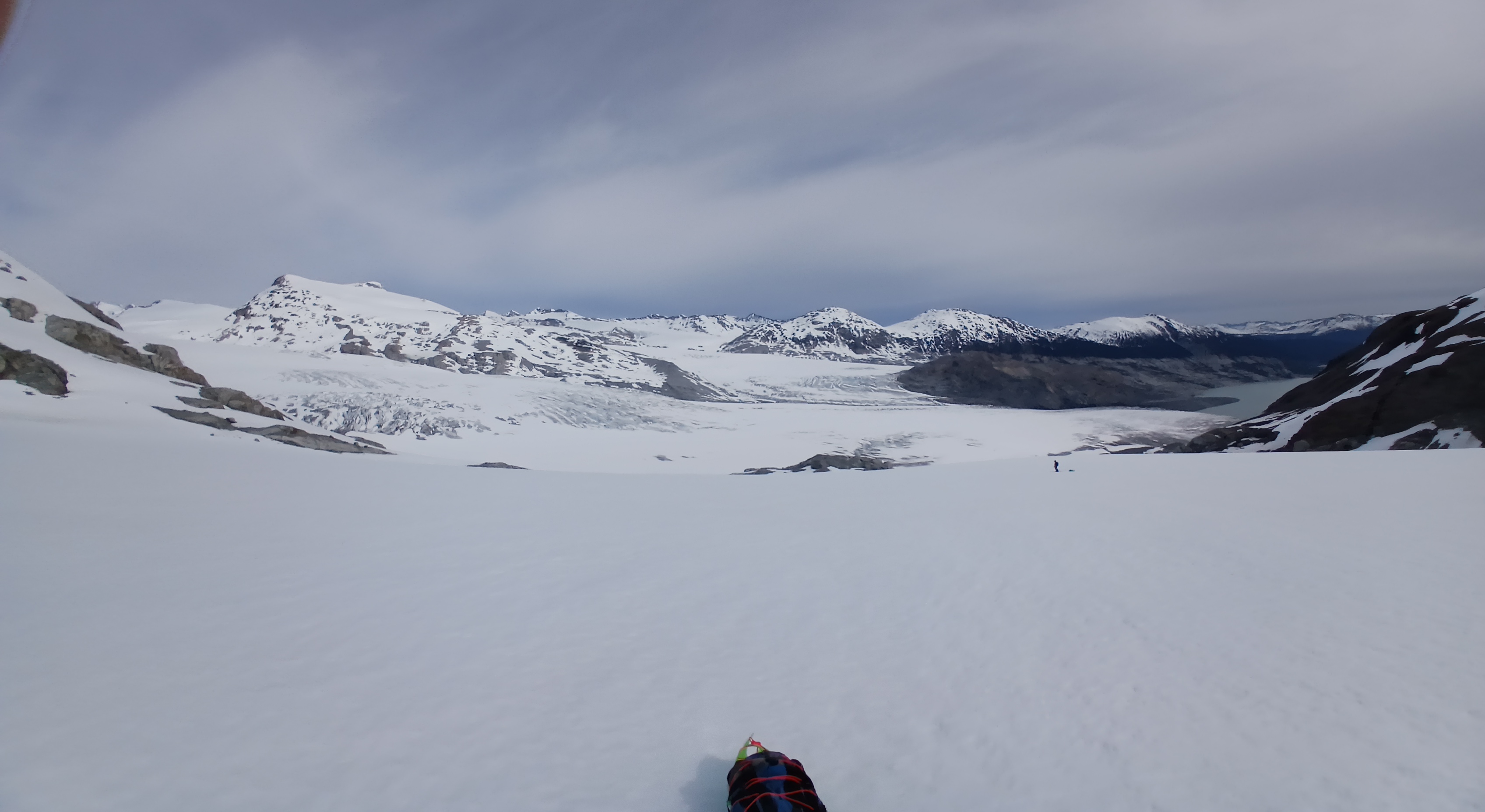
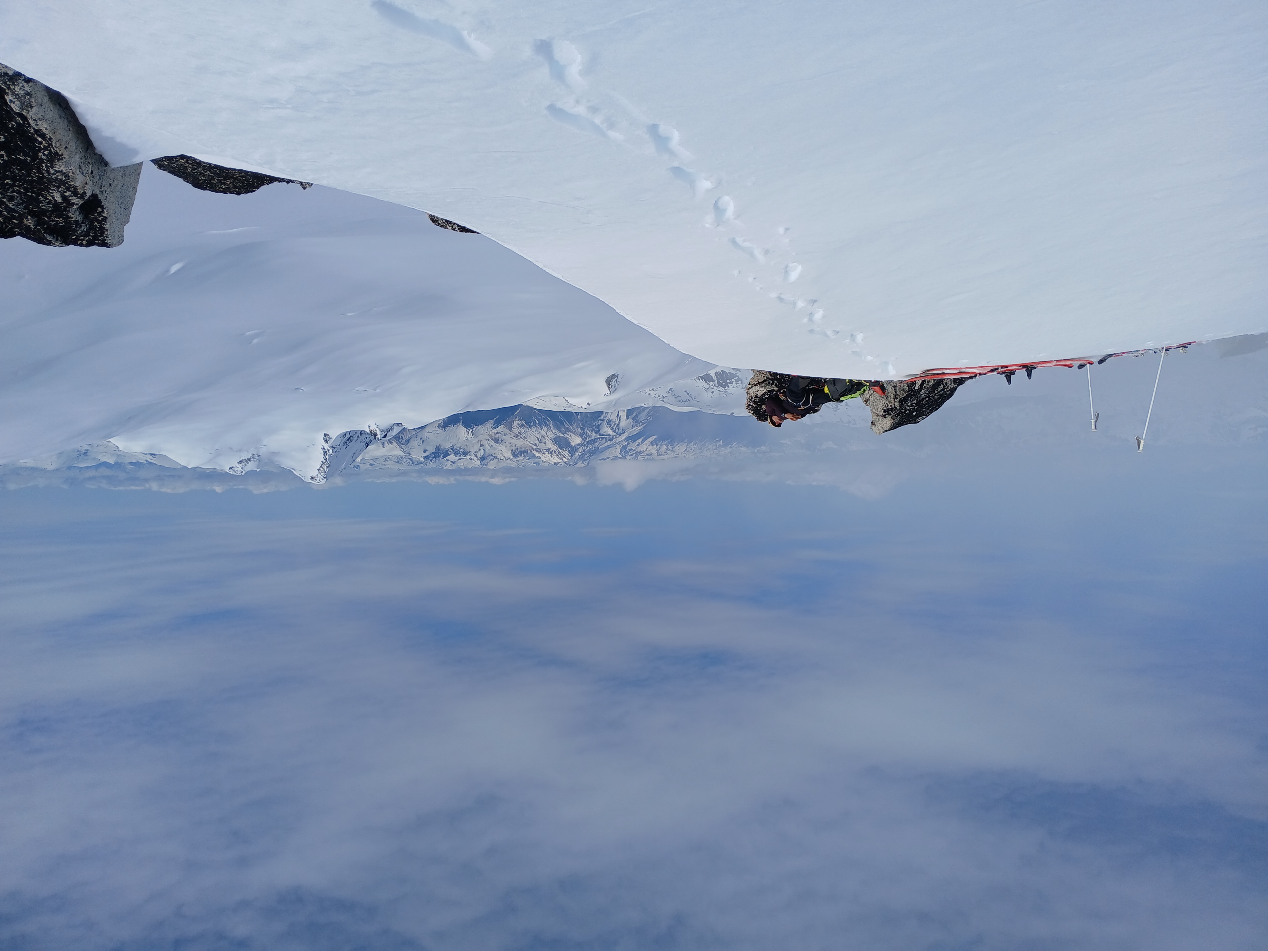
Eventually, we came over a roll which delivered us from the Bridge Glacier onto the Stanley Smith Glacier. Even compared to the Bridge, the Stanley Smith is freakin’ massive. The peaks on the far side of the ice flats were all at least six km away. The nearest mountain on our side was Mount Stanley, and we skinned for another hour or two in order to make camp at 2700 m at the base of its gentle N face. Shouldering comparatively weightless packs, we zoomed up this face from camp to the summit, where the lenticular cloud cleared just in time to give us views over a 360 degree sea of peaks. Lorin took a five-minute nap on the summit rock while I snapped some pictures of ‘Bridge Peak’, Mount Daphnis, and Mount Tisiphone. We skied back to camp on soft, sticky snow and executed a stress-free nighttime routine. We were making great progress along our route and the updated forecast from the inReach still looked perfect…
Stanley Peak summit, Bridge Peak behind
Day 3:
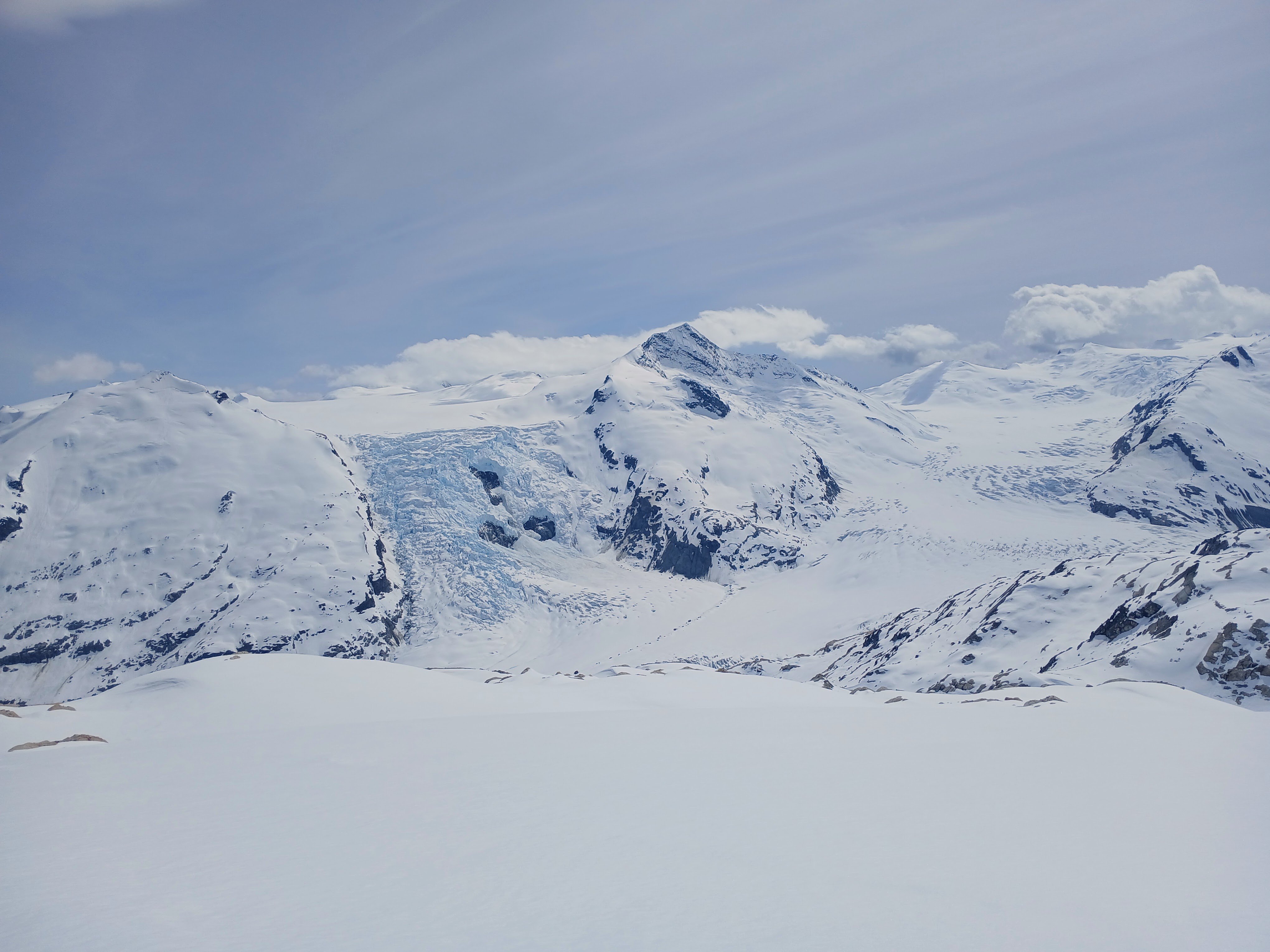
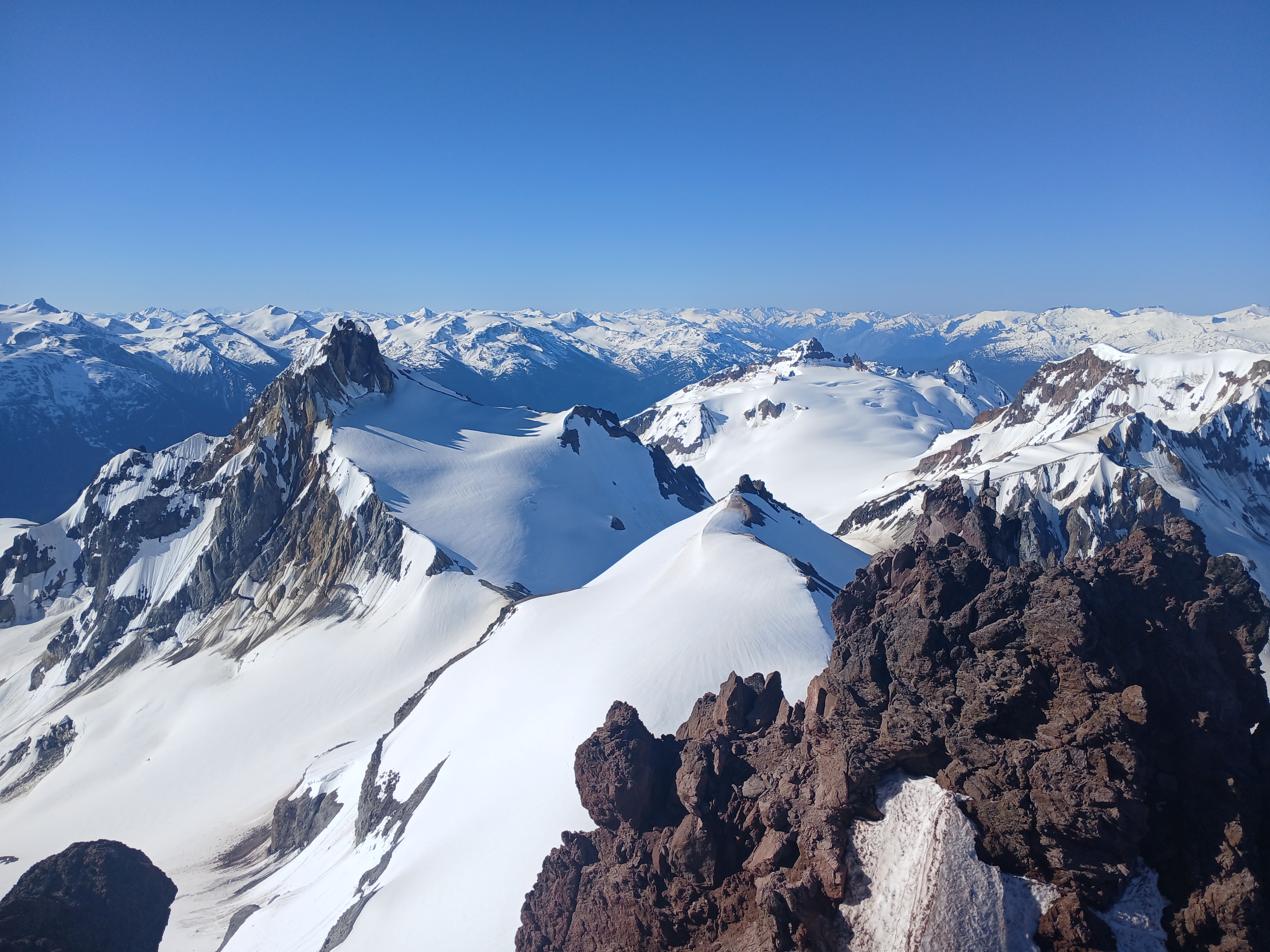
After another 5:00 am wakeup call, we broke camp and moved our gear a small distance before heading off toward Mount Fulgora with day packs. The morning crust allowed us to dispatch the first three km in about five minutes. Now we were close to the base of the climb, with 600 m of ascent ahead. We opted to ascend the E ridge in order to circumvent a partially-open bergschrund. We took short shifts leading an energy-intensive bootpack in order to keep the legs fresh until the slope eased and we were able to skin to the top. We once again had beautiful blue skies, and could see Mount Monmouth to the north, the full expanse of the Stanley Smith Glacier to the east, and some of the big mountains (Raleigh, Grenville, etc) above the Southgate River to the west. We could even see two very tall peaks rising faintly in the distance behind the Homathko, which I have since confirmed were indeed Mts Waddington and Tiedemann. We descended the NE face of Fulgora, which was getting a bit soft but was still a beautiful pitch of skiing.
Skiing the NE face of Mount Fulgora above the Stanley Smith Glacier
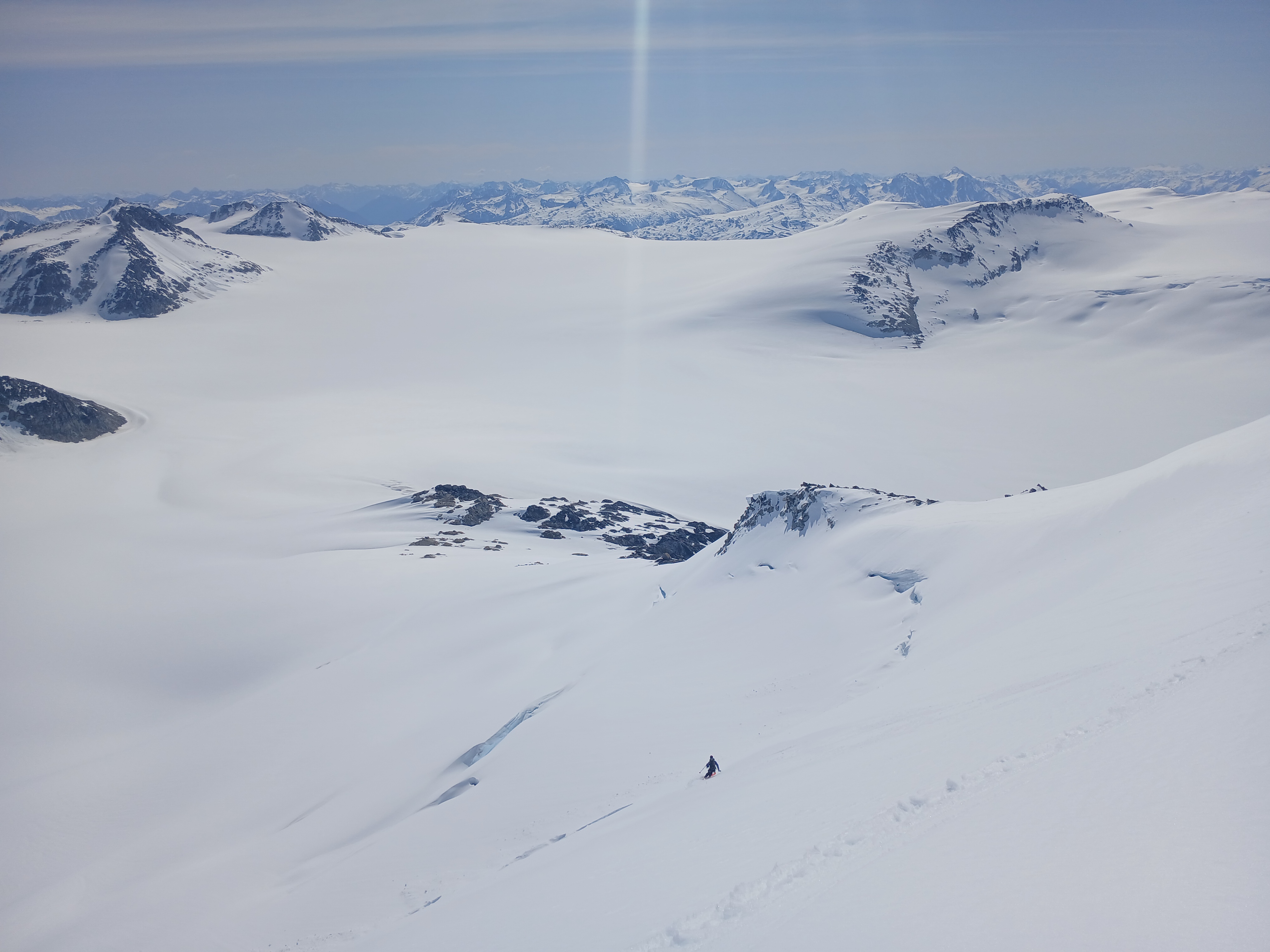
Back at our gear stash, we snacked, repacked, and started a long ski descent toward the north end of the Ring Glacier. The snow on this south-facing descent had become quite soupy in the heat and we decided to ski roped though one of the more broken sections of glacier. By the time we reached the confluence with the Ring Glacier at 1900 m the snow was even more slushy and grabby. We transitioned and pressed on, climbing sweatily up to the highpoint of the glacier. We had originally planned to continue directly onto the Bishop/Lillooet and Dalgleish Glaciers, but figured it would be safer and faster to try this upcoming low-elevation section after an overnight freeze. Instead, we embarked on a sidetrip to climb the adjacent Mount Alecto, a short but prominent summit nestled aesthetically between three glaciated valleys. We navigated up the W shoulder and onto the SW ridge while trying to avoid wetloose-prone 30+ degree slopes. Just before the summit, we were blocked by a small dip in the ridge where a cornice oddly ran perpendicular to a slabby knifeedge. It took us about 15 minutes of poking around before we realized we could just downclimb off the ridge to climbers’ right and into a moat behind a windlip, then climb a snow gully to regain the ridge just beyond the dip. From there the summit came quickly with a mixture of slushy snow and easy rock scramble. The 600 m-tall icefall near Lillooet Mountain was striking from this vantage, and we could also see much of our route for the next morning far below us. We also noticed an improbable thawing pond at the edge of the Ring Glacier right near where we had left our gear. We eventually set up camp at this pond, and ate dinner as clouds and warm drizzle moved in for the evening.
Lillooet Mountain from the S shoulder of Mount Alecto
Day 4:
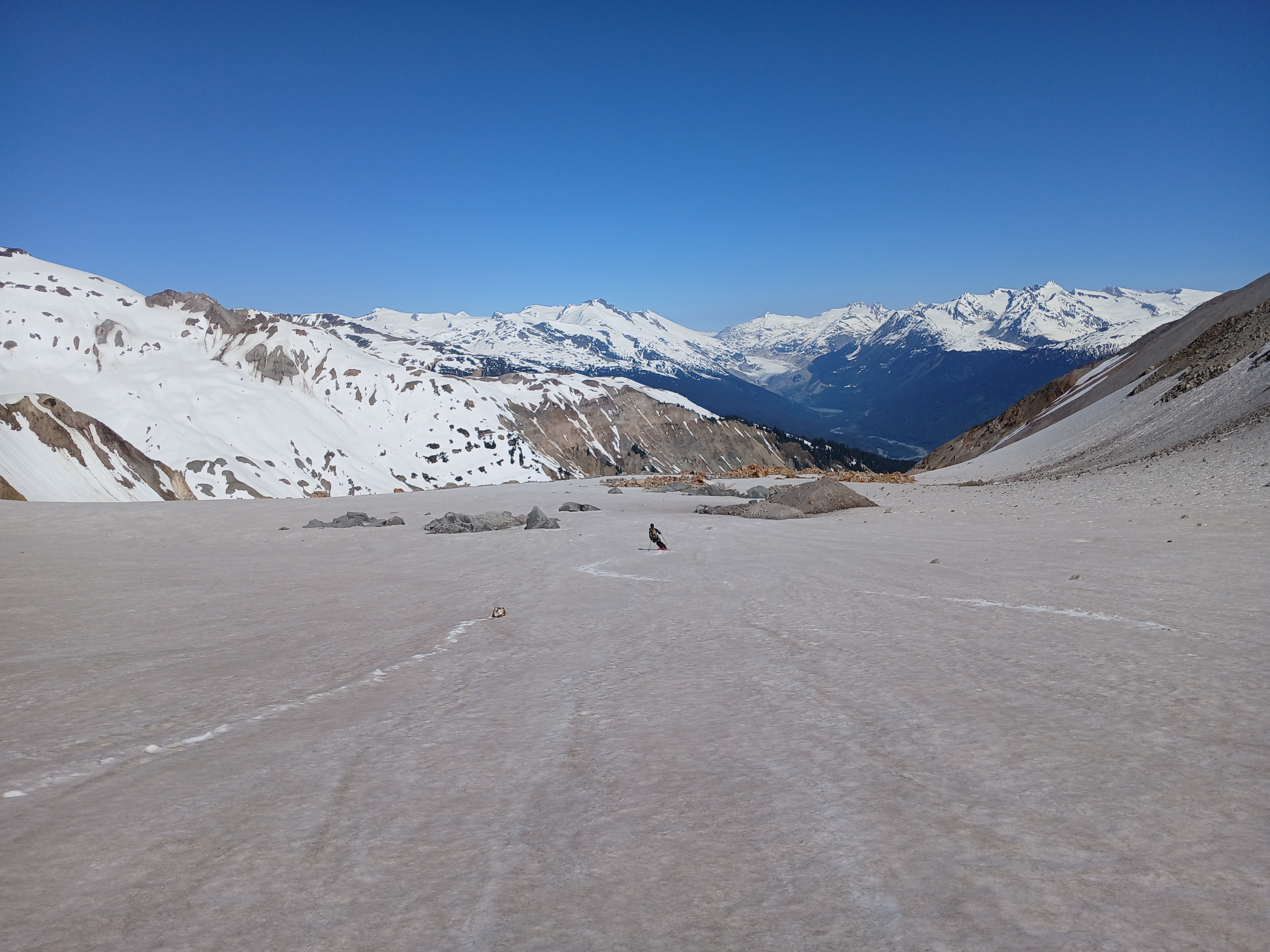
We set our alarms for 3:00 am, hoping to capture a few hours of overnight freeze before what was forecasted to be another hot, sunny day. To our dismay, we woke up still inside a fog bank, where it appeared the clouds had prevented any such freeze from occurring. Our plan to cross the low-elevation Four Way Stop under firm conditions had completely backfired. Nevertheless we packed up camp and skied/shuffled through the predawn slush past the toe of the Ring Glacier and down to the flat, muddy icecap between the Lillooet and Bishop glaciers. The fog was still thick and we navigated by compass for a few flat kilometres. The iceworms here were among the densest I have ever seen; hundreds at a time would get caught in our wet skins and fall off in large, black clumps every 10-30 seconds. Upon reaching the far side of the Four Way Stop we wound our way through a section of thin coverage with lots of exposed glacial ice, then gained a bit of elevation and poked out of the fog, finding ourselves directly under the dramatic N face of Lillooet Mountain.
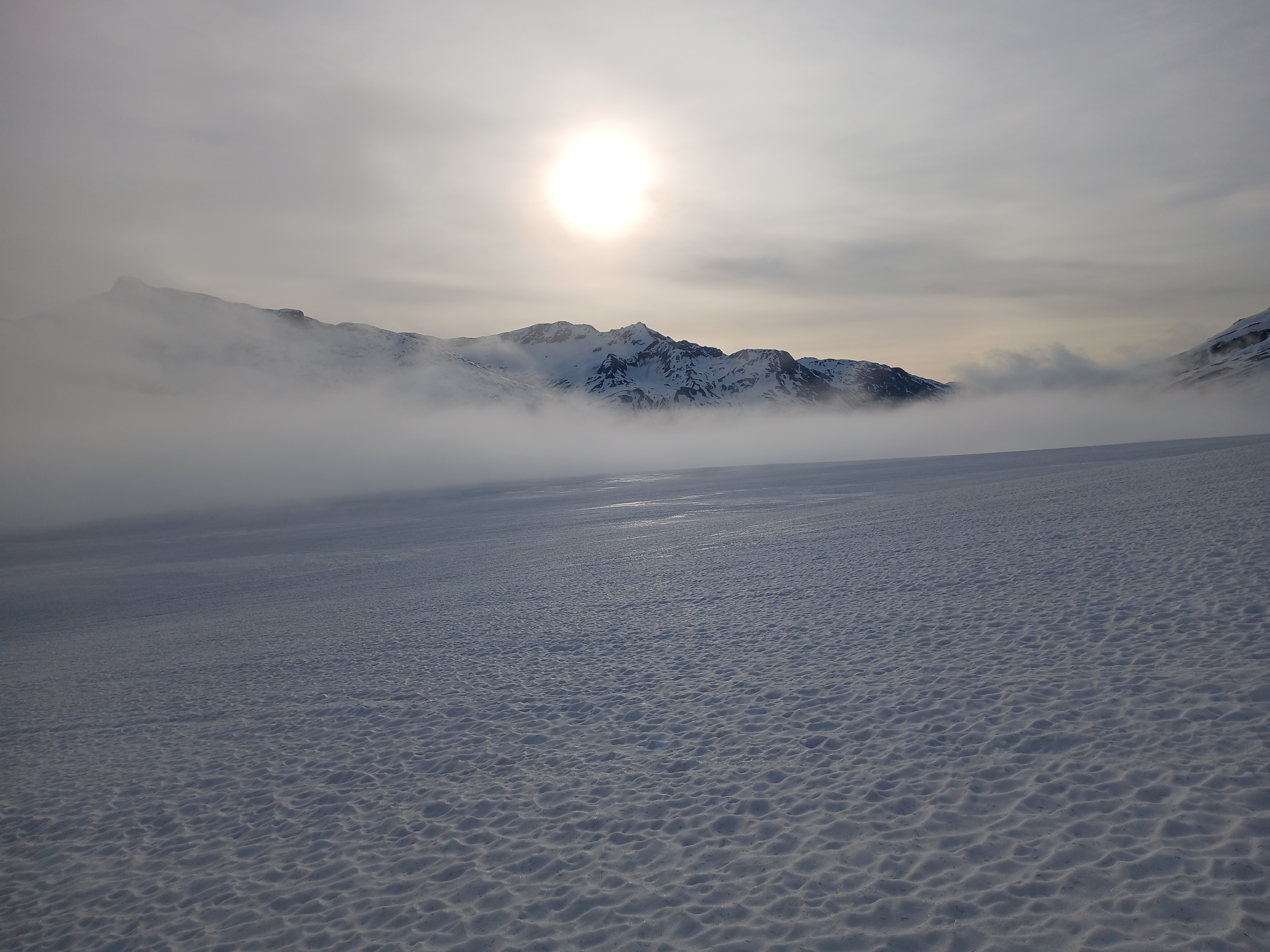
Escaping the fog bank on lower Lillooet Glacier
As we neared our next objective, Mount Tisiphone, the slush got deeper and the glacier got more complex. Eventually, it became clear that our route up might not remain safe for as long as we would need to get to the summit and back. I had spotted what I was sure was an ‘easier way down’ that we could take in the event of continued warming. Lorin was (perhaps justifiably) not convinced of this strategy. The result was that we bailed on Tisiphone before investing too much valuable time and energy, and instead made some much needed progress on our long, gradual ascent of the Dalgleish Glacier. The particularly unstable snow that afternoon would also force us to forgo the E face of Lillooet Mountain, which looks to be a beautiful, non-technical ski line under the right conditions. We settled for a nice detour to the summit of Mount Dalgleish, where some badly-timed clouds prevented us from experiencing what could have been epic views into the East Toba River valley 2800 m below us. Sometime around 4:00 pm we reached a nice flat campsite just below Mu Peak.
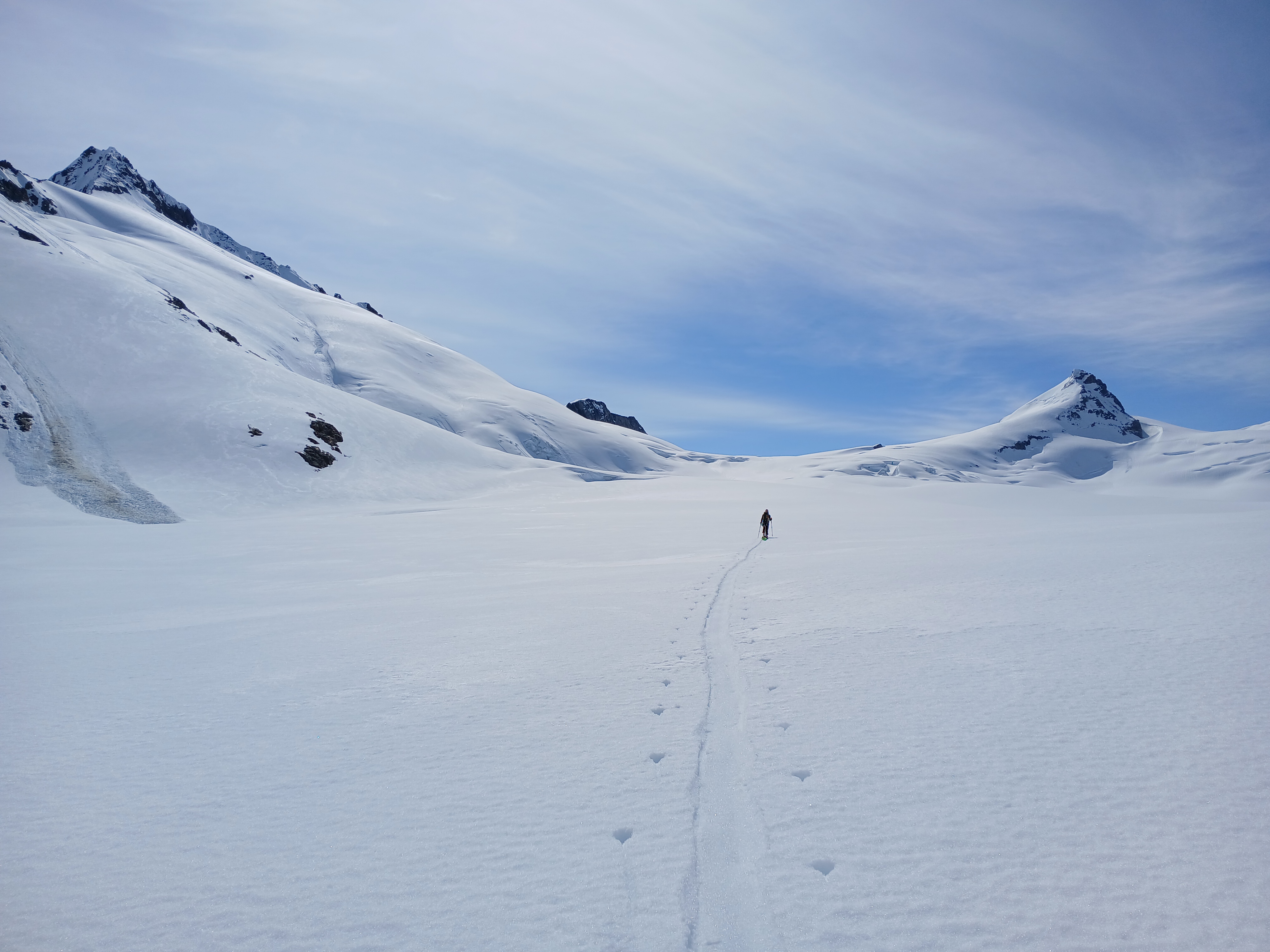
Slogging up Dalgleish Glacier, Lillooet Mountain on the left
Day 5:
With each day getting progressively hotter, the early wakeup calls continued. At 5:10 am, we reached the top of Mu Col, above perhaps the steepest pitch of our main traverse route. The first 25 m below the col was euphemistically ‘not in prime condition’. Lorin belayed me while I downclimbed some not-solid scree/dirt amalgam, then heroically soloed down the scree himself before the sun could hit us. Next came a traversing eastbound descent positioned beautifully above the gaping maw of a deep, cliffbound cirque with a low-elevation glacier hiding in the bottom. The sharp black edges of Wahoo Tower and Sirenia Mountain stood guard over the far side of the cirque, and provided epic views for us throughout the morning as we approached the Manatees via a bumpy ridge. The largest bump on said ridge had some absolutely heinous (even by the standards of this trip) breakable crust which was momentarily annoying to say the least, and legitimately frightening to say the most.
Broad ridgeline above a deep valley in the East Toba watershead
Upon reaching the top of the Dolphin Glacier under Obelia Peak at 11:00 am we were faced with a classic Scottish conundrum: should we take the high road (linking the various fragments of the once-contiguous Manatee Glacier) or should we take the low road (traversing the melted-out headwaters of Manatee Creek)? With another hot afternoon of soupy, unstable snowbridges incoming, the low road seemed like the obvious choice. We skied about ten turns of magnificent corn, followed by >500 m of the grabbiest snow you can imagine. Then we were below the glacier, using the sticky snow to our advantage as we freeheeled up and over a few bumps sans skins. We entered a strip of woods between lateral moraines where the smell of fir needles was wonderfully intense after a few days above treeline. Next came a long stretch of snow-free boulderfield where ski boots were not the ideal footwear. We encountered a lake so beautiful and swimmable that I felt a bit guilty for not making camp there. Instead, a knee-deep ford, a speculative skin over a subalpine shoulder, a sharky skins-on descent, a lucky snowbridge over a muddy torrent, and a final low-angle slog brought us to a ‘Scam Lake Pass’ at 1700 m. The topo maps show a large lake in this pass, but said lake apparently does not exist, so we resigned ourselves to melting snow for dinner, We did get to sleep on soil instead of snow, which was good timing since I had just popped my sleeping pad (PSA: always cap your ice screws).
Wading one of the outflows from Manatee Glacier
Day 6:
We figured that if we wanted to push that this could be our last day. However, we were keen on a sidetrip up the Mount Meager massif, which would only be feasible with an extra day. We had a full six days and nights of food, but would have to go a bit hungry on the last day. Surely nothing could go wrong with this plan! After selecting the ‘late checkout’ option at our campsite, we dangled our sleds across a long but ultimately efficient sidehill at 1800-1900 m before reaching the Mosaic Glacier at a 2000 m pass with ample running water. Lorin took a nap while I taped up my shins, which had been rubbing against the tops of my boots due to poor sock selection. Next up was a fun little out-and-back to the summit of ‘Polychrome Ridge’: a big pile of pumice with views of nearly our entire traverse route. After some more lollygagging back at the pass, Lorin crushed the sweltering climb up the Mosaic while I found a few more memorized songs in a dusty corner of my hippocampus. Crossing the Job Glacier, we oohed and aahed at the intimidating Pylon Peak, and scouted tomorrow’s route on ‘Plinth Peak’, the highpoint of the Meager massif. We made camp at 2300 m at a col overlooking the Affliction Glacier. After five consecutive wind-free nights, we figured there was no point in building yet another set of igloo walls around the tent. Then, right on queue as we settled into sleeping bags, the wind picked up and battered us all evening.
Day 7:
Alarms rang at 2:00 am. I was already awake due to the wind so there was no point in hitting the snooze button. Some photos taken from across the Lillooet valley back on Day 1 were helpful in finding a good way down the upper Affliction Glacier. We dropped overnight gear just below an active fumarole, where the horrible sulfur smell was inescapable (Thank god we did not try to camp down here!). The rate of erosion around us was pretty wild, with many of the nearby snow slopes coated in a layer of mud and/or rockfall. Nevertheless we made good progress, either by skin or by boot, to gain the 2350 m col south of Plinth Peak. From there, more booting took us up onto the S ridge and across a runnelled-out SE slope into a snow-filled gully that delivered us to the ridgecrest between the summit and an impossibly pointy pinnacle to the south. We transitioned to the ‘rock’ (picture a Jenga tower of choss held together by dirt) and wandered haltingly across bits of very unstable terrain, looking for a way forward. After a few dead ends, Lorin was sick of the choss and went to put his skis on. I wanted to try one last idea before giving up. I downclimbed the far side of the ridge into a partially melted-out gully that initially looked uninviting. Amazingly, I discovered a vein of frontpoint-able dirt and downclimbed onto the upper SW face, which I could follow easily to the true summit. The N face of Plinth is insanely steep and it was a great feeling to be almost directly above the Lillooet River, looking straight up the valley to the glaciated headwaters. I hustled back to my skis and followed Lorin’s tracks down the gully and SE face below. There were actually some great turns here; possibly the best of the trip according to Lorin. The two of us regrouped for the long descent back to the Affliction Glacier, during which we had to take skis off a few times to cross various piles of rocks. Then with packs reassembled we skied the Affliction Creek drainage until we ran out of snow around 1300 m.
Looking south from near the summit of Plinth Peak
Skiing dirty snow on Mount Meager, Lillooet Glacier at head of valley
It was now 10:00 am, and the sun was blazing down, as per usual. I was freshly out of food, and Lorin had two granola bars left. I checked the map and naively predicted that we could reach the car by 2:00 pm. With skis on our backs, we initially made fast, wobbly progress along sections of rocky creekbed, interspersed with sections of mandatory alder ‘shwhacking. We left Affliction Creek at 850 m following an old, barely-discernible roadbed into the bush. This roadbed became increasingly choked with alder, so that we opted to walk through the forest instead. Then we reached the first in a series of slide paths and cutblocks where the alder was once again mandatory. The alder fields went on and on as our pace slowed to <500 m/hr and an unusually thick swarm of mosquitos descended upon us, perhaps sensing that we were incapable of running away. The heat, hunger, and lack of sleep were compounding, and I started to really lose my head, yelling at the bushes and using a lot of ‘brute force’ technique. Lorin was frustrated as well, but was handling the situation with a bit more grace and patience. Eventually my body rebelled and I started feeling weak, light-headed and weirdly short of breath. I called for a long break and sat down in the shade where I proceeded to not catch my breath for 20+ minutes. We wondered if I was going to develop heatstroke, and discussed a range of options in case I could not continue. Ultimately we did continue, and soon reached the end of a much newer road which was mercifully bush-free. We also found some patches of snow on the road which, when applied to face and chest, dramatically improved my condition. 1.5 km later we crossed the bridge at Keystone Falls and reached the car at 5:00 pm.
“Hello alder my old friend, I’ve come to walk through you again”
The hydro project workers had left two notes on our windshield. The first note informed us that the road below us was in the process of washing out, and the second warned that the road was now closed due to landslide hazard. For a moment it seemed that we might be trapped up here, either behind a washout or a locked gate. We drove down to the work camp near the power station and talked to a guy there (the first person we had seen in a week) who assured us that the road was still navigable, and helped us get through the ‘locked’ gates. We drove to Pemberton, bought/ate a whole bunch of fruits and veggies, and took baths in One Mile Lake. Then we realized that all the good restaurants in Pemberton were now closed, and resigned ourselves to paying Whistler Village prices for our long-overdue dinner.
Postscript:
If you love the Coast Mountains, the Lillooet Icefields should be on your todo list. There are many routes and variations beside the loop that we did, at least some of which have associated VOC trip reports and/or VOCJ articles. The terrain feels qualitatively different from the Sea-to-Sky corridor, mostly due to the extent of glaciation (at least for now). From a peakbagging perspective, I felt that we barely scratched the surface. There are plenty of big, beautiful mountains out there, with known FAs but with no ‘modern’ beta, which are ripe for exploration. The approximate loop we did has been skied in as few as five days, but I actually felt that our 7 day itinerary, while it mostly worked out well for us, could easily be too short especially for a party that encounters bad weather. There is also a reason that most parties go up to this area in late April rather than early June, and that is to avoid the bushwhacking. We could have saved a lot of time/energy if the snowline had been even 300 m lower across the board
Thank you to Lorin for reaching out with an invite, for an epic adventure, and for hard carrying me through some of the worst sections. Thank you to Alena Dzujkova, Dean Perez, Olek Spawlinski, and Doug Vis for the useful beta. Thank you to the Lil’wat (Lillooet), We Wai Kai (Campbell River), and Tŝilhqot’in (Chilcotin) first nations for the use of their traditional lands.
Awesome trip but no side trips to Keyhole hot spring, Meager hot spring or Harrison Hut?
Thanks, Roland. Unfortunately the hotsprings are now indefinitely (Meager) or seasonally (Keyhole) closed to the public. So we sadly did not soak on this trip, but if we did you would not be able to read about it on this public forum.
After experiencing it on a hot day stuck in Chilliwack traffic, I feel that having to sit in the unbearably hot van with heater turned to max, is now part of the true Thomas Morrissey experience.
Epic! Who’s coming with me in 2026?