Nick Gobin and Olek Splawinski. Feb 10-12, 2018.
Family Day weekend 2018 coincided perfectly with sunny and stable conditions in the Coast Mountains. We were very spoiled compared to the interior of BC and Alberta, who had major avalanche warnings and closed highways.
Nick has been talking about the Blackcomb to Currie traverse for years, and after a new years trip to the Mystery Creek area, I was pretty stoked too! We planned to ski as many steep, north facing couloirs as we could fit in to our 3 day window.
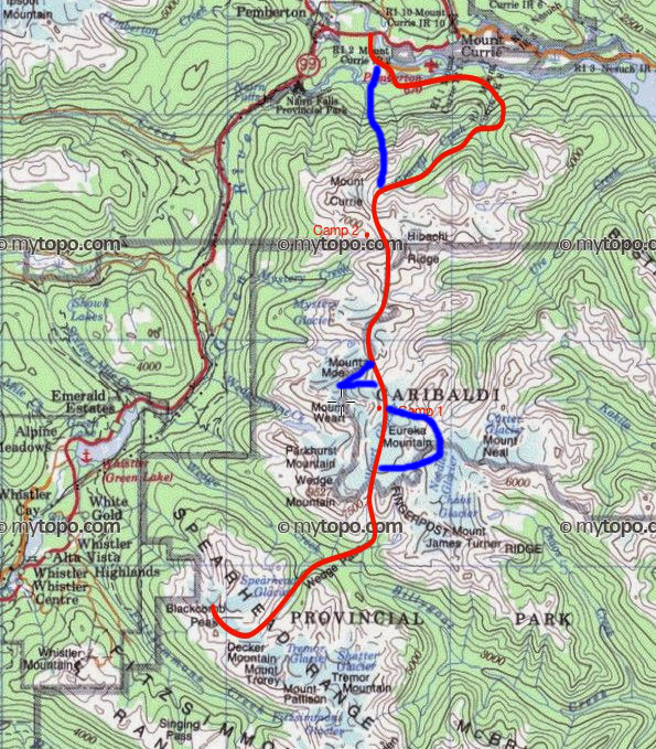
Map of the Blackcomb to Currie traverse, shamelessly stolen from Rich So’s blog. Blue depicts our major variations from the route they took: 1) Ski ascent of Eureka Mountain and descent by the northwest couloir. 2) Bootpack up and ski descent of The Owls couloir. 3) (A shortcut). A ski descent of Zorro’s couloir off of Mount Currie.
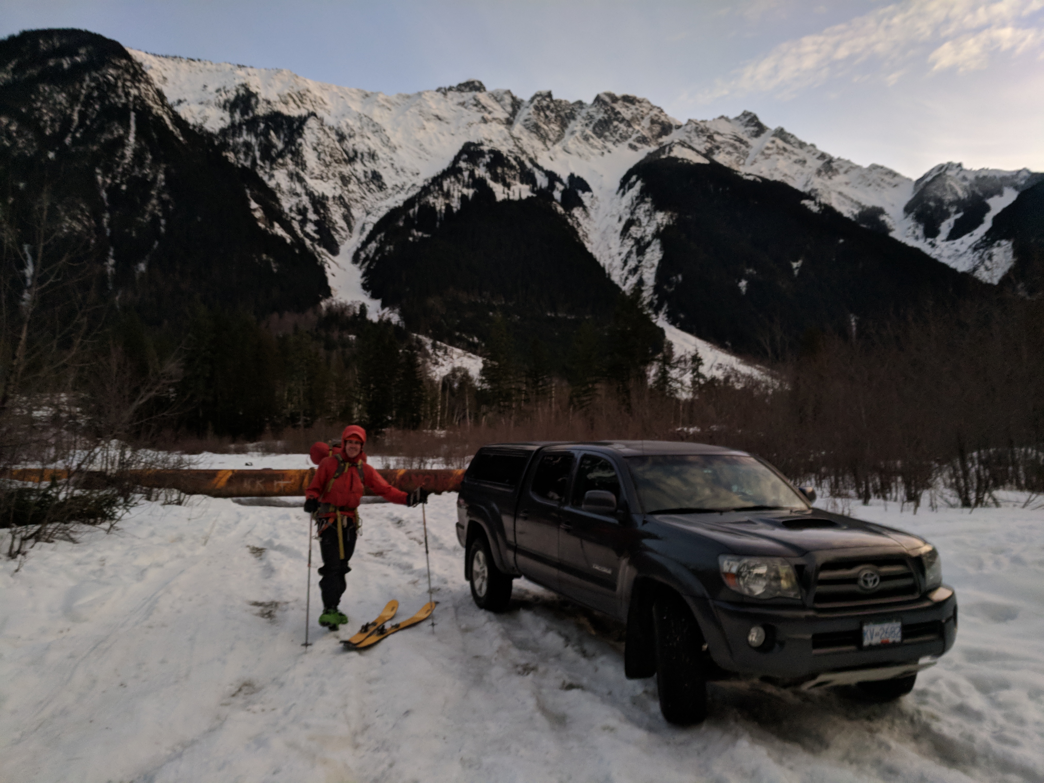
Early Saturday morning, we arrived at the base of Mount Currie to shuttle Nick’s truck. We were extremely fortunate to meet two trucks full of skiers who were doing the same shuttle. They were getting a helicopter drop to ski the pencil chute.
Not only did the party of heli-skiers help shuttle Nick’s truck one kilometre closer to our exit, but they also provided us with valuable information:
1) Pencil chute did not have a substantial cornice and would not require a rappel for entry
2) There were three heli-drops scheduled for Currie over the weekend, with all parties electing to ski the pencil chute.
Point 2 was probably the most important. Nobody was planning to ski down Currie via Zorro‘s couloir. If we chose to rappel into that couloir on Monday, we could have fresh tracks!
Point 1 was important as well. We had a backup exit that would not require any rappelling. Because of this back-up option, we could have brought a shorter rope. Unfortunately, Nick had left his 30m glacier rope at home. We were committed to lugging in the (heavy) 60m half rope.
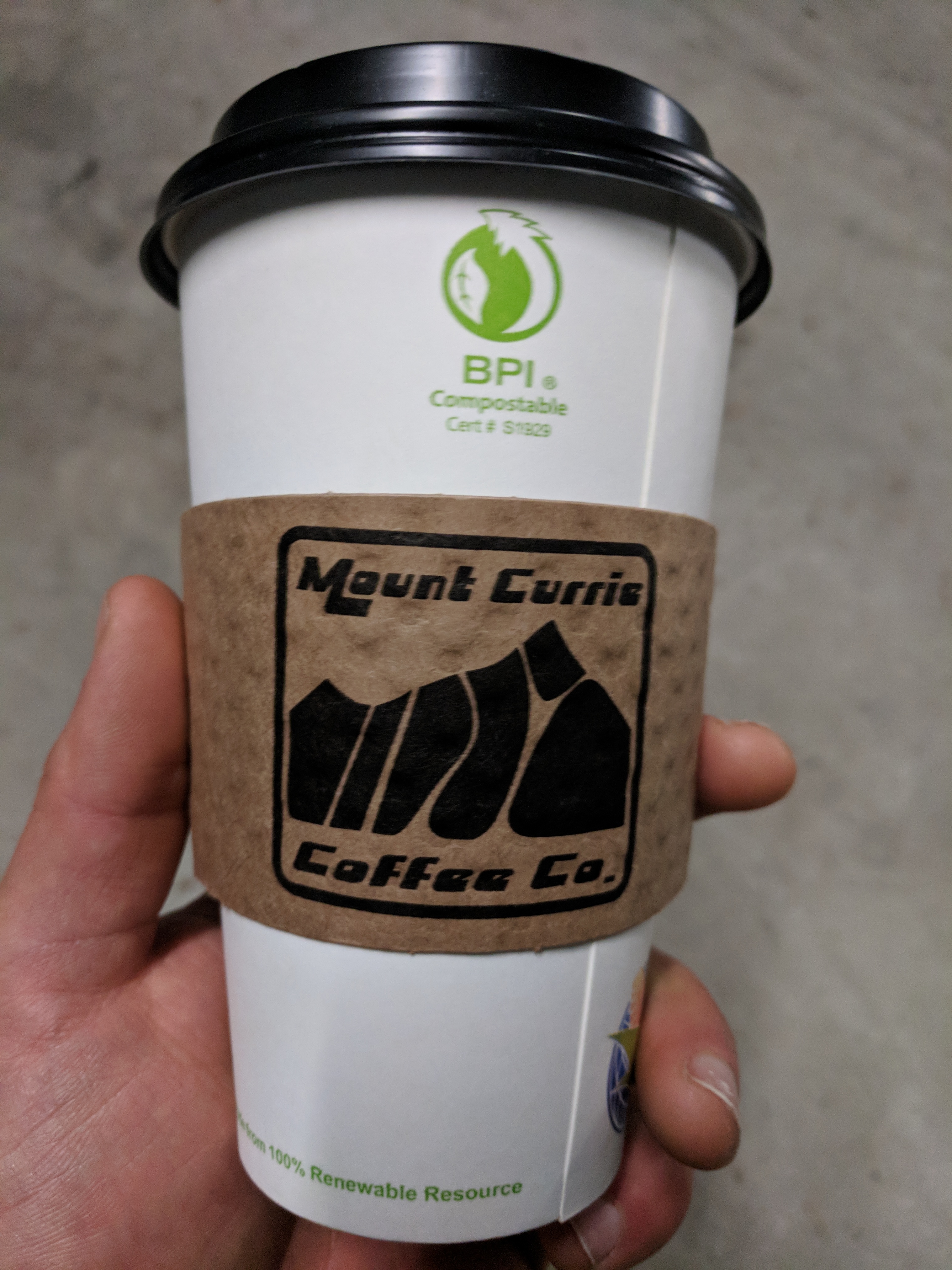
The ski lines down Mt Currie are perhaps best depicted by the eponymous coffee company’s cartoonified logo. From left to right, here is my impression: 1) Pencil chute, easiest access and most frequently skied. 2) Pterodactyl spine. Skied once and never repeated. Google the video if you are considering the second descent. 3) Zorro’s couloir. (really more Z-like in real life, hence the name). Also commonly skied. 4) Y couloir. Less couloir-like than pencil or Zorro’s, but holds the appeal of being the closest to the true summit of Mt Currie.
Of note, a party of three girls arrived just as we finished our fortuitous truck shuttle. They were also planning a Blackcomb to Currie traverse. They had a similar dilemma of one low clearance vehicle and one truck. With no truck shuttle, they were forced to leave their truck parked beside the road. We quickly parted ways. I made my prediction to Nick that we wouldn’t see the girls again until the next day. They would probably catch up to us just as we were completing a “show-off descent” down the north facing couloir of The Owls. That’s how I envisioned it, at least.
The start of a sunny long weekend meant that Whistler/Blackcomb was extremely crowded. Nick had to wait in line to purchase a backcountry access day pass. I did some people watching.
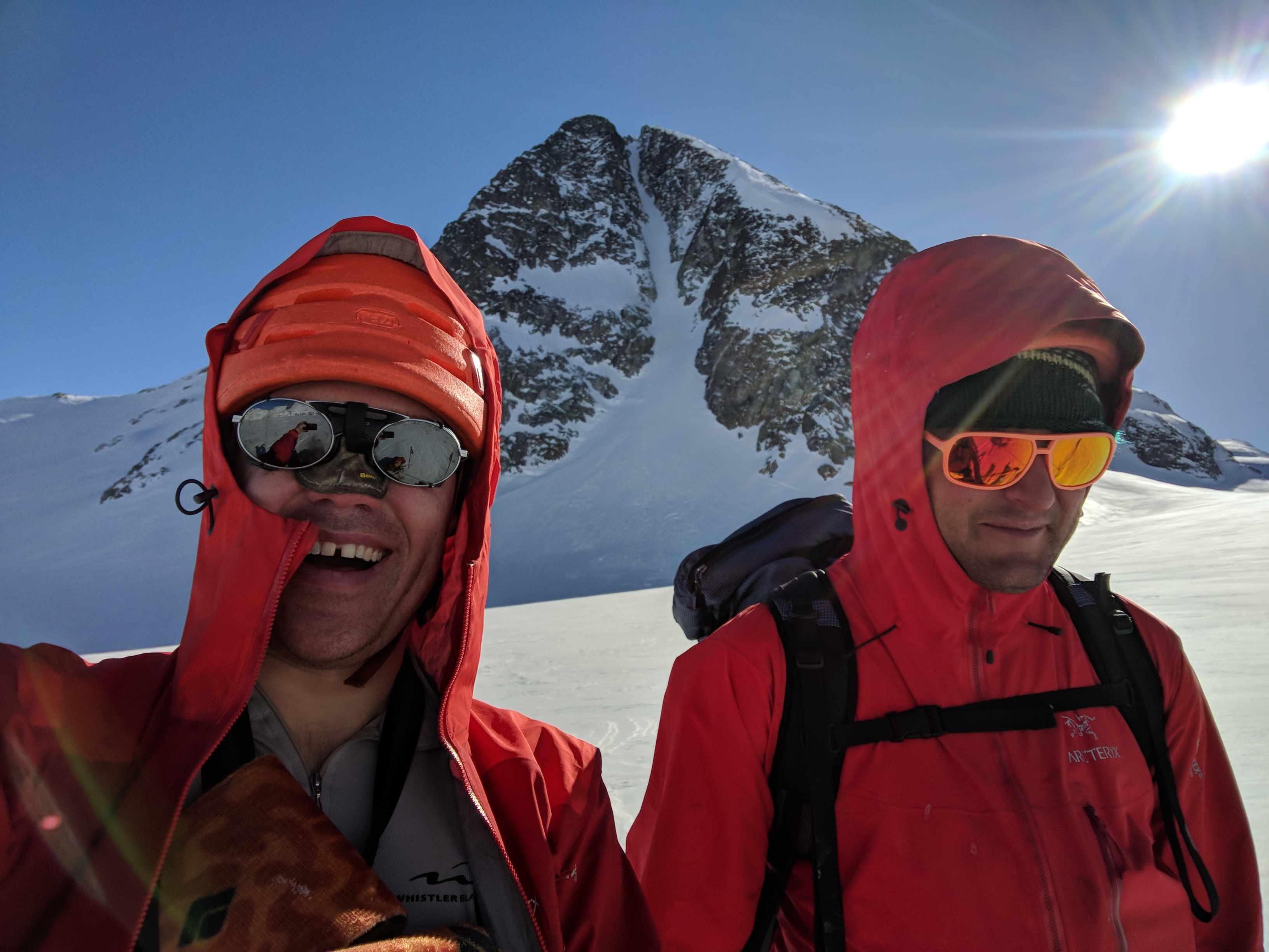
A tourist’s thumb, Nick, and I compete for attention.
It took until 11am for us to ride the lifts to the top of Blackcomb. After a brief skin up Spearhead Mountain, we started our couloir adventures immediately. We made our way over to the ‘Cham’ Chutes. Not ‘sham’ as in fake (although, some people seem to think so.), but ‘Cham’ as in Cham-onix – turns out they look a lot like steep lines in France.
We chose a very technical ‘warm up’ descent to navigate across to the start of our chosen ‘Cham’ chute. A 40-50m stretch of the steepest skiing I have ever done in my life. (Maybe that’s why nobody had skied it yet that day). Mandatory 180 degree jump turns or side slipping. 55-60 degrees? I dunno. People are inherently terrible at estimating slope angle. I only did two turns down it. I think Nick did three. Our heavy packs, and a speckling of rocks below, enhanced the rad factor.
Once we got into our chosen ‘Cham’ chute (chute #2), skiing was much more moderate. Not fresh tracks, but still enough sluffing to keep us engaged. One couloir down, several to go.
Nick skiing down a very pretty ‘Cham’ Chute in the Blackcomb slack-country.
We quickly passed over Decker Lake, and then proceeded into ‘moderate consequence’ creek hopping as we meandered down Decker Creek, towards the Wedge Pass. We wondered what the girls would think of our track down.
As we approached Billygoat Lake, the surface we were skiing had lost any semblance of snow. I’m told that Canada’s Inuit people have >50 words for snow. If slang counts, modern skiers have a comparable vocabulary. These melt-freeze conditions were best described as ‘death cookies.’
At this point, Nick voiced his appreciation for rockered skis. Although not designed for high speed ‘death cookie’ navigation, rocker made it more reasonable. Rocker didn’t make it any quieter though. I contemplated wearing my earplugs.
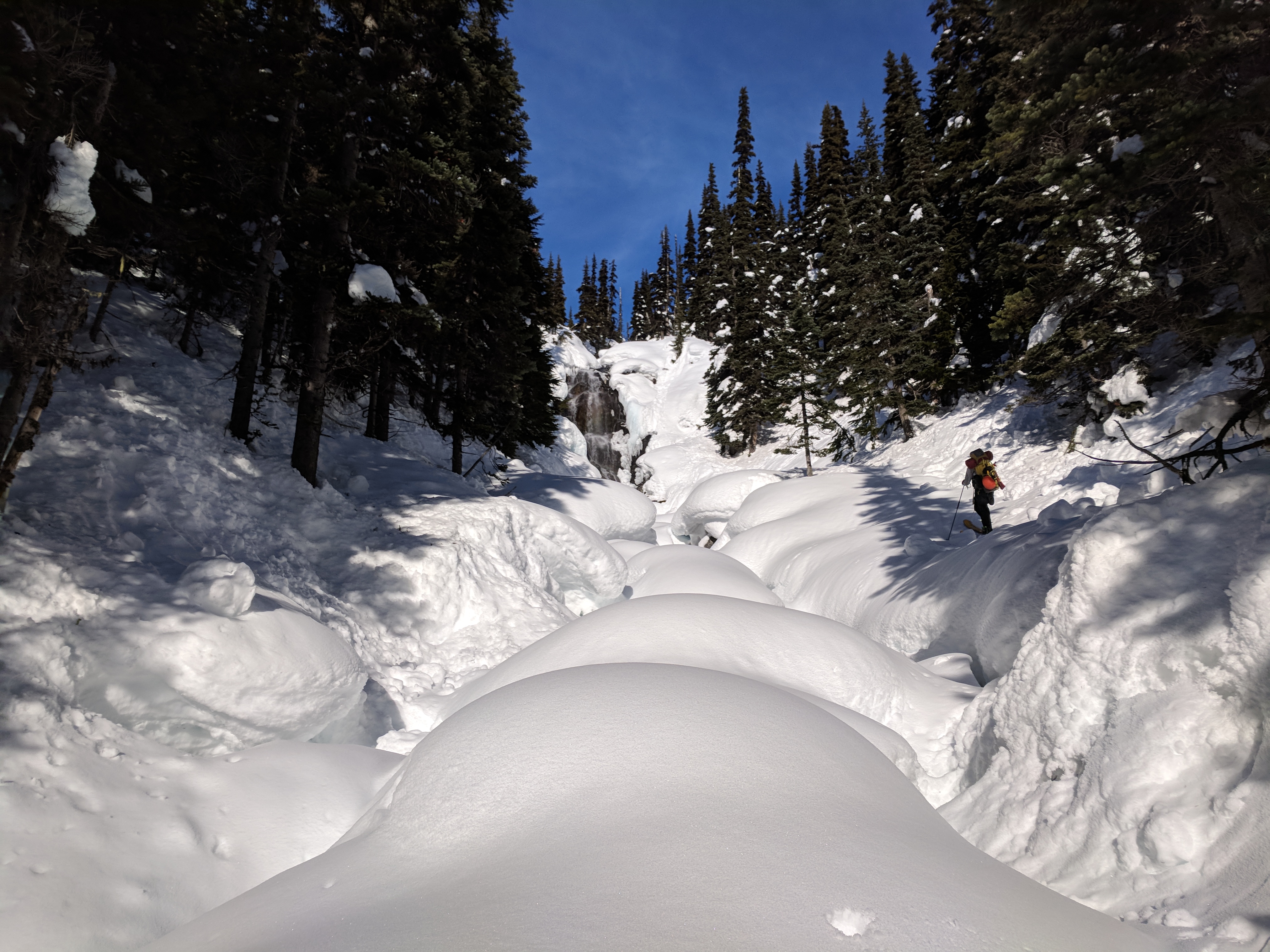
Starting our ascent up towards the Weart Glacier. A creek and a waterfall.
Eventually, we reached valley bottom and started climbing towards the Weart Glacier. As we crested onto the Glacier, the sun was dipping below the horizon. Temperatures were plummeting, and winds were howling. We had a vague notion that we could climb and ski Eureka Mountain by headlamp, but common sense prevailed. We set up camp at the base of the ridge.
As soon as we stopped, we excavated a platform for our tent. We also built walls. Nick taught me to dig effective snow blocks. Turns out, digging doubles as an effective way to regain core temperature. I even got warm enough to sit outside, melt water, and cook dinner. Our 60m rope proved that it, just like ski rocker, had its very own secondary feature. It made a nice seat.
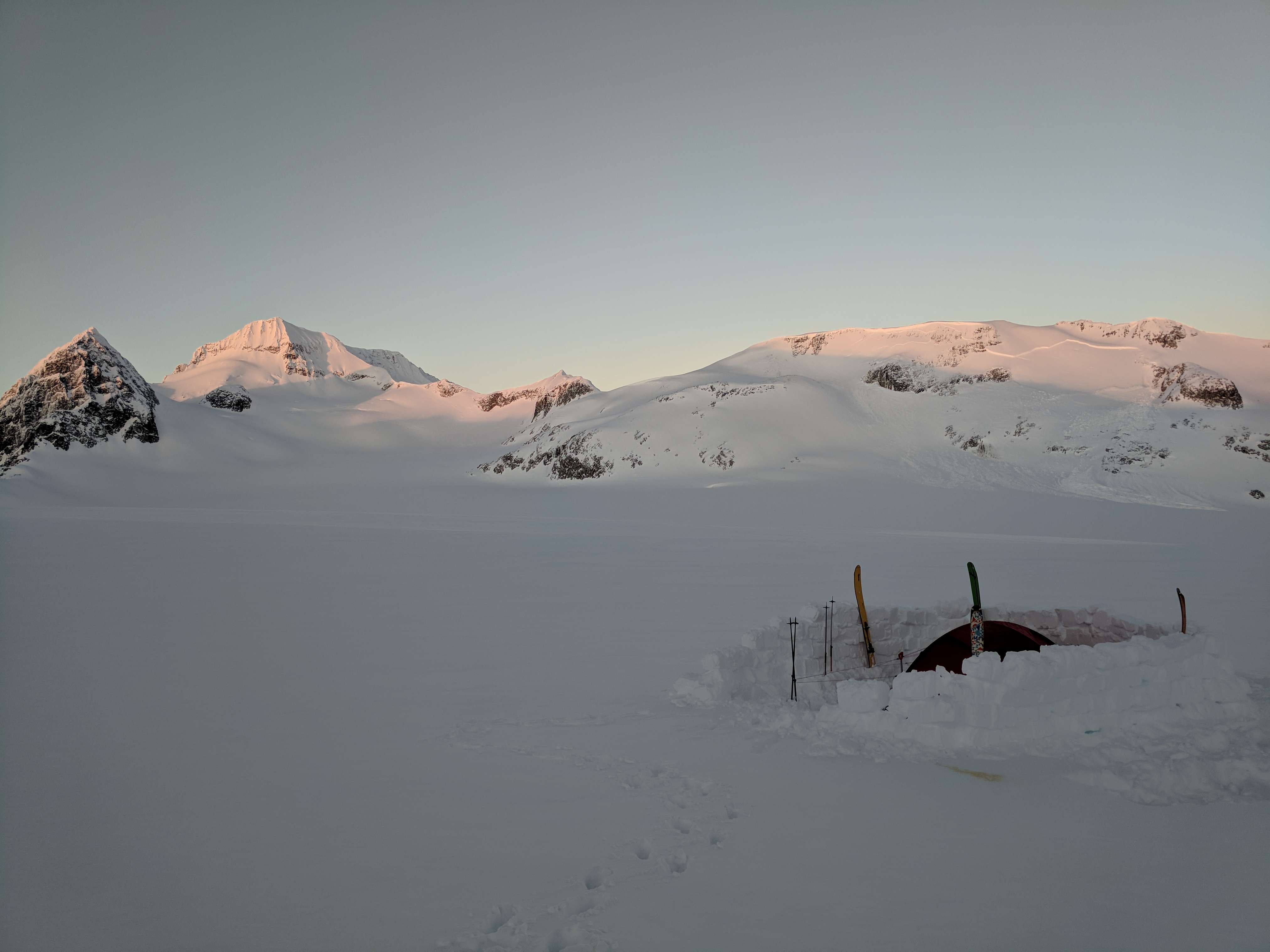
Saturday night camp. Trust the engineer to teach you real world applications for those Lego skills you honed as a child. Wedge in the background. Class 2 avalanche off the East facing sub-summit of lesser wedge. A couple days old. Suspected solar trigger.
One cold night elapsed. Bright and early on Sunday, we started climbing the ridge to Eureka. Mostly bootpacking over faceted rocks, it was fairly trivial to gain the summit. Views were acceptable. We noted a tent in the middle of the Weart Glacier, terribly positioned. Even as the sun climbed into the sky, the campers were eclipsed by the shadow of Eureka Mountain. We wondered if it was the girls. Had they travelled well into the night by headlamp?
Nick bootpacks up the ridge to gain the summit of Eureka Mountain.
Olek on the summit of Eureka with Mount Weart in the background.
We didn’t pause long at the summit. We had a couloir to ski. We bootpacked around the east side of summit to eventually gain Northwest ridge. Although these slopes were in the sun, snow stability was in our favour. It was only ~8am, and still very cold. I marvelled at our audacity to even consider attempting this in the dark… Unpleasant.
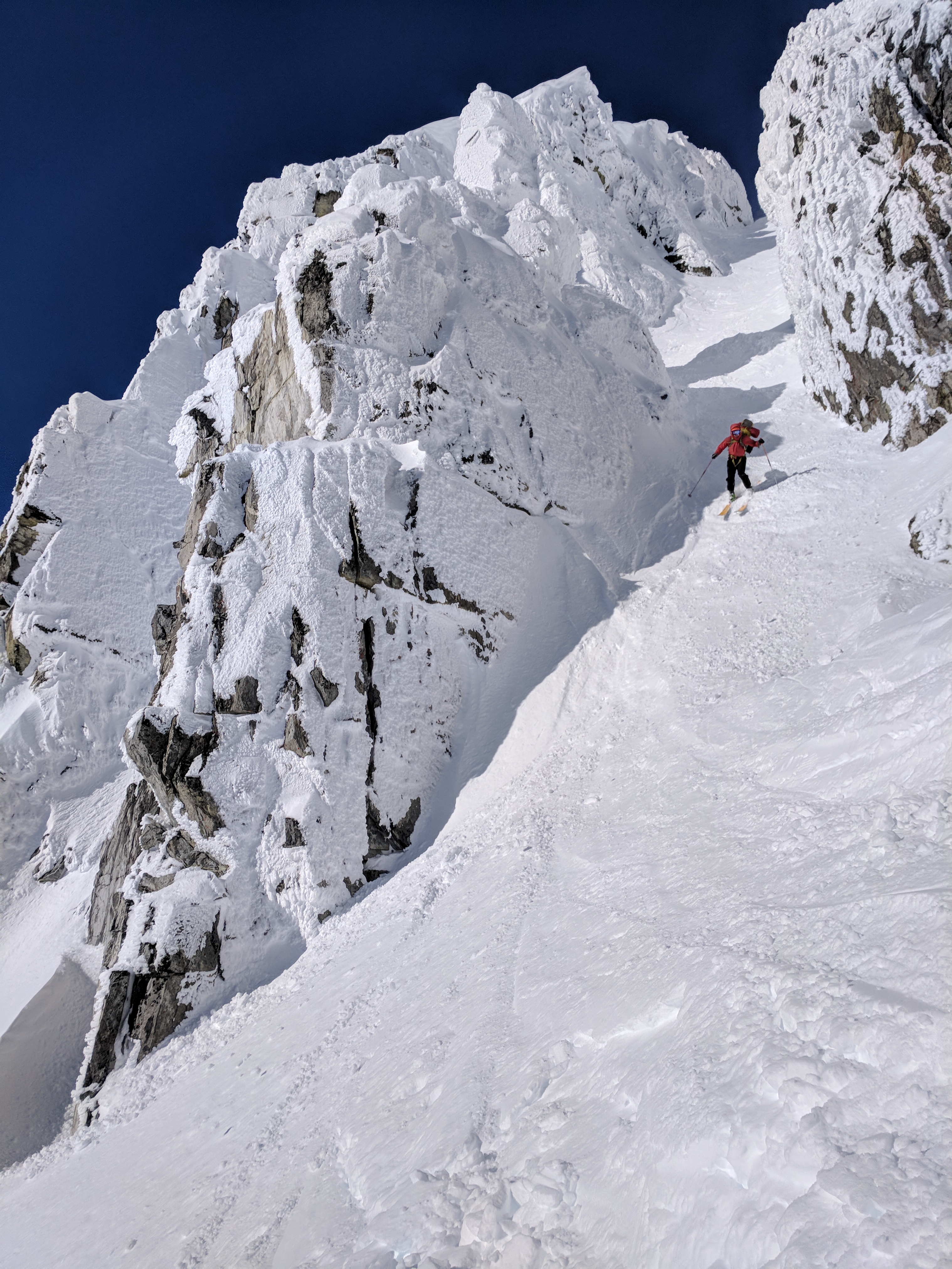
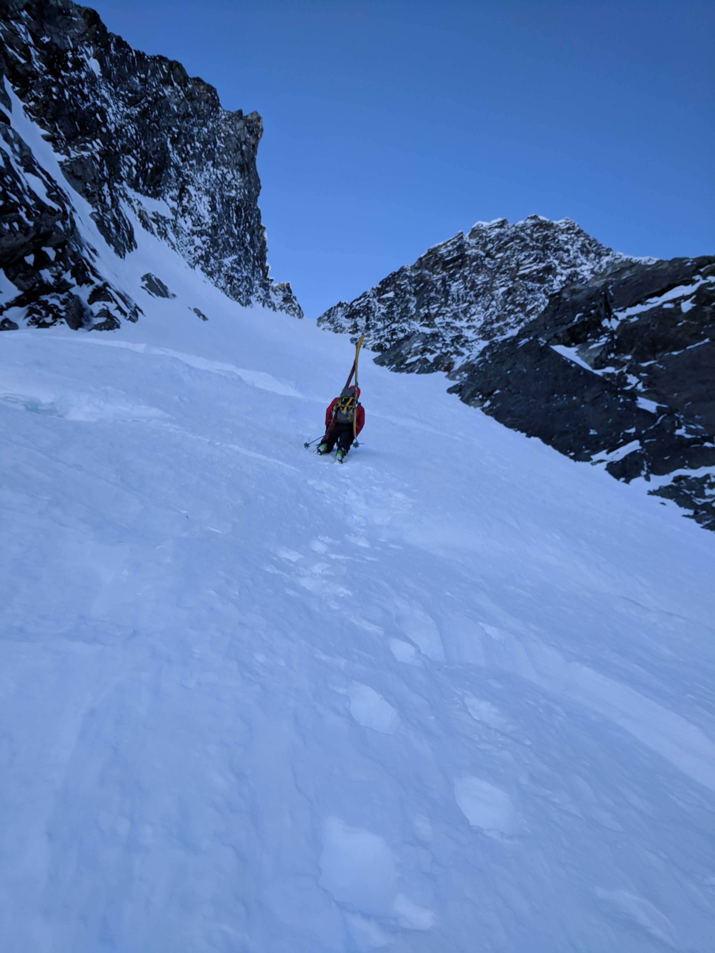
We skied down the northwest ridge of Eureka to enter the NW couloir. The entrance was quite rocky. It seemed possible to do a 5 foot straight-line entry between rocks to gain the ~40+ degree slope, but we were not that bold. We bootpacked down this 5+ feet of the choke, quickly revealing many lurking rocks.
Nick bootpacking around the east face of Eureka to regain the northwest ridge.
Olek putting on his skis at the rocky entrance to the Eureka NW couloir.
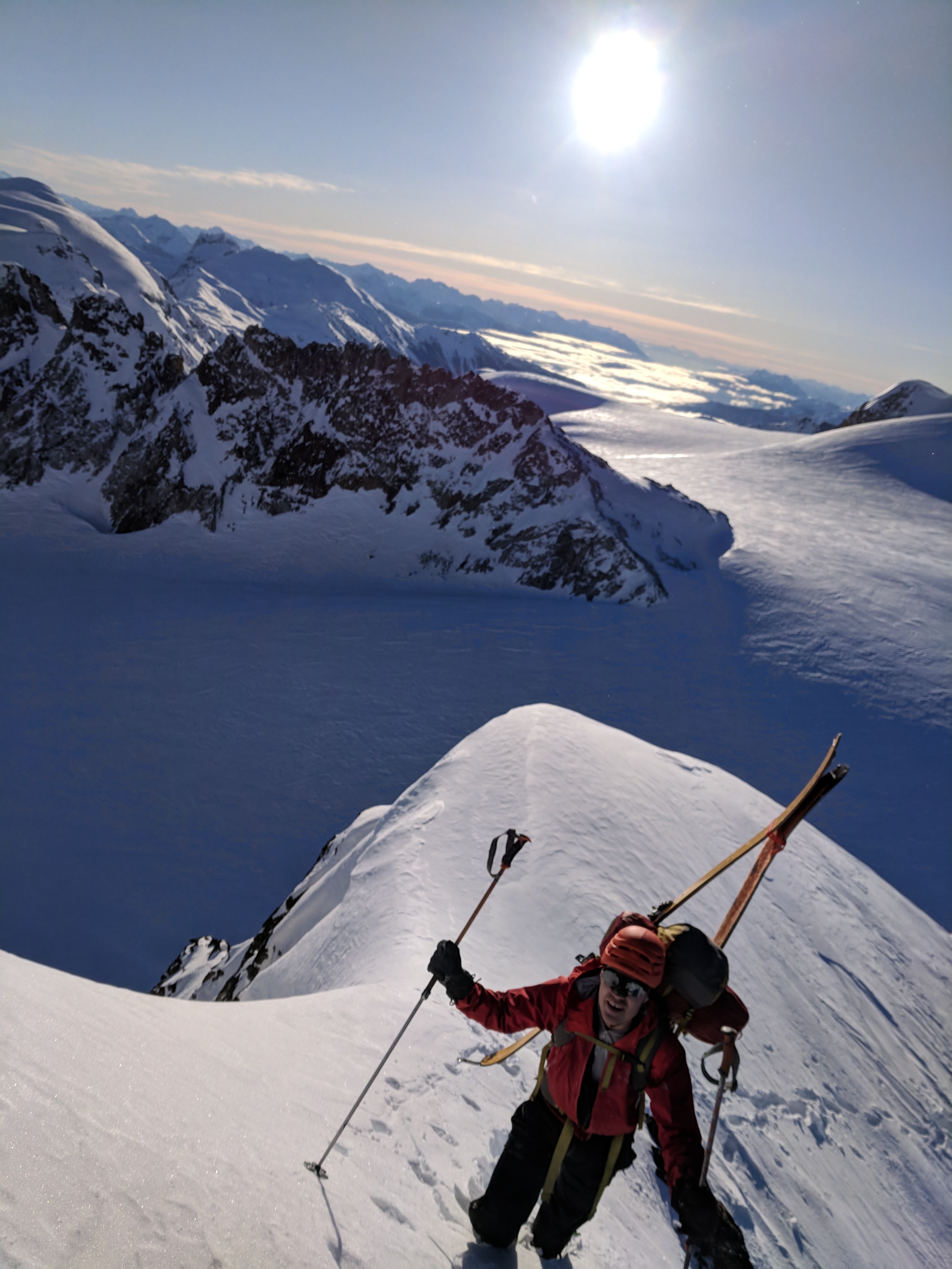
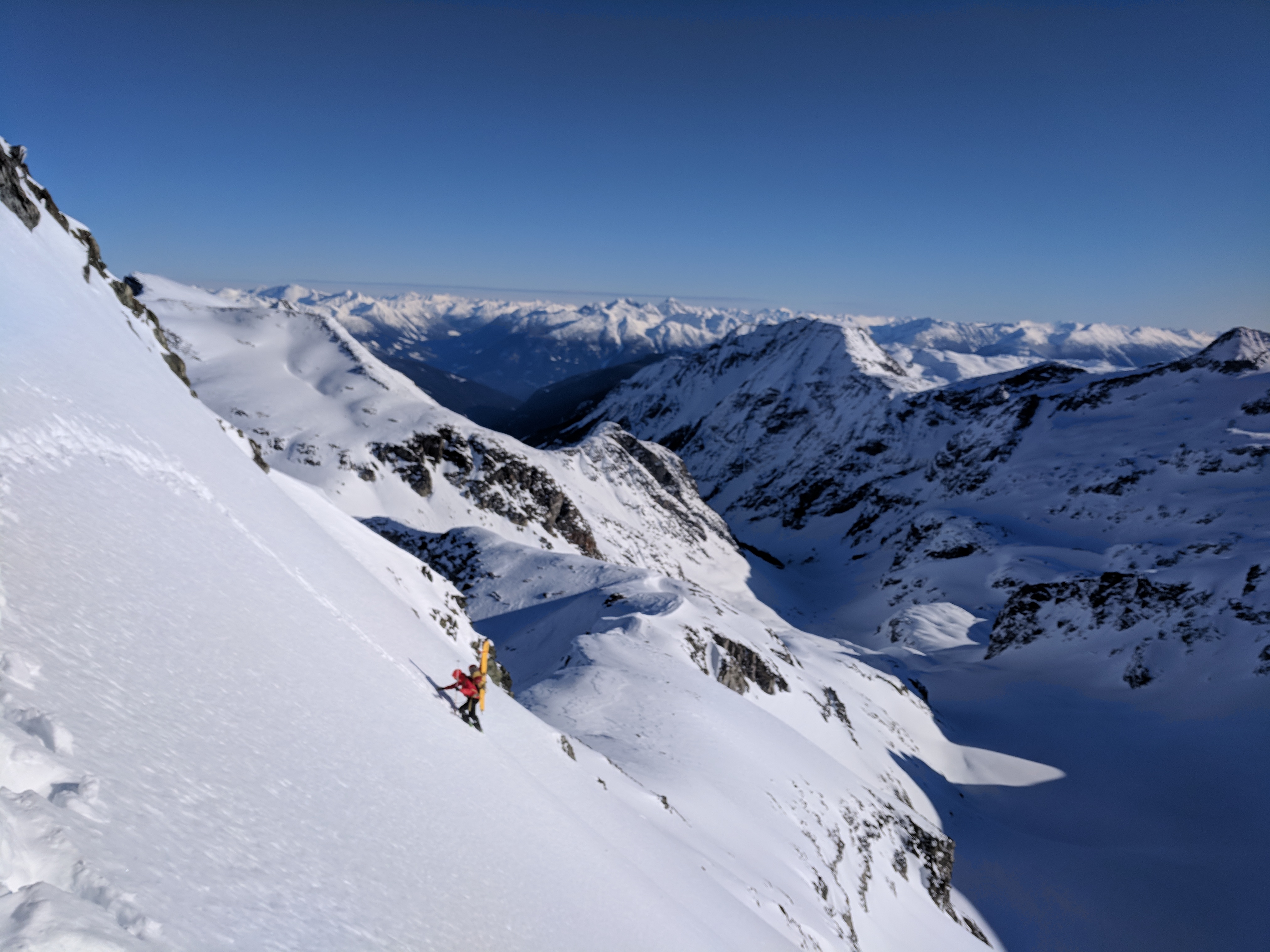
Olek skiing down the Eureka NW couloir with the Weart Glacier in the background.
Nick opening up his turns as the couloir widens.
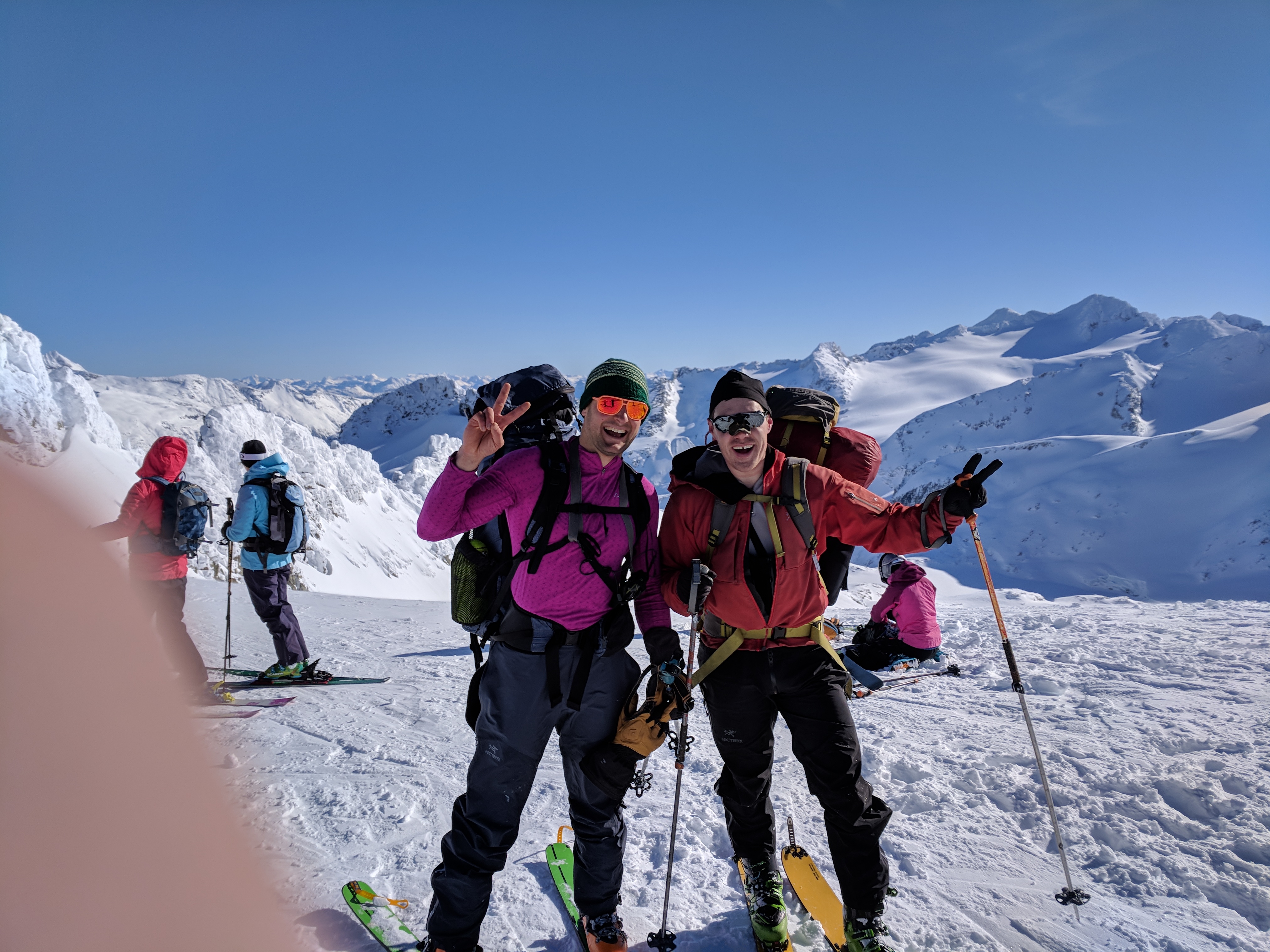
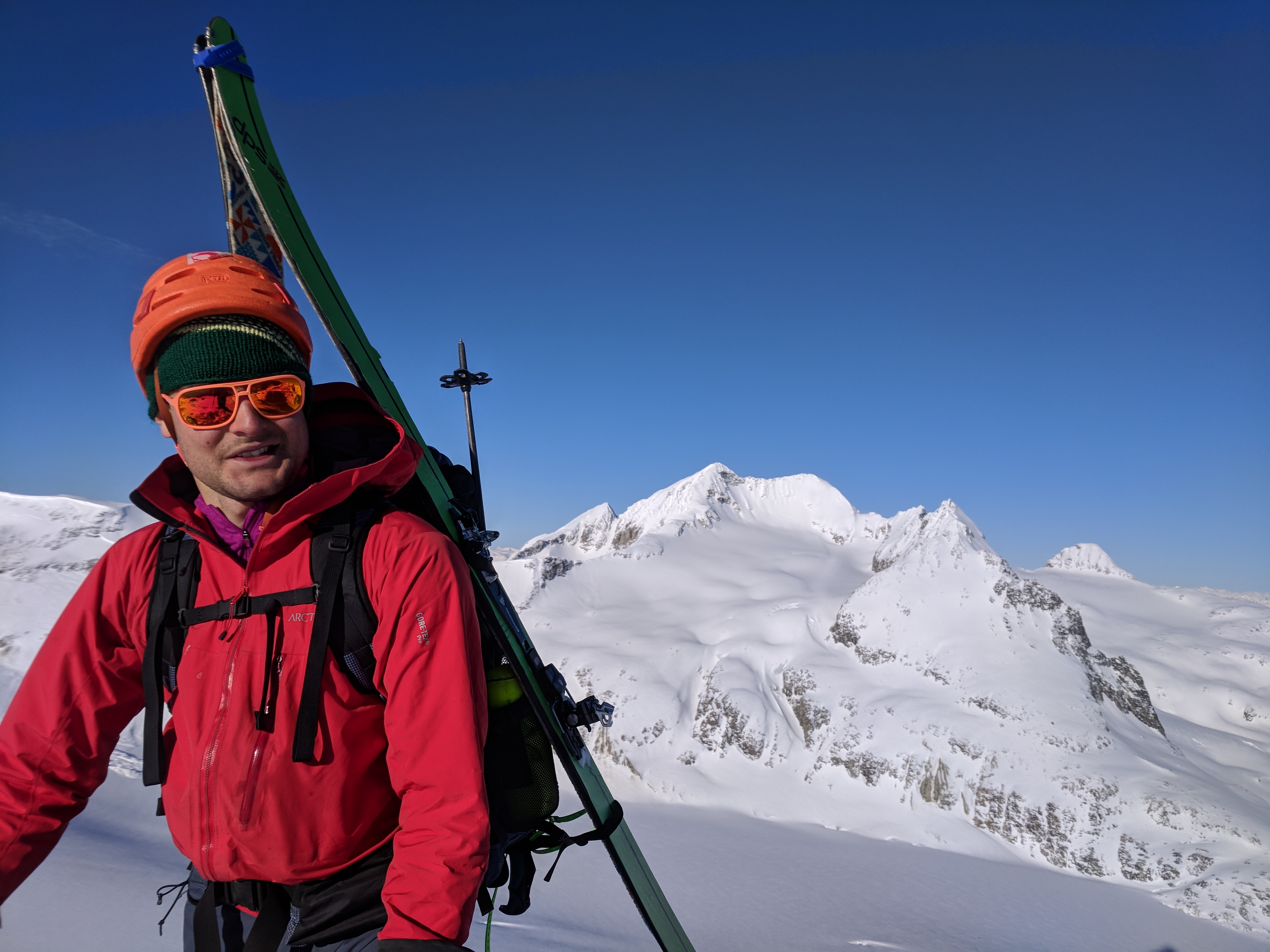
Selfie success with Eureka NW couloir in the background.
To implement the aforementioned “>50 modern terms for snow”, the surface lining the couloir could best be described as “Styrofoam”. No wind loading to be concerned of. I was stoked. Couloirs like this tend to sluff a lot in powdery conditions. Styrofoam has very minimal and predictable sluff.
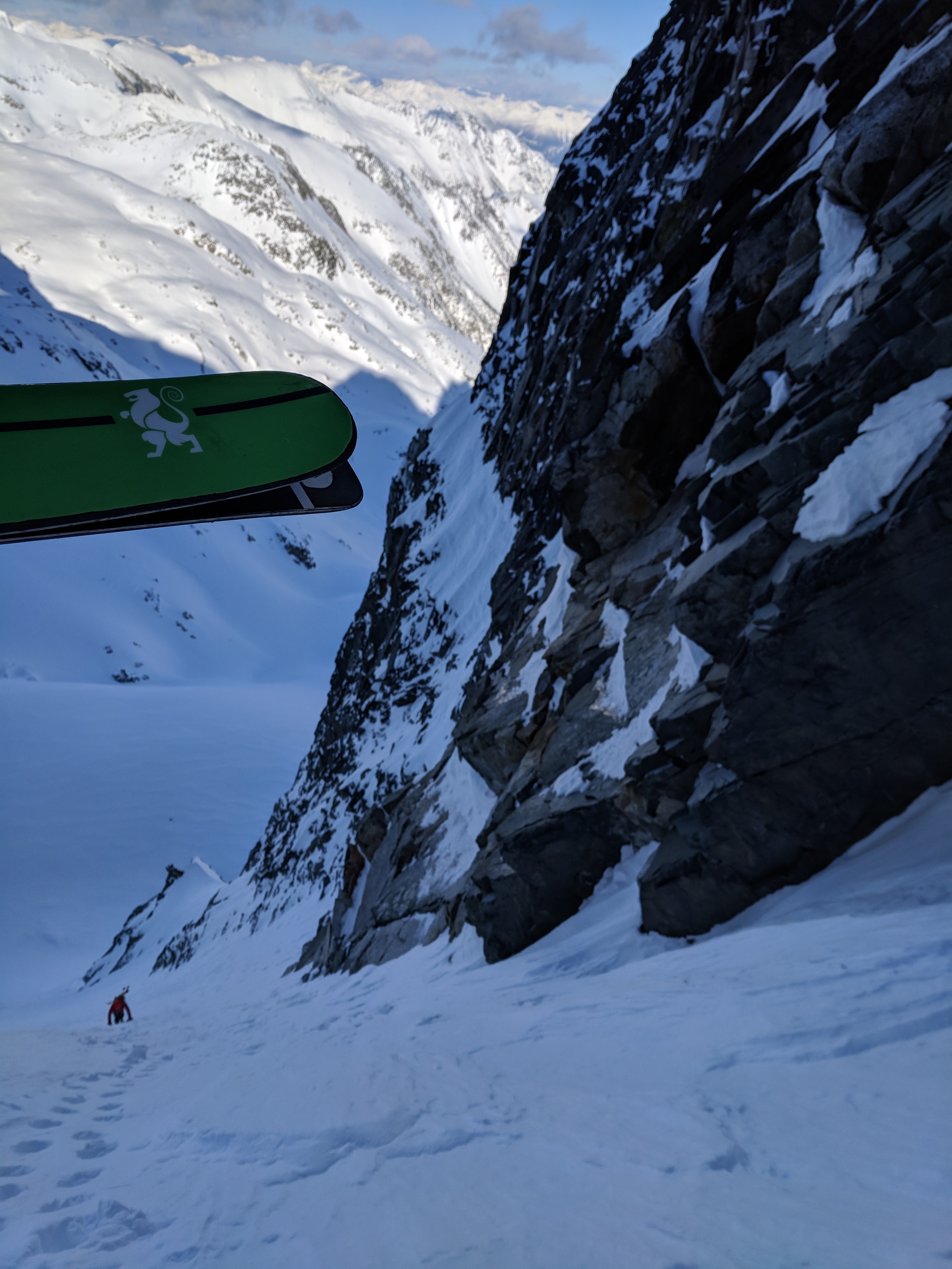
We cruised down the not-oft-skied couloir to regain the Weart glacier. All the while being watched by the shadow dwellers. Maybe my forecasted: “show-off descent” in front of the girls had happened earlier than I predicted.
We cruised into the sun to greet the campers. Turns out, they were a different party, heading the opposite direction. They had been dropped off by helicopter on top of Mount Currie the day before. They had made a solid effort to reach the Weart Glacier in their first day. One of the campers even photographed our ski descent.
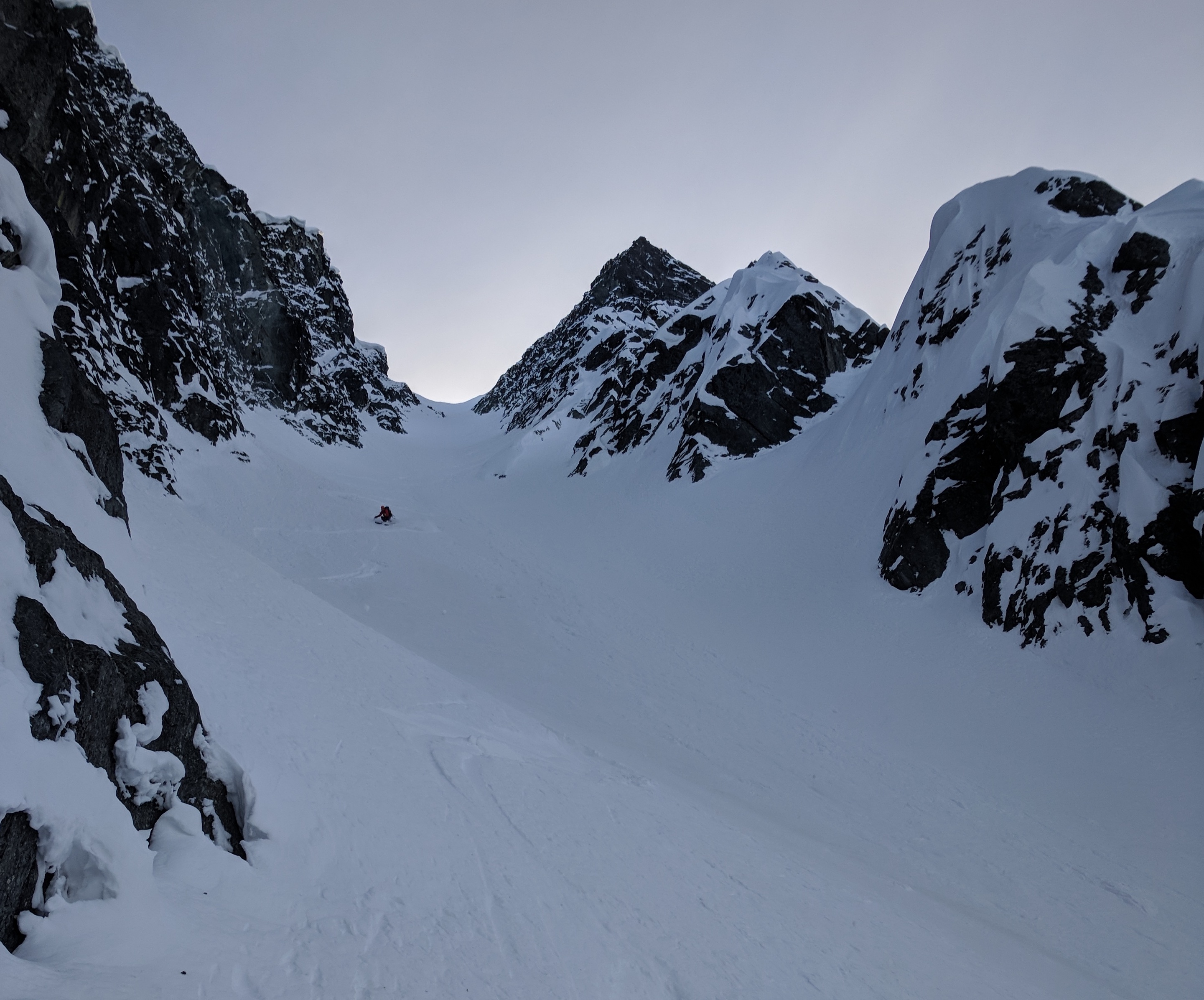
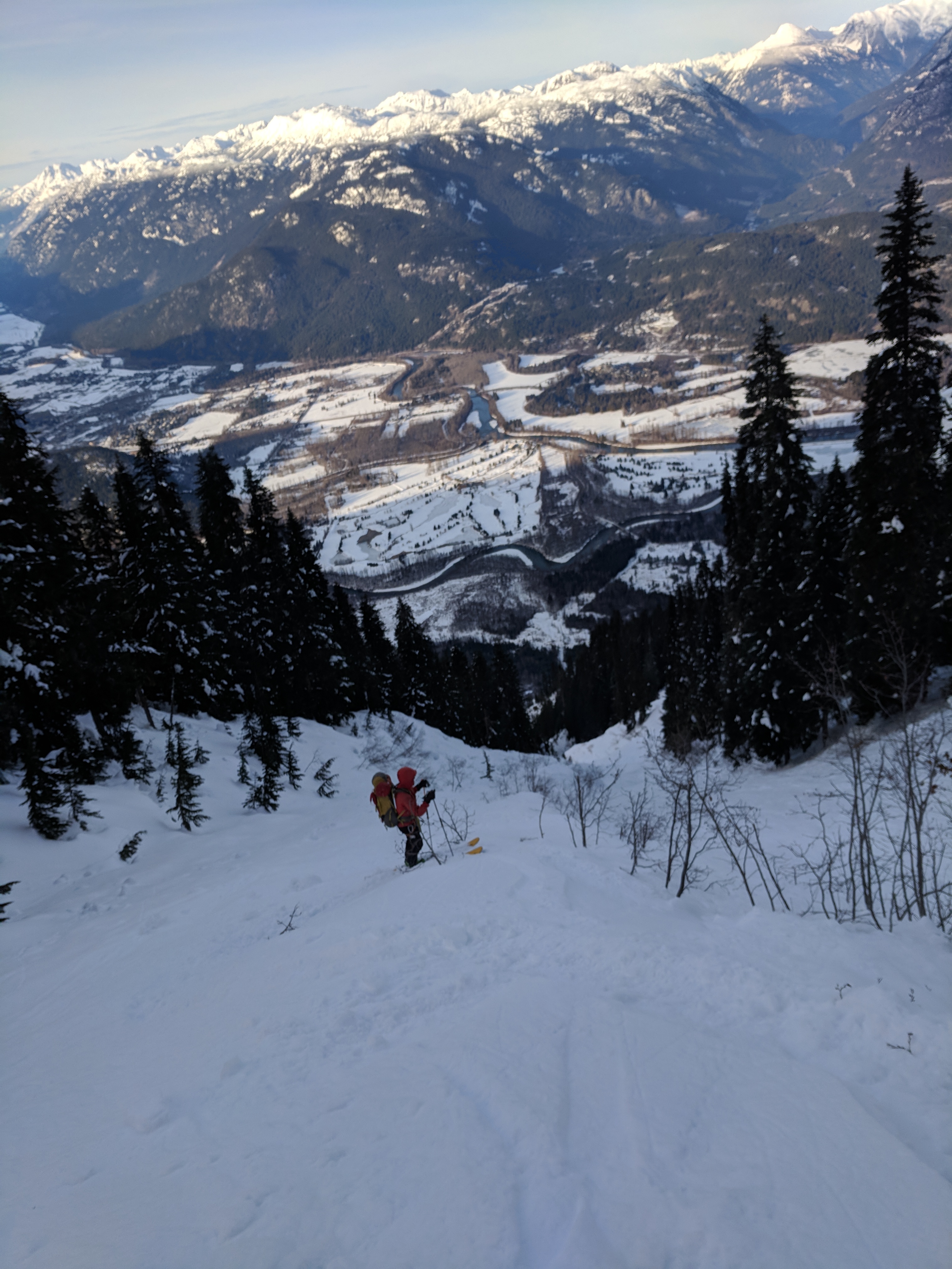
We briefly snacked in the sun, then skinned into the shade towards our next north facing couloir, just west of the true summit of The Owls. This line is one of the most striking in the region, and had been on my ‘tick list’ since new years.
The best part about this objective is that we got to ditch our heavy packs at the bottom. We bootpacked up sustained, steep, Styrofoam to gain the col. It was cold! I kept my puffy on for the 1.5 hours it took us to get to the top.
2:45pm at the crest of the col, I peeked down to watch Nick following up. To my surprise, I also saw a party of three skinning past our packs. I chuckled. Maybe my prediction had come true. I could only assume they were the Blackcomb -> Currie girls.
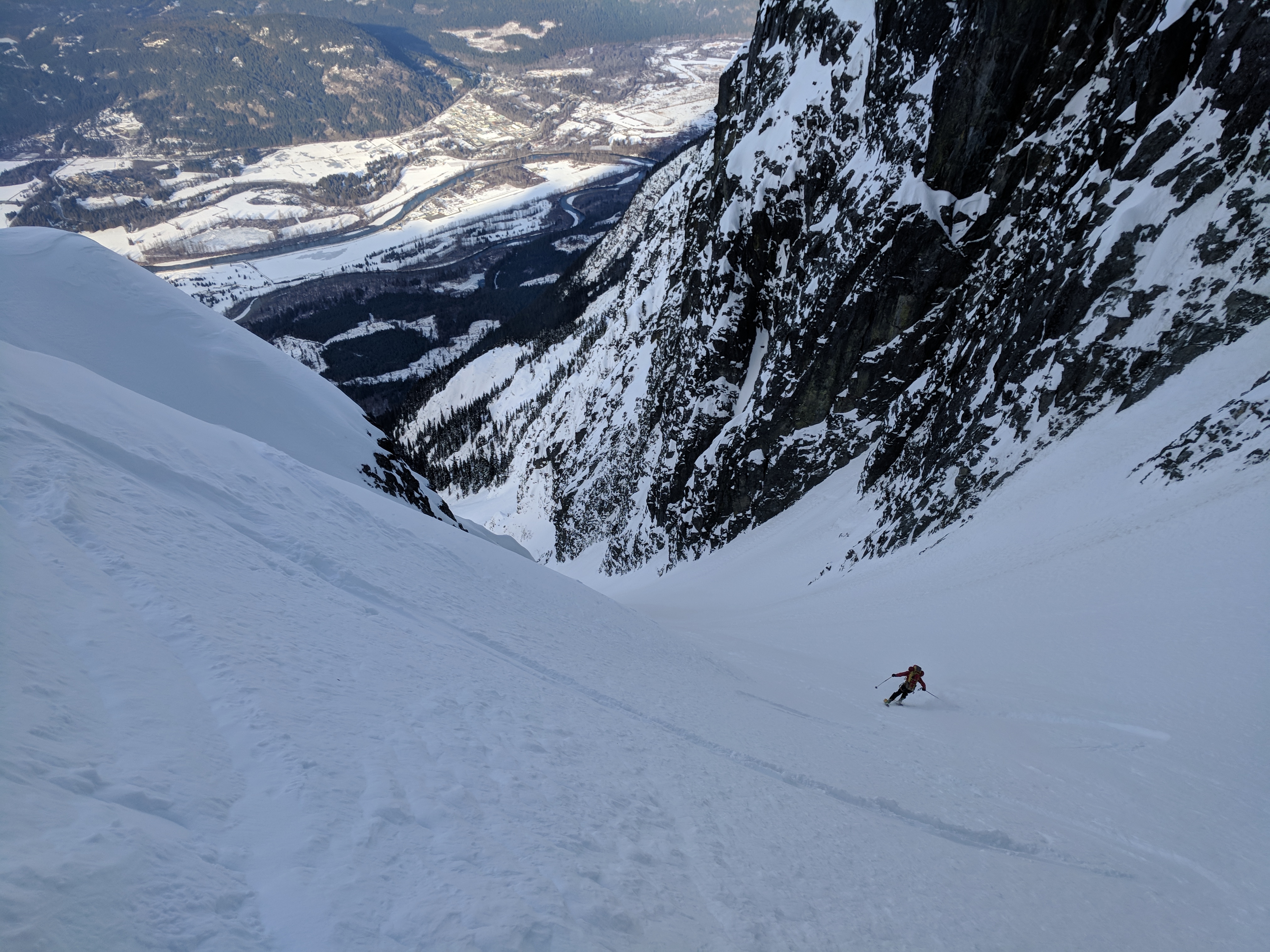
We paused briefly in the sun, then segued smoothly into more Styrofoam skiing. Jump turns were much easier with light packs.
Strong skiers have suggested that this couloir is as steep as 55 degrees, but Nick and I figured that was slightly inflated. Nick did some ski pole field measurements and wanted to pin it down at “45 degrees, but very sustained.” I’m not sure when modesty becomes sandbagging, so I’m fine to just leave it at 45++. Two small bergschrunds were easily skied over on the way down.
Nick starts the bootpack up Owls couloir, carefully treading over two, mostly filled, bergschrunds.
Nick following up the sustained bootpack.
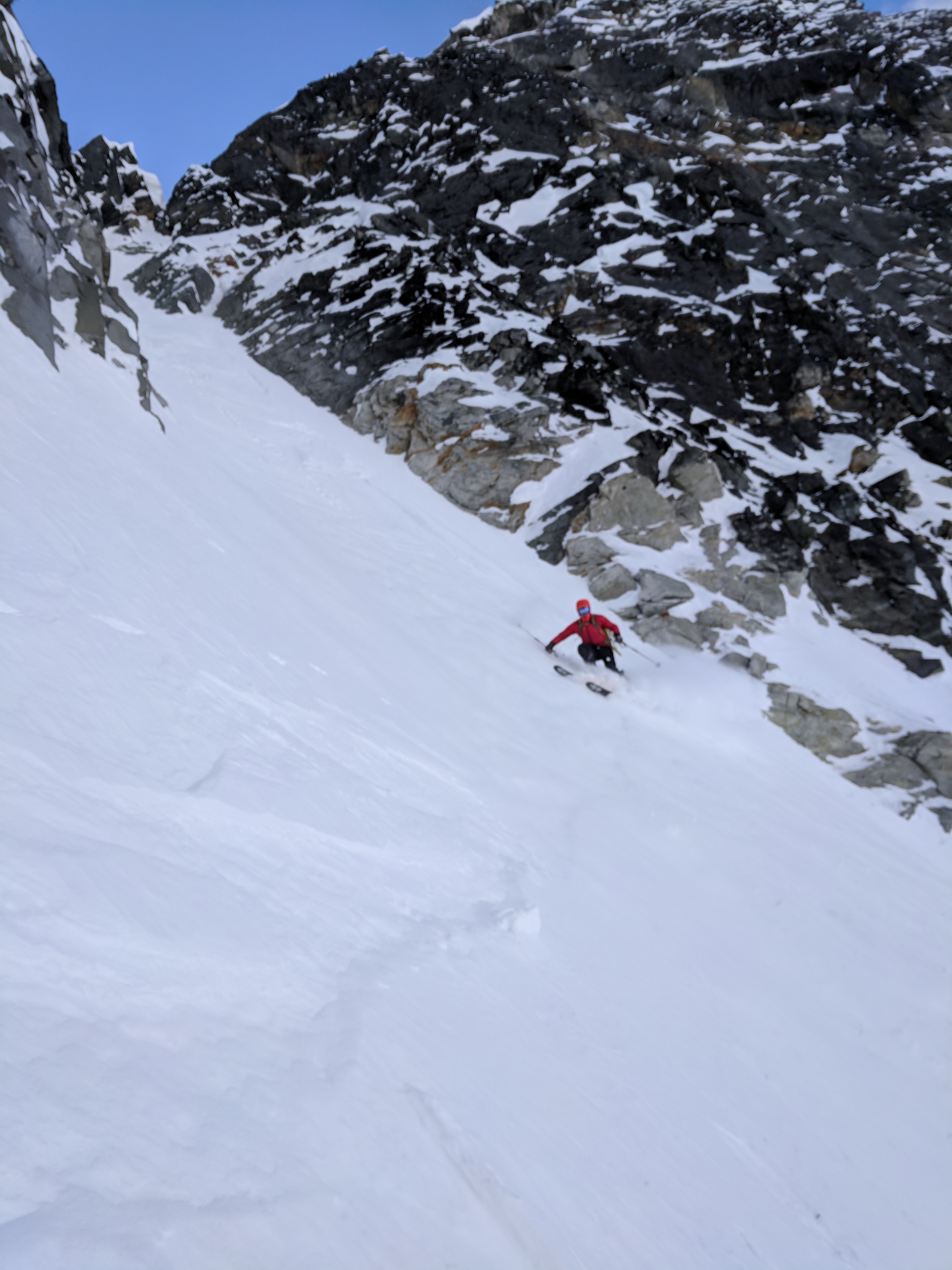
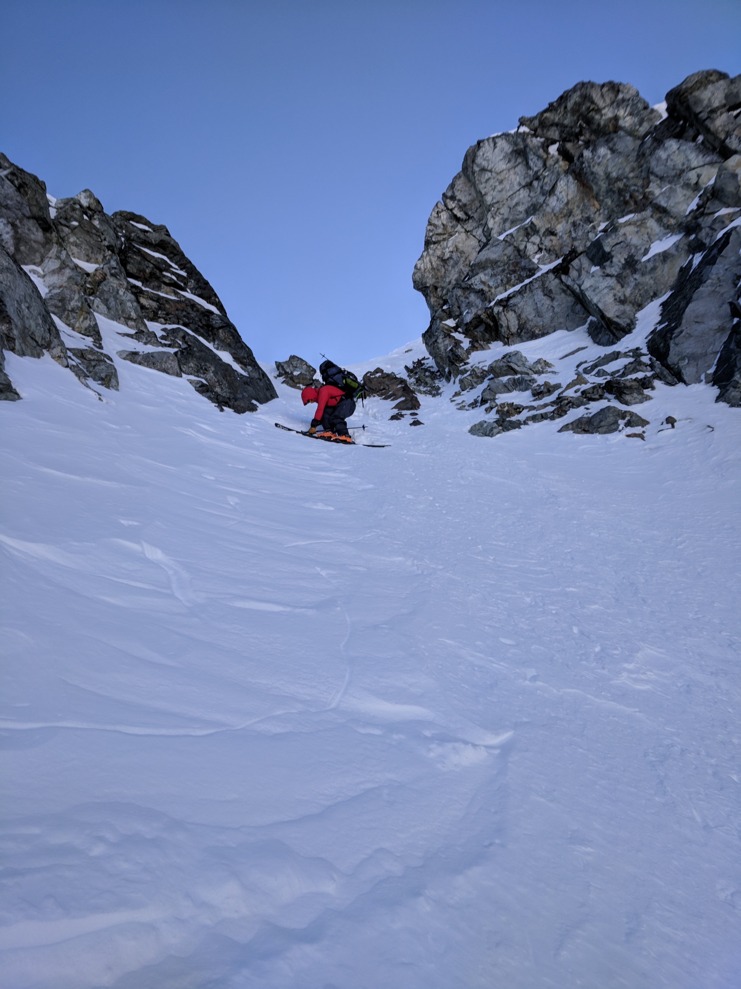
Nick makes one of many turns down the steep slope.
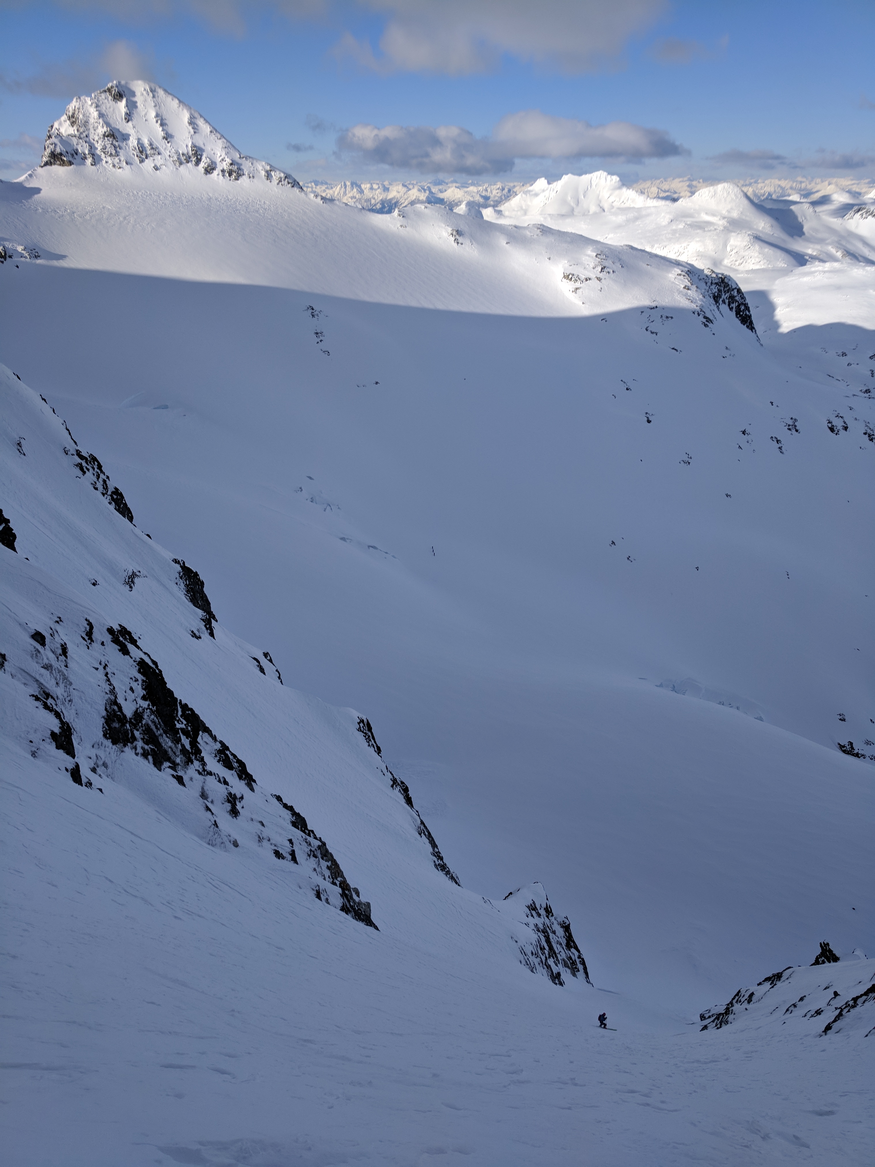
Olek nears the bottom of the couloir with Mount Moe in the background.
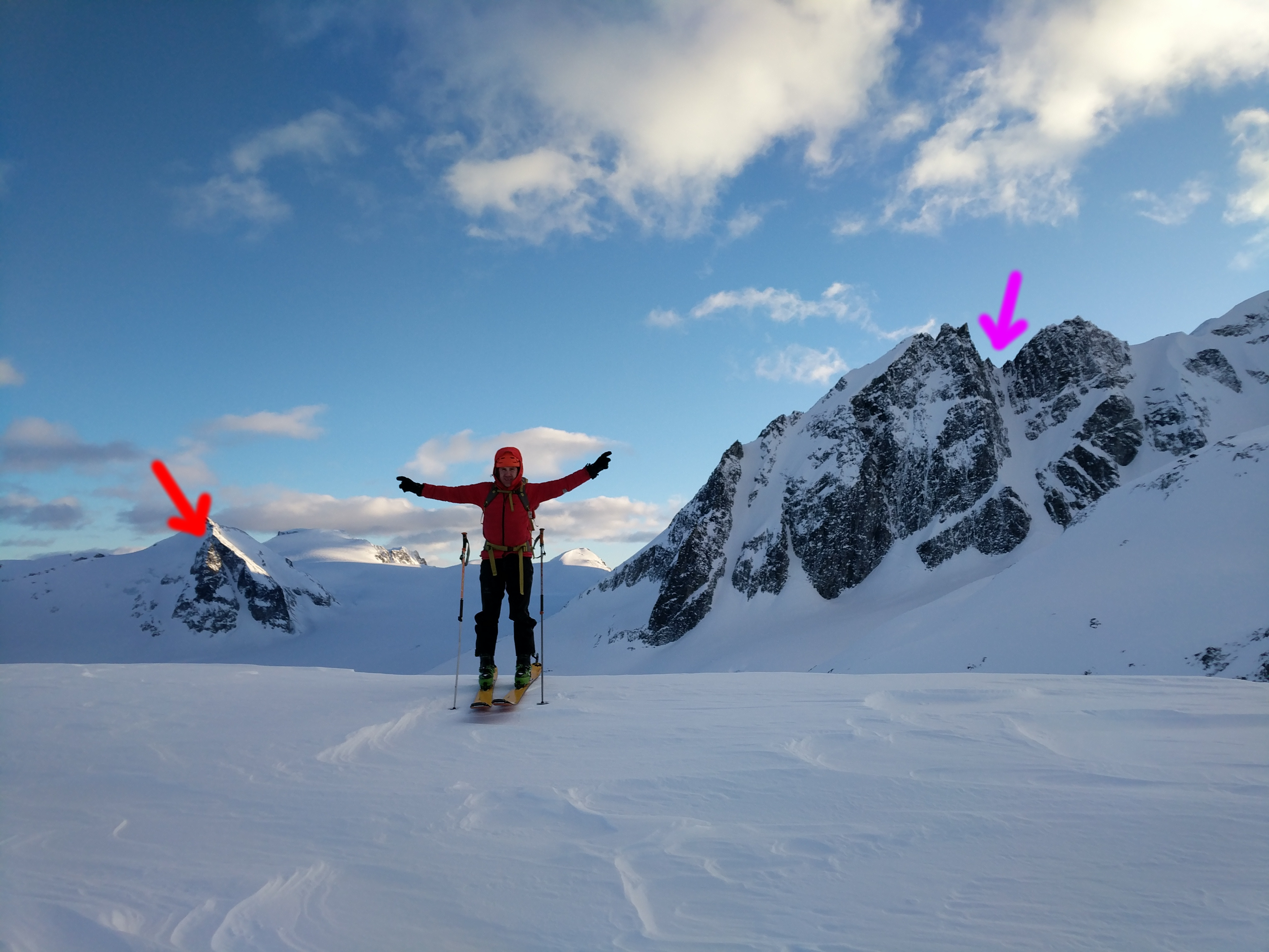
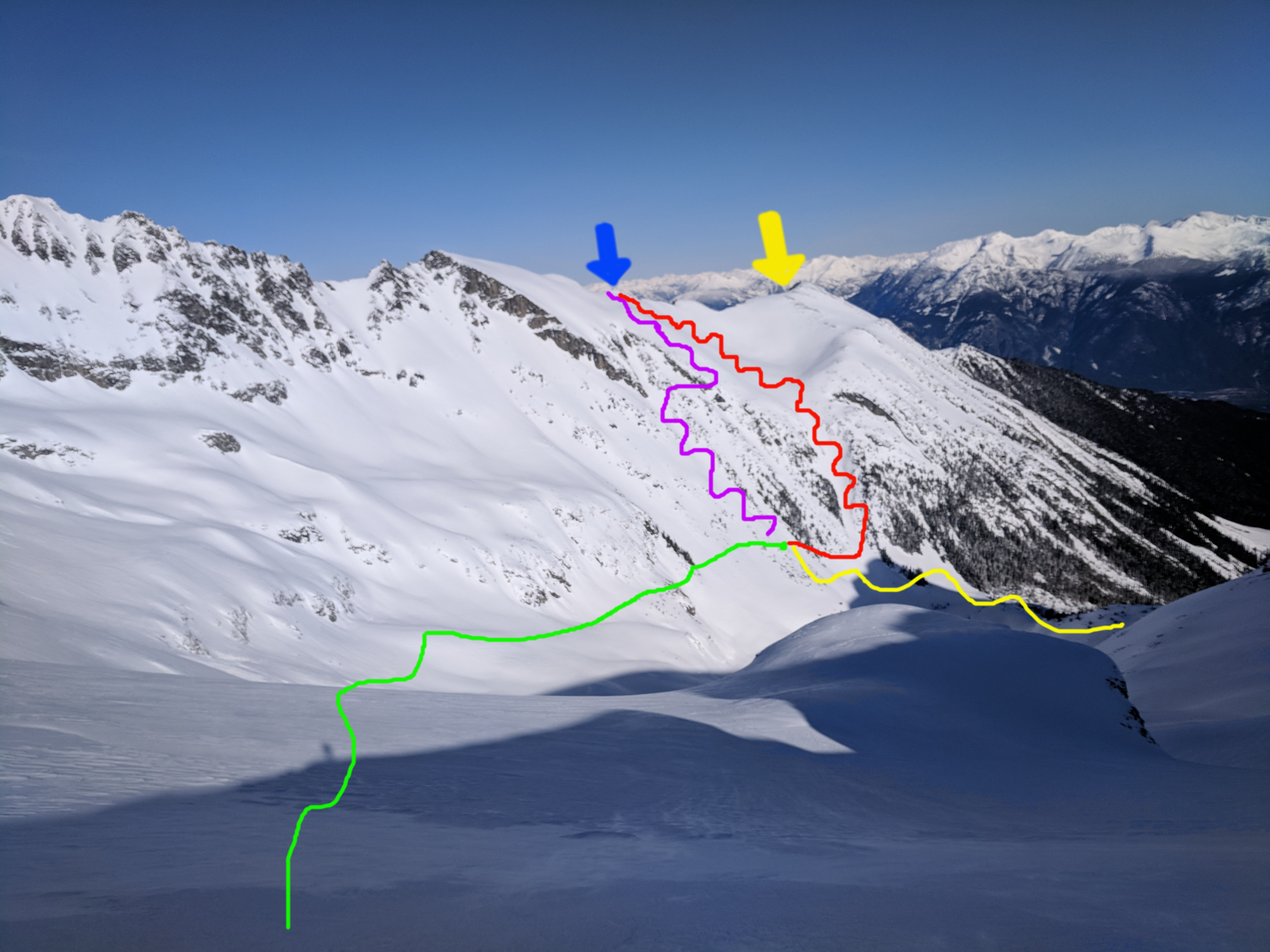
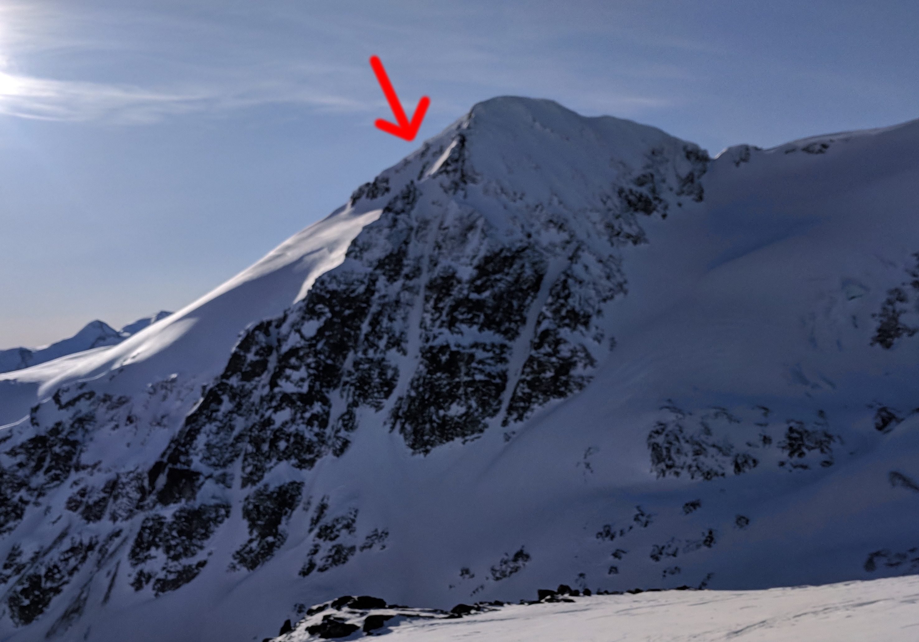
Nick points to both the lines we skied on Sunday. Northwest couloir of Eureka (red arrow) to his right and north couloir of The Owls (purple arrow), to his left.
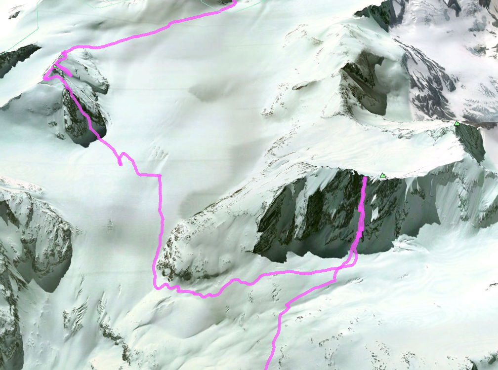
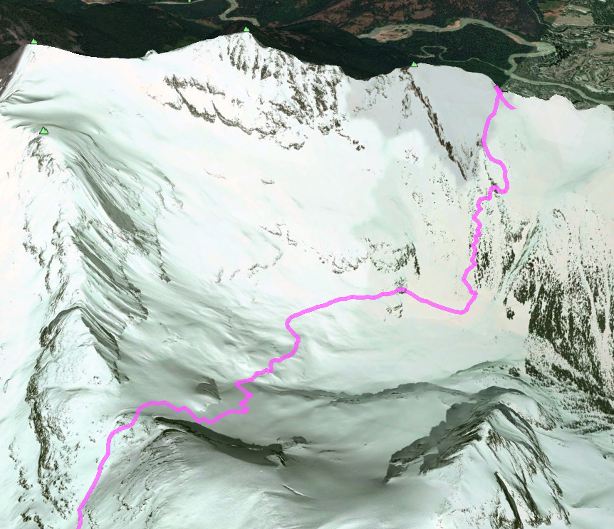
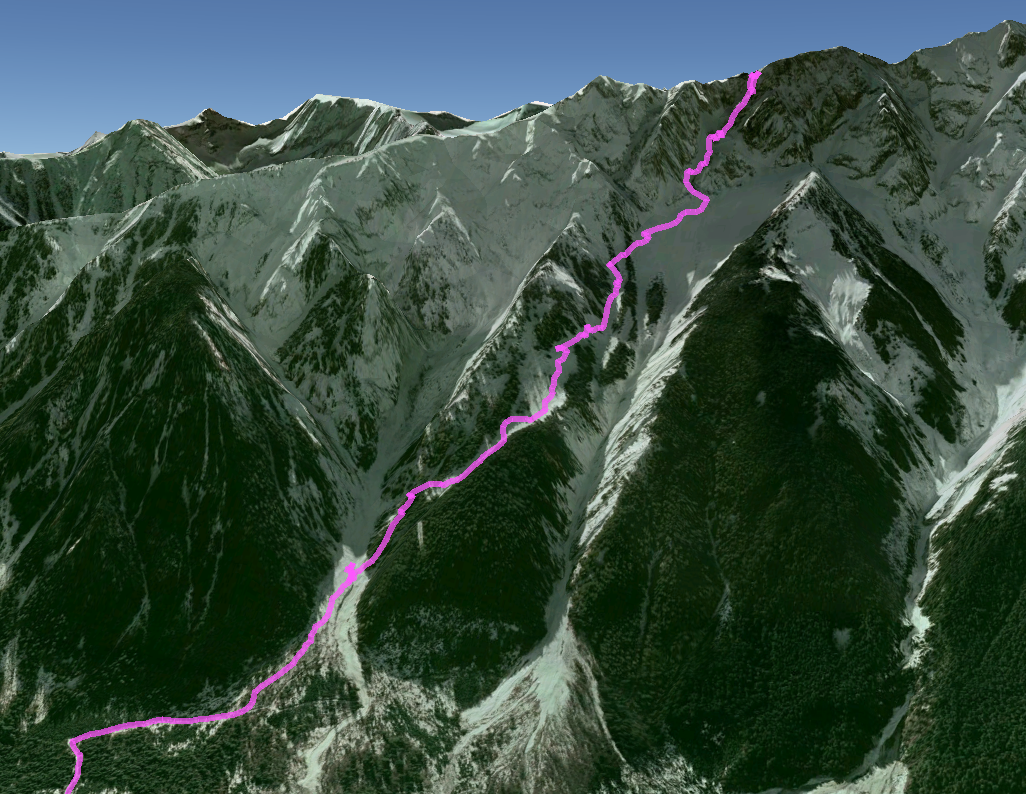
Our GPS track from day two.
As we re-shouldered our heavy packs, Nick and I pondered the direction that the three figures were taking along the skyline. They were way west of the route towards Currie. Were they planning to bail via Wedge or Mystery Creek?
We kept skinning and contouring with our puffies on. Sunday was shaping up to have an even colder evening than Saturday.
We efficiently executed our excavation/snow fort construction warming ritual. After melting water and making dinner, it was promptly tent time again. At 9pm, after 30 mins of flutter kick in my sleeping bag, my toes were finally warm. We hoped that the girls had warm sleeping bags.
Sadly, on the final morning, I experienced my first equipment failure of the trip. While Nick was removing a tent pole (my carbon-fibre ski pole) from the frozen snow, it snapped under little force. I chalked it up to the cold temps making the carbon fibre/resin more brittle. Turns out, there are internet forums full of pedantic road cyclists who are worried about this exact thing.. There is some experimental evidence to suggest that carbon fibre is weaker at low temperatures. (Don’t worry about airplanes though, they have de-icing systems in their wings.)
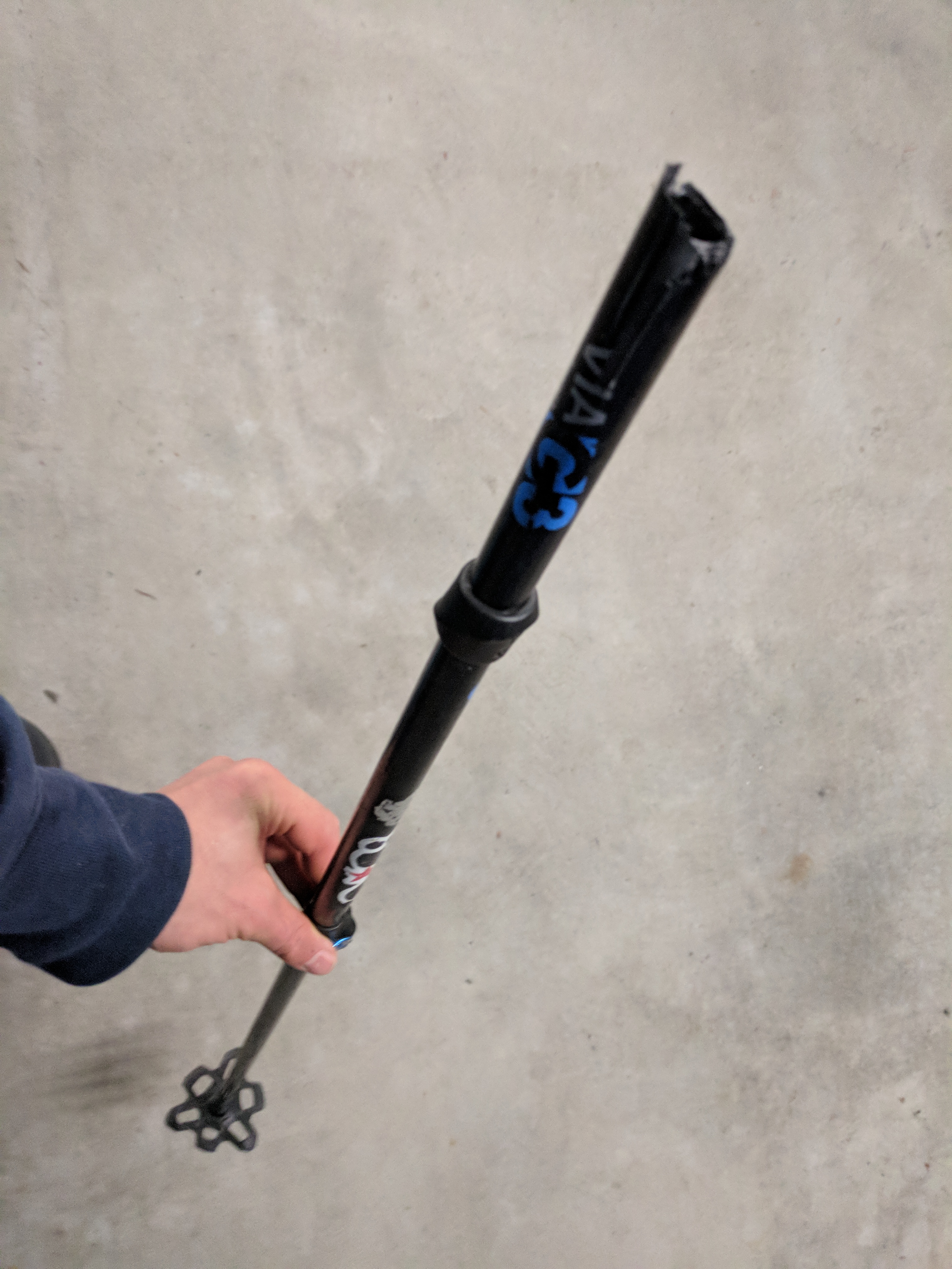
Broken but not useless. Snapped carbon fibre pole.
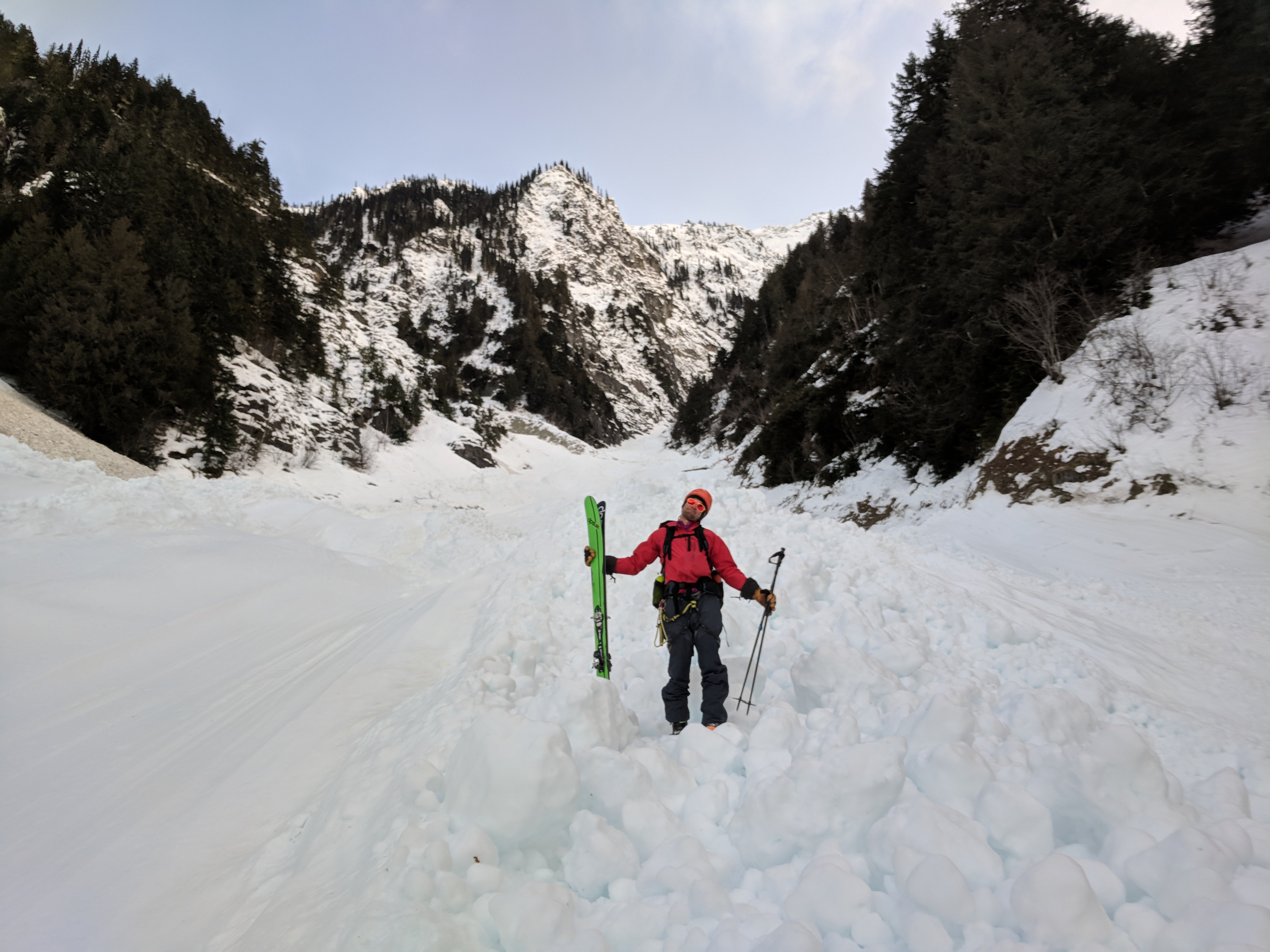
I wasn’t very phased by my snapped pole. It is an adjustable pole. It was still useable and only 10cm shorter without the handle.
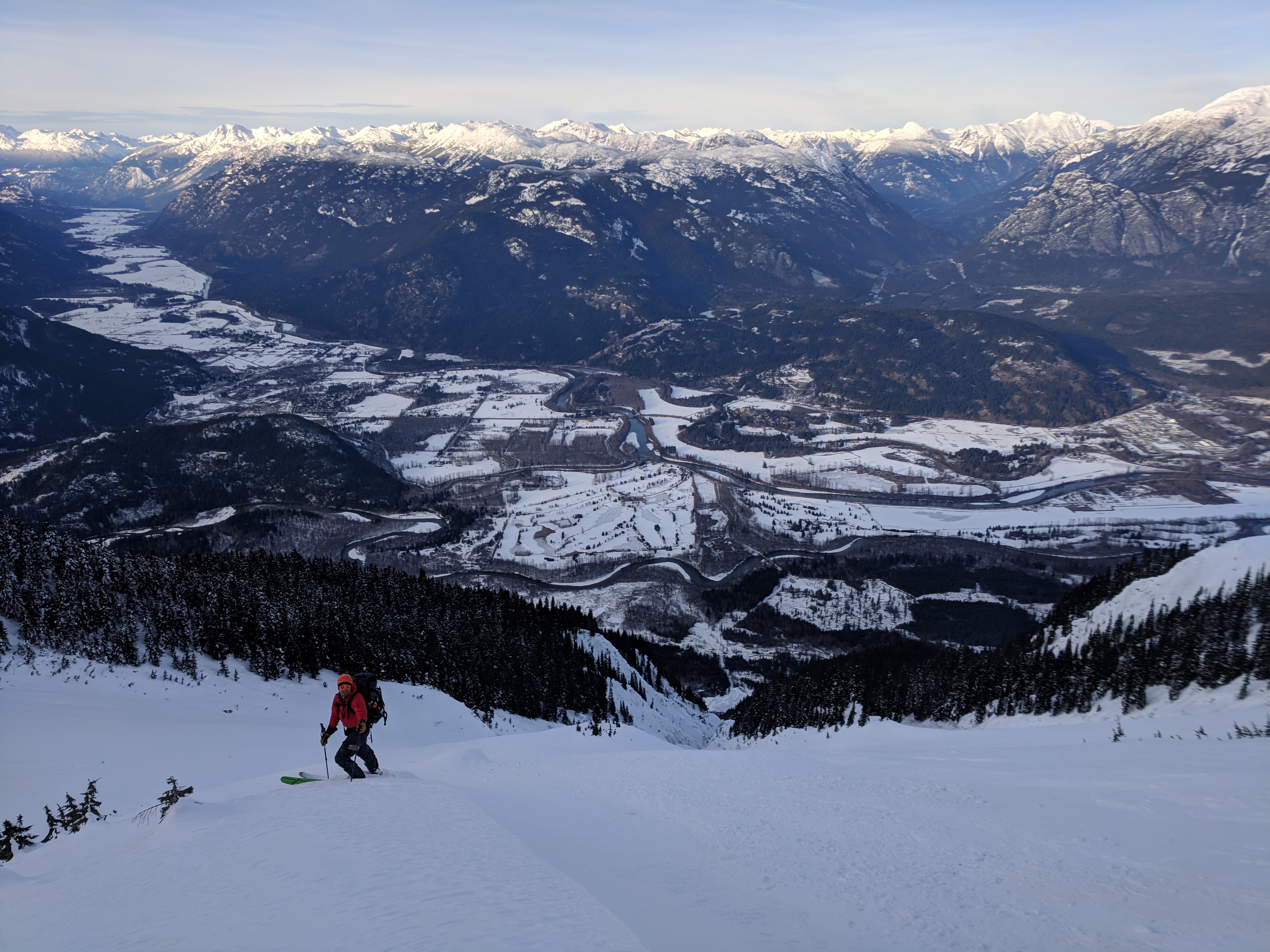
We left camp at 8am and cruised over undulating terrain before gaining the Hibachi Currie col. The slope up to this col had a bit of a melt-freeze crust. We donned our ski crampons for the first time.
From the col, we could see our final climb. None of Currie’s couloirs actually start off the true summit, but rather off of northeastern subsummits. Directly across the valley from us was the subsummit of Currie that marked the entrance to Zorro’s couloir.
By 11:30am we had skied/ contoured underneath the north side of Currie and were deciding on our next course of action. This was the trickiest decision of the trip. Although it was super cold overnight, it was pretty hot and sunny on this southeast slope, and the slope had been in direct sun for a couple hours. The top ~3cm was sun affected and slushy. Although insignificant by spring snowpack standards, we were dealing with a winter snowpack. Different (snow) ball game.
Our final major route decision. The blue arrow marks the approximate entrance of Zorro’s couloir, the yellow arrow marks the approximate entrance of Pencil chute. Just before 11:30am, we had completed traversing to the end of the green line. We had the choice of 1) Going up the route in red 2) Going up the route in purple 3) Bailing down Gravell Creek down the route in yellow. We chose option 2. In retrospect it would have arrived here one hour earlier in the day.
If we decided to proceed upwards, we had to choose between two different steep snow slopes:
1) The more eastern one that Nick had climbed up previously to ski Currie’s pencil chute.
2) The more western slope, which seemed more technical to skin up (rocks to navigate around), but looked as though it would lead directly to the zorro’s couloir sub-summit.
I didn’t like option 1. It was further away from us, in the wrong direction of our goal. Also, it had a bigger terrain trap. The huge bowl at the top all funneled into one chute at the bottom. Sure, Nick had climbed up that way before, but when he did, he started at 8am.
Option 2 seemed better, but I was hoping the snow wasn’t as sun-affected up higher.
At this point, we were good about vocalizing our decision making. We were okay with bailing out Gravell Creek if the snow slope didn’t get firmer up higher. We also decided that we were comfortable skinning up a ways to reassess the snow up higher. We started upwards. We were certain that the least sensible thing to do was to wait at the bottom of the slope and deliberate.
Fortunately, the snow began to get firmer as we climbed, and we soon required our ski crampons. It was hot in the sun though, so I wasn’t comfortable stopping until we were back on Styrofoam snow near the summit.
Just after 2pm we inspected the rappel anchor at the top of Zorro’s. Theoretically, the cornice wasn’t unpassably large. A bolder skier than us could ski left around it (carefully navigating 55+ degree rock speckled slopes). My glorified chair (rope) had a destiny to fulfill though.
Turns out that a 60m rope was super nice for the rappel. It allowed me to transition on a pretty mellow 35+ish degree part of the slope just below a rock. Doable with a 30m but you would want to use the anchor closer to the edge, and you wouldn’t reach the comfy transition rock.
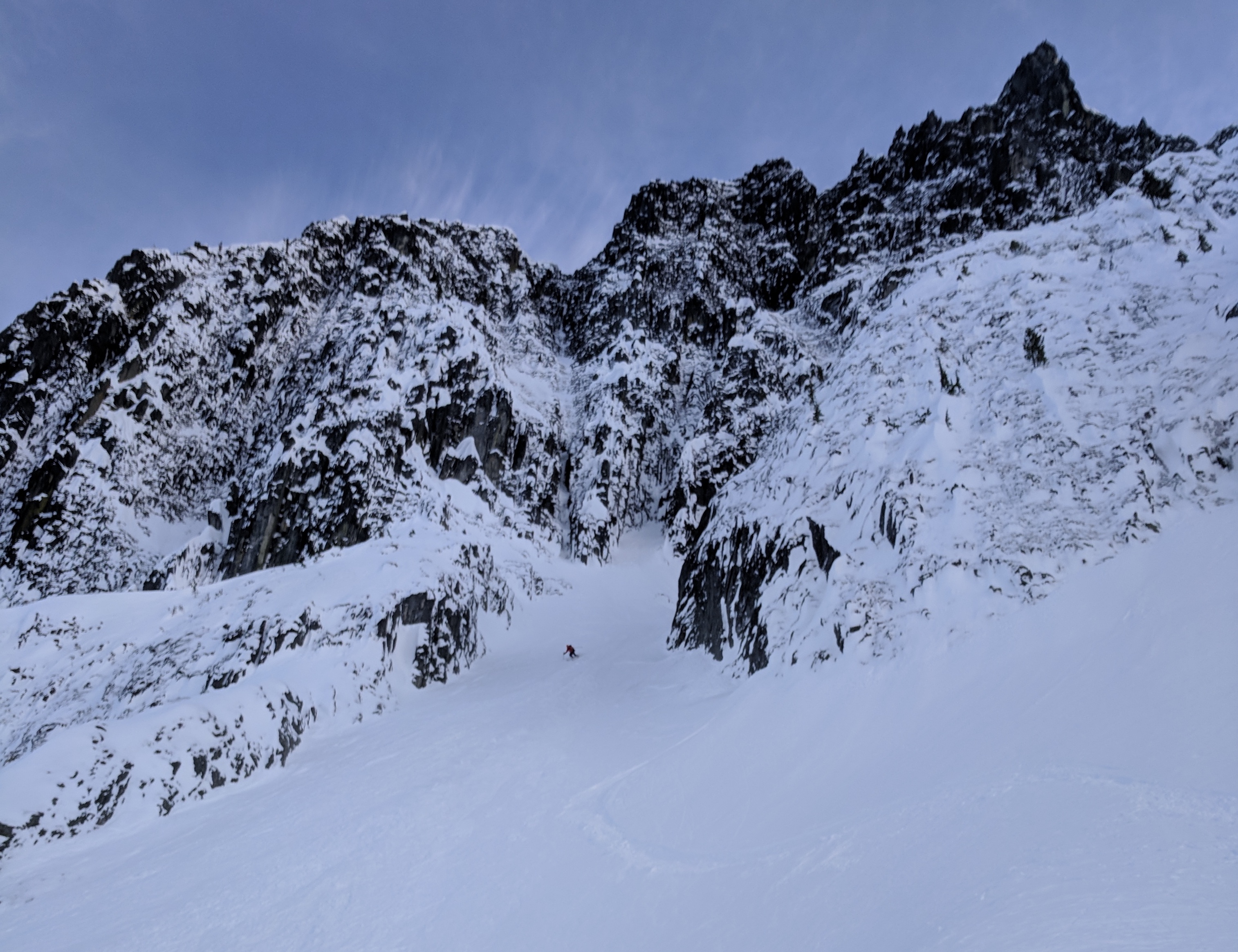
Anyways, we were super lucky. Zorro’s had untouched, non-styrofoam, dare I say, powder? I had to concede with Nick, as much as I loved stable Styrofoam, stable powder was even better. Since it was the most moderate couloir we had skied all trip, we even got to link turns down most of it… Limited by leg fatigue more than sluff management.
Our actual route over to the top of Zorro’s couloir.
Nick getting ready to rappel into Zorro’s couloir.
Olek’s comfy transition spot. Can reach with a 60m rope, but tie knots on the ends.
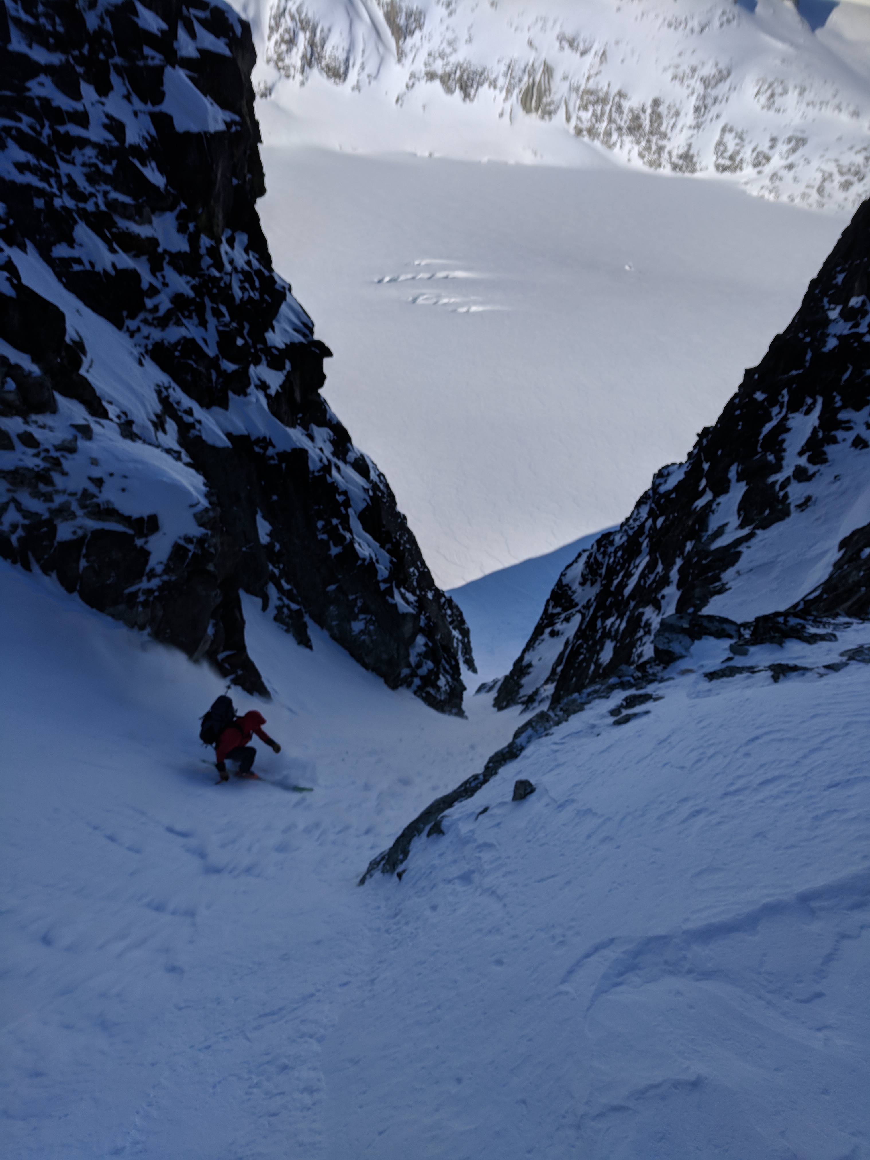
Olek skiing, close to the top of Zorro’s.
Nick enjoying our first powdery couloir.
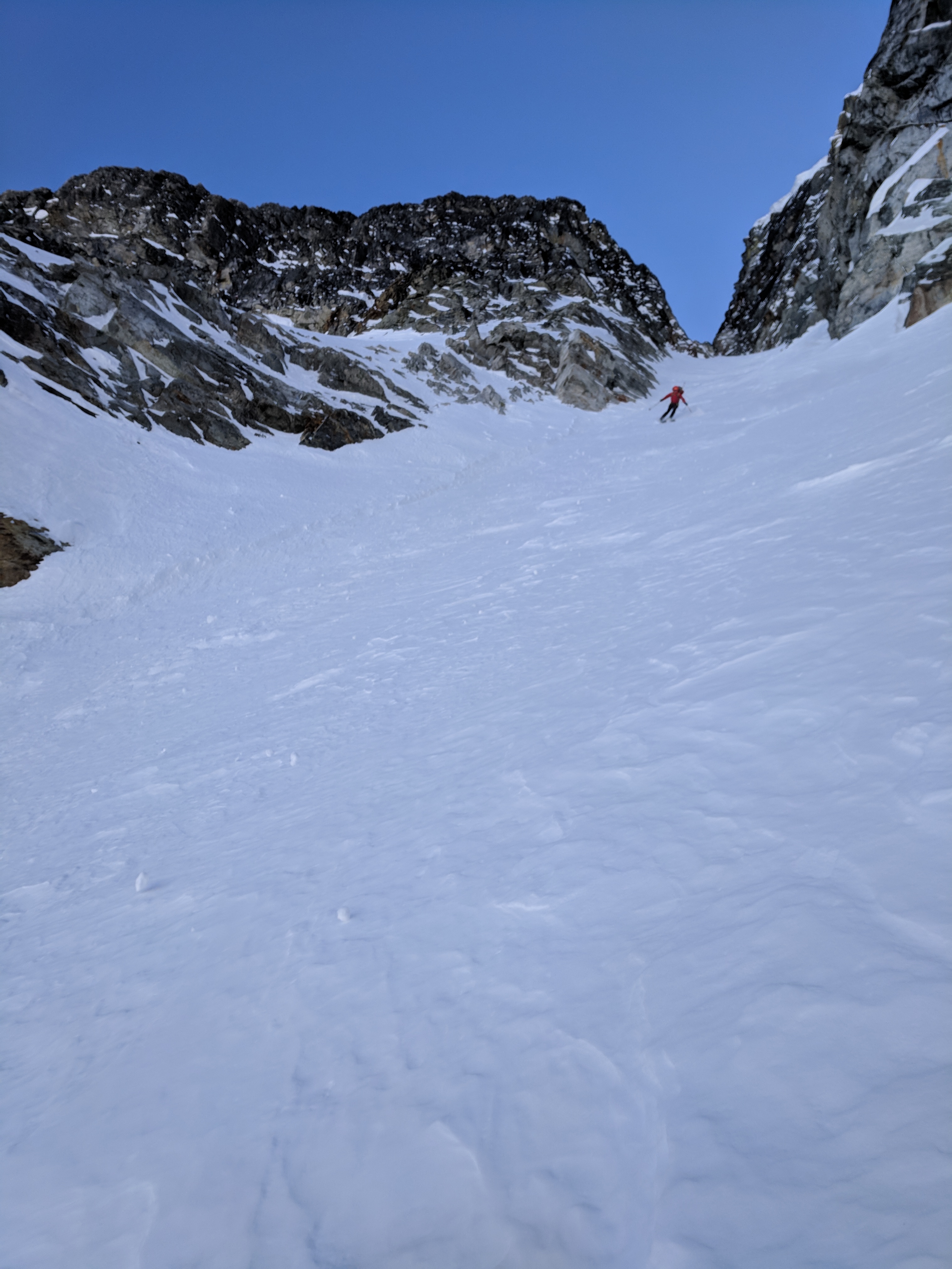
Olek exiting the final couloir of the trip. The Mordor-like, jagged sub-summits of Currie in the background.
The real blessing of our final descent was that once we were out of the couloir, we had 2-day-old tracks to follow from the pencil chute skiers who had helped us shuttle Nick’s truck. As much as Zorro’s couloir is a technical ski descent, navigation through the avalanche chutes, trees and gullies at the bottom is harder. Little did we know that a major crux was still to come.
Many of the “>50 modern terms for snow” were applicable to the final 1000m of elevation loss down to the truck: “dust on crust”, “melt-freeze crust”, “refrozen avi debris (human sized death cookies?)” and “frozen slide beds” were the prominent ones.
I felt a lot like a terrain park skier as I spent many meters just sliding sideways down icy gullies. We were once again thankful for rockered skis.
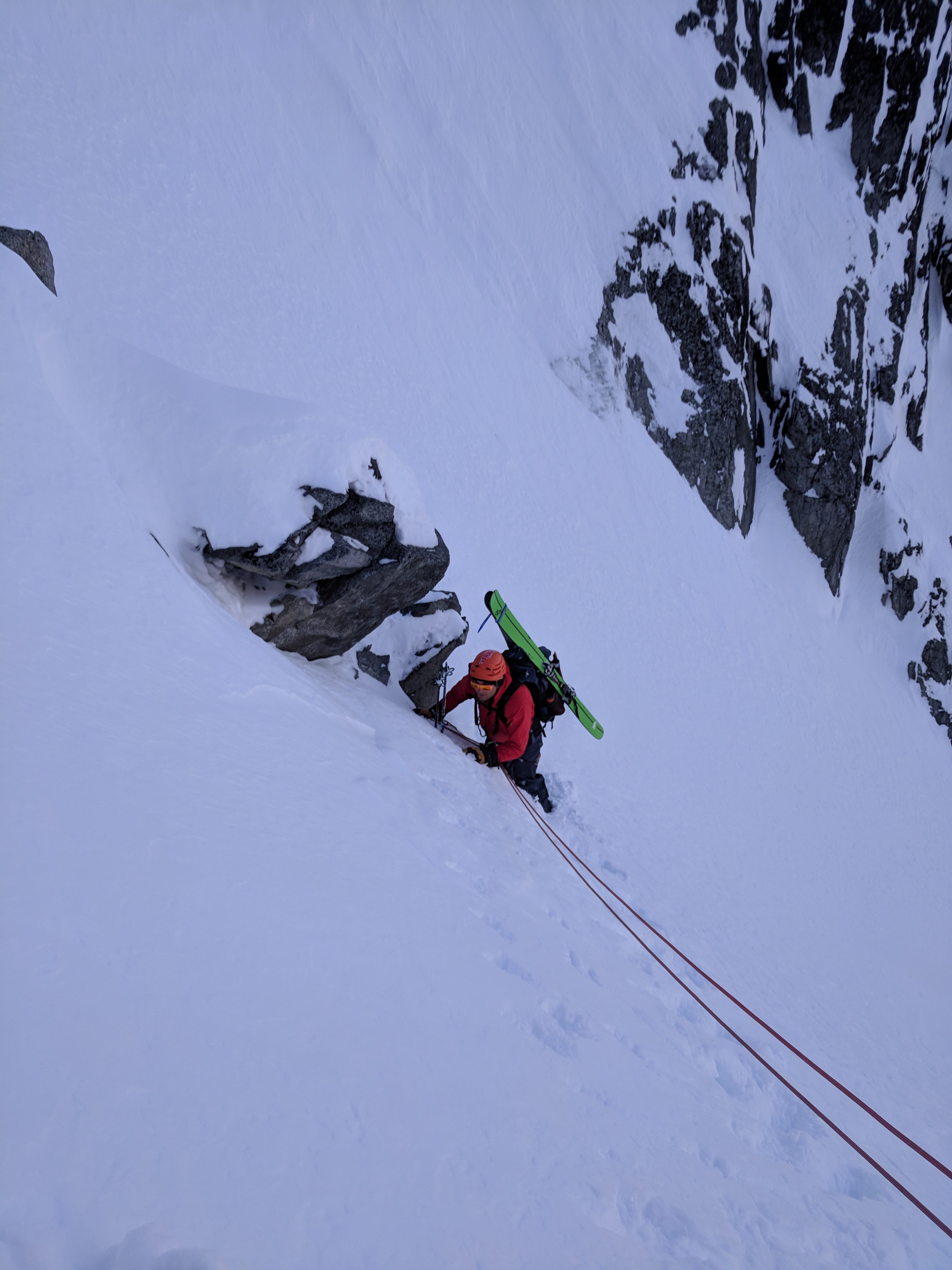
Close to the bottom, we came to a final crux avi debris field/ slide bed. The slide was huge. Class 4. It looked about 1-2 weeks old. Consolidated by several melt-freeze cycles, and even some rain. We were forced to take our skis off to walk over the snow boulders. Nick boldly strapped his skis to his pack and attempted to ford the slide path between two steep dirt slopes. Ski boots were terrible though, and he slipped! Fortunately, a vigorous self-arrest with his ice axe kept him from sliding down an even steeper part of the chute. He didn’t slide too far, and was unhurt. He daintily clambered up the frozen dirt on the far side of the slide bed without incident.
Having seen the perils of slide bed first hand, we decided it would make sense for Nick to belay me across. We climbed up to a flatter section, and I executed a flawless rope toss across the slide path.
I put on my skis. Gliding across the slide bed was actually quite casual. We felt silly that Nick had tried to cross in ski boots. Short of crampons, skis are actually pretty great on ice. We learned our lesson for next time.
Olek, with Pemberton in the background. Naively believing that the technical skiing was finished.
Nick following old ski tracks. Less snow, more trees. Still a ways from the truck.
Olek and gargantuan 1-2 week old avi debris close to the bottom of the slope.
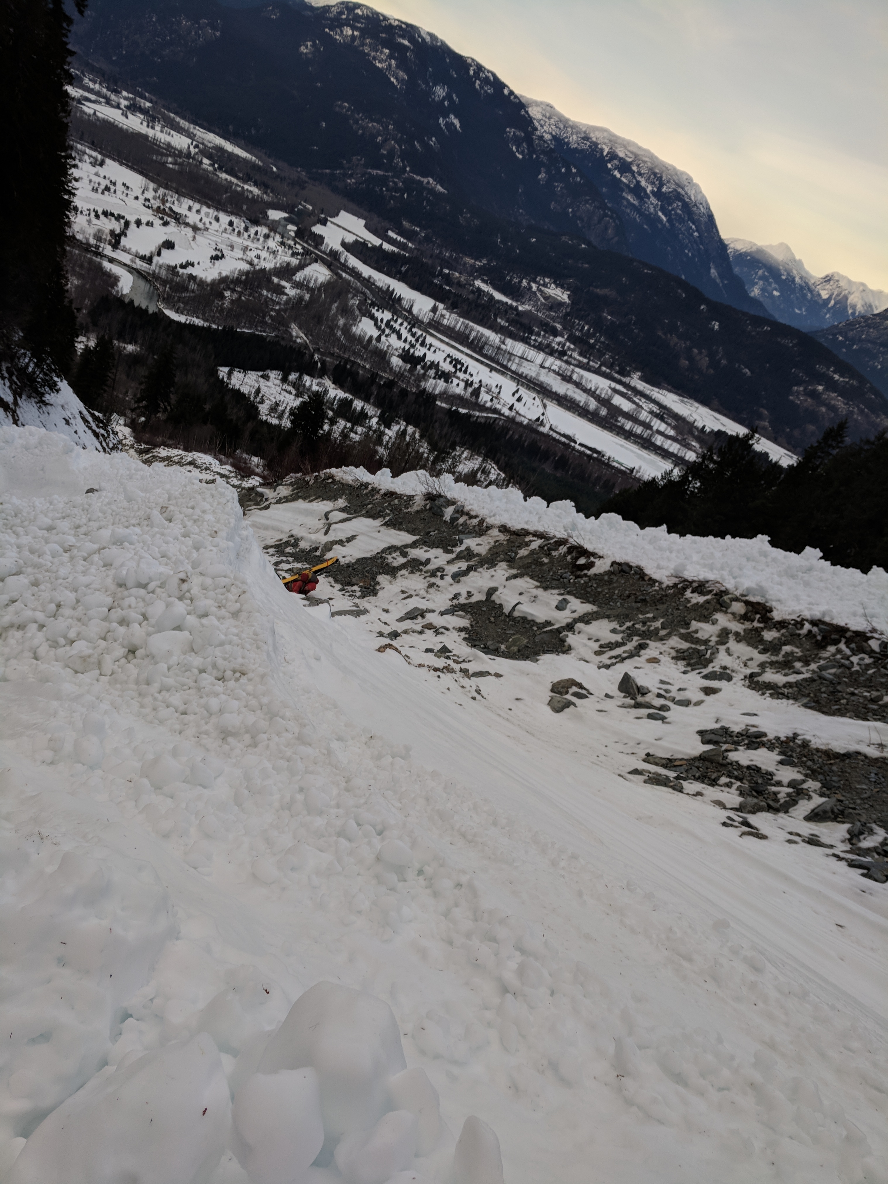
Scary! Nick self arresting with his ice axe after his ski boots slip on the very icy, low angle slide bed. Should have used skis to cross.
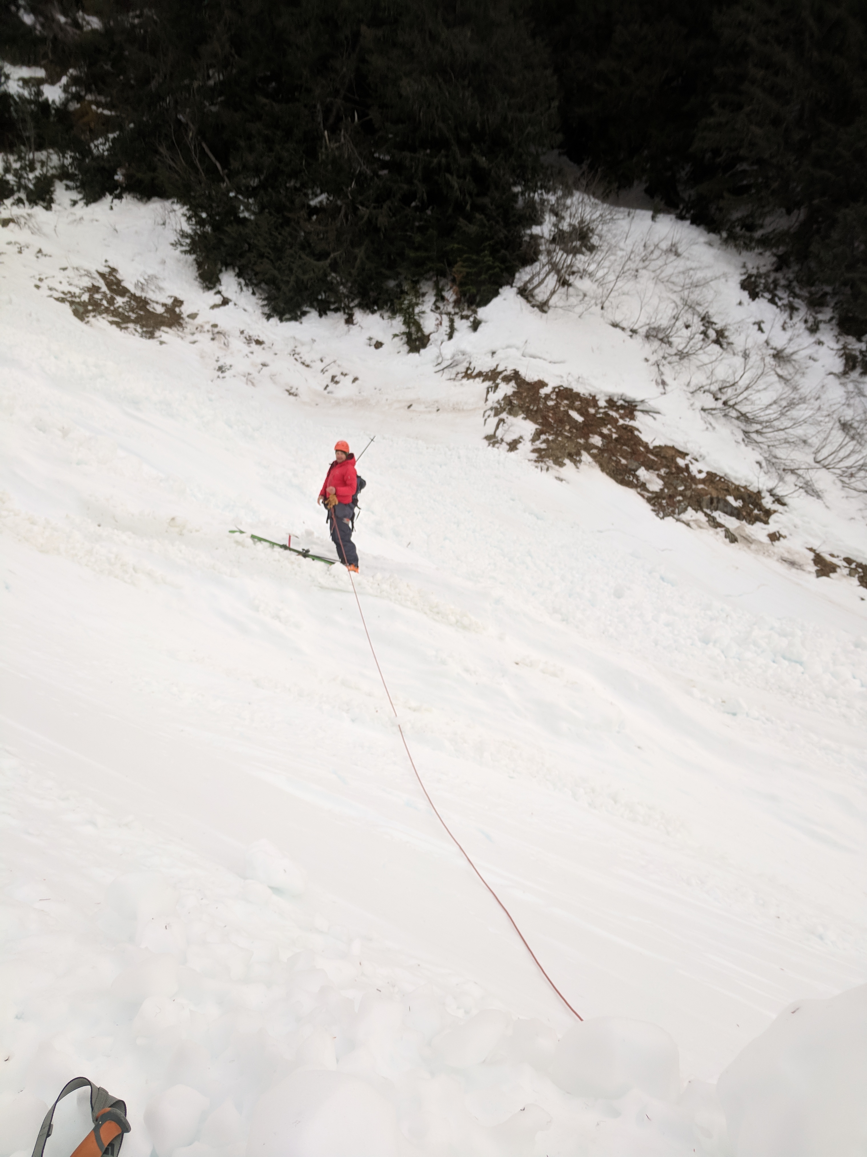
Learning from Nick’s difficulties crossing in ski boots, Olek opts to cross on skis. We walked to a higher, flatter section. We had a rope, so we belayed. Trivial with metal ski edges.
Nick at the truck, with Currie in the background. Can you spot Zorro’s couloir?
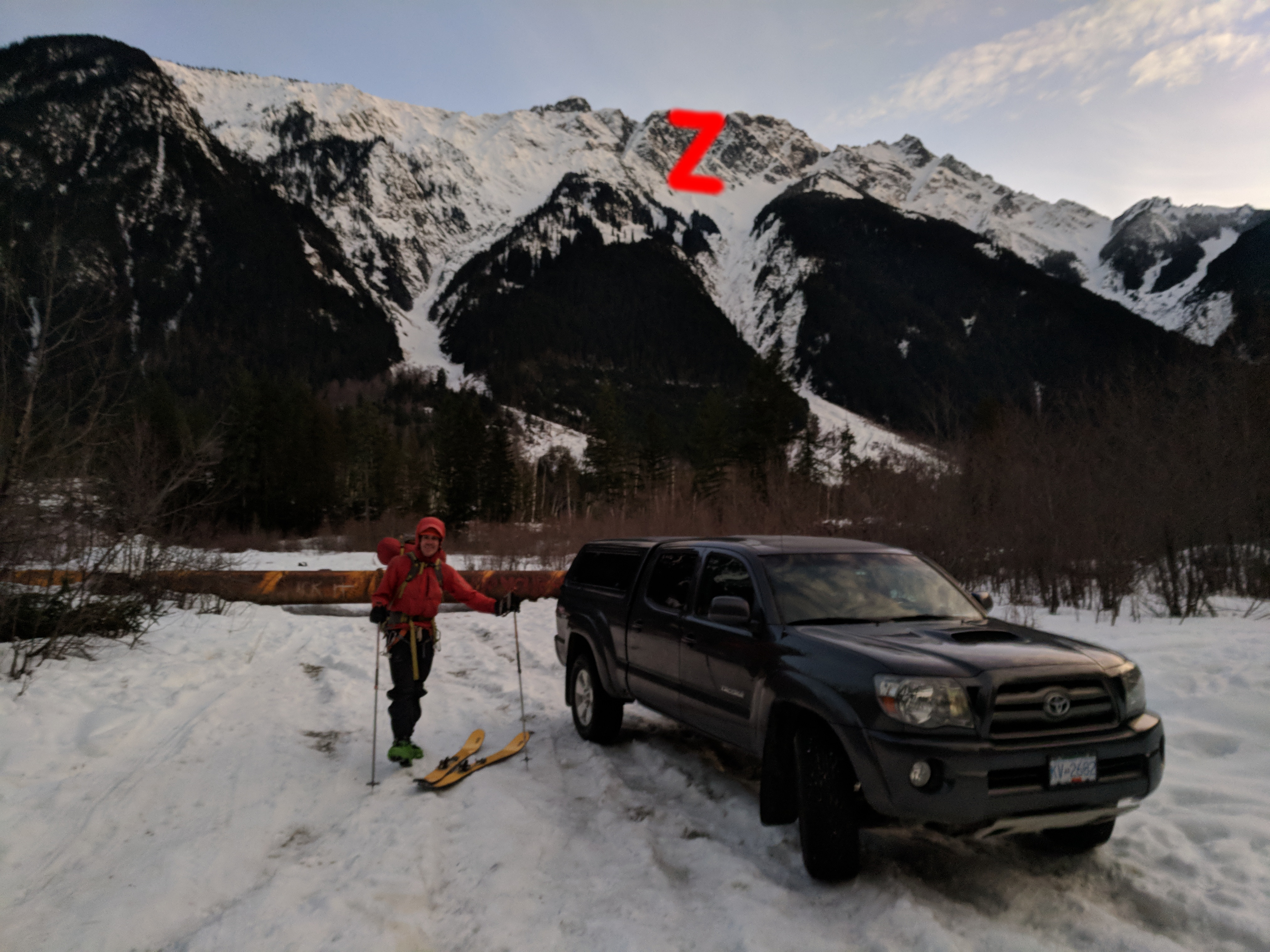
Same picture, Zorro’s Z traced out in red. Did you see it before?
Our actual route down Zorro’s couloir and back to the truck.
After some minor alder navigation, we were back at the truck. As the sun was starting to set, we had a wonderful view of our line down Currie.
1km of driving out the forest service road and we were back on pavement. The girls’ truck was still parked at the side of the road. We hoped they made it out alright.
Skiing is so cool. Thanks to Nick Gobin for a super fun trip. Probably my best 3 day weekend trip ever.
Big thanks to the pencil chute skiers who shuttled our truck and gave us useful beta!
Also, big thanks to Mitchell Sulkers who posted a concise conditions report on the South Coast Touring facebook group + advised we bring ski crampons.
Thanks to Rich So for his blog, wonderful photography, and pie baking skills. Oh, also thanks for the map I shamelessly stole from his Blackcomb to Currie traverse trip report.
Thanks to Bram van Straaten for the GPS track on bivouac that we referenced once or twice along the way.
Thanks to Skyler Des Roches for the highly entertaining read about the Wedgemount area, including Eureka NW couloir beta. The “suicidal skin track” makes me laugh and cringe every time.
Thanks to Matt Gunn for a TR on Zorro’s (central) couloir that helped us decide to ski it over the skied-out pencil chute.
PS: If anyone is keen to learn more snow slang, here is a website to check out.
PPS: Here is a line down Ure peak that is far to rad for us. Maybe it has been skied before? We dubbed it “Ure-nary incontinence”
Awesome!
Great write-up and photographic documentation, thanks Olek!