Day One: Saturday, April 19, 2025.
I awoke to the sound of birds, with a stiff breeze billowing my tent fly. Poking my head out into the morning air, I took a deep breath as the first rays of light glinted softly off the debris field outside. I crawled lazily out of my sleeping bag and into my boots, stood up, and gazed upon my surroundings: Two more tents lay downwind from mine, plus the still-bundled shape of Paul, who had chosen to sleep outside last night, as he would for the rest of the trip. The landscape was largely barren, rocky, and dry, and it seemed to stretch on for miles before terminating at a hilly horizon. My eyes were not drawn into the distance for long, however. Instead, I focused intently on my immediate surroundings, on what must have been thousands of broken shards of glass — mostly from beer bottles, but also old TV sets, light bulbs, and other household appliances — and the conspicuous piles of multi-calibre shell casings that had played a part in creating all the broken glass in the first place. It was much easier to see all of the pieces now, in the daylight, than it was last night when we were trying to find a clear patch in which to set up our sleeping gear. Gingerly placing each step, I went off to find a bush to pee on.
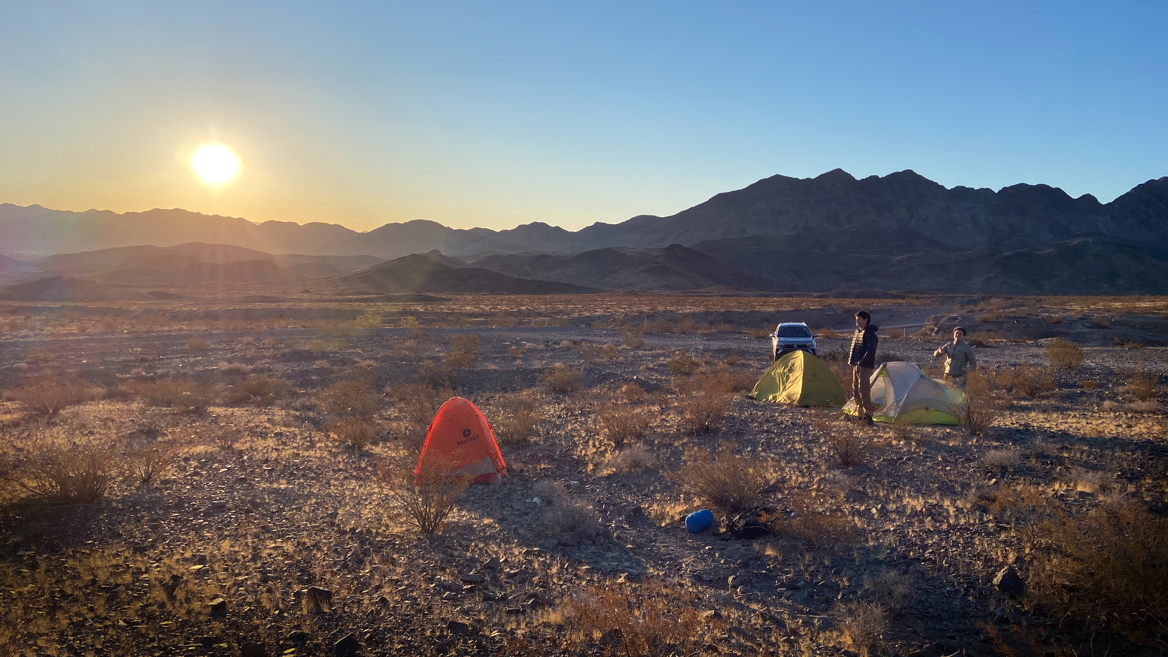
Sunrise in a random patch of land in Nevada… the shotgun shells and broken glass are a little too small to see here. Photo Credit: Paul Ramu
Today we would be entering the Grand Canyon, to begin a five-day, 80-kilometer journey on foot — but not until much later in the day. We had arrived in Las Vegas late the previous night, which presented a bit of a problem since the drive to the Grand Canyon would take several hours and we needed somewhere to sleep before hitting the road. Paul, who was leading this trip, had done a diligent job of scoping out an area of public land where we could camp for free, just outside city limits. Unfortunately, while we all had examined the satellite images on Google Maps several weeks prior and agreed on the choice, none of us had been able to spot the burnt mattress frames, trashed appliances, and general rubbish that identified this location as one of the area’s many unofficial outdoor shooting ranges.
Despite the unconventional sleeping arrangement, we were all in good spirits. No sleeping pads had been punctured overnight, and we had a scenic drive ahead of us, before an even more scenic trailhead and descent into the canyon. We packed up and climbed into our rental car, in search of breakfast and a good bit of road trippin’. We numbered five VOCers in all:
- Paul Ramu, our brave and daring leader,
- Daniel Dobjeviche, our speed demon and source of witty remarks,
- Francesco Tosello, resident jokemaster and brand new to hiking in America,
- Sujin Jung, our eternal optimist and source of general cheer,
- Luis Dias (i.e. me), serving as trip archivist.
After a drive that took us from the grey-brown landscape of Las Vegas, over the Hoover Dam, and into the warm-toned mesas and mountains of Arizona, we arrived at Grand Canyon Village on the canyon’s south rim in the early afternoon. Despite the beautiful blue skies we’d had all day, the temperature was hovering around 10 degrees (Celsius; we may be in America, but we’re still Canadians) and the ground was dotted with patches of snow from a prior night’s flurry, which isn’t uncommon on the rim in April.
Grand Canyon village is the main destination for most tourists visiting the canyon, and it has an impressive amount of infrastructure (including a general store upon which we relied for stove fuel, since we couldn’t bring gas canisters on the plane). Our plan was to start our trek at the Grandview Trailhead, about 20 km east of the village, and spend several days backpacking the Tonto trail, re-emerging at the Hermit Trailhead, 10 km west of the village. Despite only being a 30km drive apart on the rim, the complex and twisted nature of the trail meant that connecting the two trailheads by foot would require us to cross roughly 80 km inside the canyon.
The Tonto trail, especially the eastern section that we would be starting today, is notoriously dry – water sources are seasonal and generally dry up completely when the warm months arrive. Pulling into the backcountry information centre and chatting with the rangers, we were delighted to discover that most of the potential water sources along our path were reportedly still active, probably due in no small part to the recent snowfalls.
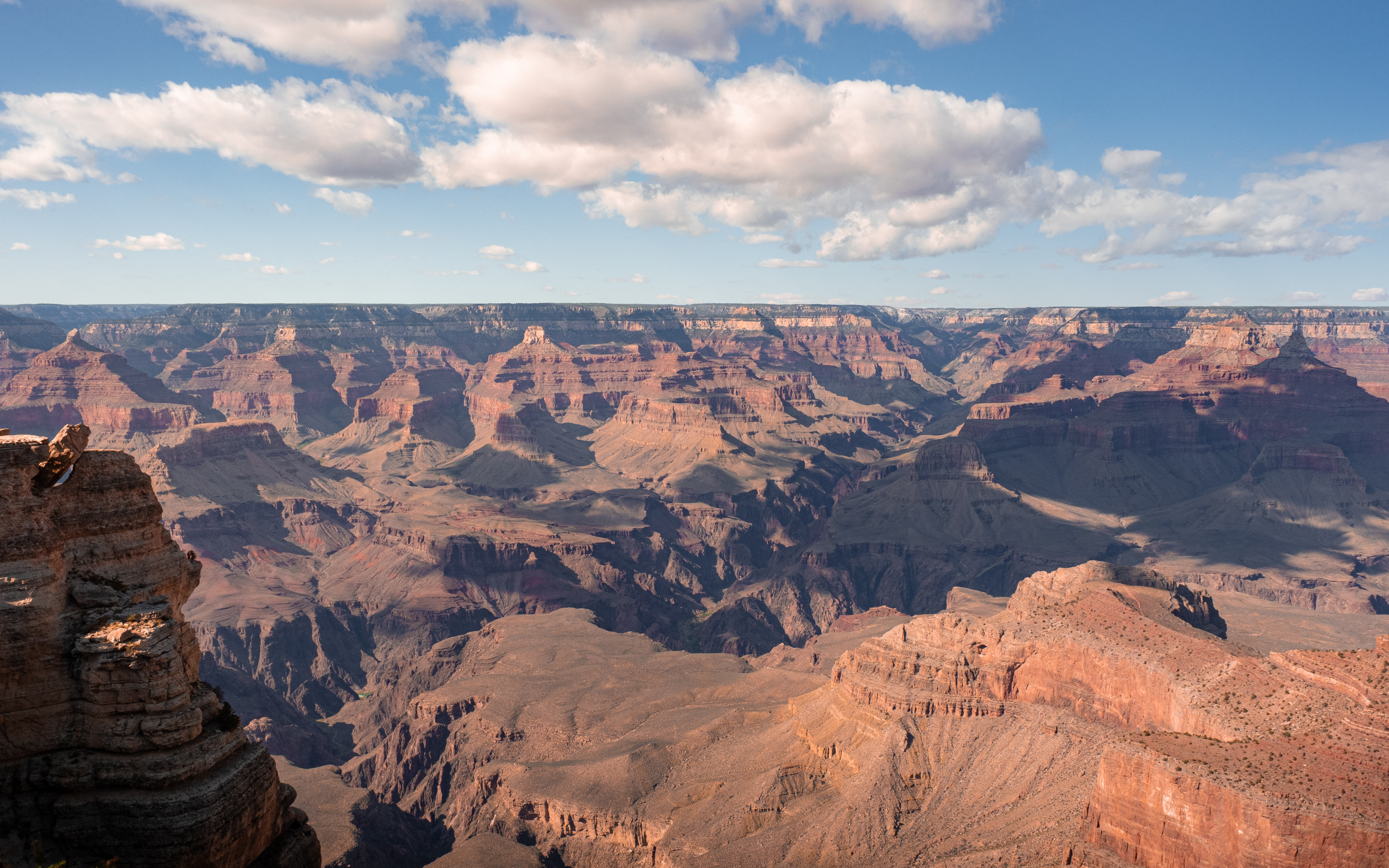
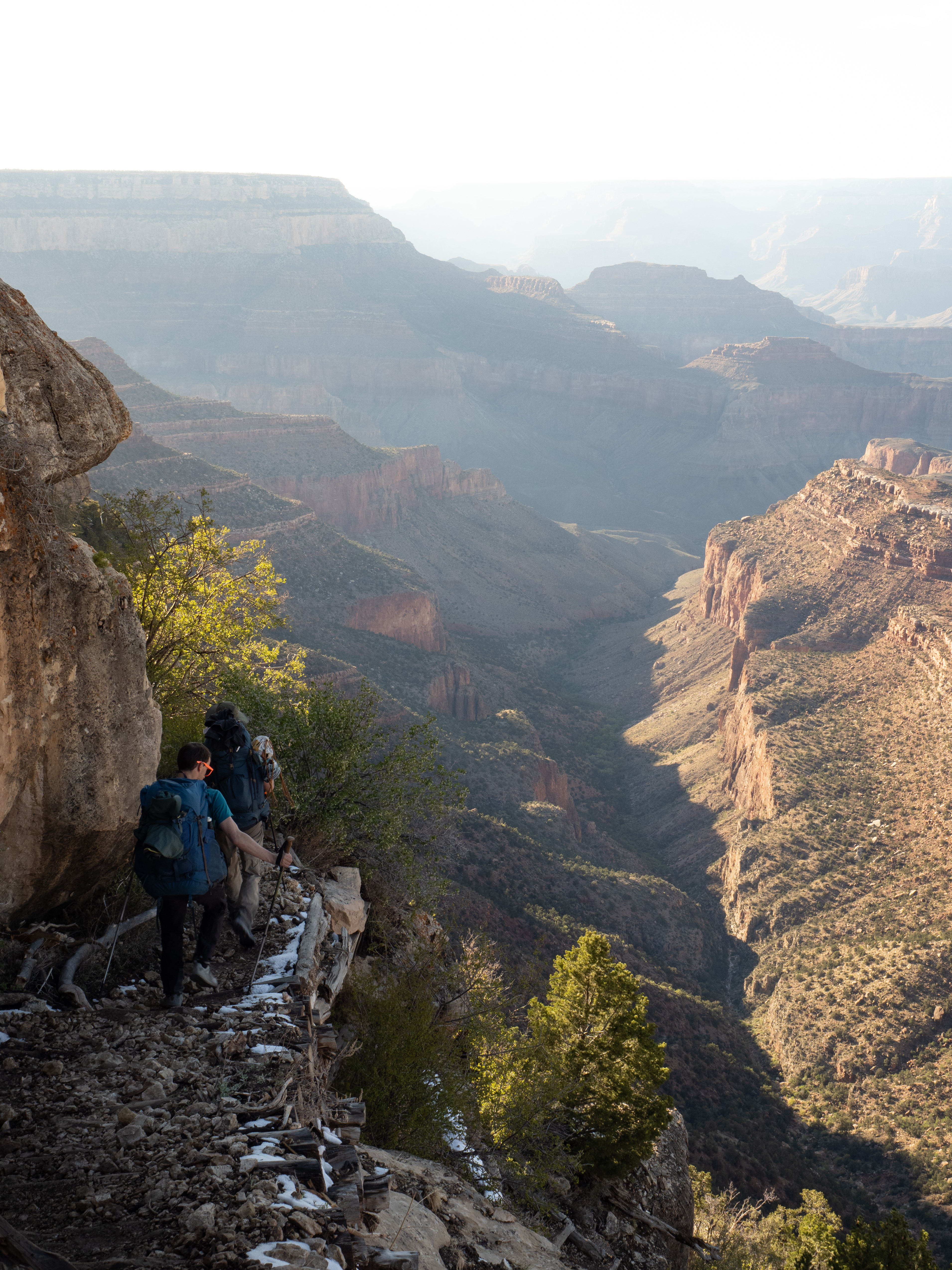
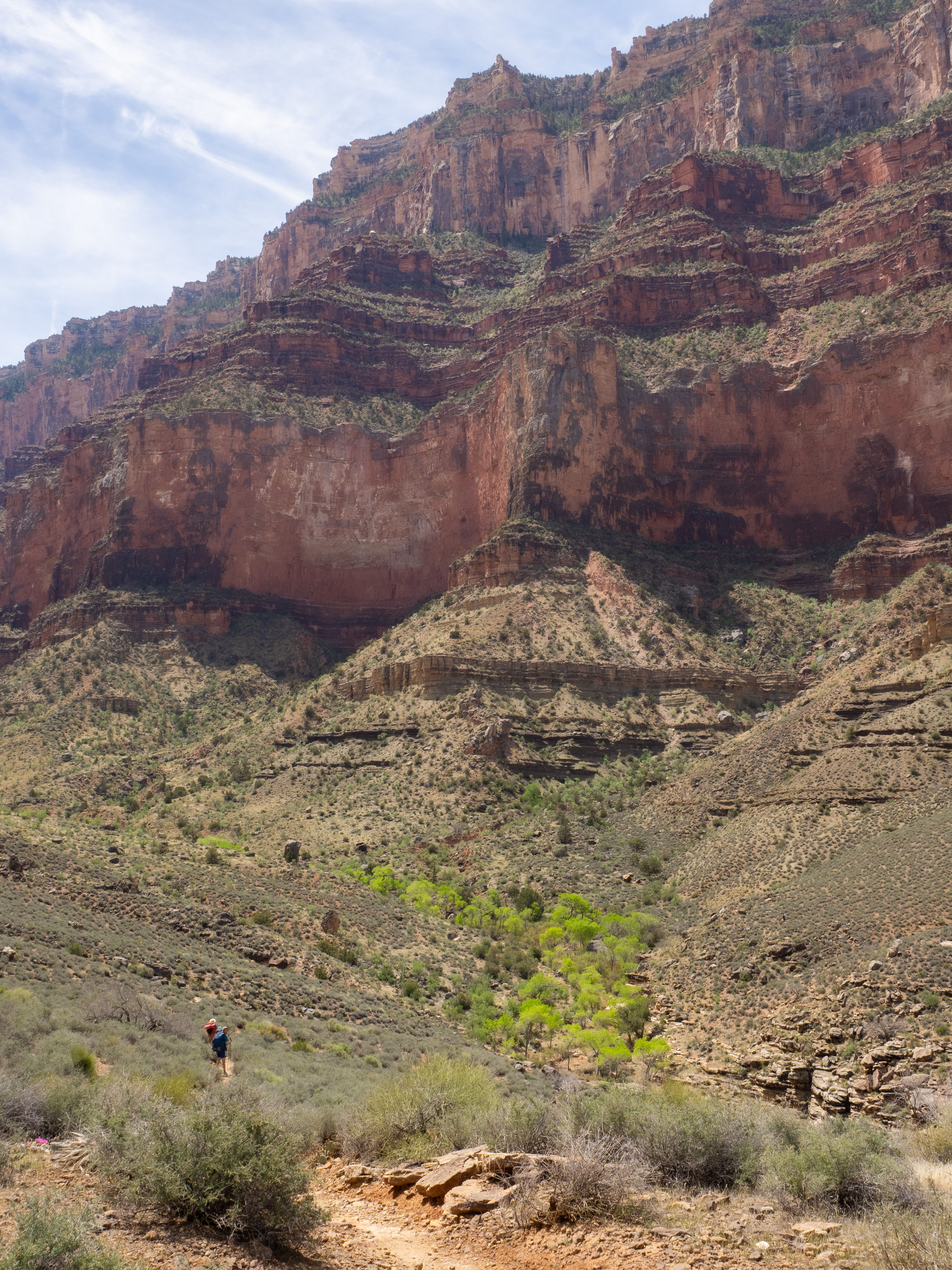
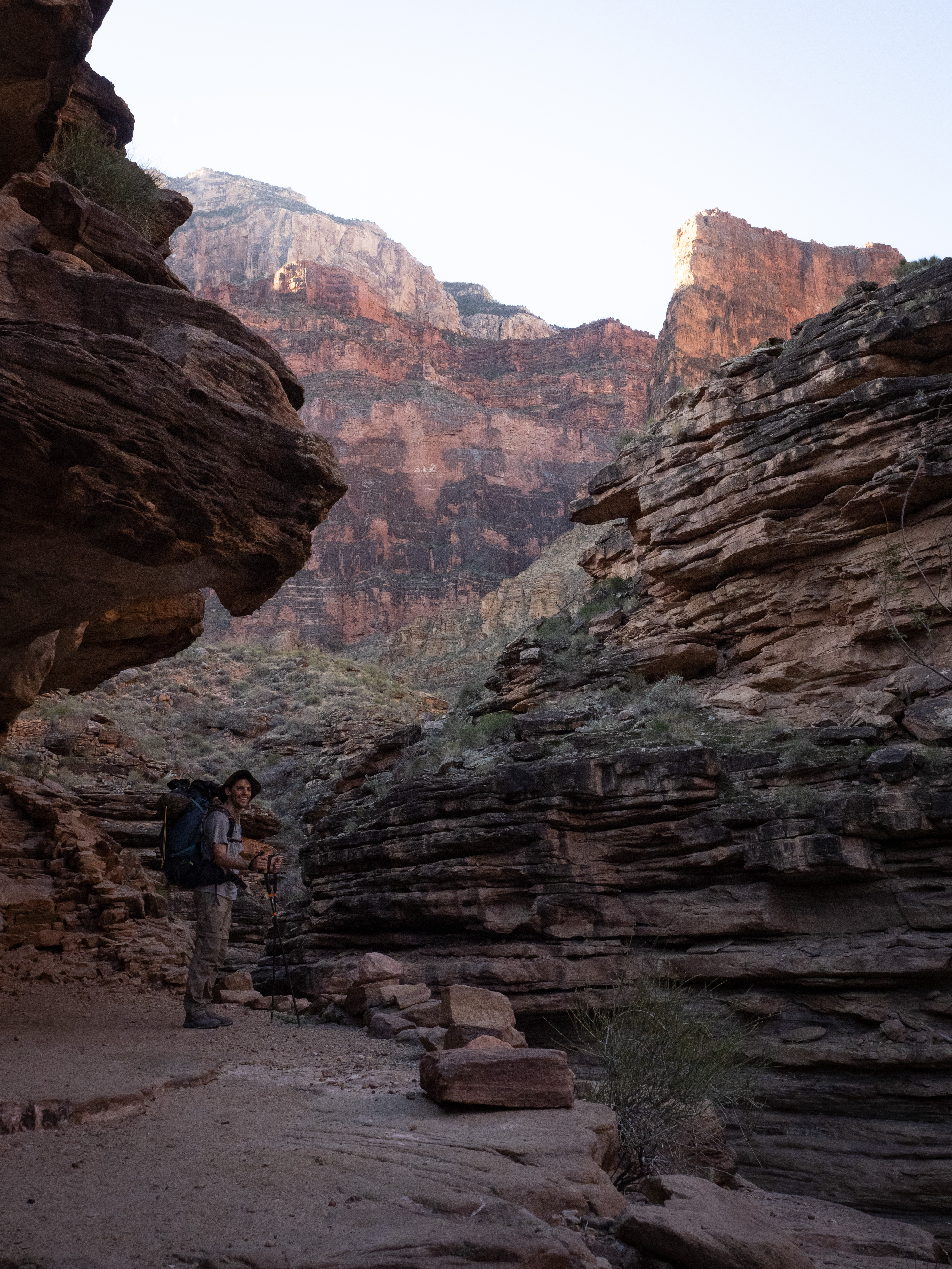
After some last-minute resupplying, we finally made it to the Grandview trailhead around 5:30 pm, a bit later than we had hoped. Our first campsite was a mere 6 km away, but with this late of a start, we nonetheless expected to be hiking in the dark by the time we made camp. However, this also meant that we were entering the canyon during the peak of golden hour, and we were treated to some incredible vistas as we started our journey.
The descent begins.
It’s hard to describe in words the feeling one experiences when gazing into the immense expanse of the Grand Canyon. Pictures don’t do it much justice either, especially when every plateau, mesa, temple, and drainage is being bathed in wisps of gold and amber light.
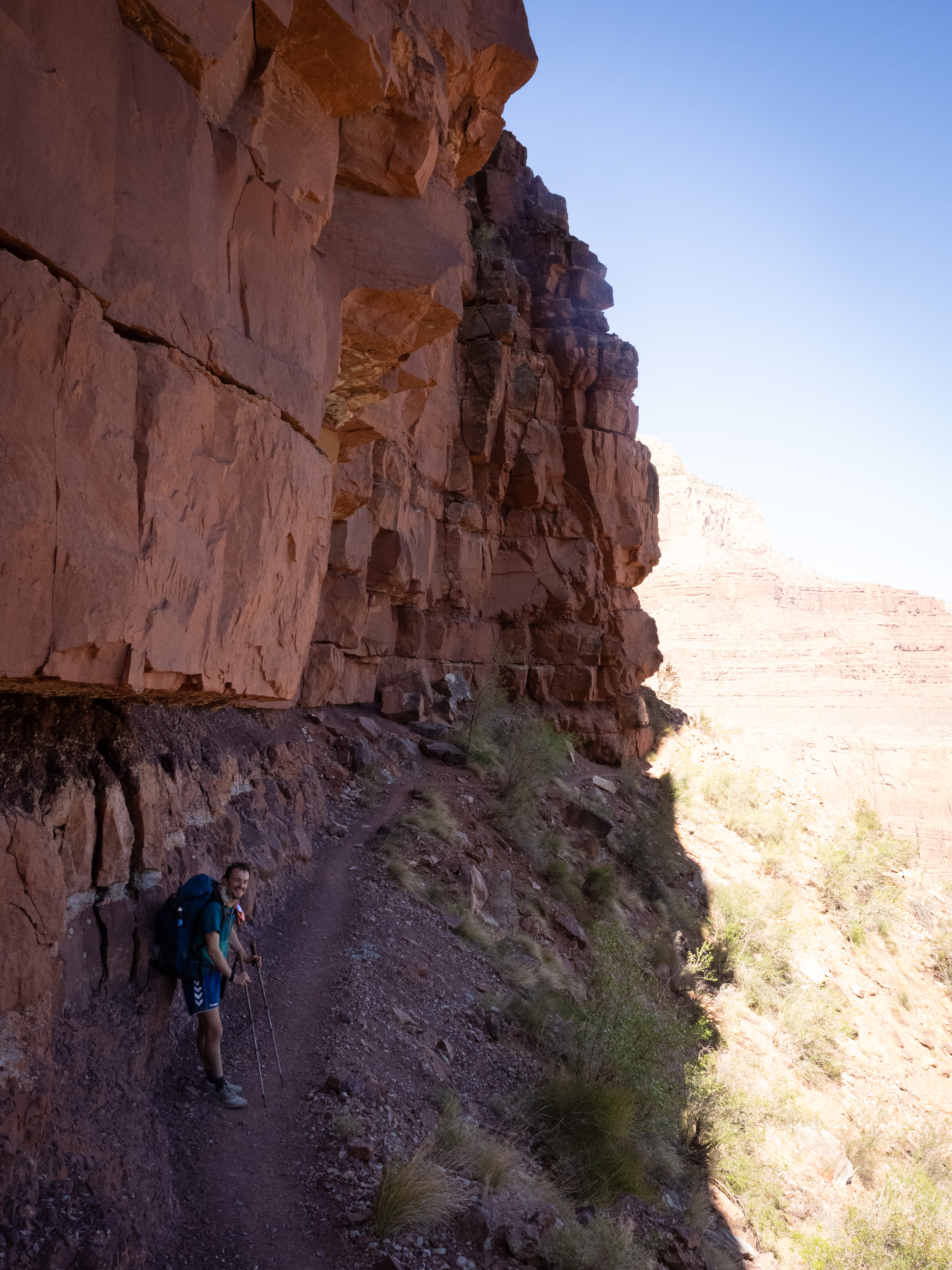
Not two minutes down the trail, the bustling sounds of the crowds at the trailhead faded, and we were alone with the sounds of the canyon. The trail was mostly steep, narrow, and winding, until it deposited us on an intermediate plateau and became largely flat and straight for a while. By this time the sun had crossed the horizon and we were in the fading light of blue hour; the temperature, however, had been climbing. The canyon effectively behaves like a solar oven, reflecting light and heat downwards, which causes it to have a much higher temperature at its base than at the rim.
Pretty majestic.
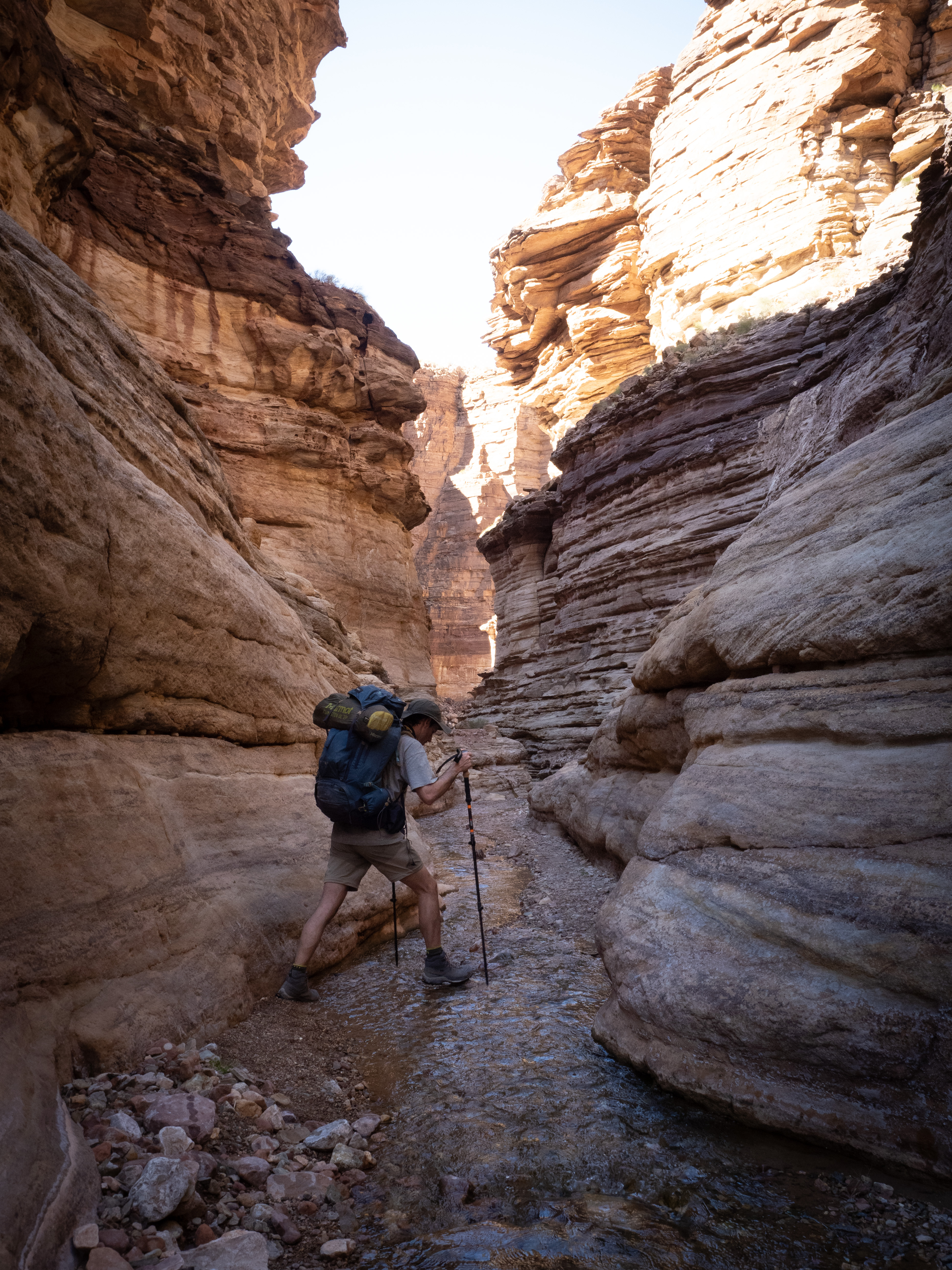
The rest of the light faded as we reached the turnoff to the Tonto plateau below, and we hiked the next narrow, winding section by the light of our headlamps. Our campsite for the night was Cottonwood Creek, which, according to reports, was still flowing. When we connected with the riverbed itself, we saw no water, but noted that the sand under our feet was wet — a good sign.
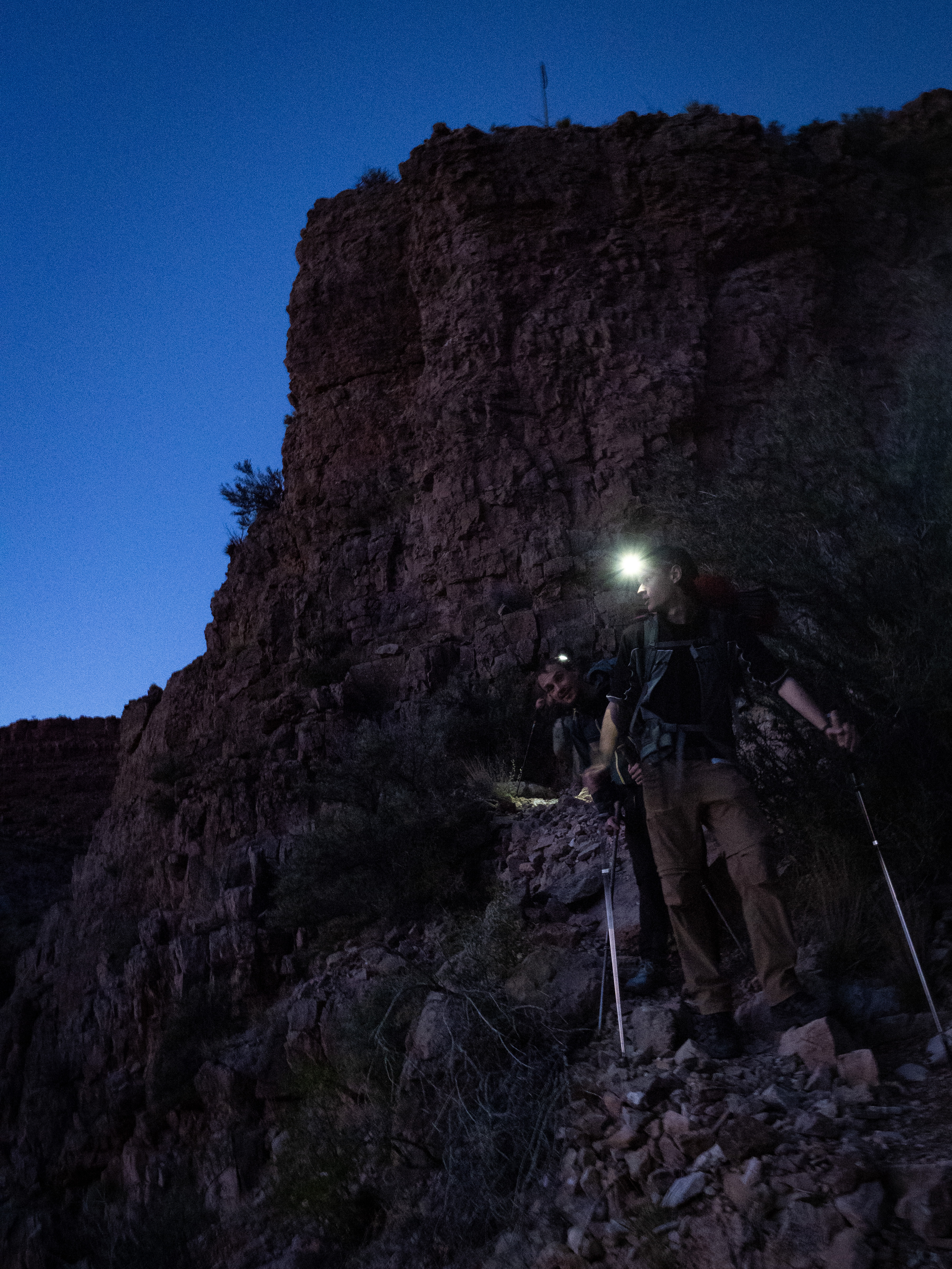
This is now officially a night hike.
Following the riverbed, we managed to get ourselves rather lost. Luckily, after a short bushwhack and an encounter with a particularly grabby thorn bush, we re-emerged onto the trail and spotted our campsite.
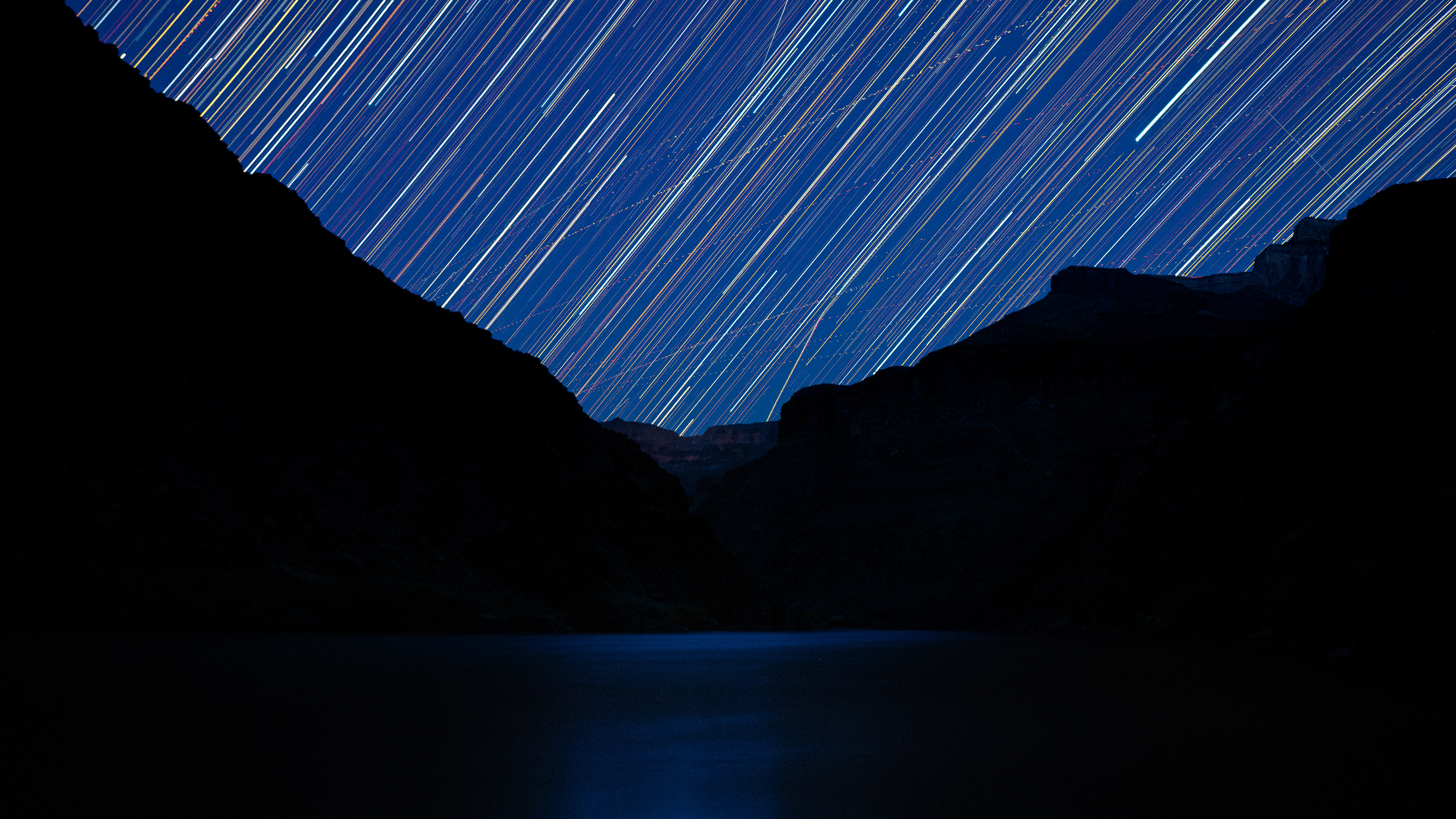
There was, surprisingly, another pair of tents already there, on pads just above the riverbed where a thin ribbon of clear water was running. Since it was late, we didn’t chat with their occupants, but they would turn out to be last people we would see for a couple of days. We set up camp a little further down the trail, prepped dinner, and spent some time stargazing under a perfectly clear sky before heading to bed.
Day Two: Sunday, April 20, 2025.
I woke up early the next morning and headed down to the trickle that was our water source to stock up for the day’s hike. Minutes after daybreak, the sunlight was already pouring into the main body of the canyon in the distance, which told us the day would probably be a scorcher. This was confirmed about one hour into the day’s trek, when we emerged from the shade provided by the walls of the drainage we had spent the night in. It wasn’t even 9:00 am, and the sun was already cooking. We had mentally steeled ourselves for this — the Tonto trail famously lacks any reliable sources of shade, and we would be hiking through in the full power of the high sun all day.
Into the scorch-fest we go!
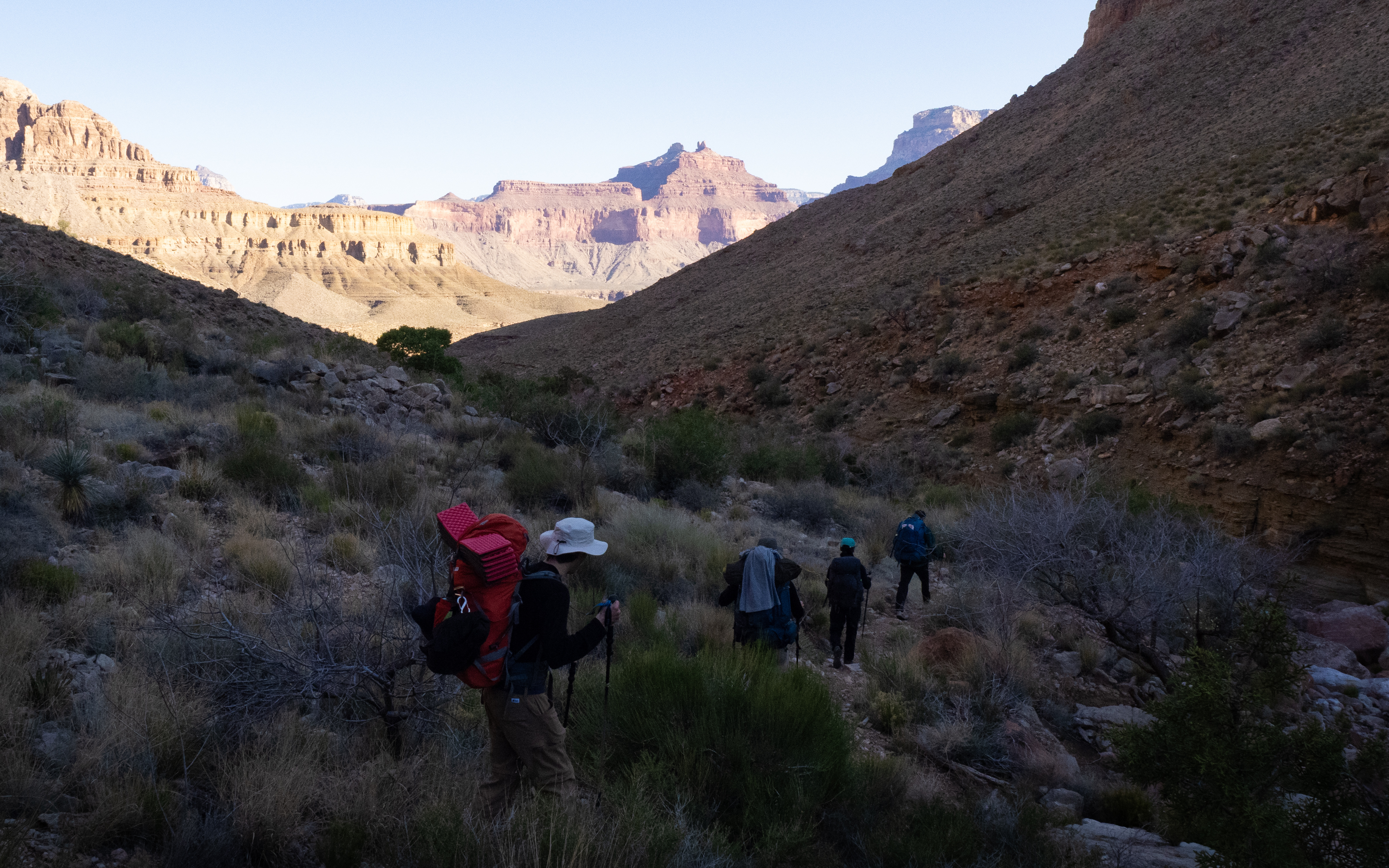
For now, however, we were soothed by a merciful breeze as we entered the central part of the canyon. The terrain on the plateau rendered a classic north American desert landscape, dotted with dry bushes and cactus groves. It was also wide open, allowing us to look all the way down this section of the canyon at the massive walls in the distance, and imparting the feeling that we were now properly inside the canyon, rather than walking down one of its many branches.
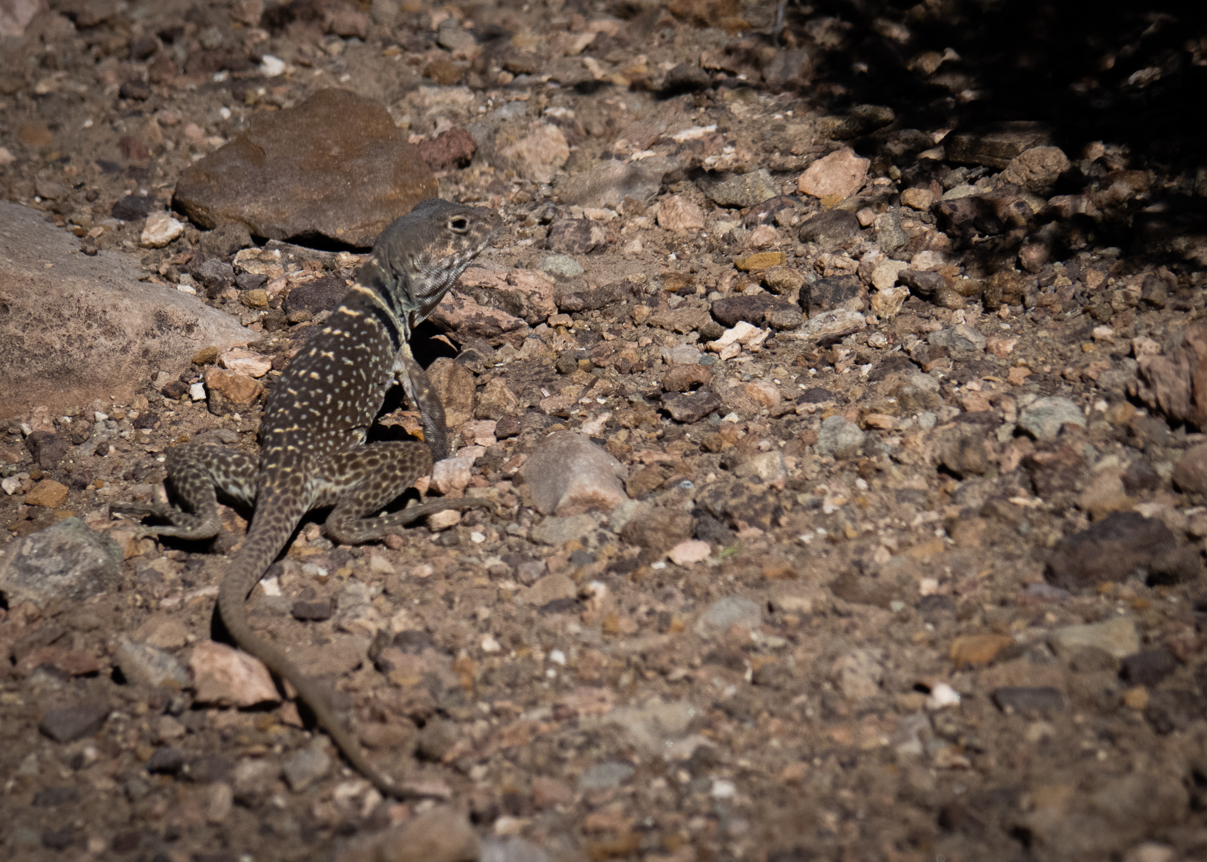
The trail was rugged, loose, and rocky, but not overly technical. Every few seconds a lizard would dart off the path, spooked by our heavy footsteps, and we had a fun time trying to get a good look at them before they vanished into the rocks.
Gotcha, you speedy little gremlin.
We also got our first glimpse of the Colorado river, which sat at the bottom of an enormous chasm, reminding us that we were only halfway down the full depth of the Canyon. The river was a deep emerald colour this far east on the Tonto, but it would turn reddish-brown further downstream as tributaries carried various types of sediment into it.
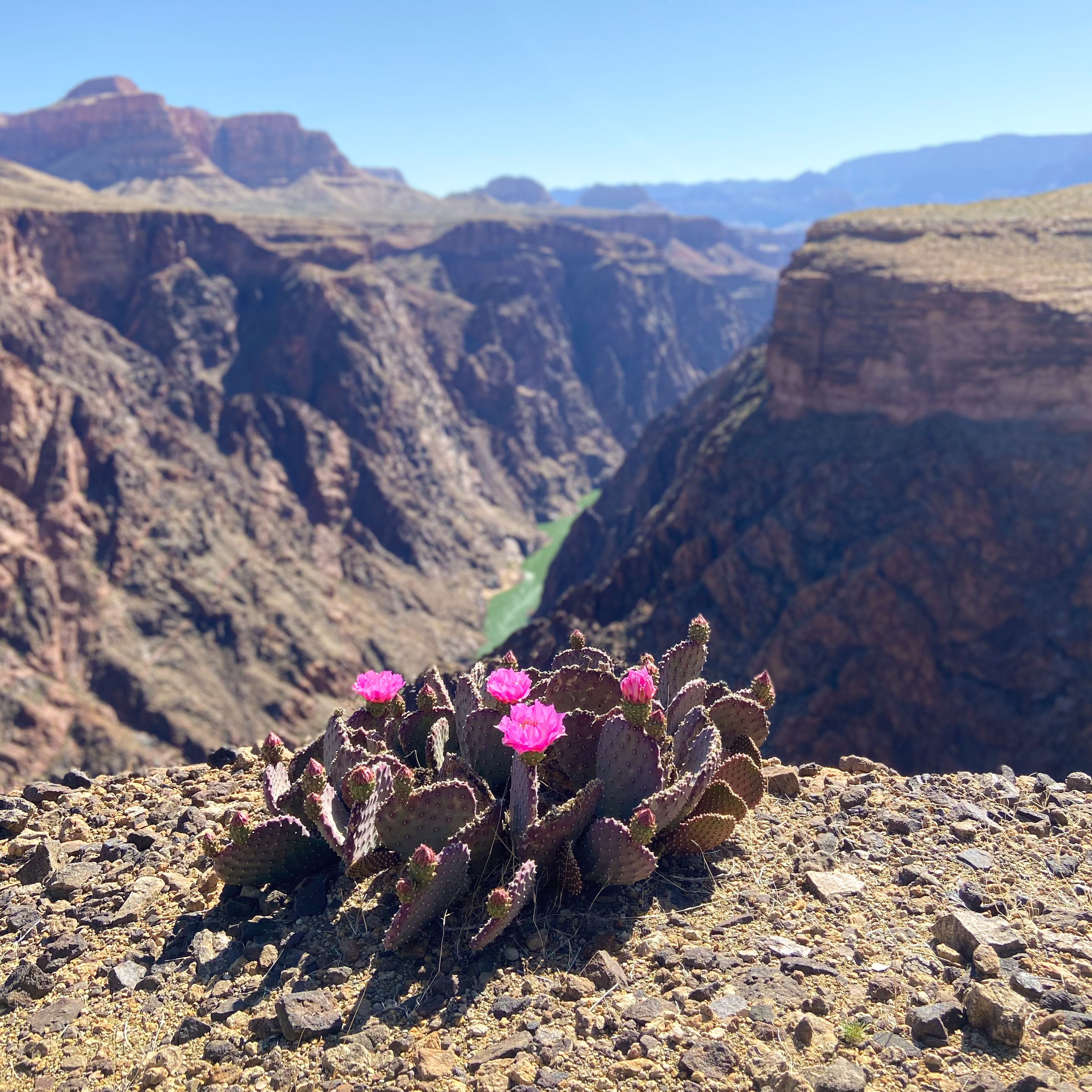
A cactus blooms, high above the emerald waters of the Colorado. Photo Credit: Paul Ramu
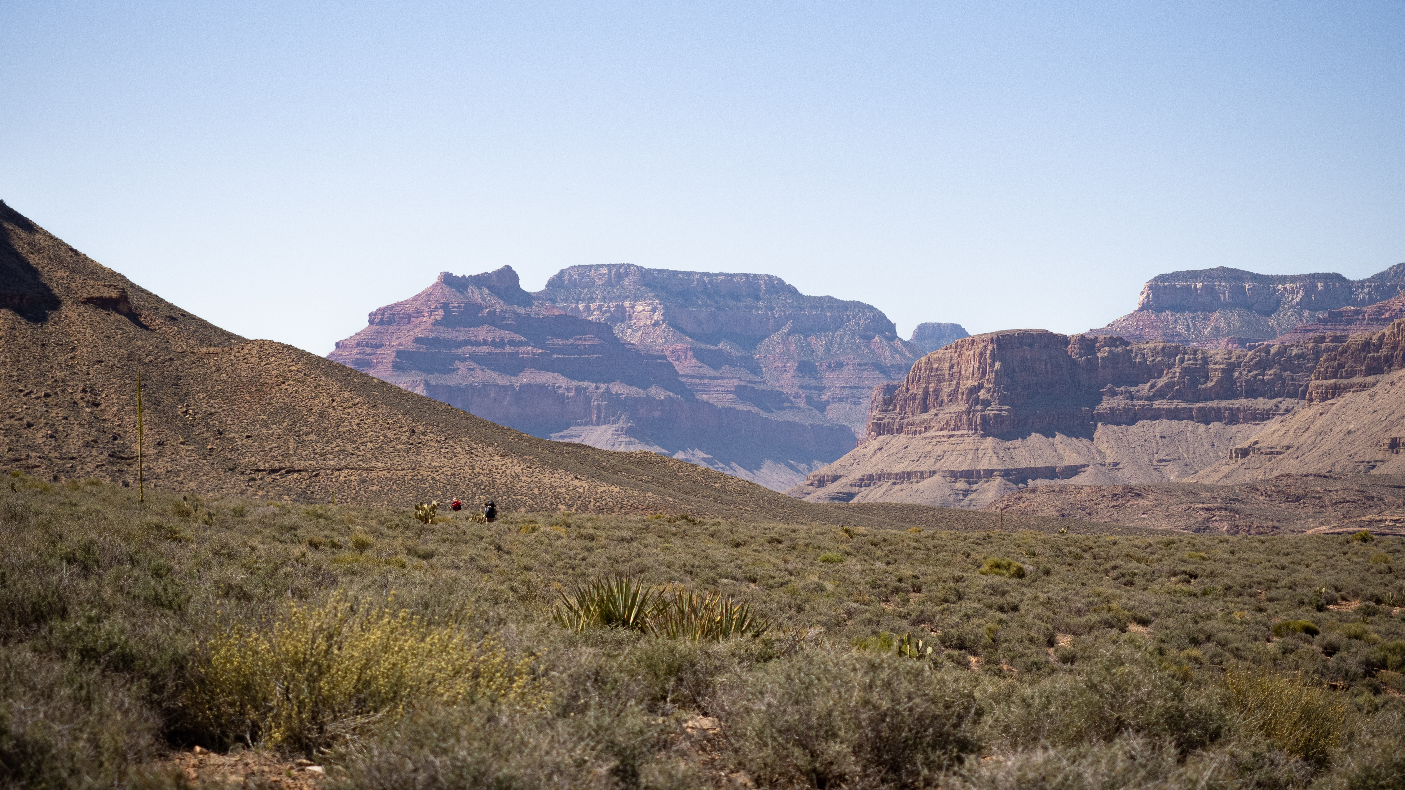
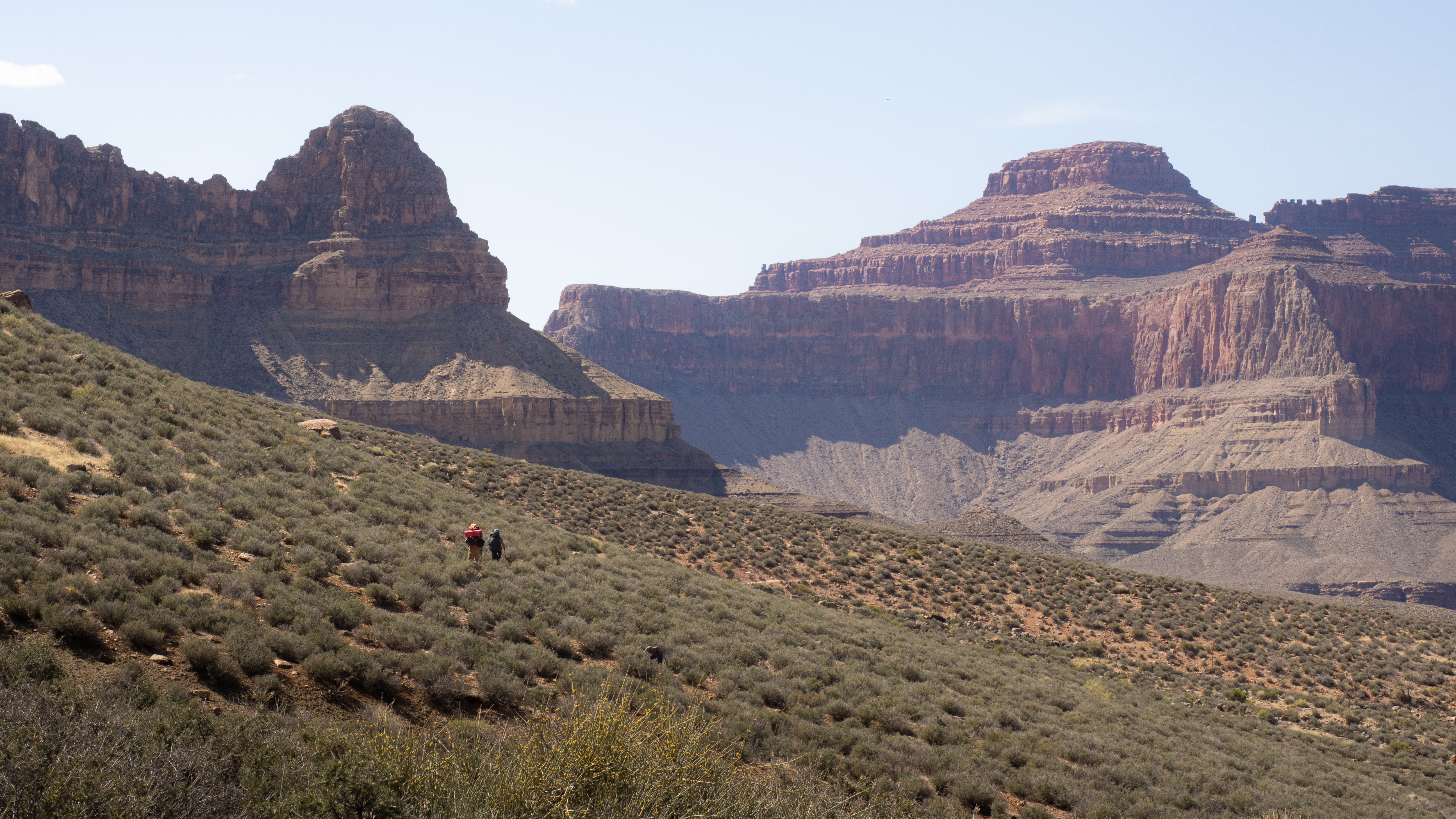
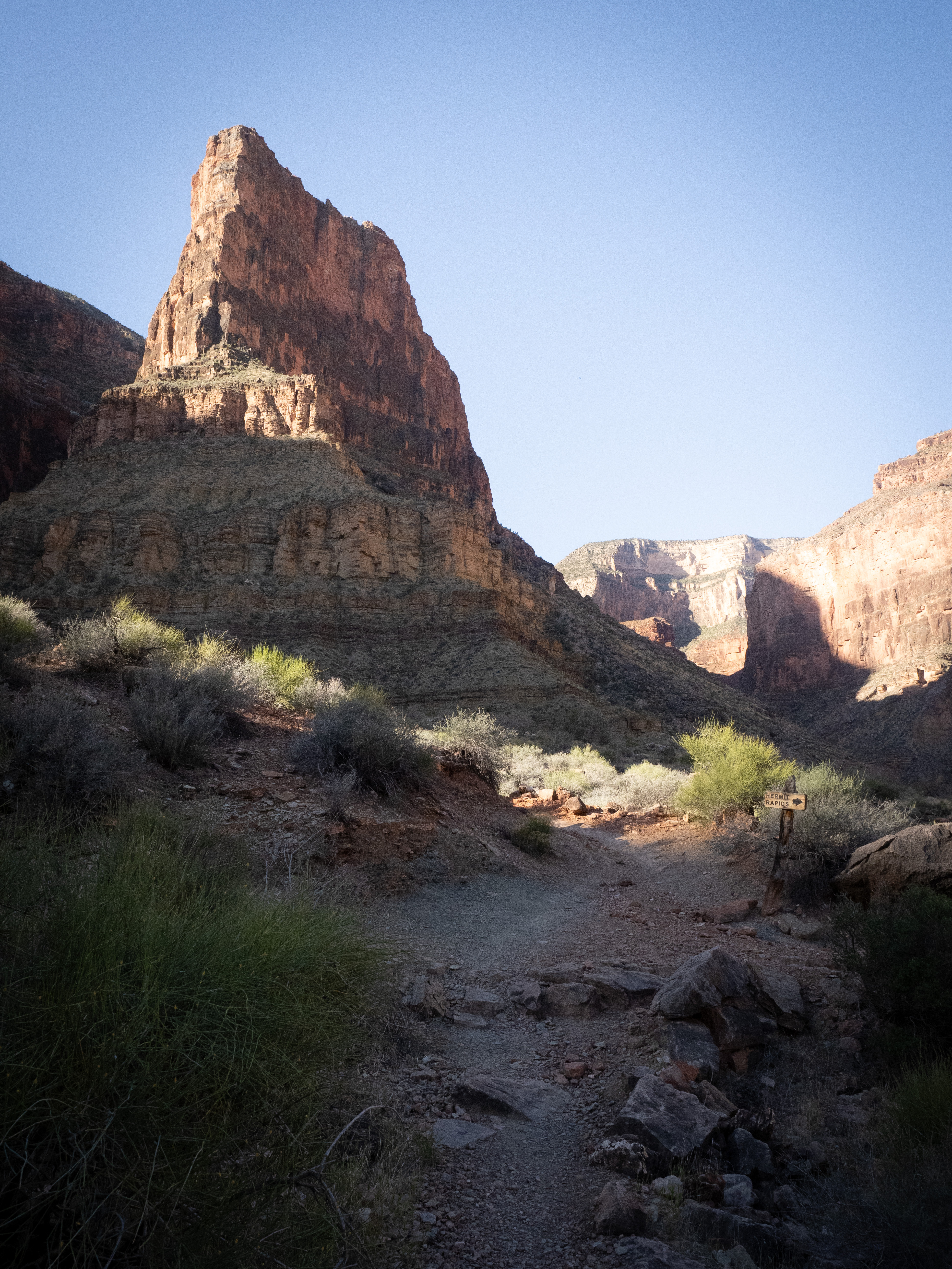
By 10:00 am, we hit our first big drainage. These drainages are the principal reason that we were going to walk so far, and this first one was immense; we could barely make out the next section of the trail across the thousand-meter-wide chasm in front of us. In order to reach that section, we would need to go all the way into the drainage and back out, which meant that traversing this one-kilometre gap would cost us eight kilometres of hiking. It felt like taking the longest possible distance to connect two points, and there were a lot of drainages in our future.
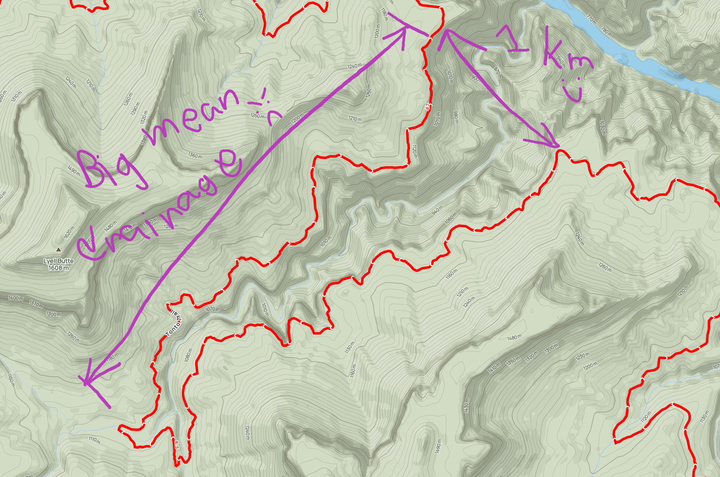
Artist’s rendition.
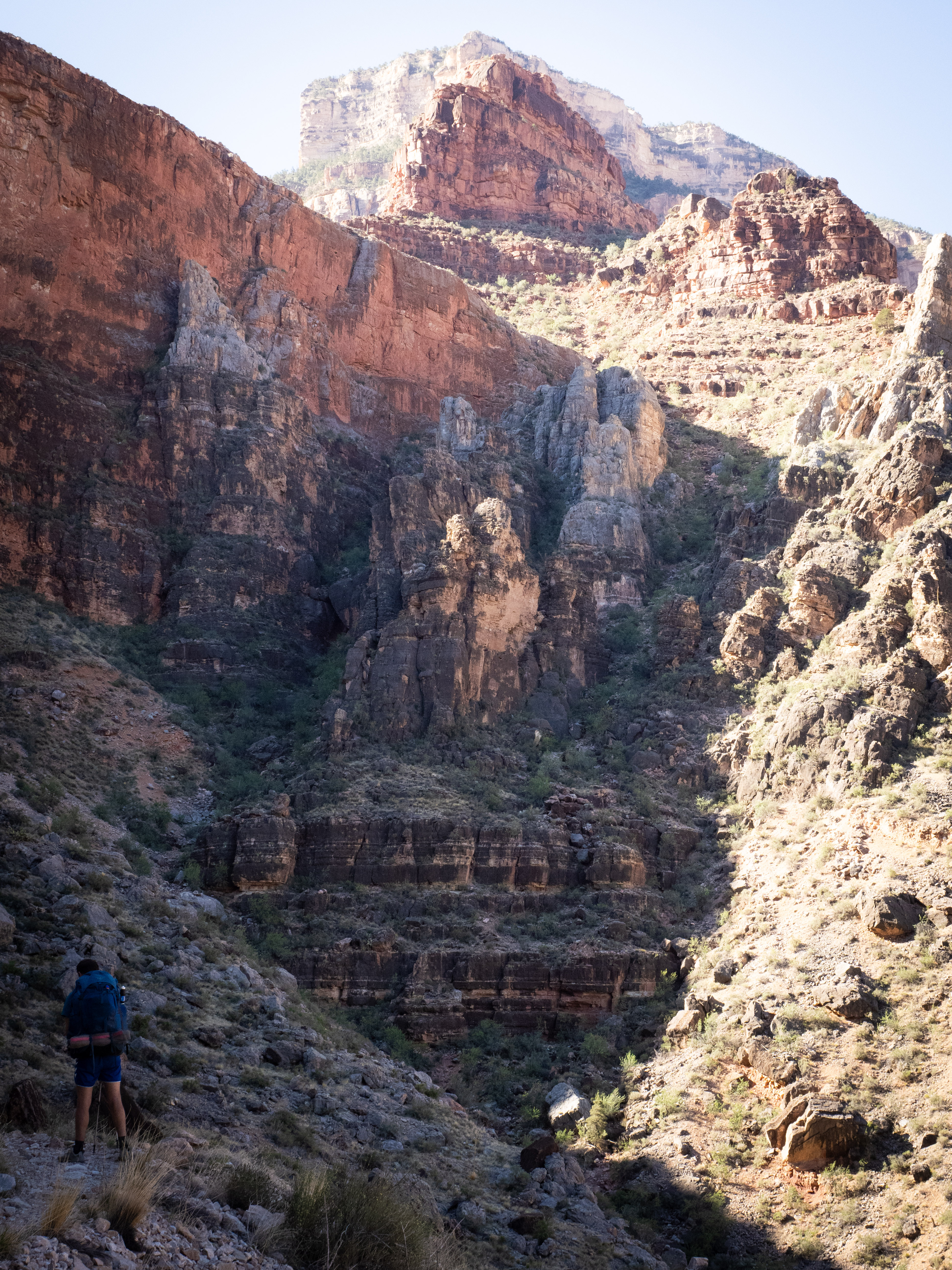
The silver lining was that the vertex of most drainages had at least a trickle of water, and the seasonal moisture meant that there was a small patch of mid-sized trees at those points. These micro-oases provided us with enough shade for the occasional break in an otherwise completely sun-baked day.
May I offer you some lush greenery in these drying times?
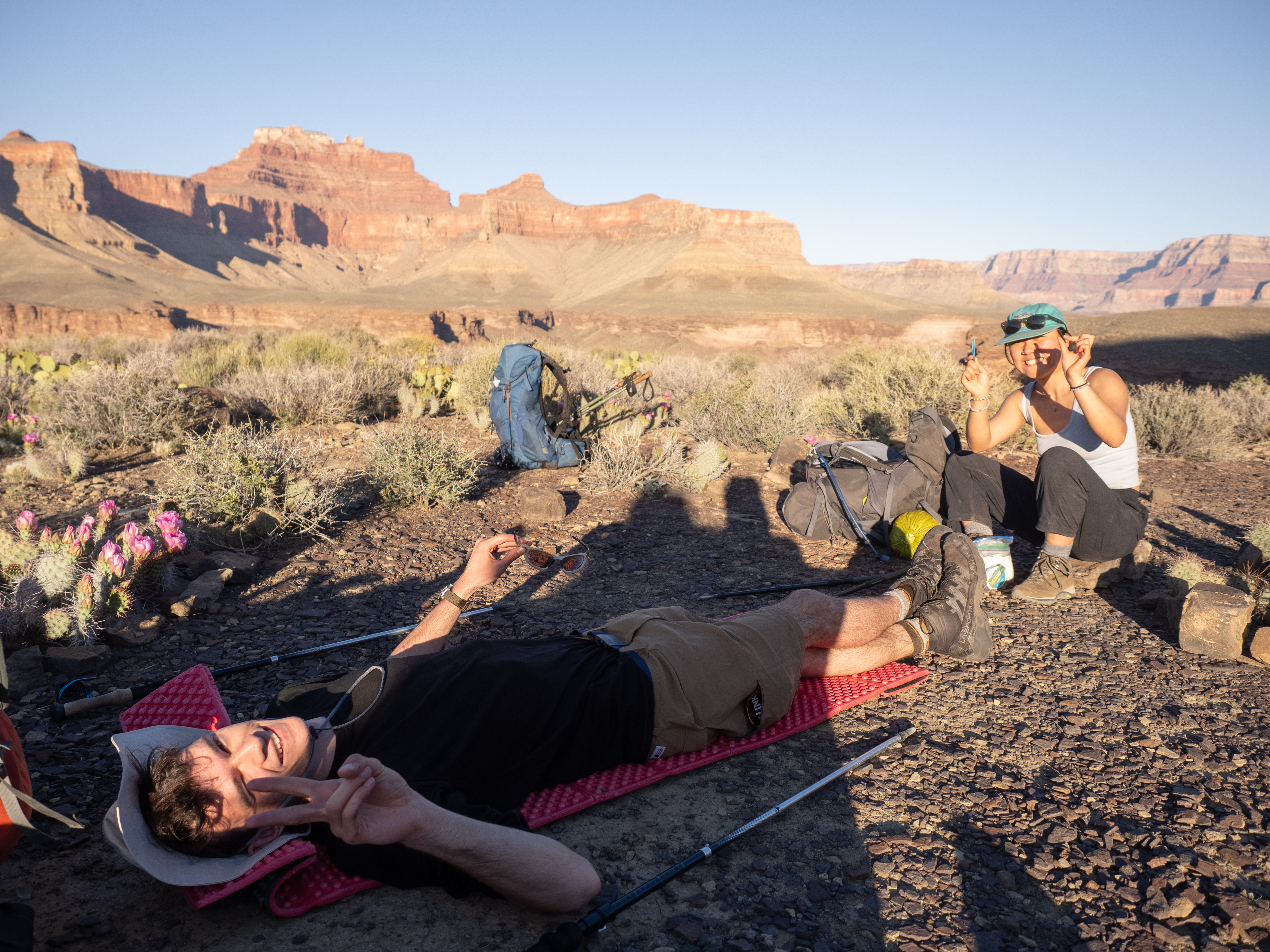
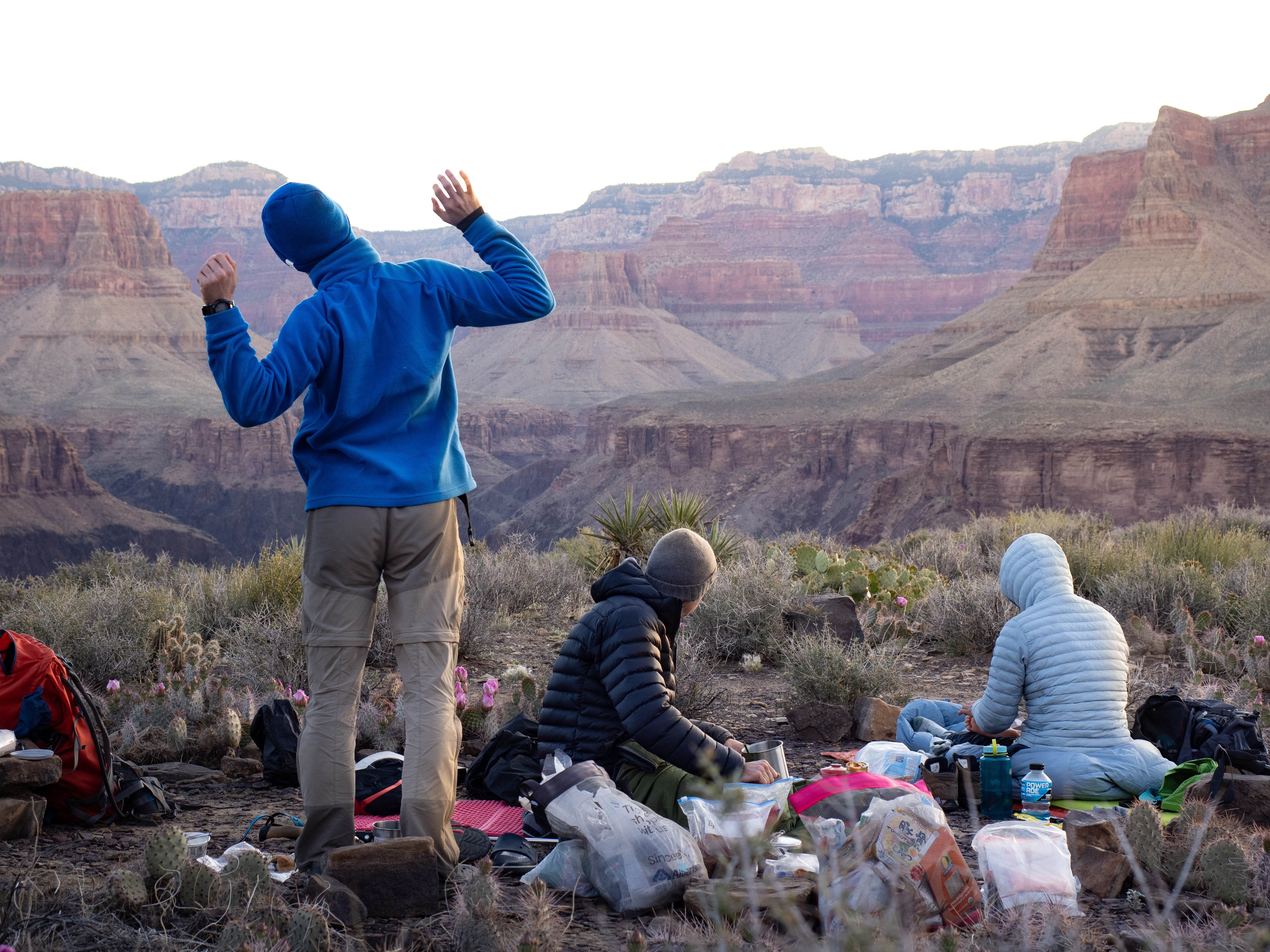
It was shortly after having our day’s lunch in one of these shaded patches that I started to struggle; after a pretty energetic morning trek, I found myself suddenly sapped of energy. I’ll shed any trace of humility here and mention that I’ve done quite a lot of thru-hiking in my time — including some in desert climates — and I consider myself to be pretty okay at managing my energy… but I’d never felt quite this bad before. I later concluded that I must have been suffering from mild heat exhaustion or something similar, from a combination of the high sun exposure, my admittedly over packed bag (bringing my tripod was a greedy move), and a lack of training hikes prior to this big trip (always do some training before a thru-hike, kids — especially if your trek is early in the hiking season). Plus, I had probably pushed a bit too hard in the morning, out of excitement.
This is technically from the following morning but is a pretty good summary of my mental state at this point. (Thanks for the lovely candid shot, Paul)
I wasn’t the only one getting tired in the second half of the day, but I was certainly the worst off of the group. I was lucky that we had a fantastic crew; Sujin was the first to notice I had slowed down, and positioned herself behind me in the line, suffering my slow pace but preventing me from being abandoned. Everyone else soon followed suit, and the group stayed together for the rest of the day’s trek.
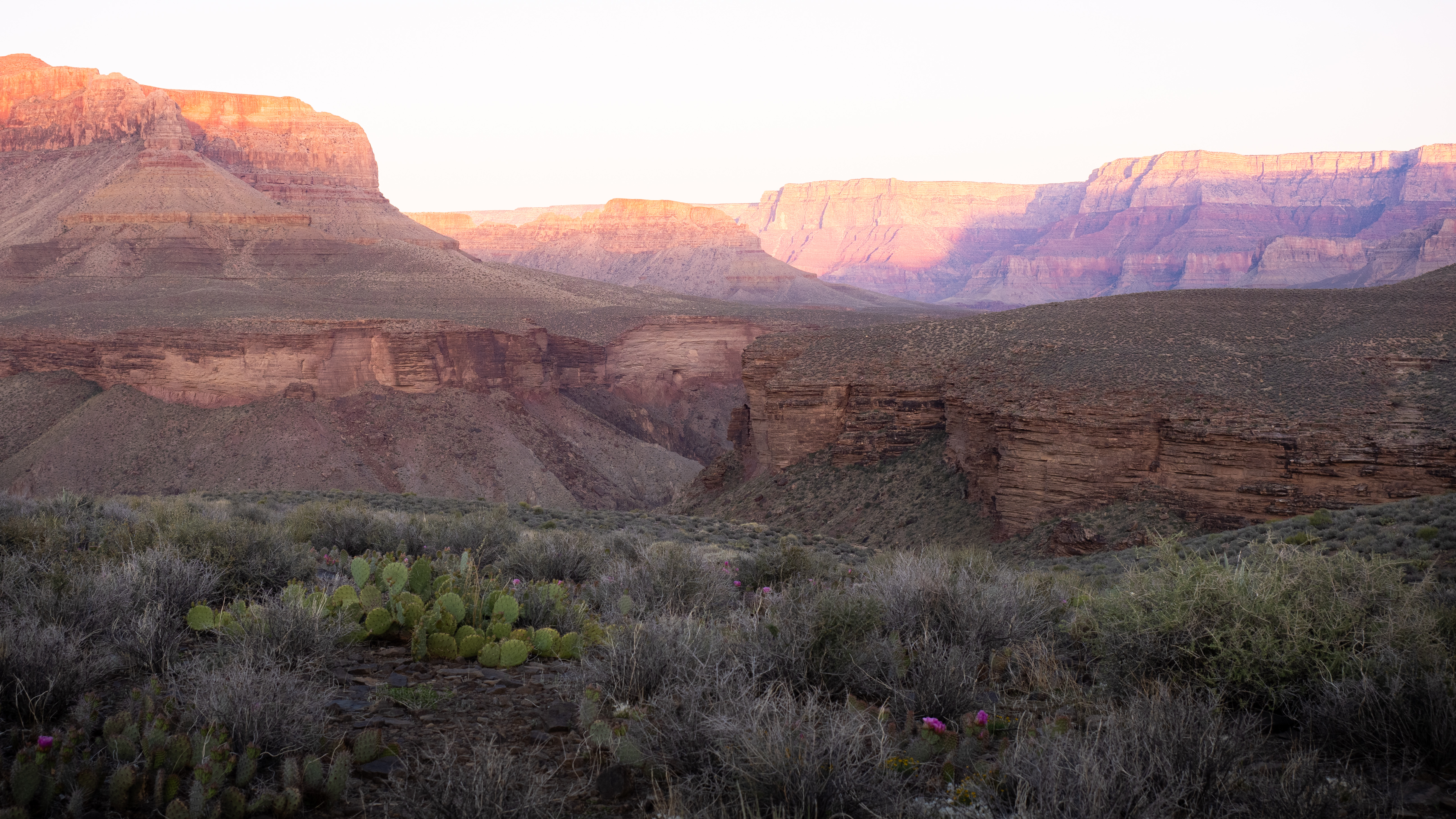
We were eventually rewarded, after 25 gruelling kilometres in the raging sun, with one of the prettiest campsites most of us have ever been to: a flat section of the Tonto plateau, in what felt like the very centre of the canyon.
A well-earned rest.
The views were incredible in every direction, whether you were looking at the giant walls that buttressed the canyon to the north and south, or the intricate, unremitting twists down the canyon’s length. This was a welcome change from our day of traversing drainages, whose walls tended to enclose us and block our view of the canyon’s expanse.
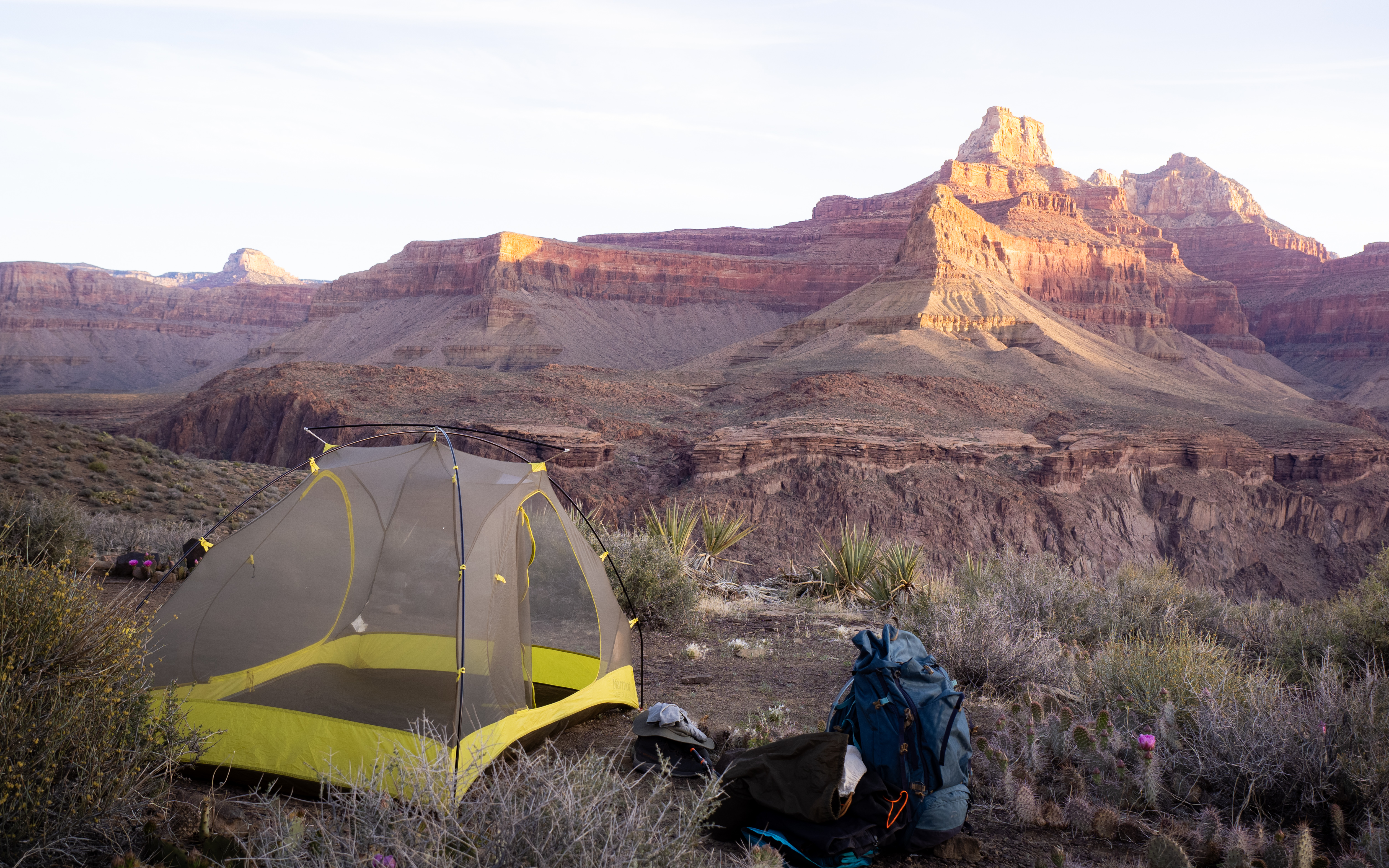
As an added bonus, since we were far away from the walls, we had a fully unobstructed view of the entire night sky. The moon wouldn’t brighten the sky until the wee hours of the morning, and that night was cloudless, so the stars were out in full force. We stargazed ourselves to sleep, a satisfying reward for a hard-earned day.
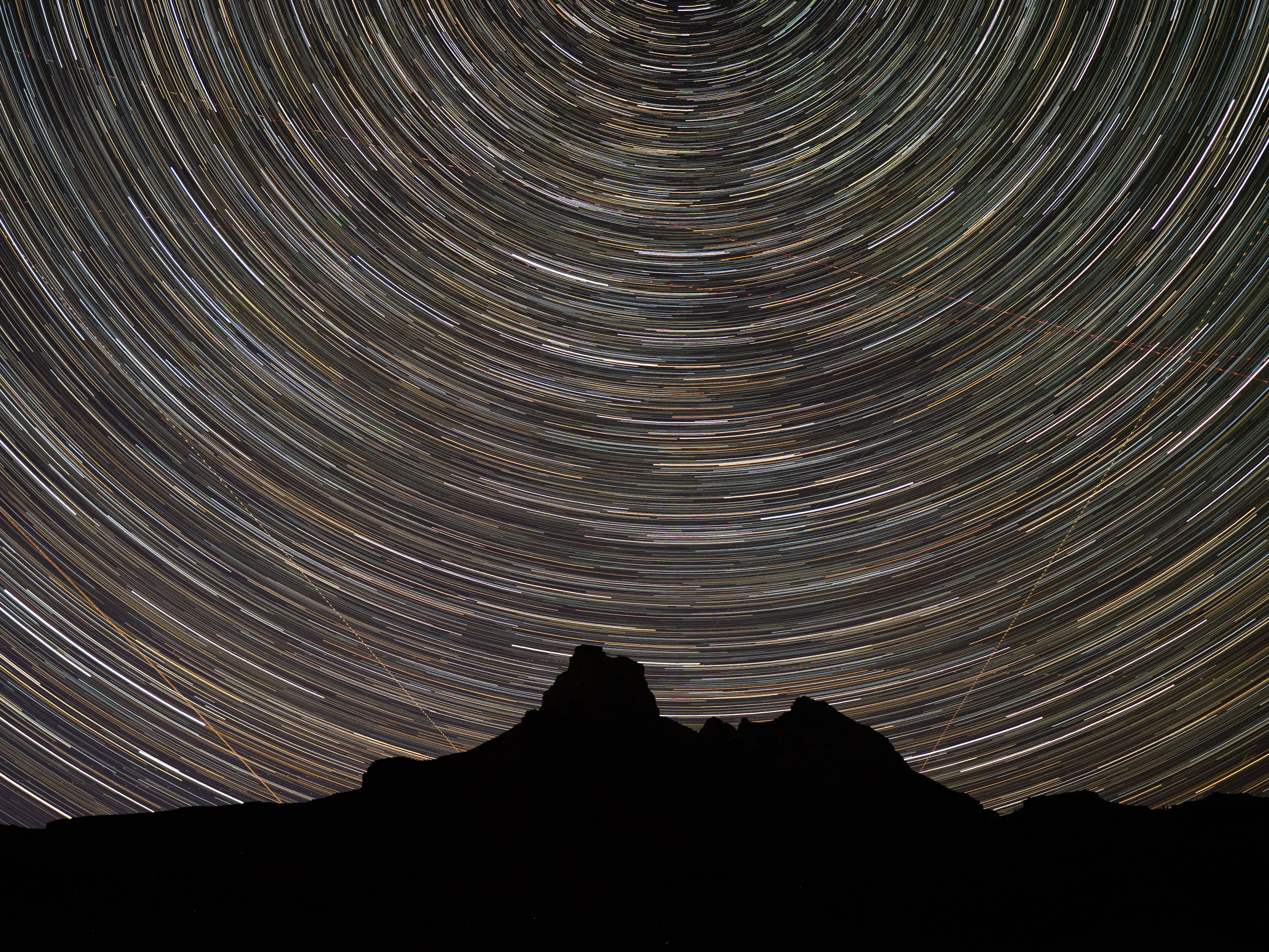
Bringing the tripod was probably dumb, but at least it let me take some night shots.
Day Three: Monday, April 21, 2025.
The next morning was bright and beautiful, the walls around us growing light and colourful in the predawn glow. We got up fairly early, hoping to take advantage of the cooler hours as much as possible; we had a second 25-kilometer day ahead of us.
Get your stretches in, it’s gonna be a long one.
I was relieved to find that I was feeling okay. After collecting myself the previous night, I had taken stock of my condition and warned the group that I might need to bail if I deteriorated further. We knew there would be a couple of connections to the rim today, and if my energy kept dropping it would be safer for me to get out under my own power. I awoke feeling decently restored, and I would have several kilometres of hiking today to monitor myself before we hit the first potential turnoff from the trail.
Unfortunately, my newfound energy was dampened by the previous night’s discovery that I had, after 12 years of blister-free thru-hiking, developed my first ever blisters, along both of my heels – and they were doozies. I took this as another sign that I had pushed too hard the previous day. Luckily, I had a first aid kit full of gauze and duct tape, and after some inelegant field surgery and wound dressing, got on the trail with well-armoured heels.
Our early start paid off, because although were hiking in the sun right from the start, it was mostly in weak morning light that didn’t heat us up very much. The terrain was flat and we kept a good pace, despite my ankles screaming at me the whole way. The easy work didn’t last long, of course; the canyon abhors straight lines, and soon enough we were entering and exiting drainages once more.
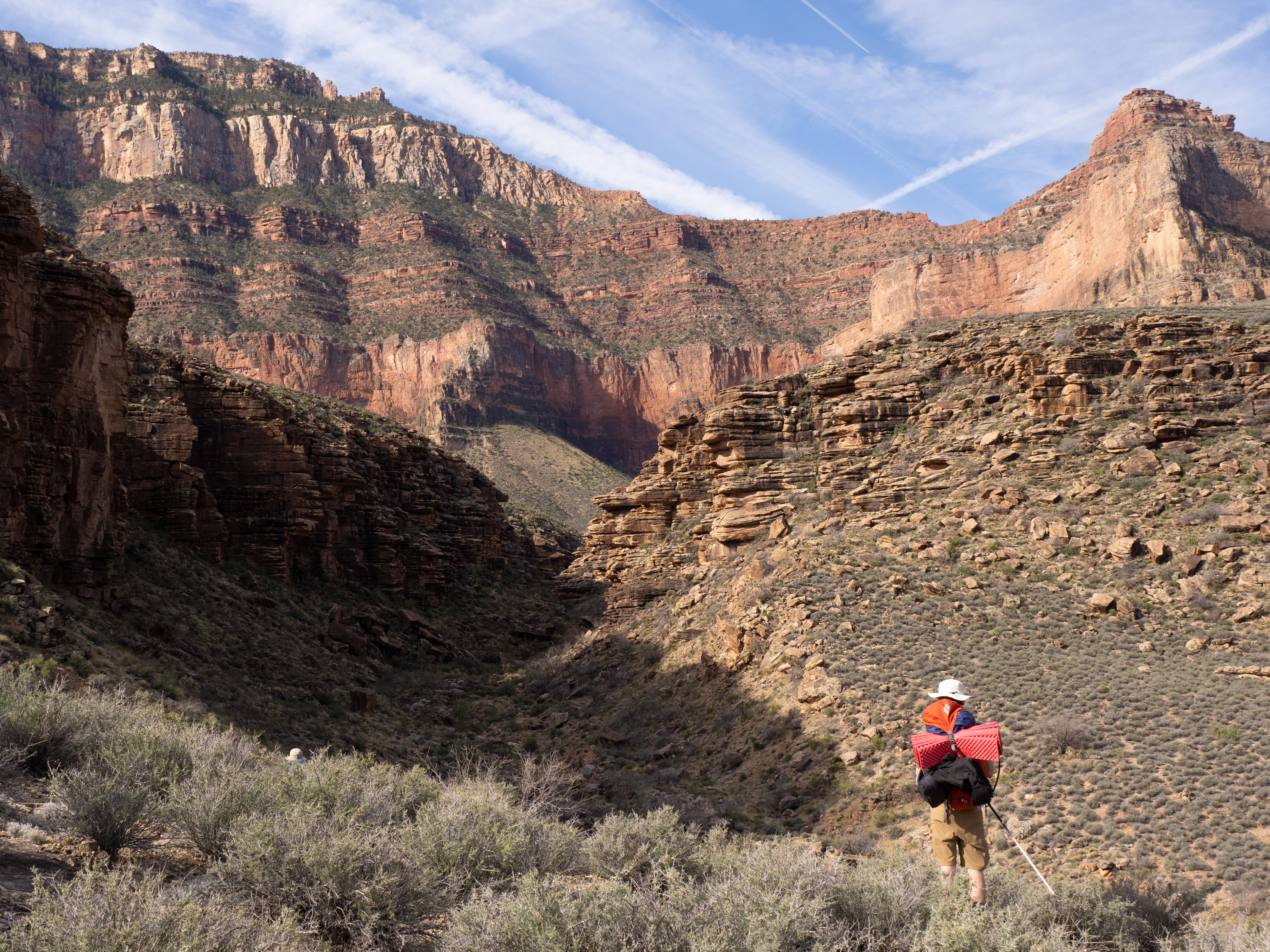
Sick of hearing about drainages yet? TOO BAD
We kept at it all morning, eventually reaching the shelter where the South Kaibab trail crossed the Tonto. Since the South Kaibab is a popular day hiking trail, there were quite a few people there — the first living souls we had seen for 36 hours. This was also my first potential option for bailing, but luckily, I was still content to keep going. There would be another chance later that day, but for now my energy was still up.
We took an extended break in the shelter, occasionally chatting up some of the other hikers, who I can only assume had weak senses of smell since they could talk to us without grimacing. We also took the opportunity to use the composting outhouses, which were somehow completely scent-free despite the high traffic through the area. It was a wonderful reprieve from digging poop holes, which was our modus operandi the first two days.
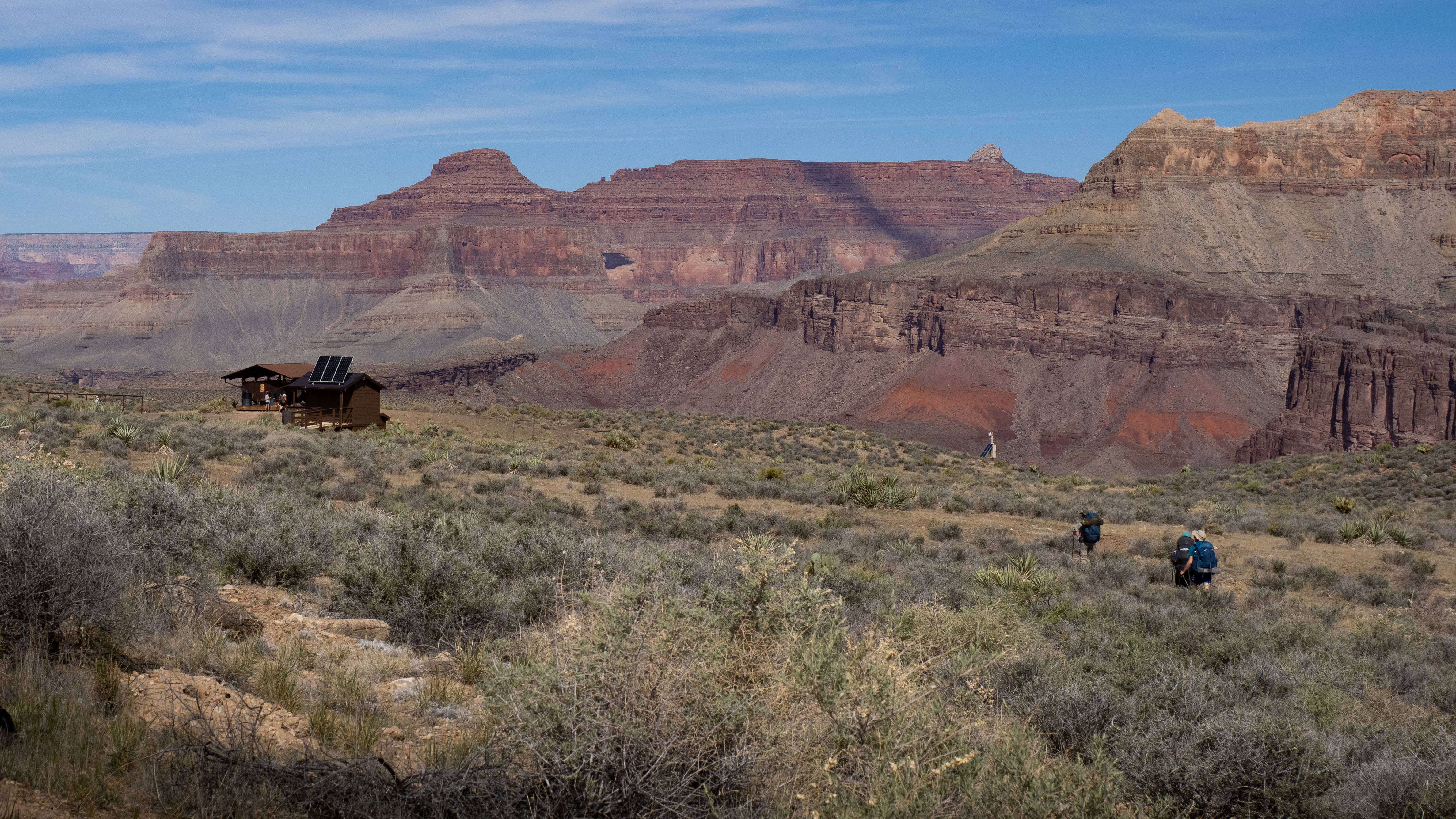
Civilization? Not quite… nice toilets, though.
We were back on the trail soon, now in full sun, sweating our way in and out of more drainages. My energy was perfectly fine, but my ankles ached so much that I fell behind the group. Francesco, my fellow blister-sufferer, kept me company at the back of the pack, chatting in an attempt to keep our minds off our blisters. At one point we tried to figure out how many jokes we both knew off the top of our heads… our grand total was five, but that’s to be expected when all of your brain cells are in your feet.
At least the views stayed nice.
After 15 kilometres, a disgusting number of drainages, and one uncomfortable trail-maintenance-related detour, we made it to our lunch spot: Havasupai Gardens, a lush oasis on a river with cold potable water, bathrooms, and all of the shade we could ask for. This was my second potential bail-out spot, but my problem now was ankle pain, not sapped energy, so I decided I could grit through the rest of the trail. I might grunt and moan as I walked, but at least I wouldn’t be passing out any time soon — as long as I didn’t have to be carried or helicoptered out, I felt safe to continue.

Now THAT’S a proper oasis.
Our lunch was rejuvenating, especially due to the cold water on tap, which we turned into several litres of Gatorade to replenish all of the salt we had perspired away throughout the day. After what felt like ten minutes, we realized an hour and a half had already passed, so we geared up and got back on the trail. Thinking I was clever, I soaked my shirt in the cold water before heading out. It kept me cool for all of 30 minutes before becoming bone-dry again.
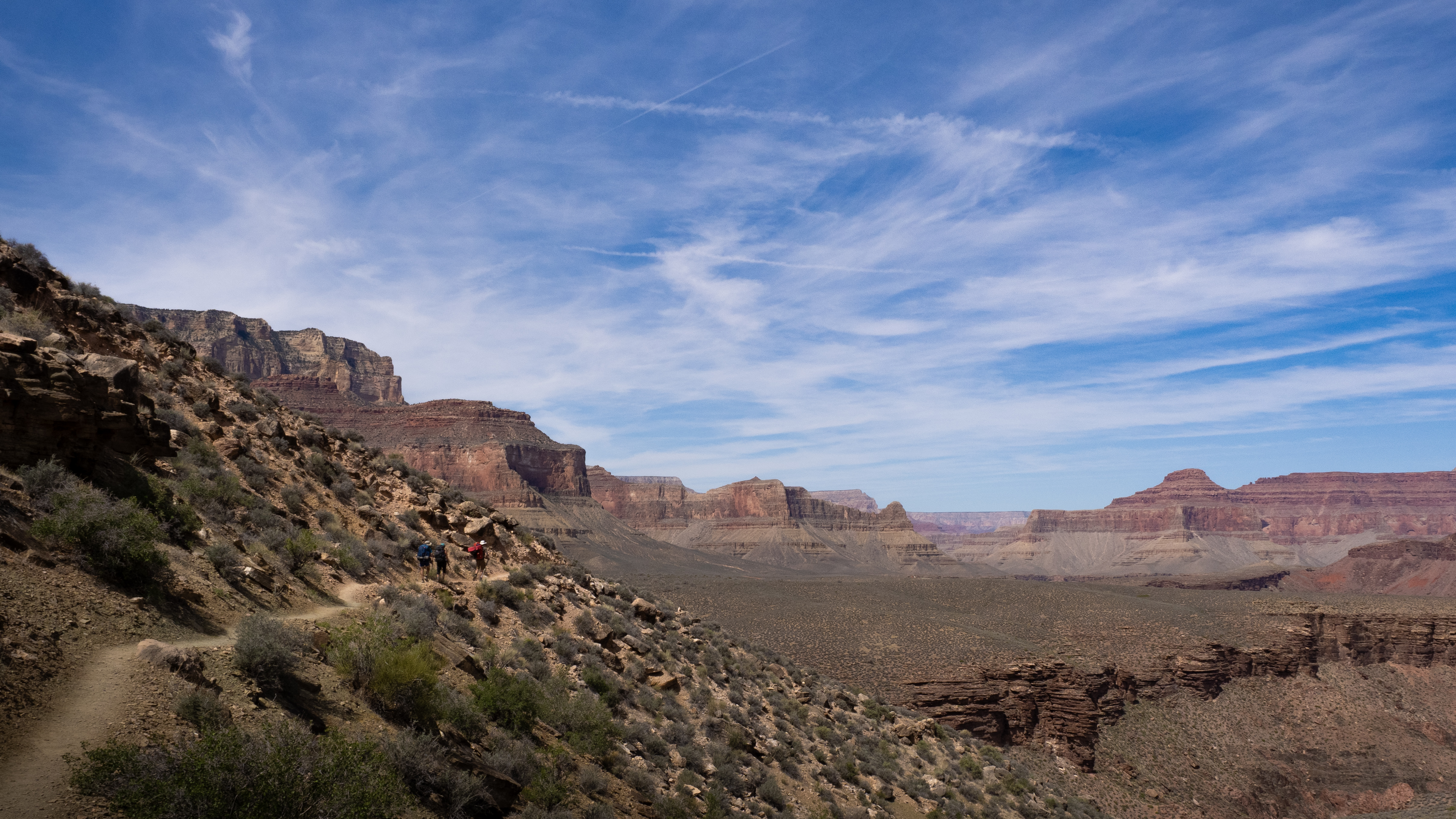
We only had ten kilometres left in our day, and the worst hours of the sun would be over soon. We kept a steady pace as we faced the drainage-pocalypse that made up this section of the trail.
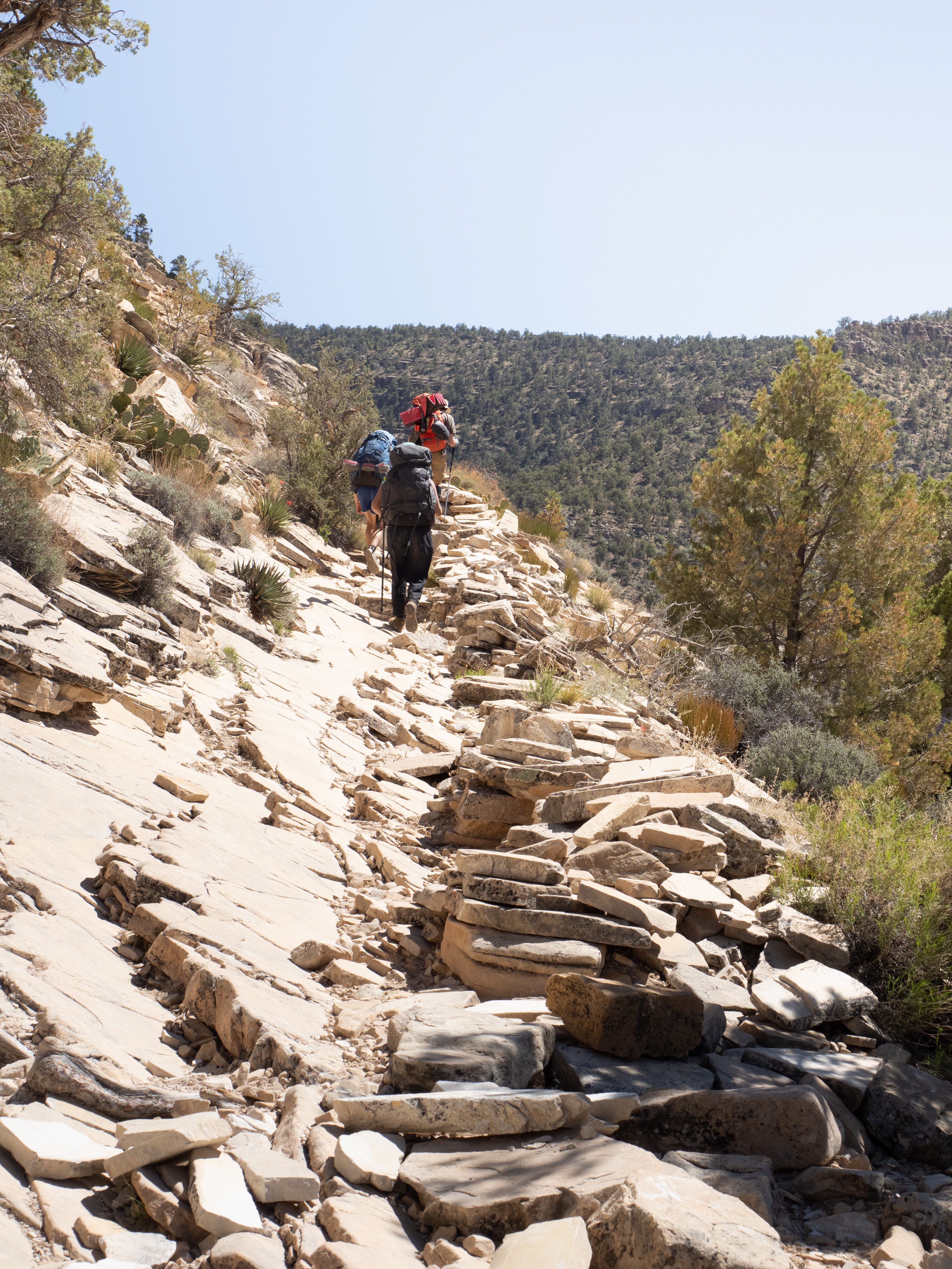
I’ve already written at length about drainages, but allow me one more rant; I promise to shut up about them after this. We really had to cross a disgusting number of these things. Moreover, the bigger the drainage, the more likely it is to have more drainages nested within it. You’ll be turning left into a big drainage that you need to circumnavigate in order to cross a massive chasm, only to be faced with another smaller chasm directly in your path, which contains its own micro-chasms, and so on. It’s like hiking in fractals.
Drainage-related gripes aside, the canyon still constantly seduces you with its vistas. This stretch of the canyon was a little more open, and we caught many more glimpses of the Colorado below us. In the afternoon light, there were multiple occasions in which we could see the entire vertical span of the canyon: from the rim high above us, though the multiple, hulking steps in the canyon’s layers, down to the river far below.
The trail had gone quiet again, and we only crossed paths with one other group as we made our way to Salt Creek, a rocky seasonal riverbed that would serve as our camp for the night.
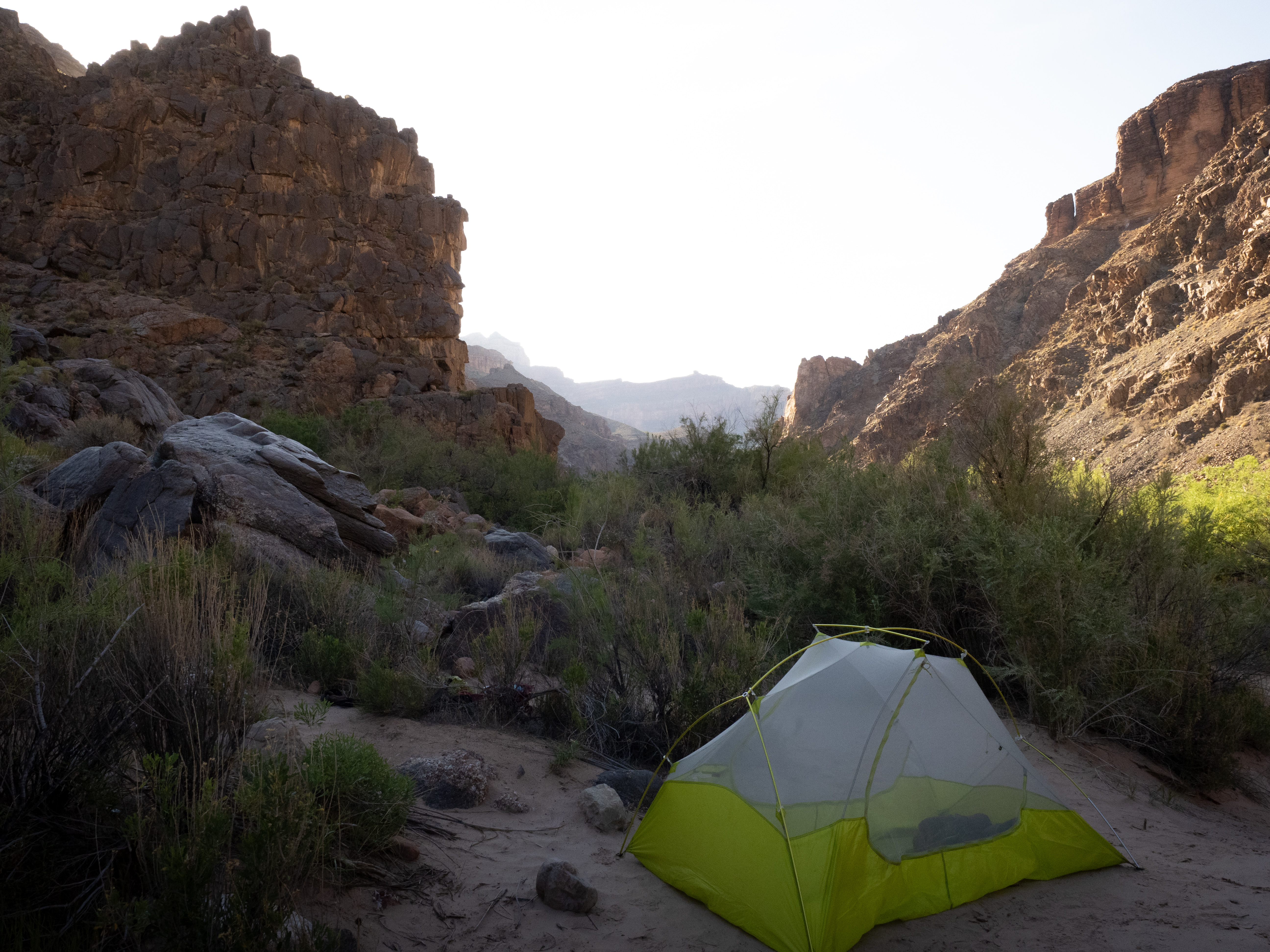
Salt Creek was tucked into the canyon wall at the end of a drainage, and was mostly bare rock. It was also a bit of a wind tunnel, particularly during sunset; we had to put rocks in our tents to keep them from tumbling down to the Colorado.
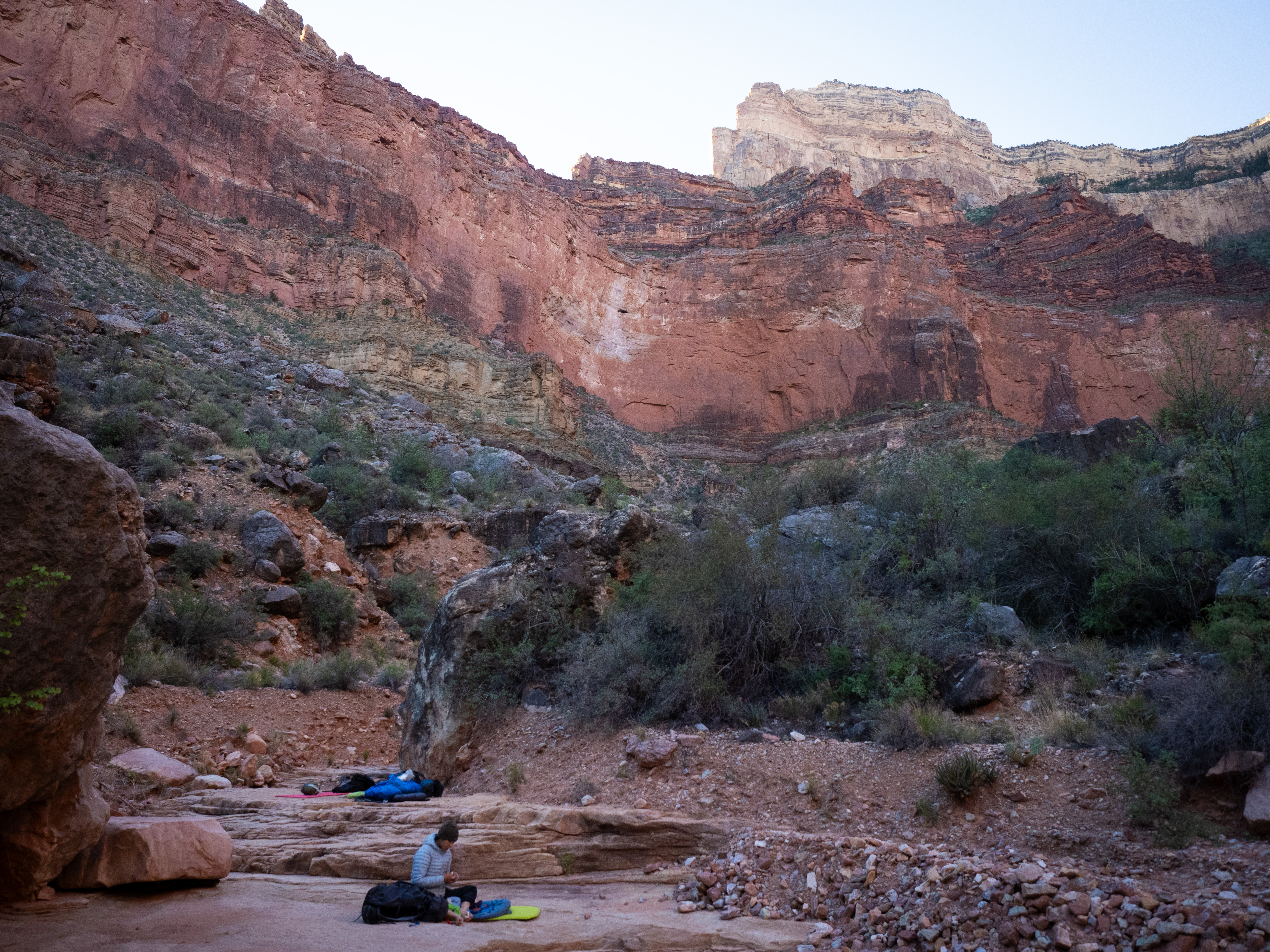
Once the sun had gone down, the wind calmed down and the frogs woke up — the river might not have been flowing, but there were obviously some big pools downstream from us, judging by the amphibian concert that was serenading us to sleep. Unfortunately for our sanity, our campsite formed a natural amphitheatre and the acoustics were excellent.
The pictures only look serene because they fail to convey the cacophony of frog noises.
This was also the night of our only encounter with hazardous wildlife during the trip: namely, the scorpion that tried to crawl into my pants while I was writing my journal entry for the night. After a jump scare, I tried shooing it away with my journal, which the scorpion promptly attempted to fight… I wrote the rest of the entry from inside my tent.
Day 4: Tuesday, April 22, 2025.
The following morning, the trail from camp took us back into the familiar embrace of the sun. It started with an ascent up the side of the Salt Creek drainage, around a saddle between two buttes, and then a zig-zag through a bunch of smaller drainages before descending through a series of rocky switchbacks to Monument Creek, about 5 km from where we had started the day.

Despite my nutritious breakfast of Ibuprofen, duct tape, and Polysporin, my ankles were screaming at me throughout the whole descent. Luckily, Monument Creek was flowing vigorously with cold, clear water, which allowed me to soothe my ankles and soak my clothes again. This was a nice spot for a break; there was a large campsite below an imposing pillar of rock (the eponymous “monument” of Monument Creek), and a surprising number of other hikers.
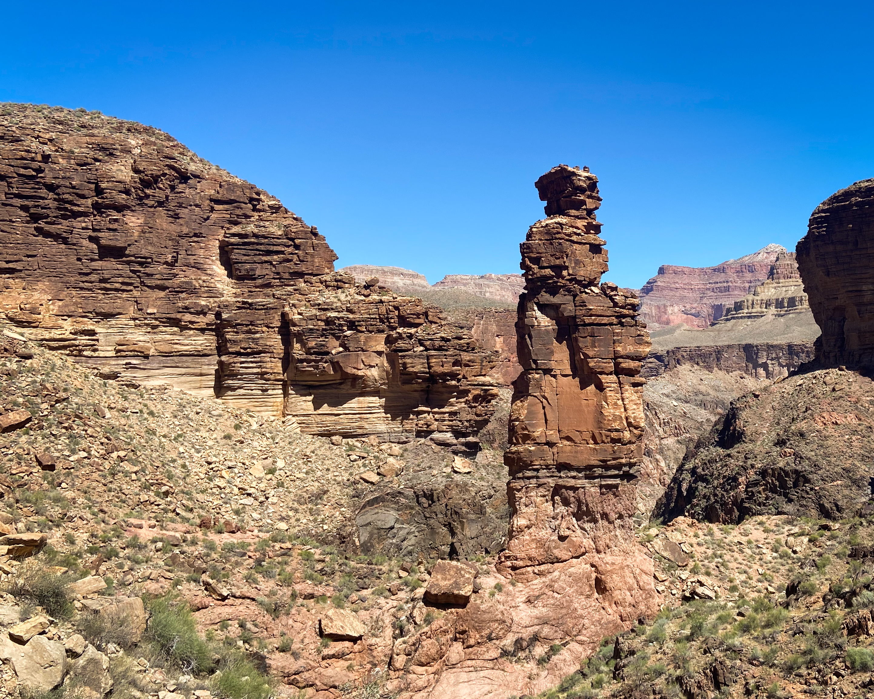
The Monument. PC: Paul Ramu
We lingered for long enough to have some snacks, refill on water, and soak our clothes, before starting our ascent up to the other side of the ravine. This took us about half an hour, which wasn’t helped by me forgetting my sunglasses at the creek. Upon hearing this, and without hesitation, Paul took of his pack and RAN back down to fetch them, telling us to go on ahead. Sure enough, he had caught back up to us, having rescued my precious sunnies, about 15 minutes later. The man is a beast.
The sun was out in full force by now, but we had gotten pretty accustomed to dealing with and made decent time to our next destination: Hermit Creek, a gorgeous flowing river that formed an oasis nestled in another ravine. We had a long, relaxing lunch there, knowing that we had covered the majority of the day’s distance: only a few kilometres remained, and we would be largely out of the sun for most of it.
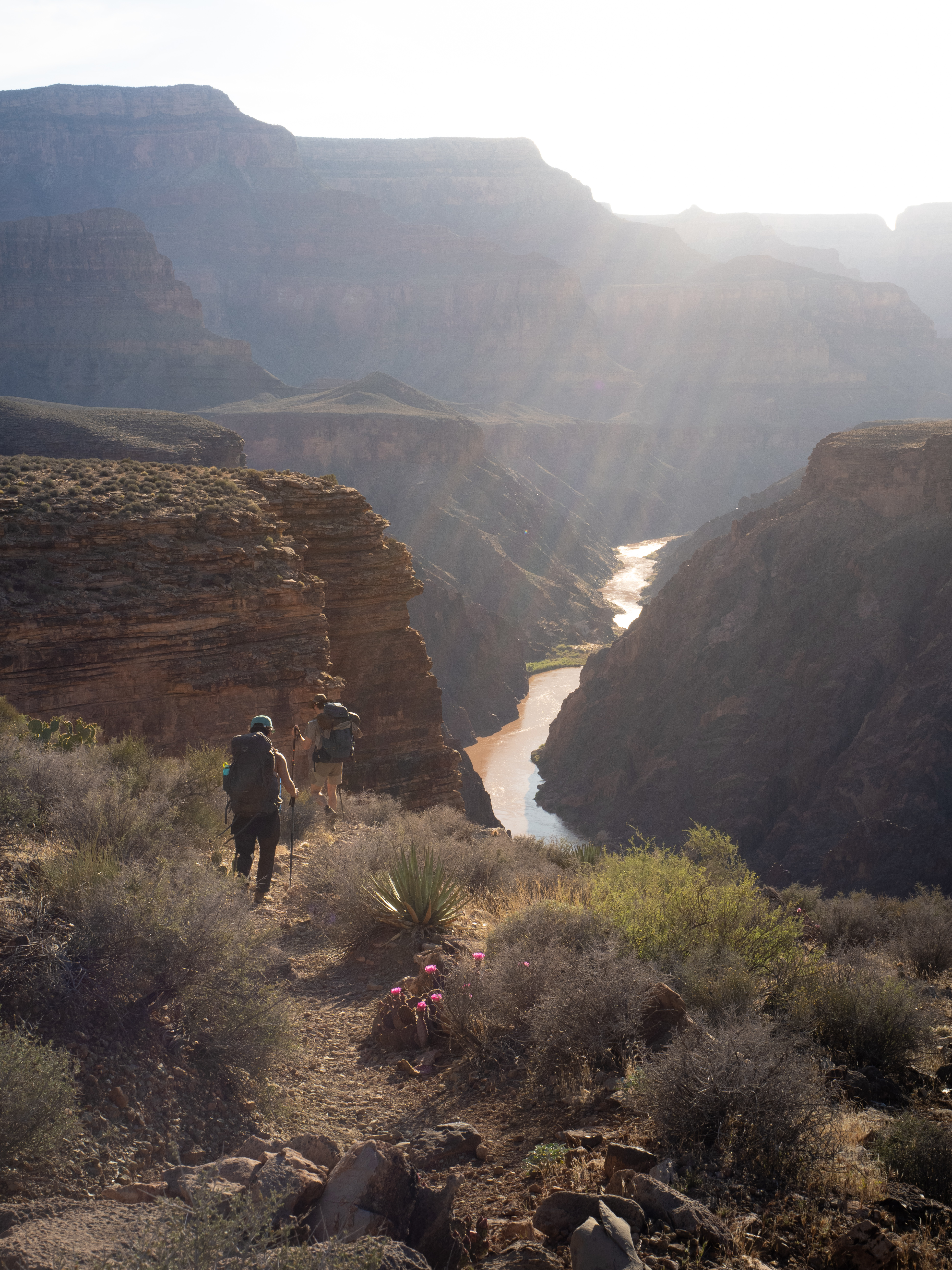
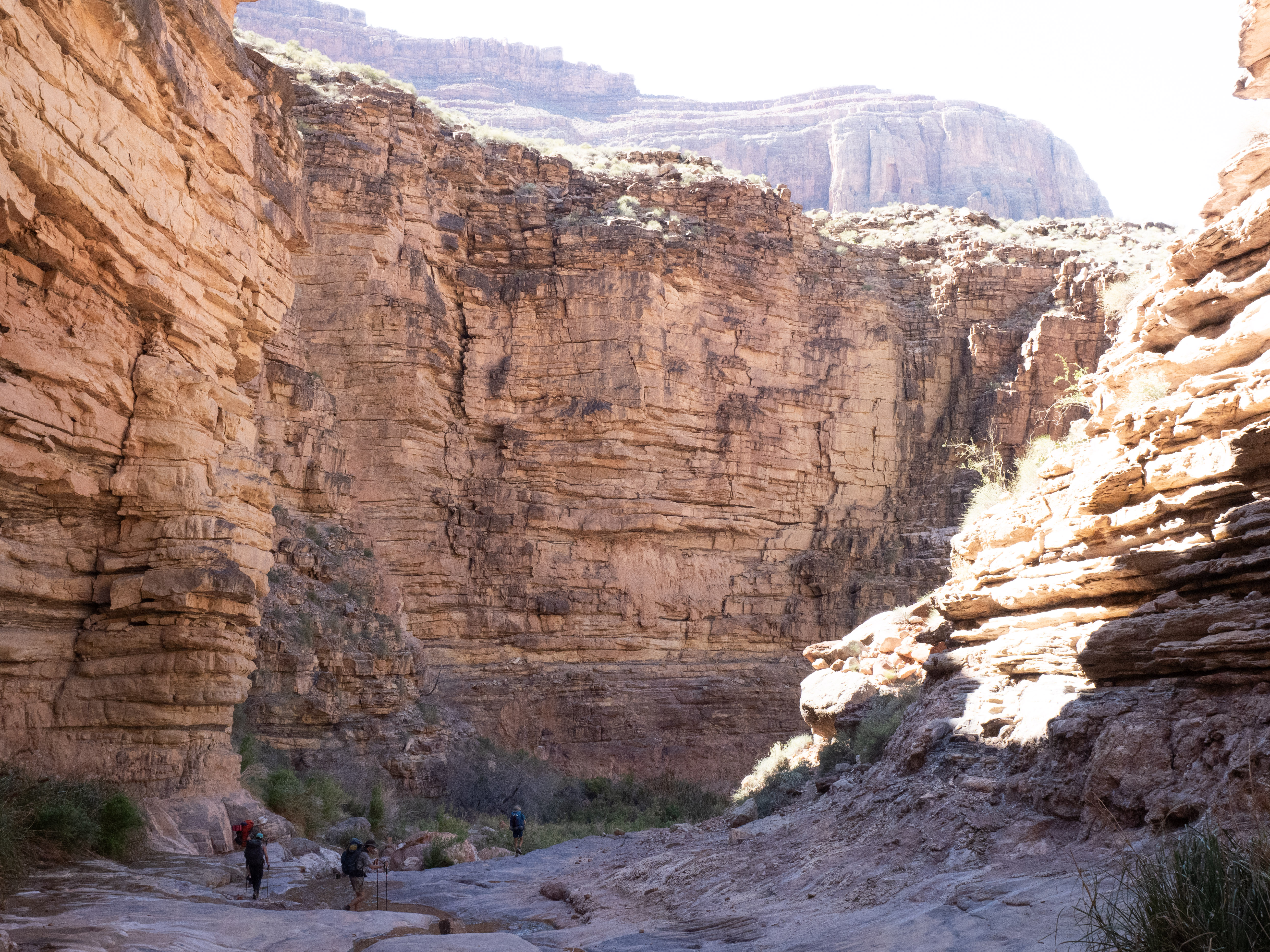
The trail we took from Hermit Creek descended all the way to the Colorado, at the very bottom of the canyon, where we would spend a night by the water. This three-kilometre stretch stood out from the rest of our trail so far – we followed the creek the whole way down, which took us through narrow, water-carved passageways in the rock, and through several sections of dense foliage that contrasted heavily with the dry, brushy terrain of the Tonto Plateau.
Of special note were the monolithic chunks of rock that had collapsed from the plateau down into the riverbed over the millennia. One particularly enormous boulder had stayed mainly intact, and by looking at its layering, which sat askew at almost 90 degrees from the horizontal lines of the surrounding canyon, one could almost trace the trajectory it took from the plateau above, slamming down with unimaginable energy and burying itself at the bottom of our narrow ravine.
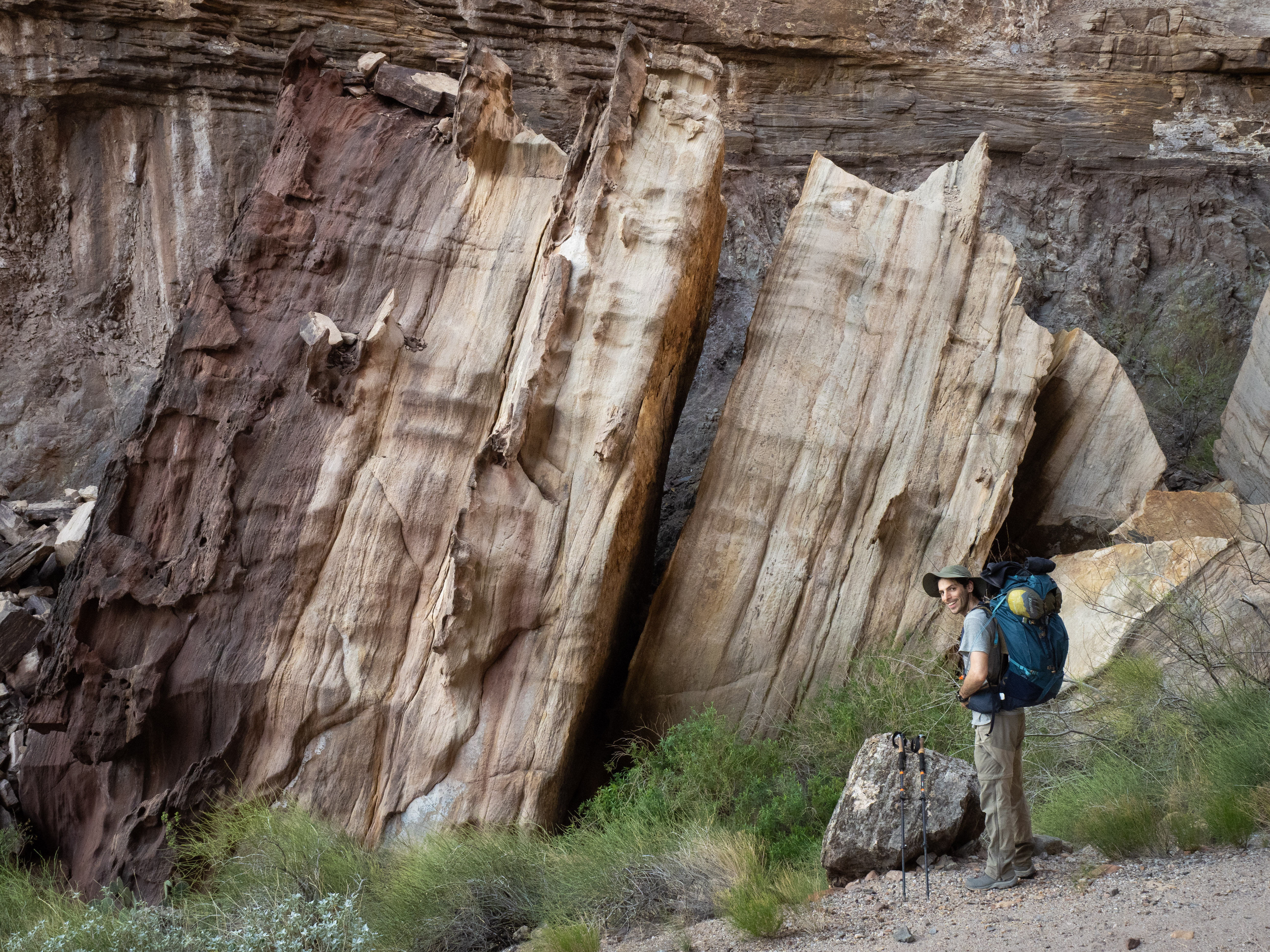
Francesco for scale.
The shaded route was a much-needed relief, especially since the air continued to warm the further down we went. As we descended, the towering walls on either side grew higher and more imposing, before opening up into a lush canyon that eventually deposited us on a sandy beach by the Colorado River.
The bottom, at last.
We spent some hard-earned minutes just laying in the sand, before eventually finding a comfortable bank by the river to prepare dinner. Paul and Daniel went for a proper dunk in the Colorado, while I was happy to soak my legs in the chilly water. I had been loading the front of my feet to reduce pressure on my ankles for all of the downhill stretches today, and my calves were stiff as bricks as a result. The frigid water managed to breathe a bit of life back into my legs.
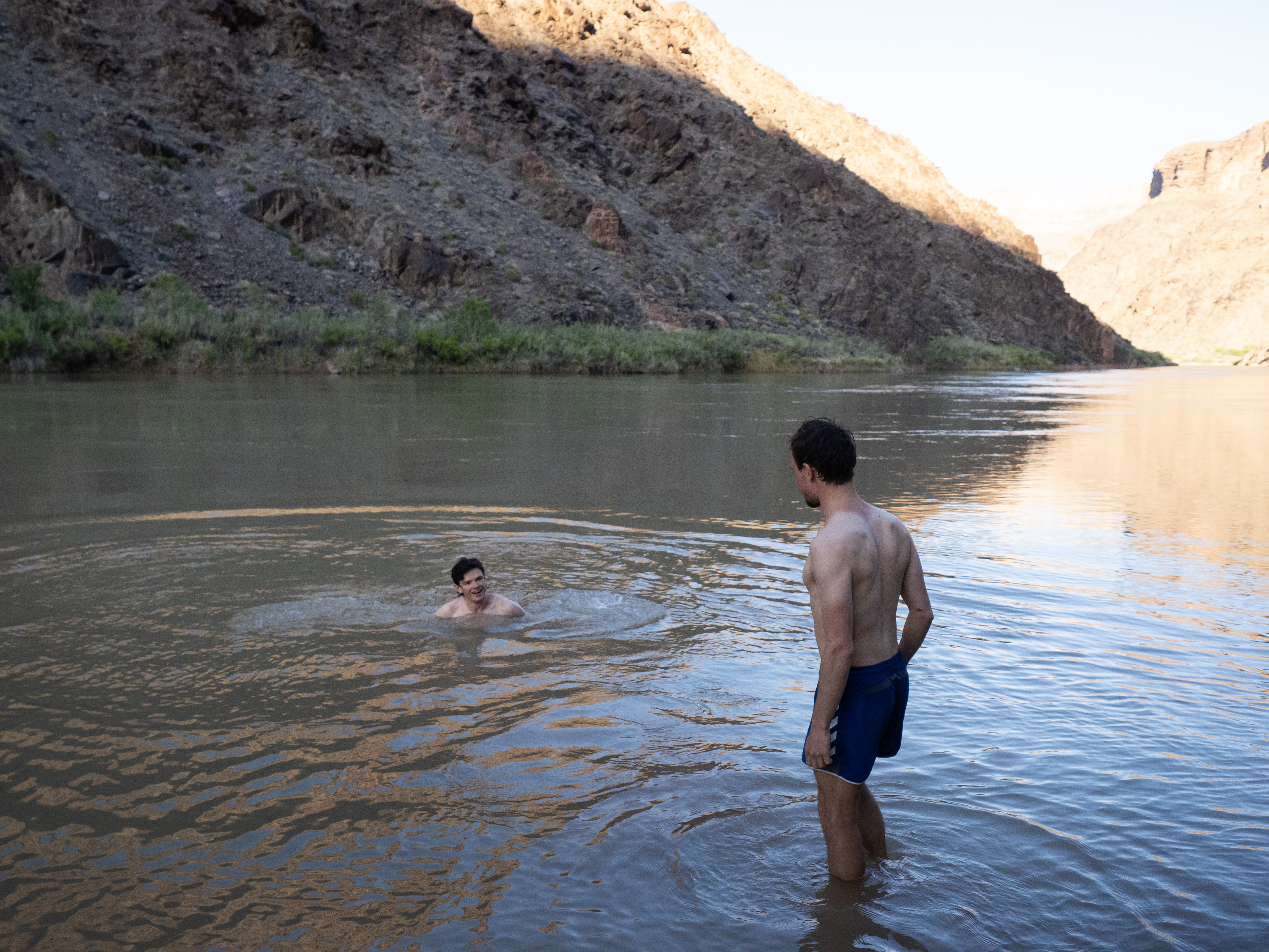
The boys take a dunk.
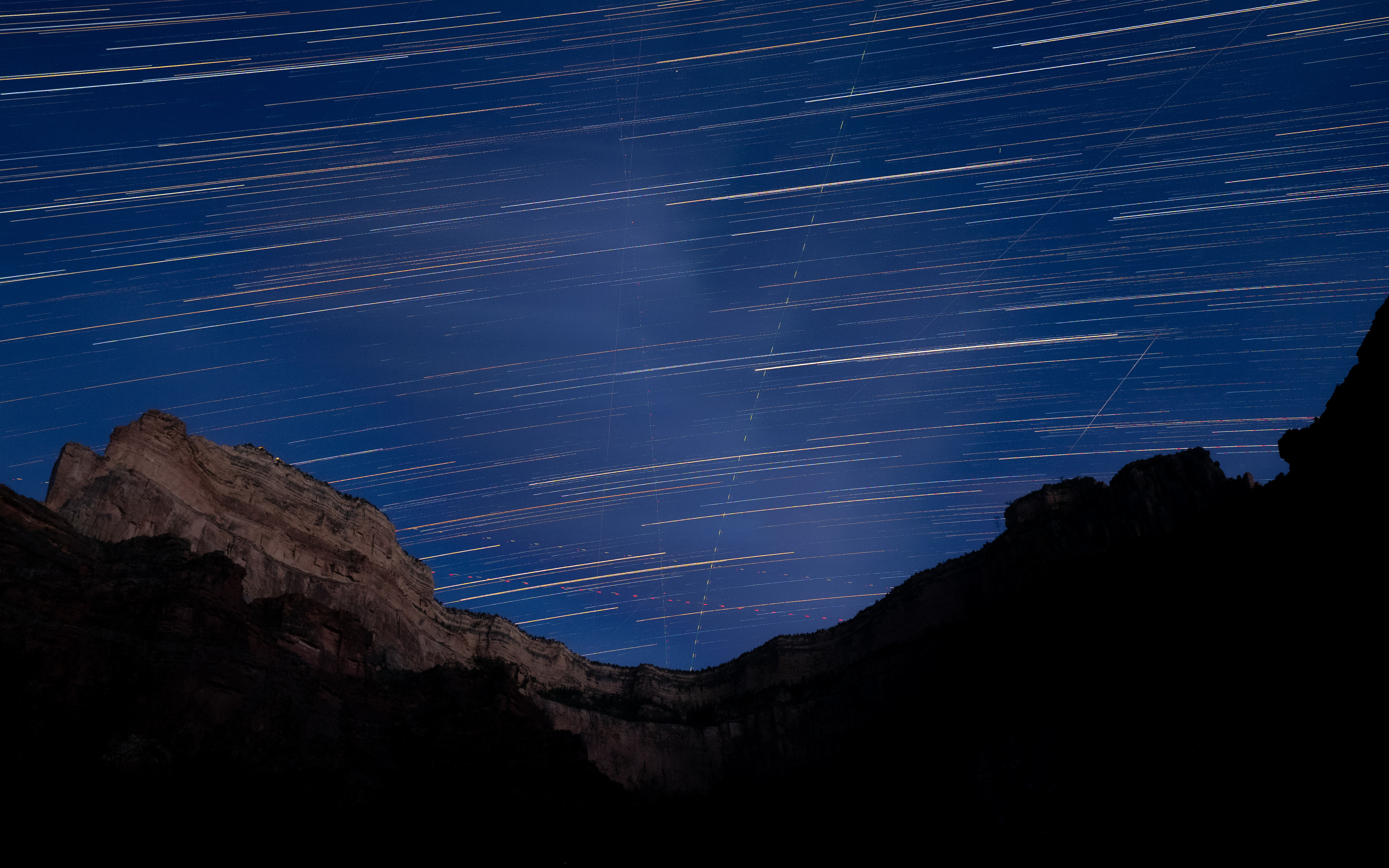
Knowing that we were facing a big day of hauling ourselves all the way from the very bottom of the canyon to the rim the following morning, we took the opportunity to gorge ourselves on our food reserves, shedding weight in the best way possible. I had carried a bag of hot chocolate powder and some powdered milk, which we consumed the entirety of as the sun went down and the air cooled. This was our last night with the clear, beautiful nightscape of the canyon, so I spent a good bit of time stargazing by the river before finally going to bed.
Before you ask – no, I’ll never get sick of star trails.
Day 5: Wednesday, April 23, 2025.
We got off to a 6:00 am start, which, in combination with the shade of the ravine and the humidity of Hermit Creek, made for a refreshing first hour or so of hiking. We followed the creek rather than the criss-crossing sandy trail for a while, but this proved to be too much for my feet; the uneven river rocks loaded my busted ankles laterally, against which the duct-tape armour-plating on my heels provided no protection. I took to following the proper trail, occasionally switching sides with the rest of the group as the trail crossed the creek.
Francesco joined me after a couple of minutes, although I couldn’t quite tell if it was because his feet were suffering as much as mine or if he just wanted to make sure I didn’t collapse and roll lifelessly downstream. Incidentally, this actually took us up a different path than the rest of the group – our trail ascended the ravine early, up a rocky side route that ended at a turnoff leading to the Hermit Creek campsite, where we’d had lunch the previous day.
Paul, Daniel, and Sujin followed the river the whole way and ended up back at the campsite, but they would eventually need to follow the trail back up to where we were since this was the way out of the Canyon. Francesco still needed water, so he took off his pack and jogged down the campsite to refill with the others. I had refilled my day’s supply this morning, which was a bit foolish since I had been hauling it up with me unnecessarily, but the silver lining was that I got to relax a bit at the turnoff, enjoying the final 10 or so minutes of shade before the sun rose above the mesa behind us. I devoted this time to a series of stretches in a partially successful attempt to limber up my calves.
The scenic, shady turnoff (and my impromptu yoga studio)
The rest of the gang soon came marching up the trail, as a park ranger simultaneously plodded down from the other direction. She knew all of our names, and was surprised to hear that we had been alone at the river the previous night. As she made her way down to the river, we were happy to see that, despite all of the turmoil with the National Park Service and on top of the massive crowds that they need to manage at the Rim, they can still send rangers into the canyon itself to keep an eye on things.
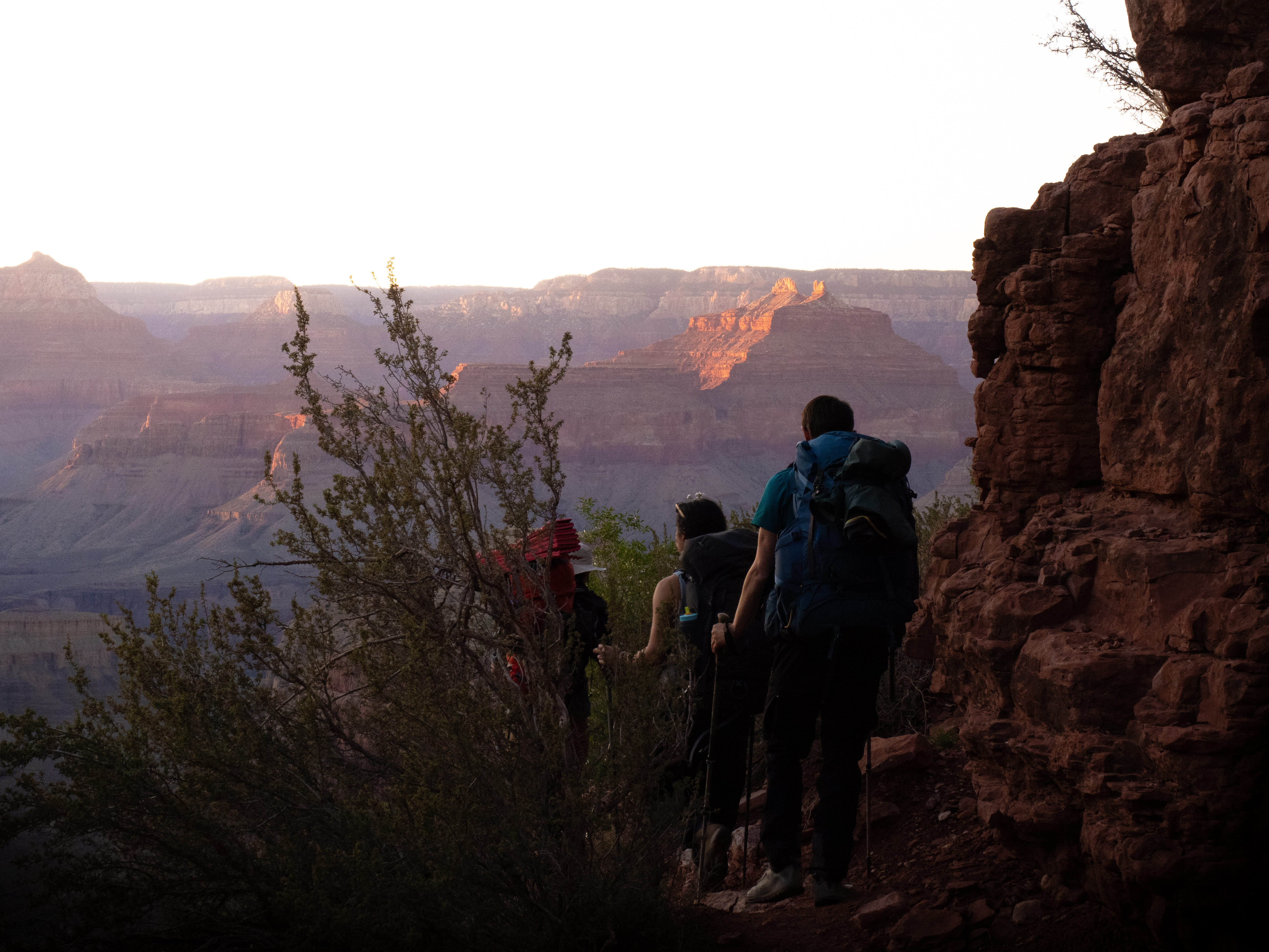
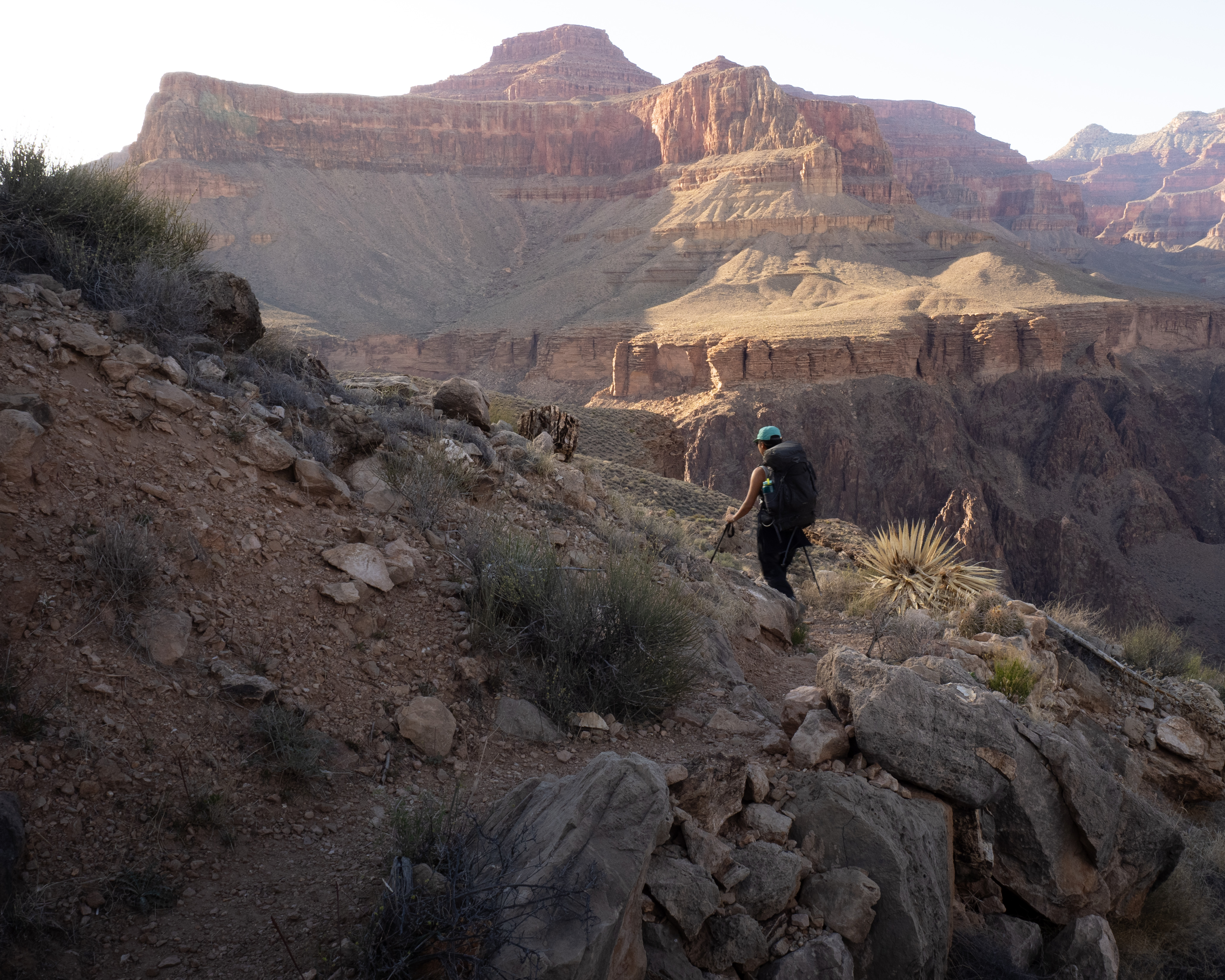
Now back on the Tonto Plateau, our day’s ascent would soon start in earnest. The first section involved a route known as the Cathedral Steps, which took us up the side of the nearest mesa. This began as a gradual climb, then became a series of increasingly narrow switchbacks before rising far above the Tonto plateau, snaking up a slender drainage, and ending at a narrow path that abutted the sheer east wall of this arm of the canyon. The climb was tough, but the scenery was incredible and we were mercifully shielded from the morning sun for the majority of it.
Looking out at the Cathedral Steps. The trail is too far away and narrow to be visible, but it took us up through the spires in the middle of the image.
At one point in a partially tree-covered ledge about three-quarters of the way up, we had a bit of a Disney moment: As we took in the view, a black-chinned hummingbird landed on a branch barely three feet in front of us, flashing its iridescent violet throat feathers and seeming to inspect us carefully before zipping away.
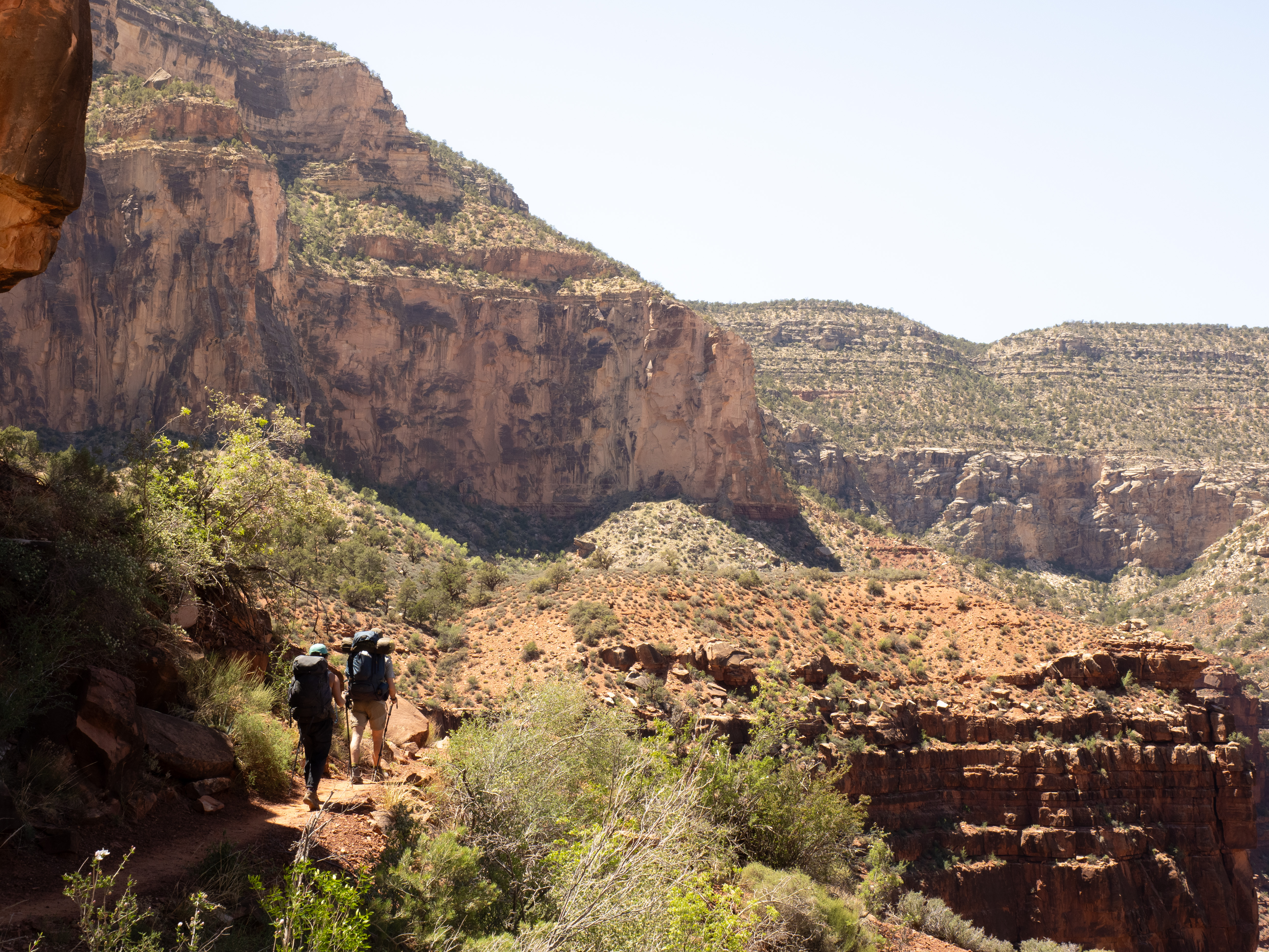
The next stretch effectively amounted to walking along the walls of a cliff for several hours. It was comparatively “flat,” rising only a few hundred meters over several kilometres, and proved to be a pretty interesting section of the trail.
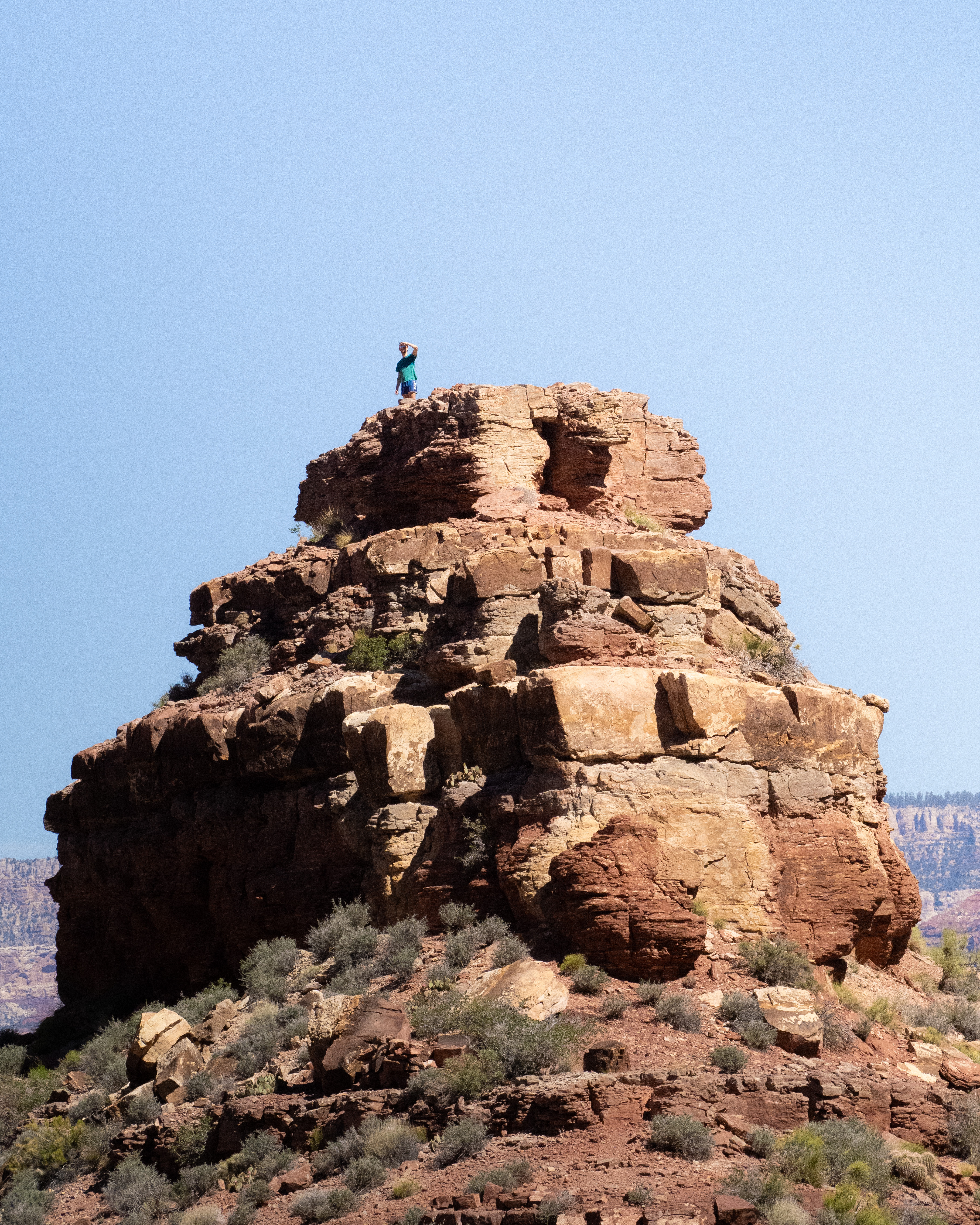
It was surprisingly verdant for such a dry place away from the canyon’s drainages, and the path alternated between shaded switchbacks and exposed, winding trails with a wall on one side and a sheer drop on the other. In one spot, a land bridge connected the trail to a spire jutting out into the canyon, which Paul couldn’t resist climbing while Sujin and I just watched from the trail, astonished at the guy’s energy.
Paul atop his spire.
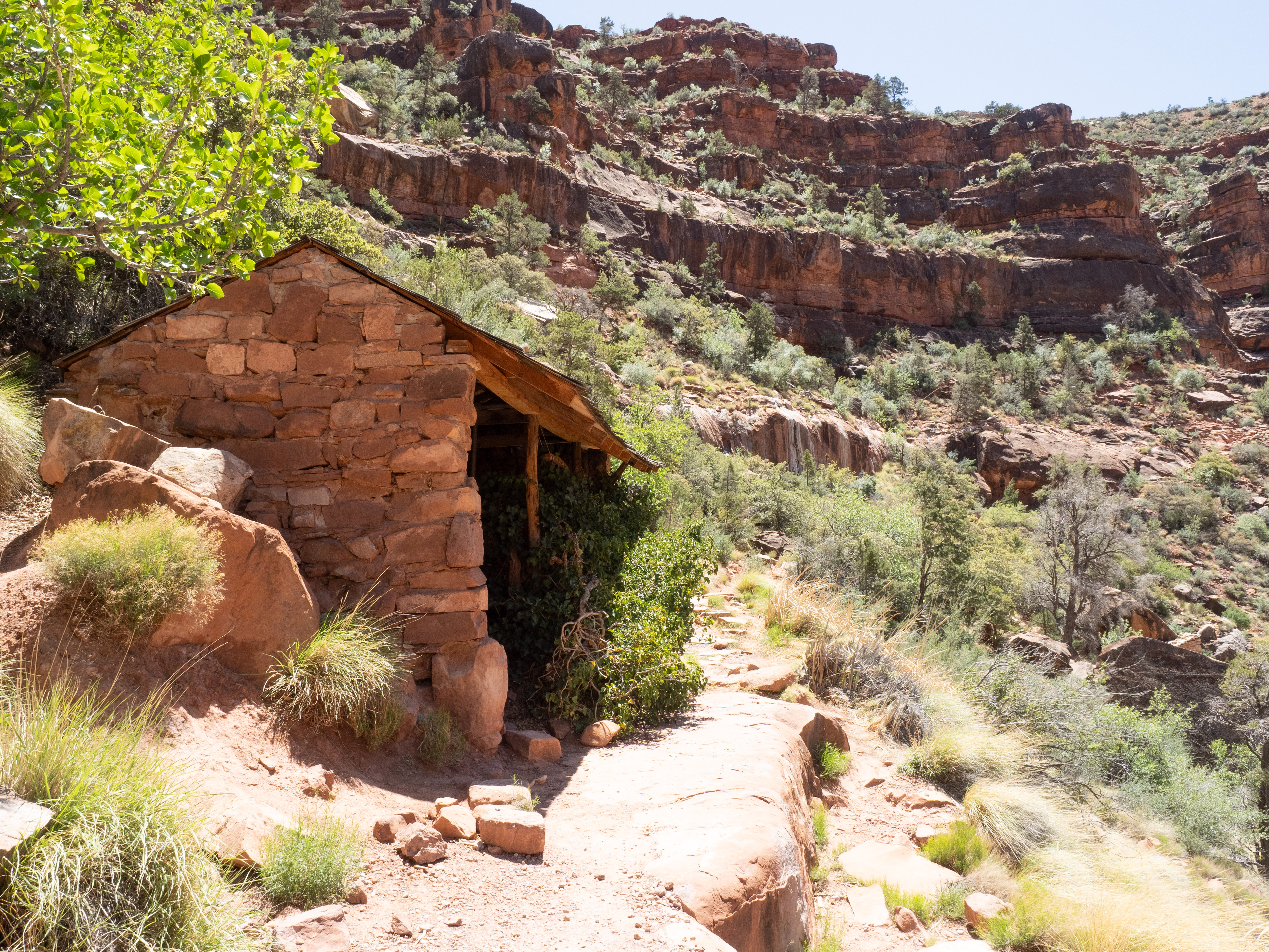
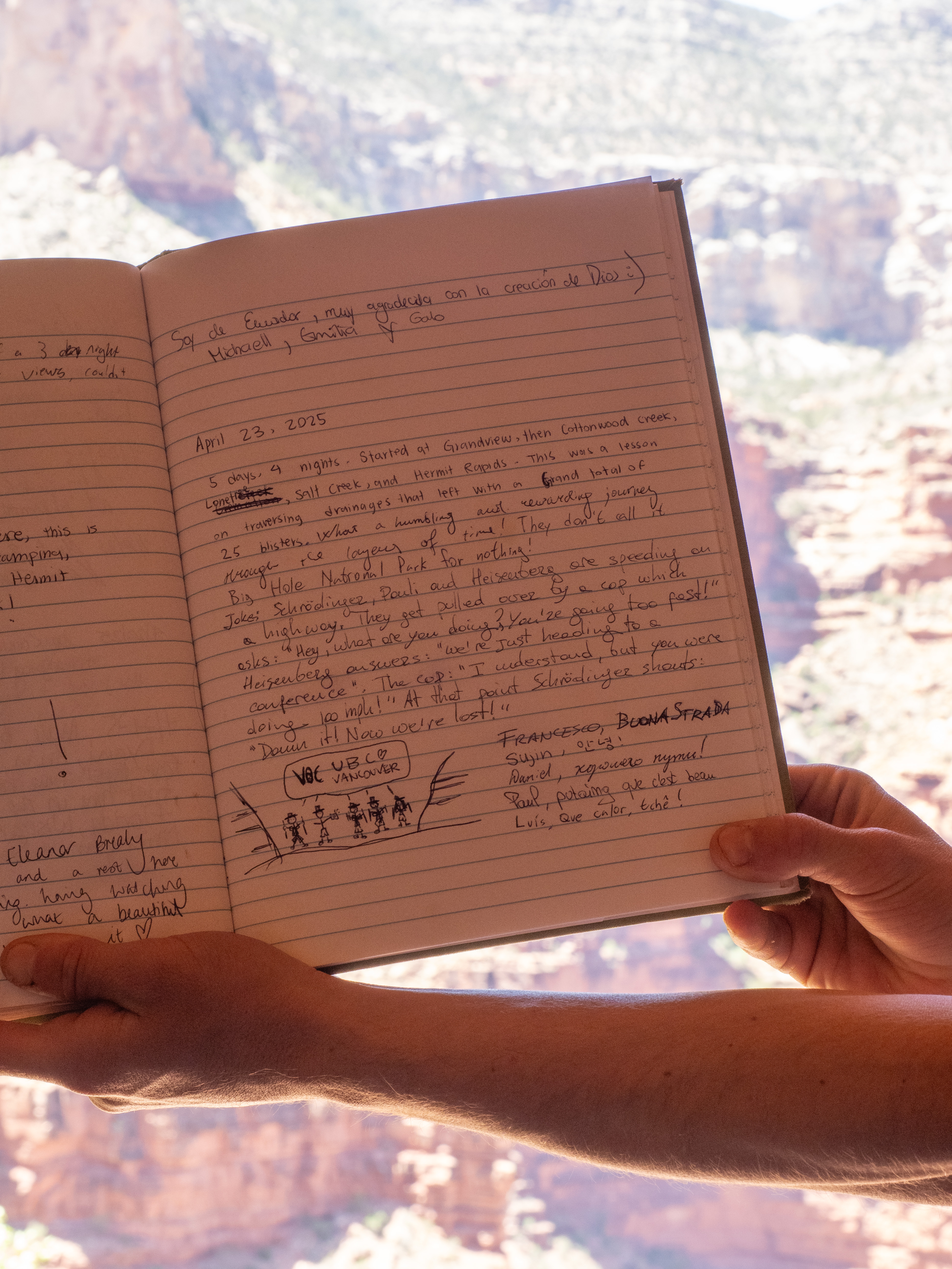
The nice thing about going up the canyon was that, despite the rising sun, the air was actually cooling down as we gained elevation. Still, the sun took its toll, and we savoured the shade when we had it. We eventually reached a small stone hut on the side of the trail called the Santa Maria Shelter, with a handful of benches where we rested our legs for a good while. There was also a tin with a logbook, which we spent some time filling out, complete with a pile of incomprehensible inside jokes, our names, and a VOC callout sketch drawn by Sujin.
Gathering ourselves, we strapped our packs back on and set out once again. We were well past halfway by now, but we knew the shelter was our last bit of shade for the day, and the next and final stretch would be fully exposed to the high sun.
farewell, last merciful patch of shade.
The loose, rocky terrain of the lower canyon turned into a rocky path made of arranged stone slabs, on which I slammed my hiking poles so hard that the tips eventually bent. While uphill was a bit easier on my heels than down, the last few days had taken their toll and I was basically dragging the bloody remnants of my feet up the mountain. I slowed down considerably over this last stretch, trying to keep my body heat regulated and manage my ankle pain.
We began to see quite a few other groups on the trail, mostly day hikers, which we took as a sign that we were getting close to the trailhead at last. In a show of support, the group waited up for me to catch up around the final kilometre, so that we’d cross the finish line together. Daniel even posted up behind me, ensuring that a) I wouldn’t be the last one to finish, and b) that he’d be able to roll my lifeless corpse along if I collapsed. I considered both of those options a kindness.
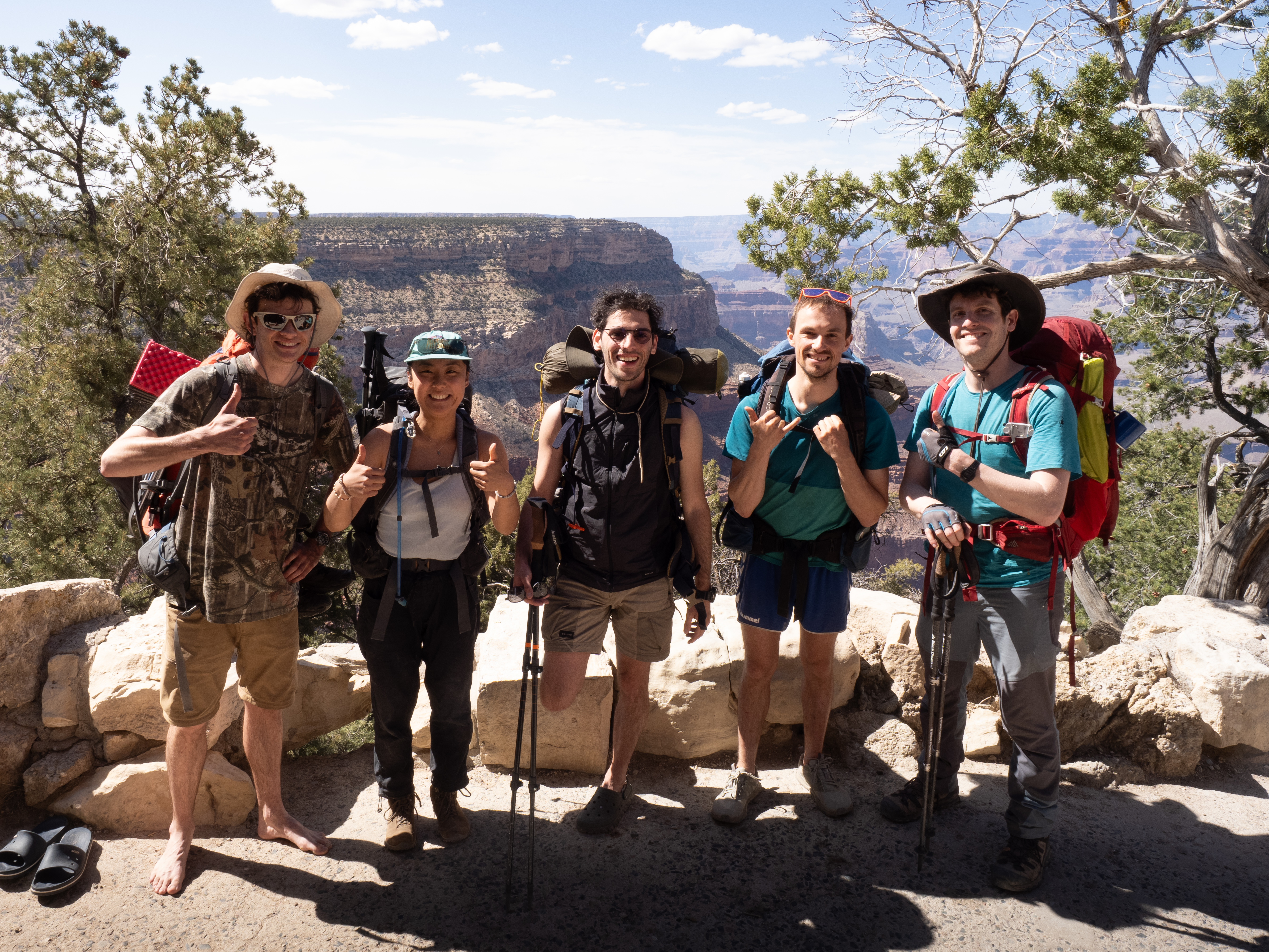
We finally emerged at the Hermit trailhead parking lot, smiling and scaring off tourists with our five-day stench. After a couple of victory laps and a group photo taken by a kind gentleman who I assume lacked a sense of smell, we took the shuttle back to the canyon village, victory in hand.
The drawing of stench lines and cartoon flies is left as an exercise to the reader.
The next couple of days were pretty relaxed, with only a minor hiccup here and there, such as Paul almost getting arrested while trying to hitchhike back to the rental car at our starting trailhead. But we spent the night at a campground in the village, made a victory feast of hot dogs over a fire, and had our first chilly night in several days, now that we were back in the shoulder-season weather of the rim.
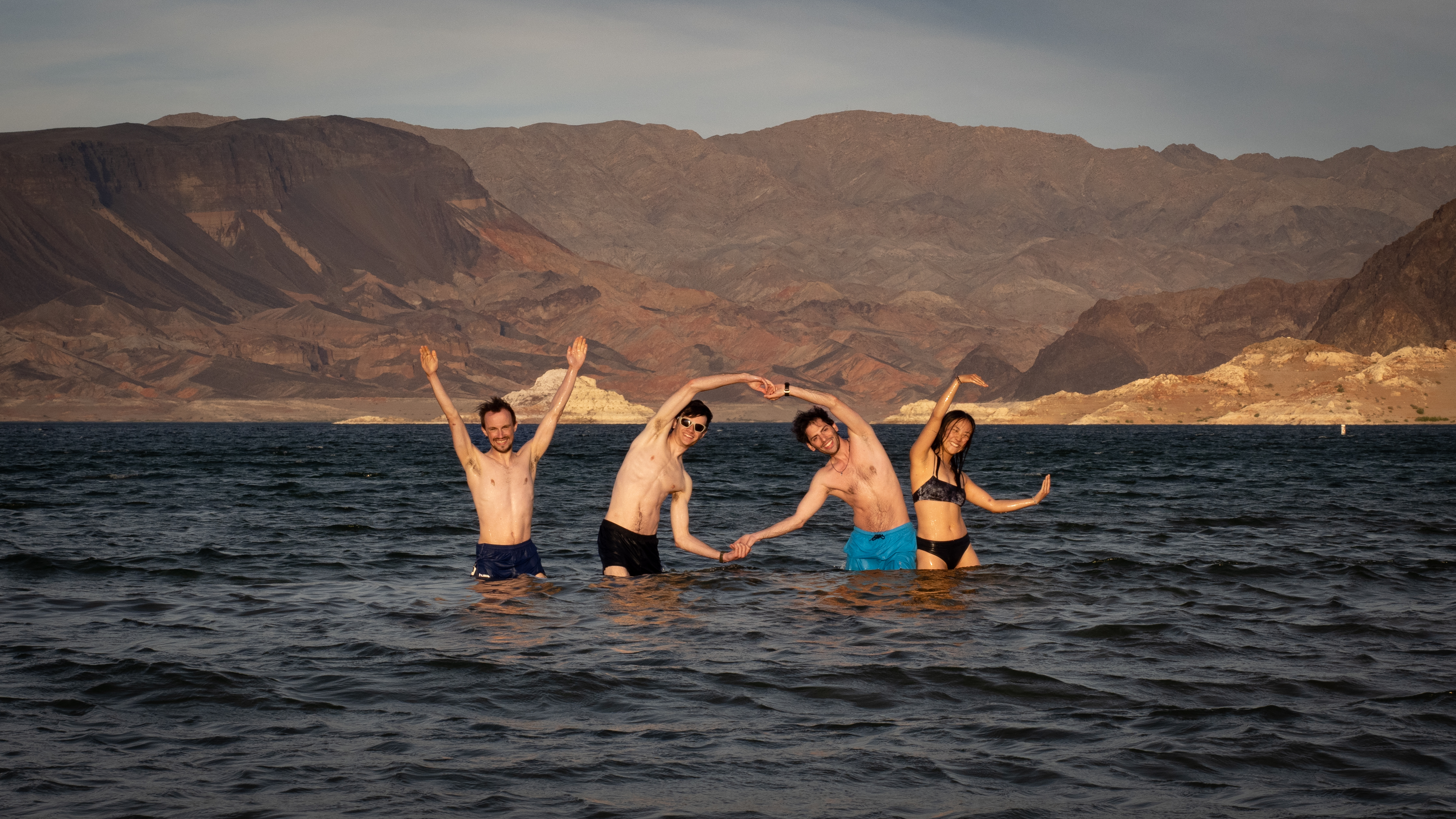
The next day took us down route 66 and to a campground just off the shores of Lake Mead. I had dished out the cash for a shower back at Grand Canyon Village, but everyone else had their victory bath in the waters of Lake Mead:
This trip showed me that, even if you think you have a decent amount of thru-hiking experience, there’s always more to learn (or re-learn… how easy it is to forget that every gram counts). The canyon kicked my butt in a way that I didn’t expect, and I won’t be neglecting the training hikes next time I do a thru-hike this early in the season – you need to get your heels calloused up before subjecting them to 80 kilometres of scraggly rocks. I was extremely lucky to have been part of such a meticulous, supportive, and attentive group, without whom I likely would have needed to bail early.
Overall, it was a fantastic trip, with an excellent crew, incredible scenery, and world-class backpacking. If you ever get the chance to visit, dear reader, I urge you to do so – even from just the rim, neither words nor pictures can do the canyon justice.
They don’t call it Big Hole National Park for nothin’.
Very nicely written and beautiful pictures!! Thanks for writing this, it’s fun to read a trip report about a trip outside of our typical VOC radius. Definitely makes me want to return to the Grand Canyon, albeit in a few years : )