The Kaskawulsh Glacier from our camp in the morning light.
The Ä’äy Chù West is the most popular overnight trip in Kluane National Park and Reserve – and for good reason. The trail travels 22 kilometres up the Ä’äy Chù Valley from the Alaska Highway to the Canada Creek campground at the foot of Observation Mountain (Ä’äy). On the second day of the typical three-day itinerary, most hikers will cross Canada Creek and summit Observation Mountain to view the converging arms of the massive Kaskawulsh Glacier, and then return to camp the same evening.
For the last three summers, I have worked in Kluane, but somehow never managed to make it up to the summit. This year, in my fourth summer, I decided that I had to make it happen, one way or another. The one problem is that I only get two-day weekends. After watching the satellite imagery for a few weeks, my coworker Lionel and I decided to give it a shot on the June 2-3 “weekend,” when the snow had mostly melted off the 2,100-metre-high summit. To get the most “value” out of the trip, we planned to hike down to the glacier to explore for a bit, then continue down through a deep canyon back to Canada Creek – completing somewhat of a loop around Observation Mountain.
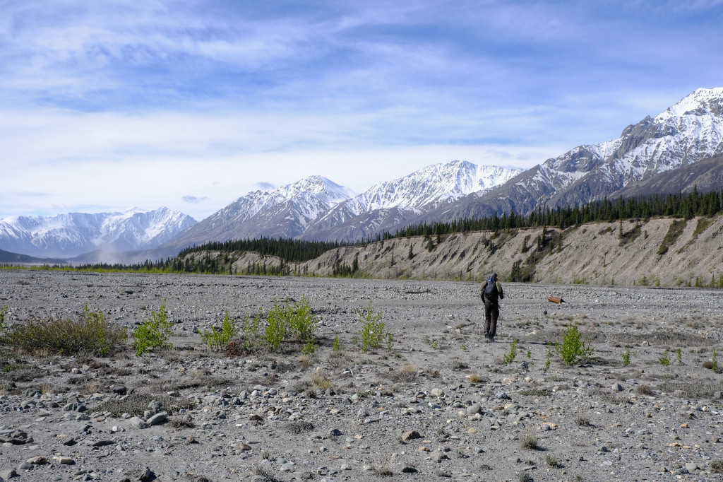
After a 45-minute drive from Haines Junction, we started hiking at around 10:00 a.m. The trail starts off pretty cruisy on what was, at one point, the original Alaska Highway built in 1942. After a few kilometres, the trail crosses Sheep Creek – a straightforward creek crossing even at the worst of times. It then winds over a small stretch of boardwalk across the Coin Creek marsh. The kilometres quickly ticked by as we crossed the then-very-low Bullion Creek and continued down the valley, staring up at summits rising 1,500 metres directly above us and contemplating possible ascent routes. Though there aren’t really any records to go off of, I wouldn’t be surprised if some of them were unclimbed despite the relative ease of access.
Crossing the Bullion Creek alluvial fan at low water levels.
We stuck to the trail climbing up over the little knoll just before Canada Creek and were treated to an incredible view of the imposing north face of Mount Maxwell looming over the toe of the Kaskawulsh Glacier. We hit the campground about four hours into our hike and continued across Canada Creek’s massive alluvial fan. Crossing Canada Creek was fairly trivial – I was able to do it barefoot, a technique that’s generally frowned upon here in the Yukon since the silty creeks often have boulders tumbling through fast-flowing water. Canada Creek has been known to sweep people off their feet and has been the site of many near-drownings and rescues over the years.
Descending the knoll to Canada Creek looking up towards with Observation Mountain (right) and Mount Maxwell (centre).
Once across Canada Creek, we followed it up the valley, watching the walls constrict and get ever taller. At the confluence with Columbia Creek, we veered left and followed it until we reached the start of the climb up to the plateau. At one point, the route used to be fairly obvious, but the lower section had washed out, rendering it difficult to follow. Last August, Lionel made this exact mistake, so we were more careful this time. After already hiking 28 kilometres, the 1,100 metres of elevation gain over 3.5 kilometres to the summit certainly hurt.
Making our way up Canada Creek towards the confluence with Columbia Creek (left).
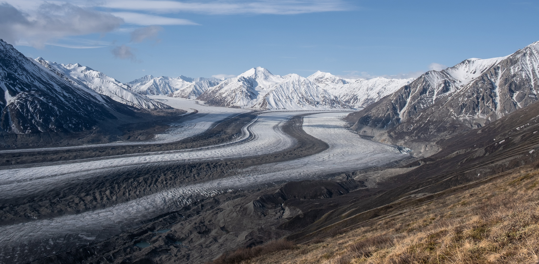
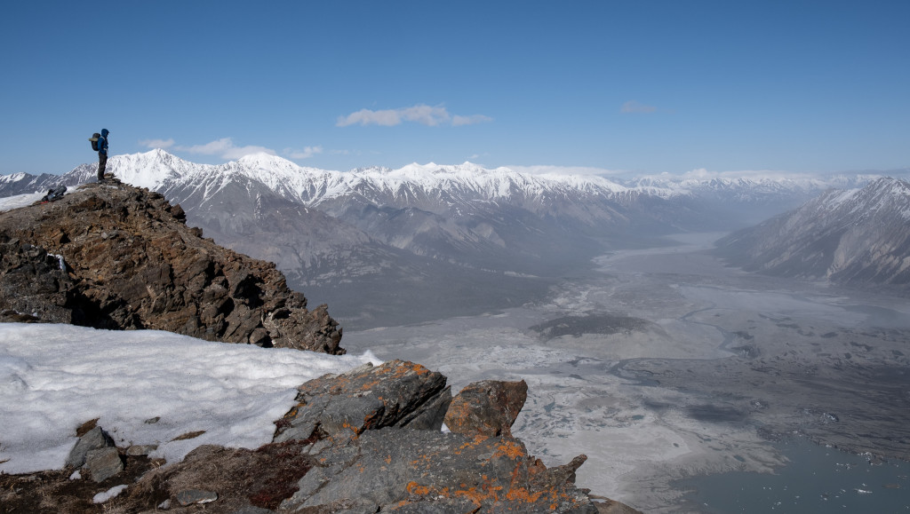
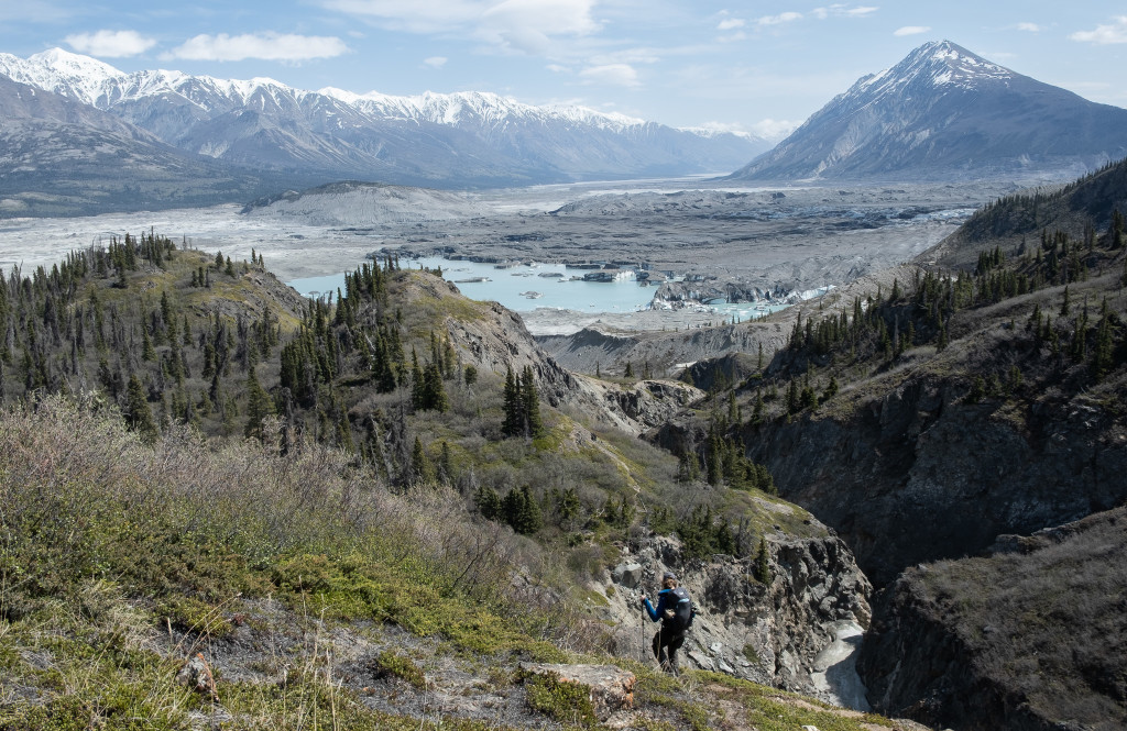
The satellite imagery turned out to be correct (why wouldn’t it?), and we only had a few small isothermal snow patches to cross before gaining the southern aspect of the ridge. We started to see the Kaskawulsh Glacier across the plateau — more than 5 kilometres wide and over 1,000 metres below us. We summitted in perfect weather at about 6:00 p.m. and spent a good 45 minutes soaking in the view.
To the south, dozens of summits rose at least 1,500 metres above the glacier’s surface, each with their own glaciers, which — while looking small in this immense landscape — would be massive elsewhere, cascading down from peak to valley bottom. The depth and scale of these valleys reminded us of the incredible power of glaciers in shaping the landscape, and that what we see today is just a vestige of what covered much of Canada 15,000 years ago. Across four or five mountain ranges, the triple peak of Mounts Hubbard, Alverstone, and Kennedy could be seen, reminding us once again that giants lurk beyond these relatively small front-range mountains.
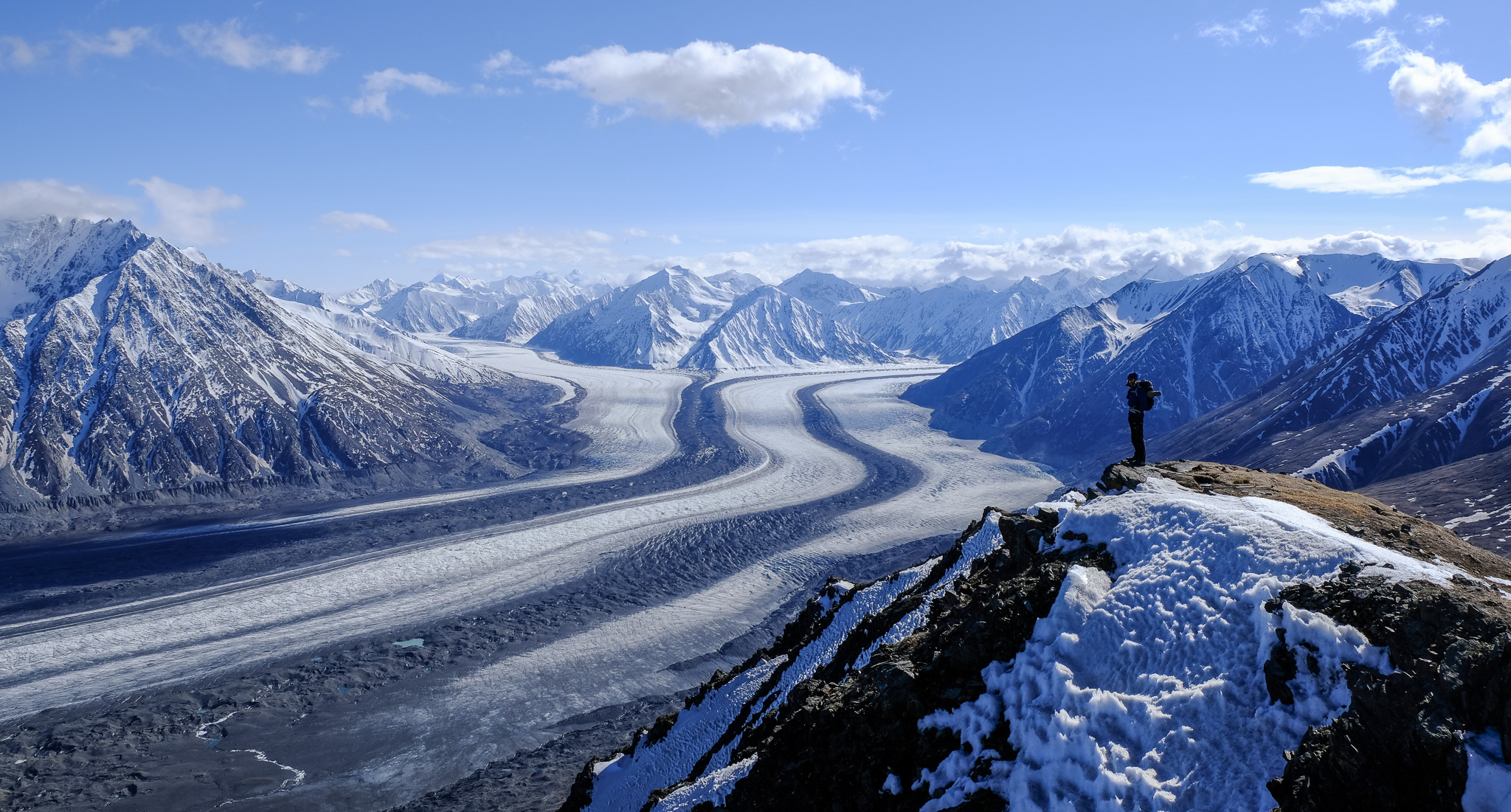
The south and main arms of the Kaskawulsh Glacier converging from the summit.
To the east, we could see the Kaskawulsh River flowing out of the glacier towards the Alsek River — defying all odds in forging a route straight through the mountains into the Gulf of Alaska.
The Kaskawulsh River extending east towards the Alsek river behind the Kluane front ranges.
To the north, the Ä’äy Chù crosses the Alaska Highway and drains into Kluane Lake, the largest lake within the Yukon and whose salmon-bearing rivers flow out to the Yukon River and into the Bering Strait.
Finally, we dropped off the summit to the southwest onto the plateau and wandered around, trying to find a somewhat flat – and ideally fairly dry – spot to camp.
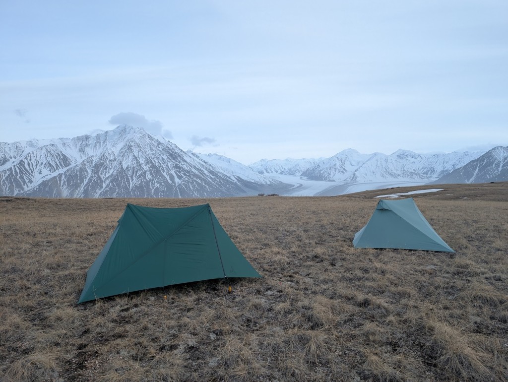
A couple of X-Mids on the plateau. (Note Lionel’s plastic yellow Walmart tent pegs.)
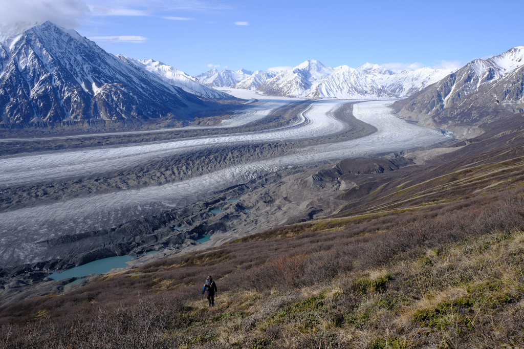
In the morning, we got up slowly and packed up to make our way down onto the glacier. We picked a steep ridge and descended 600 metres into the valley. Climbing over the horrendously loose lateral moraine, we looked for a spot to climb onto the glacier. We found a decent spot near a few small glacial lakes and scrambled up the mud-covered ice. Once on the surface, we walked out across the endless expanse of ice, marvelling at the many supraglacial streams, moulins, and impressively large medial moraines. Starting to run out of time — and conscious of the still 30-kilometre hike back to the trailhead — we turned around after 2 kilometres (and only 40% of its width) and looked for another way off the ice.
Descending the ridge to the glacier.
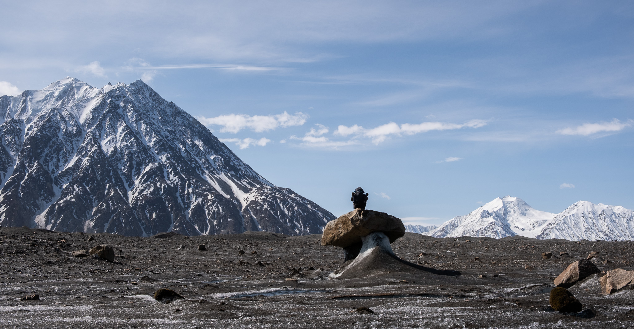
Chilling on a glacial table.
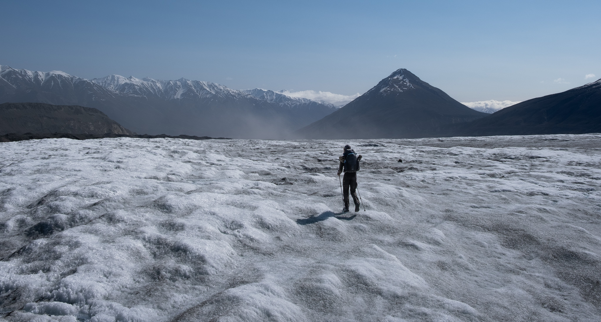
Crossing the never ending ice.
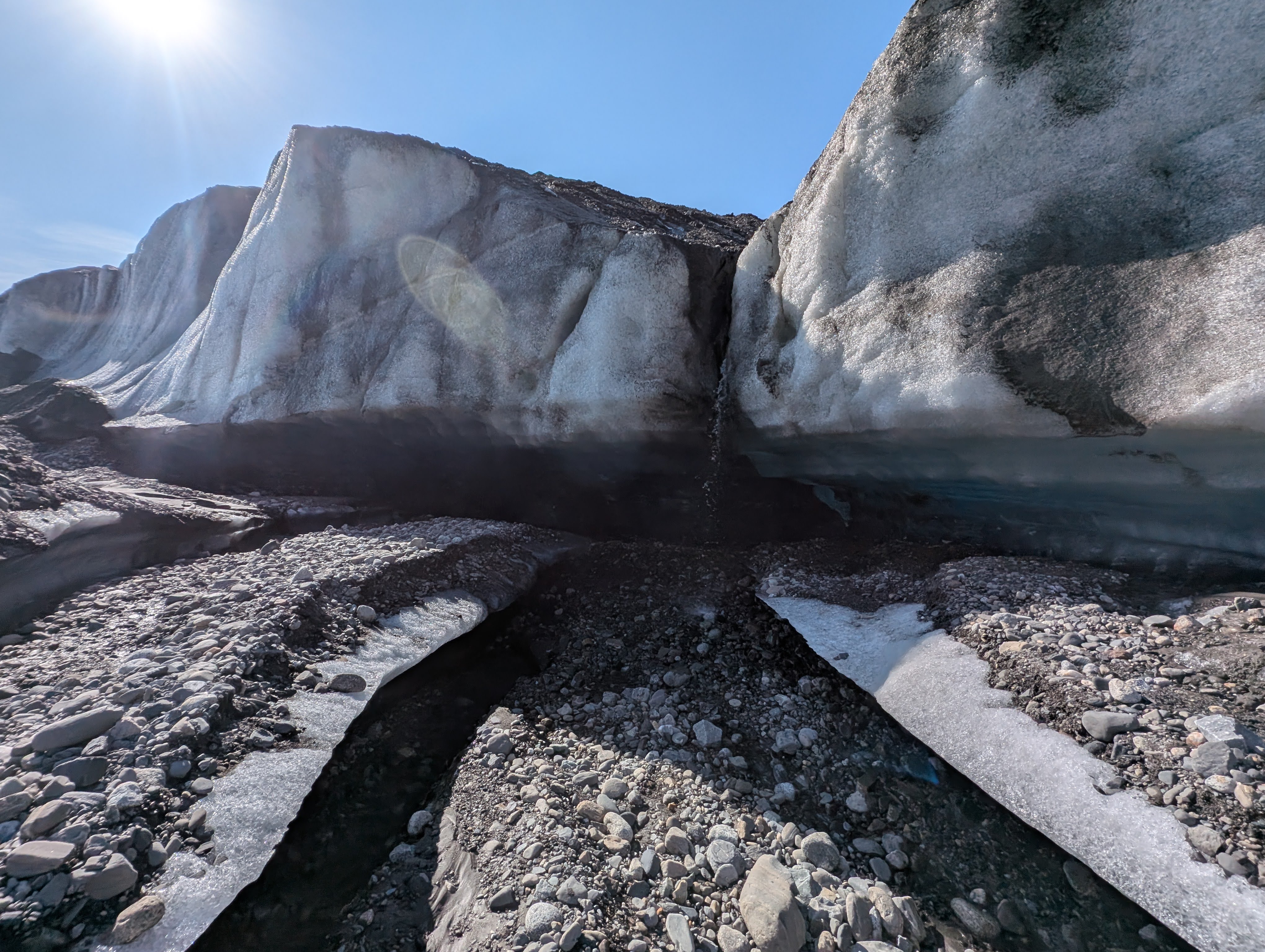
A small waterfall near where we climbed up onto the ice.
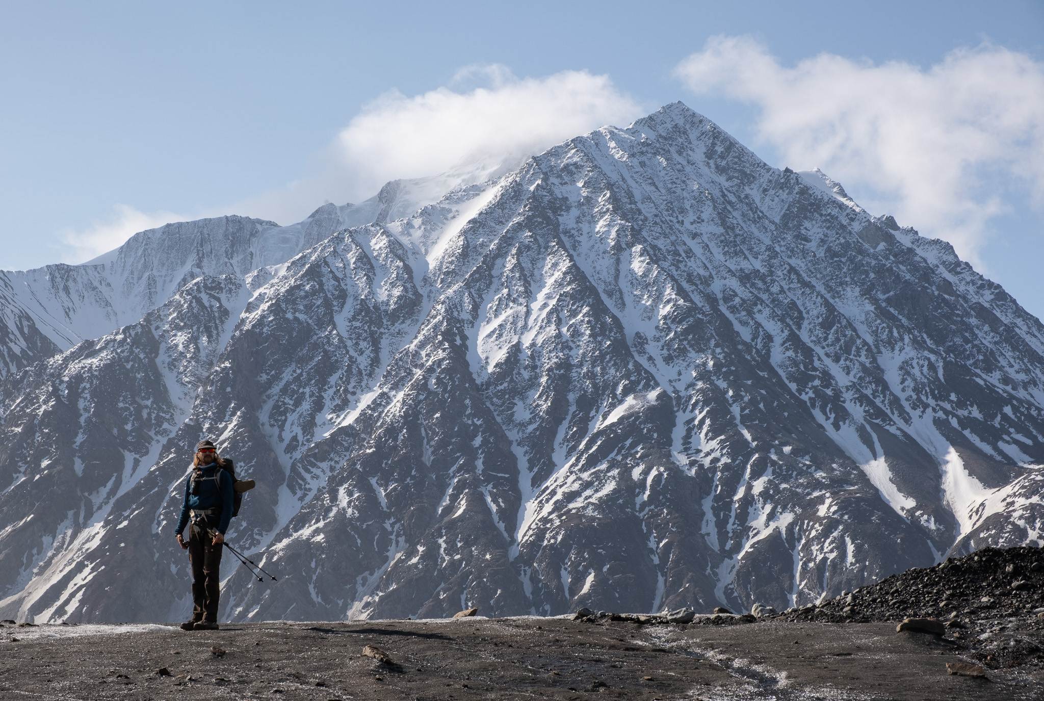
Lionel below the north face of Mount Maxwell rising 2000 metres above the glacier.
Once off, we climbed back up the moraine towards the head of the canyon more than 100 metres above the glacier. It was interesting to think that the glacier used to come up this high – and that a meltwater stream likely carved the deep canyon. After some sketchy downclimbing through the canyon, we decided to bail out of it and luckily found a really nice goat/sheep/bear trail just above, which we followed down to the old lakeshore at the toe of the Kaskawulsh Glacier.
Descending the sheep/goat/bear trail above the canyon.
Walking along the muddy valley floor, we realized that we were standing on the pre-2016 lakebed. In May 2016, the ice dam at the toe of the Kaskawulsh Glacier ruptured, and the Kaskawulsh River captured most of the flow of the Ä’äy Chù – effectively drying out the Ä’äy Chù Valley and dropping the water level of Kluane Lake by almost four metres over the course of a few days. Since then, the valley has become plagued by Mad Max- or Dune-like dust storms.
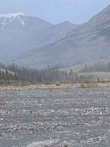
Bear! As soon as it smelled us, it booked it running in the other direction. No problem bears around here, just lots of grizzlies.
Anyway, at this point, we were looking at a 25-kilometre slog back to the trailhead. And a slog it was. On the way back, we decided to walk back through the dry river flats and were hit with a dust storm of biblical scale. I won’t go too deep into the details – the slog was mind-numbing, and the wind that battered us was relentless.
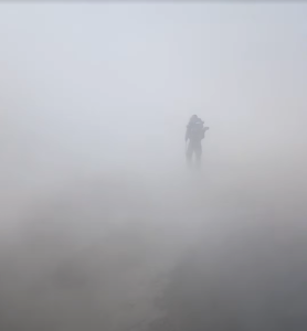
Just a taste (literally) of the dust on the five-hour hike out.
I see why this trip is as popular as it is. Despite its popularity, over the two days, we didn’t run into a single other person. Yeah, it was early June and mid-week, but this has been my experience hiking and paddling here in Kluane over three and a half summers now. It truly is some of the best hiking and backpacking in Canada (if not the entire world), and I feel like I’ve barely scratched the surface. The hiking is hard; trails are few or nonexistent, bridges certainly don’t exist, the valleys are huge, the rivers are equally big, the passes are steep, and the glaciers are the largest outside of Antarctica and Greenland. Oh – and it also happens to be home to nearly all of the tallest mountains in Canada.
Come visit! It’s worth it.
Looking down the Ä’äy Chù Valley from the slopes of Thechàl Dhâl’ above the Alaska Highway. Observation Mountain can barely be seen at the very end of the valley.
I would like to thank the Champagne and Aishihik, Kluane, and White River First Nations for the use of their traditional lands.