My dad and I went on the French-Haig-Robertson traverse in Kananaskis Country. The trip was 20 km long and 1000 metres in elevation in the guide book, but we actually did about 24 km and climbed about 1500 metres. It goes on the French Glacier, then the Haig and then the Robertson Glacier. The route goes through Alberta, then BC and then Alberta again.

It was a long drive so we started at 3:00 PM. The snow was fine at first but then it got worse. When the snow was deeper we saw some grizzly tracks. We had to go high on the left, next to Mount Murray, with lots of up and down, because it was melted out next to French Creek.


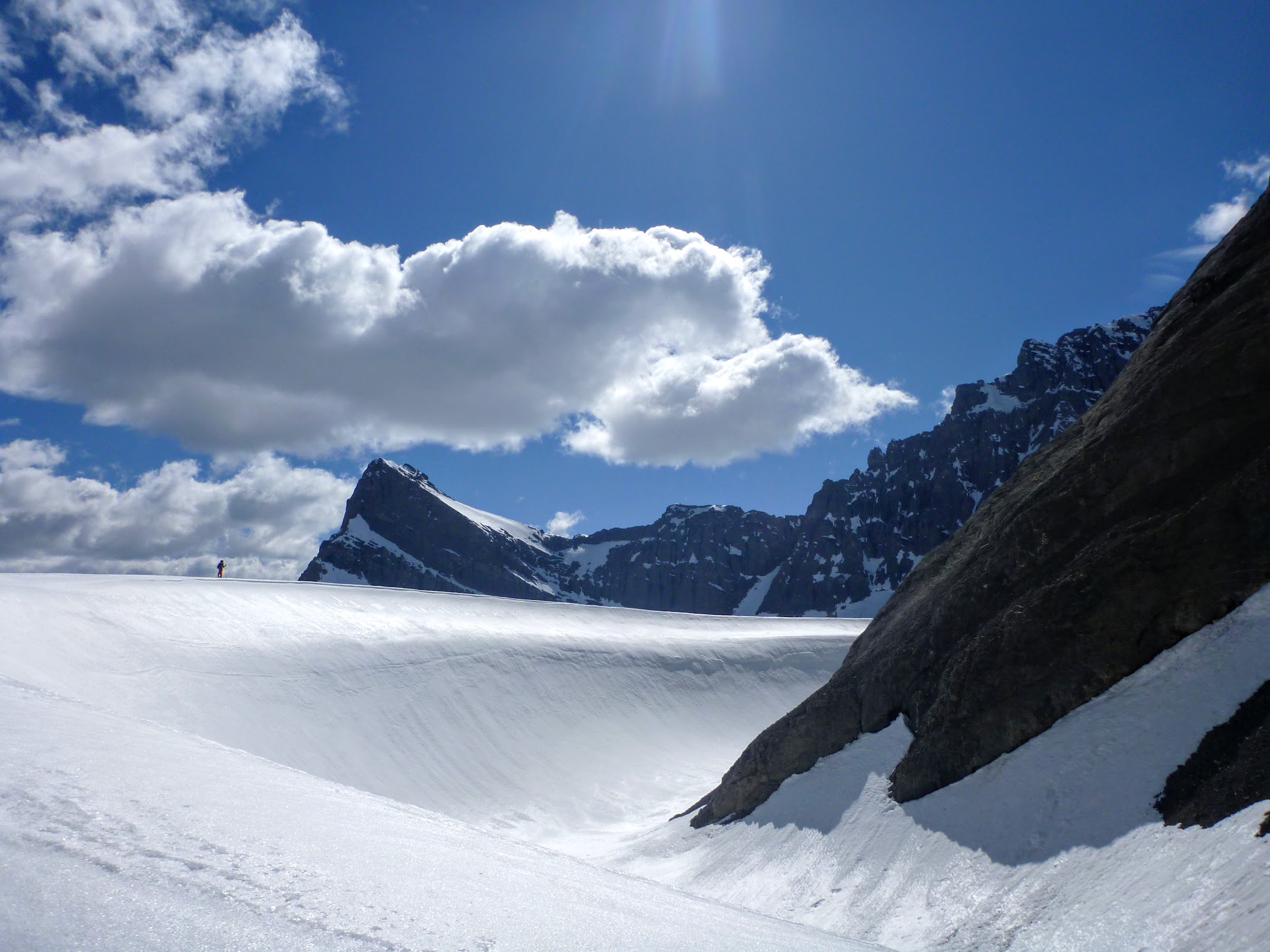
When dusk approached, we could see a tiny sliver of moonlight. We were next to the main summit of Mount Murray when it got dark. We could see that we were higher than the col between Piggy Plus and Mount Robertson and my dad got mixed up and thought that path to the col was French Glacier.

The next morning, we went up the slope next to Piggy Plus and Mount Robertson because my dad still thought that was French Glacier. When we got up to the top we were looking down a cliff and looked at the topo and realized that we were in the col between Piggy Plus and Mount Robertson. We skied down and went up the real French Glacier to get on the Haig Glacier.


On the Haig Glacier we crossed the border into BC easily but when we had to cross to the Robertson Glacier back into Alberta we had to go over the worst scree slope my dad or I have ever done. There was some snow, but it was too steep to skin and too mushy to boot pack. The scree slope at the bottom was steeper than the angle of repose, and there was nothing stable to grab on to. Every time we rolled a rock down it would go all the way down to the bottom. The scree slope was so tough that my dad had to leave the skis and empty the pack, go back and plunge steps in the snow to get the skis. When he went up, it wasn’t that bad because he used the plunged steps as stairs and went up much quicker than the scree slope.

We had fun skiing down the Robertson Glacier but there were parts where the avalanche debris crossed the valley from both sides.

When we got past the creeks that go into Burstall Lake, there was no snow on the marsh, so we had to ski on grass through the marsh. Because I wasn’t used to marsh birds, they sounded very strange. On most of the creeks, we could cross them without getting our boots soaked, but there was one creek where it was too deep, so my dad had to carry our stuff across barefoot.

We put headlamps on in the marsh, but it wasn’t too long until we found the trail because we could see on the topo that the trail was right next to the lake. When we arrived at the lake, we knew that the trail wasn’t far, so we went into the forest and found the trail. When we got back to the car, our legs were very sore. It was about midnight when we arrived at the car.

Piggy Plus is a cool name.
Awesome adventures Devlin!