Friday, July 27; Day 0:
My initial plan for the weekend was to do some mountaineering in the Chehalis range with Skyler. However, when I received word that Skyler was exhausted from an epic descent off of Mt Slesse, I realised that our trip was not likely to happen. I contacted Artem at 20:00 on Friday night to discuss possible trip options.
We narrowed the list down to: Rainier, Tantalus and Chehalis. Artem was in favour of Tantalus. A recent TR of an ACC ascent of the North Ridge of Mt Tantalus suggested that current snow levels were perfect for the trip. We were solidifying our plan when Artem’s phone died, cutting our conversation short.
At 23:00 I finally managed to get in contact with Artem again. I was dubious as to whether we had enough time left in the evening to plan the trip, but he convinced me it was still feasible. He told me to plan the food; he would plan the route. By the time I had scrounged together enough food, packed my bag and disassembled my bicycle to fit it in the car, it was about 0:30. Despite being very tired, I hardly got any sleep. I was too excited.
Saturday, July 28; Day 1:
I picked up Artem at 4:30. We did a quick check to make sure we hadn’t forgotten anything. At the start of the drive, Artem and I began discussing our trip histories. We came to the conclusion that Artem has a propensity for epics, while I have a history of epic avoidance. This trip would therefore be the testing ground. What happens when an unstoppable force meets an immovable object?
After about an hour of driving, it became apparent that our quick check wasn’t sufficient. Artem had forgotten first his compass, and then the belay device. “Whatever, belay devices are too heavy anyway!” This didn’t worry us enough to consider turning around. Artem would belay/rappel off a munter hitch, and I could use my iPhone as a compass if necessary. Points were racking up for the unstoppable force.
On the road to Squamish we discussed the route we would take. The Nicks’ Tantalus traverse of August 2011 (see VOCJ 54) was our primary source of beta. They went from north to south, starting at Sigurd creek and ending at Lake Lovely Water. Artem suggested we should go in the opposite direction. This would allow us to more easily bail from the traverse if the weather deteriorated. Also, the ACC report he read suggested that the descent of the north ridge of Tantalus would be cruisey, since snow levels were still quite high.
After a quick stop by McDonald’s for Wi-Fi to confirm the weather forecast was good, we headed for the Squamish Valley Road. We stashed my bicycle at the Sigurd Creek trailhead, and then drove 16km back towards the Squamish River cable car crossing. We parked the car then faffed a bit selecting the food and cams we wanted to bring. Artem asked me if we should bring Alpine select. I consented, so he shoved it in my pack. Faffing complete, we began to walk towards Marty the Squatter’s territory at 7:30. Marty was nowhere to be seen, and we made it to the cable car without incident. Well… almost without incident. 2km from the car Artem notified me that we had forgotten the map in the car. This caused us some pause, but did not warrant turning around. The unstoppable force struck again.
The cable car was unlocked, which made crossing the river pleasant. Being conscientious trail users, we returned the car to the other side. Artem had already lost his Tyrolean cherry, so I was volunteered to return the car and then shimmy across the river along the cables. It was about 8:30am by the time we completed the river crossing.
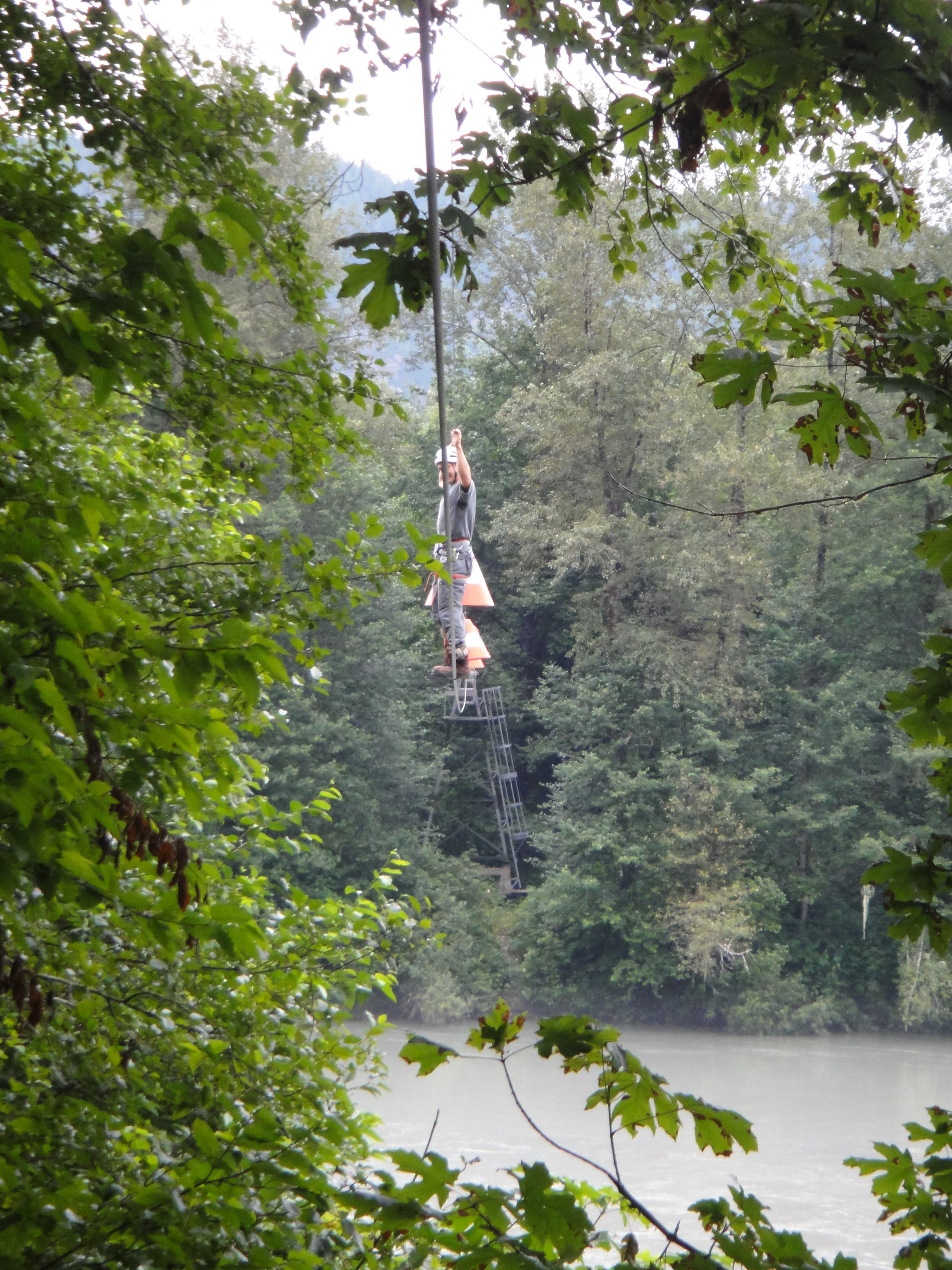
Olek's inaugural high-wire crossing of the Squamish River
Next was the Lake Lovely Water slog: a no-nonsense ~7km and 1100m elevation gain. Artem in full slog mode was hard to keep up with, but I managed. At one point I noticed him straying right of the marked trail, up a rocky creek bed. I promptly redirected him. In retrospect, this fork could have led to the infamous boulder field detour that plagues many a Lake Lovely Water trail user. We made good slogging time, reaching the lake at 11:00.
At the lake, my first observation was that the lake was indeed lovely. My second observation was that the mountains of the Tantalus range were completely enshrouded in fog. So much for the sun that mountain-forecast promised us! Artem took a dip in the lake. I spoon-fed myself peanut butter.

Perfect visibility of Artem's rear end, but not the minor Tantalus peaks
Artem and I soon continued up the trail to the Russian army camp, which we reached by 12:00. Luckily for us, by this time the clouds had mostly cleared. From here, we climbed up towards Serratus. We discussed our two options for climbing Serratus: 1) being wimps and heading to the ACC hut, dropping our packs, then heading up the PD West Face Couloir route, 2) being badass and keeping our packs on, true alpine traverse style, and heading up the aesthetically superior AD East Ridge.
We both agreed without reservation that we had to go for option 2.
Climbing the East Ridge route was spectacular. Each bump on the ridge reminded me of the scene in the Lord of the Rings movie which depicts the lighting of the beacons of Gondor. The major drawbacks of the route were that it was super exposed, and the rock was loose. Being on “you fall you die” terrain for that length of time is quite tiring. We managed to down-climb one section of the route with evident rap tat. It took us one rappel to traverse the ridge.
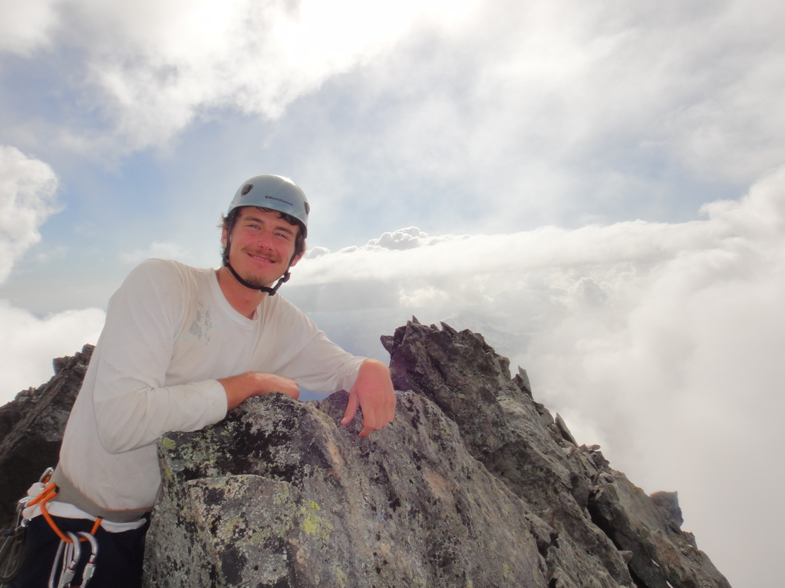
By the time we reached the summit, it was 20:00. The lighting was perfect for snapping pictures. Artem was super excited about the fact that in pictures taken towards the east, he had summited every peak in the background. While we were celebrating our summit, we noticed the ACC hut near the red tit col. We couldn’t see any people around it, so we figured no one was staying there. After all, any ACCer in their right mind would be using his $4000 DSLR camera to capture the beautiful panoramas visible from the hut.
Tantalus and Dione from the summit of Serratus
After 30 minutes on the summit, we had to choose our descent route. The steep west face couloir route led directly towards the hut. The less steep descent gulley would put us much further away from the hut. With the sun rapidly setting, we decided on the descent gulley as it seemed safer. It was not as fun as it seemed at first.
Over-Under on the bouldery summit of Serratus
At first, the descent gulley started as a 3rd/4th class down-climb over loose rock. As the sun set, the rock gave way to a 45 degree snow slope. We donned our head lamps and began to kick steps down the slope. The snow was not quite firm enough to justify crampons, but firm enough that step kicking caused me to quickly lose sensation in my big toes. 3 hours later, we finally made it down the gulley. It will probably be another 6 weeks before I can feel my big toes again.
From the bottom of the gulley, we expected finding the hut would be trivial. Apparently, it wasn’t. It took us 1.5 hours of meandering over snow littered with hut-shaped rock patches before Artem finally spotted the silhouette of the outhouse on the horizon. It was now 1:00. Since we didn’t think anyone was in the hut, Artem set to work trying to pick the lock and plugging random permutations.
It turns out, that there were people in the Jim Haberl hut. Artem’s button mashing awakened one ACCer, and they promptly struck up conversation.
“Good Evening,” the ACCer began. “Was that you guys on the summit of Mt. Serratus?”
“Yeah,” Artem replied, “we went up the East Ridge and descended the descent gulley.”
“The descent gulley?! That’s terrible, you know they put in a rappel route down Serratus last year.” The man said sympathetically. To which Artem replied,
“I did not, it isn’t in Alpine select”.
“You guys were up on the summit quite late, what time did you start from lake lovely water?” “We started at 5am from Vancouver.”
“Well that’s a long day! Where are you planning to sleep?”
“It’s really nice out, so we’ll just crash on the helicopter pad. Just wanted to get inside to make water.”
“Of course, I assume you know where everything is?”
“Uhm… of course…”
Artem and I decided to forgo melting snow until the next morning. We quickly bivied on the helipad, deciding on a 6:00 wake up time to get at least 4 hours of sleep. 3 seconds after asking Artem to pass the salami, all he heard from me was snoring.
Sunday, July 30; Day 2:
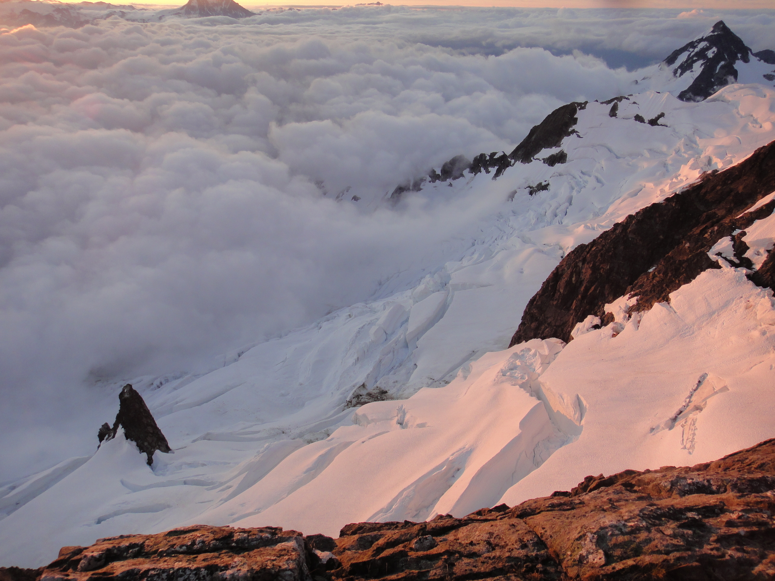
As we stumbled out of our sleeping bags, the 3 ACCers occupying the hut were on their way out, heading towards the North Face of Serratus. We set to work melting snow, and preparing oatmeal. Artem’s oats were slightly sweeter than mine. He garnished his portion with the hut’s communal sugar and coffee powder. At 7:30, we donned our crampons and began trudging across the Dione Glacier.
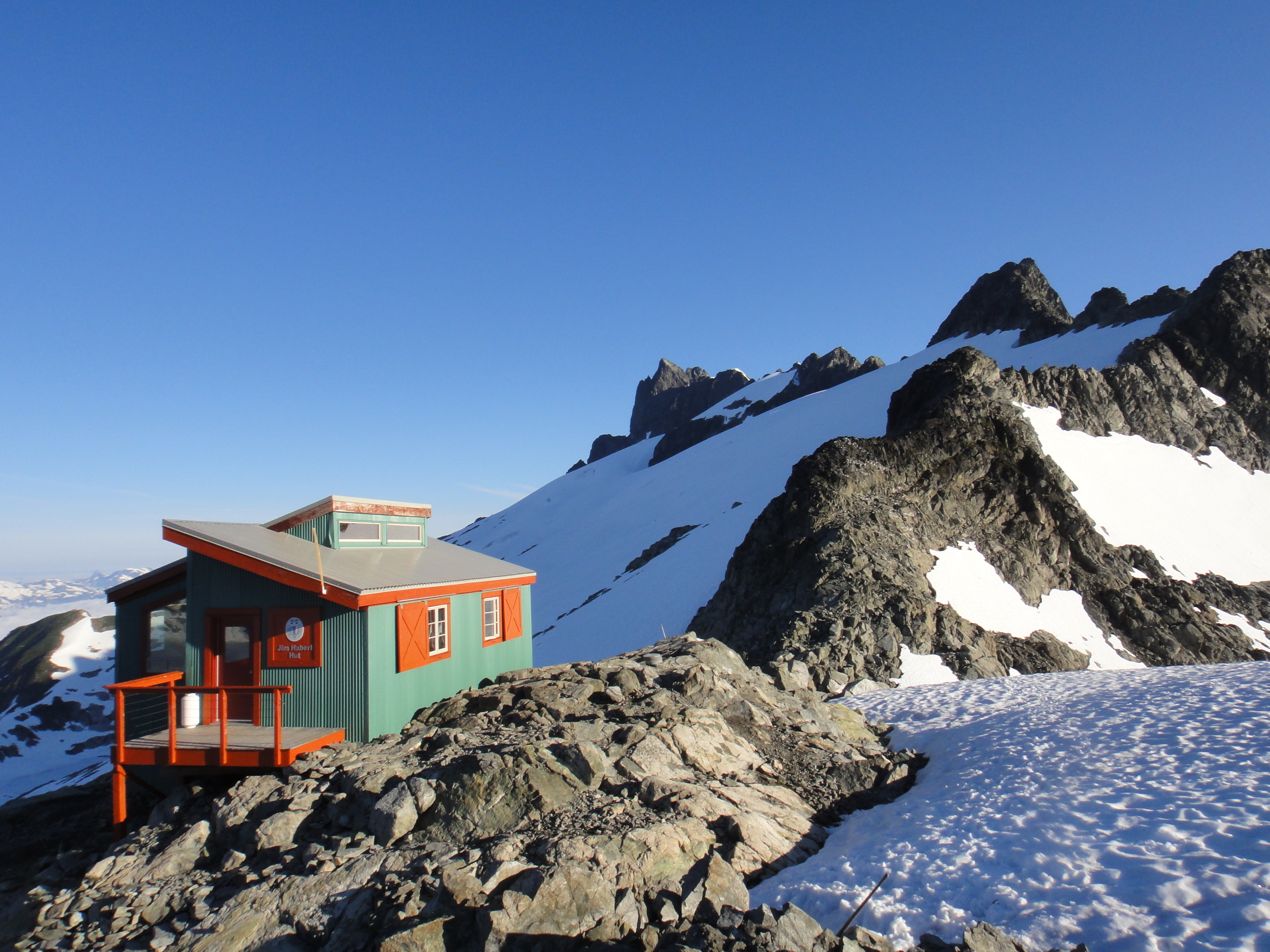
Our morning view from the helipad
At the top of the glacier we inspected the gullies for a route to Dione’s high shoulder. Although the second gulley from the right looked the nicest, alpine select gave no mention of it. We decided to traverse around all of the gullies, following what appeared to be the well-trodden route. It turns out that the gulley we thought looked nice was nice. It probably would have made our ascent to the high shoulder 1 hour faster, eliminating 2 rappels and some sketchy scrambling.
At 12:00, we reached the high col. We realized to our dismay that we wouldn’t have time to climb up both Dione and Tantalus and still complete the traverse. We opted to just do Tantalus, and still try to complete the traverse. Dione, after all, is just a glorified sub-summit. In fact, in the UBC botanical gardens’ labelled panorama, Dione isn’t even mentioned.
Crossing the moat to the rock route up Tantalus proved difficult. It took us 1 hour to move approximately 200m. I managed to drop my dromedary into the moat. It wasn’t clipped to my pack, and slipped out of my kangaroo pouch. At least I was 2kg lighter and managed to recover the picket that I also dropped. At the moat crossing, we encountered an Australian party doing the enchainment, via heli-drop, in the other direction. They said the snow on the north side of Tantalus was indeed good, which bode well for our prospects of completing the traverse.

A non-trivial moat crossing near the high col of Dione
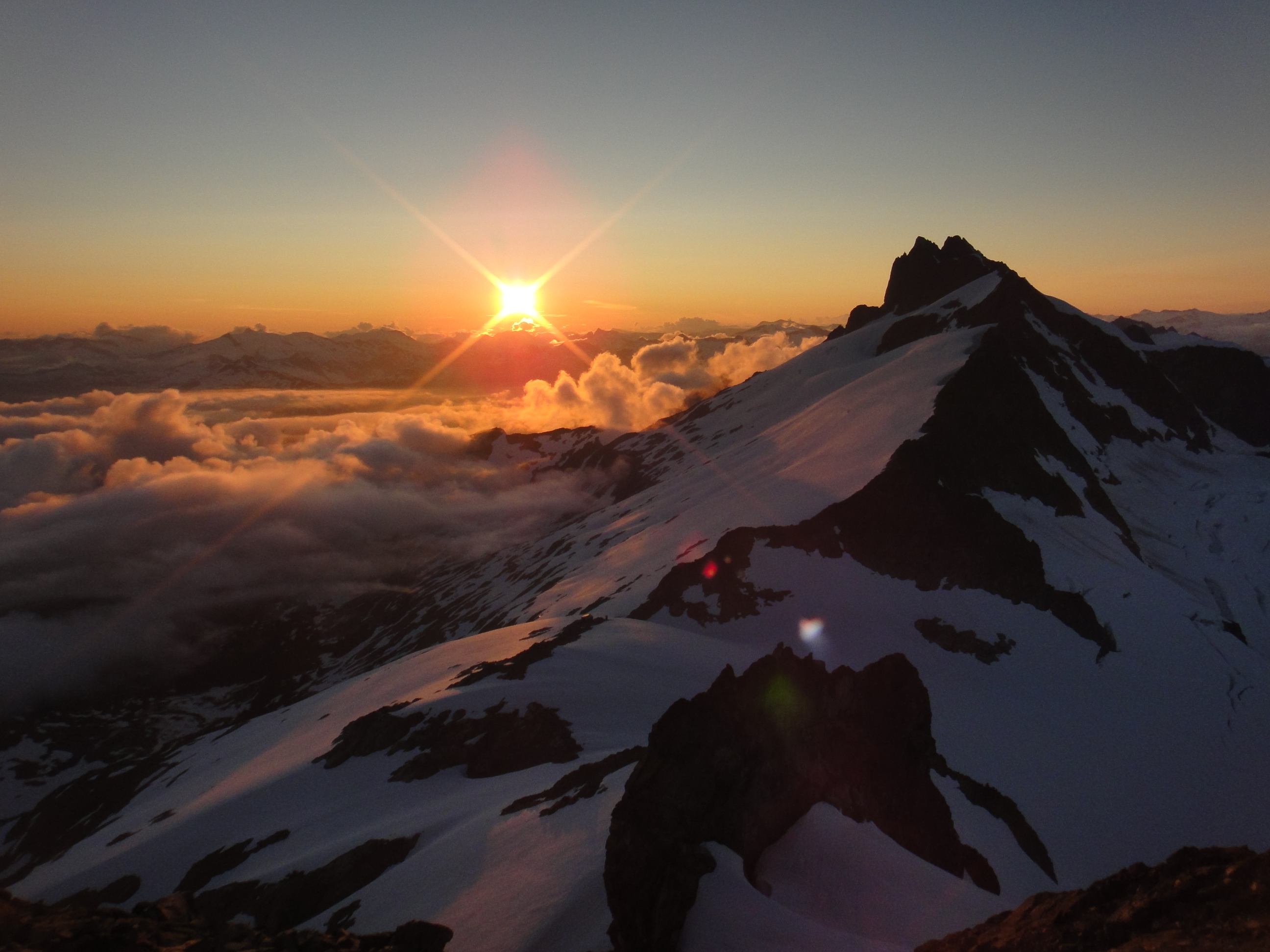
Climbing up Tantalus, we pulled out rock protection for a couple of pitches. According to Artem, many people protect the final pitch up to the summit, but we didn’t feel this was necessary. At 18:00, we were at the top of Tantalus. Predictably, since mountain-forecast called for sun, it was cloudy.
Artem on the cloudy summit of Tantalus
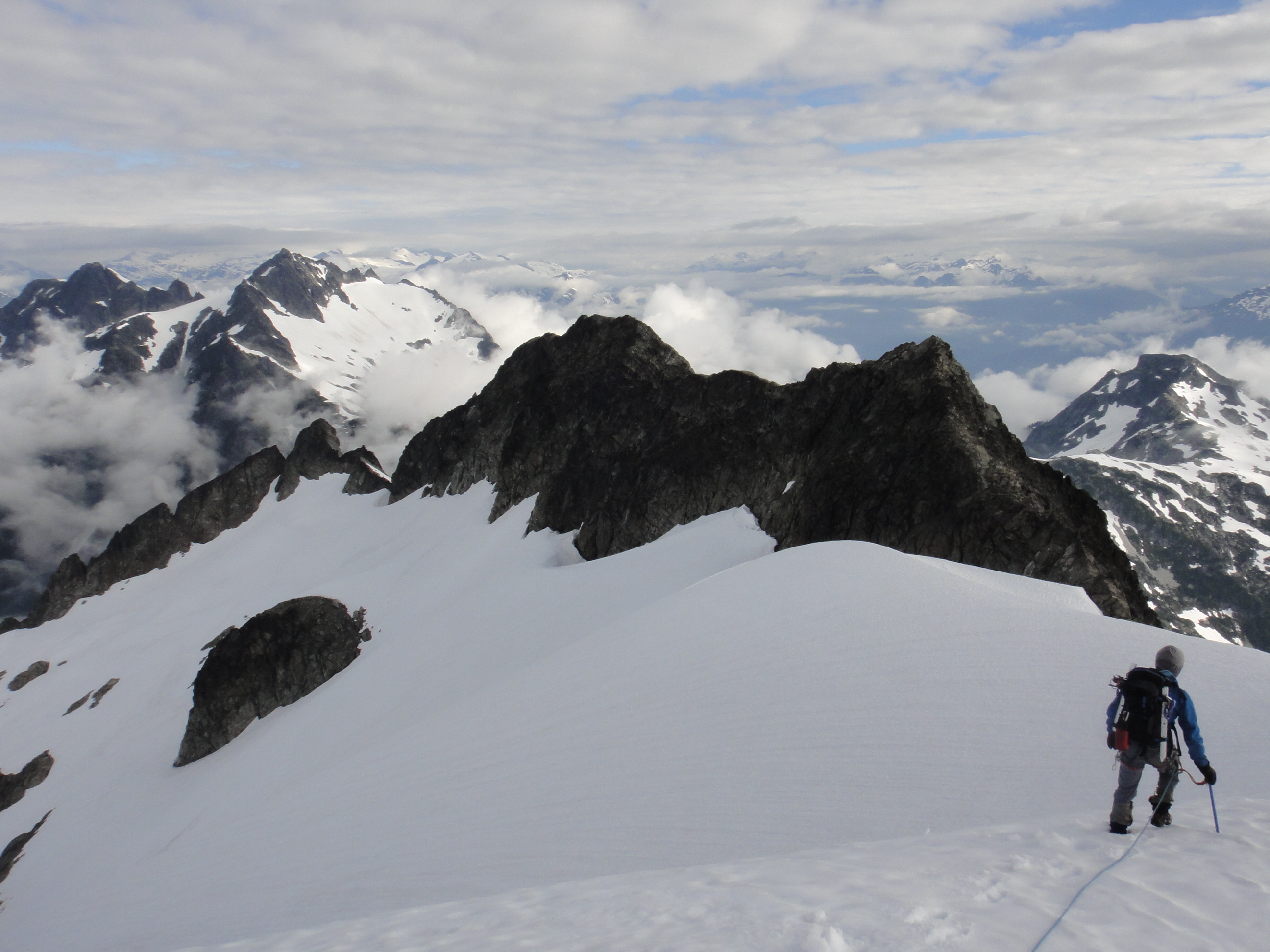
We rappelled off the summit, and Artem led the way up from the notch leading to the North ridge of Tantalus. At 5’8, this bump and knife-ridge is apparently the technical crux of the route. The clouds cleared enough for us to see the immense exposure on either side of the knife. 1000 meters below us lay the bottom of the West face of Tantalus. 1000 meters below us to the East lay the open jaws of the Rumbling glacier, which the first ascent party crossed in 1911 to gain the summit.
After a pitch of traversing, we consciously rappelled off the end of our rope to gain the start of the northern upper snowfield of Tantalus. The snow that connected 10 days ago, had been broken up by snowmelt, and we were forced to make another tight rappel to get to the second half of the snow slope. As the sun was setting, Artem led the way across a large crevasse over a narrow snow bridge which connected the remainder of the ridge. By headlamp, we made it to a flat bivy area, setting up our sleeping bags by 23:30.

Olek and Artem downclimbing a rocky patch between snowfields on the north ridge of Tantalus
Monday, July 31; Day 3:
We awoke with the sunrise after the coldest night of our trip. Artem took fast and light a little too far, and didn’t bring a proper sleeping pad. He was shivering a bit that morning. We were planning to finish the traverse today, so I cooked up all of the remaining oatmeal for breakfast. This was more than we could finish, but I was happy to keep the leftovers accessible for periodic snacking.
Another spectacular glacier view from the north ridge of Tantalus
From where we camped, we could see our next destination, the summit of Pelion. Although Pelion was lower than us, we would have to lose and regain a lot of elevation to reach it. Artem informed me almost excitedly that we had a long slog ahead of us. To this I replied,
“You really enjoy slogging, don’t you.” Artem took some offense to this, replying,
“No. That is a common misconception, probably due to the fact that I like to do trips with Piotr who actually does enjoy slogging.” I was somewhat dubious and said,
“But you excel at slogging. As soon as we get on trails, you are hard to keep up with.”
The rest of the day, Artem was sarcastically mentioning that one of us should break our arm so we could use the SPOT to get rescued. I suspect he did so to draw attention away from his true love for slogging.
As we continued our snow slope descent, we were both puzzled by how soft the snow was. We did not need crampons, and ended up plunge stepping most of the way. Periodically, there were sections of steeper snow which we down-climbed and protected with pickets. We made it on to the ridgeline by crossing a notch that Artem thought he remembered from the Nick’s TR. After this, the snow slope mellowed, and some roped up boot skiing got us down the mountain very quickly. The soft snow allowed for us to make good time, until the cloud coverage thickened. On the descent, we needed to make sure to hit the correct ridge spur. We needed to be on the ridge that leads to Pelion, and not Zenith. When the fog really rolled in, Artem and I stopped for 2.5 hours to wait for visibility. We played Bejeweled on my phone, and then began to listen to a podcast about “phone freaks” to pass the time.
Olek descending a snowfield towards the Pelion Zenith col
When the fog finally cleared it was about 14:00, we realized that we had cut way too high, and were only 100m below the summit of Zenith. I suggested, half sarcastically, that we bag the summit of Zenith to warm up. We decided against it, and continued down to the Pelion Zenith col. From here up to Pelion, some heather veggie belaying awaited us. Once partway up the ridgeline, we had to decide on our route up Pelion. Unfortunately, once again, our visibility was terrible. We waited 30 minutes for the fog to clear so that we could see the south snow slope.
We recalled neither the route the Nicks’ had taken down Pelion, nor the route the ACCers had taken up on their way out. The south snowfield looked like it would go, but it looked steep, and we were feeling more rock happy. We chose the completely unknown route of the South ridgeline.
This ridge turned out to be quite reasonable- easier than Serratus in terms of difficulty and route-finding. Along the way, we spotted a couple of mountain goats. At one point, Artem pulled on a massive boulder to get himself up to a ledge, only to have everything behind it crumble away, providing a scary moment, but luckily the boulder stayed. We saw some rap tat along the ridge, suggesting it does get some traffic – but it didn’t look nearly as new as the rap tat that litters Tantalus and Serratus. We did not end up needing any rappels or placing any protection to reach the summit.
The visibility at the summit was terrible. Artem wanted proof that we were actually at the summit. This past winter he had almost summited Pelion in a whiteout, only to realize via GPS that he was 70m away from the true summit. A pile of rocks resembling a cairn, suggested we were in fact at the summit.
At this point, it was 18:30. Coming across the 70m to the false summit, we were forced to wait in the fog yet again. I contacted my friend Mitch via text message asking him to check mountain weather forecast for Pelion. Apparently it was now foggy, and was supposed to rain on Tuesday. Artem and I decided we had to get at least a bit further down before the end of the day, but couldn’t move until we got some visibility, as we had to negotiate some serious bergschrunds on a steep slope.
Finally, at 20:00, the clouds subsided a bit, with natural evening cooling. We could see the snow slope, and Artem belayed me out and around the first crevasse, then himself lead an exciting pitch down the edge of the icefall. We got to the end of the snow slope, and a nice bivy ledge by headlamp at 23:00. We didn’t want to scramble in the dark, and succumbed to being benighted. We set our alarms for 4:00. For our final day, we would have a true alpine start.
Tuesday, August 1; Day 4:
A bland mixture of couscous and macaroons constituted our breakfast and killed off the remainder of our food. Once again, it was more than we could eat, so I packed the leftovers for snacking on. We descended the remainder of the ridge without incident, keeping to rocks to avoid putting on crampons. As a mountain goat galloped down the snow slope beside us, Artem was envious of his hooves. Eventually we met up with avalanche chutes, and decided to follow them into the valley. Sadly, the snow ran out sooner than expected forcing us into a slide alder hell. Gradually, our bushwhack began to lead us slightly off course. We were headed up river. Artem wasn’t too worried, since we would eventually intersect with the Ossa Mt. trail if we headed too far East. We knew we would have to cross the Sigurd creek eventually, but our bushwhack path didn’t lead us to the creek proper, but rather two of its tributaries. We dropped a log over the first tributary, and carefully walked across it. At the second tributary, even though our boots felt as though they were maximally saturated with water, we took them off and waded across.

Artem poses in front of Pelion for the last time before a bushwhack descent
On the other side of the creek, we found flagging, likely for the Ossa trail. Unfortunately it promptly disappeared. Somewhat misguided, we decided to bushwhack up from the flagging towards a boulder field we saw from the avalanche chutes. This proved to be a waste of time, since we ended up bushwhacking from the boulder field back down to flagging.
At 9:30 we had made it to a proper trail. We followed it a ways downstream before finding the intended sketchy log crossing of the creek. We then realized that our bushwhacking route was very inefficient and probably took us 2hrs longer than a possible route through old growth forest, but at least made the crossing easy.
From here on out, it was a slog to the car. Once again, Artem engaged full slog mode, and was hard to keep up with. I convinced Artem to make one 5 minute food and water stop at 10:45. We arrived at the bottom of the trail and the stashed bicycle at 11:30.
Contrary to mountain-forecast’s prediction of rain, the entire descent was sunny, a 4th consecutive day of incorrect forecasting. We emerged from the forest to a beautiful day. Artem headed to the river, while I set to work assembling my bicycle. I was to meet him at the river to give him my pack. As I finished setting up my bicycle, some American tourists pulled into the trailhead in a red dodge caravan. They asked me how the trail was, and I commenced a 3 minute conversation with them in the hopes of a sympathy drive back to my car. No luck. I headed down to the river with my pack and bicycle, but couldn’t spot Artem. I asked two people by the river if they had seen him, but they had not.
Artem had made it clear that he wanted to get home as fast as possible to get to work, and I was feeling pressed for time. Against my better judgement and the lesson conveyed by Sam’s and Christian’s lost skis, I decided to stealthily stash my pack rather than comb the river for Artem.
I bicycled to the start of the logging road, then on to the Squamish valley road. After what felt like 2 minutes of bicycling, but in retrospect was likely 20 minutes, I heard a car approaching from behind. I stuck out my thumb and he slowed down. I pedaled beside him and explained I wanted a ride back to my car. To my surprise, he consented, though he didn’t have room for my bicycle. I stashed my bicycle in the forest near a “trucks turning” sign, and took him up on his offer.
It turned out that the man who picked me up was an Italian priest, who had climbed in the Alps in his youth. He was curious as to whether we were climbing technical routes or not. I told him we were just trying to get over as fast as possible. 16km later as we approached my car, I thanked him and apologized for the stench I must have been exuding.
At 12:30, I arrived back at the river. My stashed gear was undisturbed. Triumphantly, Artem and I blasted music, pumping our fists out the windows.
When the unstoppable force met the immovable object, sparks flew. At first, the immovable object wasn’t perceivably budged. Eventually the ground beneath it gave way. It fell. Once it landed on more stable ground, the immovable object was once again immovable.
The trip was epic in the best sense of the term. It had everything: exciting scrambling, alpine climbing, aesthetic ridge walking, hairy snow pitches, river crossings, swimming, biking, slogging, bushwacking, being benighted, lost in a whiteout, roasting in the sun, sunrises and sunsets, good company, and above all pure joy every step of the way. All-in-all we made good decisions and never felt like things were getting out of control and fearing for our lives. No injuries to report either. Thanks to Artem for organizing this trip!
PS: Artem, this is exactly what your groans of pain sounded like, and why I would immediately follow every one with “Watch Out!” http://youtu.be/xNnAvTTaJjM?t=12s
Excellent TR!
good stuff guys!
a classic!