The Stein River watershed is gorgeous. It does not have enough hype. I hope this trip report helps ameliorate that.
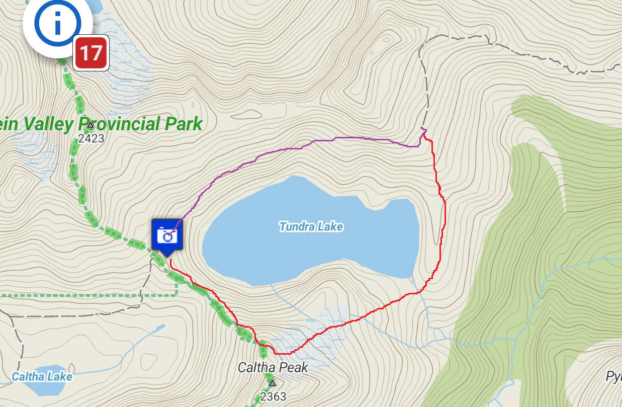
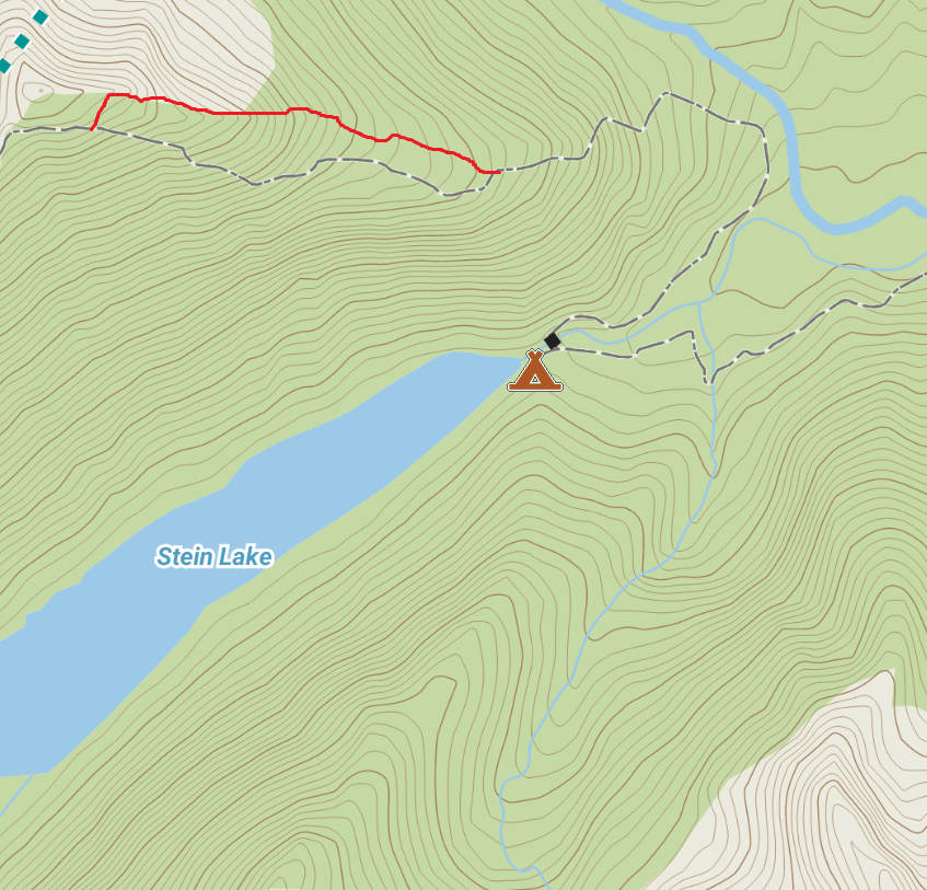
The standard traverse route of the Stein Valley starts at Lizzie Creek, just outside Pemberton. Approximately 91km of variably overgrown logging road, alpine trail, snow and rock, and finally well maintained trail, lead East from Pemberton to Lytton.
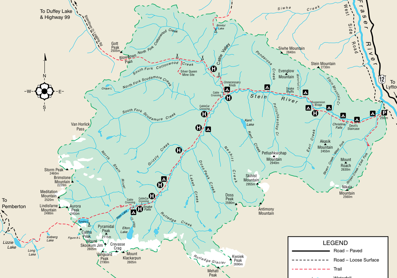
Map of the ~91km traverse of the Stein Valley
Although this traverse has been done in under 24 hrs, most mortals take longer. Parties generally take between 2-10 days for the crossing.
In the last 10 months, Lena has effectively inoculated me with stoke for the area. Last August she did a 9 day traverse of the area with her cousin and nephew. They passed a crew of trailworkers. The last 25 kilometers of their journey was on freshly repaired trail. She was keen to see how much better the trail would be this year.
Mark Grist, Lena Rowat and I planned for 2 nights and 2 days for the crossing. We left on Monday evening as soon as Mark finished work, and returned on Wednesday night, giving Mark time to get to work on Thursday.
We travelled light. We ditched the camp stove and just carried cold food, warm clothing, sleeping gear and tent. We also elected to bring ice axes, since it is still early season and we didn’t know how much snow to expect. I didn’t really want to bring my light mountaineering boots, so I purchased a pair of $20 runners from Sports Junkies on Monday afternoon that fit like a dream. Mizumo, “Wave Sayonara” shoes. Based on their name, I assumed that they would endow me with magical running powers to leave other people in the dust.
We had a long way to travel. Fortunately, we had all had super restful weekends…
Lena had just finished a 2.5 day north to south Tantalus traverse with her husband. My climbing partner and I were hot on their tail, completing a similar trip to them in ~48 hours (less sleep). (Nick and Lena’s Squamish River crossing was way cooler than ours).
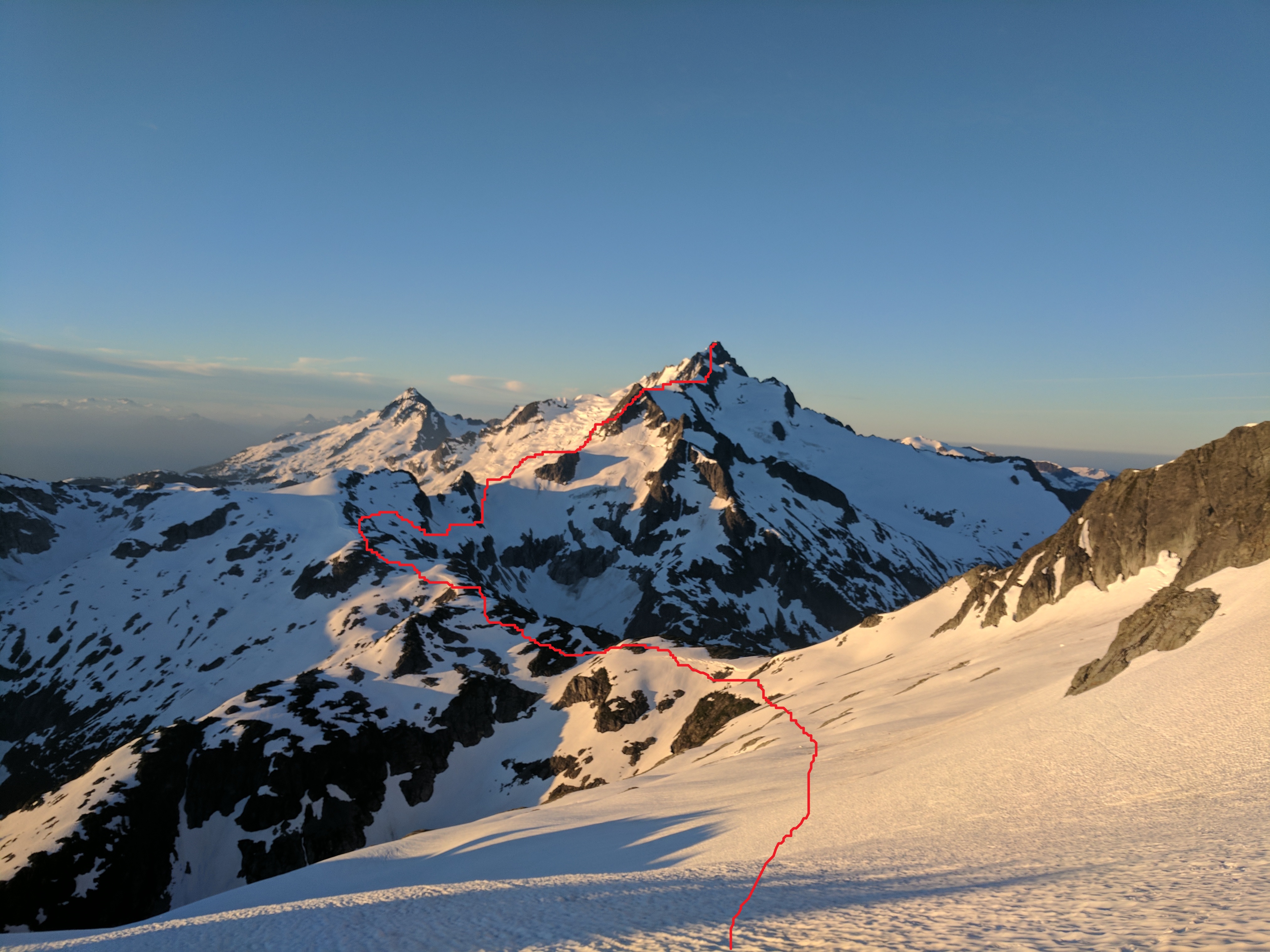
Sunrise on the Tantalus. A picture of the approximate route that we took down from Pelion up the North Ridge of the Big T.
Mark also had a languid weekend. He just did a little north shore jog the day before entitled “the knee knacker.”
Fortunately, Lena dispatched of the first Crux of the trip for us: Transportation. She recruited her mother, Nona, to drop us off on the Pemberton side and pick us up 2 days later on the Lytton side.
We departed Vancouver around 5pm. The province wide fire ban and sunny weather forecast assured us that we would be greeted by clear skies to start our moonlight hike.
At 7pm, the first raindrops splattered across my windshield as we forged past whistler on the sea to sky.. Oh well, the province needs it. Maybe it would motivate us to hike faster.
~8pm Monday night, we departed. My 2wd Mazda protégé was sufficient to grant us access to the well labeled trail.
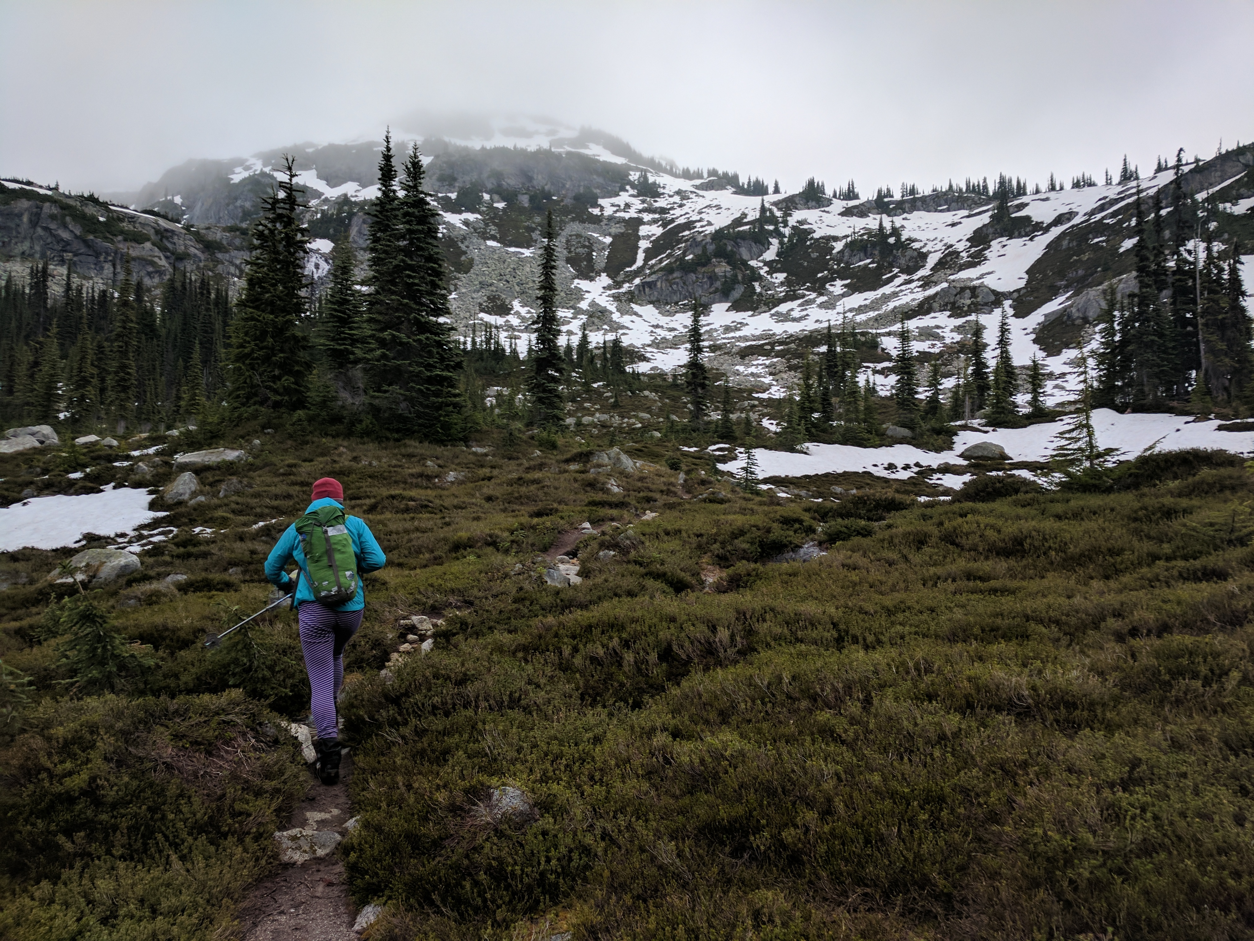
Very little precip was coming from the air, but the foliage was soaked. This necessitated a good pace as we headed up the overgrown logging road that leads to Lizzie Creek Cabin.
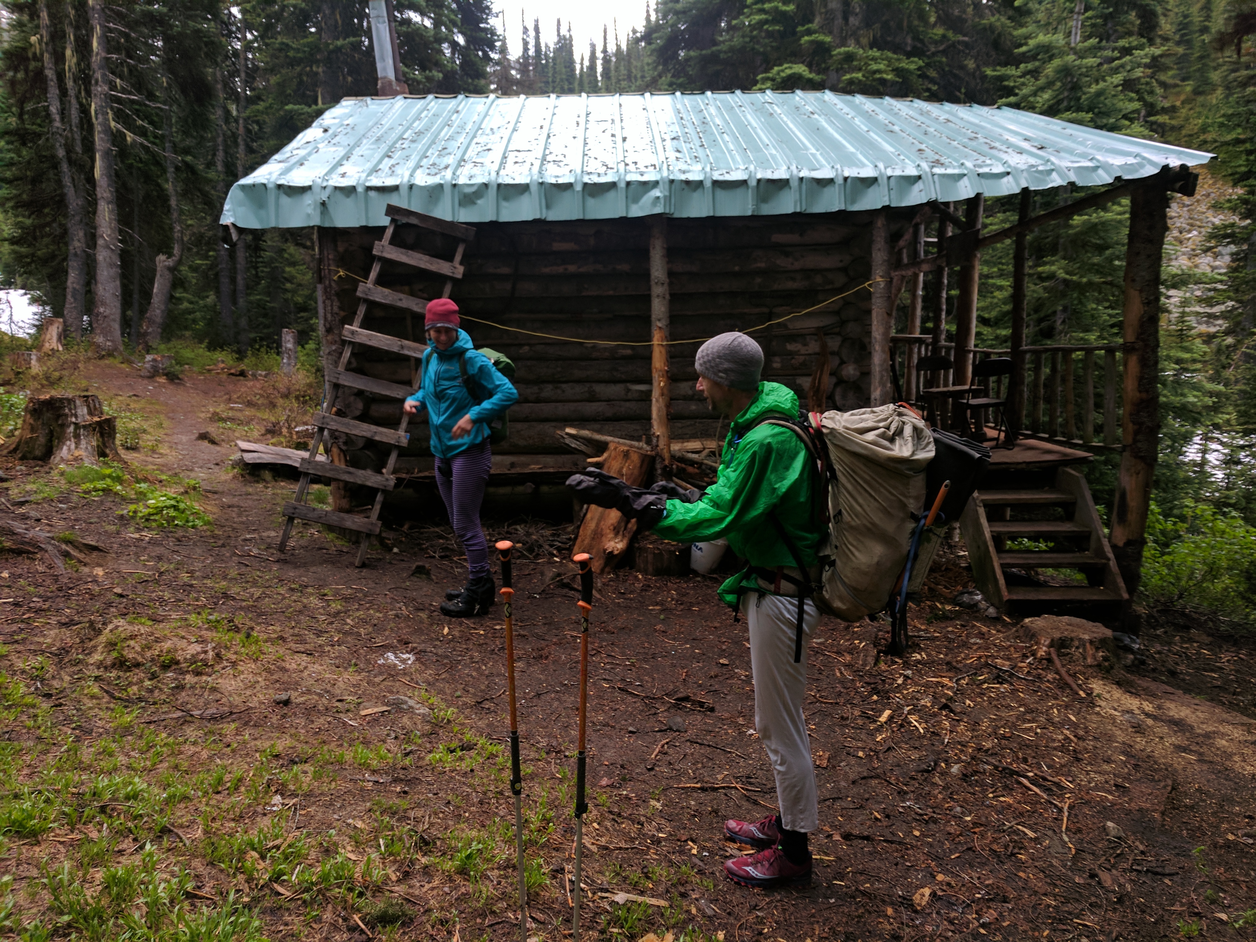
The Venerable Lizzie Creek Cabin. Built in 1966. Fortunately the infamous pack rat who once lived here is now deceased.
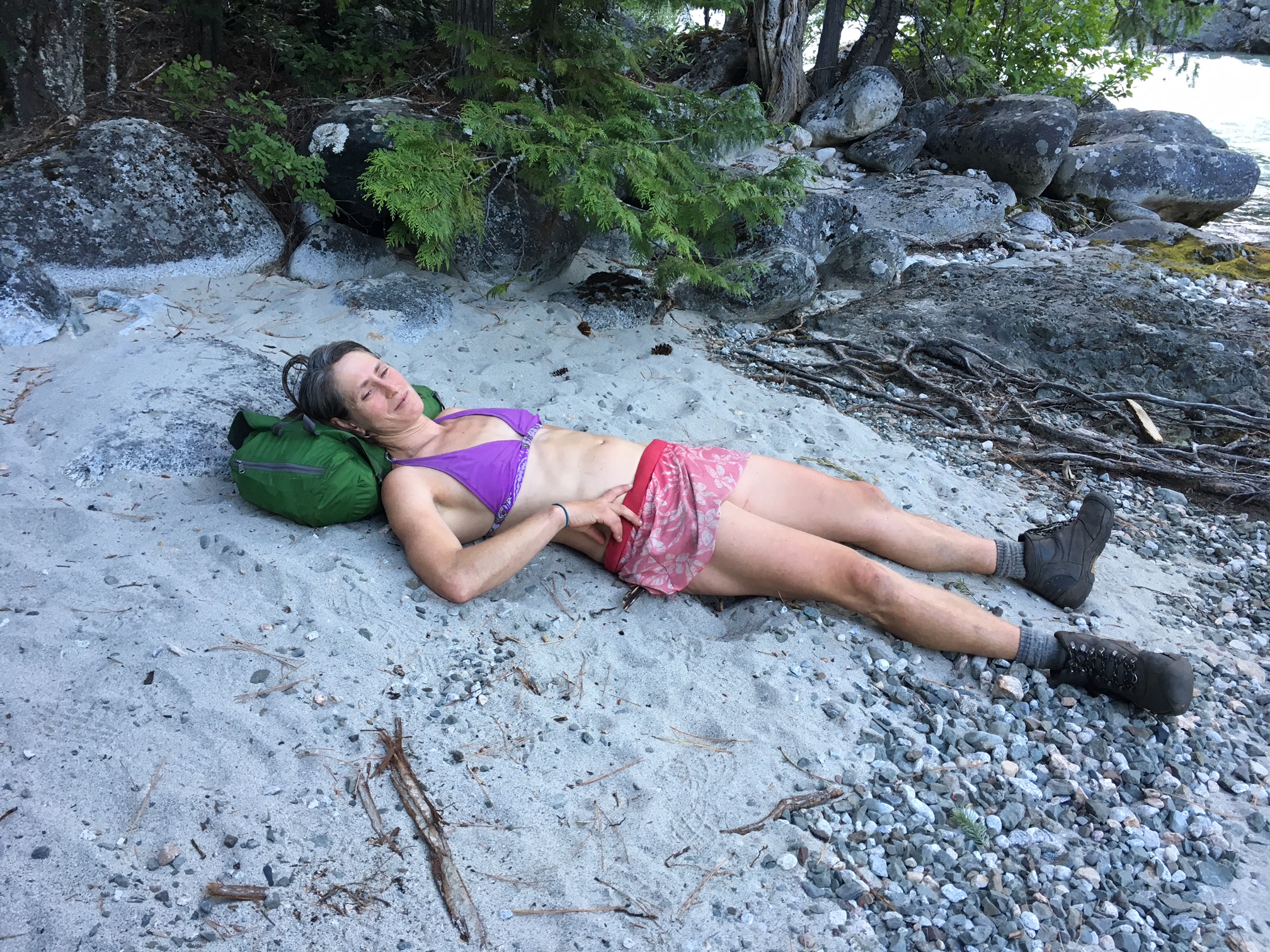
In addition to my new (to me) running shoes, I was proud of my newly crafted “castaway” capris. A crampon hole in my hiking pants from the day before had prompted me to amputate the lower cuffs of both pant legs.
Showing off my “Castaway Capris” in the fog.
When we reached a 1 km section of intermittent Devil’s club, I appreciated the knee protection that my capris provided. However, my ankle socks were not the brightest decision. A small, 5×10 cm patch of skin on each shin proved to be my “Achilles Heel”. Devils club doesn’t bother me much though. At least I wasn’t in a skirt like Lena.
The next “test” of the trail was the slide alder covered logging road. Within 100m of travel through this, we were completely drenched.
With constant uphill movement, we kept warm. We made it to the Lizzie Creek Cabin just before midnight. This venerable hut has recently been upgraded with a new stove pipe. Lena wanted to try it out. Mark and I were less keen on a fire, so we decided to go straight to bed.
We woke up to our alarm at 6am the next morning. Fortunately, there were no rodent incidents overnight. Collectively, however, we didn’t sleep very well. We were still a little wet from our hike up and were just warm enough.
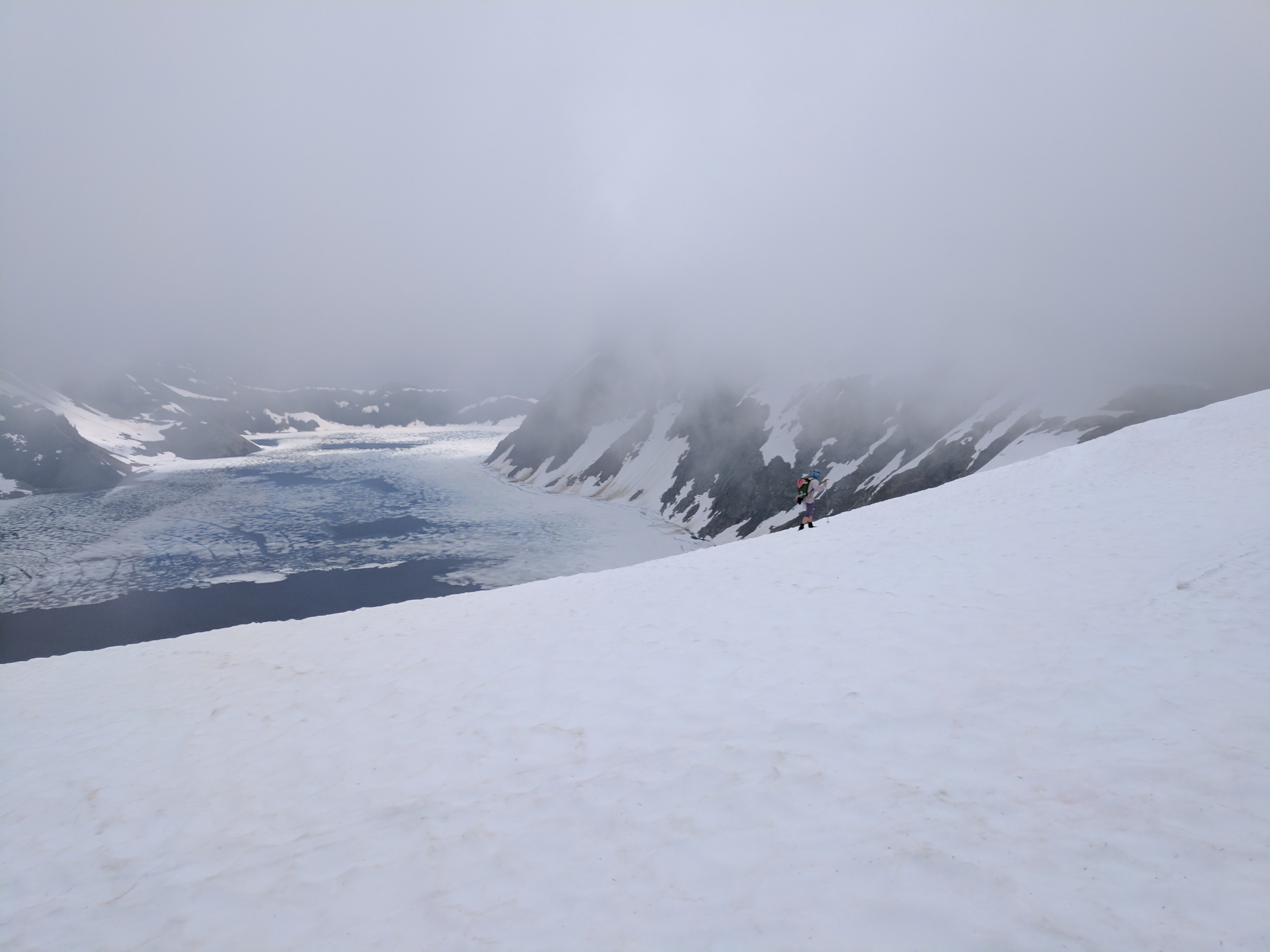
Our “bomber” weather forecast continued to surprise us. We began the day by hiking into a whiteout.
Leaving the cabin. Clouds creeping in.
There was intermittent snow covering the trail as soon as we left the cabin. The trail was fairly easy to follow. Most of the cairns were melted out.
Ironically, with my terrible navigation skills, I proved to be a very useful route finder. Solely due to the GPS on my phone. (I use an app called Locus Pro and have downloaded the openstreetmaps of BC, which includes the Stein traverse(!) ).
As we crossed rivers and crested ridges, I tried to remember what the landscape looked like. I had been to the area for New Years of 2012, and it is gorgeous. Unfortunately, I had to keep imagining for the next couple hours.
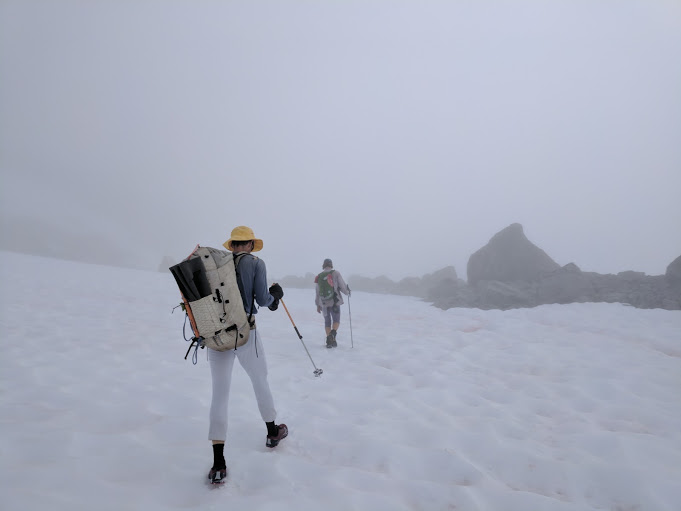
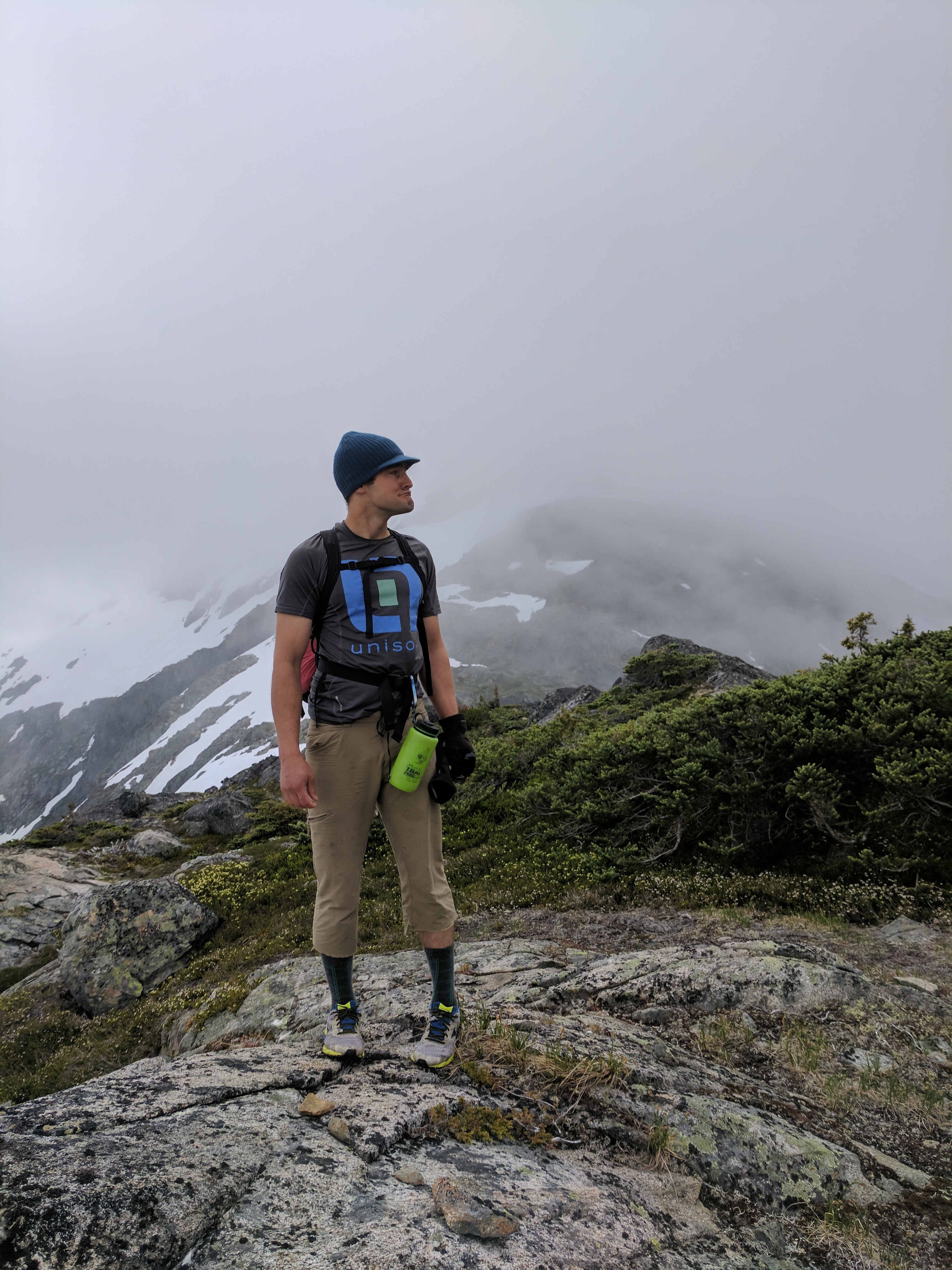
Mark steps into a cloud, dressed in full snow camo minus the hat.
Mark, Cloud, Snow, Rock
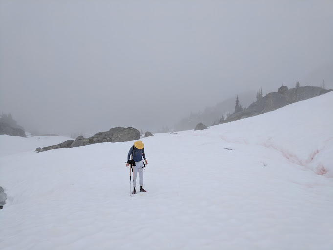
Antarctic Scenery. I hear part of the Larsen C shelf just broke off. Maybe we located it?
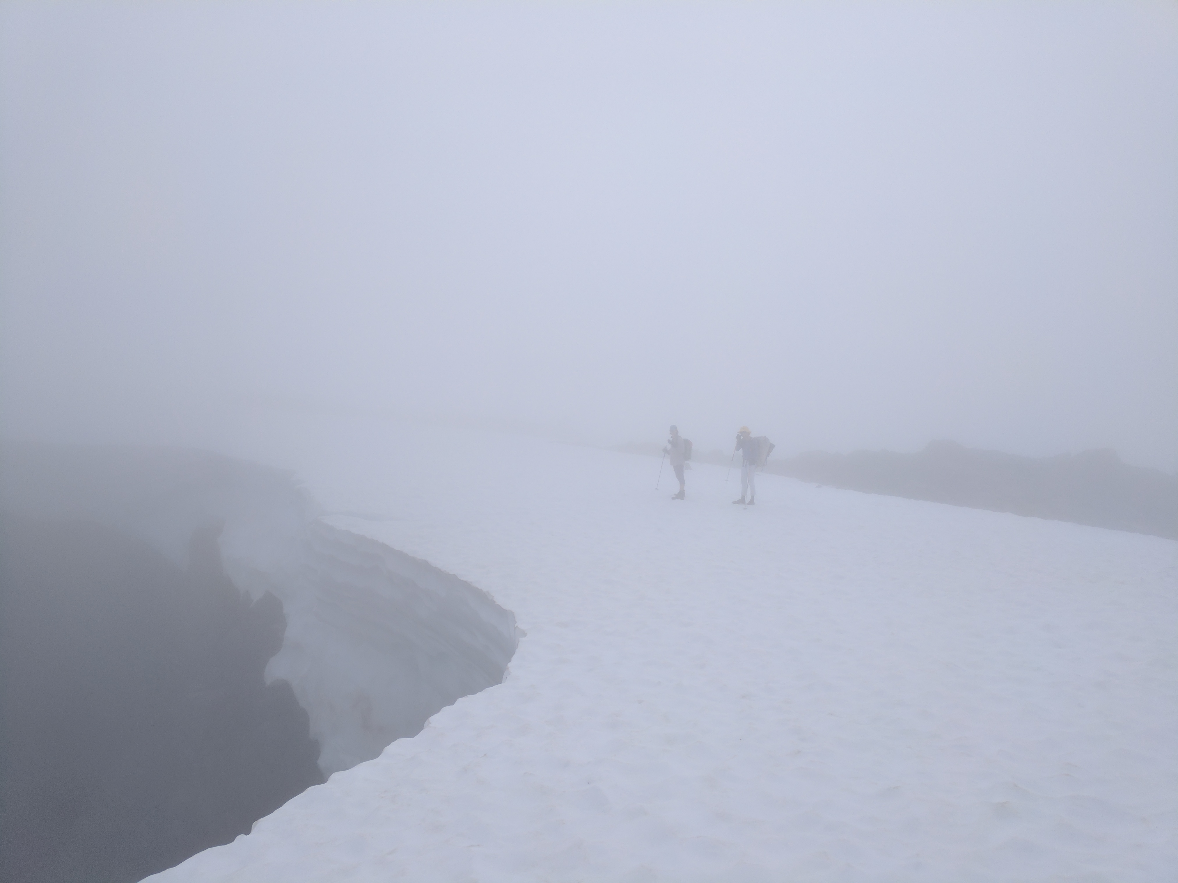
Finally as we approached Tundra lake, the clouds started to clear. We sat on the ridge for 15 minutes for a shoe drying and snack break. Eventually we had a good view of the entirety of the lake. About 2/3’s of it was still partially frozen. With streaks of snow, ice and cloud on its surface, Tundra lake lived up to its name.

Waiting behind the wind shadow of a boulder beside Tundra Lake as our feet dry.
Lena Traverses over Tundra
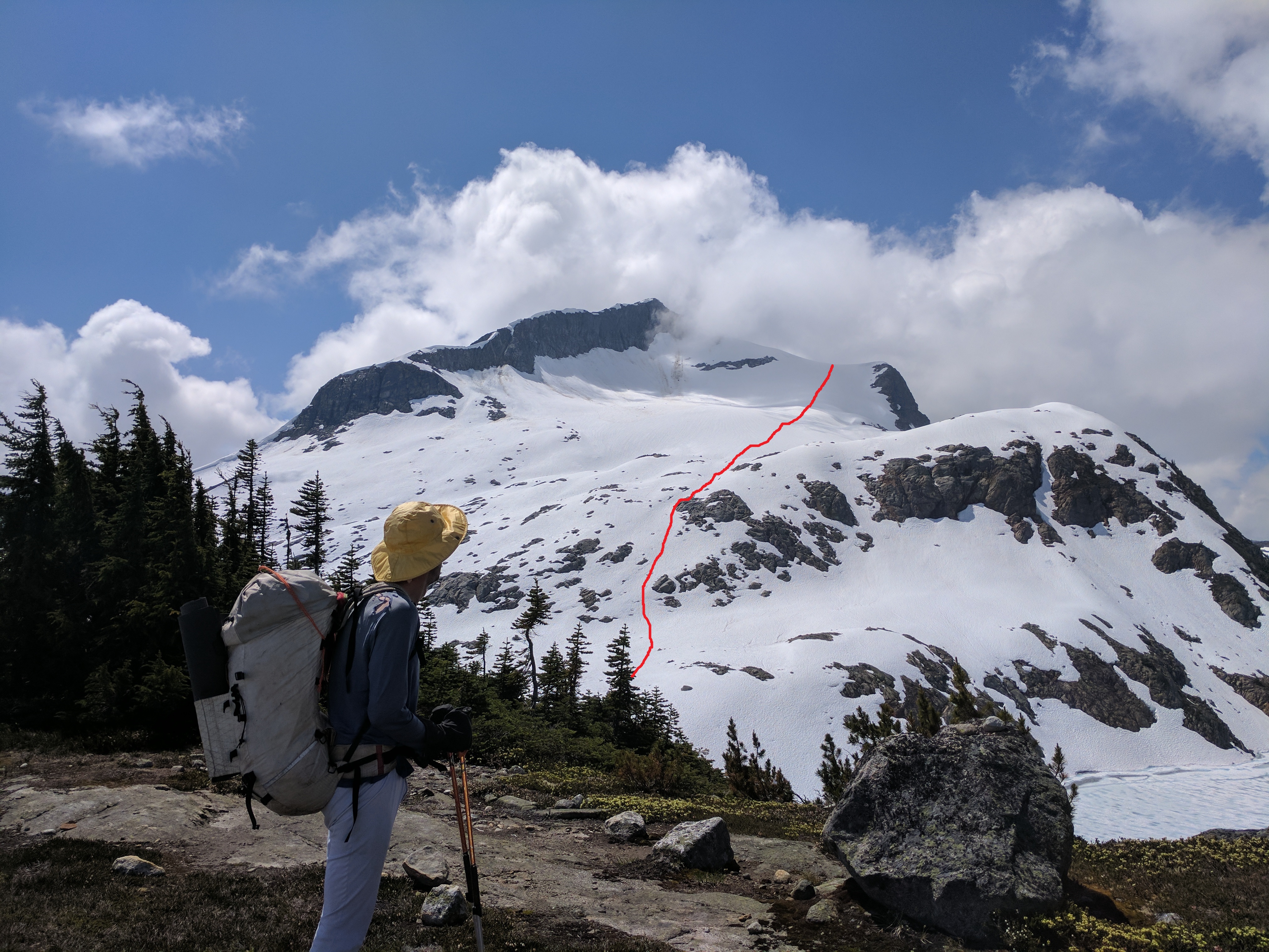
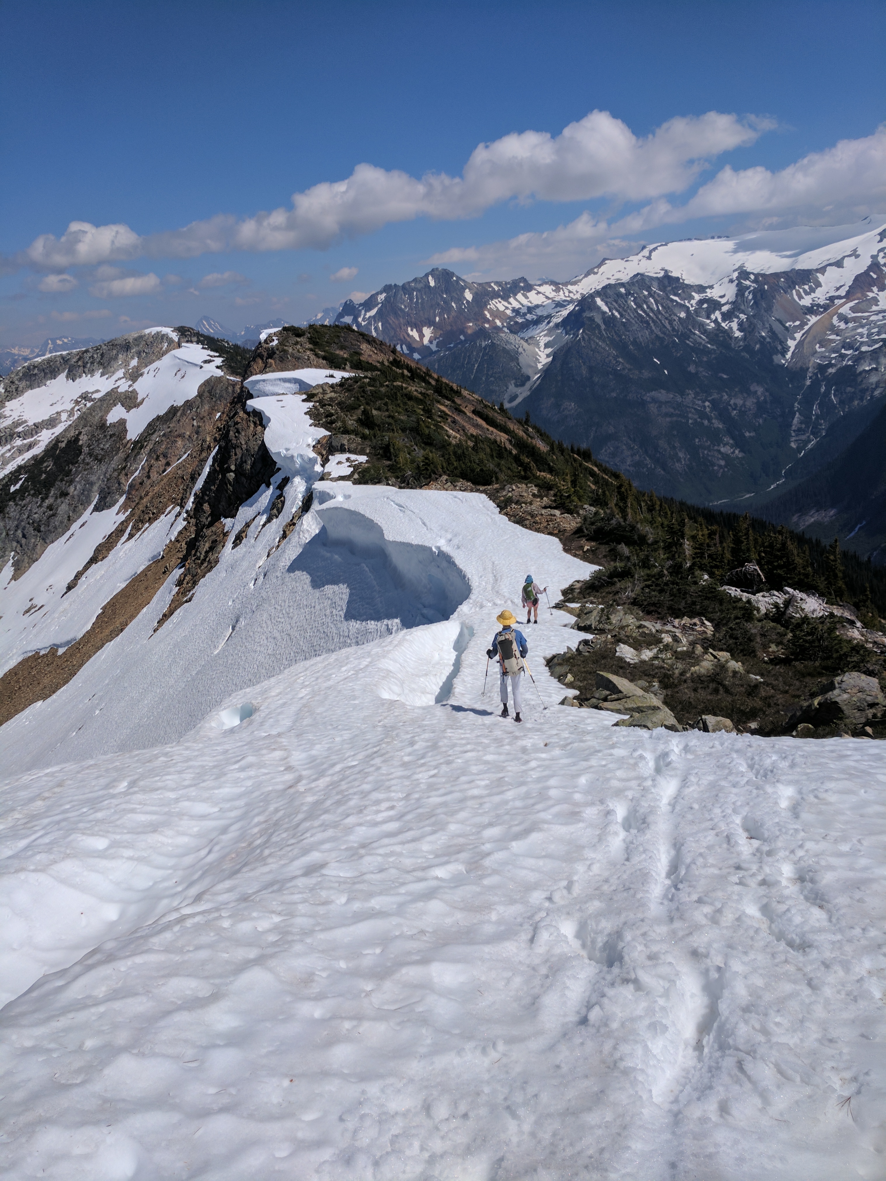
At this point in the Stein Valley Traverse, most parties elect to scramble around the north side of Stein Lake on Scree. However, Lena presented us with a more enticing option. Last summer, Lena went around Tundra lake to the south. Although there is 300m of extra elevation gain going this way, it is a very good early season option. From a col close to the summit of Caltha peak, you are able to boot ski down to the other side of the lake. This way wouldn’t work very well in late August or September, though. The small glacier is usually bare ice during this time.
The “Lena Variation” route up to the col of Caltha peak (and down by boot-ski) in red. Purple is an approximation of the way most people go.
As we climbed towards Caltha peak, we re-entered the whiteout. My GPS helped us figure out where to drop on to the snow to start our boot-ski. Although I had my ice axe in hand, I didn’t need it. The slope quickly mellows out for a casual boot-ski/ glissade.
We emerged from the whiteout and were able to slide down snow until we reached the east side of Tundra lake.
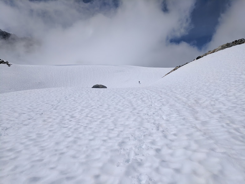
Boot skiing out of the fog.
As the clouds clear over Caltha Peak, Mark admires our line.
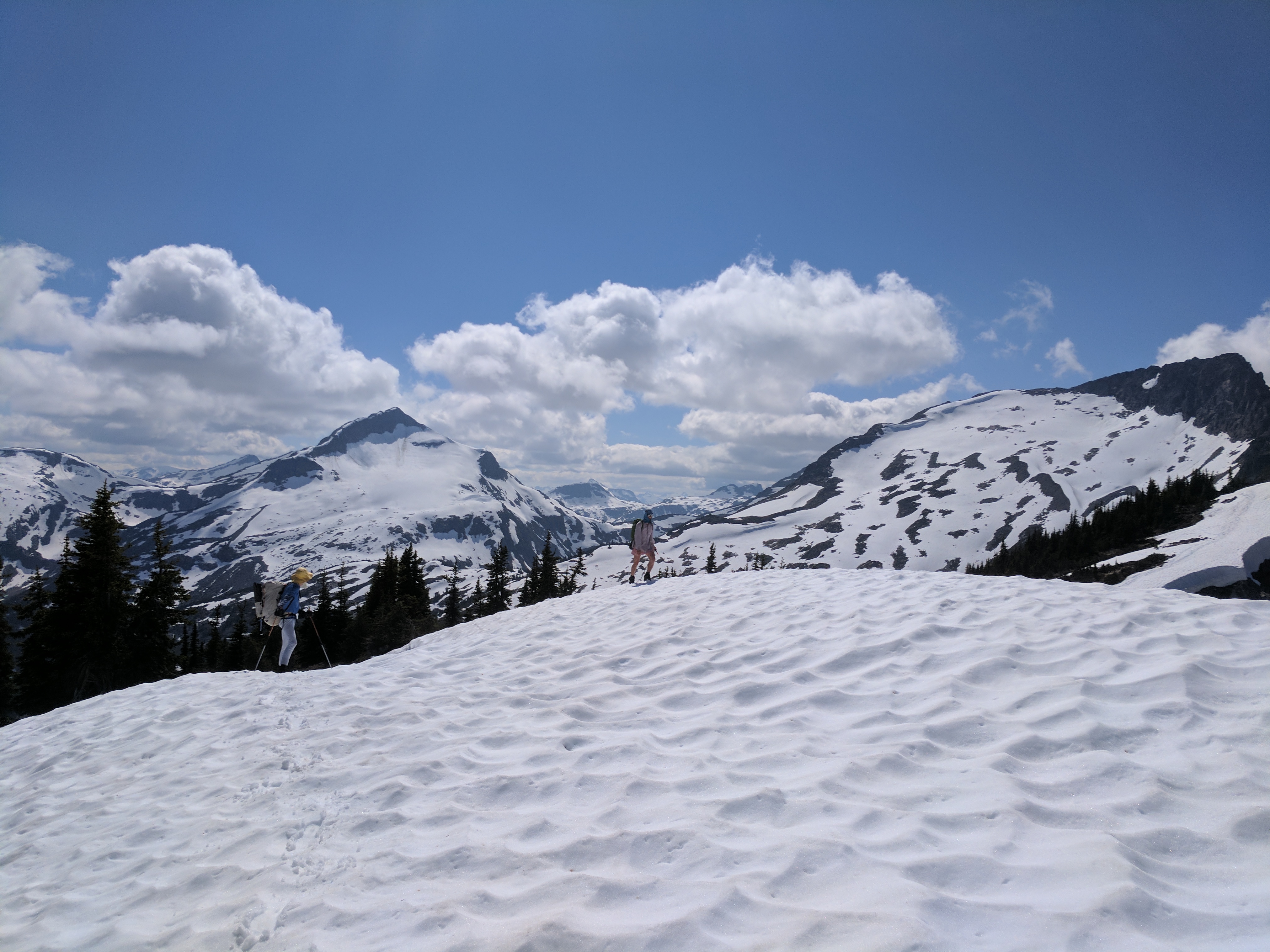
After a quick lunch stop, we started the last significant ascent of our trip to gain the spectacular 10km ridgeline. Mark dubbed this the “money pitch” of the traverse; Akin to a perfect hand crack on an alpine rock climb.
Needless to say, we were all very happy that the clouds had cleared by this point. We were even afforded some views back towards Lizzie Creek. This included a view of the aptly named, Cloudraker mountain, one of my most memorable alpine ascents back in New Years 2012.
The neverending 10km ridge. Plenty of snow made some of the downhills easier on the knees, but kept our feet wet.
We also had a beautiful view of the path that lay ahead of us. Numerous small alpine lakes flanked our ridge on either side. They were pristinely clear. Tropical Ocean hues. Mark suggested that it would be a fun endeavor to swim them with goggles. Cold prospect.
Along the 10km ridge, we still had quite a bit of snow. Although this was the only section of the route that I carried water for, I could have easily made due without it. There were plenty of alpine tarns. That’s the beauty of early summer. And travelling along a watershed. Water, water everywhere and plenty a drop to drink.
Good views back on the Lizzie Creek valley that we walked through in a whiteout.
Along the ridge line, Lena pointed out to us the vicinity of Elton lake to the southeast. Unfortunately, we were only ever able to see the outflow of the lake, never the lake itself. By all accounts (Lena’s) it is a gorgeous lake. Similar in size to Stein lake, but several hundred meters higher. It has an “even prettier colour than Tundra lake” and granite shores that are decorated with huecos. Unfortunately, our trip did not afford us the time to detour up there.
From our vantage point along the ridge, we were able to see 2 unnamed peaks that lena has named John and Guy peaks after her coast range traverse partners and eternal friends… and of course an Elton John pun.
I spent a small portion of the trip trying to sing a rendition of “Candle in the Wind” but found that my knowledge of Guy Edwards and John Millar wasn’t quite to snuff. Shortly afterwards, I was relieved of singing Elton John. Mark had the song “Crazy Love” from Paul Simon’s “Graceland” stuck in his head. Turns out my musical tastes fit right in with my two 40 something friends. I started singing Paul Simon instead.
At the end of the ridge, eventually, the trail dips a bit south of the summit of the last peak. It sidehills for a bit and steep switch backs lead you down to Stein lake. Unfortunately, the trail deteriorates here. It is almost inevitable that you will lose the trail markers before gaining the switchbacks.
What we found to be the best solution to losing the trail, is to keep contouring but trend upwards to gain the ridge. The terrain over the ridgecrest is mellow and eventually you intersect with the steep switchbacks. (Especially if you have a GPS to tell you exactly where the trail is).
Approximate line of our switchback beta in red.
This was the only part where I regretted not taking hiking poles. The descent was steep.
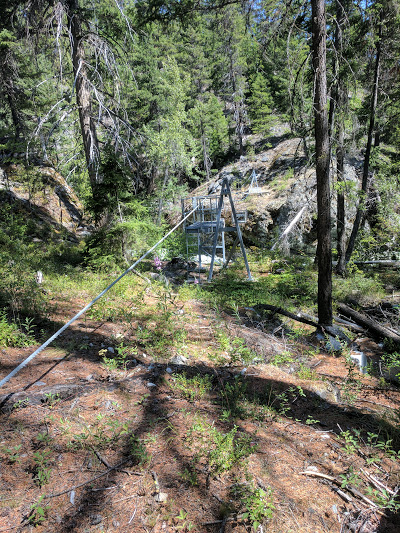
We made it to the first cable car crossing at the north end of the top of the Stein river only to find that the cable car was stuck at the south side. We couldn’t pull it over to our side.
Fortunately, Lena knew another way across. There is a log jam 50m to the west. She scrambled across, and discovered that somebody had jammed a stick into the pulley to prevent us from pulling the car across… As if they thought people only go over it in one direction… Oh well. We fixed it and hauled ourselves across.
Rather than stop at the campsite on the lake, we pushed on eastwards. 5km later, our day had a bit of a sting in the tail as we gained a bunch of elevation to end up on a bluff overlooking the river. We figured the trail builders got bored of the riverside or were paid by the meter of elevation gain.
We set up camp at the top of this hike, relieved that it would be 300m less elevation we would have to climb the next day. The campsite we used was labeled on my GPS as Mid-Canyon campsite, but was not refurbished with a bear cache and pit toilet like most of the other sites we encountered.
There were no bugs until 5am and we slept a whopping 7 hrs from 10:45-6am. (The most sleep Lena or I had had for the last week..)
Mark looks on as Lena performs an unneccessary log crossing
We quickly travelled the next 1 km to arrive at the Avalanche campsite. This was the only place we saw other hikers. They had hiked up from the Lytton side, along the length of the stein river to Stein lake and were making their way back down… As far as we could tell, they were carrying all of their food with them rather than stashing it in food caches along the way. We thought this was silly. We forgot to ask them if they were the culprits of the cable car jamming.
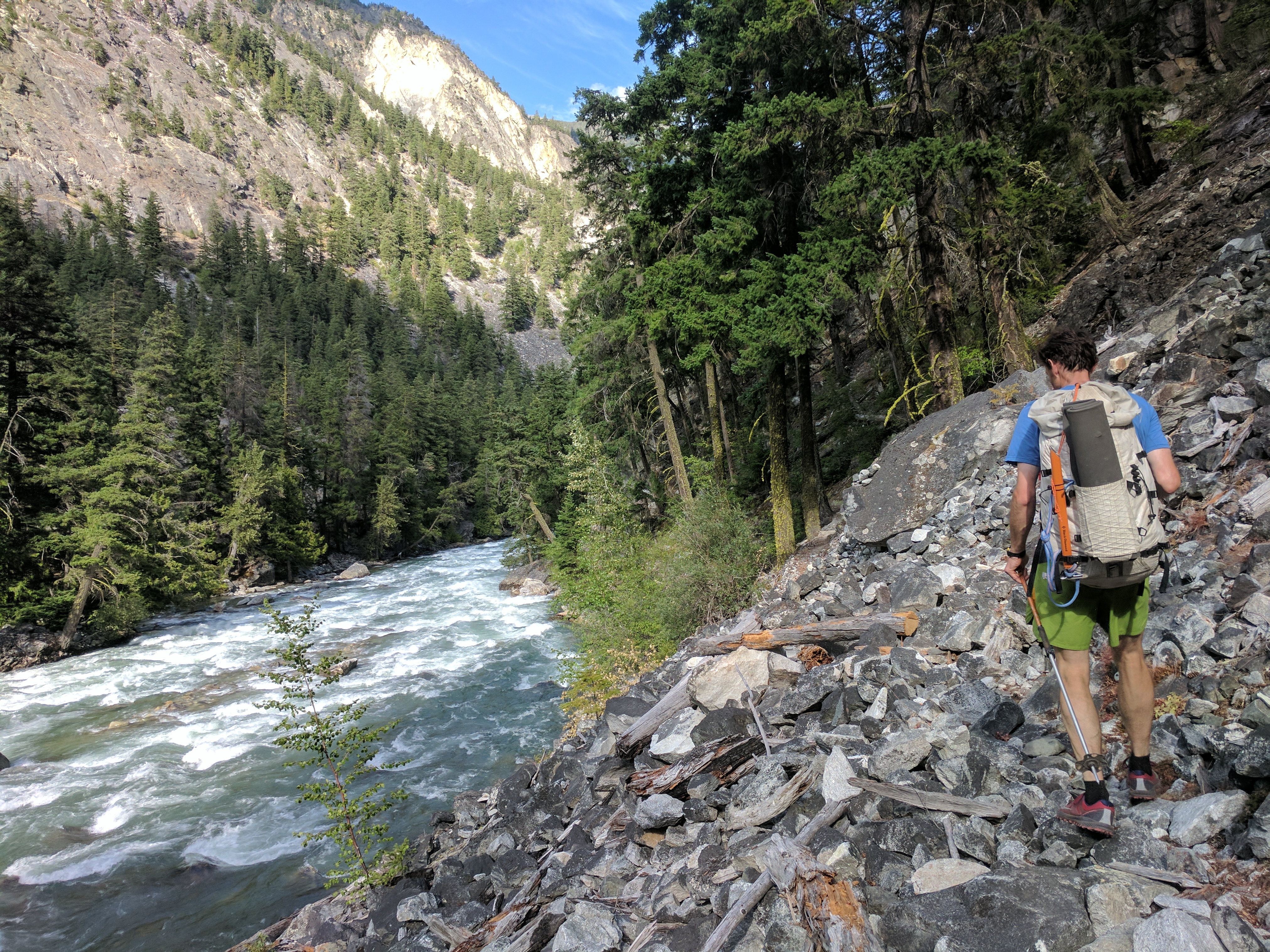
As we hiked for the remainder of the day, it became apparent that we still had a long way to go. There were several cable car crossings and seemingly unnecessary elevation gains up scree slopes.
One of several cable crossings
Fortunately, the berries were spectacular! Mostly the wild raspberries and strawberries. There were also huckleberries, thimbleberries and Saskatoon berries, but they were not as tasty.
A little more slogging, and we made it to “Rowat Crossing” named after Lena’s family that established it. The sign was still in place. This cable car was particularly over loaded with the 3 of us squished into it. We had to remove our packs and 2 people before docking.
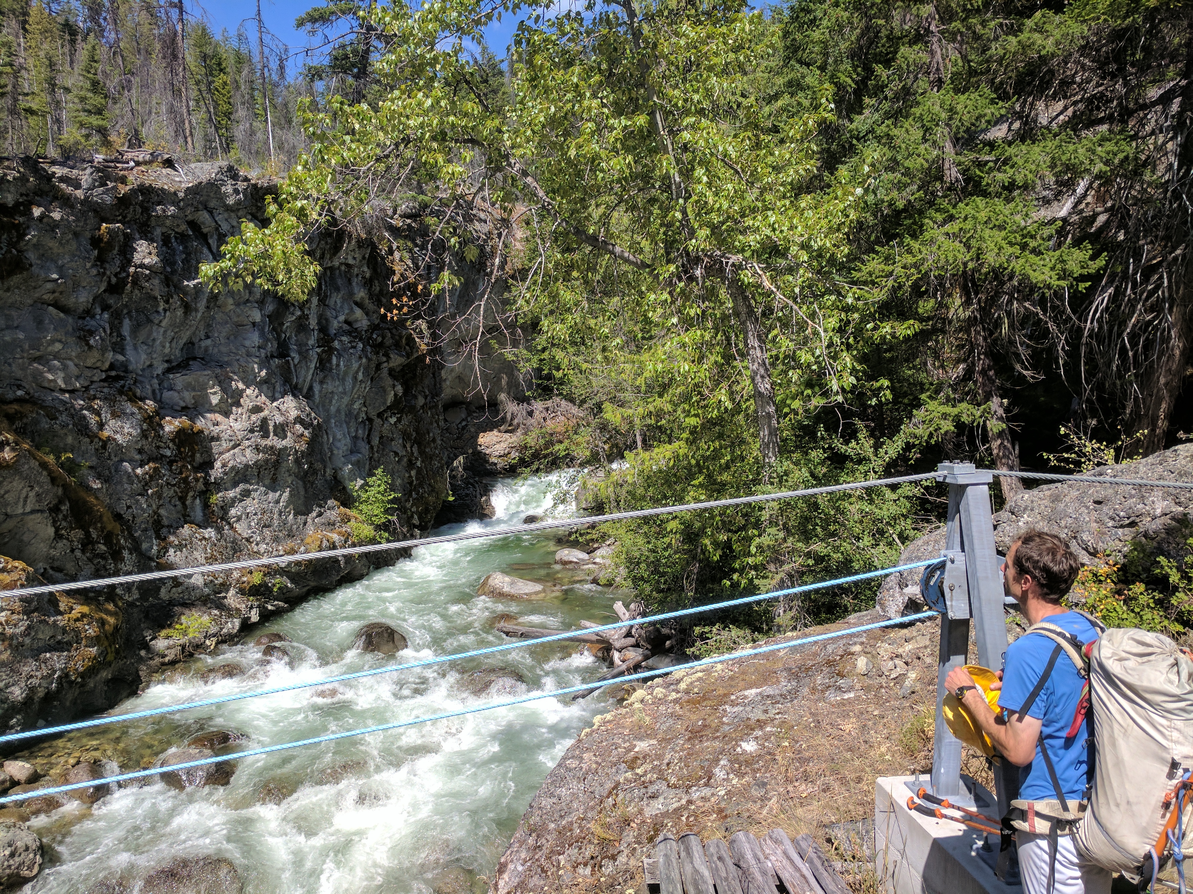
Mark gazes back across “Rowat Crossing”
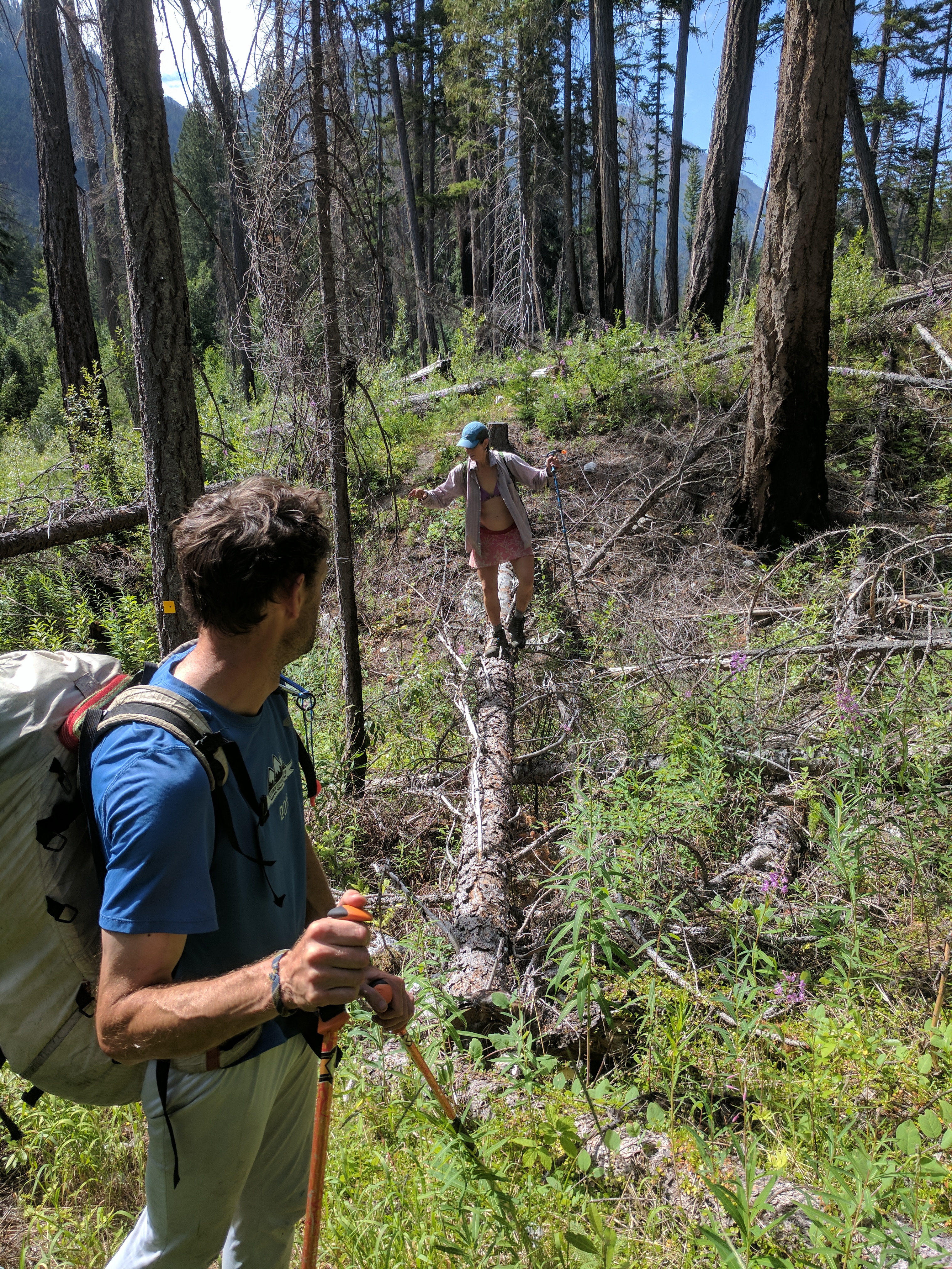
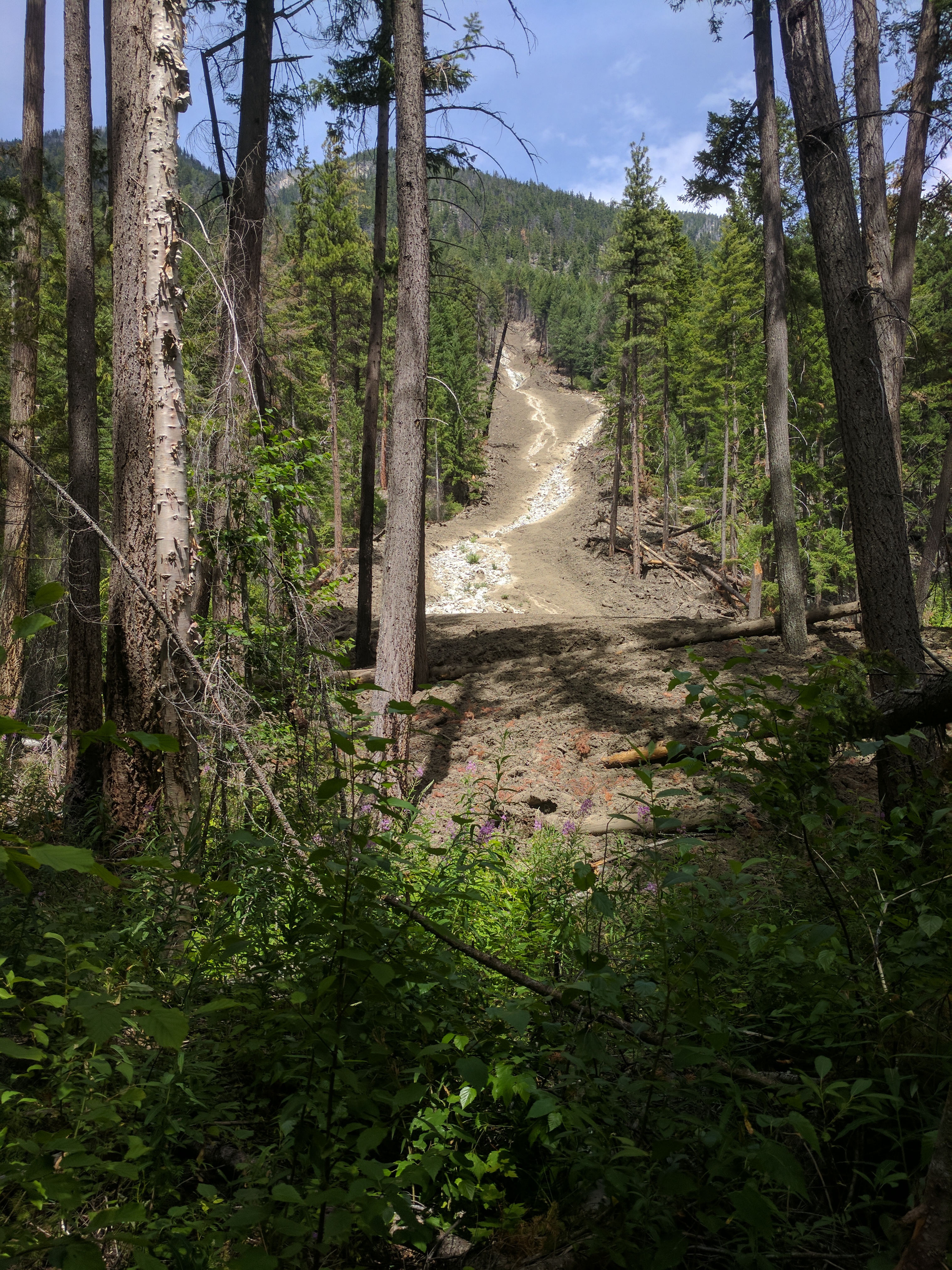
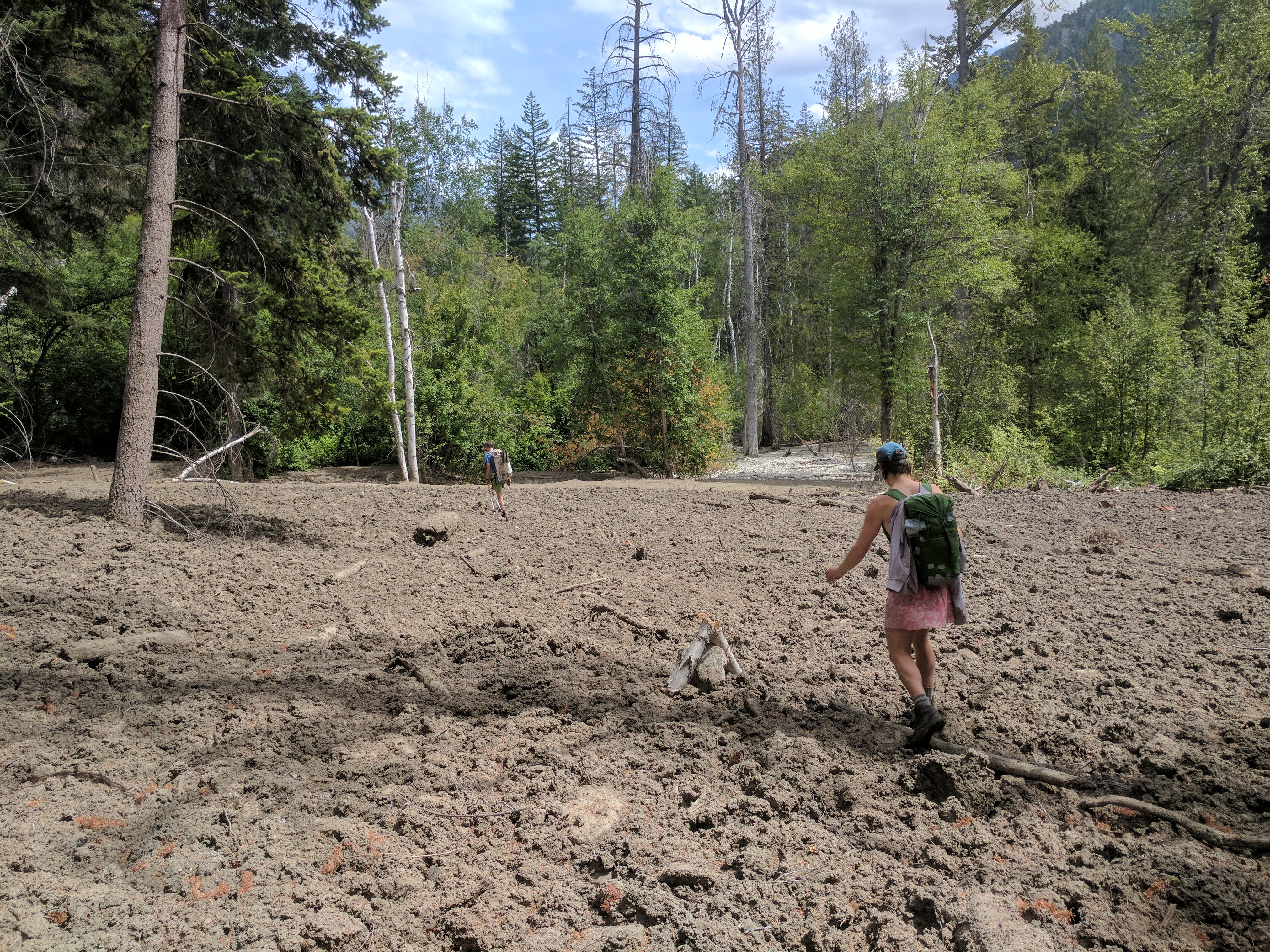
We went through tonnes of different ecology along the trail, including a multi-million dollar grove of cedars. The next major event was coming across a couple of spectacular mud/ debris sides.
The slides likely came down this spring with the heavy melt. The mud that flowed down had congealed and completely hardened to cement. It had uprooted some massive trees, but a couple stayed rooted. The hardened mud was very easy to walk over.
After the mudslides, we encountered a mother grizzly bear and her cubs along the trail. We carefully made noise and let them scurry away. One of the cubs showed off its athleticism. It scurried up and down a giant cedar very adeptly. Anyone who tells you that bears can’t climb trees, does not know what he/she is talking about.
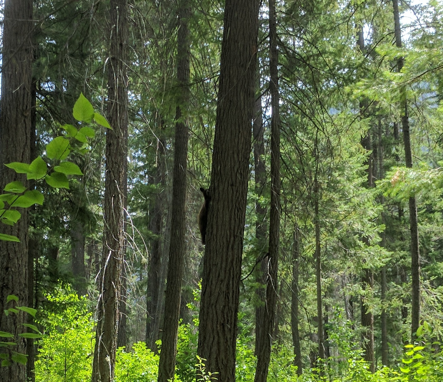
Can you spot the grizzly cub?
As we approached the Lytton side, the earth got drier and the foliage kept changing. Cedar and spruce transitioned to ponderosa pine and Oregon grape.
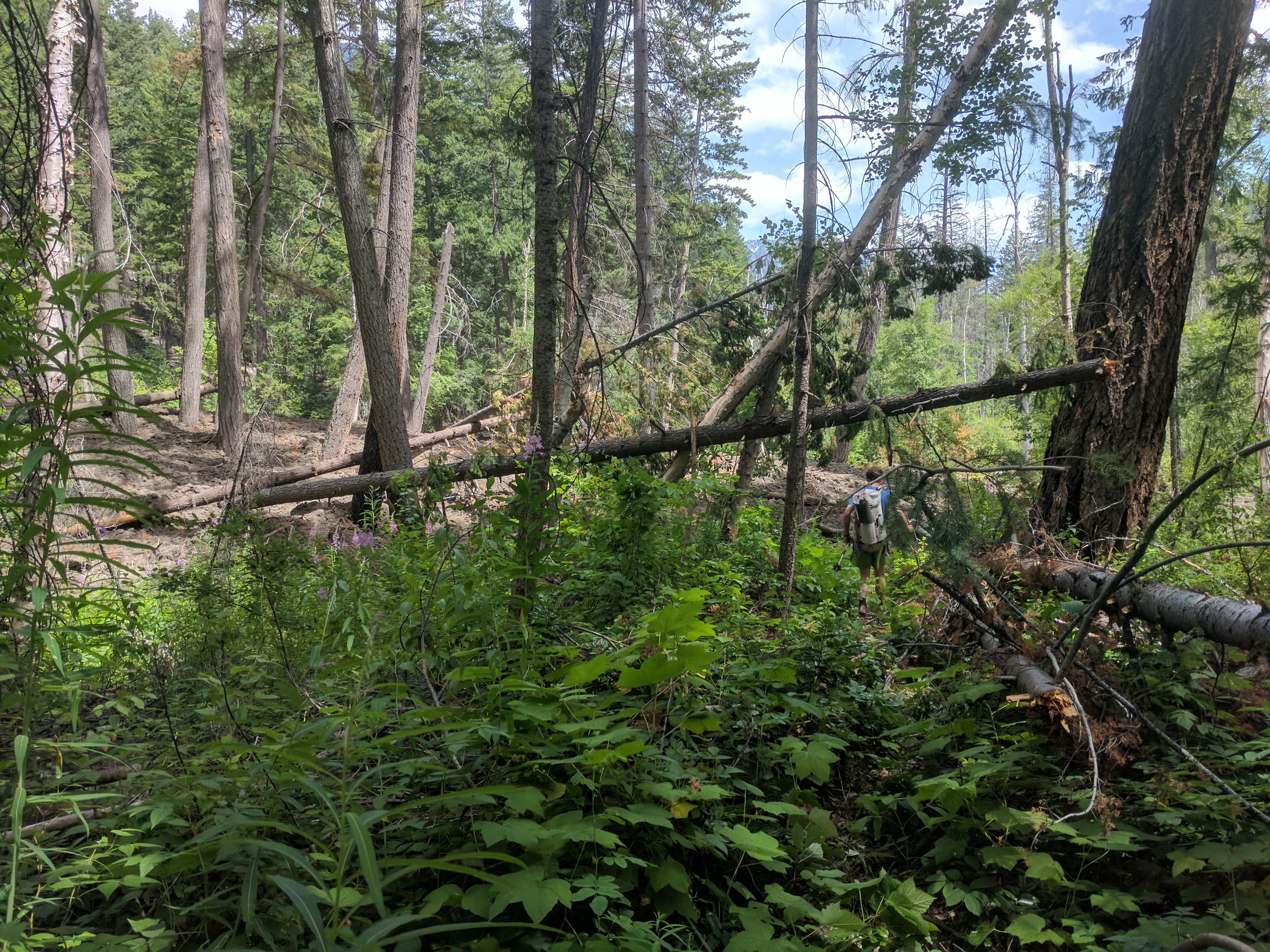
It became apparent that we had longer to go than we ideally would have wanted to on that day. The last 10-15km felt like a bit of a slog. Fortunately, at this point we had caught up to this years trail crew work. Fresh sawdust and clipped shrubbery meant that we did not have to do much bushwhacking or log hopping.
Well manicured trails of the lower stein.
It was mostly cruisey, flat trail, but the sign markers worried me a bit. “Devil’s Staircase -> 4km” is not something that you want to read towards the end of your 45km day.
Fortunately, the staircase was not that bad. There are some old pictographs that you can look at near the west end of the “Devil’s Staircase”, but they have mostly worn away.
Big boulders in the lower Stein
Within the last 3km of the trail, it became apparent to me that Mark and Lena were starting to get tired, as I was having to wait for them a bit rather than struggling to keep up.
Mark snapped a picture of Lena in her Sleep deprived, back to back traverse, fatigued state. She claimed that she had only felt “this kind of tired” one time before, when doing a 100mile hike in Alaska back in 1999 with a friend who had to be at work on a given day. She stuck with him for the length of it, because she was worried about doing the final river crossing by herself…
Tired Lena on the banks of the lower Stein. Photo: Mark Grist
I wasn’t convinced of this, though. She probably has a very finely honed “Alpinist’s Memory” after the Coast Range Traverse. Regardless, I joked that I had just achieved a tick box. *See Lena definitively more tired than you on the same trip*. Don’t think that I’ll ever be doing that with some of the other members of the VOC that I know… *Cough* Veenstra *Cough*
A little plodding longer, and we passed a sign for an “Asking rock”. It encouraged us to ask for something we desired. I asked for Nona to be at the trailhead with my car. My wish was granted. We arrived to find Nona and food. Including fresh cherries. We finished sometime after 8 but before 9. I forgot to check. Regardless, 49 hours was a good number for me. It was almost the exact length of time it took me to do the Tantalus traverse immediately prior.
Once at the car, we realized that it was a good thing we arrived before 10pm. Sometime after 10pm, the ferry over to Lillooet closes.
During the drive back, Nona asked me how I fared with my new (to me) shoes. I replied, “I fared well, but my shoes did not”.
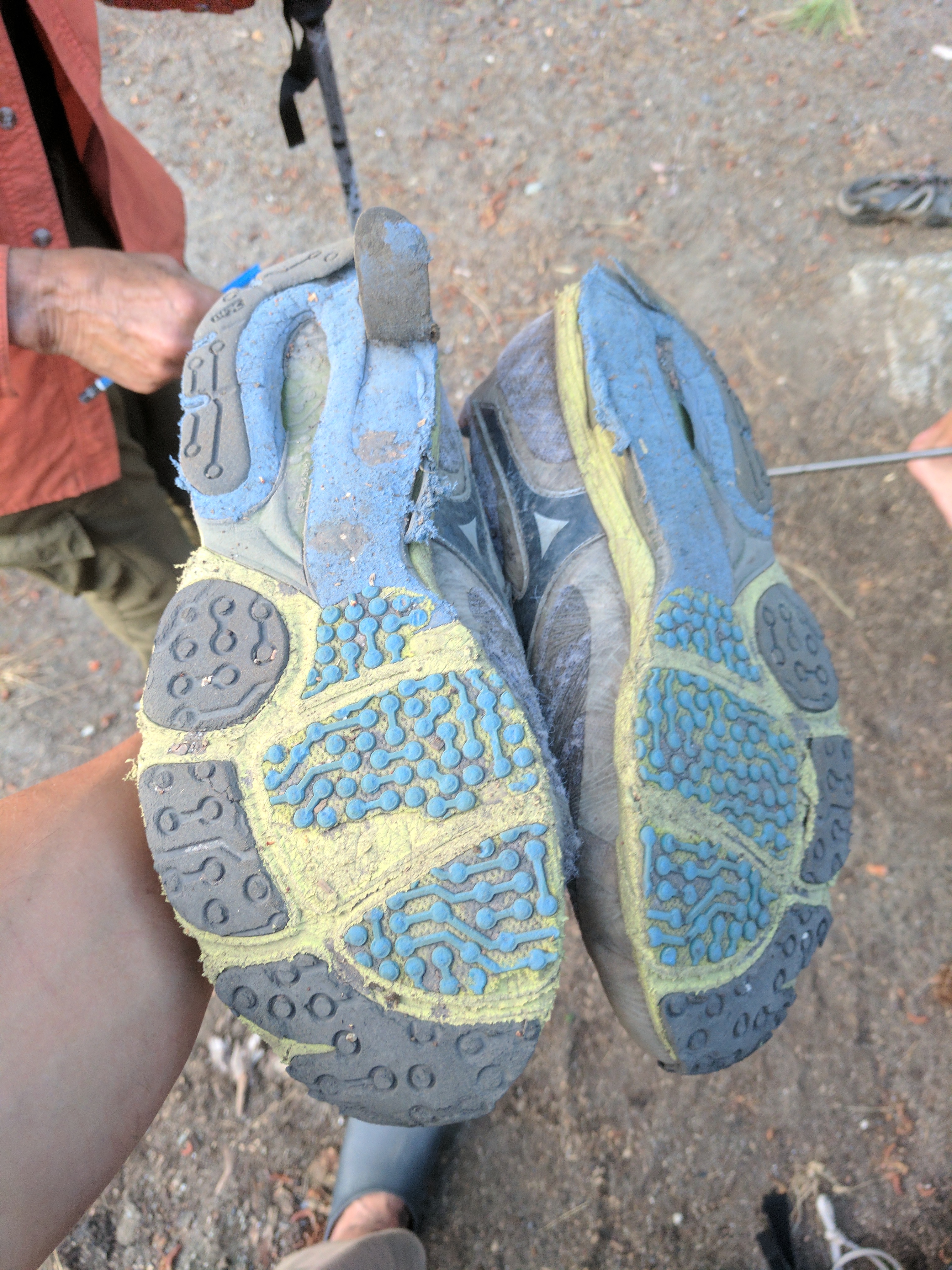
Exfoliating rubber after only ~48 hours of use.
Oh well, nothing gold can stay.
On the way back, we stopped only once, in Hope for some very tasty tandoori vegetable pizza. (The restaurant is right by the Chevron gas station, close to the Dairy Queen). Plenty of Paul Simon was listened to.
That’s it. Hopefully it inspires more people to hike in this cool area.
“Unfortunately, we were only ever able to see the outflow of the lake, never the lake itself. By all accounts (Lena’s) it is a gorgeous lake.”- hahahahaha…
“There are some old pictographs that you can look at near the west end of the “Devil’s Staircase”, but they have mostly worn away.”
Have to go a bit further down towards the river, where there’s almost a hundred. It’s pretty cool.
Great report, insane amount of snow up there!