I know, I know, it’s late. This trip happened in August, we wrote the VOCJ article in December, and we still haven’t posted it as a trip report. But here it is, at last—and with lots of extra pictures!
Richard Shaw, Birgit Rogalla, Vincent Hanlon, and Cassandra Elphinstone
August 24-31, 2017.
Grand ideas for a summer traverse, for some reason, are always conceived in the spring; then follows an obsession with routes and logistics that lasts at least six months, many emails, anxious discussions about kilometers-per-day and impassable cliffs, and finally–-departure.
We arrived in Squamish one morning late in August to meet Arran Whiteford. Our car faff was extensive: since our plan was to hike the full length of Pinecone Burke Provincial Park from Watersprite Lake to Widgeon Lake, we recruited Arran to drive us to the Watersprite trailhead, Harlin Brandvold to drive Birgit’s car back to Vancouver, and Ross Campbell and Tom Curran to drive to the south end of Pitt Lake with two canoes and then paddle out to Widgeon to meet us at the end of the trip. Thank you all!
Blissfully ignorant
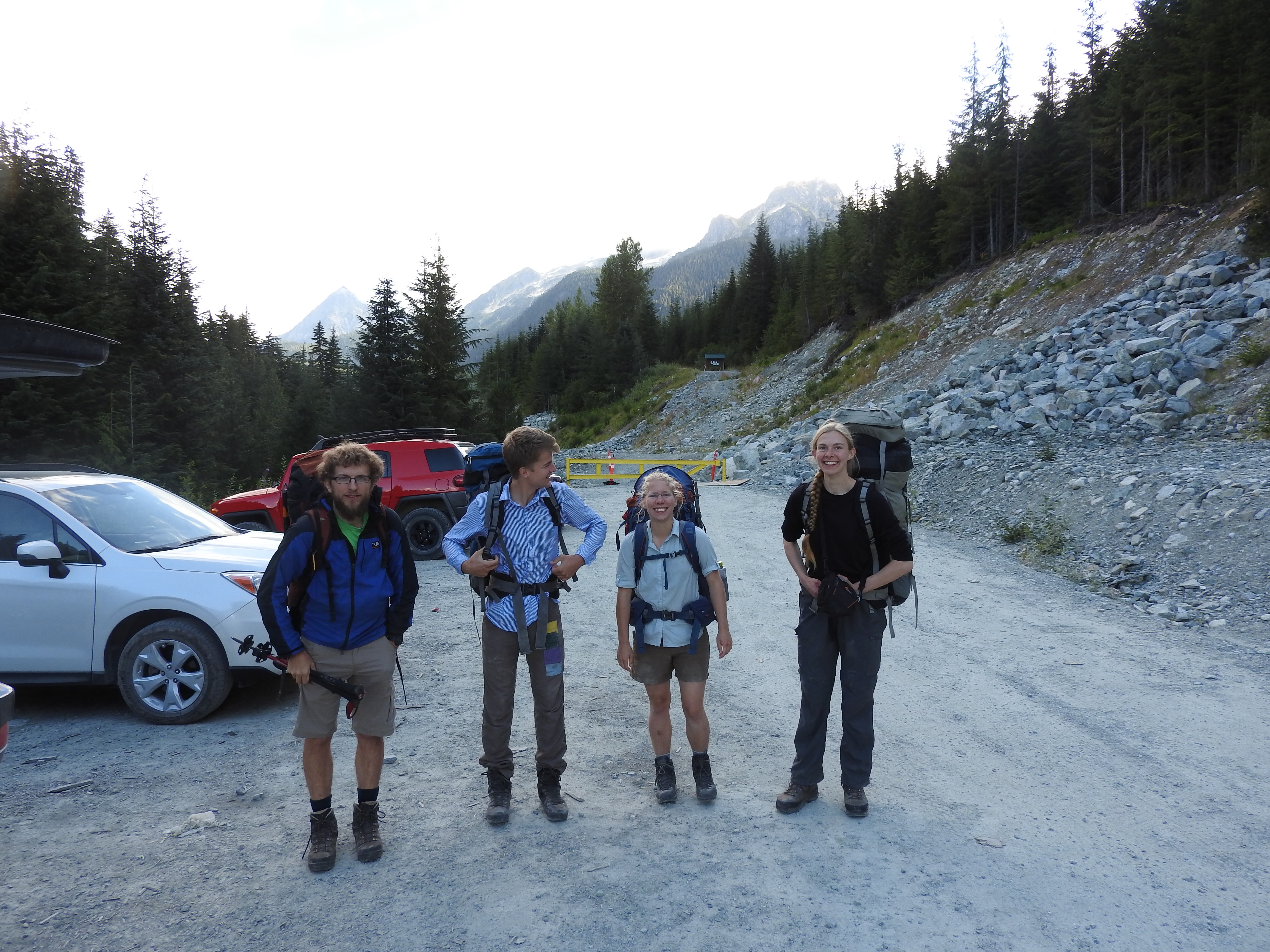
Arran chatted while the four of us faffed in the parking lot and took a picture–-then we ambled anticlimactically up the logging road. It was pleasantly sunny, but everyone had something to worry about. Cassandra was worrying about the weight of her pack, 10 Ibs more than everyone else’s, as she’d glimpsed on the luggage scale Richard had brought to the trailhead. Birgit was occupied with the two wasp stings she acquired almost immediately. Vincent was trying to convince everyone that the bright orange Chicken of the Woods he found (a fungus) was edible. And Richard, of course, was calculating each person’s daily ration of sunscreen, anxious that we would soon run out.
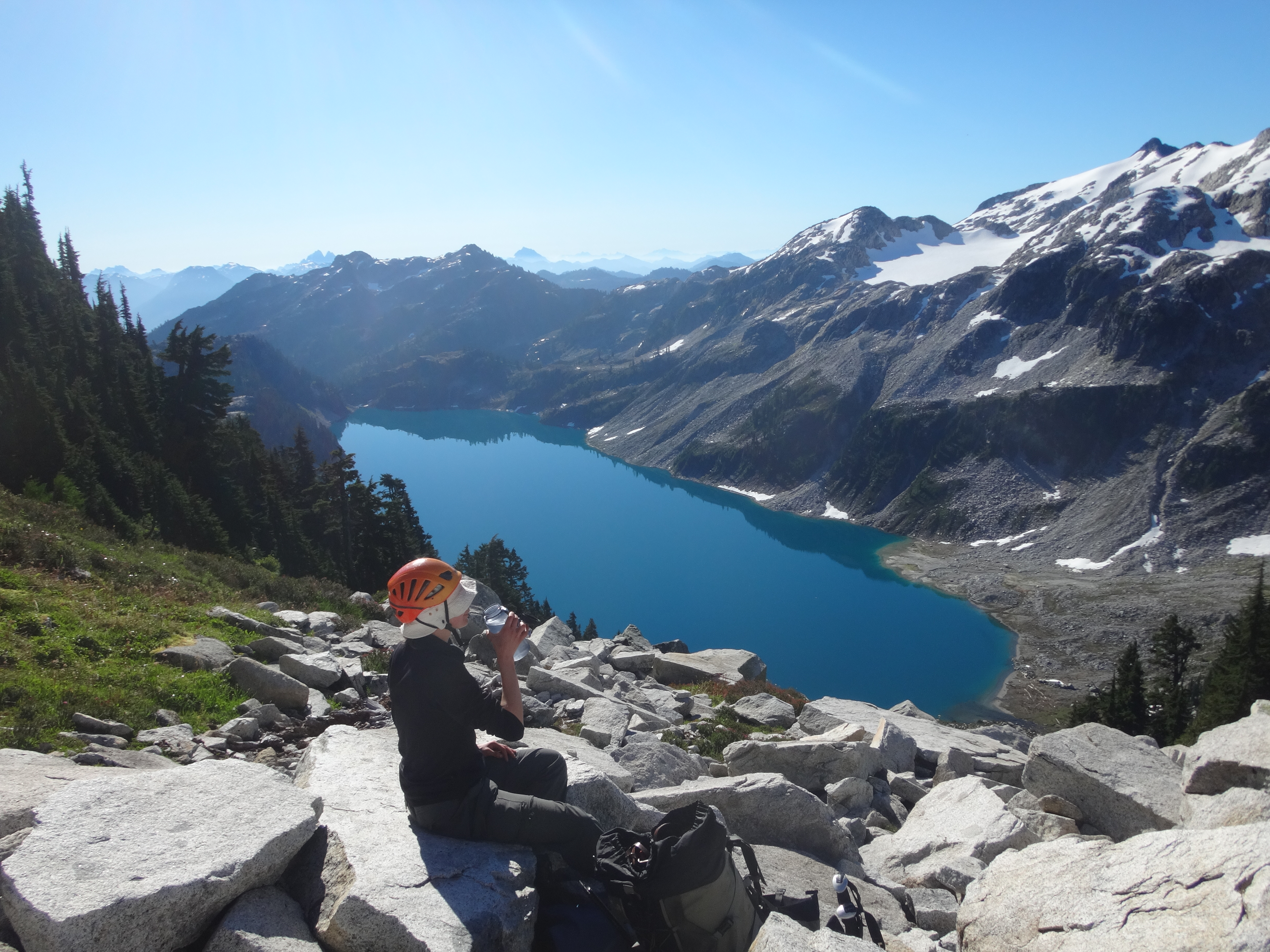
Richard, you see, was in charge of bringing sunscreen for two people for the entire trip. In the labyrinth of the internet he had read that 1 L of sunscreen was necessary to cover two people head-to-toe for eight days, and since he was packing with little sleep late into the night, he believed it. Cassandra, wise in the ways of the interwebs, brought less than a quarter of that. Heated discussions ensued, and Richard had reluctantly left one 500 mL bottle in the car, making dire predictions that we’d be four lobsters by the time we reached the Five Fingers.
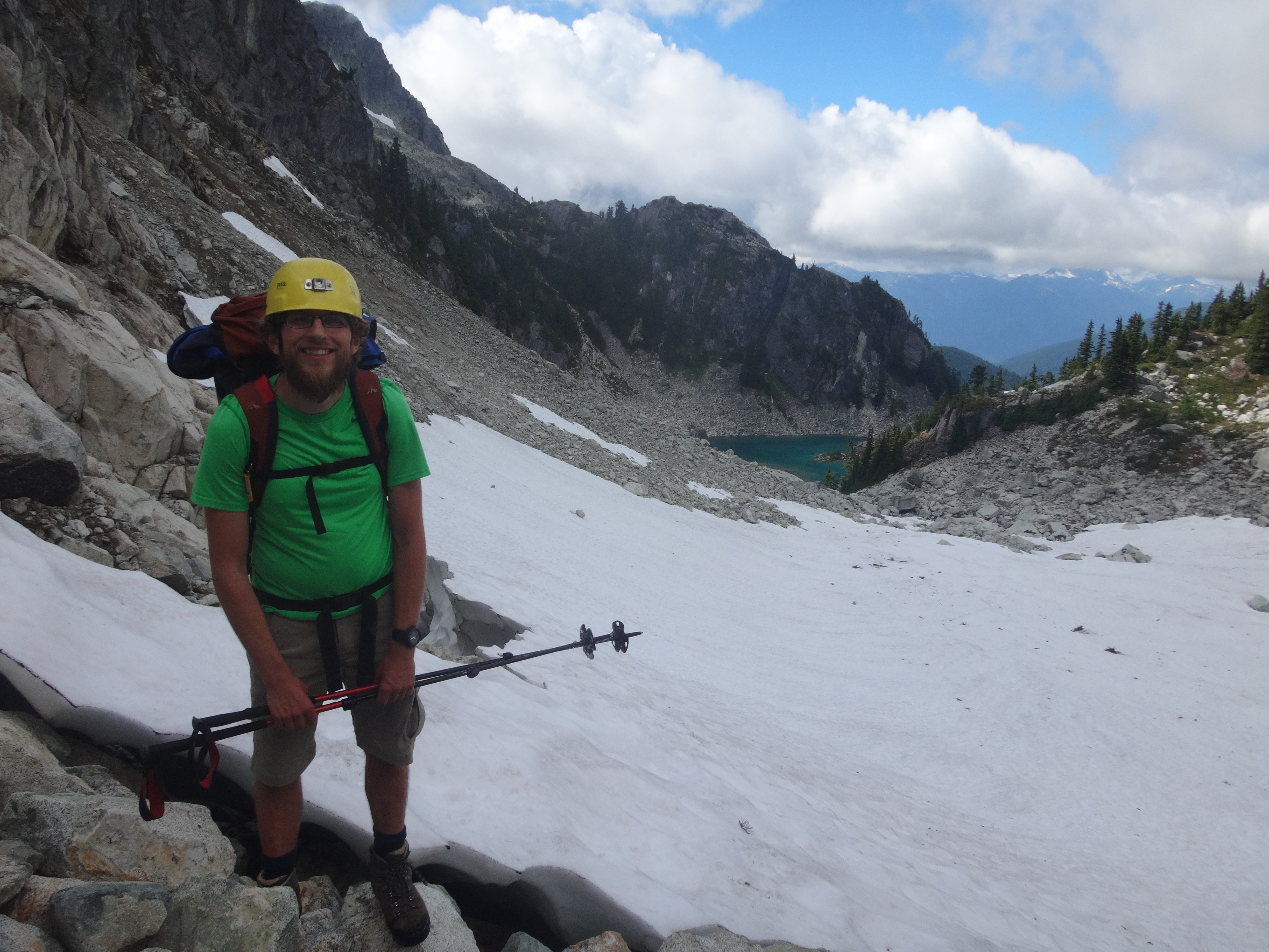
Richard near the top of the pass above Watersprite Lake. Photos in this TR are by everyone except Vincent.
Well, we reached Watersprite Lake and the new hut beside it, passed them both, and climbed up the pass to the left of Watersprite Peak. The descent from here was uncertain, and we were lucky to find a steep loose gully that led all the way down to flower-filled gravel flats in the valley below. We crossed over to the lower flanks of Crawford Peak and started up through steep meadow and forest. The going was slow (or so we thought), but we made it to the high, still-snow-covered lake near the top of the mountain before dark and camped with beautiful views on the Pinecone group and the sunset silhouettes of the peaks west of Watersprite. At dinner we learned that tofu does not rehydrate well, tried some of Vincent’s lemony fungus fried in olive oil, and slept soon afterwards.
Looking back over our route from below Crawford Peak
Cassandra and Vincent leaving camp on day 2
We predicted the next day would be one of the easiest of the trip, since the map said our net elevation change would be near zero. We didn’t want to dawdle, though, and so we ate, packed, and departed efficiently, wandered around the side of Crawford Peak, slid and bushwhacked quickly down to the broad heathery pass north of Cotard Peak, and climbed up to the rarely-visited lakes on its northern slopes. Here it was all talus and snow, and we swam quickly in the bright water before ascending up steep snow to the high saddle west of the peak for lunch.
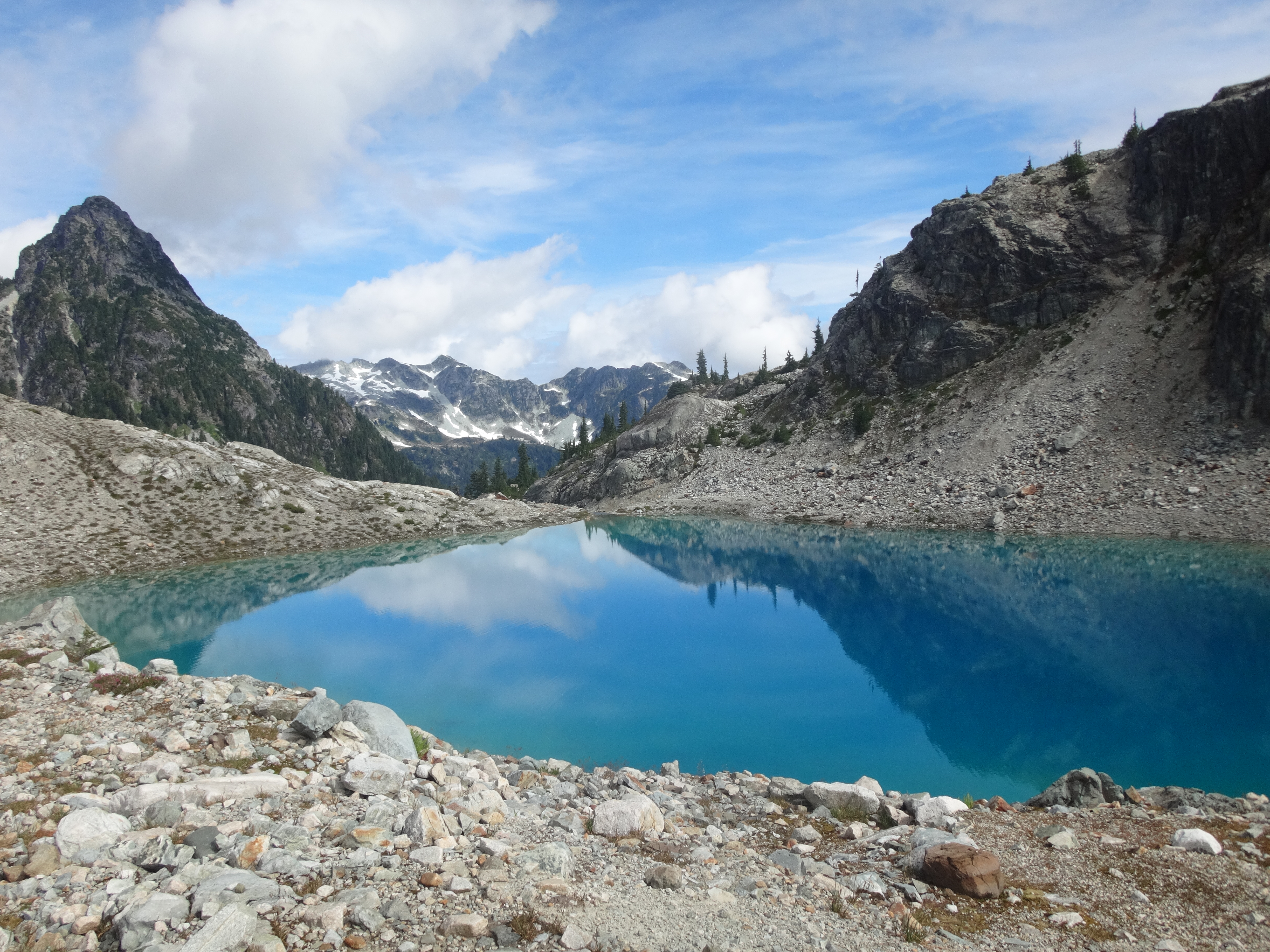
The first lake under Cotard Peak
The lakes below Cotard Peak, with Mamquam in the distance.
Over the next few kilometers, the bushy descent to the low forested saddle south of Cotard Peak and the climb up to the ridge north of Pinecone Lake, Birgit pioneered one of the trip’s major technical innovations: the blueberry buttslide. Many of our descents involved steep forest thickly carpeted with blueberry. We’d weave through cliff bands downwards, but since slippery blueberry stems offer poor footing we often fell. Birgit expedited the process by sitting down right away–-surprisingly, buttsliding was at least as efficient as walking and a lot less tiring.
Hours later, we left the bush and ascended a mossy boulder field to the alpine, then followed four mirror-like tarns up a wide bleak valley into the evening. We made it to the ridgetop just before sunset, exhausted, a bit shell-shocked by the bush’s brutality, but exhilarated to see our camping spot beside another small snow-covered lake nearby.
Our second camp looks a lot like our first
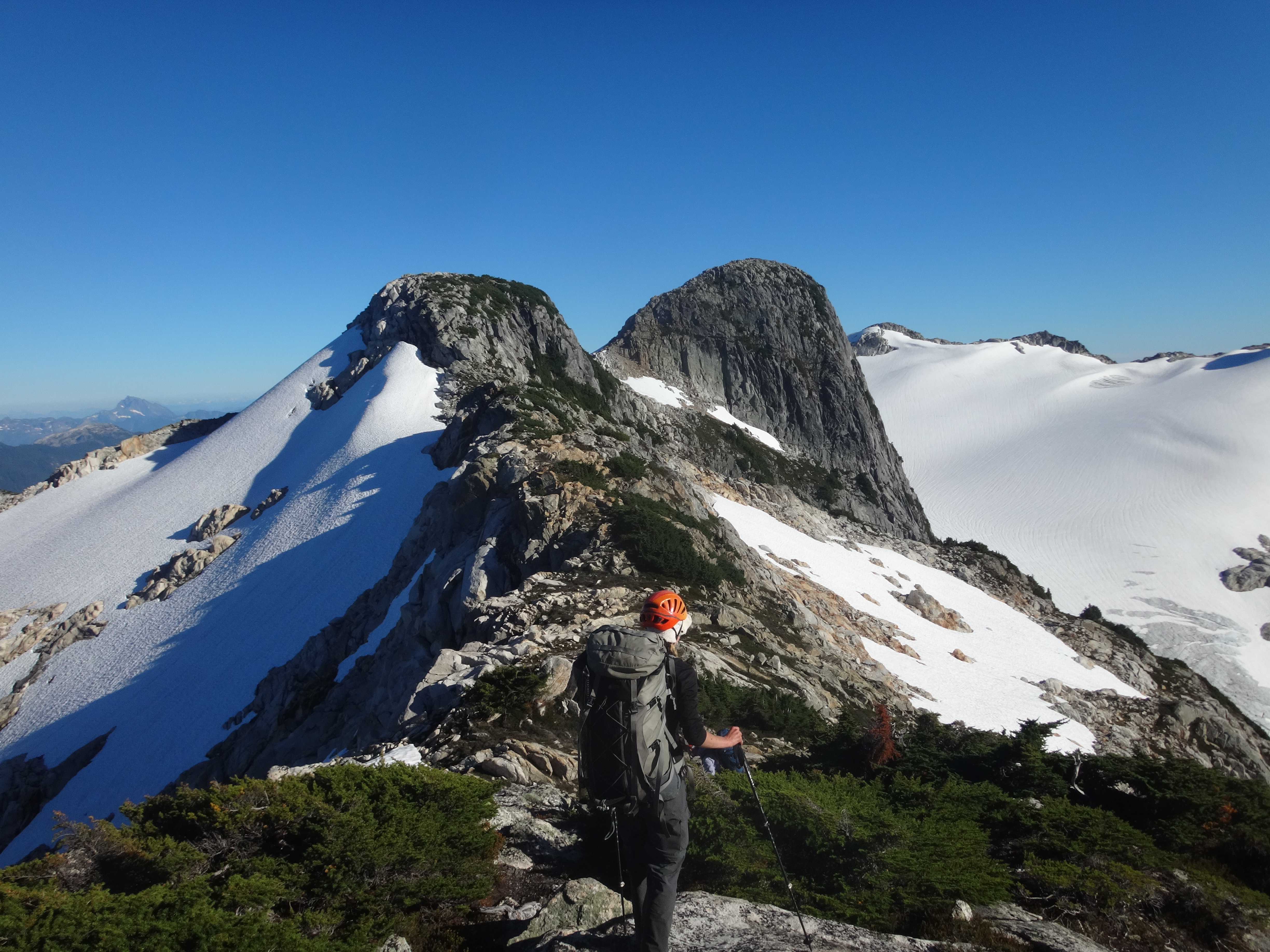
The Five Fingers! Our intended destination
The snow was icy in the morning but we trotted along (Cassandra with crampons), contouring below what we thought was Pinecone Peak and then following the ridge south. We knew this would probably be one of our easiest days, since we had barely any uphill to do.
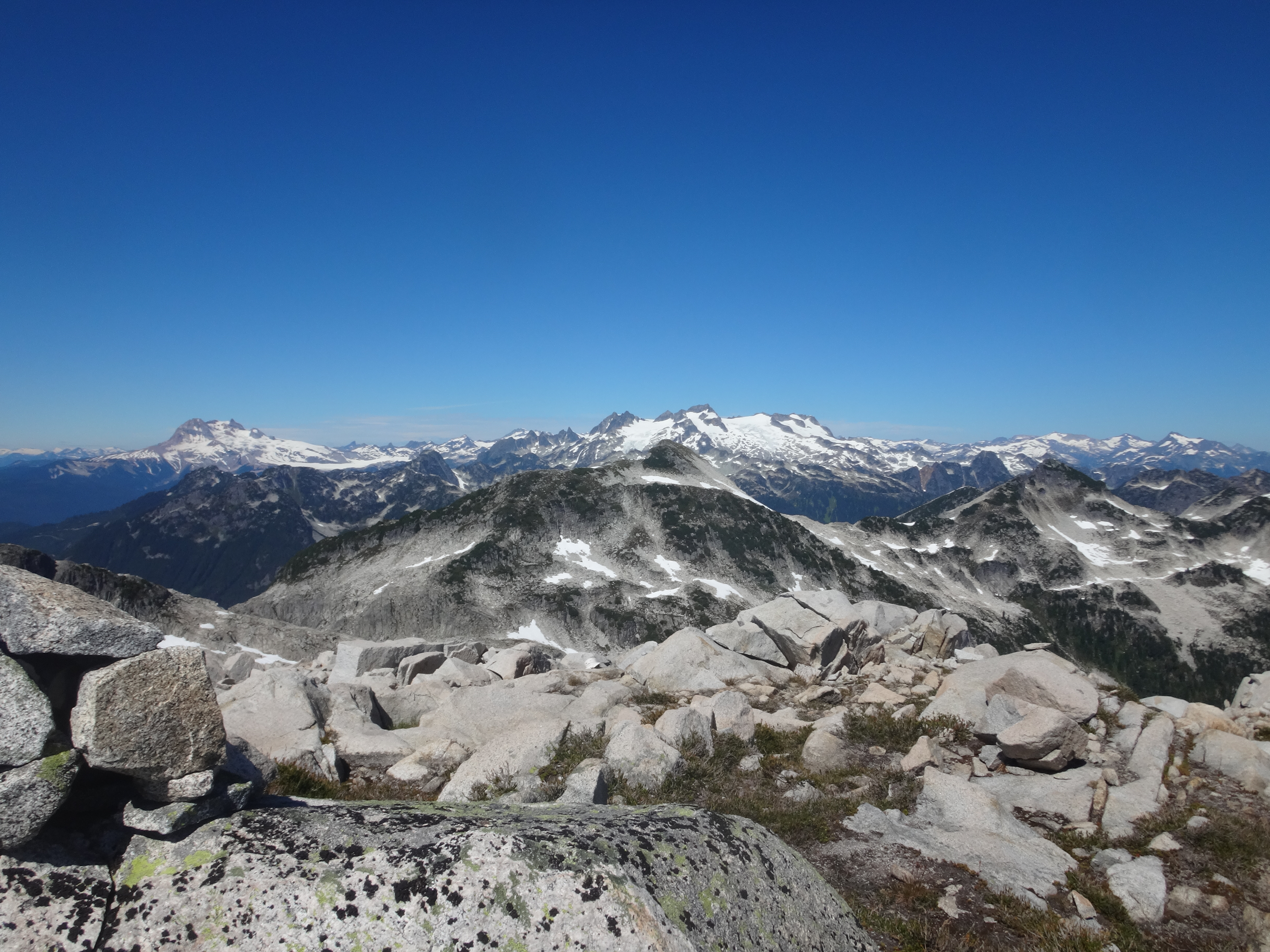
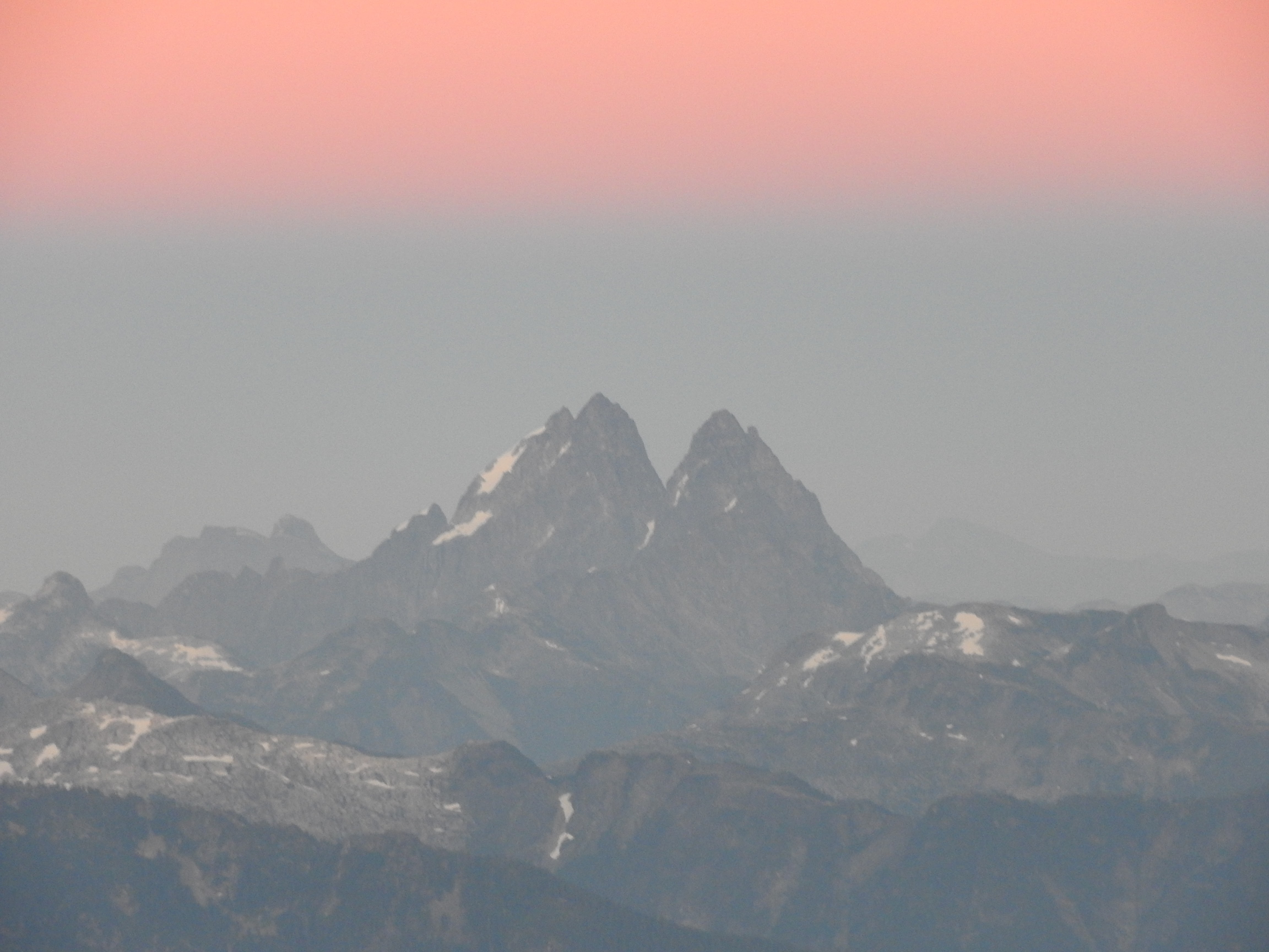
Everyone says this about their trips, we know–-but the views were spectacular. Really some of the most stunning in the VOC’s usual stomping grounds around Squamish and Pemberton. The classic mountains were all in a ring around us: Garibaldi and Mamquam to the north, the Misty Icefield, Judge Howay, Robie Reid, and Meslillooet to the east and south, then Cathedral, the Lions, Brunswick, and Skypilot to the west, and near the north again, the Tantalus. And the lakes… and the mountains in the park itself… and the isolation! So near Vancouver, and yet we spoke to only one other person in all the days after Watersprite Lake
Pinecone Lake and Cassandra
Looking back: Mamquam and Garibaldi.
Who was that one person? Vincent thought he looked familiar as he climbed over a steep bump on the ridge. None other than the author of the only online trip report covering our traverse! This guy and a friend had tried the same traverse from the south a few years back, but had bailed at Meslillooet due to bad weather.
We continued up over the real Pinecone Peak (by mistake), had lunch, and considered our route options. The way we had charted went steeply down the backside of Mt. Gillespie, and it looked nasty. We chose to take a shortcut down to November Lake, and then around to the northern slopes of Pollen Peak. After passing another another snow-covered lake, we found a rocky overlook that offered a choice of four or five talus-gullies disappearing into the steep wforest below. After some investigation we chose a central one that looked mellow, and sped (relatively speaking) downwards.

Our intended route along the ridge from Pinecone Peak; instead, we descended right, to Novembre Lake. (see Baker in the distance?)
Of course, it was not so simple. The gully, steep-sided, ended in a cliff. So we backtracked a bit, scrambled out into sketchily steep forest while dangling from blueberry bushes, and cut left in search of a better gully. We couldn’t descend (more cliffs), and when we found the next gully it was lined with cliffs. Damn. We scouted the forest below and found terrifying cliffs. Damn. Then Birgit found a way into the gully, and found some sketchy slippery little cliffs. We were desperate, so two more of us went in for a second opinion, balked, and returned to the forest–-Goddamn. We probed our cliffy options in the forest again, balked, then returned to the gully for a second opinion, slithered uncomfortably down the little cliff, found another cliff, swore, slithered uncomfortably down it, continued, skirted an awkward slab, and then stepped into sunshine, out of the gully, and bushwhacked over scree to the lake.
More blueberries, some atrocious sidehilling over cliffs, a horrible plant-rappel on fragile hellebore and spiky salmonberry as it grew dark, and a final stumbling exhausted climb to the alpine lake underneath the peak, only to find–-no lake, and dense buzzing clouds of mosquitoes.
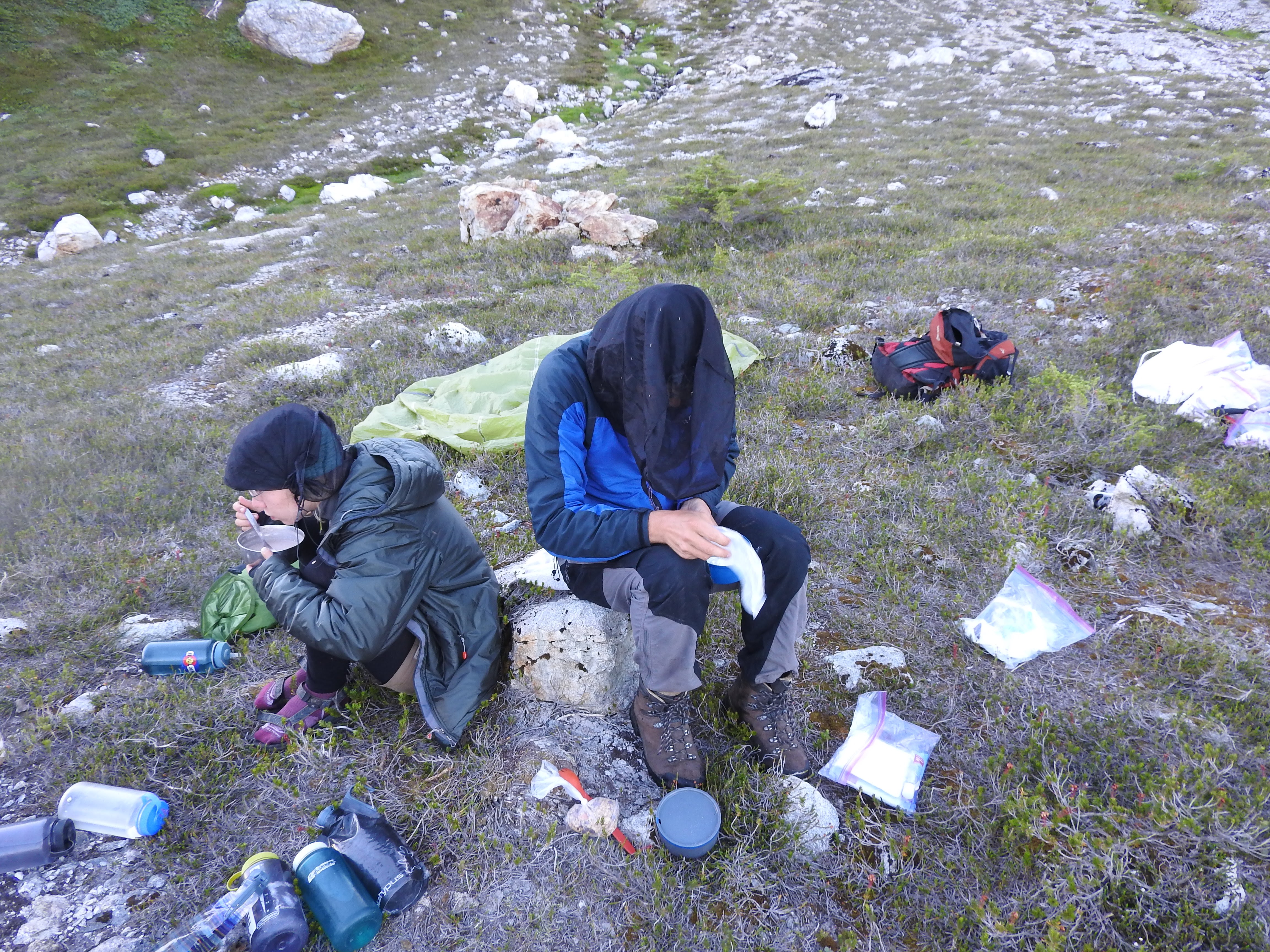
Very happy breakfast.
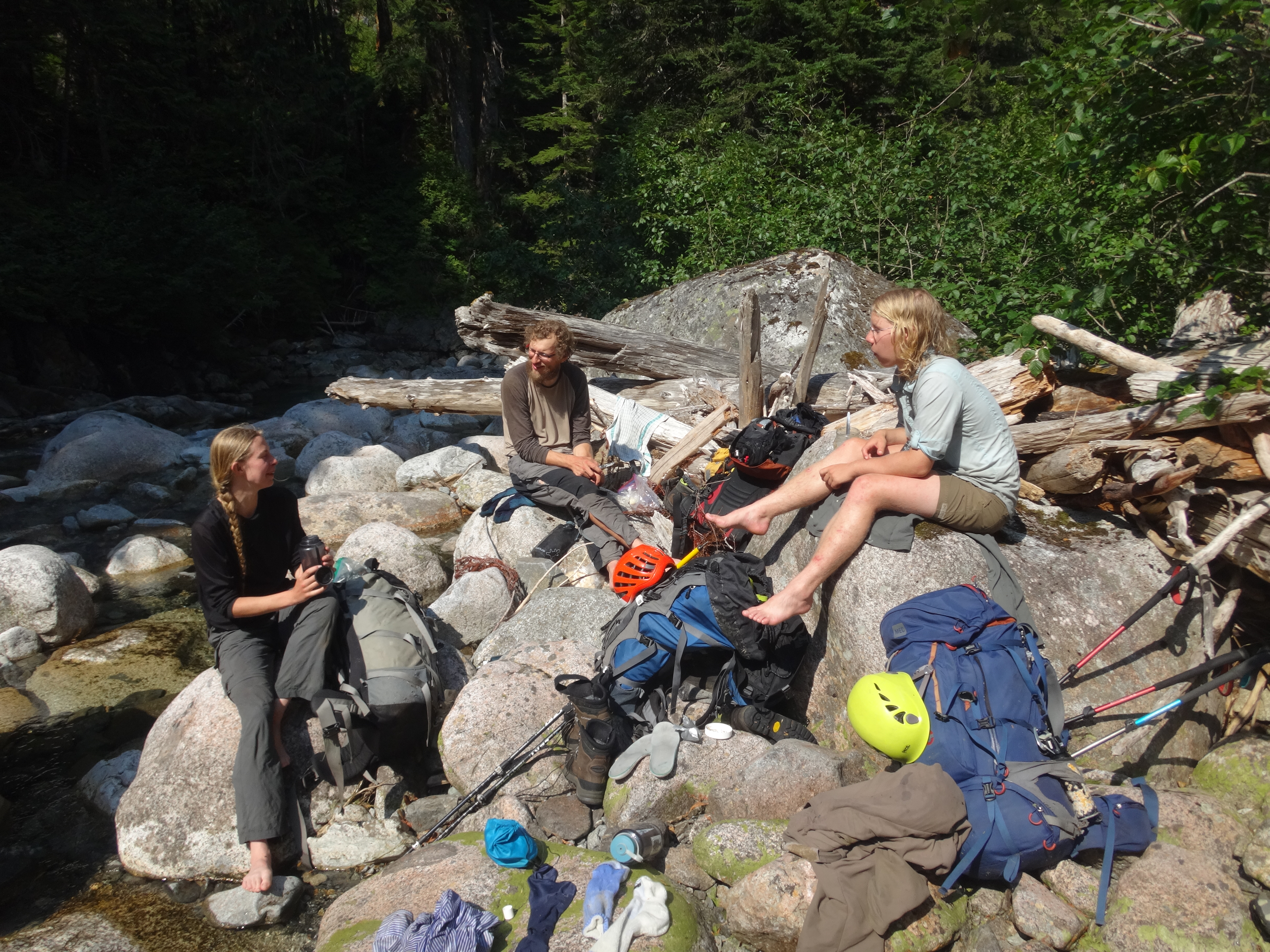
In the morning, mosquito bites and muscles were sore and we were tired. The next day was supposed to be one of the easiest–-“we say that every day,” grumbled Richard, “but our shortest day’s been 10 hours and we never finish before sunset.” Well, it was true, and we were barely making our daily distance, without time for extended breaks, peaks, long swims, or much leisure at all.
The map showed a gentle stretch of forest across the ridge, so we hiked up and over to it. Of course, it was cut deep with gullies, but we expected that. The bush was thick, as usual, and sometimes we four were invisible to each other even when only a few meters apart. More often we saw only hats and helmets bobbing along through the leaves.
The climb up the next subalpine ridge, along, and down to the pair of lakes north of Meslillooet was surprisingly pleasant. We swam at the larger lake, ate, washed our clothes, examined Richard’s mosquito-ravaged back (hundreds of bites), dove after dropped soap, and debated our route. Then we climbed up towards the next ridge and crossed flat open slabs and bushes strewn with mountain goat hair to the bump across the glacier from Meslillooet, watched a serac tumble down, scoured the ridge for water, and camped with the sun nearing the horizon.
The ridge just shy of Meslillooet
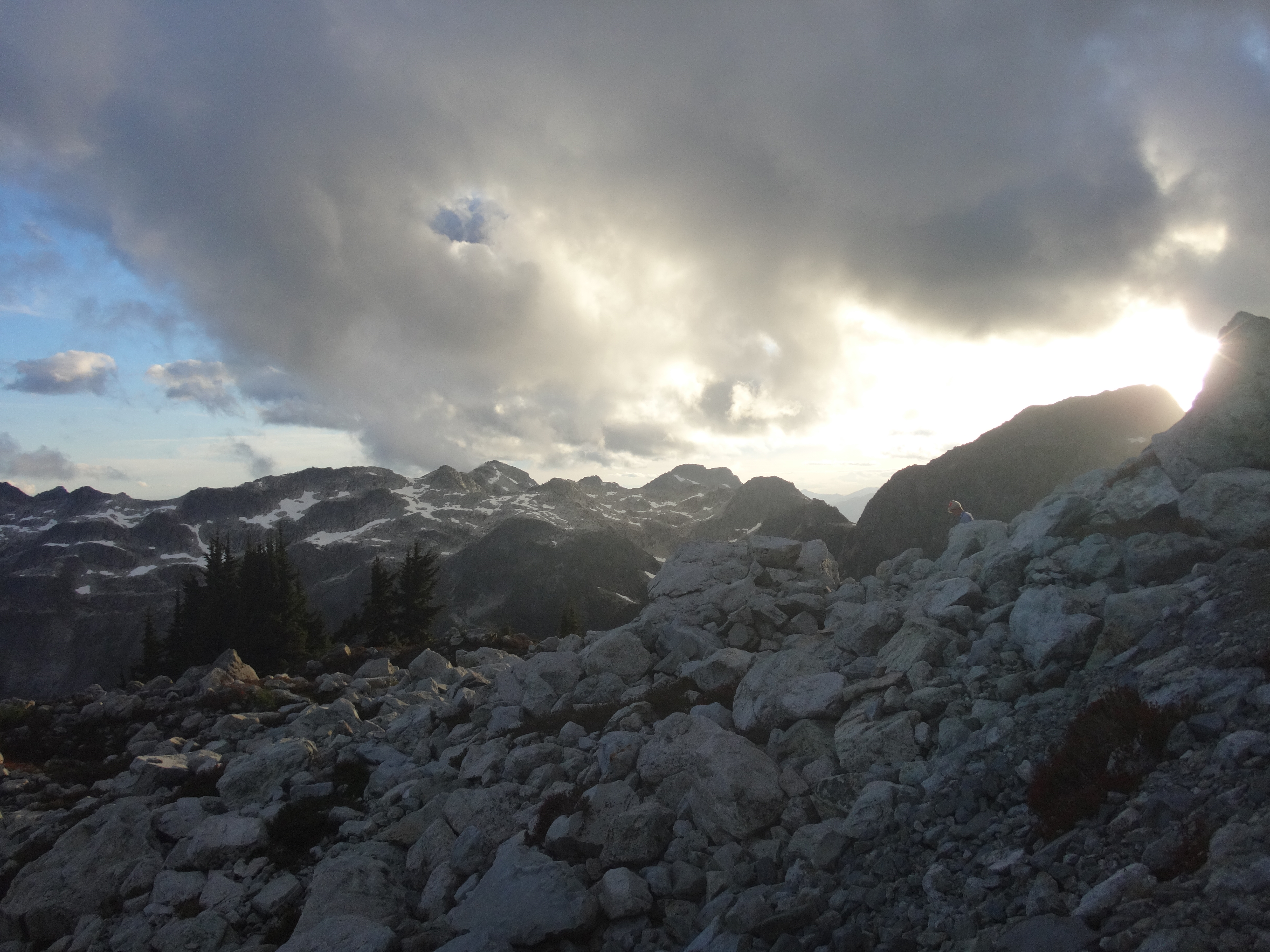
Before long we noticed a cloud of smoke hanging over the Mamquam valley. A new forest fire! A few planes buzzed overhead from Vancouver, and we saw helicopters dipping into the smoke. We were so close to the metropolis that Richard could phone in to report it–-in fact, we could see the city lights over the dark shoulder of Meslillooet. It was a striking mix of wild scenery with signs of our urban life, and it was a perfect evening. We sat in the dark looking over the broad glacier and towards the wizardly spires of our next destination, the Five Fingers group to the south.

A forest fire on our escape route…

Vancouver’s lights are visible at night over Meslillooet’s left shoulder!
Judge Howay
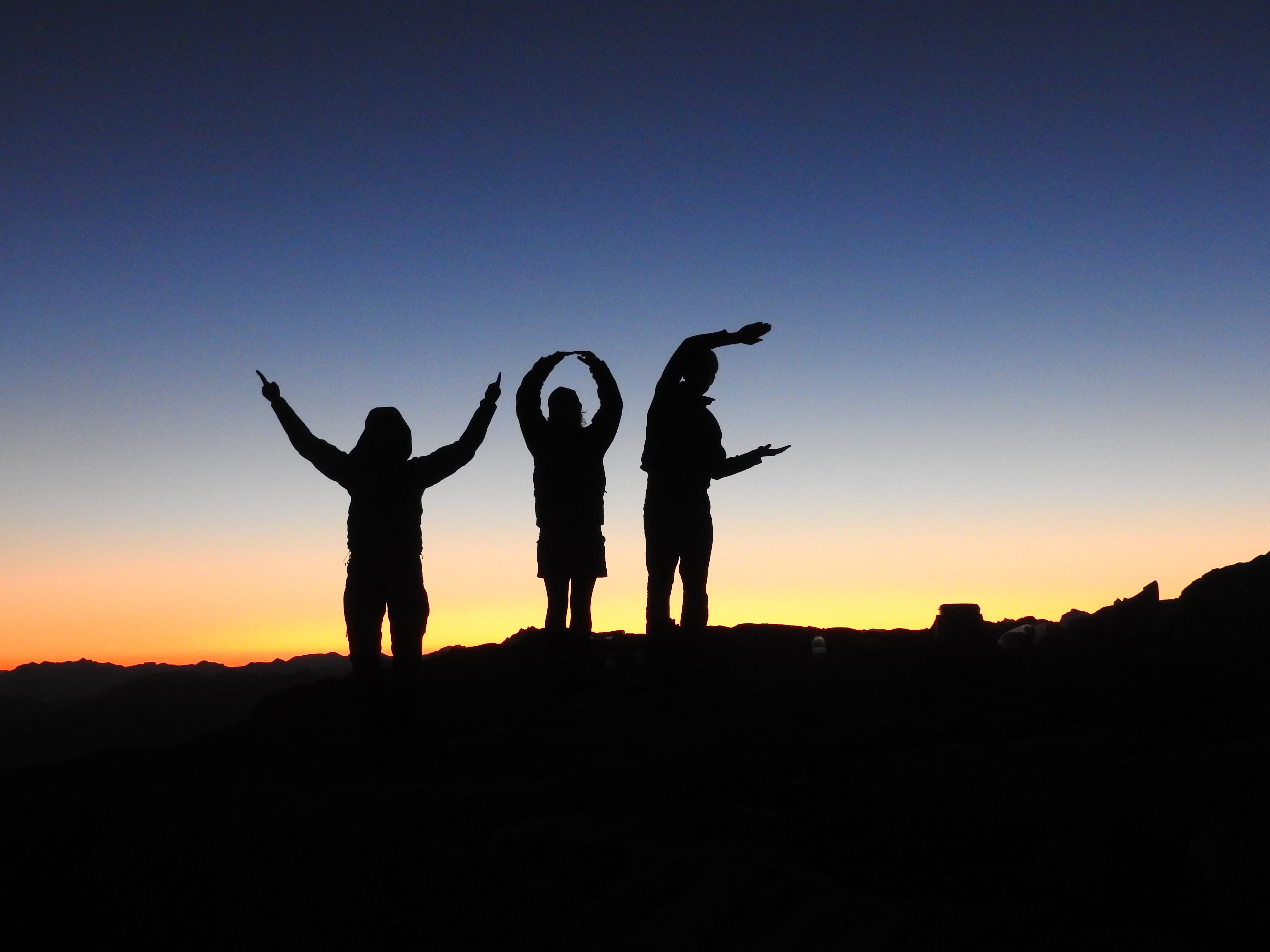
VOC
The next day we scrambled along a bare ridge to the divide between the east and west glaciers of Meslillooet. From there a short blocky ridge and steepening snow climbed to the intersection at Meslillooet’s east ridge. With the peak a mere stone’s throw away to the west, we faced a delicate situation: could Vincent be successfully convinced to abandon his long-held ambitions on Meslillooet for the sake of maintaining the illusion that we were running on time?
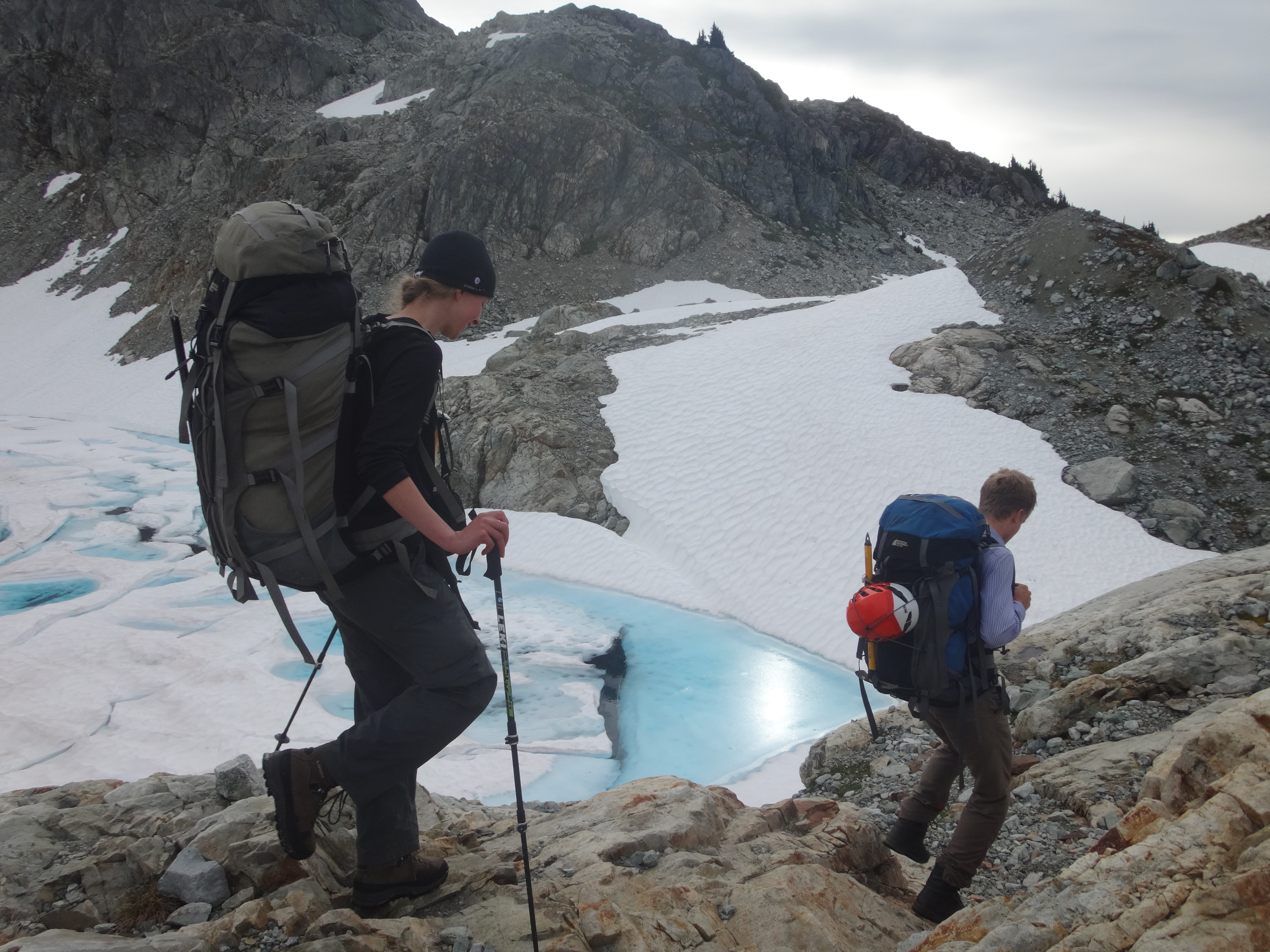
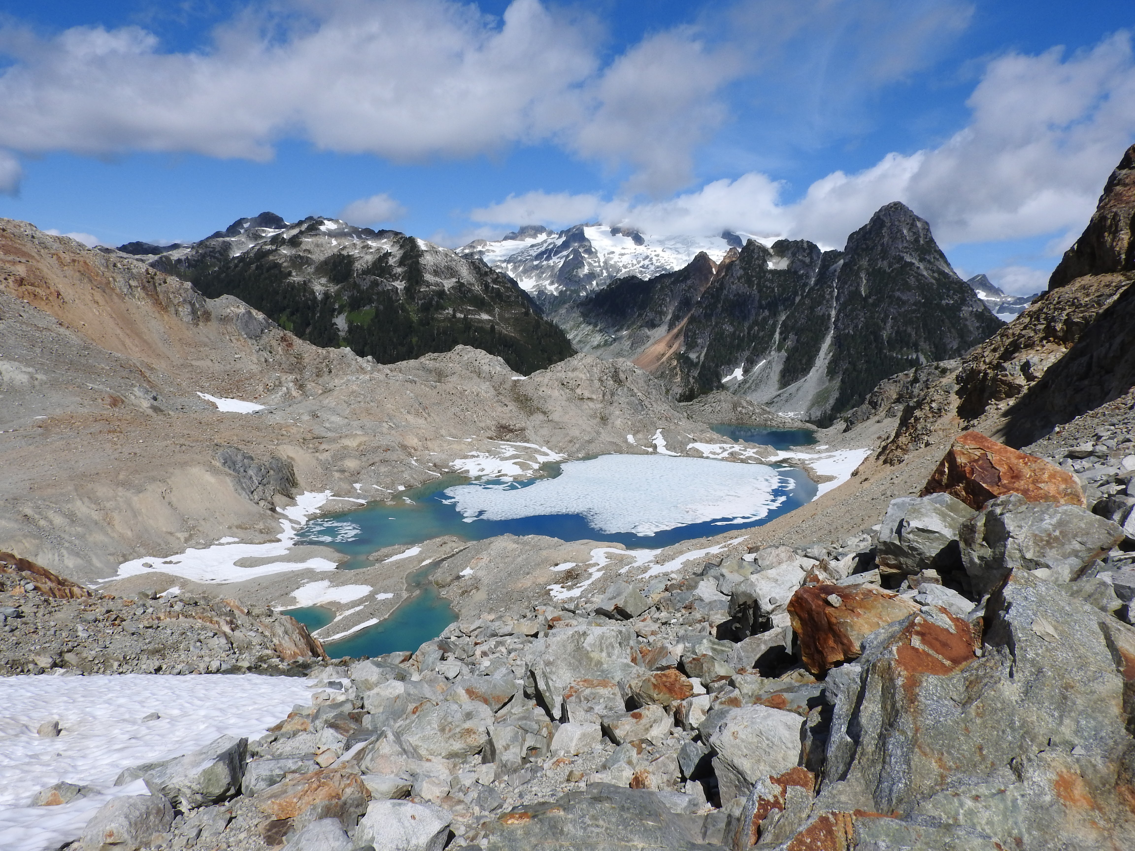
After a little discussion and a little more disappointment we continued towards the Five Fingers, resolving (again) to avoid all “short” cuts. We scrambled along the rocky and snowy east ridge and made a short descent down onto the glacier, which we quickly crossed to its southeast corner, roping up more because “we’d carried the bloody rope this far” than because of any fear of crevasses. From here we descended eastwards towards a beautiful (unnamed) lake complete with ice floes–-perfect for a lunchtime swim!
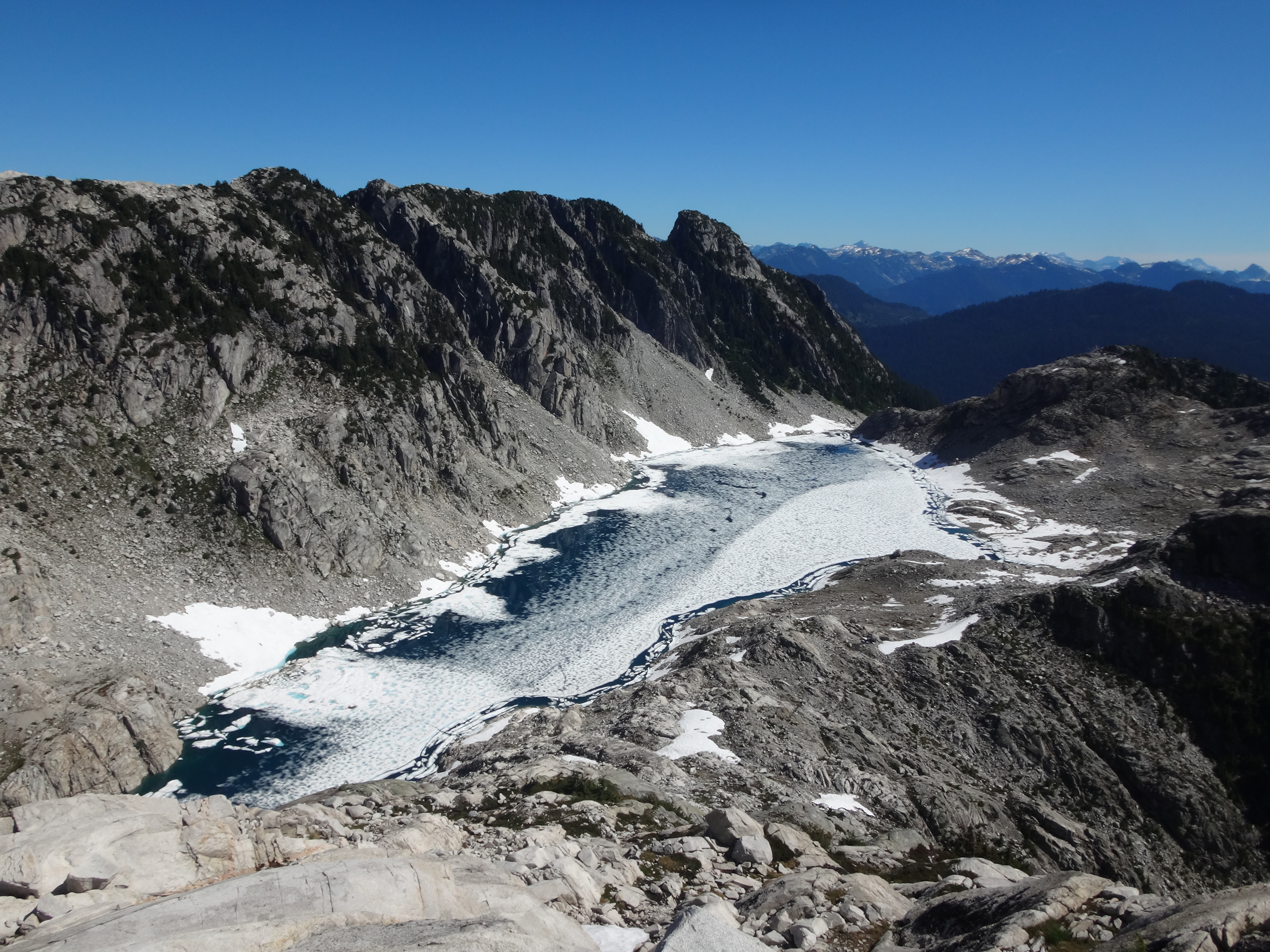
Isolated lake just south of Meslillooet; cold for swimming!
With sore muscles soothed by their ice bath, we headed back onto the ridge crest to consider our next steps. Climb onto a higher scrambly ridge, or wait, what’s that? You’ve found a sequence of lakes in the valley beneath connected by extremely mellow contours? Well that seems like a shortcut that can’t possibly go wrong.
Like all similar ideas, it all started so well. A descent down the highway of the alpine (more talus) to a beautiful, clear, sunny lake made for very quick travel, and expectations (and hopes) soared. However, the universe fired a few warning shots: Vincent dropped his sunglasses under some talus and had to crawl in up to his ankles to retrieve them, and then as we began to traverse the lake shore we had to take off our boots to get through some deeper patches.
By this point Richard dropped back a little due to an overly meticulous removal and stowing of his boots, which delayed him enough that he was extremely surprised when he rounded the corner to find Cassandra and an inexplicably undressed Birgit attempting to conjure a raft out of two thermarests and some hiking poles. After a few moments’ thought the issue became clear: the 15 m wide cliff around the corner plunged 5 m deep into the water with no ledge or shallows to walk along. While Vincent went off to scout for a higher route over the cliffs, the remaining three assembled the raft before commencing sea trials. After some time Vincent returned, claiming to have found a longer route around the top, but by that point it was too late. The majority had long since decided that it couldn’t provide nearly as much fun as plan ‘Naked Bag Raft Ferry’. After four or five trips ferrying the contents of our packs across the great divide, we swam across ourselves, abandoning our troubles on the far shore.
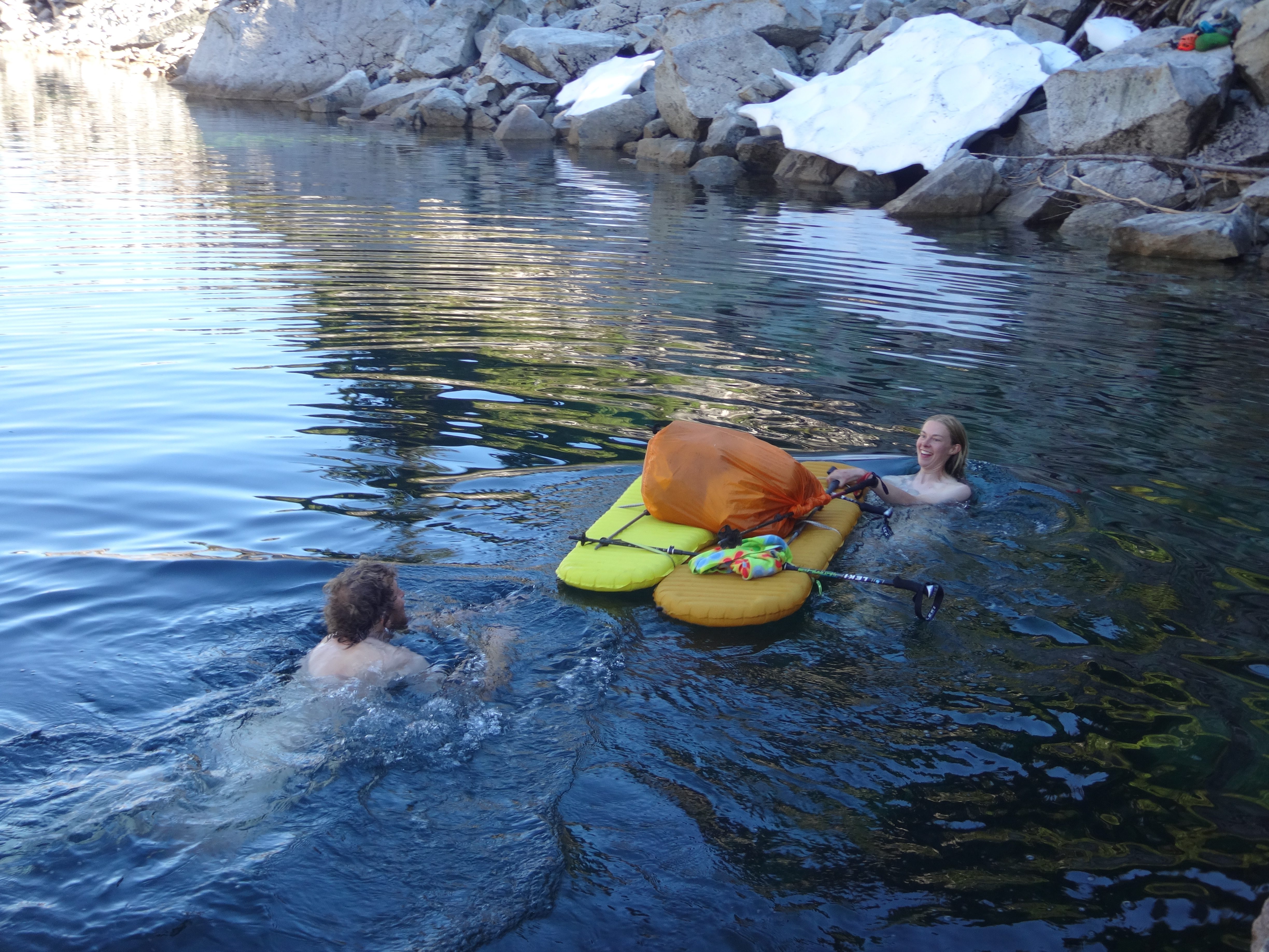
Plan “Naked Bag Raft Ferry”
Looking down towards the next lake, it was a touch further down and slightly steeper than expected, and so we fell into the routine of searching for alternative routes, circling the bluffs on which we were standing before committing to a bushy bench that descended towards a questionable bushy gully. We soon regrouped at the lower lake, ready to face the next trial: the numerous cliff bands near the outflow. Playing to our strengths we climbed up and down bushy cliffs, before finding our route. As we walked on towards the next difficulty we reflected on our “shortcut”, glad to see the back of it, but regretting that we didn’t have the time to explore one of the most idyllic areas of the traverse.
(Note: in this area there were some huge granite faces, that would provide some excellent routes for the highly motivated climber. Not all these cliffs are apparent from the contours.)
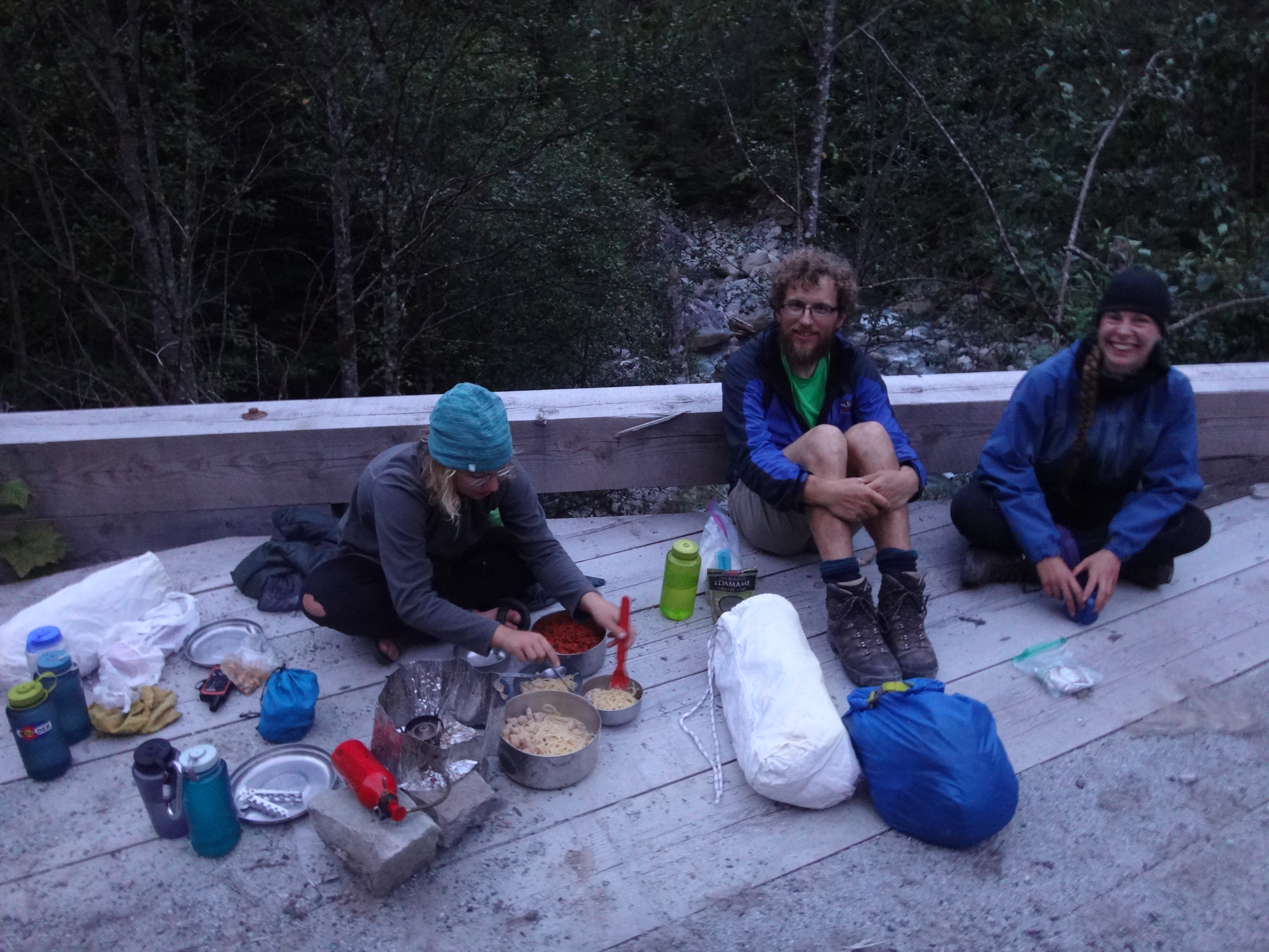
By this time, it was early evening and our intended camp lay far ahead, on the other side of an imposing peak, which we had very little idea how to ascend. Picking a gully that ran up between two sub peaks we fought through thick bush before coming across a steep talus field that led rapidly up. Arriving at the top of the gully as night was closing in, we blundered around for another hour through steep bluffs to reach our campsite by the light of our head torches. We pitched our tents, stocked up on water (avoiding the crayfish) and settled down for another tasty dinner.

The Five Fingers; much nearer, and yet…
The next day we set off for a long descent and an equally long climb back up towards the Five Fingers, hoping for fast travel, yet knowing that this section had sufficiently demoralized the previous group that attempted this traverse. After running into a few cliff bands and descending through thick brush, we eventually found a rocky gully leading straight down. The problem was it did not lead directly towards the Five Fingers but instead seemed to point towards Pitt Lake and one of our exit routes. We stopped to study the map. The contours between us and the Five Fingers looked steep, but although our rocky gully promised mellower contours it added distance to our day. We began to calculate the time needed finish the traverse, knowing that we were behind schedule already. In a few days’ time, Cassandra needed to catch a flight to Chile. We figured that we could finish in time only if everything went according to plan (which it hadn’t so far), and a number of the cruxes we had spotted on google earth still lay ahead. In the end we decided that we should head out towards Pitt Lake and request a water taxi pick-up.
Our planned escape route looked hilly, so we plotted a new one. A nearby creek, Bull Creek, eventually ran into Boise Creek beside one of the closer and newer looking logging roads. So far, following creeks had been an easy way to travel, since bushwacking slowed us down considerably.
Decision made in favour of Bull Creek, we began to head down. We had a mixed feeling, relieved to have made the right decision but disappointed that we could not finish the whole traverse. We headed down through some meadows and swamp. The blueberries were abundant and we made fairly fast progress towards Boise Creek. All too soon the ecosystem changed and we found ourselves swimming through forests of devil’s club and other thorny plants. It was an interesting old growth rainforest with beautiful enormous trees, but we soon discovered it also contained ferocious wasps.

Richard deep in Devil’s Club
This lovely valley, it turns out, was infested with the meanest, most trigger-happy wasps you ever saw. Every few minutes we’d hear a buzzing and then we’d be sprinting and falling and getting stung. Birgit got stung the most (20 stings combined on this day and the next!), and this made us paranoid and unsettled–-twitching whenever a fly buzzed past, and tensely watching every footstep for a flash of yellow.
After an hour or two of wasps and thorns we made it down to Boise Creek for lunch with a dip in a pretty pool. Birgit’s shirt tried to escape downstream but we caught it before it got too far. Feeling refreshed, we decided to try hiking directly down the river. After not too long it became clear that this was much easier travel (nearly 1 km/hr!), but also that the river was getting wider. After a short discussion Birgit changed into sandals, Cassandra put on her barefoot runners and Richard and Vincent decided to get their boots wet. At the time this seemed like a good plan. After all we were only about 2 km from the logging road, right?
Lunch in Bull Creek

So speedy!
Hiking down the river was fun and beautiful. After a kilometer or so, we began to notice that the banks of the creek were getting steeper and steeper. We decided the next time we saw an easy way up out of the creek we should take it. Another couple of minutes later, it became clear that the banks were only getting steeper and there was more and more water in the creek. Should we head back upstream to find a way up? There was one possible slope that looked like it might go. Cassandra led a rope up without a pack and it seemed alright so we followed up on prusiks.
As the evening encroached, we made the last push to the logging road 1 km away in the dim light under massive old growth cedars. The map showed a flat valley bottom at the confluence of Bull and Boise Creeks, so we were surprised to see the ground sloping downwards as we approached the junction and the logging road. Suddenly, it all became very clear: we had arrived at the intersection of two 40-60 m deep canyons, each with a creek invisible in its depths, and the logging road was on the other side only 200 m away.
Big cedars
There was nothing to do but find a flat spot to camp and try to find a way out in the morning, though we sent a message by InReach to friends in Vancouver to ask whether the crossing was possible at all (no answer). We were disheartened, and the gloomy campsite we found offered no water for dinner or breakfast. Cassandra and Richard made an unlikely foray in search of a stream, but they soon returned. The forest was so dark, thick, and disorienting that you could walk 10 m away from camp and only find your way back by calling to your companions. It was time for a potluck consisting of our emergency chocolate bars and blueberries gathered from the surrounding bushes. That night we had confusing dreams, revealing hidden talus-fields that descended into the canyon bringing us to the logging road, or mystical connections between Boise Creek and Boise Idaho, and woke drenched in sweat.
In the morning we agreed that the junction of the creeks was impassable, and that we had better retrace our steps, cross Bull Creek, and search for a way across Boise Creek farther downstream. We rappelled back down to the water, drank thirstily, and Cassandra led a rope up the slippery canyonside opposite. Birgit was grateful for her prusik as her arms had swollen with the wasp stings enough that they were mostly useless. At Boise Creek we found more wasps (Vincent got stuck clinging to a tree at the edge of a cliff while they buzzed around his head) and, after a while, Richard found a possible crossing. A massive old tree trunk bridged the creek (really a river, by now) exactly where the canyon walls relented a little. As we descended we found that it was suspiciously like the remnants of a trail; then we saw bits of old SAR flagging tape and an old rap station for the last few meters to the creekside (it later turned out that a lone hiker had vanished in the area a few years back and was never found).

Escape bridge at the bottom of the canyon
We crossed the log bridge, clambered up to the overgrown road, and bushwhacked down it for half an hour until we found ourselves on a helipad at the end of an improbably broad and well-maintained logging road. Very relieved, we had lunch, trotted down the road to the next bridge (to make sure it existed), and camped early. In the morning, we walked 10 km or so down to the Pitt River and found ourselves a quiet little beach on the riverbank covered with elk tracks, and we slept, swam, and ate in the sun like something out of Mark Twain–-a perfect peaceful day. (We saw a seal swim by, too, far away from its native saltwater!)
The bridge exists!!
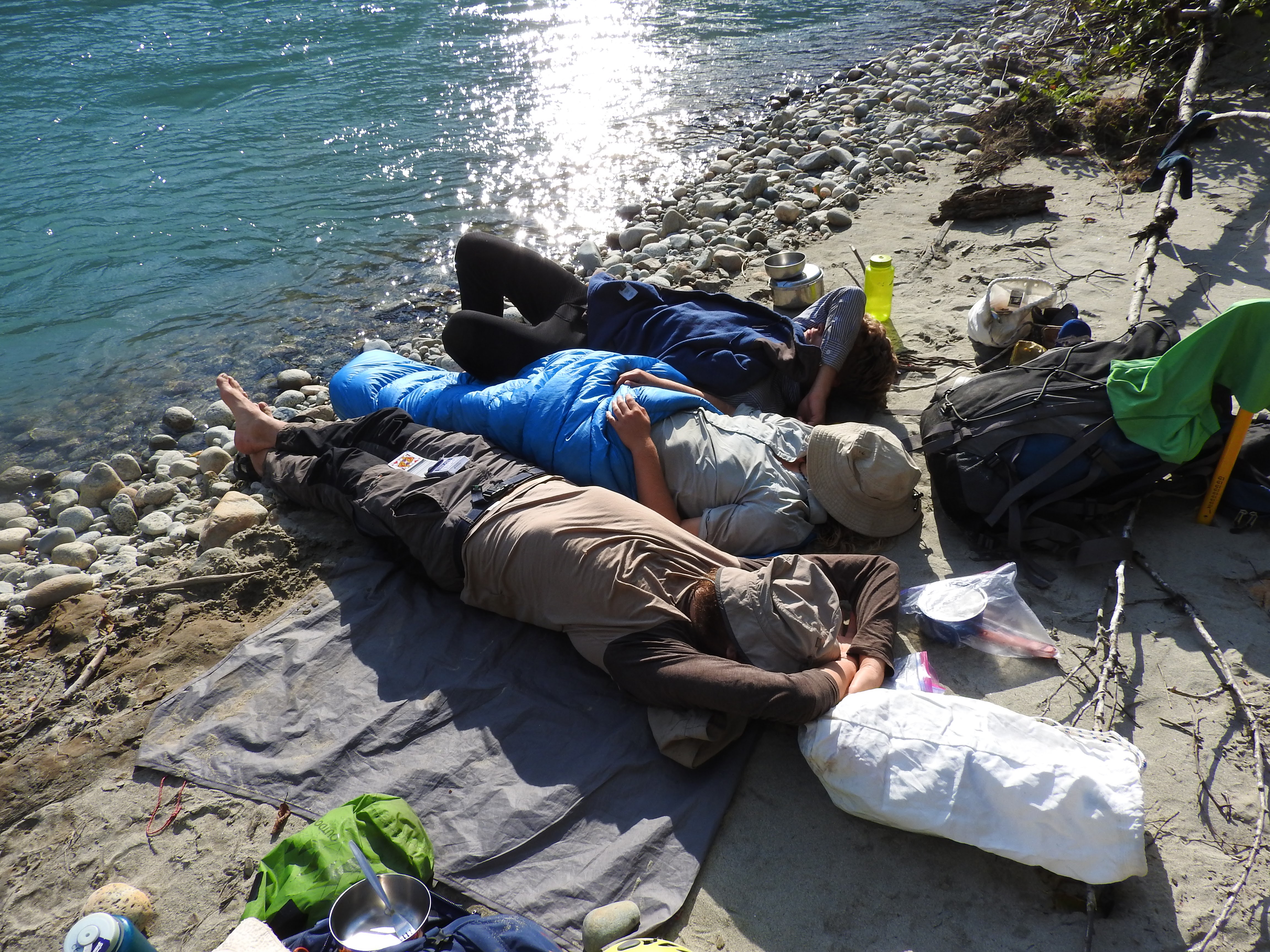
Lounging on the riverbank
Even though we were only 2 km from the dock at the end of Pitt Lake, we were quite concerned about making our 9:00 AM appointment with the water taxi the next morning because our sense of distance and time was so skewed by bushwhacking. So we arrived early, but the boat had arrived earlier and the skipper was just setting out to look for us in his car. We raced down the lake in no time at all, a beautiful trip, and Ross soon met us in the parking lot at the other side with fresh fruit and juice (thank you!). After a decadent brunch in Coquitlam, Ross taught us the Salty Dog Rag for the Centennial Banquet and we were home.

Cassandra’s excited about Pitt Lake!
What was your average speed, in units of kilometers per day?
I expect it was something like 9 map km/day (or 12 real km/day?)—but I’ll ask Richard what his GPS says. We did more on the first day, of course, since half of it was on a trail, and also more once we reached the logging road on the last days. That translates to about 1 km/hr…
Yep, Richard says his GPS track recorded 9-12 km per day, excluding the first day which was longer because of Watersprite. Not the fastest travel… some sections were easy walking, but we lost a lot of time to obstacles like the gullies and the raft lakes.