Context
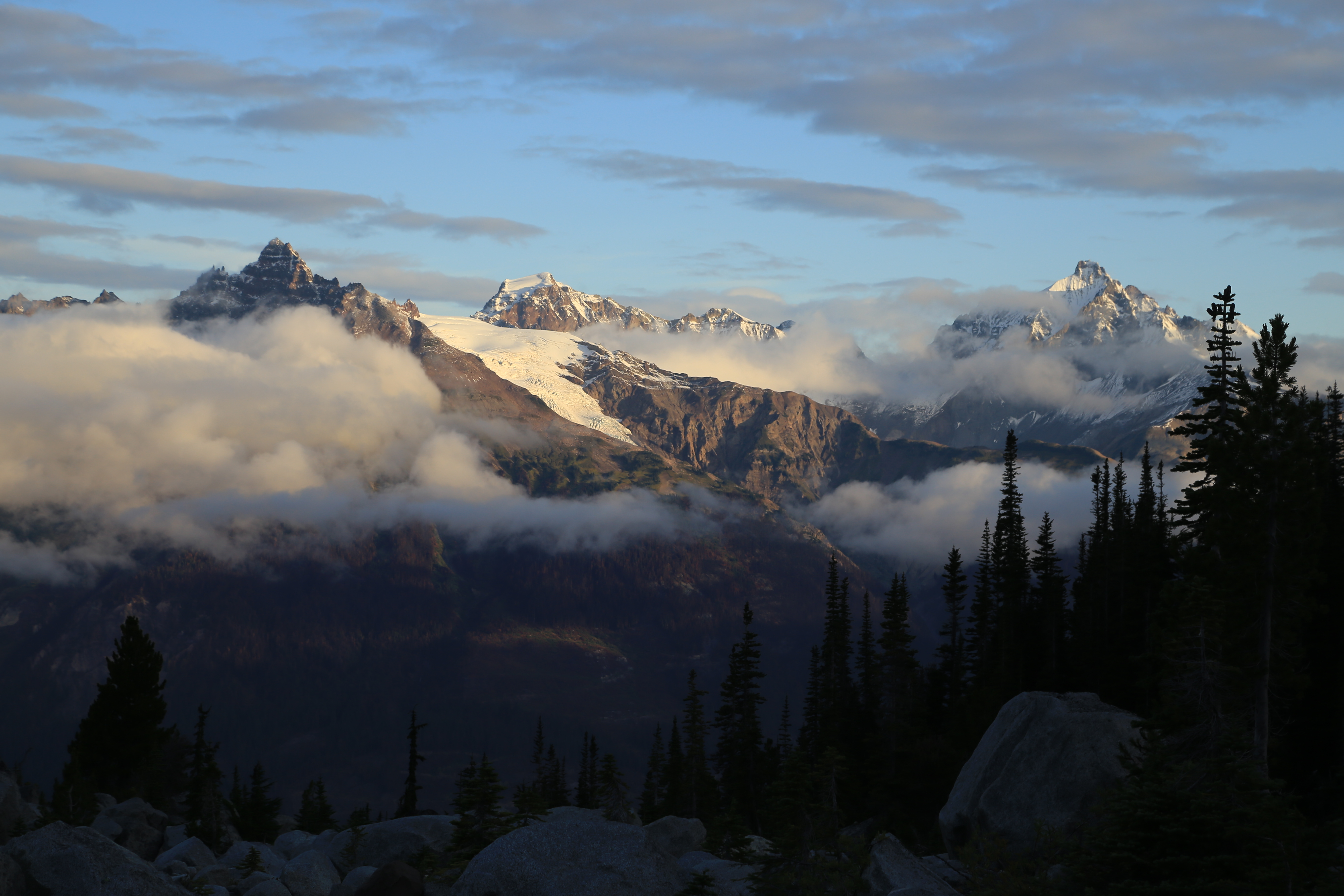
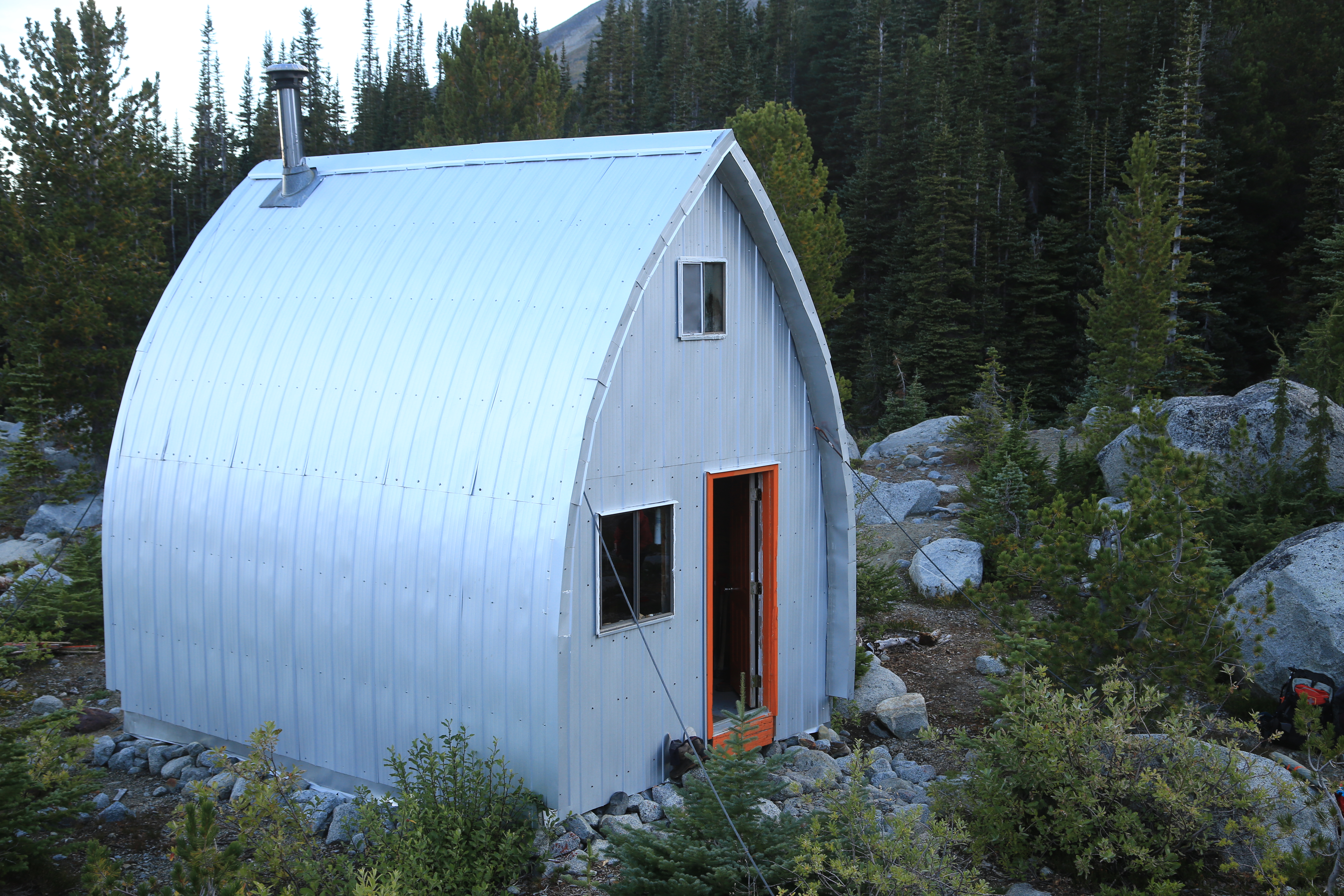
Harrison Hut is a spectacular alpine hut, situated in a beautiful glaciated valley at 1725m. It provides access to the Pemberton Icecap in the spring and numerous mountaineering opportunities in the summer and fall. The hut was built in 1983 by the VOC as a memorial hut for Julian Harrison a past VOC president. Since the hut was built, the club has had varying success accessing it for a number of reasons (https://www.ubc-voc.com/wiki/Harrison_Hut_Trail_Project_2007-2012 ). Prior to 2010, there was an old trail that accessed the hut via the Meager Hot Springs Provincial Recreation Site. You could at the time drive to Meager Hot Springs and then hike up to the hut. In 2010, the Meager landslide, one of the largest landslides to occur in Canada, came down wiping out the road that lead to the Meager Hot Springs and the old Harrison Hut trailhead (https://en.wikipedia.org/wiki/2010_Mount_Meager_landslide ). The VOC got together to search for a new trail to access the hut. Countless hours and time went into building a 12km long trail that accessed the hut via the South Lillooet FSR (https://blog.whistlermuseum.org/2017/12/23/the-harrison-hut/). Consultations with the government got the new trail a Section 57 designation – meaning that it could be logged but was official enough that the logging companies would need to rebuild any sections they affected. Trail work occurred from 2011-2014. Once the new trail was built, a group of VOCers headed up to the hut to do some maintenance on the hut, install a new outhouse, and fix the bridge across Barr Creek (for the 3rd? time). We thought all the access problems to the hut had been solved and the hut was in good shape.
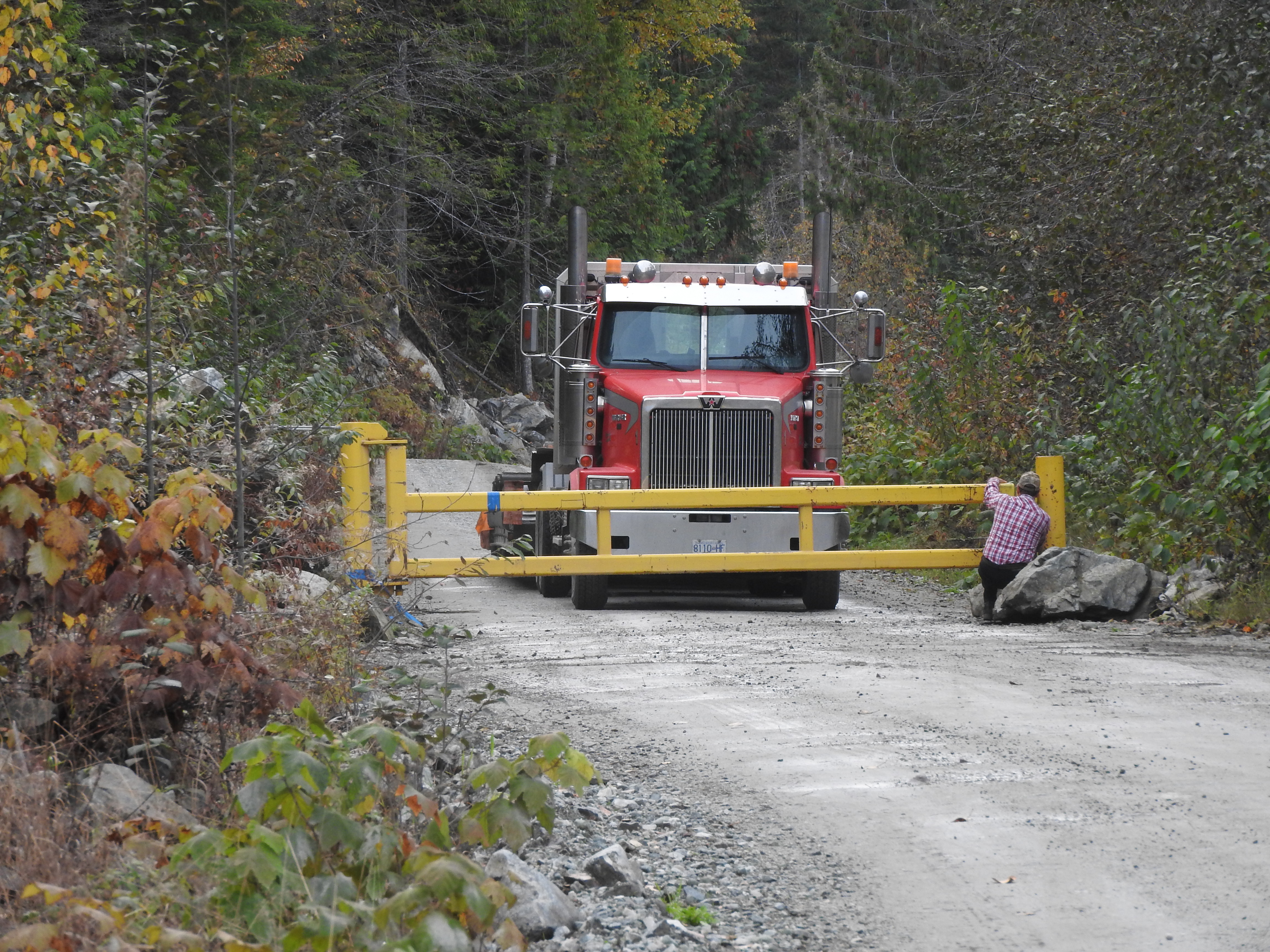
Then in 2018 gates went in at the 2km and 24km marks on the South Lillooet FSR. The permanent 24km gate blocks access to the 4 wheel drive parking lot a few kilometers and 500m elevation above the gate. The 2km gate, locked from April 15-June 15 and from Sept 15-Dec 15, prevents access to the entire area during these time periods, making access to the Pemberton Icecap traverse in the spring nearly impossible. It had become difficult, yet again, to get to Harrison Hut.
Oct 2019
I had spent some time over the last year wondering if accessing Harrison Hut through South Creek was a possible alternative to the current route. The route was longer and had more elevation gain but was possibly better than having to bike 30km up an active logging road to access the hut. Thus I managed to convince Ross Campbell, Tom Curran and Andrew Wilson to join me in exploring the options up South Creek over Thanksgiving.
We had heard recent warnings about two problems with the South Creek access which we chose to not pay as much attention to as we perhaps should have. Krista and Piotr had tried to come down from the Pemberton Icecap in the spring via South Creek but had run into a collapsed bridge only a few kilometers from the South Lillooet FSR. In the spring, the creek had had so much water in it that they decided to call a helicopter. Secondly, we had been warned by someone in the government that “By going into South Creek you are taking your life into your own hands.” However, I thought that there must be some way to get to the hut without needing to cross the creek (addressing problem 1) and how dangerous could bushwhacking through forest be? (problem 2).
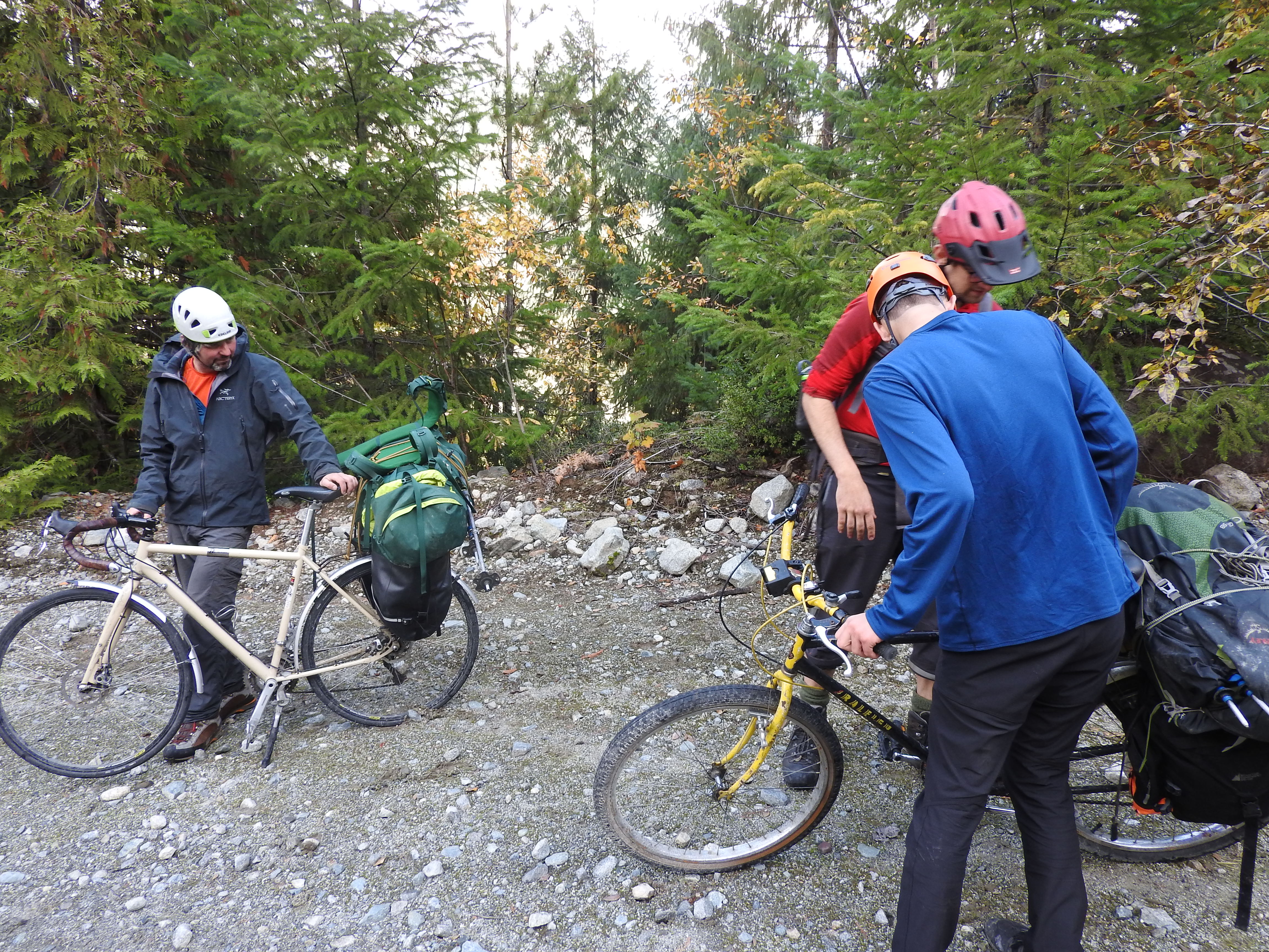
On Saturday October 12, we left Vancouver at 5:30pm with four bikes strapped to the back of Tom’s car. We stopped at what used to be Mag’s 99 (now Sunny Chibas) for dinner and then drove straight up to Pemberton. On the drive up, we all tried to guess how many cars would be at the gate and whether or not it would be locked. The result was unexpected and a combination of everybody’s guesses.
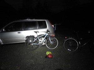
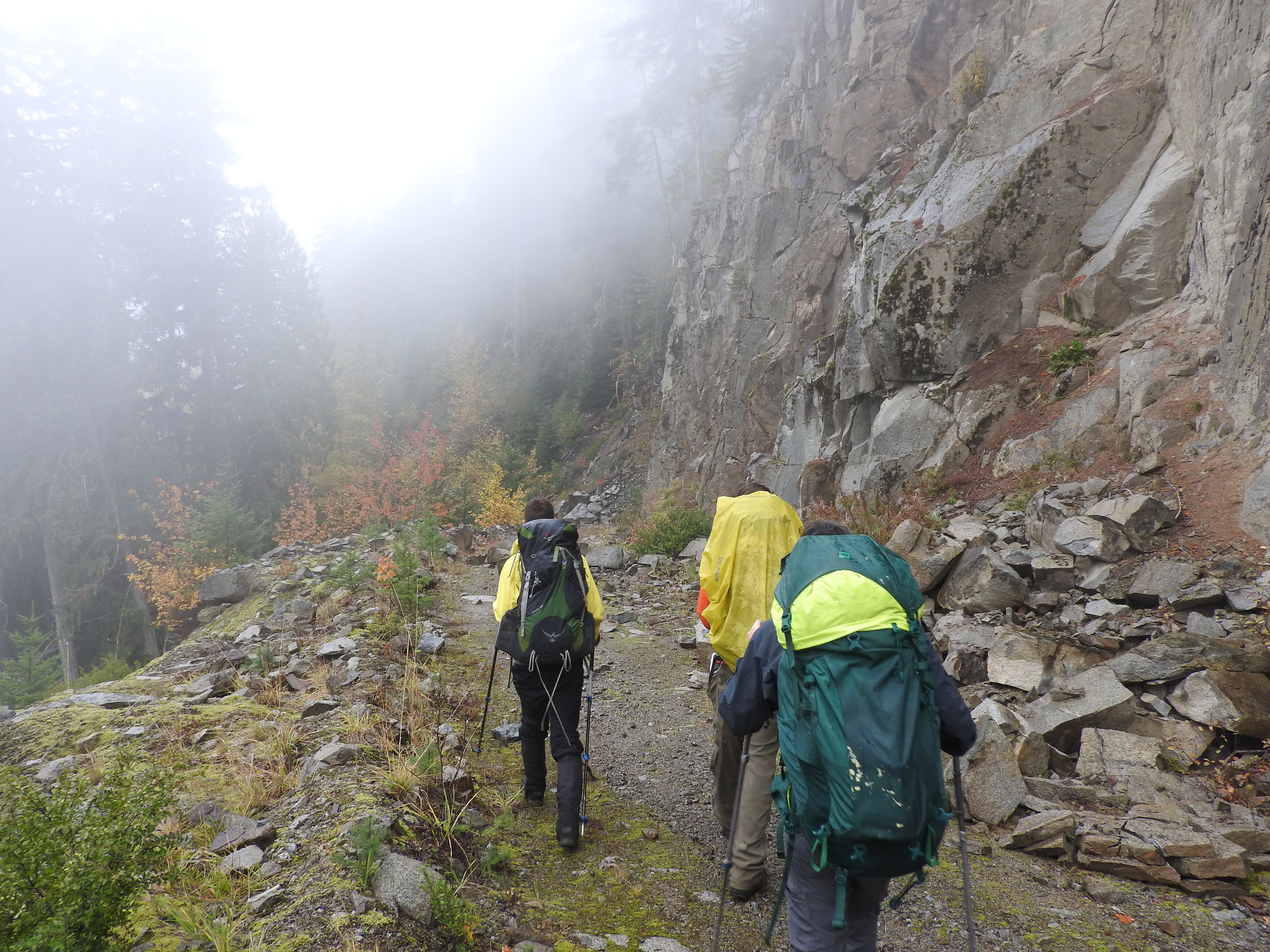
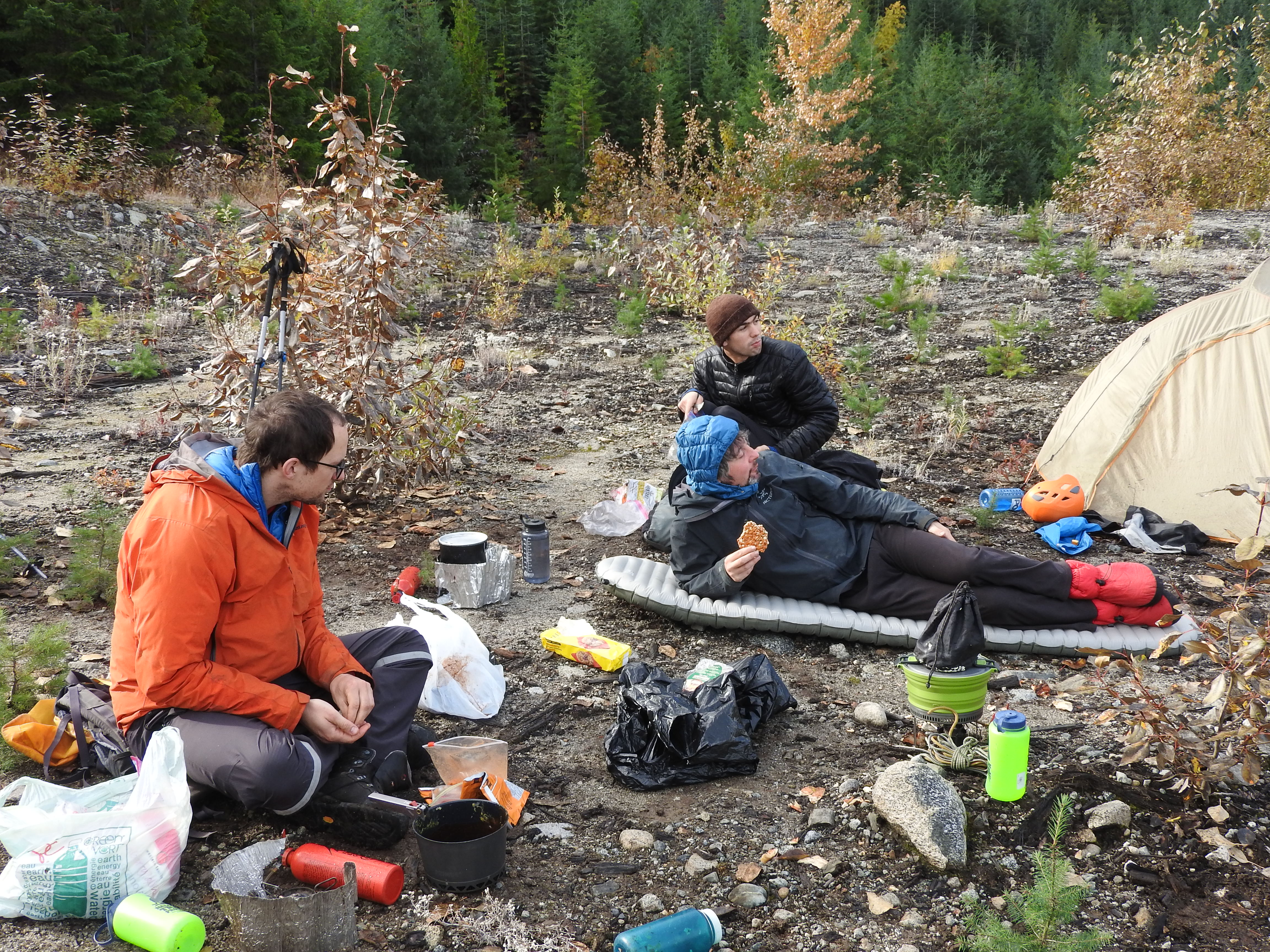
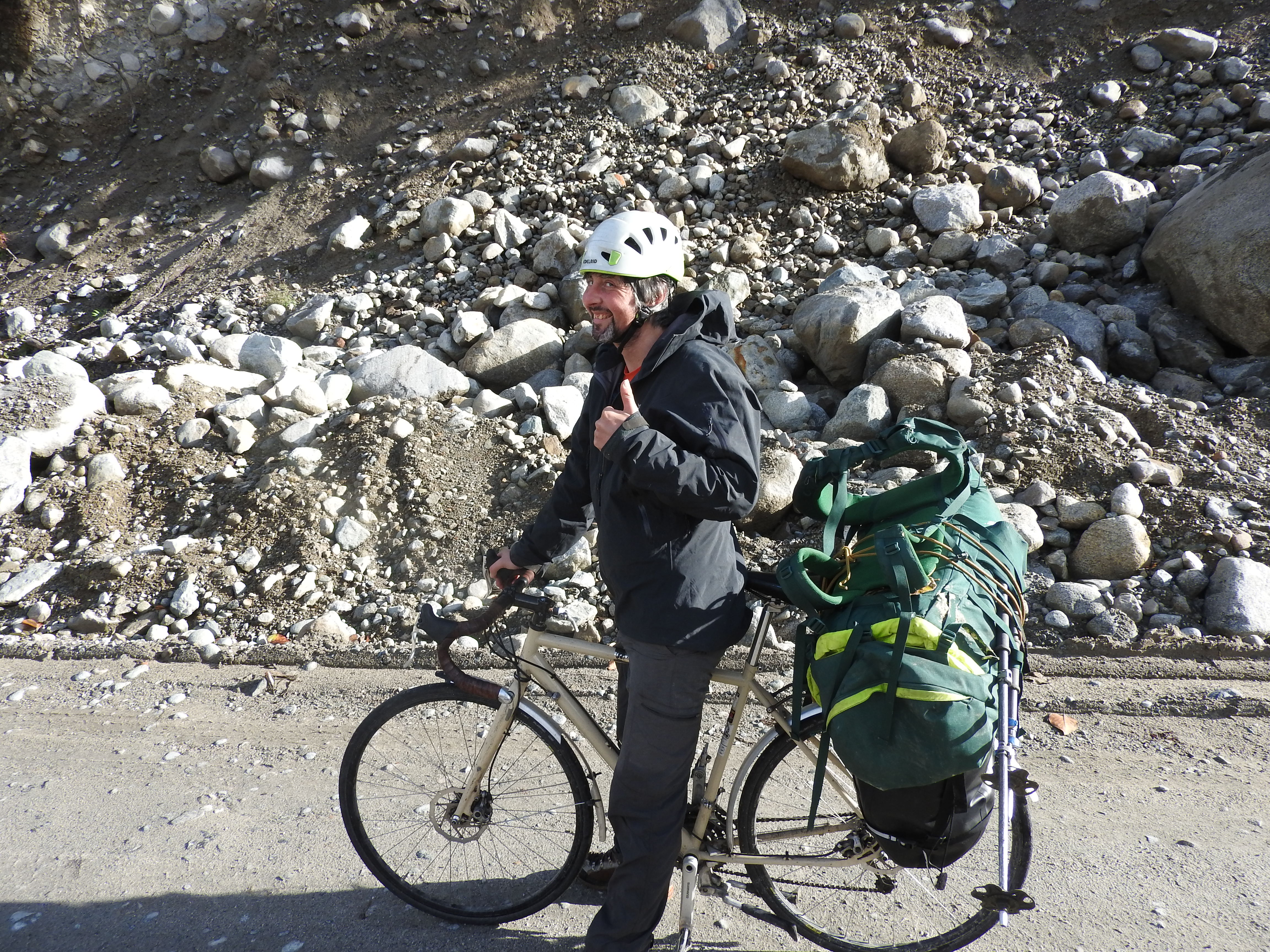
We unloaded our bikes from the car around 11pm and biked the 6km up the South Lillooet FSR to the turnoff for South Creek. The logging road up South Creek was too steep to bike easily so we just pushed our bikes up the hill until we ran into some logs across the road. There we set up camp around midnight.
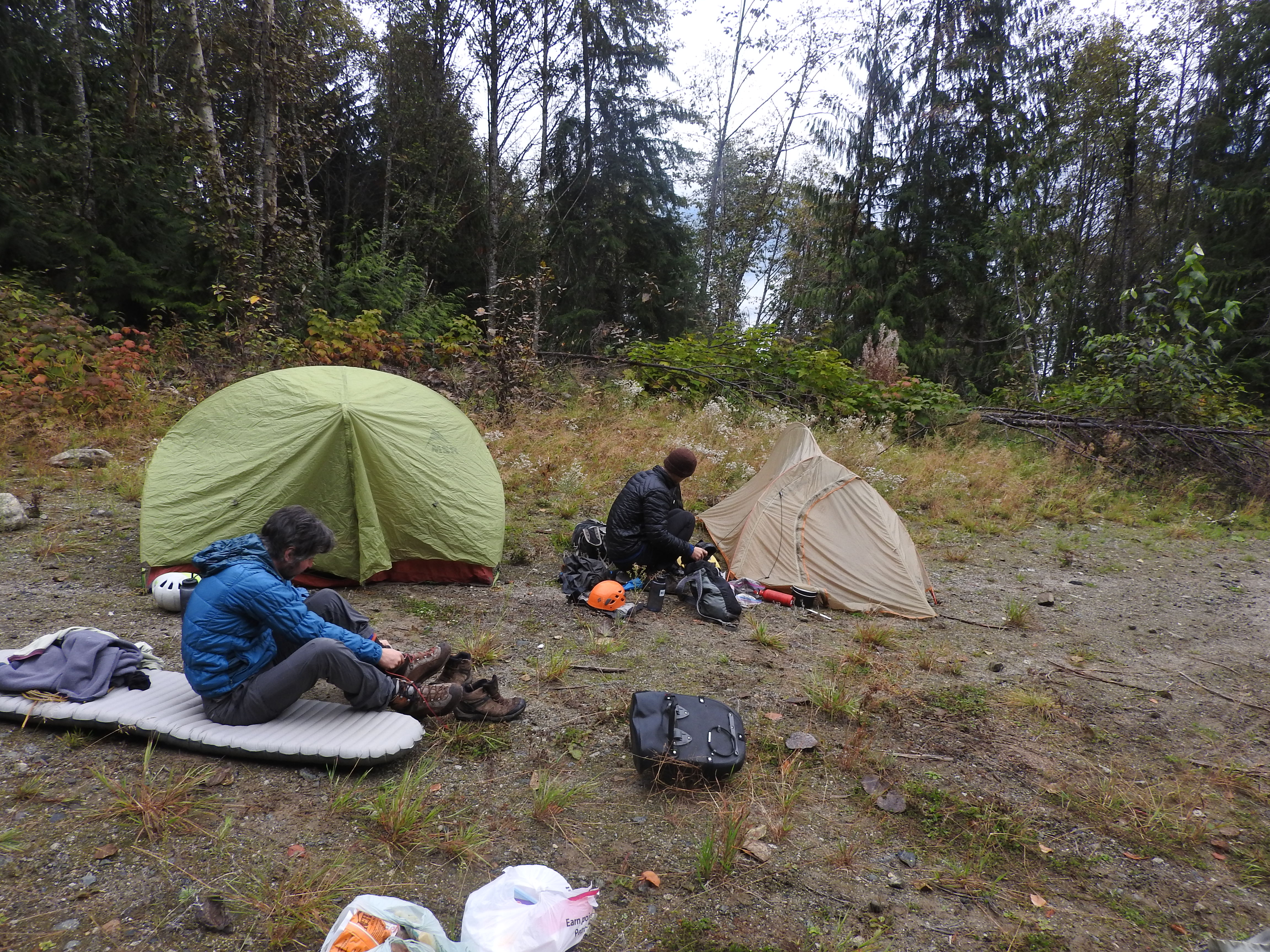
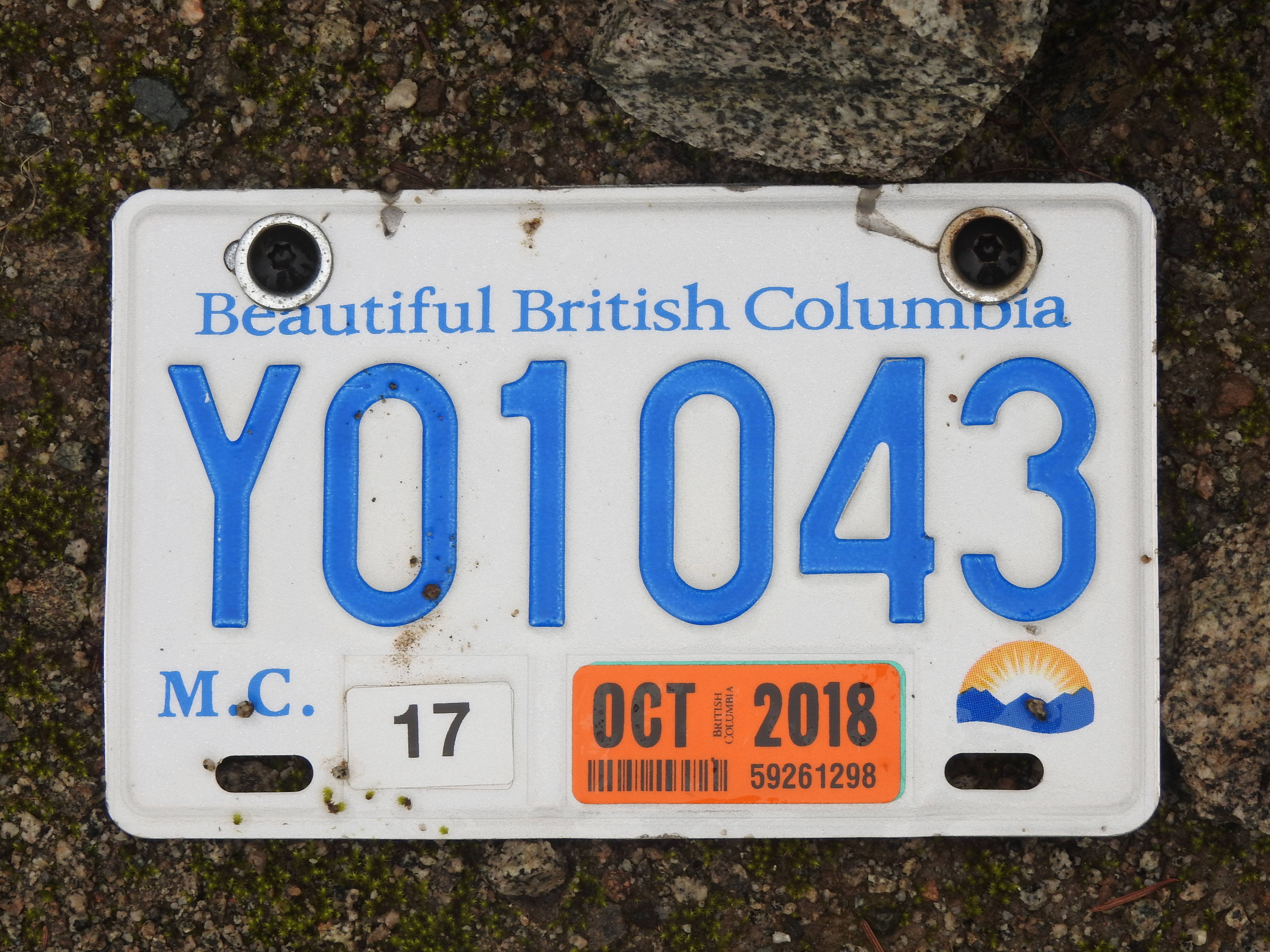
We woke up around 8am surrounded by cloud. Ross found a dead squirrel next to his tent. After packing up our gear and deciding what to leave stashed with our bikes, we headed up the road. The road was in great shape. It continued to go up steeply until we reached about 700m elevation. Eventually it flattened off a bit and we found an ATV licence plate from 2018. Clearly some people used the road recently.
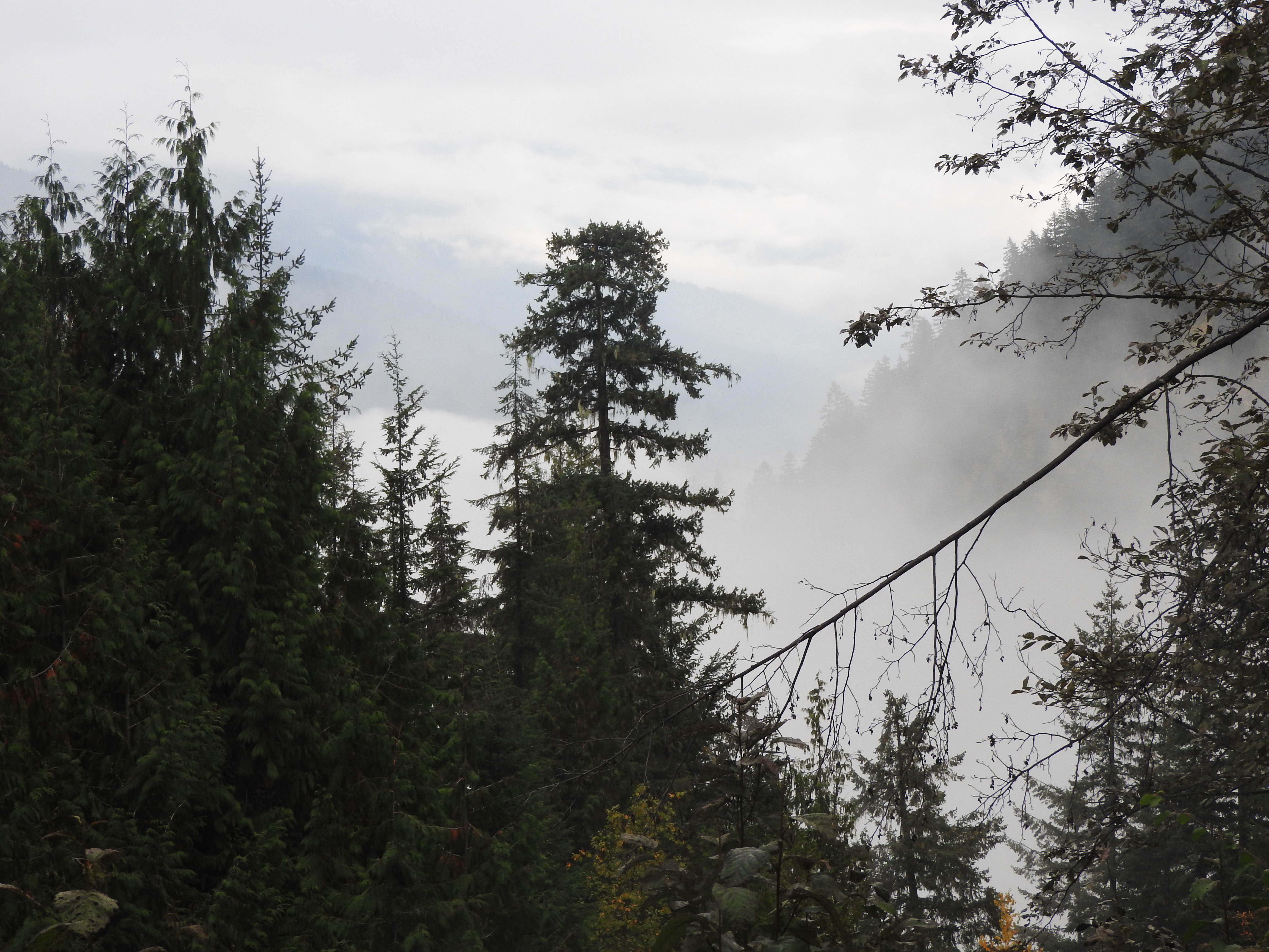
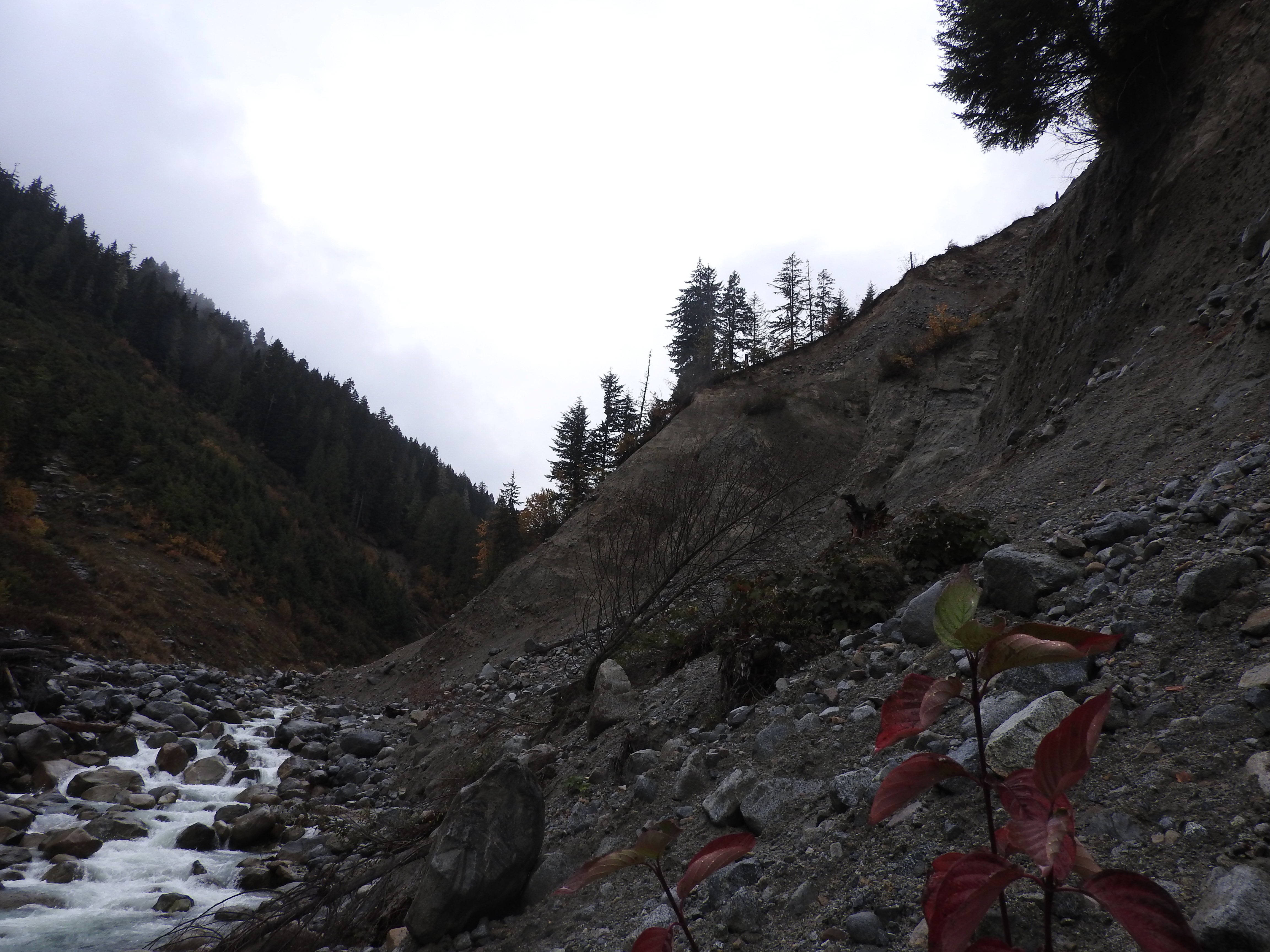
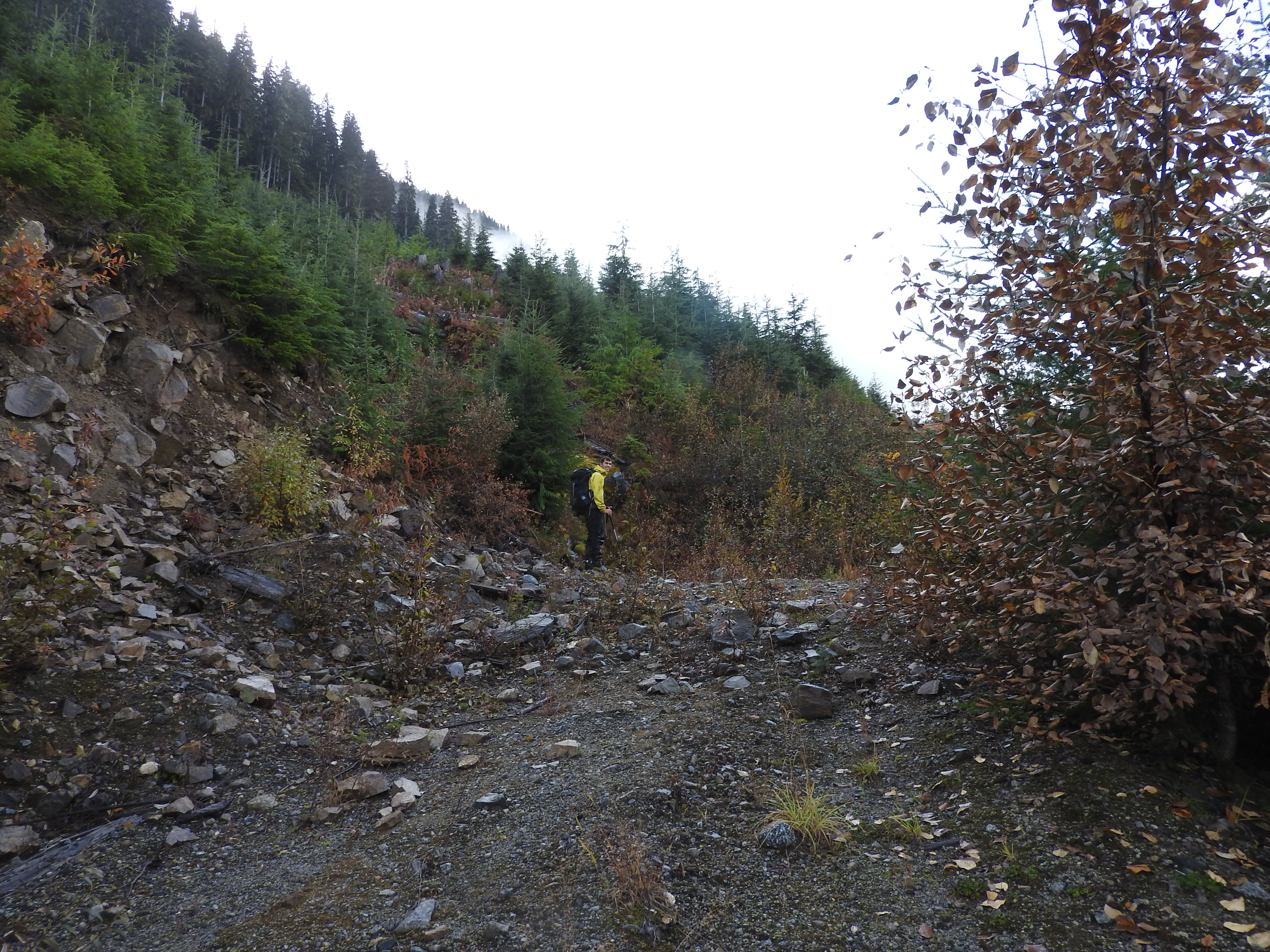
Before long though, we hit the end of the road. It was the clearest ‘end of the road’ I have ever seen. A landslide had come down from above and washed the entire road away. The road ended in a cliff looking down into the creek.

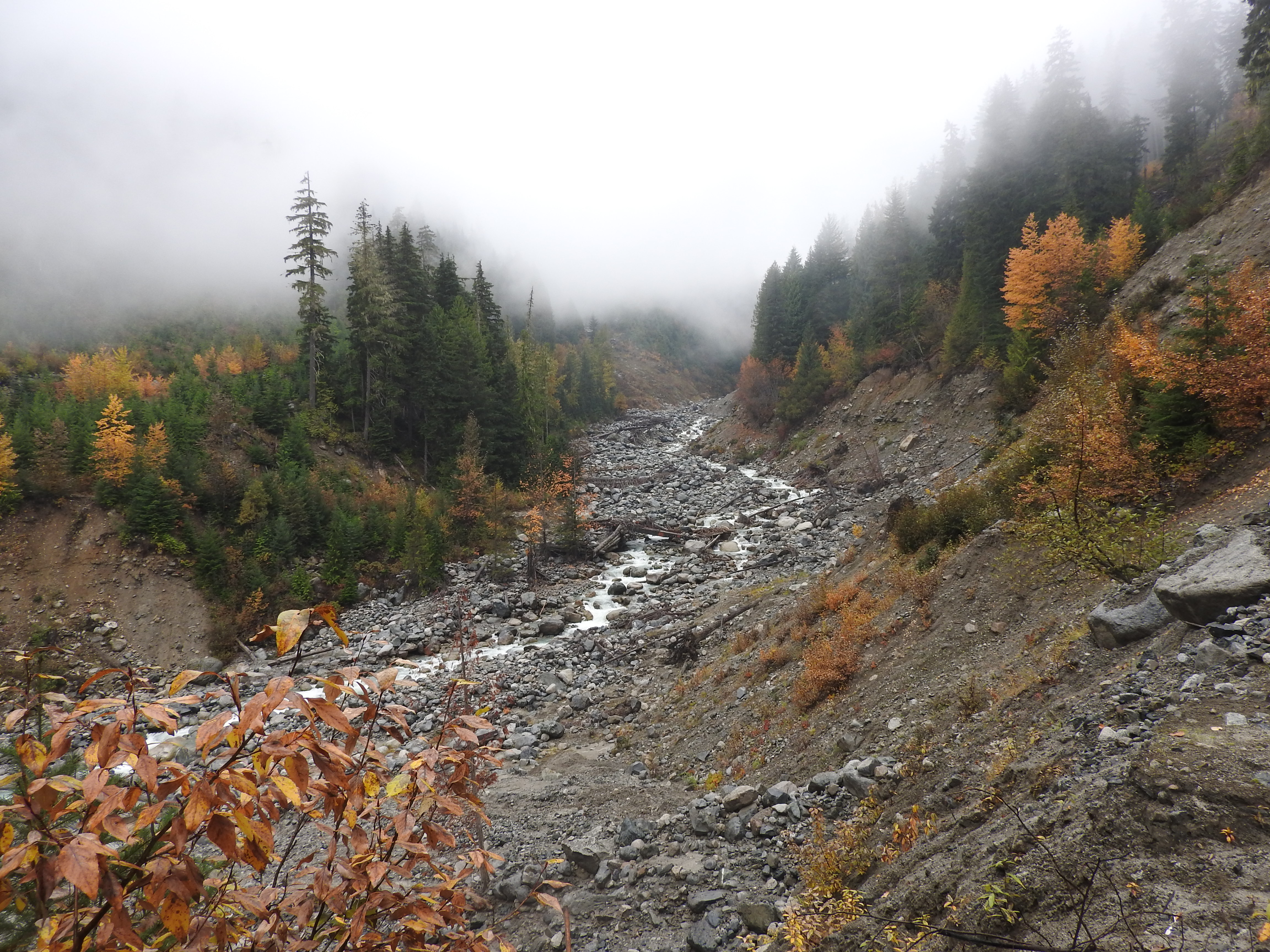
After some debate about what to do next, we found ropes descending into South Creek. Our two options were either to hike up through insanely steep forest and climb over the landslide or to descend the ropes and quickly walk under the landslide. We opted for the second choice, descending the ropes into the creek and hiking up the creek. Above us were steep, seemingly unstable looking landslide paths. Andrew pointed out that some of the house sized boulders looked like they had come down fairly recently. We decided this was not really where you would want to stop to have lunch.
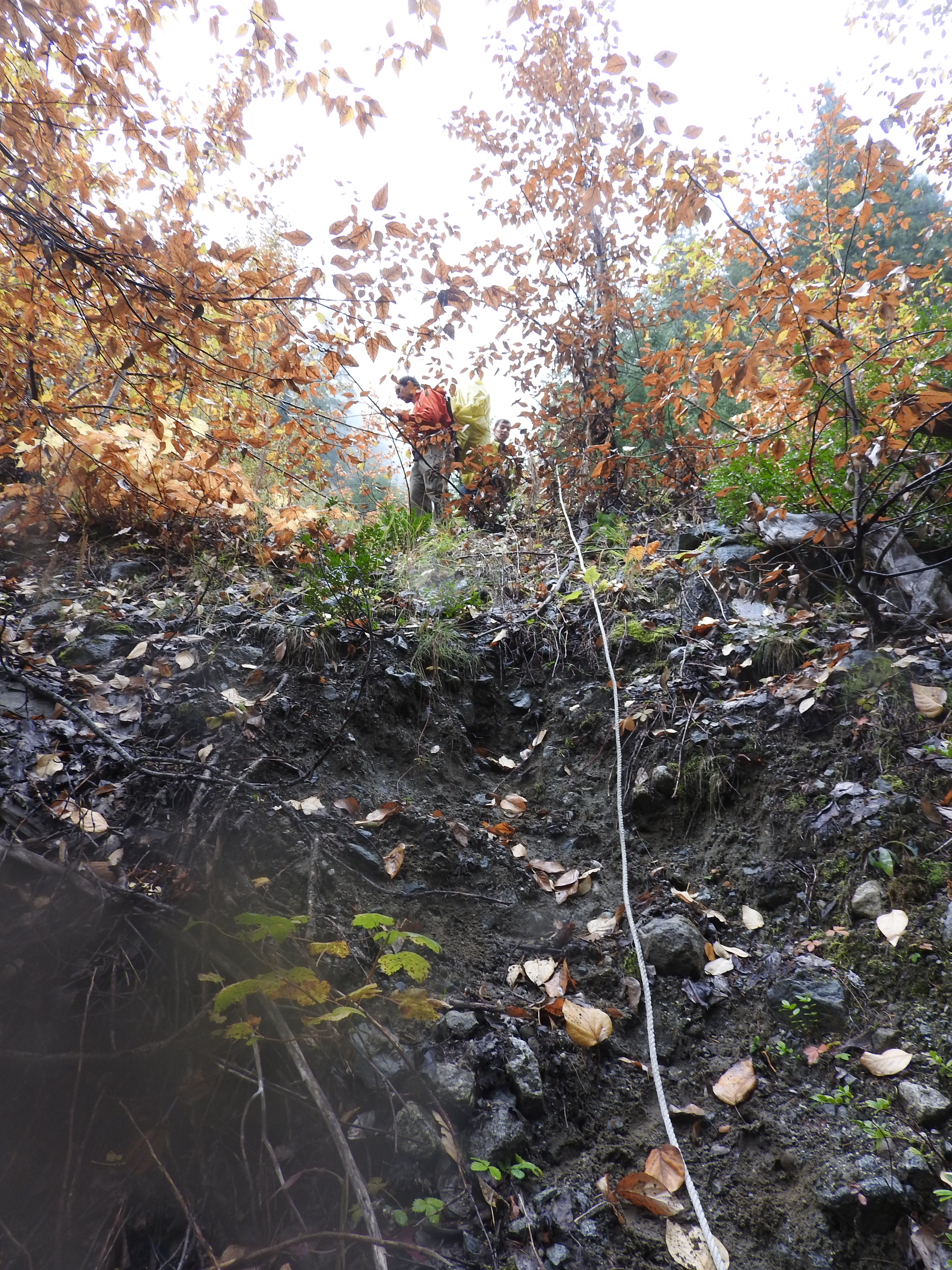
Tom tried to scramble up one of the slides but to no avail. I continued to hike up the creek below the slides until I came to an even larger slide. The top had some overhung sections that looked unstable enough I did not want to risk walking under them. We decided we should probably pursue the first option and see if we could hike over the slides.
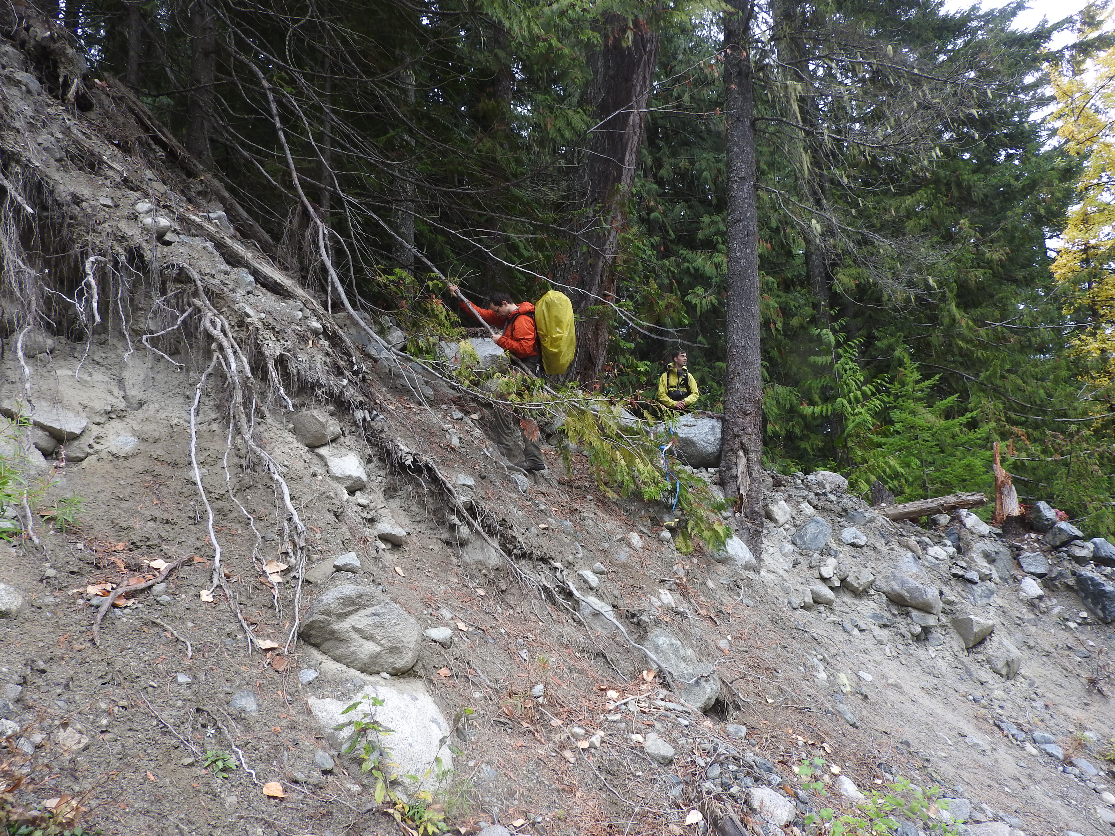
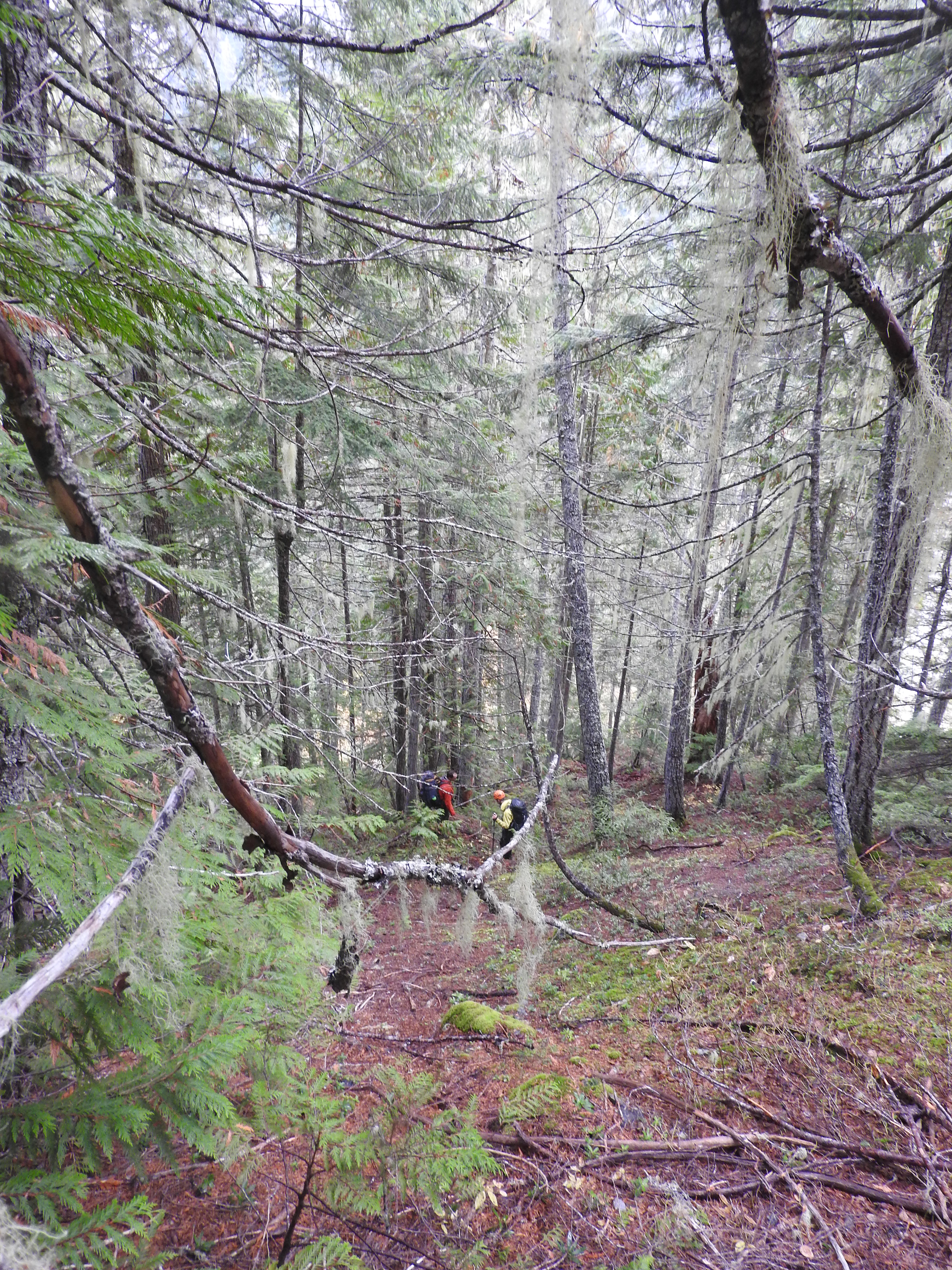
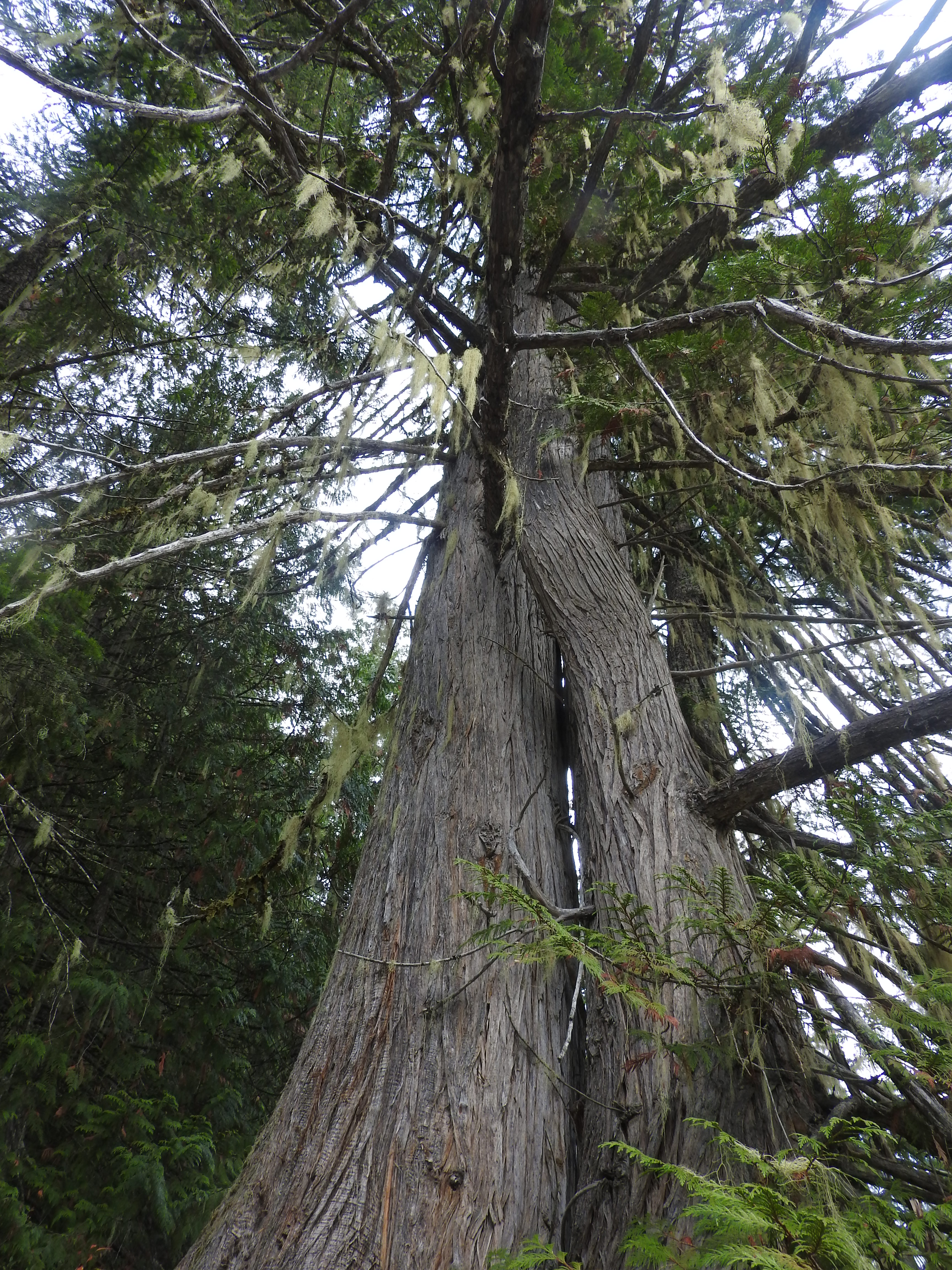
We climbed the ropes back up to the ‘end of the road’. Above the road was some steep loose rock and then a very steep large old growth forest. We hiked up through the forest for a while admiring the trees. We tried to decide if a trail in this location would be crazy. The steepest parts of the old trail were the average grade of this route up through the trees. Eventually Andrew and I dropped our packs and ran up ahead. There was nowhere the route cliffed out or got stuck between landslide paths, it was just continuously very steep. It was also unclear what traversing above the landslides would be like on such steep terrain. After some debate we headed back down and met up with Tom and Ross. In reflection after the fact, of everywhere we went in South Creek, this steep forest was the best option for a trail…

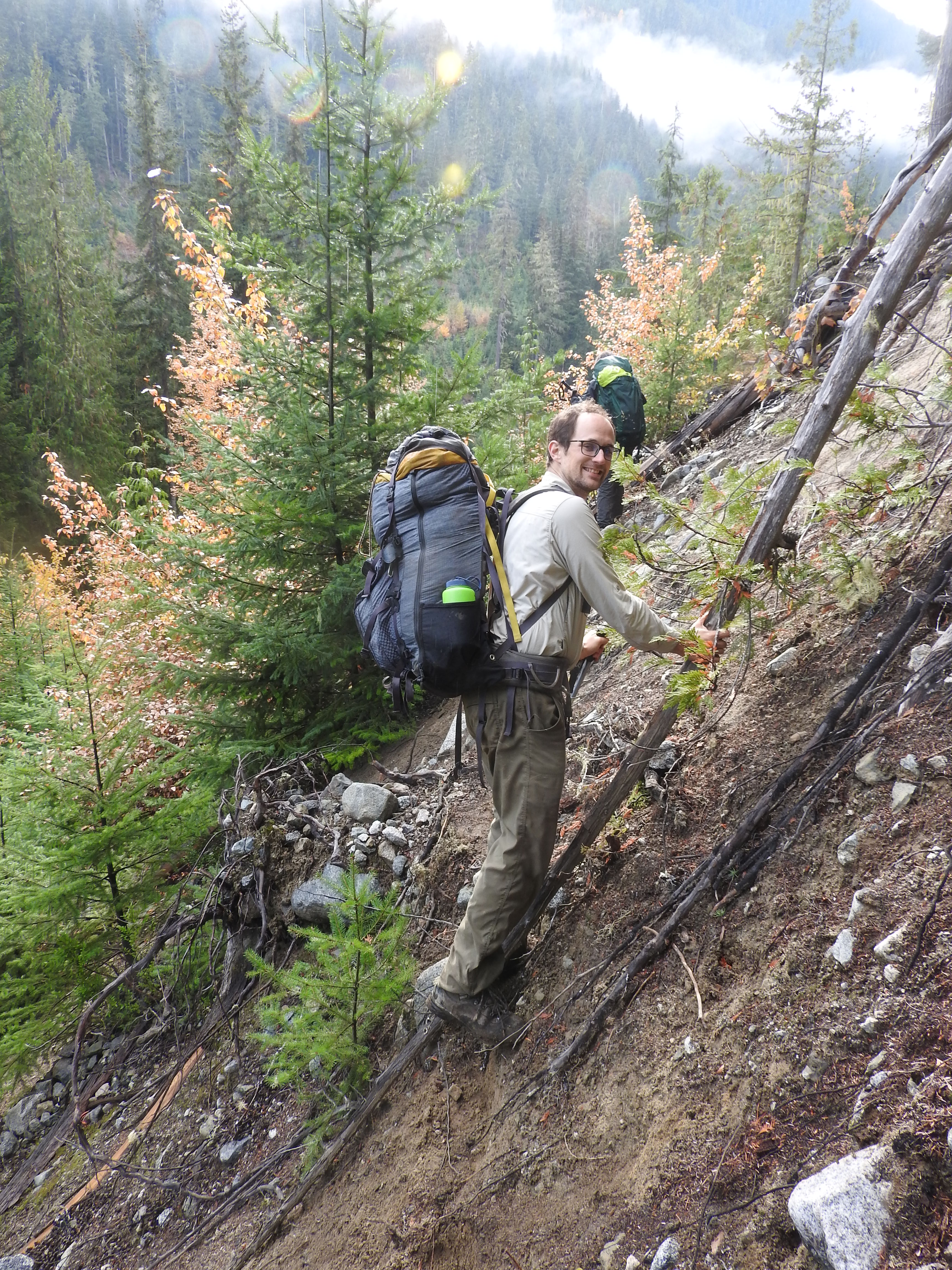
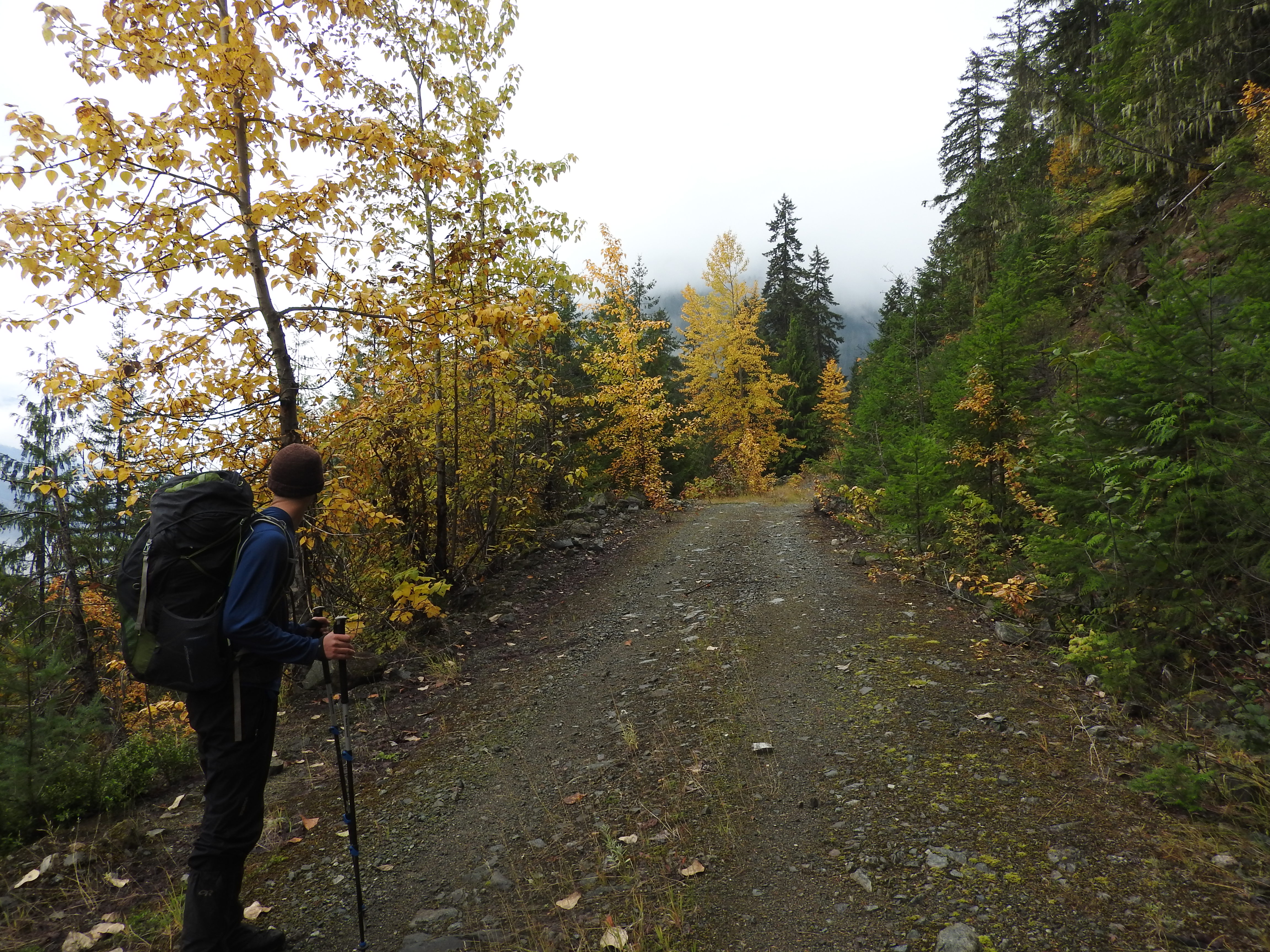
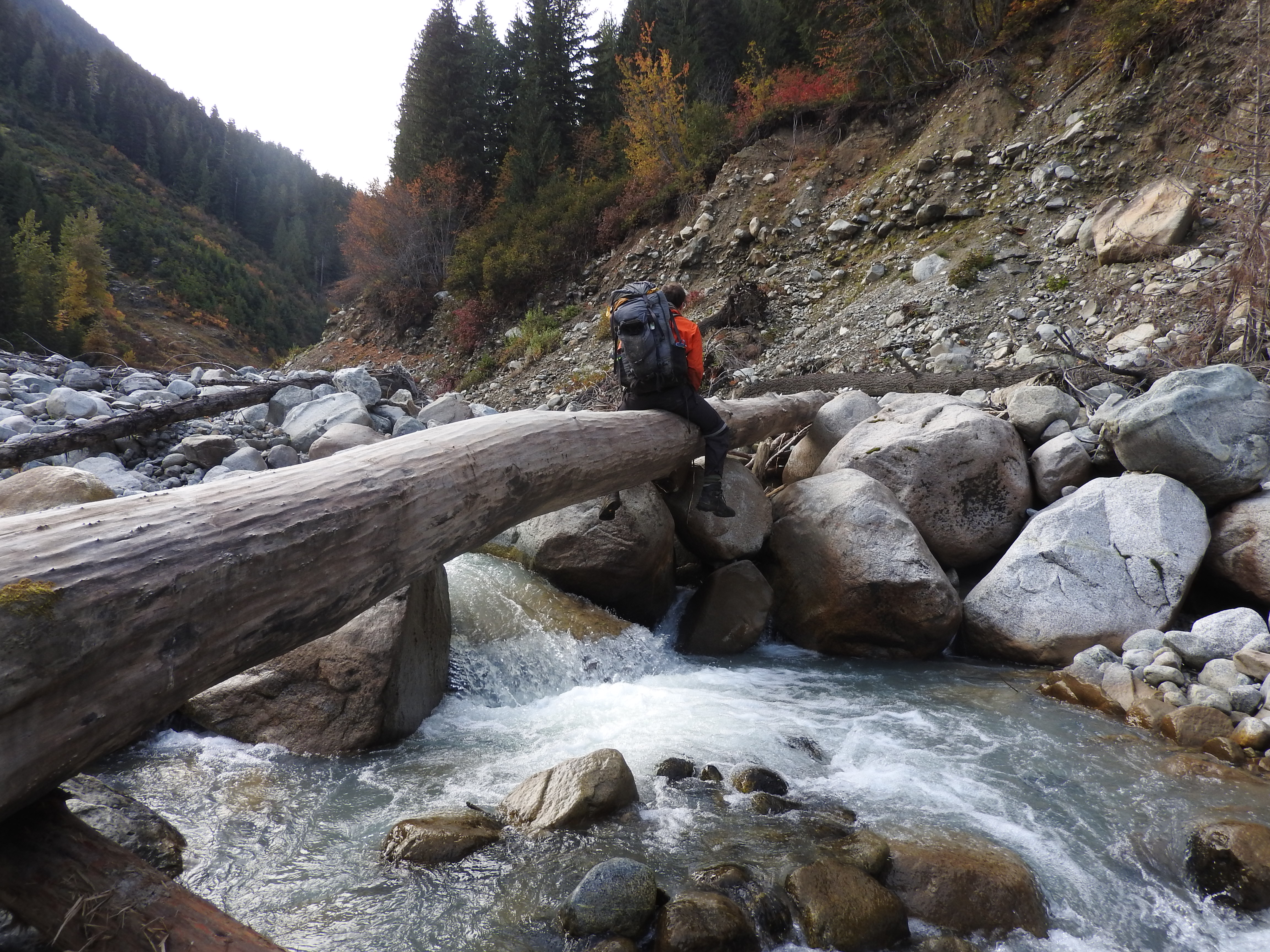
Once we were back at the ‘end of the road’, we tried to decide what to do. I really wanted to see the alpine. The possibility of biking to the pools was suggested but was decided against because Ross only had his road bike and Tom had a potentially broken rib that did not make pushing a bike uphill very appealing. We debated trying to bike out to the car, drive to Phelix and meet the VOC trips in that vicinity. After checking the time (it was 2pm) we decided this might be a bit ambitious. As it seemed we were no longer realistically scouting for a trail, we decided to cross the creek and try to get into the alpine near the Pemberton Icecap following the road Piotr and Krista had come down in the spring. After crossing the broken down bridge, we hiked up the logging road on the other side.

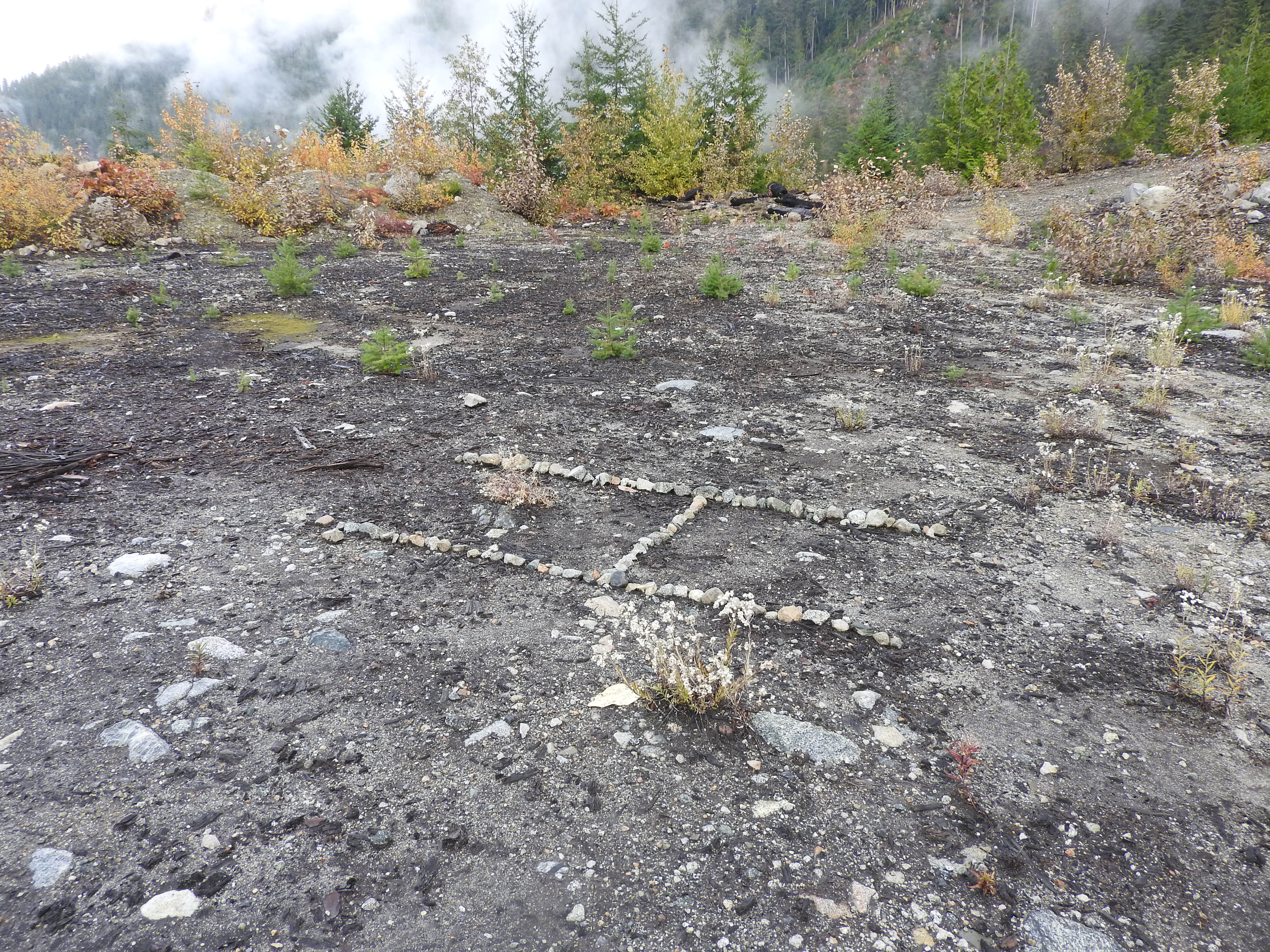
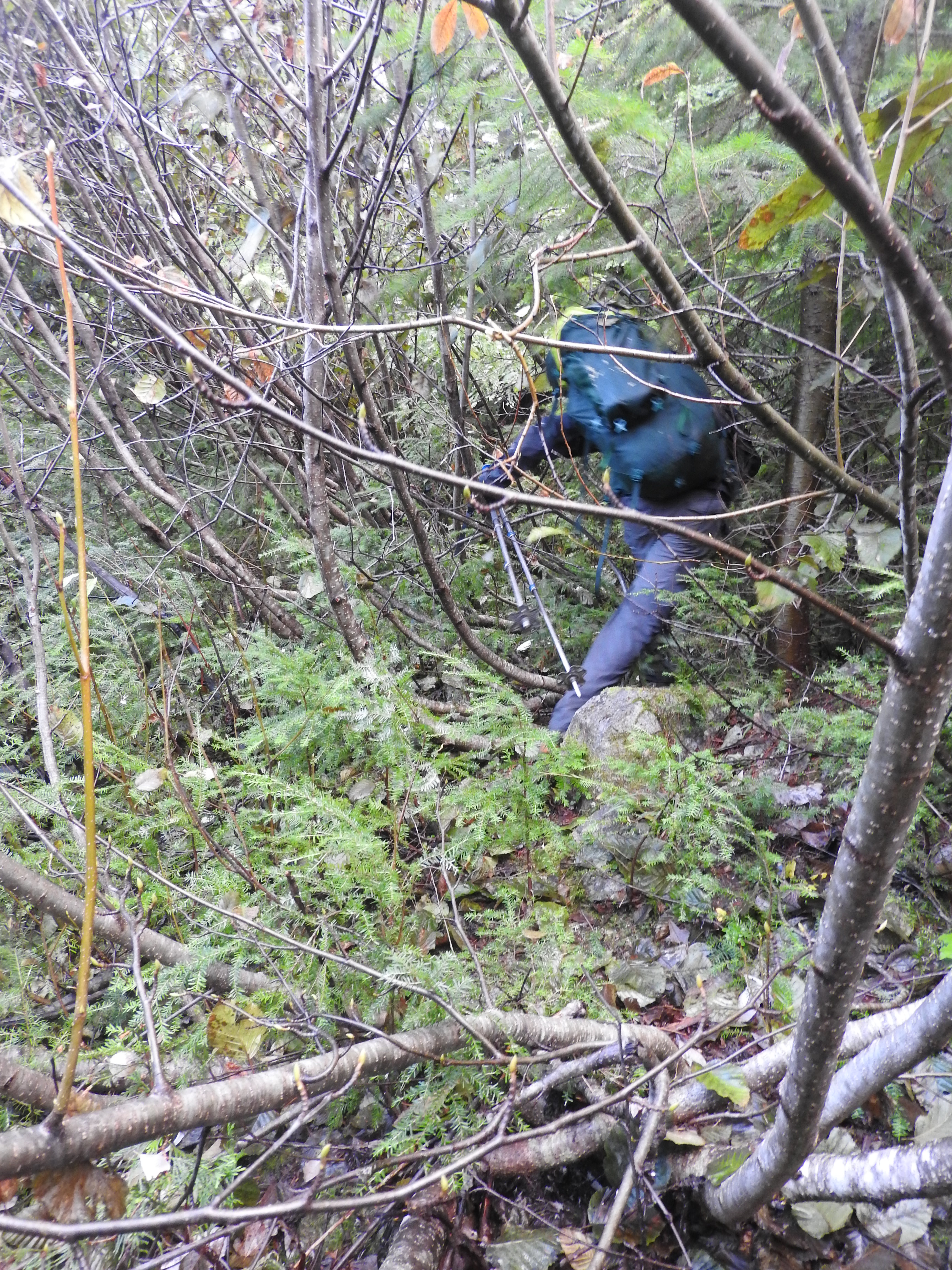
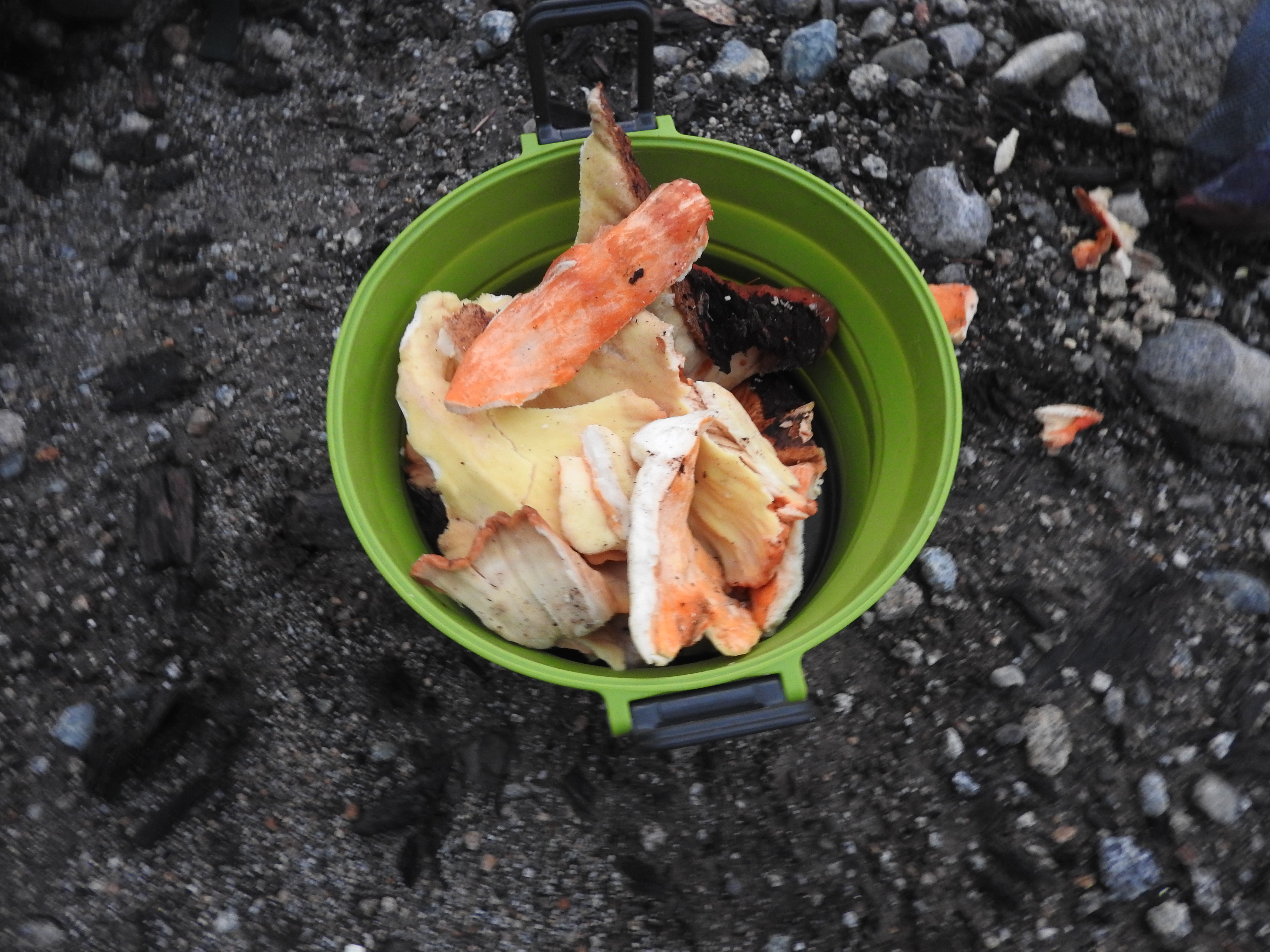
Fairly quickly, we came to a clearing where we found the letter ‘H’ outlined by rocks. Tom was fairly sure it had been drawn by Piotr. We hiked past the clearing and followed the road up. Ross found ‘chicken of the woods’ and picked enough for all of us to enjoy a great Thanksgiving dinner late that evening. The alder on the road rapidly began to get denser and denser. We continued to push through. The bushes soaked our clothes. We started to wonder if we were on the right road. After another half hour of barely moving through the bush we decided we were never going to reach the alpine before dark. The thought of climbing through the bush in the dark had us turning around.
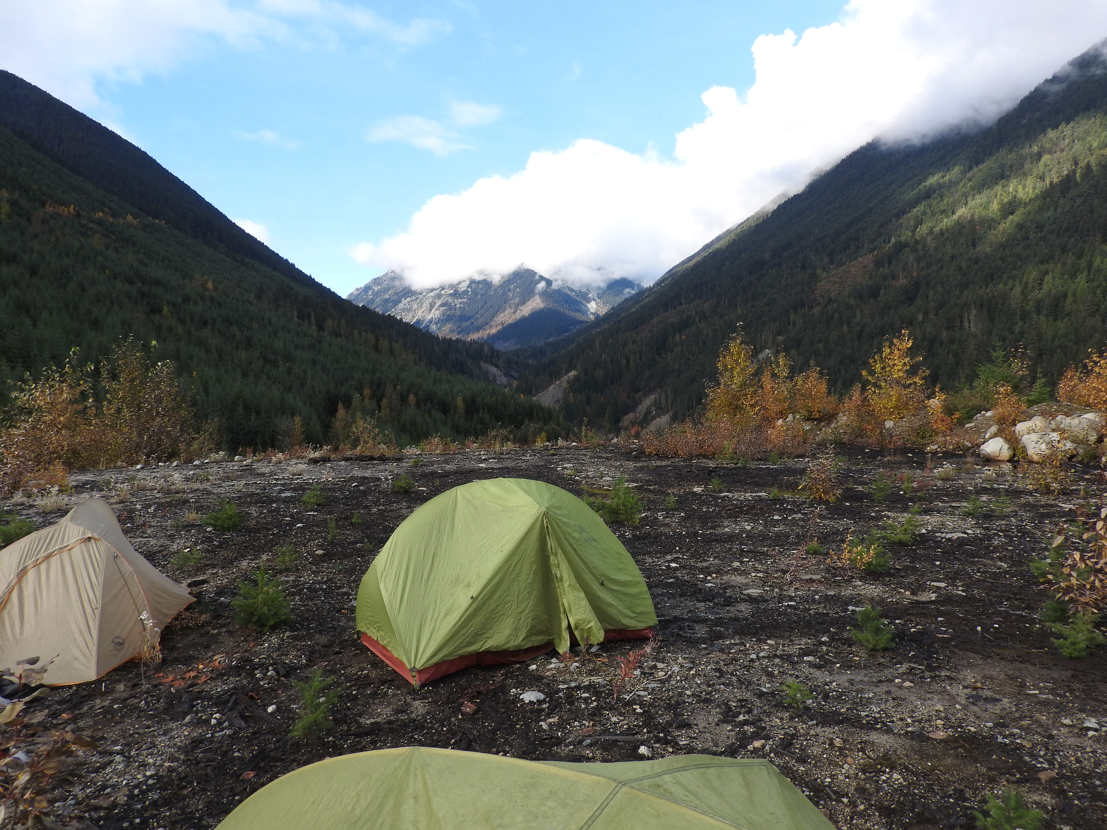
We went back to the clearing where Piotr and Krista had camped in the spring. We set up our tents and cooked up the ‘chicken of the woods’. Tom and I had forgotten spoons so we practiced eating mac cheese and chicken of the woods with sticks. Pudding, as I discovered, is not so easy to eat with chopsticks though.
The next morning we got up late. I checked the GPS and we were only camped 2km from where we had started the day before. We hiked back down to the bridge. Ross announced that crossing the bridge was the craziest thing he had done all year. We reminded him that earlier in the spring he had skied for a day without putting on the sunglasses in his pack and gone snow blind.


We eventually got back to the South Lillooet FSR and hopped on our bikes. The road was in great condition and we had no problems reaching the car. At the car we noted that the bike rack – built to carry three bikes – was not holding up so well after carrying four bikes here. We put the bikes on the car and I (fortunately) tied an extra European death knot (overhand knot) onto my bike with one of the extra straps right before hopping in the car.
We drove to the Pemberton McDonalds and ran into Julie and Max. We offered Max a ride to Whistler. On the way to Whistler the car behind us began flashing its emergency lights. Tom pulled off to the side of the road. The bike rack had collapsed and my overhand knot was holding all the bikes on the car. My bike tire now has slightly more character to it after having been lightly dragged along the highway. We took all the bikes off the car and Tom, Ross and Max drove into Whistler to drop Max off.
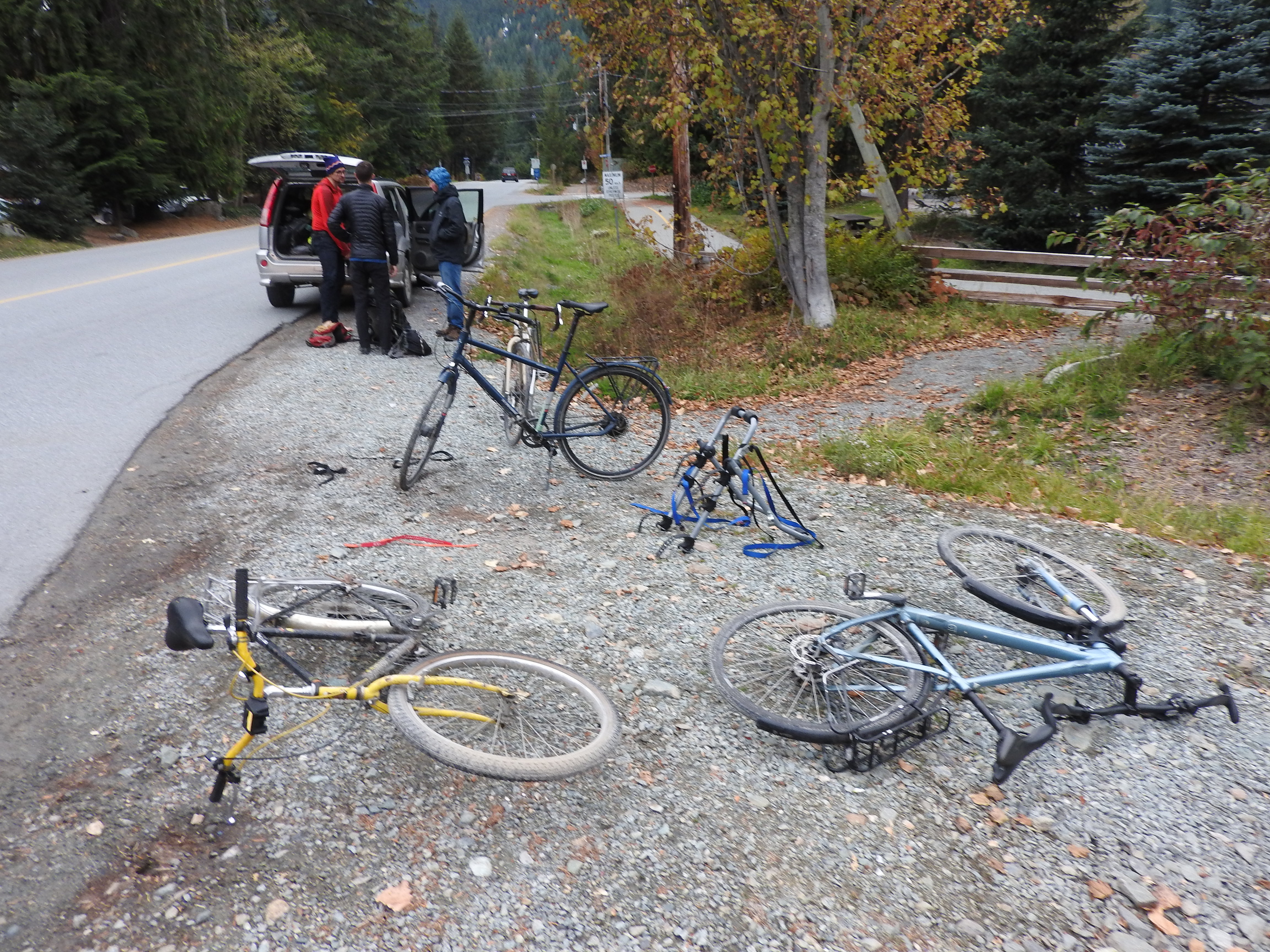
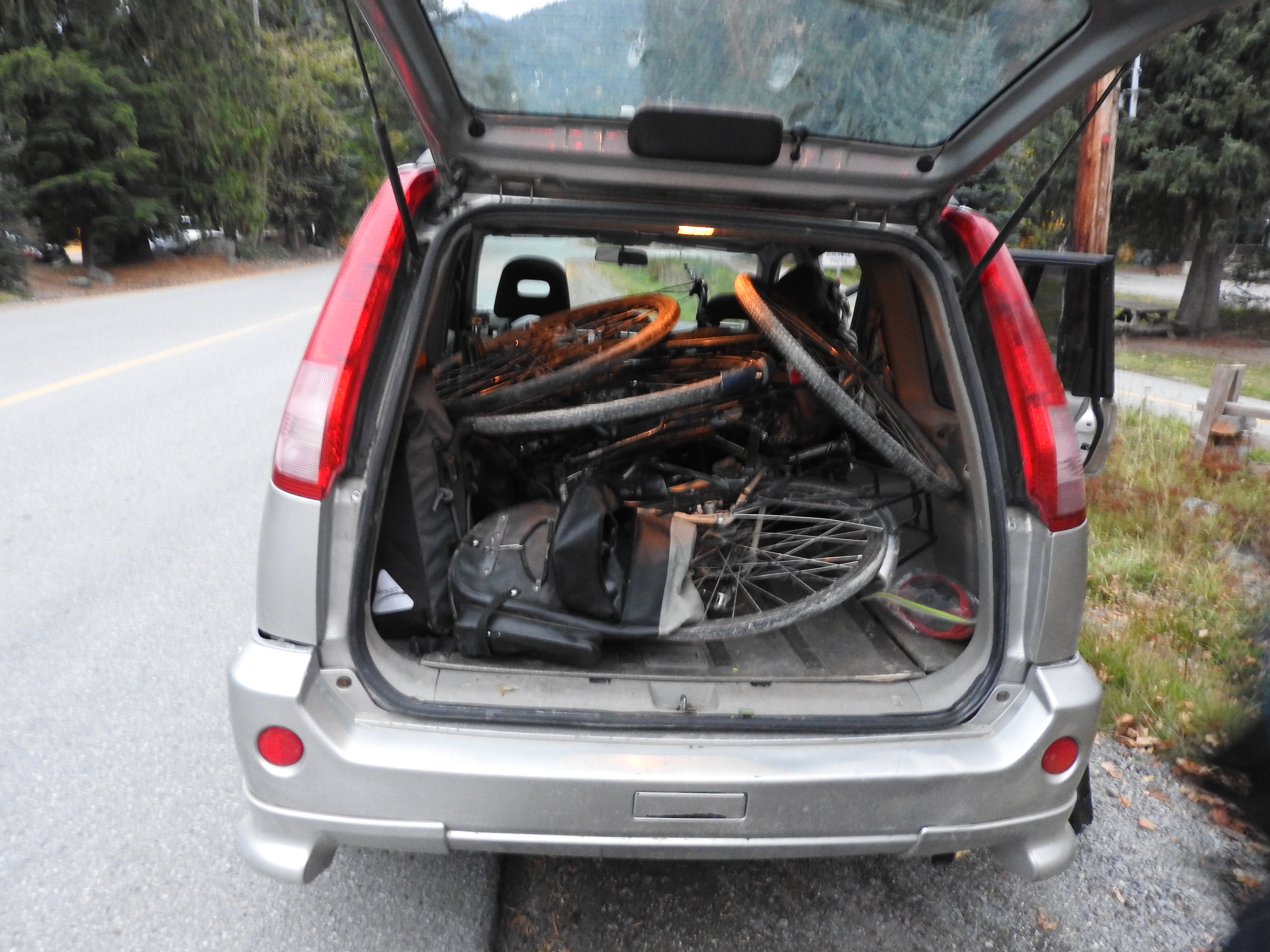
Once Tom and Ross returned, we discussed our options. It was decided that the best option was to get the bikes into the car and some of us hitchhike. We debated going to find and buy a new bike rack but it seemed almost everywhere would be closed at 6pm on Thanksgiving. Ross and I went out to the highway with our thumbs out. Before long a car pulled over and said hop in. The driver was only going to Squamish but we decided this was better than nothing. After a bit of faff – thanks by the way to the driver who waited – Andrew and Ross got in the car. Tom and I packed all of the bikes but one and the gear into the car. The last bike – Tom’s mom’s bike- would not fit in the car. Tom and I took another look at the bike rack and realized that if we switched the plastic parts around so they took the force in the opposing direction the rack should be able to hold at least one bike back to Vancouver (probably would have worked with three bikes but we were not going to test it).
We drove down to Squamish without any more mishaps. In Squamish, we called Andrew and Ross and suggested they walk towards Mag’s 99 from the gas station under the Chief. Our hope was that at Mag’s we would find people that had a spare spot in their car or better yet run into someone we knew. Shortly after we got to Mag’s though, we got a message from Andrew saying they had been picked up while walking along the highway. Supposedly, this was a rather interesting ride although I did not get to experience it firsthand.
Overall this was quite an interesting trip for not really getting anywhere notable at all. We saw huge landslides, washed out roads, a raging creek, beautiful old growth trees, broken bridges, insanely dense bush, and enjoyed ‘chicken of the woods’ for Thanksgiving dinner. Andrew pointed out that the ride home was almost as dangerous as the trip itself. Conclusion: South Creek seems an unlikely candidate to replace our current route into Harrison Hut.
Thanks for the very nice trip report. I think you should have mentioned the dead squirrel in the summary. Jeff’s research into crossing the Lillooet River also has issues. I’m trying to decide if an electric bike would get me up there.
“We had been warned by someone in the government that “By going into South Creek you are taking your life into your own hands.” ”
Daaaaaang, and the trip report delivers. That is some wild terrain modification going on in there, 10/10 enjoyable read.
I guess everyone survived the chicken of the woods.