Pedal Paddle Pedal
Gabrielle Booth & Charlotte Scholten
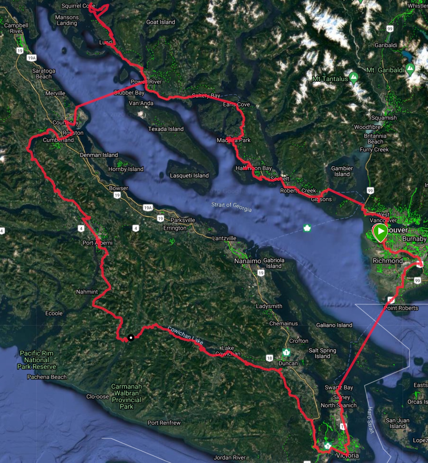
GPS track of the final route.
Total Distance Cycled: 679.41 km
Total Distance Kayaked: 48.57 km
Total Elevation Gain: 9123 m
Charlotte and I pedaled or paddled on the traditional, ancestral, and unceded territories of the following indigenous groups: Tsleil-Waututh, Coast Salish, Squamish, Shíshálh, Sliammon, Homalco, Klahoose, We Wai Kai, We Wai Kum, K’ómoks, Hupacasath, Tseshaht, Nuu-chah-nulth, Ditidaht, W̱SÁNEĆ, Lekwungen/Songhees, Stz’uminus, Tsawwassen, Stó:lō, Kwantlen, and Katzie.
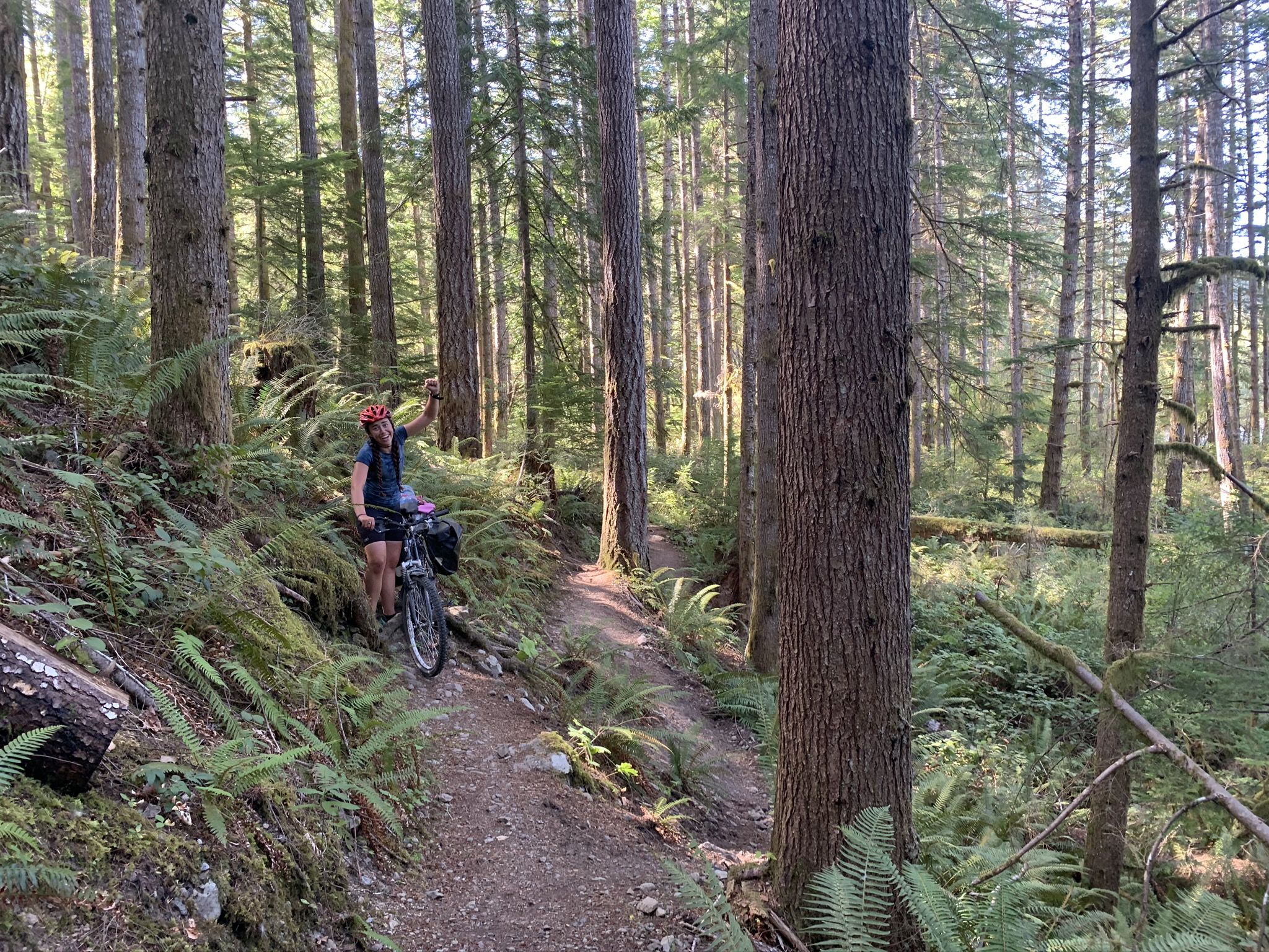
After exploring much of Vancouver, the Sunshine Coast, and the Gulf Islands through bike touring this summer, Charlotte and I wanted to cap it off with a larger, more adventurous tour. In the nine days between our summer jobs and when school started back up again, we figured we could loop the Sunshine Coast and Vancouver Island in seven days of biking and toss in a couple days of kayaking.
Day 1: Vancouver to Halfmoon Bay
Distance: 91.23 km
Elevation Gain: 1235 m
In the first hour of our trip, we were already late. Both Charlotte and I were independently in the midst of moving, so when the first morning of the trip came, we decided to push back our start a few hours to take care of some final in-the-city responsibilities.
Amped up on coffee and stoke, we enjoyed the lovely ride to the Horseshoe Bay ferry and arrived early enough to have a relaxing lunch. On the ferry I listened, slightly amused, as Charlotte called to schedule a physiotherapy appointment for her shoulder immediately after our return.
The Sunshine Coast is quite popular with bike tourers, and they’ve developed a simple app to guide cyclists along it, conveniently called the Sunshine Coast Bike Route App. We did our best to follow the ‘scenic routes’ which the app presented from Langdale to Halfmoon Bay, but we somehow still managed to get lost on more than one occasion.
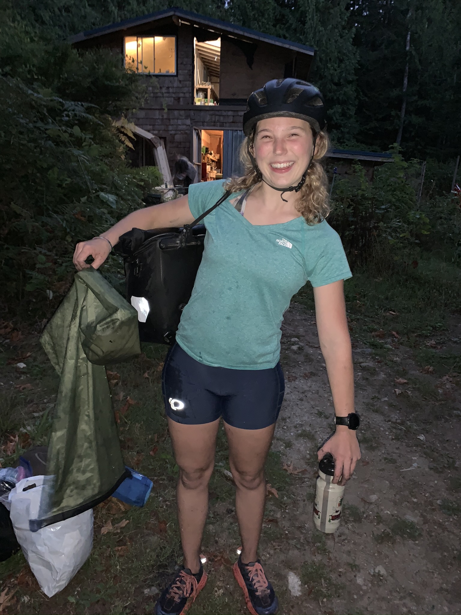
After a nice ride, we were able to get some essentials from Halfmoon Bay General Store, i.e: water, salty snacks, beer, and dessert. We biked into Smuggler’s Cove with the last of the day’s light, which made Charlotte look quite satisfied with our complete use of the day.
Day 2: Halfmoon Bay to Okeover Park
Distance: 122.12 km
Elevation Gain: 2249 m
Realizing we had a long ride ahead of us and that we had to make an early ferry, we woke to our 5AM alarms and packed up our bikes before sunrise. We gave ourselves a half hour to explore Smuggler’s Cove in the light; little did we know that this highly scheduled ‘recreational time’ would become a new norm. There were two ‘scenic routes’ which allowed us to trade parts of the highway for fun little side roads along the water and through the trees. On the second ‘scenic’ route detour, we found ourselves biking along a very hilly road and were enchanted by the water occasionally on both sides of the road. We both independently noted that the Pacific was on our right and that this ‘scenic’ route was taking a lot longer than we had expected. Many hills later, when we stopped for a snack, we decided to consult our map and noticed that we had taken a wrong turn about 10 kms ago and had almost biked around a small Peninsula. But hey, bonus hills! We decided that in the future, if either of us noticed that the ocean was on the wrong side, we should probably check the map before biking 10 kms. We found a more direct way to get back onto the initial scenic route, and eventually, the highway. A bit behind schedule, we recognized that we could probably still make the ferry if we just biked as hard as we could for the next two hours. Naturally, this is what we decided to do. Grinding up and pounding down big hills, we fantasized about our 10AM lunch planned for the ferry. Just when we were starting to lose morale, a 3 km godsend of downhill materialized before us. Absolutely careening into the Earls Cove ferry terminal, we were sent rolling directly onto the boat. Parking our bikes and letting out a deep exhale, I turn to Charlotte who is suddenly smiling and makes the quintessentially Charlotte comment: “perfect timing, right?”
Some context: I honestly believe that half of Charlotte’s fitness (and now mine) comes from permanently (literally) running or biking at least five minutes late. But to this day, I cannot recall a time where we’ve missed the ferry or bus that we intended to take. I can, however, recall having jumped in front of, not one, but two busses in order to stop them from rolling to allow Charlotte or myself to get on. Well sure, our deep distaste for waiting and highly stubborn personalities have created some very stressful bike rides, but also our personal records.
As we were polishing off a half kilo of hummus, we enjoyed the views of beautiful mountains in the Tantalus Range and the Comox Glacier on Vancouver Island towering over the inlets and ocean.
I felt rejuvenated and ready to hit the road again when we arrived in Saltery Bay. We still had a significant ride ahead of us which, for the first half hour, was purely uphill. Finally coasting down to Powell River, we were psyched to see a black bear bouncing about 3m in front of us across the road.
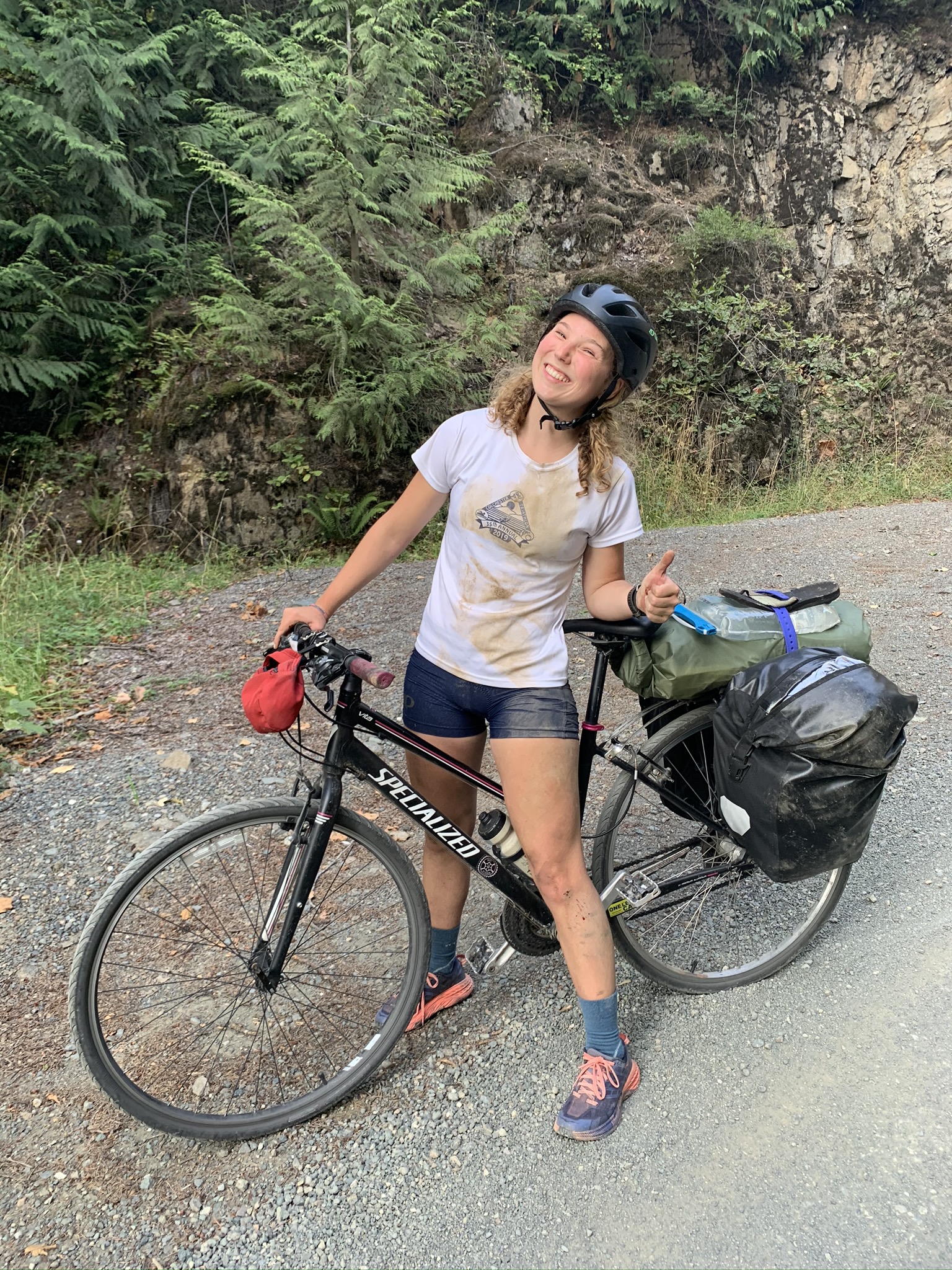
We traded our salty sweat for some of the Pacific’s on a beautiful beach just outside of Powell River. My visions of beach naps and some ‘recreation time’ were stamped out by Charlotte’s responsible eye on her watch. We loved biking through the cute town of Powell River, where we noticed huge cinnamon bun potential, and Charlotte (finally) invested in her first pair of bike shorts. I gave the not-so-subtle suggestion that she might take this opportunity at the bike shop to get some help with her not-so-functional gears (or brakes for that matter). She gave me a “yeah right” kinda look, and we continued on our way.
Our next challenge was to get the food and water we would need for the coming three days. Because of COVID restrictions, Powell River Sea Kayak, was no longer allowing people to fill water at their site. While this may not have been a big issue for people with cars or dromedary bags, it was a major challenge for us. Between the two of us (and Ryan, who is a two liter water jug that we salvaged from the side of the Sunshine Coast Highway) we had capacity for 8.6L of water; we figured we would need around 18L. We were dreading carrying these 18L between the two of us up a 3 km hill out of Lund, which was 12km away from our campsite for the evening and the closest place we could get food and water. Just as we had begun filling our Nalgenes, a kind woman and fellow bike tourer said that the quality of the water which we were taking was very low and that she wouldn’t recommend drinking it. We described our predicament, and she offered to allow us to fill our water at her home which was directly next to the campsite, and more importantly, after the huge hill which faced us.
Thrilled at our luck, we bought some chocolate and local craft beer to give her to show our gratitude. As we set off up the hill, loaded up with groceries, I thought that I had just packed too much food on my bike, but instead we noticed that a couple of large staples had made their way through my back tire. After fumbling through the tube replacement which took far longer than it should have, I bellowed out my classic “on the hill again, just can’t wait to get on the hill again,” and we were on our way.
In our new friend’s backyard, we offered our gifts in trade for the water from her hand pump well. It was here that we learned both of our dry bags which we were using to carry gear on top of our racks had pinprick holes in the bottom. The only option left was to fill one of my panniers completely with water and hope for at least 60% retention. Clearly, we hadn’t been utilizing our bike rack capacities to the fullest since somehow we were able to carry more than 20 L of water between us on top of our regular gear. Thankfully, the ride to Okeover Provincial Park was short and downhill. Exhausted and trying to navigate in the dark, we dropped our stuff at the nearest camp spot we found and stuffed our faces with tasty tortellini and fell immediately asleep.
Our waterproof bags aren’t so waterproof after all!
Day 3: Paddle to East Curme Island
Cycling Distance: 2.82 km
Kayaking Distance: 17.94 km
Elevation Gain: 95 m
We woke up to see the lovely campsite which was located right on Okeover Arm for the first time at sunrise. Already, I had learned that it wasn’t in my best interest to speak to Charlotte in the first 15 minutes of her waking up, nor did she seem to appreciate me loudly greeting the morning with “GOOOD MOOORNING, BALTIMORE!” So right away we fell into an unspoken morning agreement where I would get up, take photos of the sunrise, and make breakfast, as she took down the tent. After these tasks were done, I would approach her slowly with a hand on imaginary bear spray, speaking in a soft and low voice: “Good morning, your coffee’s ready.”
Chatting with our campsite neighbors about our trip and the bikes that we were doing it on made for a fun morning. As I was lubing our bikes’ chains, I found four small sparkler-stick like pieces which were just shoved in some hole in Charlotte’s rear derailleur. Holding them up to show Charlotte what I had found, she just shrugged and returned to casually sipping her coffee and writing some notes about the previous day.
We packed the water and our gear back on our bikes for a 3 km dirt-road ride to Powell River Sea Kayak. This ride was a cause for reflection on how long 3km can be. Charlotte nearly tipped over backward multiple times as she attempted to bike up the steep dirt hills, and I, with my thin and worn hybrid tires, barely escaped taking a huge and watery tumble while going down on the other side.
Enjoying the looks of amusement on the faces at the kayak rental place, we reorganized ourselves and tucked our panniers into the compartments of the double sea kayak. Stoke was high when we piled into the kayak, pulling our toes away from many little pinching crabs. Okeover Arm must have been 20% jellyfish by volume, and we enjoyed checking them out along with the numerous seals along our leisurely paddle. Neither of us were particularly interested in idling about, so Charlotte made us lunch as I continued to paddle us along; though, we did find a neat little cove half way out of the Arm to float around and eat.
While it seemed clear on the map, in practice we had a bit of a tough time identifying which islands were which, but after a little over four hours of purely type 1 fun, we arrived at a gorgeous and tiny archipelago (which is effectively only kayak accessible): the Curme Islands.
Kayaking is Type 1 Fun
It was mid-week in the first week of September, yet these small islands were chock full of kayak campers. For $5 each, we had permission to ‘wilderness camp’ in Desolation Sound Marine Provincial Park which included the Curmes. We landed with our jaws hanging open on the rocky shore of East Curme Island. The tiny island had an outhouse and 12 wooden tent pads, and we were lucky to score one. I think that Charlotte would agree with me when I write that this was one of the most incredible little camp spots I’ve ever been to.
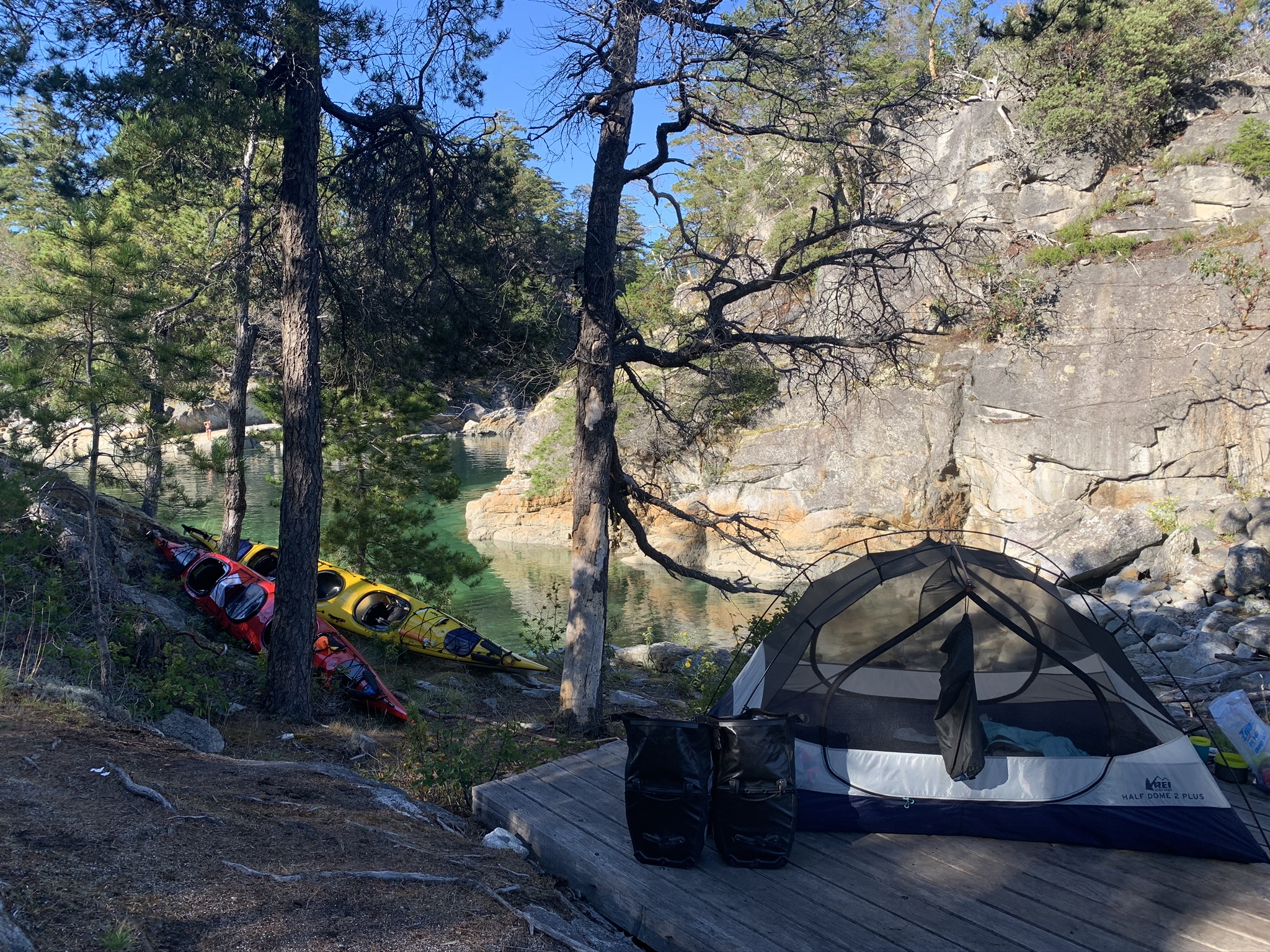
Curme Island Campsite
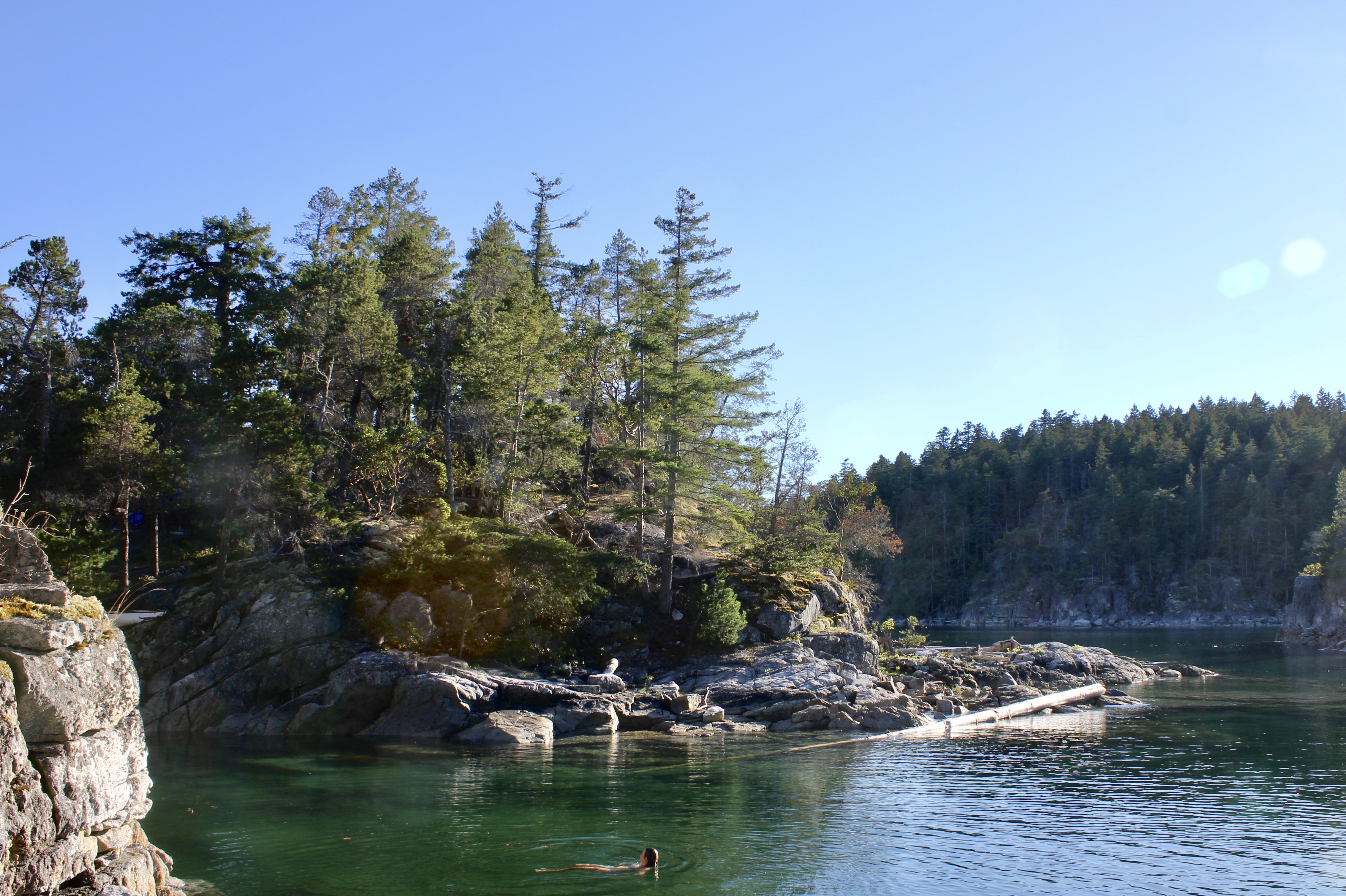
East Curme Island Recreational time
We spent the evening swimming in fairly warm, Carribean turquoise water and checking out the starfish. While planning, I had hoped to spend three days kayaking, but time did not permit. Charlotte’s response prior to the trip was that if we could do all the kayaking that we intended to do in three days in two, then it didn’t really matter that we didn’t have the extra day. That evening we agreed that we could have spent a week easily just kayaking in different directions from this one campsite, and kayak touring was solidly type 1 fun. Then commenced our first serious conversation about building kayak trailers for our bikes.
The view of the sunset from the island was nothing short of spectacular and was accompanied by the sounds of birds dive bombing a fishing sea lion. To top it all off, just before turning in, Charlotte and I watched the full moon rise from the horizon.
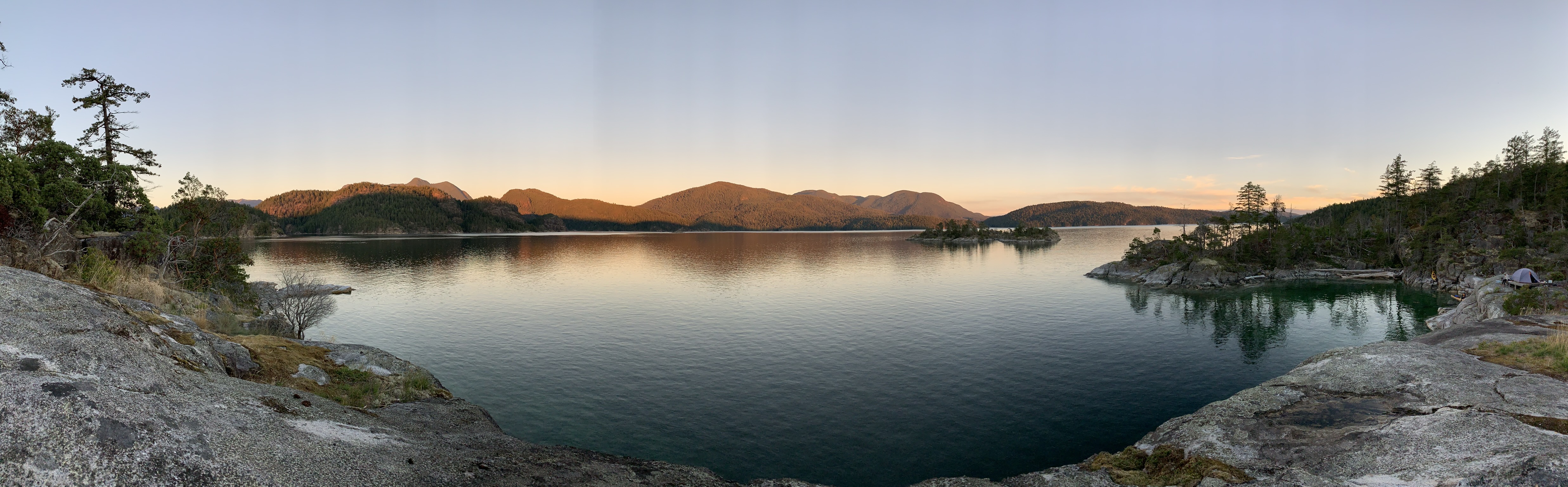
Sunset from East Curme Island.
Day 4: Paddle to Refuge Cove and return to Okeover
Cycling Distance: 2.96 km
Kayaking Distance: 30.63 km
Elevation Gain: 88 m
We rose to eat breakfast while watching the sunrise, stoked on our day ahead. It was a quiet morning when we set off paddling along Mink Island, so we moved slowly to check out seals. Eventually, we had to cross a stretch of open water to follow the coast to Refuge Cove, our morning destination. While we were crossing, Charlotte pointed to a large blackish thing in the water and said: “I think it’s a log, but let’s just go and check it out.” As we got closer, it quickly became clear that it was not a log but a massive humpback whale. We were thrilled, but for me, half of the fun was watching Charlotte alternate between absolute excitement and being terrified. We were able to hang around for a while and watch the whale and two others who showed up shortly after swim along, occasionally showing us their tails and slowly huffing and puffing along.
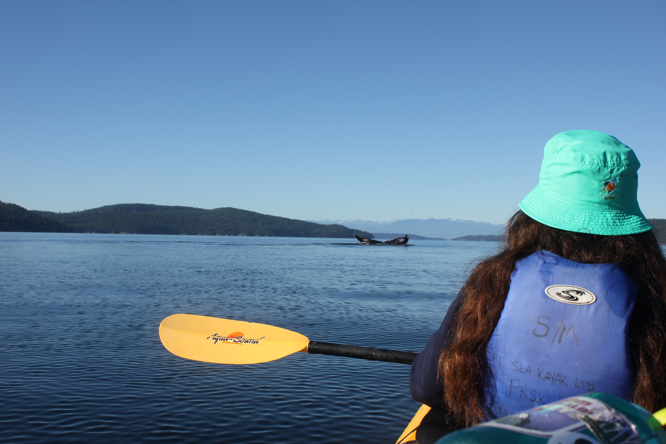
Little kayak meets big humpback whales.

Orcas in the distance.
Just when we were completely convinced kayak touring was the coolest thing in the world and that nothing could top this, a pod of orcas appeared along the coast of Mink Island. We paddled hard to try to get closer to them, but the orcas were far faster than the humpbacks so we sat back and watched them swim toward Vancouver Island. Absolutely gobstruck, we made our way to Refuge Cove.
Refuge Cove is a cute little spot with a General Store and importantly, washrooms. We knew when strapping our 18L to our bikes that we could have restocked water here, but we didn’t plan on it because we weren’t sure we would be making the trip. After a quick lunch, we hopped back in the kayak to start the paddle back to Powell River Sea Kayak.
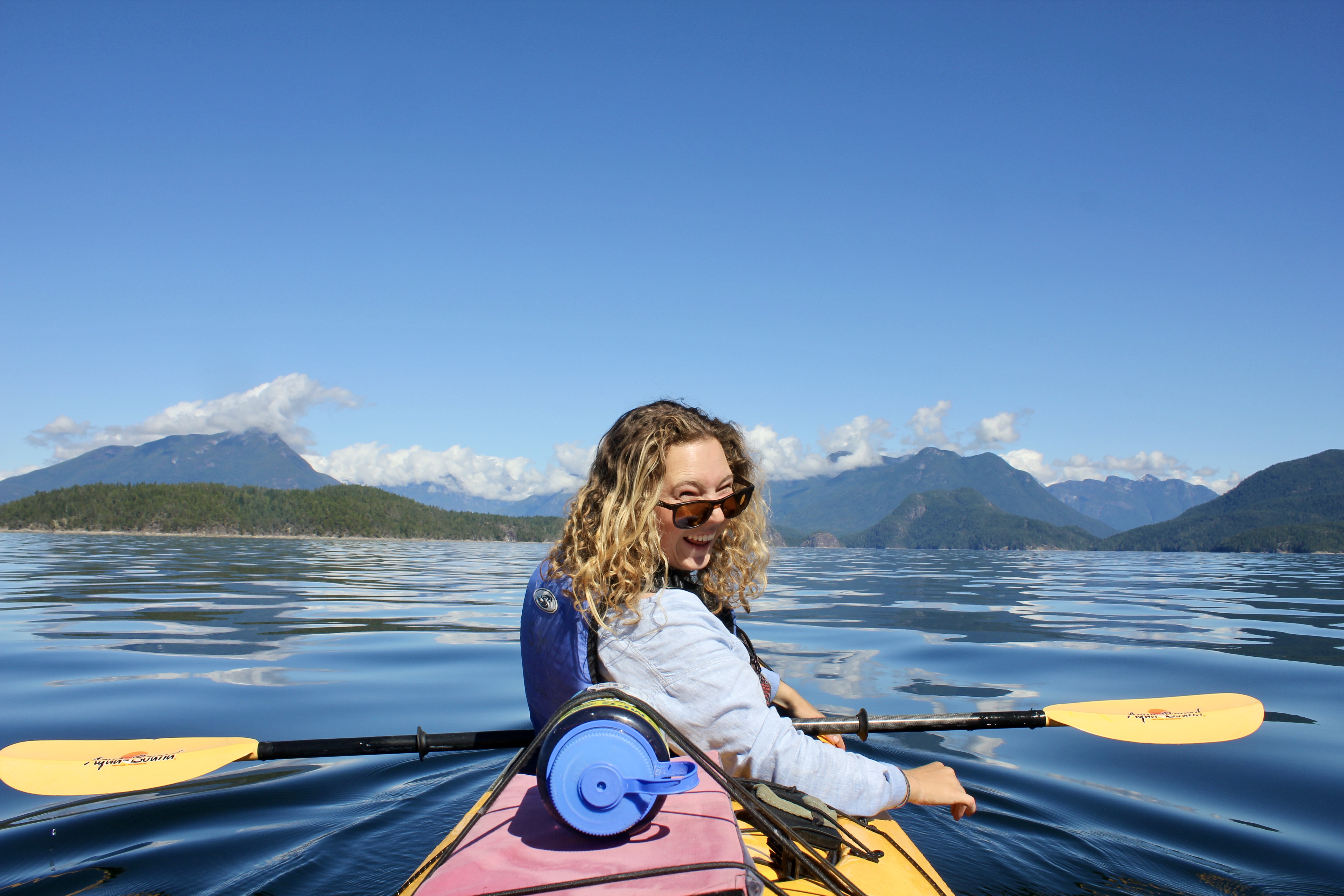
I was thrilled to be out there; it was a gorgeous day and the views of the mountains were incredible. Happily paddling along, I see Charlotte put her paddle down and point somewhere ahead and to our left. After a moment of straining to see what she was pointing at in the distance, a humpback whale erupts from the water, does a quarter turn and smashes back into the Sound. We looked at each other, eyes wide, thinking we were short on time even to return the rental by 4:30 PM, but that we’d really like to get a bit closer to the show that the whale was putting on. After a brief discussion, we decided that seeing the whale was more important than bringing the kayak back on time. Besides, Charlotte had read that they had some sort of ‘grace period’ where they gave you a little leeway in bringing the kayak back on time. This all sounded good to me, so we kicked it into high gear propelling the kayak at 8 km/hr — which was suspicious because Charlotte had hidden from me that she was capable of paddling this hard for the past day and a half, even though we thought we were late to return the kayak. When confronted about it, she said that returning the kayak on time wasn’t nearly as good of an incentive as a whale breaching in the distance.
The whale tired quickly, so by the time we got within a kilometer, the humpback was sound asleep. I wanted to go a bit closer and Charlotte wanted to be a little farther away which must have looked funny to the onlooking boats, a double kayak in tug of war with itself. A boat for governing whale/vessel interactions came over to us and told us about the whale distance guidelines. When the whale is active, you need to keep a distance of 100 m, but when it is resting, you need to be farther than 200 m away. Thanks to Charlotte, we were just about the right distance away.
We were hopeful that the whale might start breaching again and that we would be in a better position to see it; instead, the whale seemed content letting us watch it nap. Eventually, we had to start heading back. I was nervous about getting the kayak back on time, so I asked Charlotte again what she had read about the ‘grace period’ she had mentioned earlier. This time she elaborated and said that after the time you were supposed to be back, they would wait an hour to call in the Coast Guard. I declared loudly that getting there just before they call in the Coast Guard is not exactly what I would casually call a ‘grace period,’ but due to the paddling power that Charlotte had previously been able to hide, we made it back by 4PM. Once again, we had offered ourselves a choice: See the whale or get the kayak back on time, and decided to try to do both by paddling faster. Charlotte, as always, made the comment when we arrived that we shouldn’t have built in so much time for the kayak journey because clearly we could paddle much faster than we had planned for. For this, I had no response.
With sunburnt lips and tired bodies, we hopped back on our bikes for the treacherous 3km return to Okeover Provincial Park. Dinner was determined by which items had gotten most soaked by the leakage in our fresh water pannier and topped off with mounds of chocolate which we had picked up in Refuge Cove. Thankfully, the Ortlieb pannier successfully held the majority of the stored water and only one item over the course of the journey was completely drenched: Our massive bag of trail mix.
Day 5: Okeover to Comox Lake
Distance: 67.53 km
Elevation Gain: 1078 m
Up before the sun again, we began our ride up a large hill. My daily morning song was updated to reflect the fact that we were always starting from sea level, so as we pedaled I crooned: “GOOOD MOOORNING, BIG ASS HILL!”
A car had pulled over on the side of the road ahead of us, and they waved to us shouting: “Apples!” We slammed on our brakes and began chomping down on roadside apples and blackberries with some new faces. The group was headed kayaking and after a while of chatting, we realized that I had some mutual friends with them. They were impressed by our trip and peppered us with questions about bike touring. As was common with people we met along the way, they had all of the gear necessary for bike touring (including far superior bikes) and had wanted to try it, but had never felt ready to give it a go. We hoped that by seeing us making it work with the gear we had, they would just go and try it! In fact, I think that bike touring is one of the most accessible outdoor activities I’ve gotten into and can be quite leisurely (especially, if you aren’t as ambitious or stubborn as we are). We revelled in the spotlight and used their compliments to propel us back into Powell River, happily chatting about future trip ideas.
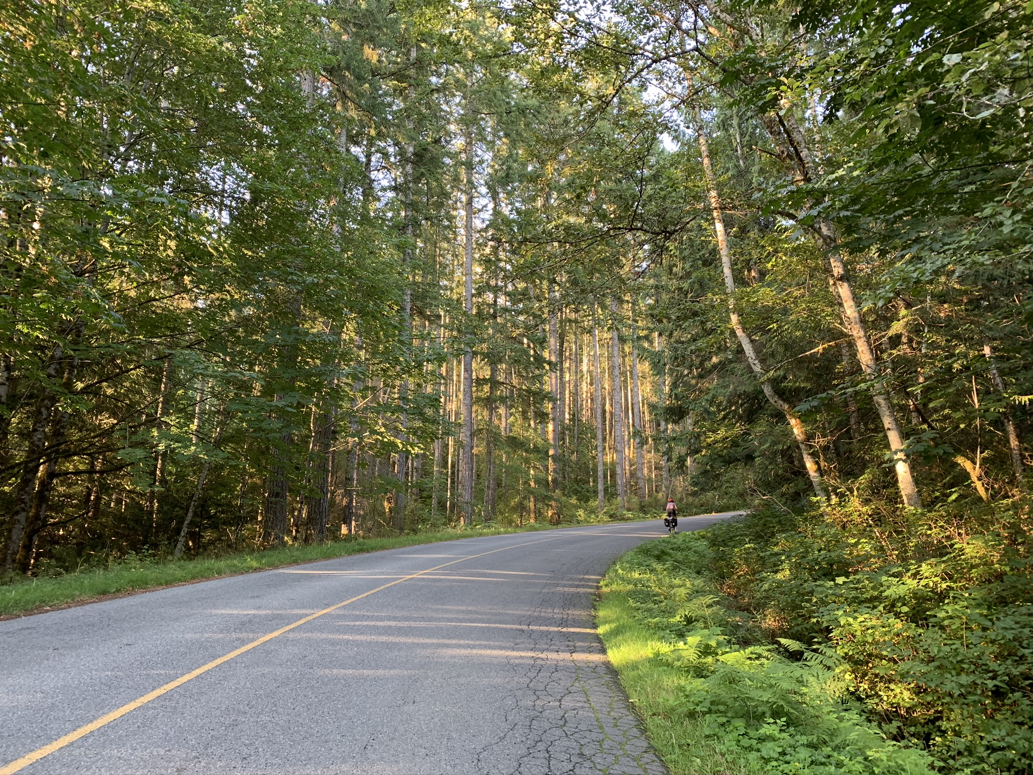
Coastin’!
In Powell River, we treated ourselves to a four-part lunch consisting of delicious bakery treats at 32 Lakes Cafe and Bakery, and then at Base Camp where we both had the most incredible sandwiches. Somehow, despite eating lunch right beside it, we almost missed the Powell River Ferry. On the ferry ride, we considered the feasibility of trying to hike to the Comox Glacier which had been an obvious feature of our view of the Vancouver Island landscape for the past few days. We had considered it before leaving on our trip, but agreed that the added time and gear wouldn’t have been reasonable to add to this trip. Eventually, we decided it would have been a bit much to try and fit into our tight schedule and settled on getting a beer in Cumberland rather than pushing to reach the trailhead that evening. We planned to work on getting more knowledge and experience with safe glacier travel before returning to self-propel ourselves up Comox Glacier.
To add to our already delicious day’s diet, we filled ourselves up with much needed fresh veggies at a hipster and bike-themed brewery in Cumberland (called Cumberland Brewery). We planned on camping on Comox Lake that evening, so we found our way to the beginning of Comox Lake Logging Road. The road had some really steep dirt hills, so even the short amount of time on the road that evening began to wear us out. While my lighter bike and better gears allowed me to struggle a bit less on the uphill, Charlotte’s mountain biking tires held better on the downhill. So we were repeatedly trading places depending on the road’s grade. On a particularly steep downhill, my wheels lost all traction in a deep patch of gravel, and I was ejected forward off my bike, sliding on my stomach, like a penguin, down the logging road. Thankfully, I escaped with only some minor cuts and bruises and was immediately able to hop back in the saddle and meet Charlotte at the bottom of the hill. There was a beautiful beach right there, so we called it a day and set up camp.
Gabrielle recovering from a little logging road tumble.
Whipping out our biodegradable lavender soap, we took luxurious ‘showers’ in the freshwater. Tuckered out and feeling far cleaner in a fabulous spot, I crashed before 9PM.
Day 6: Comox Lake to Port Alberni
Distance: 80.09 km
Elevation Gain: 1420 m
We thought the ride this day would only be about 60kms, so I woke peacefully without an alarm at 8AM. But Charlotte informed me that there were very high winds all evening, and she had hardly slept.
On our private beach we found jungle shorts, a much needed new garbage bag, and a bucket had that fit me perfectly. What we need, nature provides!
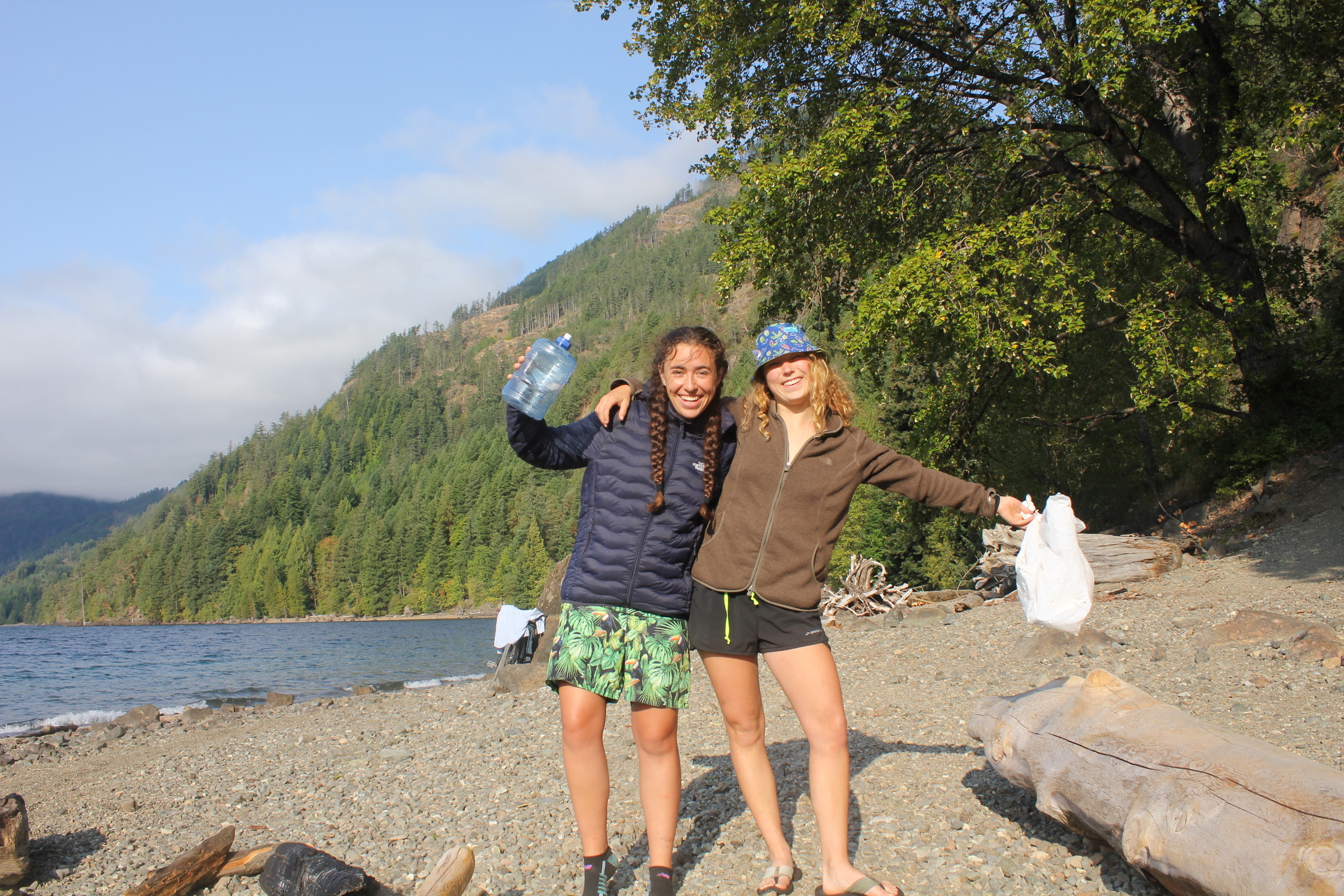
What we need, nature provides!
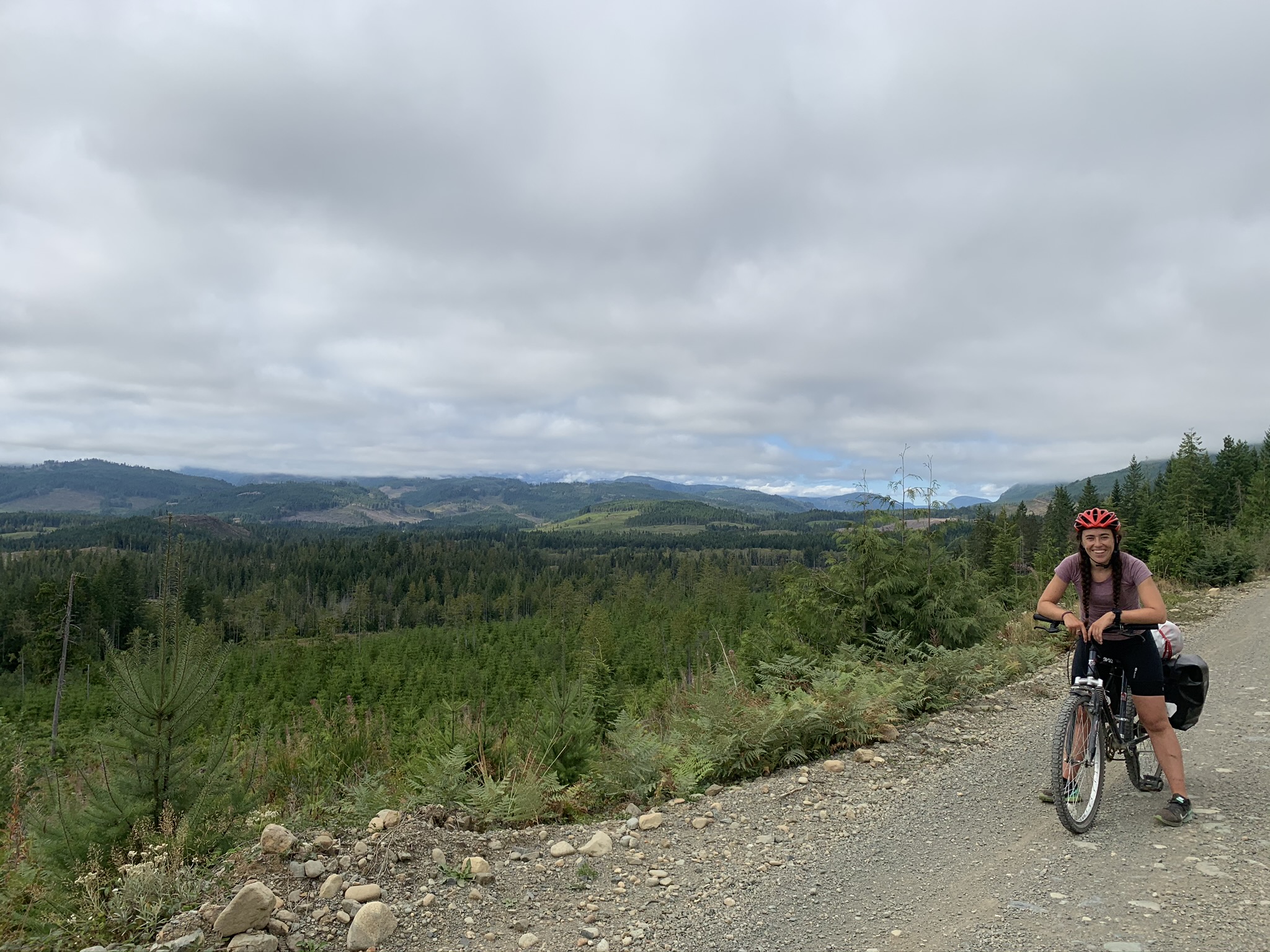
Charlotte laughed as I tucked my new bucket hat under my helmet grinning ear to ear. The ride along Comox Lake was a bit hilly and tough on the dirt, but there were beautiful views to distract us from the tough ride. At some point, we turned on what Charlotte later named: “The logging road of death.” It only feels right to quote directly from Charlotte’s trip notes which adds the description: “Only uphill. Not good road. A lot of pain. Endless hill. No bueno.”
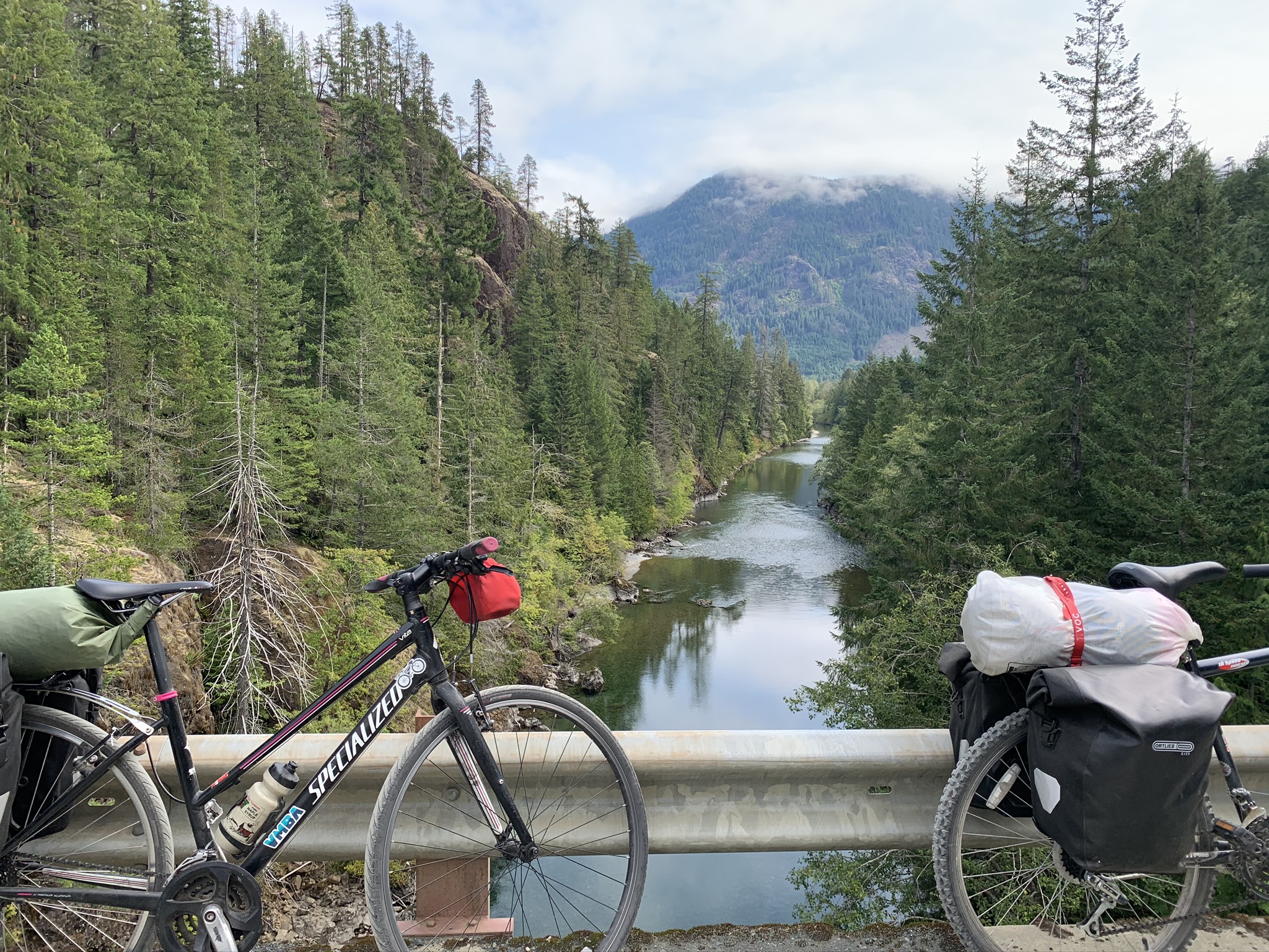
View from Comox Lake Logging Road.
Charlotte’s shoulder was killing her and the steep logging road was merciless. I tried to stay upbeat to lift the team’s morale, but I could tell she was really in a lot of pain. Charlotte’s bike was of little help; our friend had generously given the old bike to her at the beginning of the summer, and Charlotte had (only sort of) jokingly said that fixing the gears and brakes to get them operational would detract from the challenge of the trip.
At a gate after a particularly brutal section of the road, we plopped down in the middle exhausted and ready for a lunch break. At some point, I began to casually talk about why I thought bike touring could be a sustainable long term adventure for me, until I caught Charlotte’s eyes over our massive peanut butter container, and I got quiet fast.
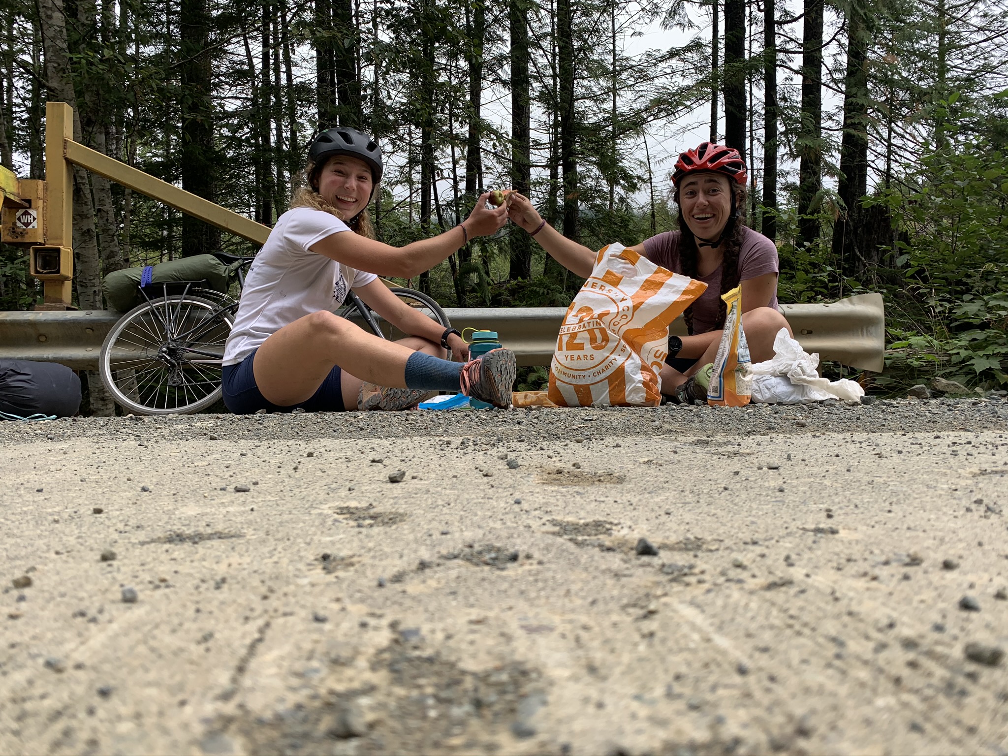
Logging road lunch.
Fortunately for the both of us, as we were packing up our lunch and starting to leave a couple of bike tourers with gravel bikes rolled up and told us it was entirely downhill from where we stood to Port Alberni. Charlotte was ecstatic when we began the long logging road descent. While it was certainly better than the uphill, the downhill on the rough road was a challenge for my hybrid tires. This part of the road was full of some spectacular purple flowers and big views of the western parts of the Island, but the view was diminished by huge clear cut areas.
Rattling down Comox Logging Road
After a long teeth-rattling descent, the logging road ended at a T. Here we had a choice to make, take a right on the luxurious freshly-paved road which we knew would be slightly downhill all the way to Port Alberni or to take a left onto the Log Train Trail which is just over 20km of a multipurpose trail which leads from the base of the logging road into Alberni. Even though we were pretty worn out, I had really been looking forward to seeing this trail. We had heard from another cyclist that there were plenty of opportunities to bail out, so we decided to give it a go. Most parts were nice hard-packed gravel, but a few sections were washed out and carrying our bikes over logs continued to tap what was left of our energy. We accidentally took a path which kicked us off of the trail about halfway through, which we took as a sign to call it a day on being rattled off our bikes. Our joints and butts loved the steady downhill on the newly paved road into Alberni.
After a grueling day, we had some much needed craft beers and pub food at Dog Mountain Brewery. Though, we knew that our day was still far from over.
It’s one thing to bike all day, but it was an entirely different set of tasks to handle the logistics like navigation, preparing food, and finding places to camp. This particular evening we restocked on the calories for the next few days as well as some ice cream for Charlotte for morale. By this point it was dark, but eventually we found a trailhead parking lot to camp behind. Given that the ride that we had thought would be quite easy had nearly broken us, we were concerned about the supposedly challenging day we had scheduled for the next day. After six straight days of heavy exertion, we were exhausted and beginning to reevaluate our next steps.
We were covered in logging road, sweat, a little bit of blood, and a few tears, but we crawled in our sleeping bags anyways and crashed.
Day 7: Port Alberni to Lake Cowichan
Distance: 117.20 km
Elevation Gain: 1901 m
I made breakfast and coffee as Charlotte, looking pained, researched and evaluated our options. As Charlotte knew, I wanted to go on as planned, through the logging roads to Cowichan Lake, but I knew the previous day had been extremely painful for her shoulder and incredibly draining for the both of us. Only slightly begrudgingly, I agreed to take whatever course of action she thought would be best. After some careful consideration of the options, she advocated for taking the highway over to Nanaimo and choosing our next steps from there. A little disappointed but feeling as if it was for the best, we set off toward the highway.
Four kilometers later, I hear a proclaimation, something resembling “fuck it,” and all of a sudden we were turning around and mentally preparing for another huge day.
We had read bike tourers reports which described the terrors of the numerous logging trucks moving at break-neck speeds and kicking up dust for the entirety of the logging road between Port Alberni and Lake Cowichan. In the first few kilometers, our fears were only propagated by the trucks which thoughtfully stopped to inform us of how we might turn around or best avoid getting hit by fast moving trucks. Sufficiently concerned, we could only begin to enjoy the confused, amused, or supportive looks on the faces of the drivers flying past.
To ensure we had the best chance at our bodies physically lasting the day’s feat and to hope we would remain friends on the other side of this adventure, I implemented a mandated snack schedule. Charlotte wrote in her notes that the “road was gravel, not hilly, only speed bumps,” a statement that may more truthfully speak to the steadily improving morale rather than the actual grade of the road, which in my memory was still far from flat. Though maybe my perspective was coloured by the sheer terror of having almost no control while trying to guide my little tires through the deep gravel on steep downhills. In general, though the road was much easier to navigate than the logging road of the previous day, and we were moving faster than anticipated. On top of it all, perhaps because it was a Sunday, a long weekend, by some miracle, or whatever the reason there were no logging trucks for the entire day.
After turning onto Bamfield Road, we were graced by 13km of riding “on a baby’s buttcheek” or as others may know it, paved road.
We had a glorious lunch on the side of the logging road in stark contrast to our demoralized, just-dip-everything-we-have-into-the-peanut-butter approach of yesterday’s logging road lunch. So good in fact, that I declared that I would begin making this lunch at home. The European in Charlotte slipped out here and had a bit to say about my cooking if our lunch on the logging road was inspiring…
In jolly spirits, we crushed the paved section of the road and kept moving fast on the hard gravel roads. Since we hadn’t seen cyclists all day, we were surprised when a group of very knowledgeable gravel riders caught up with us. They briefed us on what we could expect coming up to the lake: There was a shorter North option which involved bougie paved roads, cell service, and a grocery store and a longer South option which involved dirt roads, more hills, and supposedly better views of the lake. Which do you think we chose?
We felt pretty high and mighty when we passed the bikes of Juliette and Co., our new bike idols, which were sitting on the side of the road. That is of course, until they smoked us in some sort of perfect formation at what must have been like 30 km/hr uphill.
The last hill at about 115 kms on the day felt a bit cruel, but gave us a good bit of downhill to leave us coasting to the campground at Half Moon Bay. Despite this, we still showed up at the Provincial Park looking like we had gotten into a fight with a logging road and lost.
The campground was full, but we learned that Provincial Parks are not allowed to turn cyclists away around or after sunset, so they gave us a small daysite area right next to the beach and told us where the showers were. The teller laughed when she saw my eyes get wide when she mentioned the showers, and Charlotte shook her head, “you aren’t seriously thinking about showering are you?” Ignoring my crazy friend, I immediately went to have a swim and a delicious shower. A few minutes later, I saw some familiar flip flops materialize.
Feeling clean and relieved that our most challenging and unknown section of ride was behind us, we had another delicious meal. “I would make this at home too.”
Day 8: Lake Cowichan to Goldstream
Distance: 91.77 km
Elevation Gain: 729 m
This morning on Lake Cowichan was wonderful. We slept in and enjoyed a slow morning at the campsite. Well at least it was mostly wonderful, our oatmeal was becoming slightly less tasty after running out of our high-powered topping mix, and I noticed another flat tire on my bike. It was difficult to figure out what had happened because I couldn’t decide which large hole in my back tire had led to the tube’s puncture this time. The leak was pretty slow, so I decided not to replace the tube and instead faff around and put the front tire, which was in significantly better shape, in the back. After cleaning, adjusting, and greasing both of our bikes, we set off later than we had intended but with bikes which felt much smoother. How long it would last, we weren’t sure.
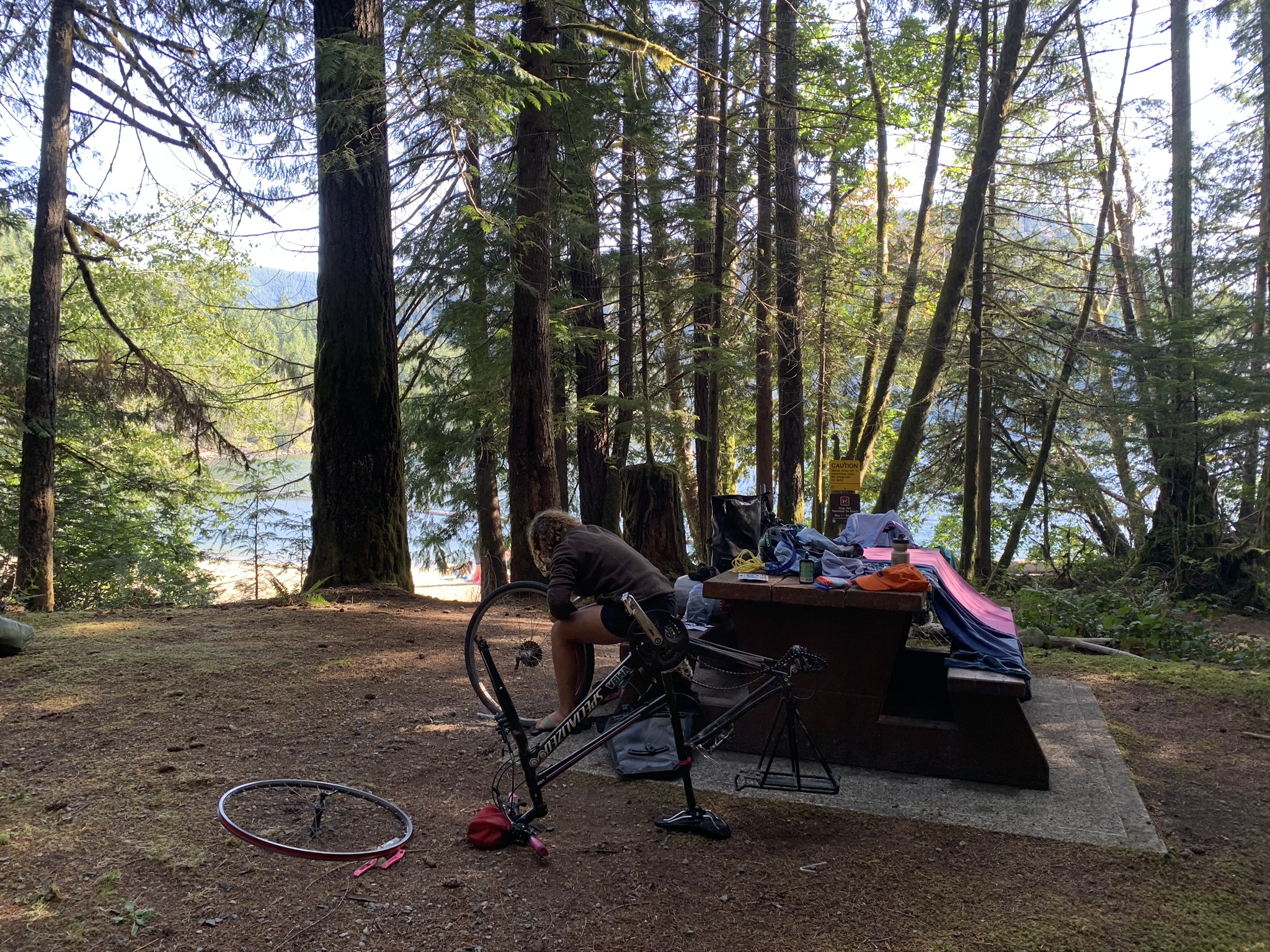
Is the bike still ride-able?
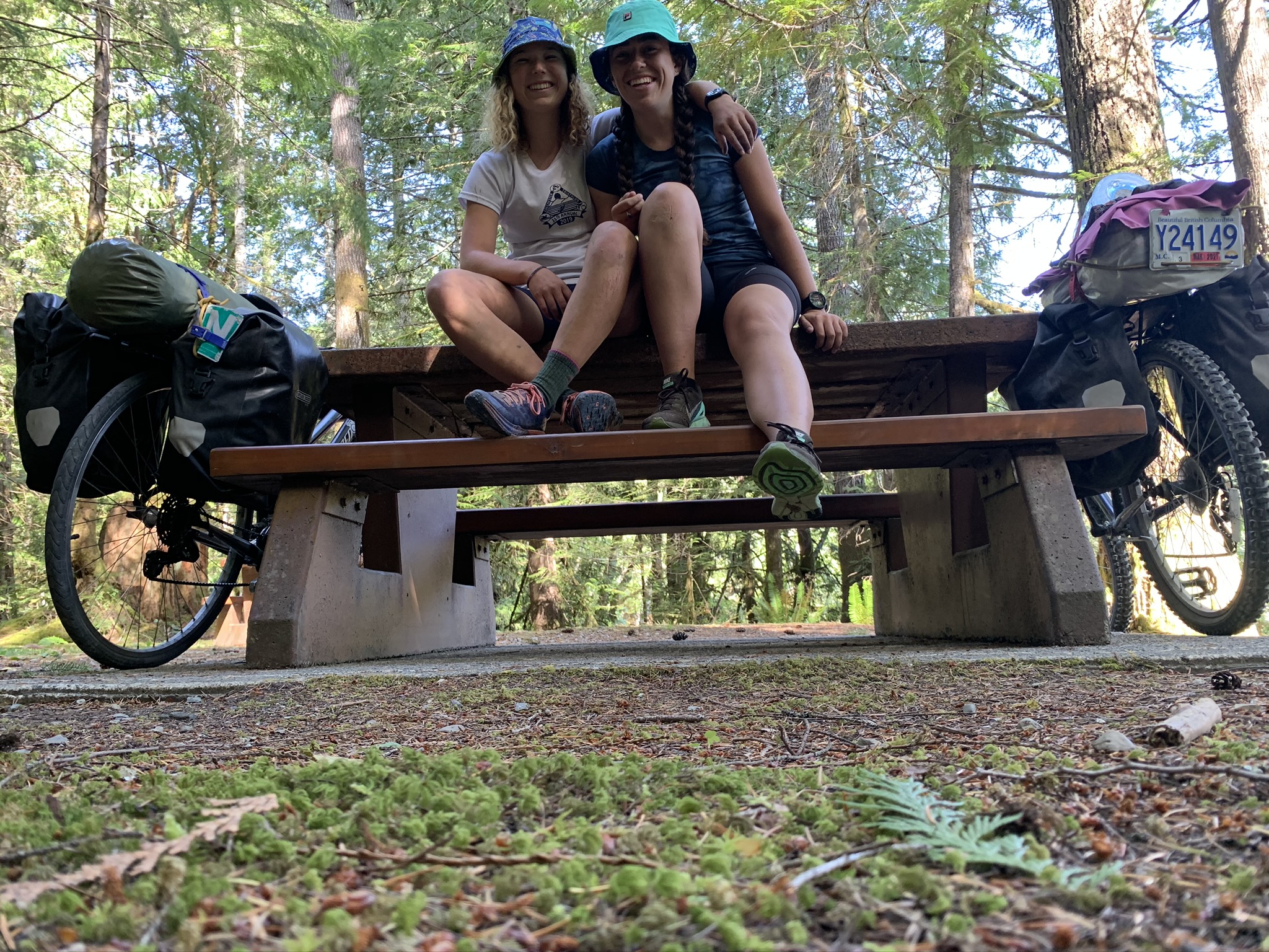
On Wednesdays, we wear bucket hats.
We cheerfully zoomed down a beautiful section of the gravel Trans Canada trail, which constantly entertained with hummingbirds, bridges, and gorgeously treed alleys.
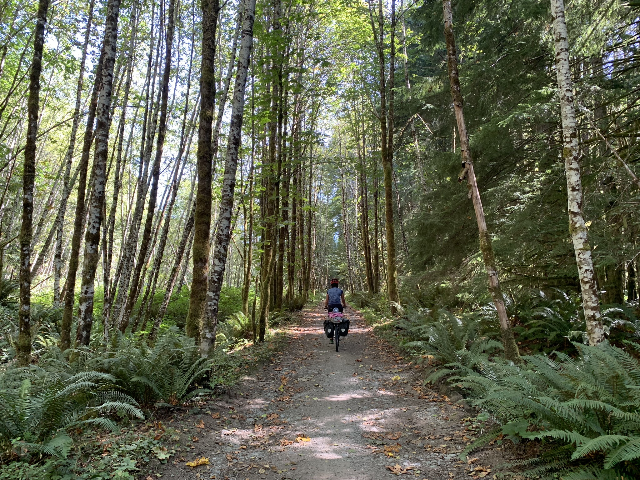
Trans Canada Trail in the Cowichan Valley
Unfortunately, we soon arrived at a closed bridge which seemed to be the only way of crossing a large river and continuing on the path. It was unclear as to how to get around this blocked off section of trail, but some locals told us about a short walking path which should allow us to circumnavigate it.
What was sold as a short, a km or two, hiking path where we may have to occasionally walk our bikes turned into an hour and a half of lifting our bikes and gear over large fallen trees and using dramatic running starts to propel our bikes over steep dusty inclines. Often, one of us would have to climb a feature of the trail and catch the handlebars of a bike which was propelled from the back by the other. I was getting incredibly frustrated and worn out, so Charlotte critically reinstated the snack schedule.
“an easy shortcut through the trees” … 1.5 hours later
Dripping with sweat and muscles shaking, we finally arrived at the other side of the bridge. After I removed the plastic protective pieces on my bike which the trail had snapped, we returned to the gravel trail far behind schedule. Because it was a public holiday, no one was guarding the remaining sections of trail which were closed for construction, so we were able to easily navigate through them.
When we return with more time and knowledge, Cowichan River Provincial Park will be an excellent place to camp, swim, and explore. The path running though it is spectacular and features a couple massive trussle bridges. We might just be a little more wary of the local’s advice.
After our exhausting detour, I was running low on steam and feeling the toll of the past seven days catching up with me. It was now Charlotte’s turn to keep us caloried and moving.
Because it was getting late, we decided to bypass the final hilly section of the trail and take the Island Highway instead. Fortunately, up to this point the day had involved no significant climbs. Charlotte was now working with four operational gears, which rudely did not include her lowests, and I lost the ability to switch into my lowest just in time for the only, and sizable climb to the highway.
But boy oh boy was it worth it, on the smooth shoulder of the highway my watch clocked a max speed of 61 km/hr and with the traffic, we were moving faster than the cars. While I could tell she was enjoying the downhill, Charlotte didn’t quite share my enthusiasm. Because of how fast we were able to move, we cut an hour off of the two we expected.
We arrived at the Goldstream Provincial Park just after dark and for a second night in a row were treated with warm showers. This campsite had heating in their bathroom and a sink to just do dishes. We were sure it had other beautiful facilities, but we didn’t see those because we were only ever there in the dark.
Day 9: Goldstream to Vancouver
Distance: 103.69 km
Elevation Gain: 328 m
The last day of oatmeal was decidedly bad; however, it was more than made up for with a fantastic celebratory brunch in Victoria. The sunrise was blood red due to the wildfire smoke wafting up from Washington and made breathing all day a little uncomfortable.
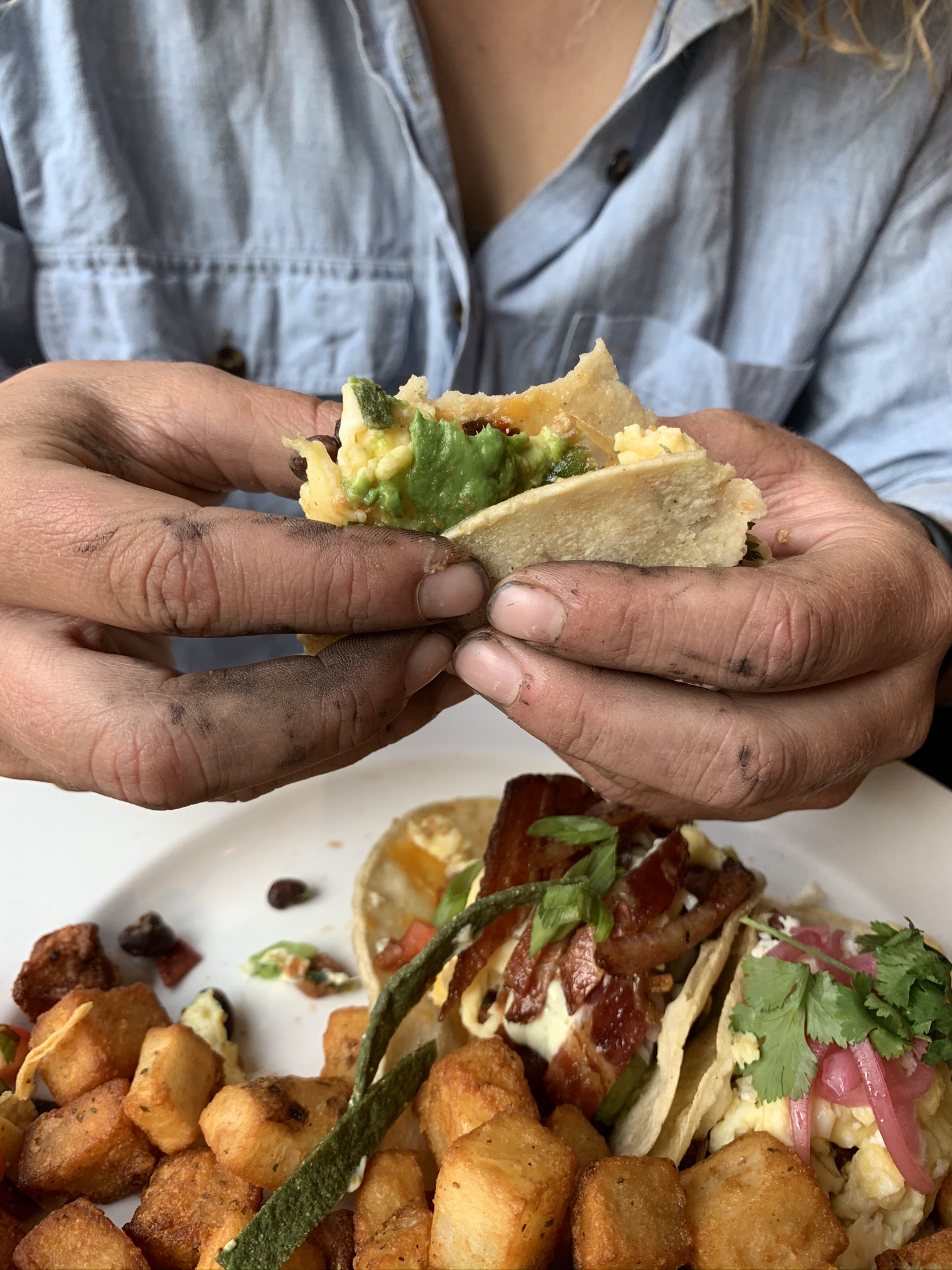
Fine dining
Though sometimes difficult to keep track of, the Lochside trail is a nice protected bike route from Victoria to Swartz Bay. Charlotte had it in her head that we would make the noon ferry, but I thought it was unrealistic and wanted to aim for the 1PM ferry for a more relaxing ride. In the final half hour before the ferry left, we kept losing the trail and it wasn’t looking good for us making it. Saving the day, an older local cyclist decided to lead us directly there and surprised us by leading the charge at a quick 27km/hr. For the third time (out of four), we rolled directly on to the ferry at last call, Charlotte looking pleased.
The ride from the Tsawwassen ferry was long, smokey, and flat, so we entertained ourselves by crooning “old country roads, take us home.”
Finally home. Damn. That was a long ride.
Epilogue:
A couple weeks after our trip, Charlotte’s handlebar disconnected from the rest of her bike while she was cycling. She finally took it to the Bike Kitchen where they took one look at it and recommended recycling the bike. The only pieces she could salvage were the rack and the bell.
This sounds like a wonderful trip! Well done.
This is incredible and a massive effort. Way to go!
I enjoy your writing style—-this is hilarious. Also it sounds like you packed an incredible amount of trip into 9 days!
Your hands in the last picture made me laugh — you two are tough ladies!
ps. I love that you included the names of the traditional territories you travelled through!
Crush the self-propelled! Amazing!
You two are incredible! Just the sheer stats of distance and elevation per day is inspiring. The pictures and jokes add to the grit you two possess. I’m eager but also scared to ever go on a self-propelled trip with you two…