-Douglas Coupland from City of Glass
Will you still be doing trips 25 years from now? Will they be with your *old* VOC friends?
* * *
Looking in the rear-view mirror, the University years are some of the very best… before jobs, families, aging parents & General Responsibility put a major crimp in how much free time is available.
Our group of Old Goats has VOC history going back to the mid 1990’s… history of visiting remote places with occasionally difficult access… literally going for all the blank spaces on the map wall, where you often see more goats than people.
After a decade hiatus, it’s great to receive an e-mail out of the blue proposing a gathering of the herd in mid August. But where to go? Easy! The biggest spot on the map wall with no lines!

Our traverse, around Lone Goat creek, including side trips. START and FINISH on the Hurley River FSR near Downton Lake (just visible) and the booming metropolis of Gold Bridge (top right).
Day 1: Vancouver to Green Mountain fire lookout. [5.9Km, 800m ascent]
Old Goats like to ease into things: A four-hour drive (2WD) and three hours of easy hiking up an old fire lookout road (still driveable, as we saw a skookum Toyota Tacoma coming down from the lookout). We had plenty of time for catching up, bullshitting and remembering how to swat mosquitos.

Evening light on the Green Mtn fire lookout, with the Bendor Range behind.
Day 2: GMFL to Buggy Lakes [8.8 Km, 890m ascent, 920m descent]
Old Goats like scenic ridges: We followed one for 3 Km from the summit of Green Mountain before dropping down just south of Upper Ault Lake, then plodding up the main tributary creek (gorgeous flowers) and what’s left of the glacier beside Mt Land. The side trip up Land (30 mins each way) reveals old VOCers have been active in the area, understandably so. Easy travel and a fun descent to the SW brings us to a camp by three lakes (and the bugs).
Three Old Goats, Upper Ault Lake and Mt Land (top center). Our route took the pleasant ridge looker’s left of the lake
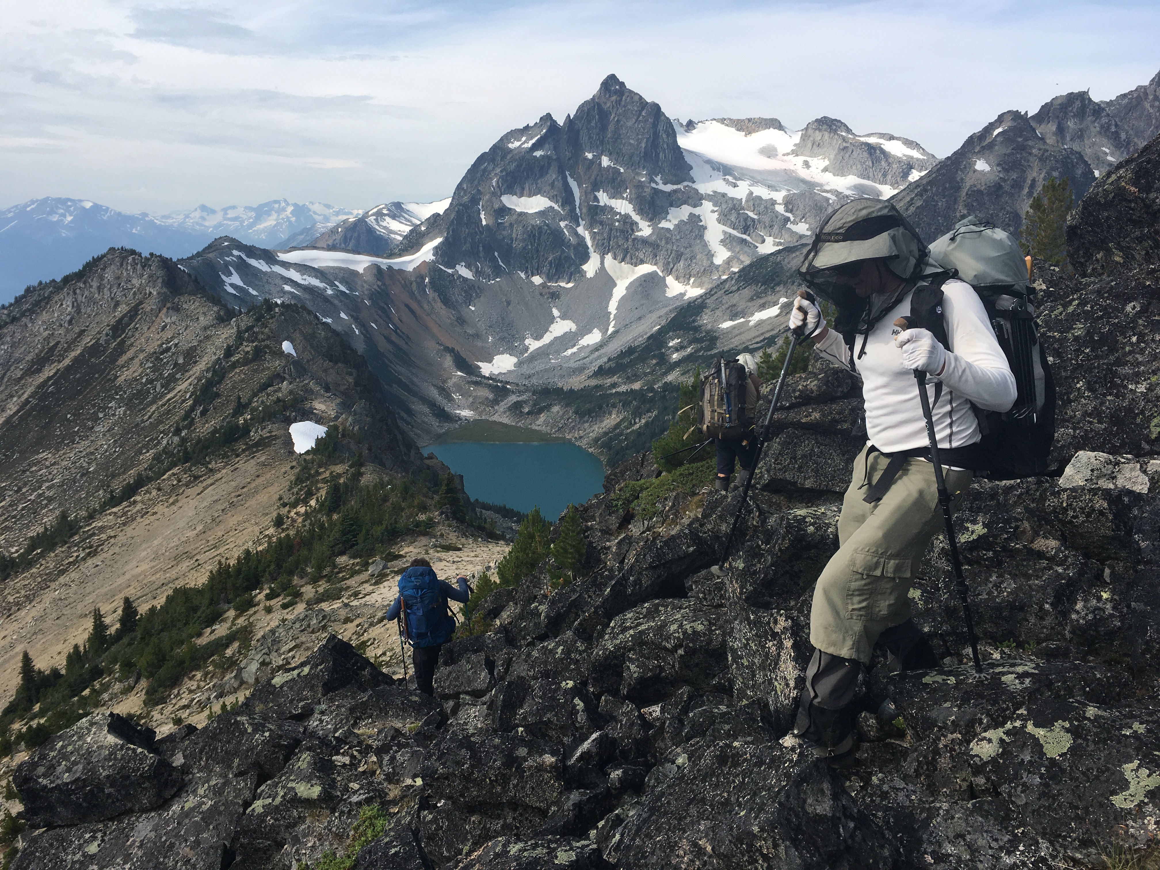
Day 3: Buggy Lakes to Scenic Ridge [6.4 Km, 860m ascent, 620m descent]
Much as we’d like to go ridge running right off the bat, the terrain isn’t looking super friendly… recall, we are Old Goats, soon to be put out to pasture. So we head west, eventually climbing to the long ridge above the north side of Lone Goat creek after lunch. Along the ridge, there are some tricky sections beyond a small peak… class 4 on the ridge proper, or exposed class 2 with some scouting. Fun stuff! We find a lovely flat spot in a shallow col… snow patches nearby, a little sheltered below the ridge but with easy access to refreshing breezes and fine views. Goat heaven!
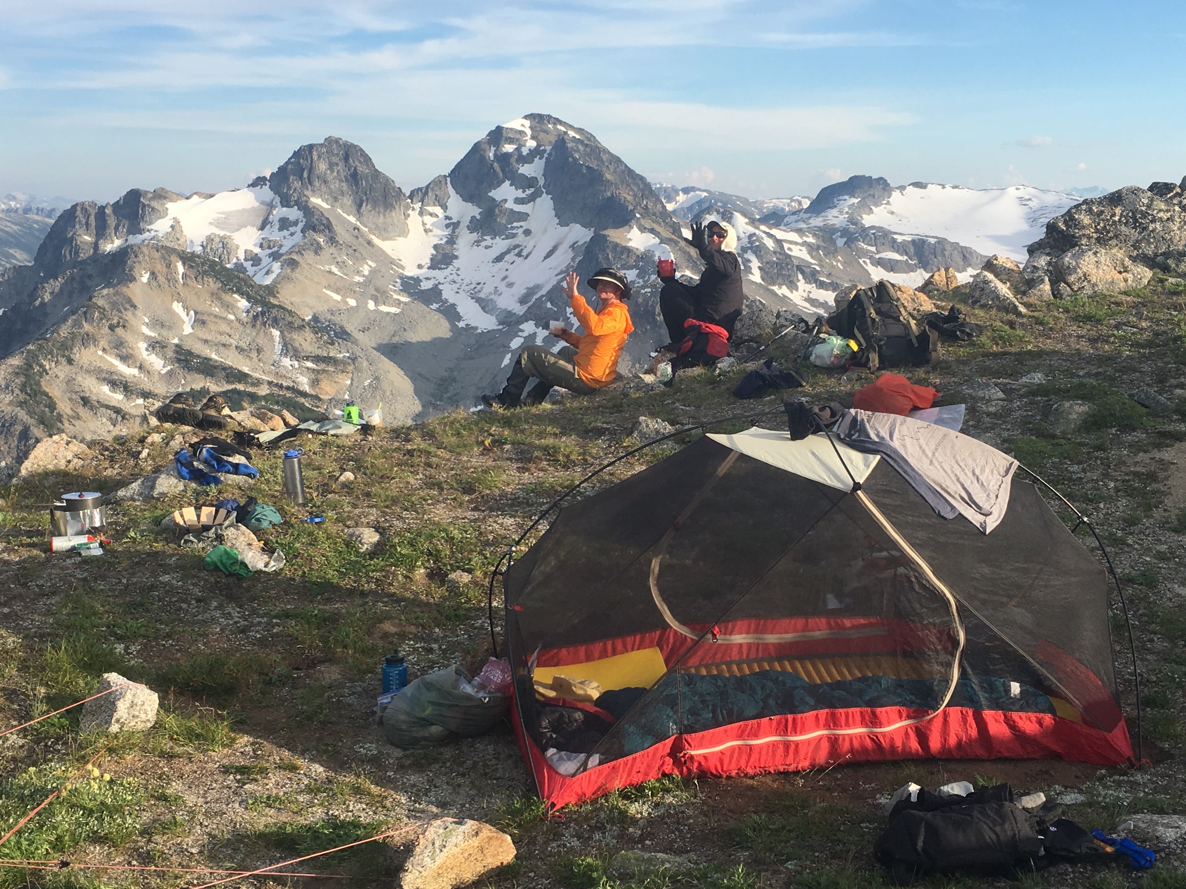
Five star camping above Lone Goat creek. Mt Dix is the highest peak in the background – we would camp on the other side of it two nights later.
Day 4: Scenic Ridge to Lone Goat Lake [4.9 Km, 350m ascent, 525m descent]
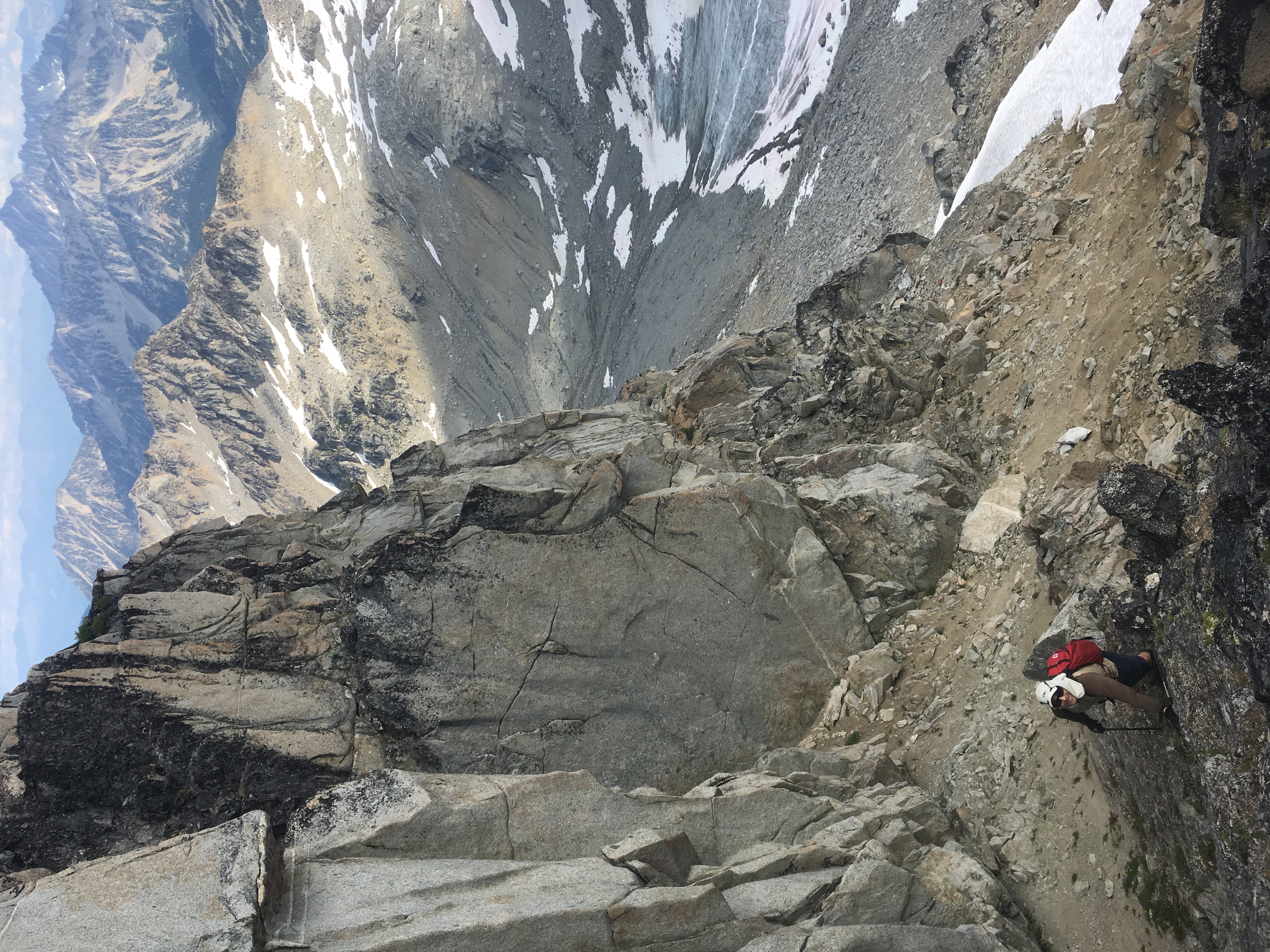
The day starts with primo ridge rambling for 2.5 hours before we drop the packs to make the side trip up the Frost Fiend. It’s a bit of a ways but Holy Hannah is it spectacular, with just enough route finding challenges on the upper reaches to keep us guessing. 5 hours return + some summit time.
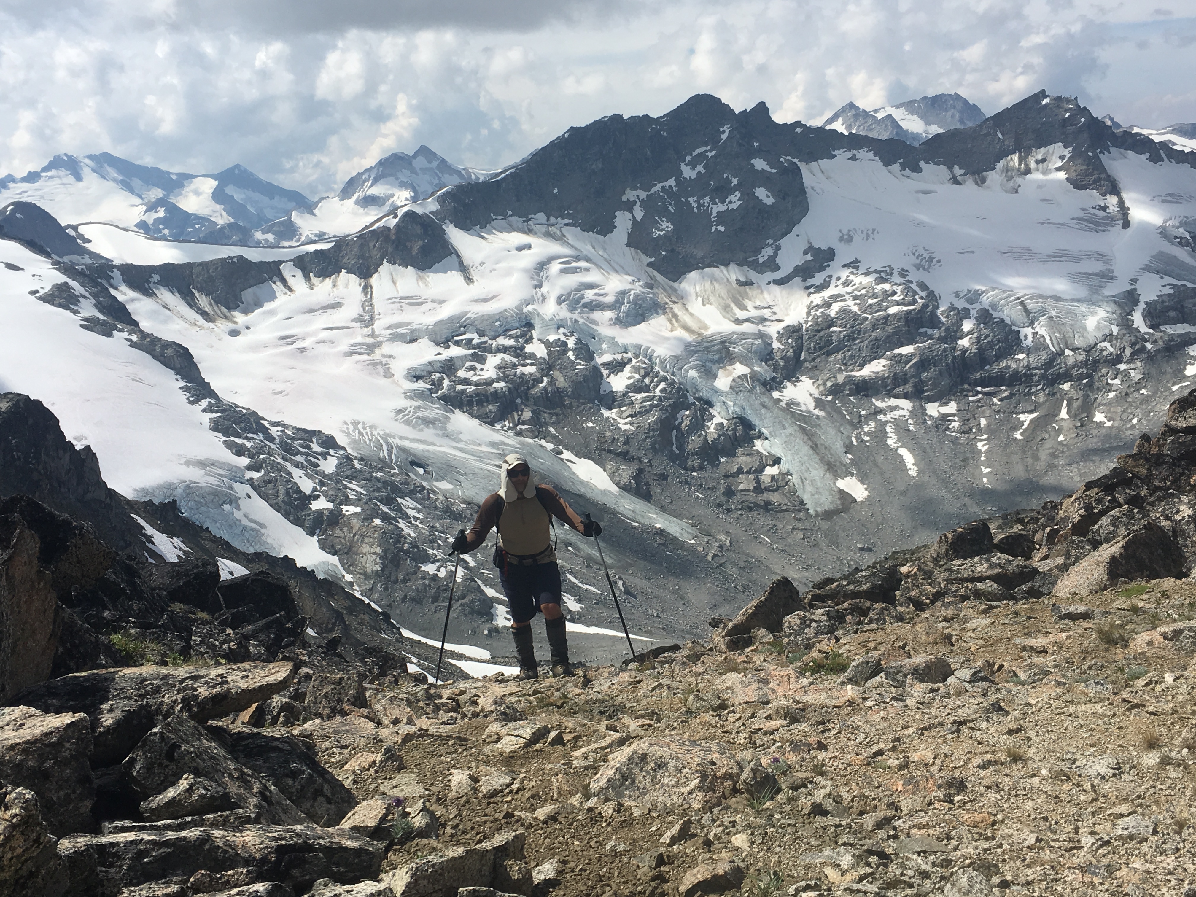
En route to the Frost Fiend, with what’s left of the Surfusion Glacier in the distance.
Fun & engaging scrambling below the south ridge of the Frost Fiend. Mt Sloan at the upper edge of the image.
The drop down to Lone Goat Lake is fast thanks to steep sandy slopes and lingering snow patches. We camp beside the lake, and it’s idyllic. The late afternoon walk around the lake (in sandals) is highly recommended. How can such mellow terrain exist in an otherwise crazily rugged landscape?
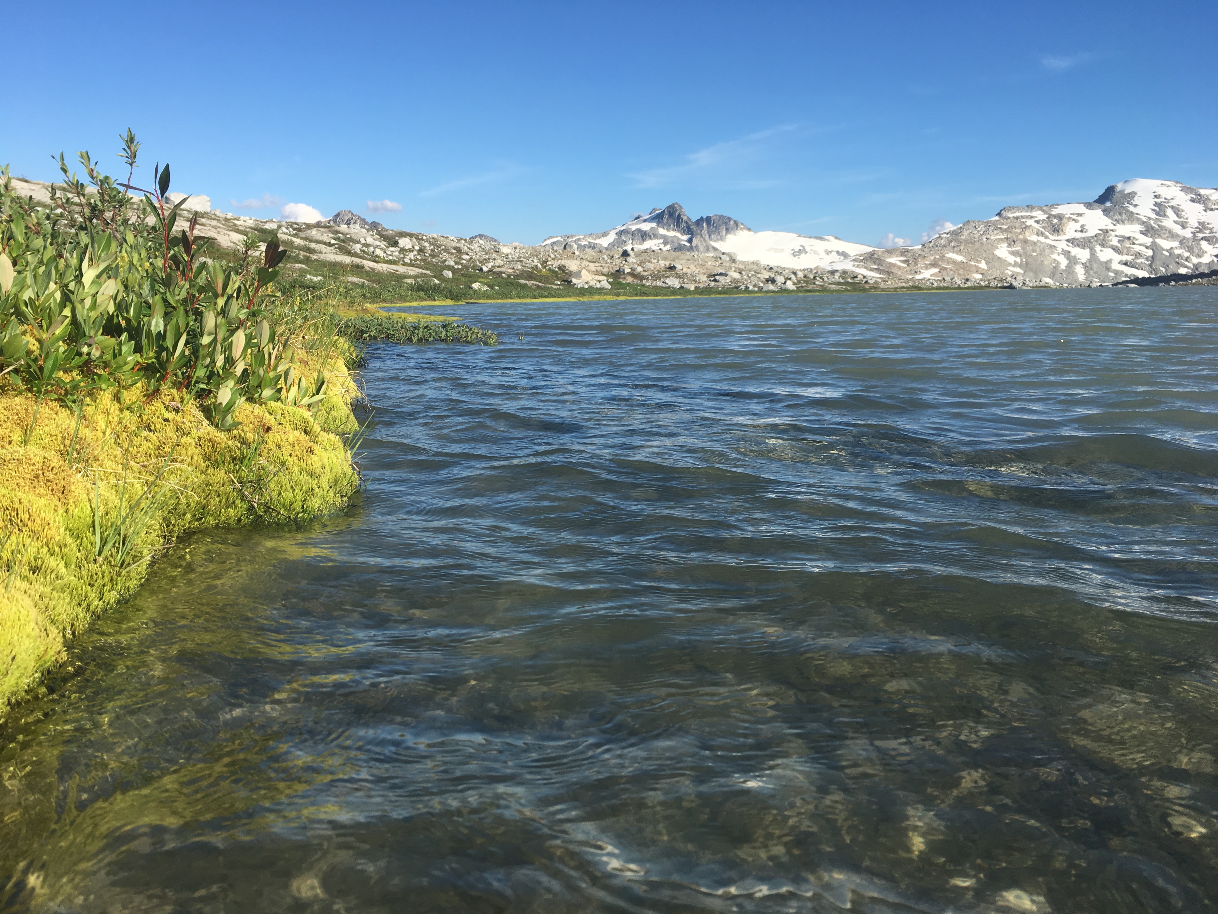
Lone Goat lake before an evening stroll around the perimeter… sandal friendly terrain!
Day 5: LGL to Tarn Camp [10.5 Km, 710m ascent, 705m descent]
Cooling overnight meant the lake level had dropped about 6 inches (Old Goats still use Imperial measurements) and the inflow creek was quite subdued. More primo hiking beside the creek (through heather meadows and moraine features) takes us to the sledder cabin in less than an hour: Empty beer and jerry cans mark its location. Below is an easy creek crossing, and then it’s up the broad valley opposite the cabin… the flowers are spectacular, and about a month later than usual. We have lunch in the shade of a large boulder up on the ridge with sweeping views of Mt Sampson’s north side, the upper Hurley drainage, refreshing breezes and few, if any bugs. One pundit gave it a 99/100 rating.
After lunch, a short scramble up a loose gulley gave easy access to the summit of Mt Tate, where we spent quite some time picking out distant peaks. We lucked out and were able to zip down continuous snow from just below the summit to the far side of the glacier. A short climb east of Mt Dix brought us to a ridiculously beautiful ridge and perfect camping beside a shallow tarn. The brave went swimming; others wandered farther east along the ridge (again, in sandals), exploring cute tarns surrounded by heather gardens, bonsai trees & fine views all ‘round.

Tarnswimming below Mt Dix. Primo camping just to the right of the picture frame.
Day 6: Tarn Camp to Vancouver [11.6 Km, 140m ascent, 1190m descent]
We got an early start in order to cross Lone Goat creek at low water. The bugs were noticeable at times, especially the high sub alpine and main creek crossings. At any rate, fording Lone Goat creek was largely uneventful, just below a prominent oxbow we’d seen a few days earlier. I’d say we got off easy with only an hour of hiking down valley through some classic moose pasture (and 3 bee stings) before finding the end of the logging road. Nobody lost anything from their pack so it doesn’t really qualify as a bushwhack. There’s been some recent maintenance on the old FSR so it’s an easy 2 hr walk back to the Hurley… and it would be driveable in a (narrow) 4WD, but expect pin striping!
I dunno if the Instagram crowd would like this kinda excursion, but the effort-to-reward ratio was just about right for a bunch of Old Goats on a reunion tour. If you like scenic rambling with fun peak bagging options, you might want to put this one on your list… our main route was ~48Km with ~3,800m of elevation gain. Side trips added another 8Km and 600m of gain/loss.
So incredible to see how far back VOC history stretches… looking forward to hearing more about your adventures!
Thanks – it’s been fun to connect with VOCers from different eras (or generations even)… we’re all the same at heart and recognize how important the VOC was during our formative years.
Working on another TR: I had the pleasure of moving thru mountains and seeing some spectacular terrain with a VOC legend from the 80′s this past summer.
Great trip report. Nice to see that VOCers are still exploring together long after university.
Looks like a great route! Always nice to see what the old guard are up to!