Trip participants: moi.
Trip dates: August 5th – August 7th, 2024.
A circumnavigation of Garibaldi Lake had been on my list for at least a year. However, seeing as I have no car, and I wanted this to be a solo trip, I would have to bike to the trailhead. Rather than biking the entire 110k or so from my house to the Rubble Creek trailhead, I took the Squamish Connector from downtown Van to Squamish, shortening the total distance by a good 65k or so and removing the most dangerous parts of the Sea to Sky for bikers.
Day 1:
Upon seeing a weather window starting Monday, I hurriedly rebooked and commenced a frenzied morning of packing and shopping in order to be ready by the 1:50pm departure. I thought it would give me enough time to bike to the Rubble Creek Trail, hike up to Garibaldi Lake, then up and over Mount Price into the Garibaldi Wilderness zone. I failed to factor in the unreliable punctuality of the Squamish Connector… I was on the bike almost an hour and a half later than I’d wanted to be.
My first lesson was that there is a whole lot of elevation gain between Squamish and Rubble Creek, something that goes unnoticed when in a vehicle. The bike ride up was quite a trial, at one point less than a half hour in I already had doubts springing to my mind about the trip. ‘You can turn back any time you want :)’ my consciousness was annoyingly reminding me. Although after stopping for a quick break, and absolutely guzzling some H2O, I was feeling much better. Maybe it was the lighter pack, the hydration, the break? (hint: I only realized this when biking back, but it was because the first 10k north of Squamish on the Sea to Sky is one continuous fucking hill).
Once I’d gotten past this initial crux, I was able to enjoy the ride. Not that it was a walk in the park, but there was less suffering and more pretty views. Speaking of which, biking the Sea to Sky would have been an absolute blast if it weren’t for my heavy pack and cars whizzing by. Highway 99 is something I don’t appreciate much anymore since I drive up and down it all the time, but the views are absolutely gorgeous. Not that it’ll ever happen, but it makes me seriously want a proper bike lane going all the way up to Whistler. The last hill up Daisy Lake Road to the trailhead proved to be just a little bit too much for me, I’m not ashamed to admit that I walked my bike up the final few hundred meters.
After stashing my bike and consuming some calories I started up the Rubble Creek Trail, which had its typical day trippers. There were some reasonably prepared seeming people, although most were in varying states of dejection. On two occasions I was asked how far it was to the parking lot, less than 100 meters following a sign which told them exactly that.

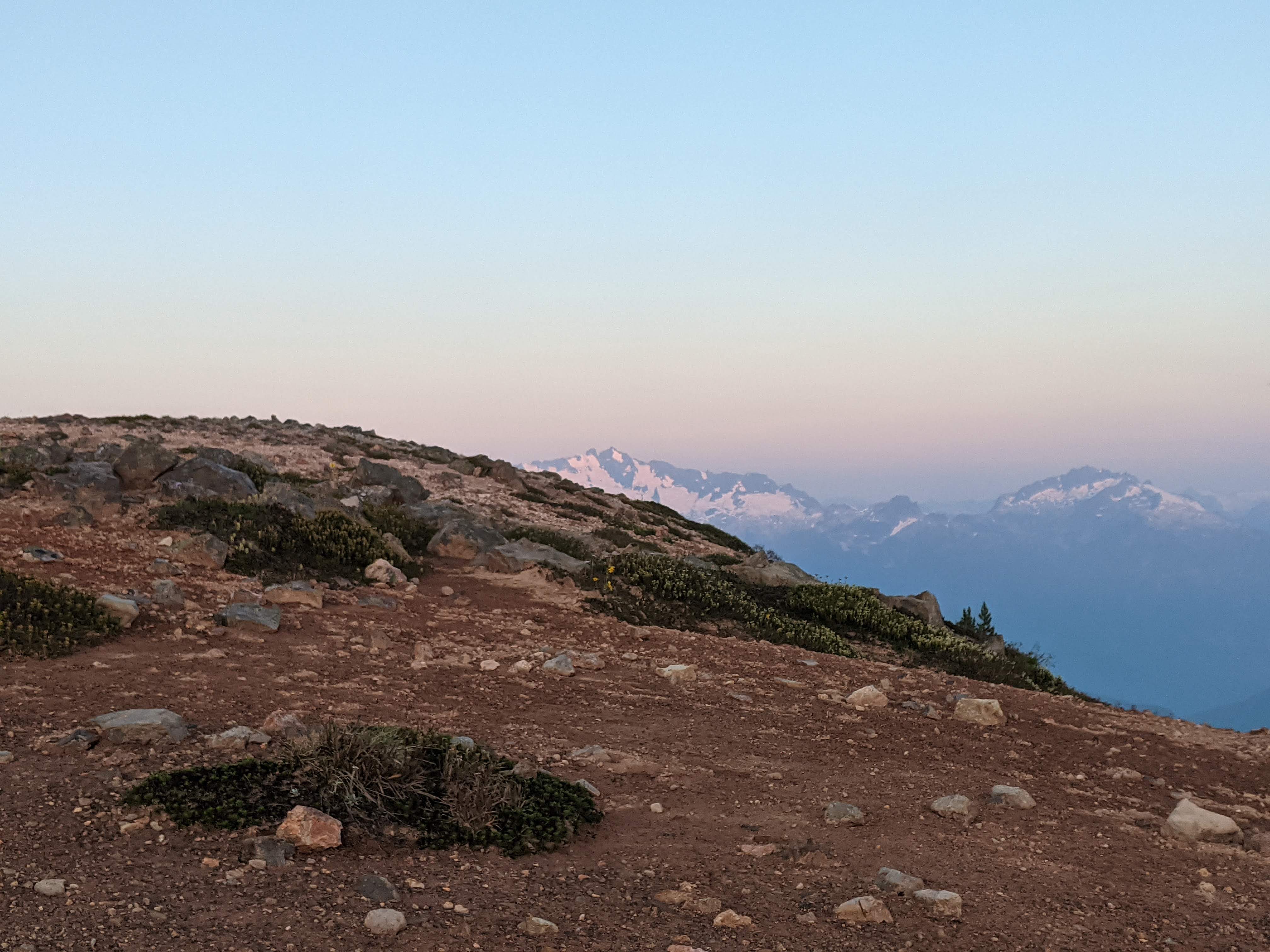
First view! — Lesser Garibaldi Lake
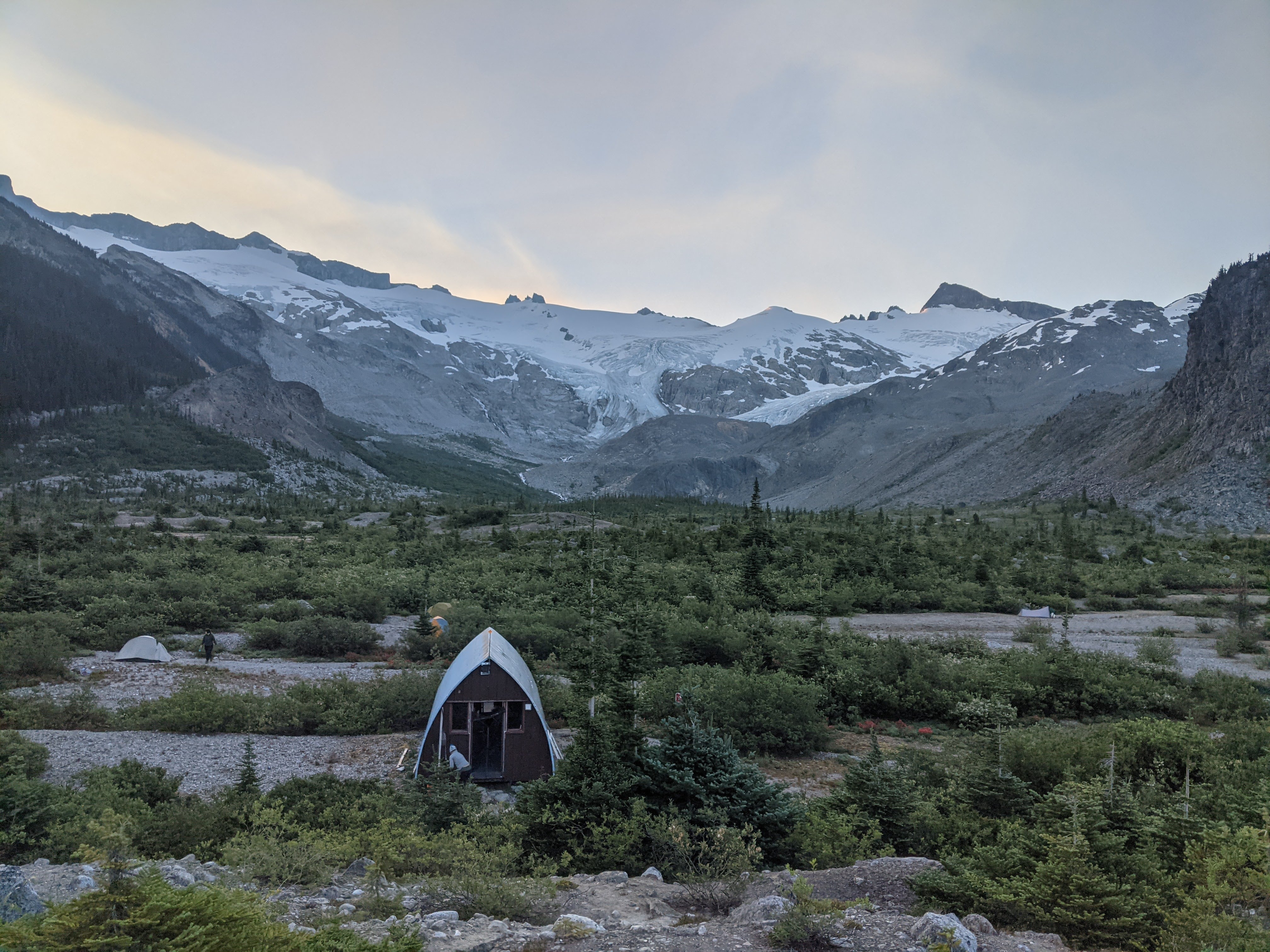
I motored up as best I could and made it to the lake just as the sun had gone down. Unfortunately, probably too slow to make it into the wilderness zone safely. There was naught to do but hike on, however, so hike on I did. Headlamp donned, I continued. The trail up to Price turned out to be quite difficult for me to follow in the dark, the boulder hopping bits were a particular challenge since there weren’t many cairns and the flagging was intermittent. Thankfully, the trail became clearer for a while, and I managed to get into a rhythm before the steep scree/dirt/loose rock section preceding the summit, making it to the top at 11pm in the pitch dark where I set up my bivy for the night. There was no way I was making it into the wilderness zone. I would’ve had to descend the steeper and unmarked section down the back side of Price tired in the pitch darkness (curse you Squamish Connector!!!).
In all seriousness, despite Mount Price being a solid bivy spot, this is definitely illegal and I don’t recommend that anyone plan on camping where I did. I would hope, however, that any governing body which may happen to be reading this in the future would recognize that it was the safest option available to me save turning back before the trip even started. It would not have been safe to descend the backside of Price in the dark with my exhaustion, and turning around would have left me biking the Sea to Sky in the dark (I did have bike lights obviously, but still) with no place to stay in Squamish.
Day 2:
(I think) Brandywine and Cayley peaking out in the center.

Alpenglow on Garibaldi (fair warning there’s a lot of Garibaldo photos in this TR)
I woke up to the sunrise in the morning, not wanting to move whatsoever. I hadn’t slept very well. Although, after finally dragging my groggy self out of the damp sleeping bag, I finally had the motivation to get moving, there wasn’t really anything else to do. Some minutes were wasted trying to find the ‘right’ way down based on the GPX track I was following. I eventually just gave up and followed what seemed to be the path of least resistance, which worked out fine. The GPX track was from folks who had done the circumnavigation the other way around, leading me astray a couple of times since the most obvious looking way up is often not the safest/easiest way down. What followed was a section of mildly heinous bushwhacking. Take this with a grain of salt though, as bushwhacking is neither my preference nor my specialty. However, I survived – the promise of gorgeous alpine ridges always egging me on.
Finally, Table meadows opened up before me, and I exited the ‘schwack for the time being. As its namesake suggests, the very angular looking rock structure called ‘The Table’ dominated the view. I walked along its flank, finding a route that allowed me to boulder hop rather than bushwhack to the ridge, while staying far enough away not to be in the line of fire for any of its well known rock fall. I’d picked up my own personal posse of mosquitos in the boggy marsh of Table Meadows, and they were hell-bent on ruining my boulder bash. I sped up, assuring myself that once I reached the top of the ridge, a refreshingly cool breeze would send them careening away from me…

The big ‘baldi from above Table Meadows, with the Table visible on the left
I was wrong, but reaching the ridge was worth it as it marked the beginning of one of my favorite stretches of the route. Tremendous views opened up across all the peaks surrounding Garibaldi lake and Sphinx Bay, and all the glaciers sprawling further back into the park including the Neve. The rock was solid, and was fun to ramble over. I was welcomed by Heather meadows and craggly bent Subalpine Fir at every turn. Unfortunately, my alpine fantasy could not last for ever as I had to descend to lake level, cross a creek, then head back up the Guard/Deception col in order to continue my journey.
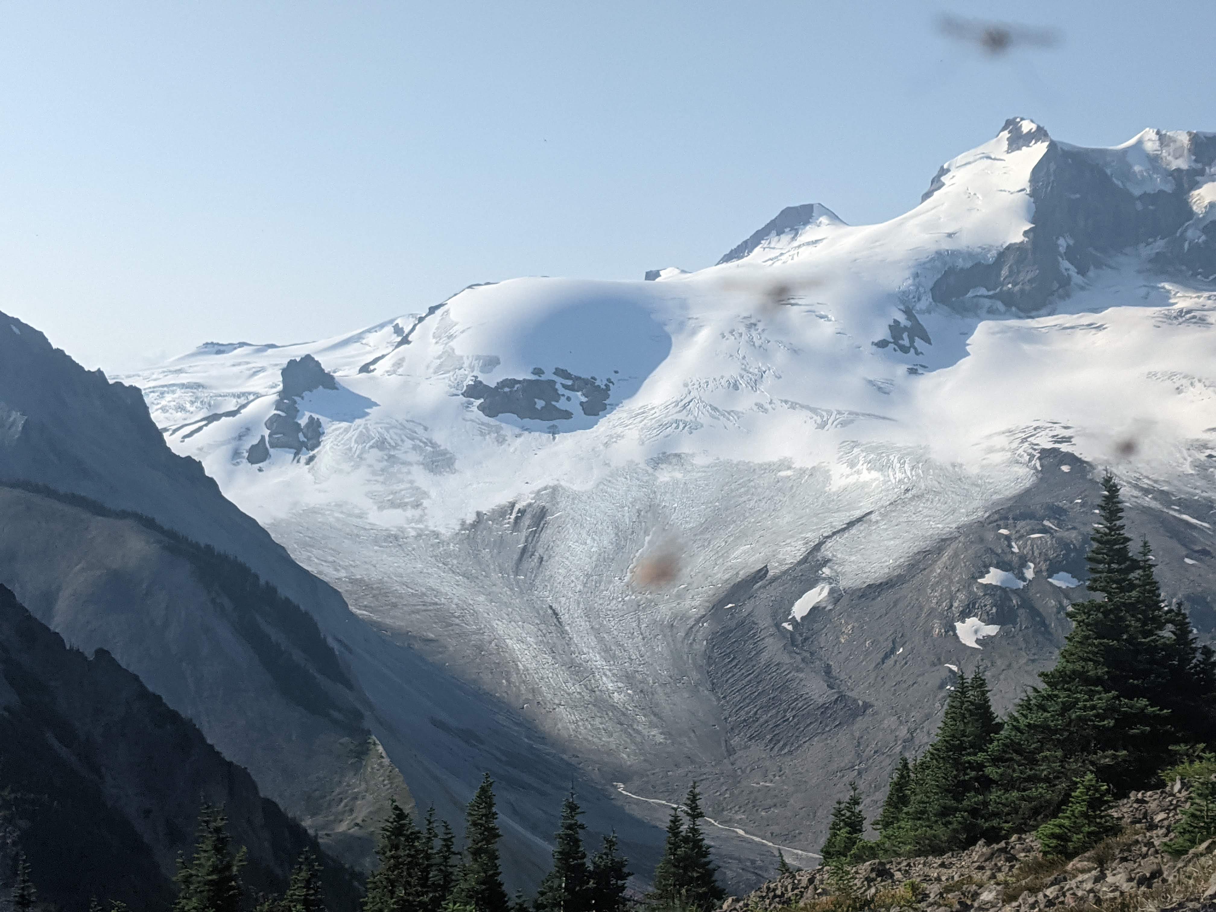
Glacier.

Lake.
Once completing the plod up the Guard/Deception col it was just before lunchtime, which I hoped would give me time to scramble both Guard and Deception and make it to the hut before 5pm. I shoveled some food down my gullet, my fanciest course being dry Gatorade powder followed by a swig of water. The weather was looking a tad foreboding, with dark clouds weaving around the nearby peaks, although it was not bad enough to turn around at the moment.
Guard scramble:

Me on the summit of Guard! Foreboding clouds staying away, thankfully
The first part of guard was a quick scree jaunt to the scrambly bit. The route finding started out relatively straightforwards through some loose class 3 or 4 terrain. I reached a towering piece of rock (gendarme?) that seemingly obscured my path moving forwards, and the routefinding difficulties began. I’d made it up but would have to descend to continue the route, I don’t remember seeing an easy way down, so I backtracked slightly and began a downclimb to climbers left. It worked, but I don’t know that it was the best way. This was the most scared I’d been on the trip yet, downscrambling unknown and loose class 4 rock. I checked every rock that I put even a tiny amount of weight on, and was sending some moderately sized pieces down off the mountain. After passing this difficult part, the name of the game was climbers left, as I made multiple jaunts in that direction to avoid sketchy/unpassable terrain. More solid class 3 and 4 terrain and somewhat straightforwards routefinding had me at the summit with time to spare.

more Lake. This time from the top of Guard.
Coming down I’d resolved to find the same gully I’d downclimbed before or find something asier. I downclimbed it well enough earlier, and sent down a lot of the looser stuff, which I figured would make the climb back up pretty straightforward. It probably would have been if I’d actually found it, but I second guessed myself and ended up descending too early (I think). This left me in an even more difficult section of loose 4th class scrambling. I was less than enthusiastic, but I kept my cool, the moves I was making were not especially difficult or strenuous. The only way I was going to get into real trouble would be to freak out, make a mistake, and put weight on something that couldn’t hold me. There were multiple small ledges that I found were safe to put my weight on after clearing them of small rocks. I eventually made my way back to the ‘route’ I’d followed on the way up, being very careful to avoid ankle-breaking rocks in the boulder field, and made it back to the col.
Deception scramble:
Deception, overall, was a more enjoyable objective then Guard. I found the routefinding to be easier, and there were more fun scrambling moves. From the col until nearly the elevation of the summit is fun class 2 boulder bashing on bomber granite boulders/slabs. I knew when I reached the proper scrambling section, which was a string of false summits I had to get over/around in order to get to the true summit, hence the name ‘Deception’. I resolved not to be Deceived. Starting out, the obvious and only route forwards deposits you by an airy and fun 4th class ridge, thankfully the rock in this section wasn’t as loose as guard. Hearing about all of the deceptive sub summits I didn’t even try to go up them, there seemed like a pretty reasonable route that ducked below, sticking on climbers right. This worked miraculously, and I avoided some very sketchy looking terrain higher up and made good time.
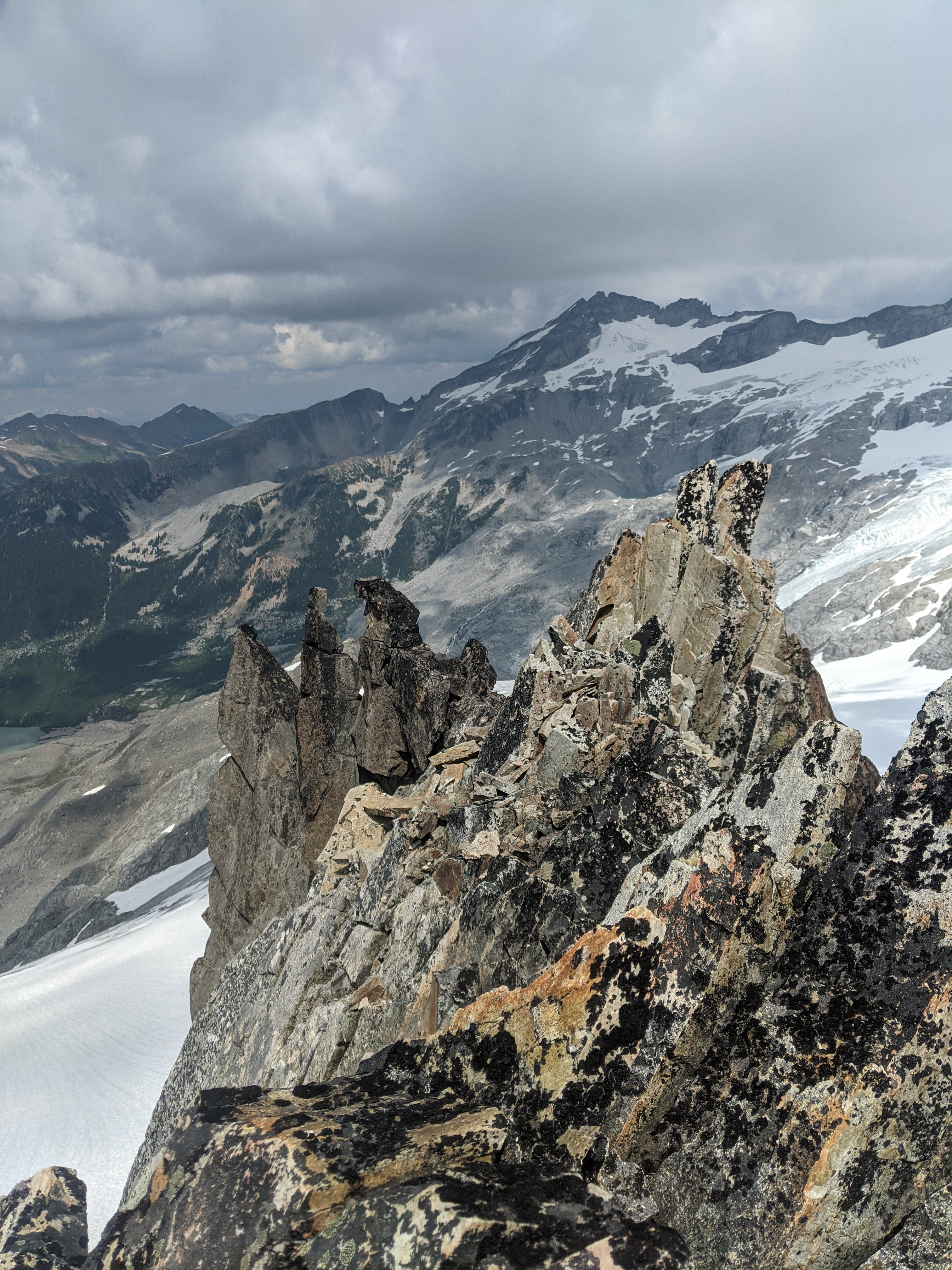
Deception being craggly.

The Sphinx! From Deception.
The name of the game with Deception was to stick climbers right. Eventually, it looked on my GPS like I was getting very close to the summit, and I didn’t see any obvious ways to continue down to the right. There was a very fun and airy ridge/arete feature that led directly up to the summit! Deception turned out to be a bit less sketchy feeling to me, the routefinding seemed more straightforwards and it was less loose. I let out a whoop of celebration just as I was reaching the to– oh shit this isn’t the summit… I looked across a very sketchy section of loose shit that I’d have to downclimb directly below another summit feature that looked like it was at a very similar elevation to the one I was on. I checked my GPS and realized I was not at the very top, assuming whoever made the map had any idea of where the top actually was. Based on the very scientific method of my eyes I deemed it likely that I was standing on something that was maybe a meter or two shorter.
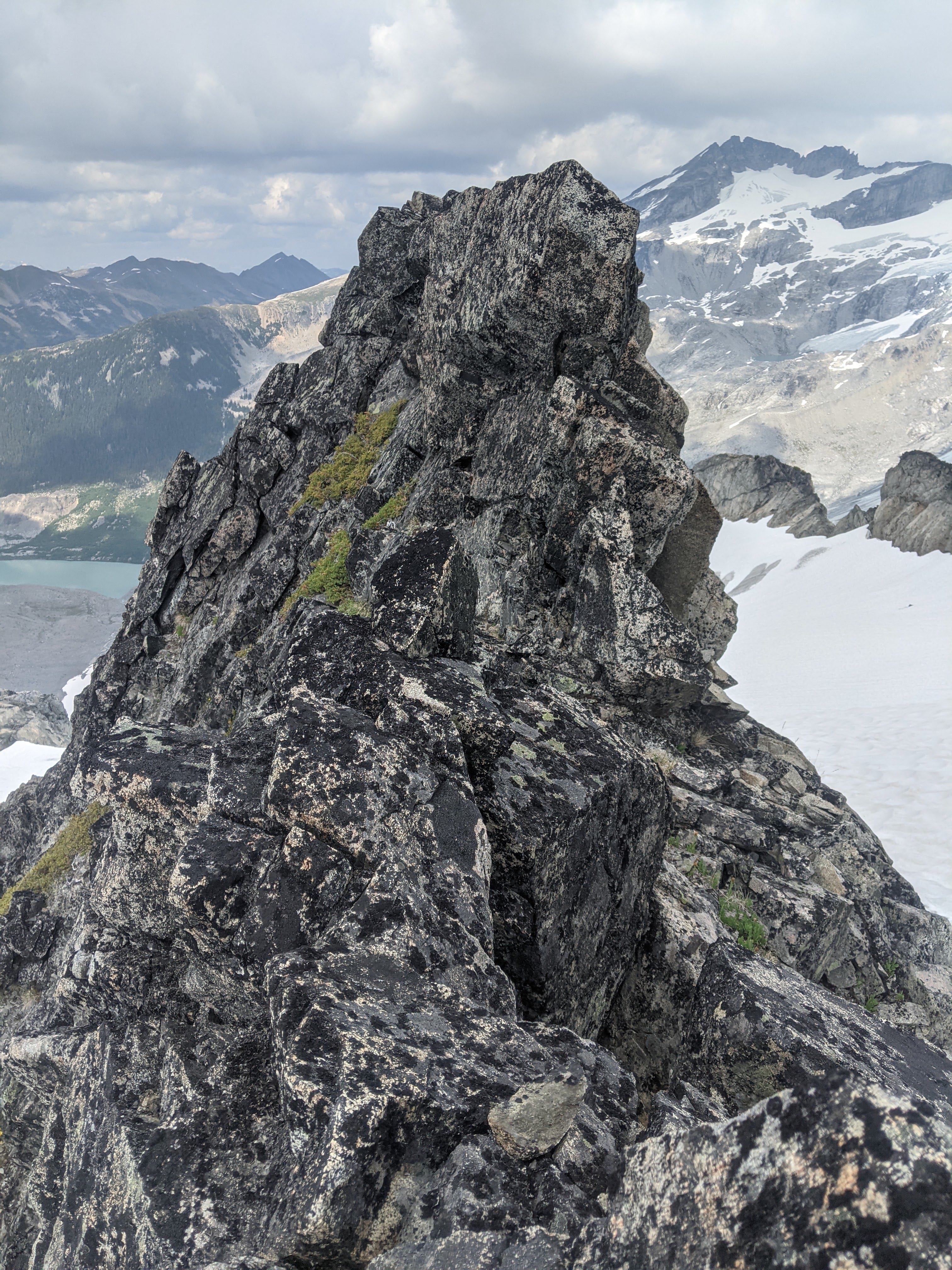
More Deception being craggly.
The last section was the sketchiest of the Deception scramble, and was not possible to bypass. I’m unsure as to whether I was actually correct about which was the true summit, as the scramble over to the other peak clearly hadn’t been walked on recently at all. It was extraordinarily loose and there were rocks sitting on the most obvious hand/foot holds, which I cleared off in order to make those holds usable. I was at 100% focus, and with a measured pace made my way to the summit (the actual one this time)!
On the way down, I followed roughly the same route I had come up with no issue. I may have been a bit higher in elevation on the traverse section but it went just as well. Once again I had to be very careful not to turn a knee or something on the walk down through the boulder field below Deception. Over the next few minutes, my walk became a plod.I was very tired from not sleeping well the night before, from the early wake-up and intense day, and from needing to be 100% focused in exposed terrain. I thankfully made it back to the col well before 3pm, the time I was aiming for to be heading down.
Day 2 continued:
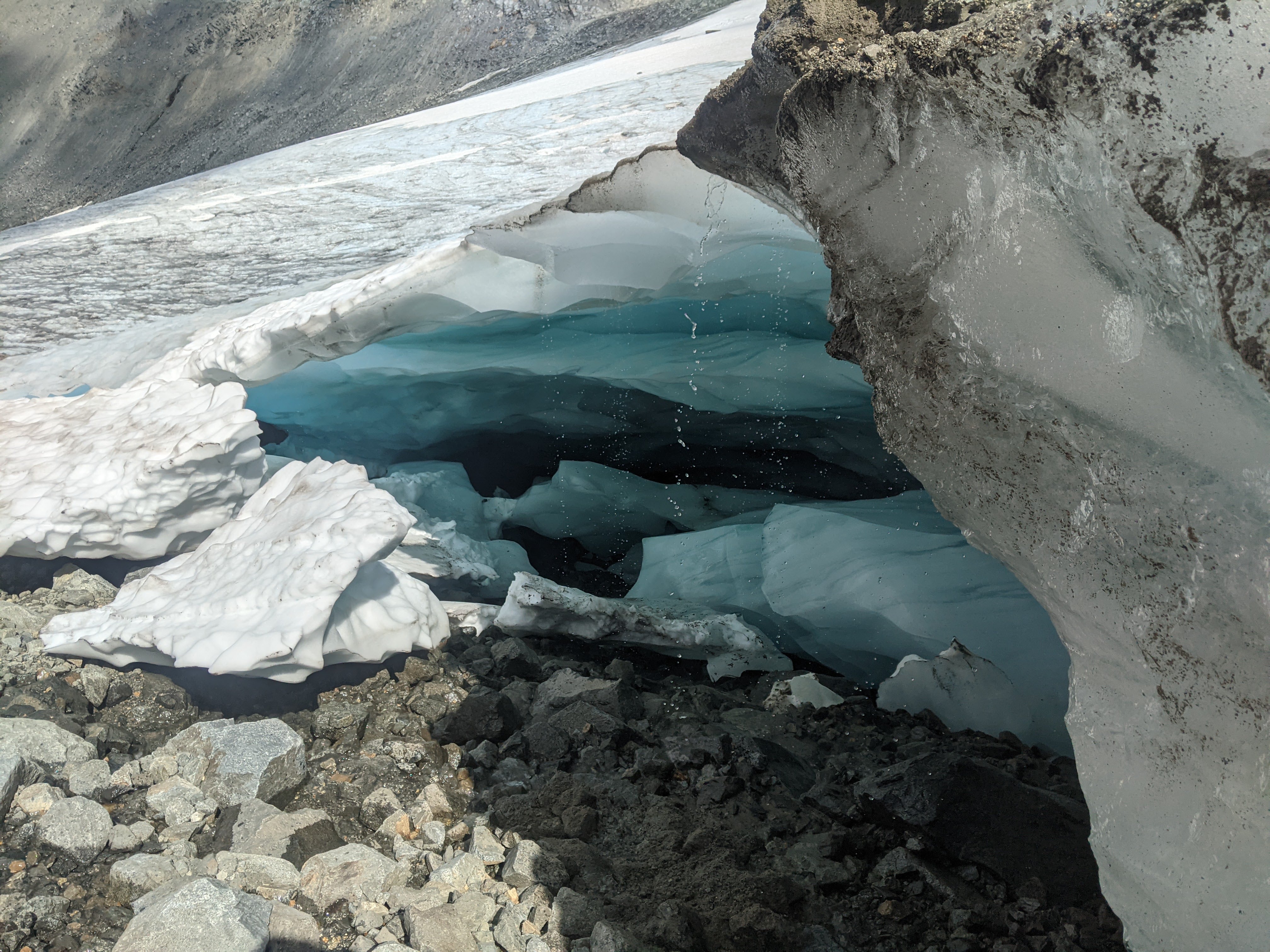
Ooooooh glacier cave.
The plod continued, first on the snow directly to descenders left of the Guard glacier, far away from the crevasses. I ended up passing a very cool glacial cave, although I opted not to go into it for fear of an unlikely collapse. The final crux of the day was the river crossing in Sphinx bay. It was very deep and fast moving, I stripped from the waist down and waded out into the slowest moving section I could find. My feet were in numbing agony as I was forced to step heavily on hidden rocks, and I almost fell over multiple times with the water sluicing by. After many grunts, swears, and gritted teeth I finally made it to the other side. My already sore feet were absolutely pulverized, moral was rather low. summoning what energy I had, wondering whether I’d have the gumption to continue walking the next day, I forced my way past vast thickets of alder before finally making it the the hut. Whew!

Post lake crossing pic.
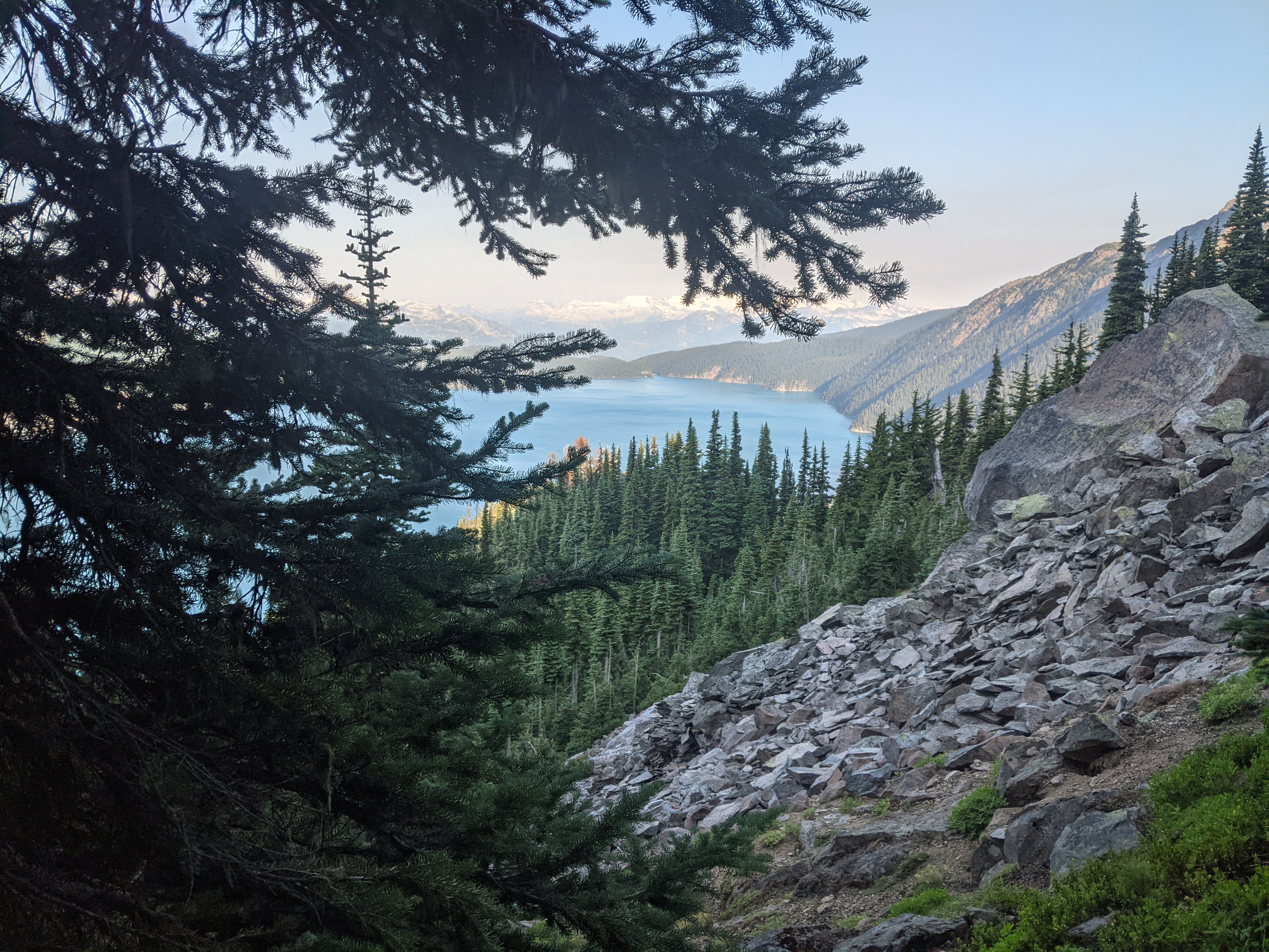
I was expecting to be fully alone until reaching Panorama Ridge, but discovered 4 researchers who were doing field work by the hut! They had arrived just a few minutes before me, and were about as surprised to see me as I was surprised to see them. I was, however, not in a particularly chatty mood considering the trials of the day, so I dropped my stuff in the hut and b-lined it to the lake. It was time for a swim, one of the highlights of the trip. It’s amazing the impact jumping into an alpine lake has on my disposition. I went in being fried, pondering why I was putting myself through this, and almost wishing I didn’t have to hike the next day. I came out happy as can be, excited to see what the rest of the trip had in store for me. The researchers were kind enough to offer me some of their food, and I chatted with them over dinner, they were full of great stories.
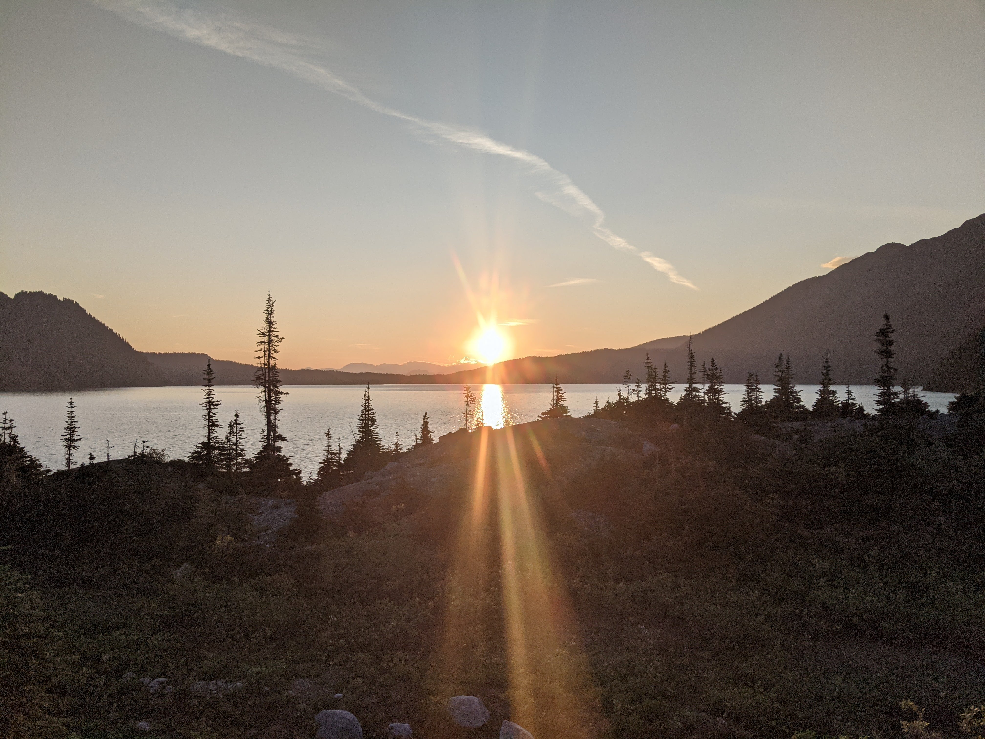
Lake sunset.
Day 3:
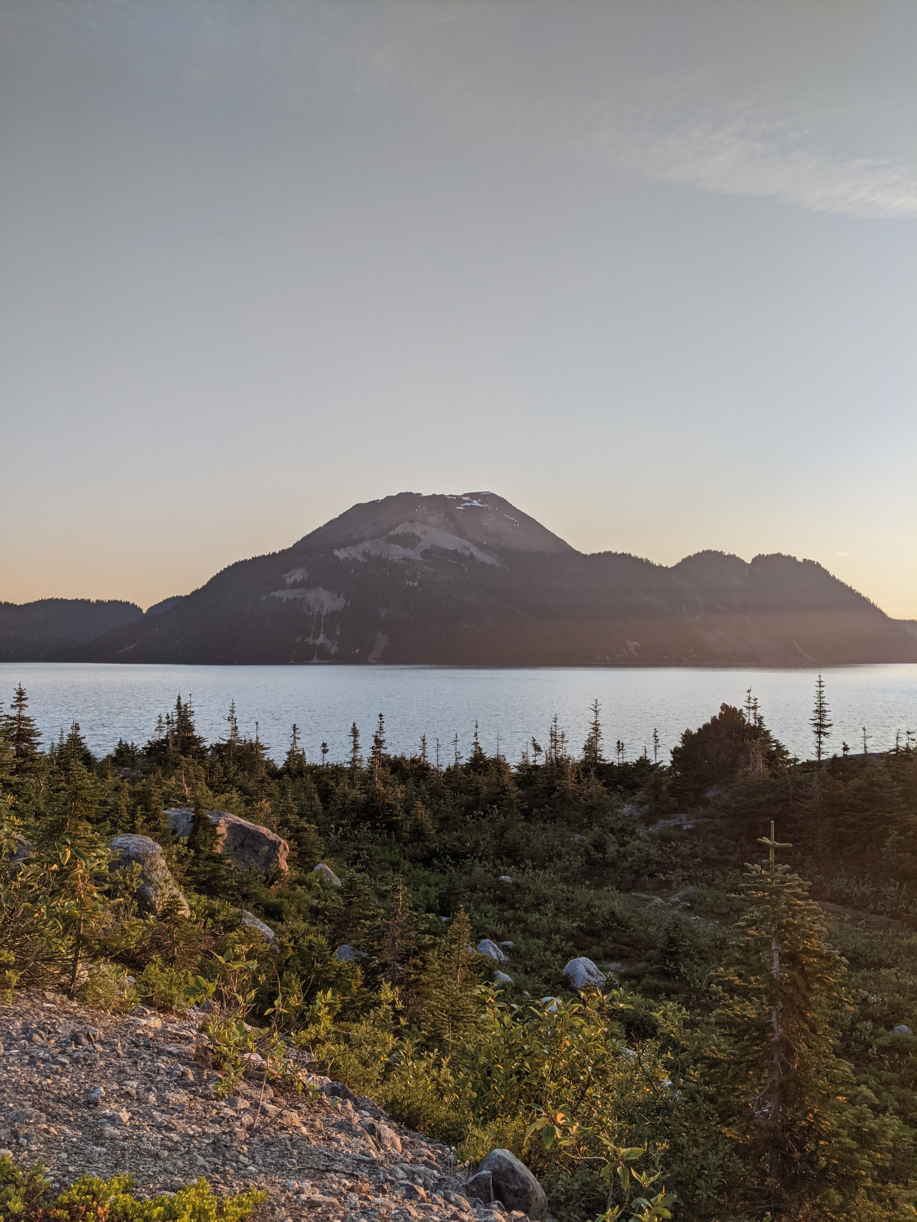
Sunset on Price.
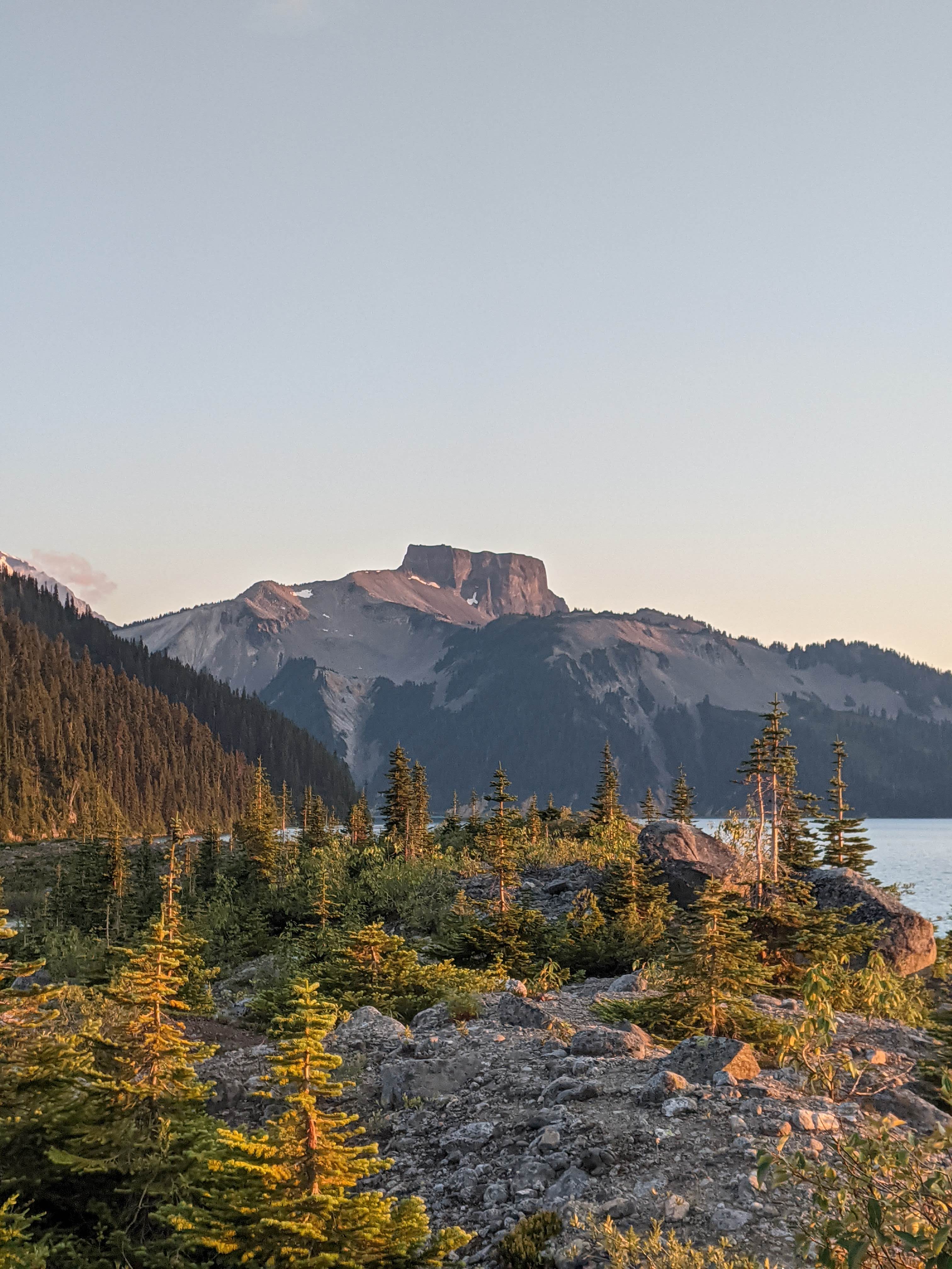
Sunset on Table.
I woke up bright and early to sunlight streaming in through the hut window, and considered my options. I could stay in the hut another night, potentially climbing Castle Towers as a day trip. I could also pack everything up, camp wherever I wanted, going for castle towers if I felt like it because I had the time. The option I went with though was to just hike out that afternoon, trying to climb Castle towers along the way. Doing it this way saved me the stress of getting to Squamish in time for my bus ride the day after.
Saying goodbye to Sphinx Bay.
Bushwhack over
The bushwack to the ridge north of the hut was definitely annoying. It was super steep, in places steep enough that I was crawling up the ridge on hands and knees. There was also some Alder to navigate, although contrary to the feelings of many hikers and skiers, the Alder was actually helpful this time as I could use it to pull myself up particularly steep sections. I’d also learned from my mistakes the previous day and preemptively applied bug-spray, which proved to be an A+ decision. Soon a swarm of Mosquitos showed up, conspiring from behind my back how best to suck my blood.
When I finally reached the ridge line, I breathed a sigh of relief, that was the last of the bushwacking for the trip. The clear views of Gentian, Castle Towers, and Sphinx Bay rejuvenated me even more than the knowledge that the mosquitos plotting my downfall had all been blown away. I was realizing that this route, while it has it’s fair share of shitty bushwacks, they’re balanced out by 10 out of 10 alpine ridge walks, boulder hops, and heather meadows. All with terrific views of the towering peaks and resplendent glaciers that blanket the park.
Slopes of flowering heather and granite stretched out before me all the way up to Polemonium Ridge. Castle Towers was looking intimidating, majestic, and inviting all at the same time. Considering the time I was making, I was definitely going to go for it.
I dropped most of my gear at the top of Polemonium Ridge and started the scramble to Castle Towers. The route is well cairned, and almost entirely on Gaia GPS so I never was in danger of going off trail. It starts off with a dusty but safe descent, which has a potentially optional but IMO very fun move at the bottom. Then its one long boulder bash for the rest of the way (to the west-peak, the true summit which I was hoping to reach requires class 4 scrambling). I love boulder hopping, so this was a great time for me, but those who are less boulder-inclined should be warned!

Me photobombing Garibaldi
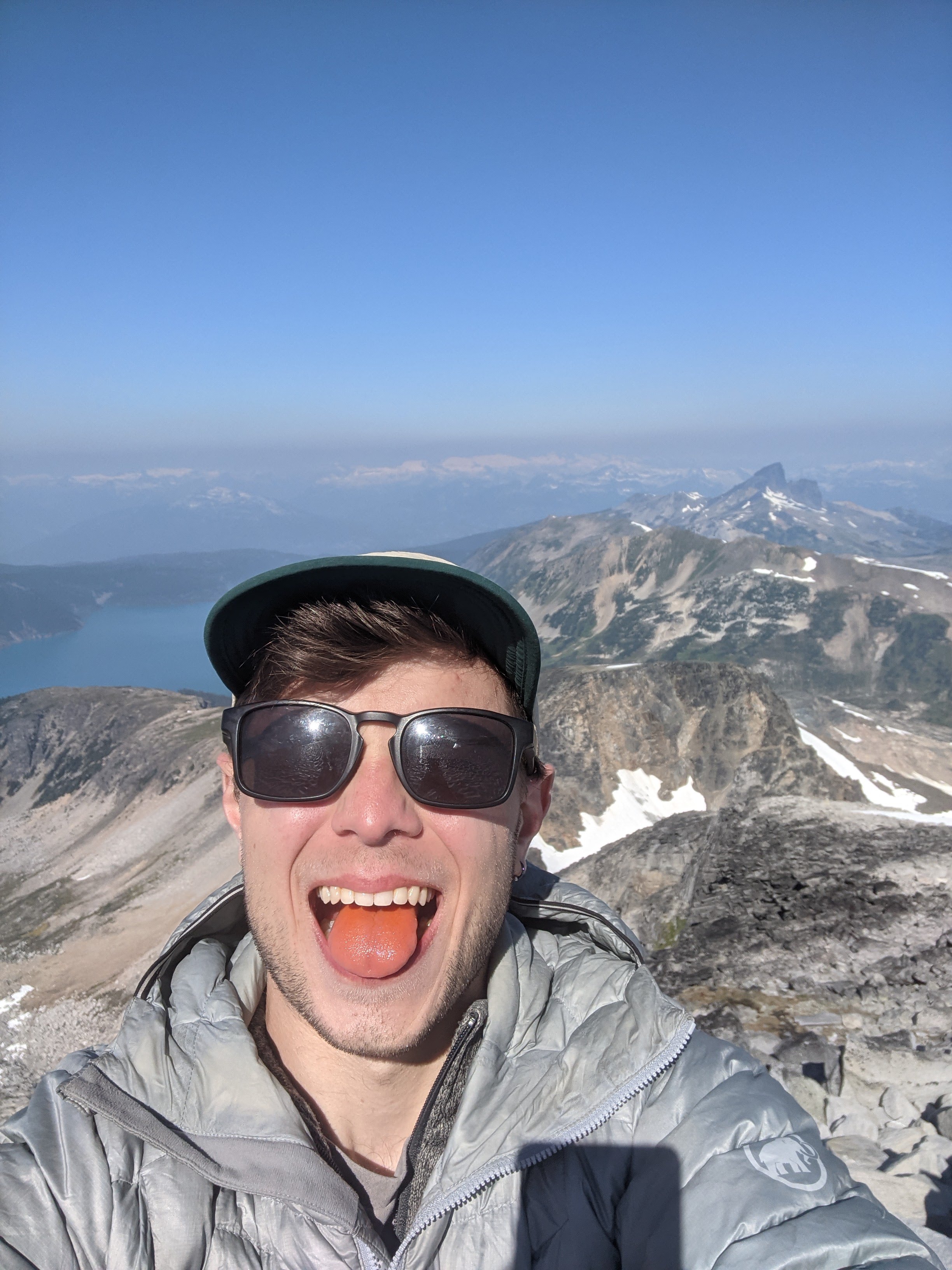
Me with Gatorade Powder on my Tongue
Unfortunately, I reached a steep strip of snow that wasn’t possible to navigate around. I wandered, looking for an alternate route, and considered how dangerous it would be to climb/descend the snow at it’s safest point. After some waffling, I decided against going for the summit, despite how close I was. I had only trail runners, no ice axe or poles, no sturdier shoes, and I had quite a bit of difficulty trying to kick steps in. It was definitely possible to make it without injury, maybe even likely, although ‘I did something that likely wouldn’t have resulted in a serious injury while in the mountains by myself’ is not the kind of thing that I would be proud to have done.
With the weight of a decision unmade off my chest, and the need to keep pushing my pace gone, I was able to fully relax. Despite not making it to the top, I reflected on how lucky I ws to be sitting there at that moment, seeing the things I was seeing, and feeling the things I was feeling. I had a snack and chilled out for a while before heading down.
The descent was uneventful until I ran into another human! He was doing Castle Towers in a day, and was far more prepared than I was (sturdy shoes, ice axe, crampons). Despite the sun hoodie and sunglasses, the dude looked familiar somehow. I couldn’t place it until a few minutes after I’d passed him, realizing ‘damn, tht dude looked like Matt Gunn’. Don’t ask me how I know what Matt Gunn looks like because I’m not sure, but after getting back to society and googling to be sure, I’m basically 100% sure I ran into him while I was coming down Castle Towers on a random Wednesday. What are the chances???
The next spicy part of the day, besides getting my ass covered in mud after slipping on a muddy part of the trail, was after I’d reached the top of Gentian Peak. All the trip reports that I’d read said to descend the scree on the north side of Gentian. I ended up starting down the incorrect way multiple times before realizing, I have to go down THAT? The descent was 45 degreeish scree, dust, and loose rock. It was (and I don’t say this lightly) extraordinarily unpleasant, and I was very glad there was no one descending above or below me as someone would have inevitably gotten beaned by a cantaloupe sized rock.

Chilly magnificence, I was not in for very long…
I eventually made it out of the scree and was greeted by a magnificent tarn. It felt like the tarn was placed there to be a balm an the soul of all those who had to descend the unholiness that was the north slope of Gentian. I took a quick but phenomenal skinny dip before rallying myself to make the final ascent of the trip up to Panorama Ridge.
Even though it was less than 48 hours after I’d started, it was a shock to be around so many people, all loitering on top of Panorama Ridge. It was a weekday! Don’t you have work or something? The descent back to my bike was, you guessed it, a slog. It started out as a beautiful slog, but a slog nonetheless. I was realizing that of the 6-odd times I’ve had to descend the Rubble Creek Trail, hiking or skiing, it has never not been a slog.
I was dreading the bike, to say the least, everything hurt and spirits were relatively low after the Rubble Creek death march. One thing I’ve realized though, with the whole bike and hike thing, is that the bike out is never as bad as expected. I always seem to find a second wind, perhaps because biking is just plain fun. There were a couple of annoying uphills but it was gorgeous downhill for most of the way. There was no need to stop at the Tantalus lookout pullout on the highway, because the whole damn ride was one big Tantalus lookout.
As I was finally pulling into Squamish I was hit with a massive wave of catharsis, the struggle was worth it but over, and the goal from months before was achieved. I inhailed a greasy meal and a delicious beer or two at a pub and slept in the dirtbag/overflow area of the Mamquam River Campground, catching a morning run of the Squamish Connector back to Vancouver.
So… Would I do it again?
The Garibaldi circumnavigation? probably not. I don’t know if it would be worth it to do all the bushwacking and scree bashing to be somewhere I’d already been, not that I wouldn’t wholeheartedly recommend it for folks looking for a challenge.
Biking up the Sea to Sky? I think so, with some improvements. First of all I’d pack lighter – I was already packing very light but could’ve gone without a stove, book, journal, and piece of clothing or two. I’d also find a way to get everything on a rack and panniers because biking with an overnight pack while doable, sucks.
Mega effort! It was a good hit of nostalgia reading how you had so many similar experiences to when I did the circumnavigation. I especially remember the mosquitos at Table Meadows following us for hours. Doing it all solo and biking out there is so much bigger though, congrats dude!
Thanks Julian! Your TR was definitely the biggest resource I used when looking into doing it, I don’t think I would have had the confidence that the route was doable otherwise. Also, props to you guys for surviving the night Table Meadows without going completely insane, the mosquitos there were absolutely vicious and I only ever stopped to take photos…
Oh I certainly went insane…
Great effort out there, that is super cool! I don’t think you should discount doing it again though. You can avoid most of the bushwhacking by doing the high route. Going CW you go from Rubble to helm glacier, Castle Towers, then glaciers. You can choose to go up Carr and Sphinx as well if you want. Then onto more glacier to stop at Sentinel Bay or carry on to Price. Going up the gulley to Price isn’t so bad and really has no bushwhacking. The Price trail, as you discovered, is not well marked and very confusing. It goes in one gulley, then another, up and down, etc. Daylight makes it much easier.
Great TR, Joe! Just chiming in to second Nick’s recommendation for the high route. You definitely save a ton of energy by not having to drop down to the lake at Sentinel Bay or at Sphinx Bay. When I did it (mid-August 2023) we chose to rope up for the vast majority of the Sphinx Glacier, so I still like the idea of the low route for a summer solo trip.
Awesome trip report!
You have further inspired me to attempt this someday.