I know this is kind of a big deal to say, but I have to call it as I see it right now: I’m not convinced we can pull off the eastern half of this route. I don’t think it can be done in the summer without some significant 4th class climbing, and the ‘valley bottom bail option’ isn’t really an option… I’m not really sure where this leaves us. Let’s chat in the morning.
This message from Stuart arrives in my inbox three days before our planned departure. Our route seems harder each time we look at it, and our doubt is beginning to overcome our bravado.
~
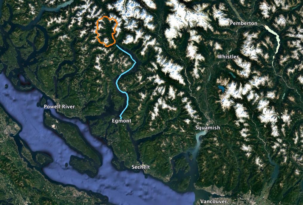
I was combing Google Earth for long trip ideas. Inspired by John Clarke and John Baldwin’s Tahumming traverse and recent kayak-accessed VOC ski expeditions, my attention focused on winding alpine ridges within striking distance of tidewater. I noticed a horseshoe of glaciers and peaks at the head of Jervis Inlet, 100km north of Vancouver on shíshálh Nation territory. I dubbed the route the “Skwawka River Horseshoe,” and a plan emerged: kayak 72km up Jervis Inlet and ski 77km to encircle the entire Skwawka drainage before paddling back. Three weeks, self-supported. No helicopters, no planes, no food drops. I pitched the idea to Stuart Higgs. Stuart is a rare and special person: someone whose judgement is good enough that I trust his decisions in the mountains, but not so good that he would wouldn’t come on the trip in the first place. He jumped at the idea. The potential for funding from the Neil Mackenzie Memorial Fund made the trip financially possible. Fortunately our application was selected, as was our submission to Mountain Equipment Co-op’s Expedition Fund. While Stuart’s work situation forced us to change to an August trip, swapping skis for mountaineering boots, we were going to the Skwawka! The west half of our proposed horseshoe followed the North Powell Divide, a John Clarke route from 1984 that has been repeated at least twice using food drops and float planes to access the ridge. Returning to our kayaks on the east side of the Skwawka River would require navigating the challenging eastern ridge from Little Toba Peak to Mt Victoria–a traverse that has likely never been travelled.
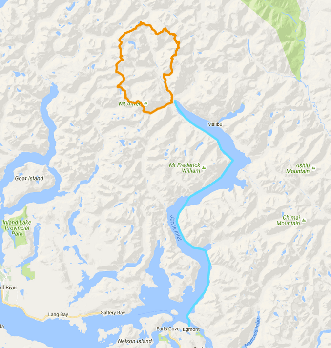
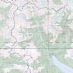
Proposed route showing alpine portion in orange and kayak portion in blue
Despite reaching out to logging companies, searching through old journals, and combing online trip reports, we found little information about much of our route. Google Earth was our primary guide, so we spend hours huddled over laptops studying the terrain. The longer we looked, the more intimidated we got. The route seemed long and committing. We would be carrying two weeks of food and should we run into an impassable crux, bail options seemed desperate. Things would be much more reasonable if we could rely on old logging roads in the Skwawka Valley. But their unknown condition, kilometers of valley-bottom brush, and potentially missing bridges pushed us to stay in the alpine. Our plan, therefore, was to finish the western half fast enough to turn around and retrace our steps back to the kayaks if any obstacle on the eastern half blocked our way. This would mean travelling the North Powell Divide faster than any party before us – despite bushwhacking from sea level and completing it self-supported.
-

- Regional overview of route. Kayak portion shown in blue, alpine portion shown in orange.
-
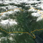
- View of proposed Skwawka Horseshoe Traverse from south
-
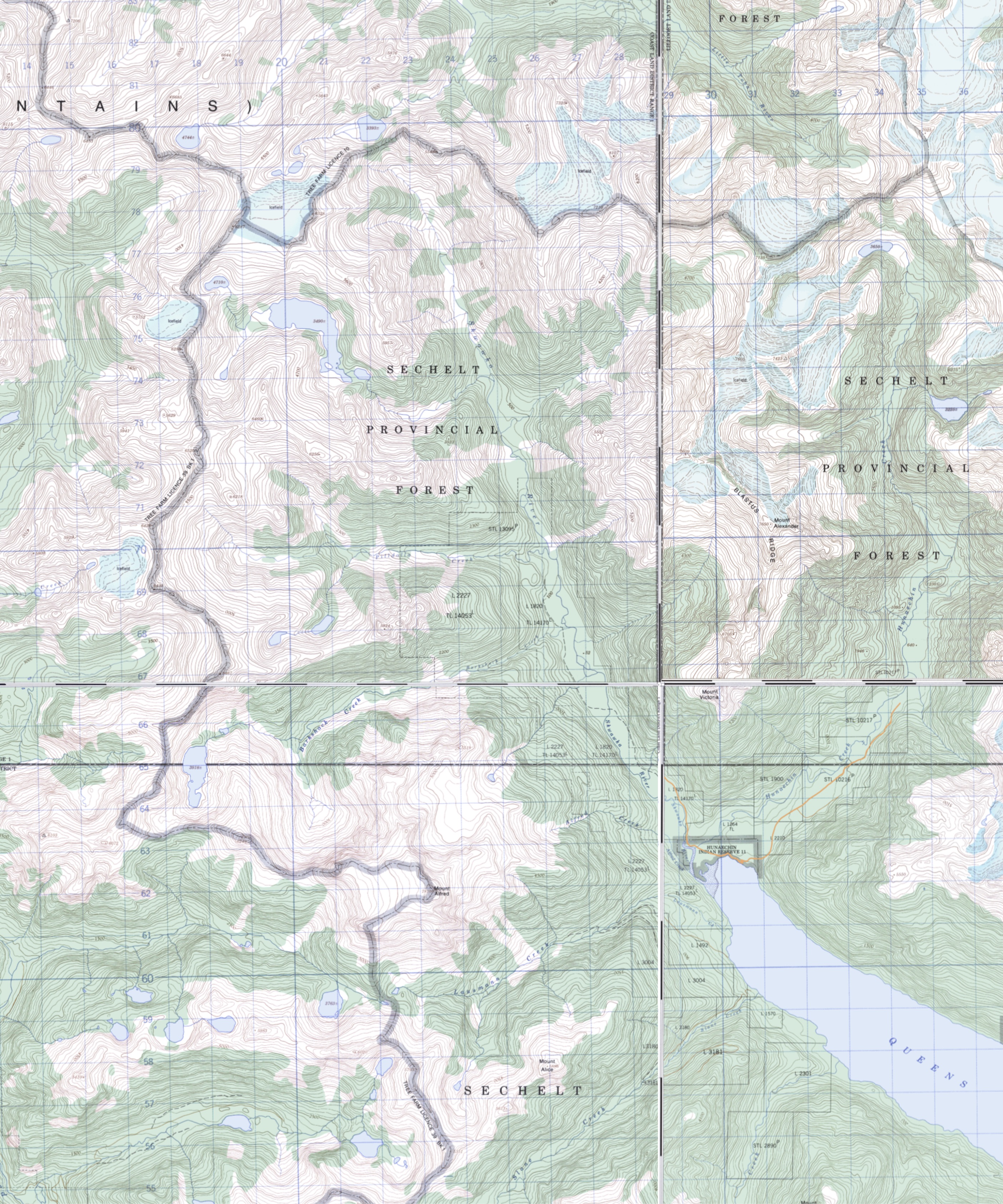
- Mosaic of NTS topographic maps showing route
~
With doubts fresh in our minds, we pile into a borrowed car and catch the ferry to Egmont. Hannah, Stuart’s girlfriend, has taken ‘significant other’ to the next level and has come almost directly from her night shift to be our shuttle driver. Truly heroic. Three weeks of food and mountaineering gear fits easier than expected in our kayaks and we’re soon on our way. Clouds fill the inlet for our three-day paddle to its end and the water is mostly calm. I wonder why I had heard so much about the nasty conditions supposedly common to BC’s fjords. The internal baffles on my sleeping pad start ripping, causing a whole line of micro-leaks that I’m never able to properly patch. I’d spend the rest of the trip sleeping on a mostly deflated pad. After three days later we arrive at the head of the inlet.
-
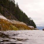
- Spencer paddling Jervis Inlet in Princess Royal Reach (Photo: S. Higgs)
-
- Stuart finds convenient water bottle refill station (Photo: S Rasmussen)
-

- Spencer paddling Jervis Inlet in Queens Reach (Photo: S. Higgs)
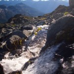
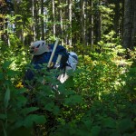
The next morning we faff with gear and head toward Lansmann Cr. It’s high tide, a welcome elevation bonus before we climb into the alpine. Maybe our trip isn’t fully self-propelled after all. We know the large bridges at the head of the inlet are in, but almost nothing else. Quickly, the roads close in with alder. There’s no skill to this sort of bushwhacking. Just close your eyes, keep walking and let a thousand branches whip into your flesh. We may not complete a new traverse, but at least we’d found a new BDSM sub-genre. In late afternoon the road runs out. The next kilometre takes us 2.5 hours. The day is fading and so are we, so we’re happy to spot flagging tape ahead. “Road Centre Line,” it reads. It appears our 400m/h bushwhacking route will be a nice new logging road next year. Not the motivation we needed. We eventually reconnect with a higher logging road and make camp on an old bridge. The remainder of the road takes the next morning, and we’re happy to find a trail continuing up the valley. Not one, however, made by humans. There are claw marks on the logs, and Stuart spots hairs on a branch. Grizzly, he says. We see scat every ten minutes, and put our hands close to feel if it’s still warm. It never is, so we continue. Pepper spray is in the front pocket and we yell continuously to announce our arrival to our furry hosts.
-
- Day 1 — Stuart: 0, Alder: 1 (Photo: S. Rasmussen)
-
- Stuart thanking the bears for their incredible trail (Photo: S. Rasmussen)
-
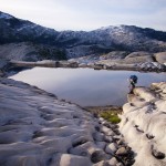
- Spencer crossing a tarn below Mt Alfred (Photo: S. Higgs)
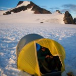
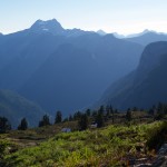
We lose the Lansmann Cr. Bear Highway, and resort to pulling ourselves up the slope with blueberry branches. After another camp and a surprisingly craggy forested ridge line southwest of Lansmann Peak, we’re finally in the alpine. We do a bit of scrambling and pitch the tent on the glacier. It has been three days since we left the kayaks. We were hoping to complete the first half of the route in six. We’re badly in need of rest, and decide to take the next day easy. But we can’t resist climbing Mount Alfred. A perfect little snow climb on its west face and we’re on top. We can see Jervis, our bushwhacking hell, and even Mount Waddington to the far north. Mount Albert looks stunning across the inlet. Our suffering is forgotten, and we bask in the views.
Full panorama from summit of Mt Alfred. Click twice for high resolution (Photo: S. Higgs)
-
- Spencer in high camp below Mt Alfred summit (Photo: S. Higgs)
-

- Spencer leading up west face of Mt Alfred (Photo: S. Higgs)
-

- Mt Alfred selfie (Photo: S. Higgs)
We scramble down rock to the southeast. Back at camp we decide to continue on the route. It’s mostly downhill, so that’s basically like resting, right? The descent northwest of Alfred prove a steep mix of heather, waterfalls and cliffs. We abandon our fantasy of camping on the divide to the north that night, and set up the tent on a slanted rock slab mid-slope. I anchor the tent to a rock horn so we don’t slide off in the night. Stuart secures his thermarest inside with slings. We finish the descent the next morning, and, a bit more bushwhacking later, we’re on the divide. We make camp early and finally take a break during daylight hours. We are badly behind schedule, and our last hope for completing the west half in time is to fly along the divide. The terrain, however, has other plans, and eleven days of food doesn’t feel much lighter than fifteen. This part of the route is described in John Baldwin’s article “Great Skyline Traverses of the Coast Mountains” and I’d read it dozens of times. I guess the line “this is general mountaineering, not backpacking” never really stuck. On our sixth day we make less than half the distance we need if we were going to get back on track.
-
- Spencer enjoys evening light from west col on Mt Alfred (Photo: S. Higgs)
-
- East face of Mt Baldy from Mt Alfred (Photo: S. Higgs)
-
- Spencer above Barnshack Lake (Photo: S. Higgs)
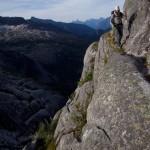
The east half of the route also comes into better view as we travel along the western divide. However tough it looked on Google Earth, it seems even harder in person. Fourth class seems like optimism, and it looks like a great place to get into trouble. If we continue, we will arrive at the unknown east half with, at best, exactly half our food. Keep going past that, and bailing would mean an unknown bush thrash, days retracing our steps on empty stomachs or bankruptcy by helicopter. For both Stuart and I, it’s our first funded trip, and that complicates decision making. The alpine community had supported us to try this route because they wanted to know if it can be done. We need to give it our all. But for every person who was waiting to hear if the route would go, we knew there were far more waiting for us to come home safe. It was decided; we would turn around. We continue on the ridge for another day, but truth be told, stoke is dangerously low. The bugs, even in the in alpine, are ferocious. Mosquitoes, gnats, midges, horseflies, nos-ee-ums – they flew so thick the air turned black, like a plague summoned by the Lord. Our new plan is to make it as far along the ridge as we can before turning around. Or, in other words, to carry heavy packs along rough terrain, then retrace every step. Just to say we’d pushed it as far as possible. “Maybe we should just turn around now and use the rest of our food to climb Albert.” I’m not serious. Not even slightly. “Um, ya!” Apparently Stuart is. His eyes light up and he refills with the stoke that had been slowly draining. Albert caught our attention during our paddle approach, but since it wasn’t on our route, we hadn’t researched it and knew nothing about the access or terrain. We dimly remember seeing a logging road switchbacking up its flank on the north side of the inlet. We reason that the road must reach the water somewhere, so we would just kayak until we found it, then follow it to the alpine. After a quick study of the map, we snapped a selfie at our far-point on the divide and started back toward the kayaks.
-
- Stuart and Spencer at turnaround point on North Powell Divide. Barkshack Peak in background (Photo: S. Higgs)
-
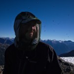
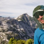
- Stuart and insect friends in the alpine on Mt Alfred (Photo: S. Rasmussen)
-

- Spencer descending towards Tea Pass below Mt Alfred (Photo: S. Higgs)
We manage to shave two days off our return trip. Keen to avoid the worst bushwhacking in Lansmann Creek, we cross at the bridge we camped at on the way up, gambling that continuous logging road on the south side of the creek was worth the risk of being unable to recross to the north near the inlet. The bridge is out when we hit Jervis, but fording Lansmann Cr. is easy and the gamble pays off. We decide the next day will be a rest day when we return to the kayaks. Stuart’s feet are destroyed. He seems more excited to reunite with his sandals than he will be to see his girlfriend. We pack up the kayaks and leave after dinner. We plan to simply kayak along the shore until we see the end of a logging road. But we don’t see it, or any other place to land for that matter. Dusk arrives and we’ve paddled nearly to Princess Louisa Inlet. In the last minutes of light we see a dock and stop for the night. Stairs lead up to a fantastic, yet deserted, campsite. It’s so level, it looks like you could drive a car on it. There’s even electrical outlets! The next morning we run into a fellow who doesn’t think it is a campsite at all. He seems to think it is in fact a driveway for the ornate beach house he was checking on. Strange. We had indeed found the start of the logging roads, but we wouldn’t be allowed to access them. The fellow tells us, however, about a trail up from Princess Lousia. Someone had constructed private mountain bike trails and visits once a year to lap them with a helicopter. Maybe we could access the alpine via them. While we don’t follow his advice, we do stop to take a look. The mountain bike trails start at 50.186149, -123.816892 but we have no idea why anyone would want to know that.
-
- Stuart in the thick of it, descending Mt Alfred (Photo: S. Rasmussen)
-
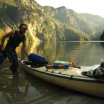
- Stuart lands at the head of Princess Louisa Inlet, switching back to Alpine Mode (Photo: S. Rasmussen)
-
- Millionaire Mountain Bike Trails. Private Property is theft! Anyone up for a ride? (Photo: S. Rasmussen)
We continue along the shore to Club Malibu. Once a failed resort for the rich and famous, it’s now a thriving bible camp. Turns out they also run mountaineering programs and we chat with one of their guides. The mountain bike trails will only take us to mess of overgrown logging roads. If we want to climb Albert, we should paddle to end of Princess Louisa and take the public trail up through the park. Our bible camp friend testifies to glory of this route. We are converted. After days of uncertainty, we have a new direction. Divine intervention? Perhaps. The only problem is that they usually take four days to summit Albert, not counting the return. We have four days food left in total before we must paddle back. The trail up from Princess Louisa is a revelation and soon we’re scrambling over fascinating, sculpted granite. Another day’s travel over more ridge line and mellow glacier and we’re looking down at a pass before the final climb up Mount Albert. It’s just a bit too far for our remaining time, so we adjust our plans yet again.
-

- Spencer navigates glacial fluting on granite above Princess Louisa Inlet (Photo: S. Higgs)
-
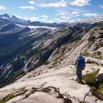
- Spencer following granite ridge lines above Princess Louisa Inlet (Photo: S. Higgs)
-
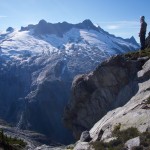
- Spencer and Mt Albert from the south east (Photo: S. Higgs)
-
- Spencer on granite slabs above Princess Louisa Inlet (Photo: S. Higgs)
-
- Spencer at tarn below Mt John Clarke (Photo: S. Higgs)
-
- Spencer channeling his inner mountain goat above Princess Louisa Inlet (Photo: S. Higgs)
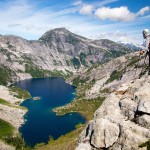
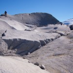
We have two days of food remaining, enough for another two peaks. The next day we climb slabs and mellow glacier up to a peak to the south east of Mt Tinnswood referred to as “lactic acid hill” by the Malibu guides. On our last day in the alpine, we decide to climb Mount John Clarke before returning to the kayaks. The climb up the NW face glacier goes smoothly and we find ourselves on top reading heartfelt tributes to the late mountaineer. The summit register had become waterlogged and we try to dry out dozens of handwritten messages. It feels appropriate to finish our trip here, having even deeper respect for John Clarke’s journeys.
-
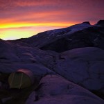
- Alpine glow on our camp below Mt John Clarke (Photo: S. Rasmussen)
-

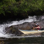
- Stuart happily swapping bushwhacking for crevasse hopping on Bon-bon glacier (Photo: S. Rasmussen)
-

- Spencer and Stuart at the summit of Mt John Clark (Photo: S. Higgs)
We miss slack tide at the rapids between Princess Louisa and Jervis the next day, and portage through the Malibu bible camp. The wind is fierce, 15-25km, and we manage only a few kilometers before camping. Stuart develops muscle strain in his wrist and resorts to tying the paddle to his arm for the remainder of the trip. We fight a headwind much of the next day as well. Jervis won’t let us go easy. Only on our third and final paddling day do we get the wind at our backs. Hannah picks us up from Egmont with potato chips and hard iced teas. Hannah then trades a Modo car for my kayak, and she and Stuart paddle back to Vancouver over the next twelve days as a “vacation”.
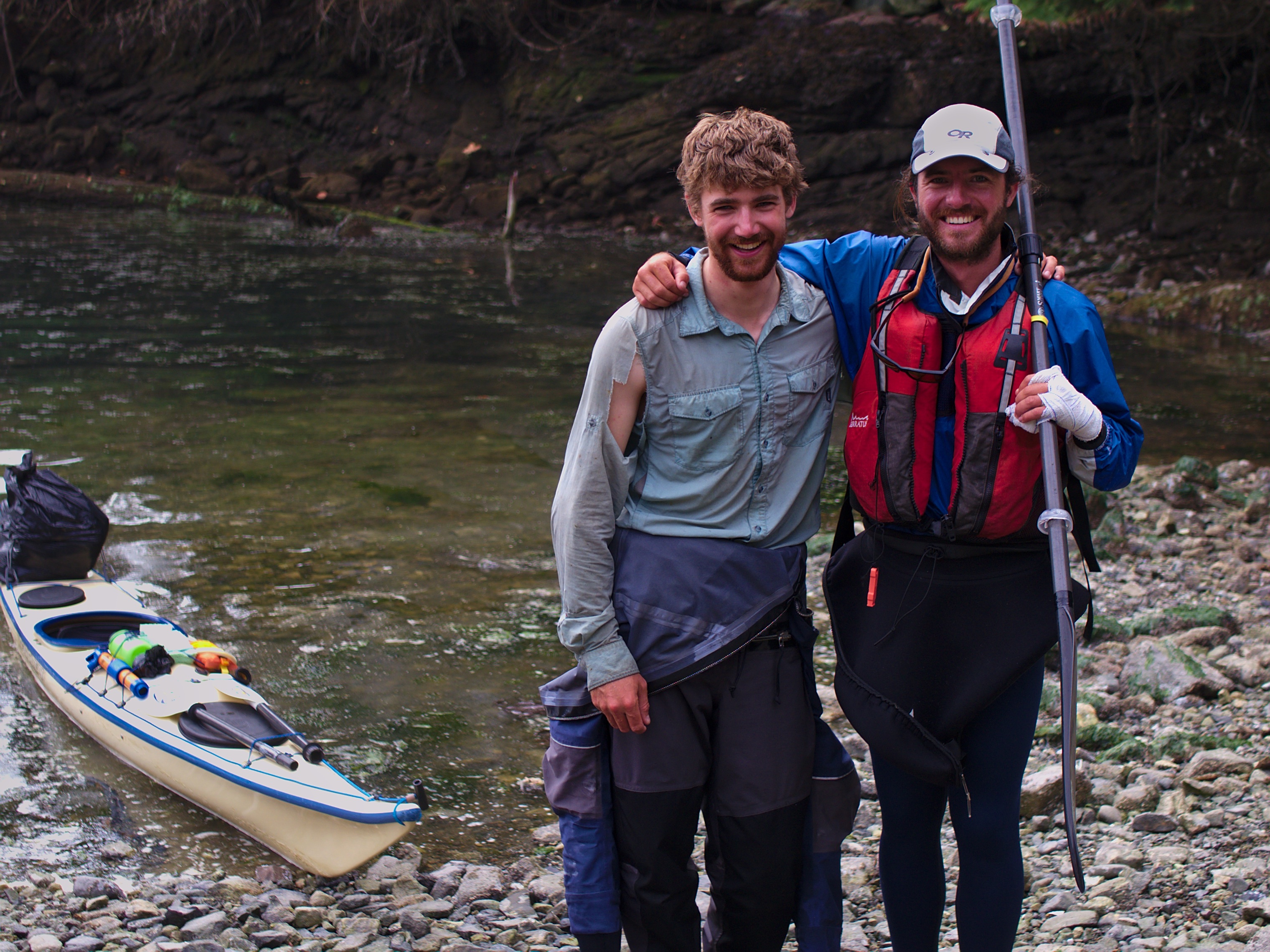
Stuart and Spencer back in Egmont (Photo: Hannah Zalmanowitz)
~
It was an honour to be chosen for the first year of the Neil Mackenzie Adventure Grant. It’s a pretty tall order to carry on his legacy of adventure, but I hope he would have been proud. The trip wouldn’t have happened without the support from Neil’s friends and family through the fund. Similarly, thanks are due to Mountain Equipment Co-op for their support through the Expedition Grant program. So many of our friends and family supported us in this as well — especially Hannah Zalmanowitz who shuttled to and from this crazy trip, Jess Ables for lending your car, and Dave Rasmussen for driving a kayak to Vancouver — and other members of the mountain community including Rennata Mannino; thanks! Thank you to the shíshálh Nation, on whose territory the trip took place. And thank you finally to the Grisly bears for letting us use their trail, but otherwise staying away.
~
If you’d like to see more photos from our trip, check out the full flickr album here. Here is the actual route we followed. You can view it in Google Maps and download the KML file here. You can view the proposed route here.
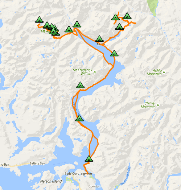
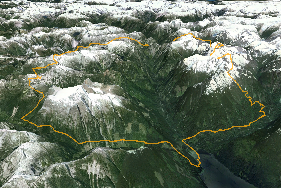
Actual route followed during trip