Before we begin, a shout out is in order to the Neil Mackenzie Trust and the VOC for putting together the Neil Mackenzie Adventure Grant. Learning about this grant for grand expeditions inspired us to dream up a longer combined kayak and mountaineering expedition than anything we had done before. We are grateful for their inspirational and financial support that allowed us to go on this trip.
We are also grateful to live, travel through and camp on the unceded traditional territories of the Coast Salish People, including the Musqueam, Tsleil-Waututh, Squamish, Shíshálh, Tla’amin and Klahoose nation. In particular we would like to thank Chief Kevin Peacey and the Klahoose Council for giving us permission to go through their lands for our attempt on Mt. Champion, as well as go through their Ahpokum 9 settlement and land on the way to Mt. Denman. It is a beautiful place, so thank you.
Gabe
By March 2021 I still had no idea what I wanted to do for the summer. I was dreading finding a co-op job and I didn’t feel much like taking summer courses. It had been a long lonesome year due to ~current events~ and I needed a break.
It was during this time that Eloise Faehndrich called me with the excuse I was looking for; her brothers and she had received a grant from the Neil Mackenzie Trust and were looking for a fourth to round out a kayak-mountaineering trip up the Toba Inlet. With very little in the way of kayak or mountaineering experience, I agreed immediately and stopped applying to any more co-op jobs. I would take the summer off to explore British Columbia and take the break I so desperately needed.
The Faehndriches are a sibling super-squad of ski-mountaineers, mountain runners, and general South Coast wanderers that put this whole trip together. I met Eloise in the fall climbing at the Aviary, and after a couple day trips touring in the South Coast, she figured I was fine enough to tag along for a longer expedition. Simeon, the eldest , took on the lion’s share of planning and preparation, and can generally be considered for the purposes of this trip report to be “the guy with the plan”. Finally, Tobias, the youngest of the team, was appointed stoke-master and cameraman-extraordinaire.
The plan was simple: drive up the Sunshine Coast and put in as far north as we could make it; kayak through Desolation Sound and up the Toba Inlet and bag a few choice peaks along the way. We settled on Champion Mountain, described as “an attractive horn” at the far end of the Toba Inlet, and Mount Denman, an icon of Desolation Sound.
Towards the end of May, we began eyeing the forecast for a 10-day weather window. We needed to be back in town by June 15th, but could see nothing but rain in the forecast. Instead of waiting around for some sun, we decided to head up the coast a few days earlier in order to pad the trip with a couple of buffer days. We booked a ferry for June 2nd and began our final preparations.
Day 0
 The first shots on the expedition photo album are of Eloise attending her virtual graduation and finishing up cooking falafel for our lunch the next day. I had spent the morning fretting over what to pack for lunch on the last day of the trip, but I decided to go bold with a bag of apples and some peanut butter.
The Faehndriches pulled up outside around 12:30pm and with a quick hug goodbye to my roommates we were off.
We spent the ferry over from Horseshoe Bay trying to one-up each other by naming South Coast peaks from the sun deck. We soon bid our goodbyes to our friendly backyard mountains and looked north towards an unfamiliar range. There was a ferry announcement as we approached Langdale and we returned back to our car, Tobias with a rowdy sunburn.
The remainder of the drive passed us by quickly, and before we knew it, we had pulled into our campsite for the night. When we arrived, we pulled everything out of the car and began sorting through our gear. Having never been on a sea-kayaking trip, I was under the impression that there was near infinite room for extra layers and camp comforts. With all of our bags piled high on a picnic bench, I realized that with mountaineering gear and 12 days of food it would be a tight squeeze into our boats.
We walked around the campground and found a good spot to put in the kayaks. We then spent the rest of the evening playing cards, and pouring over our marine charts as we recapped our trip plan. That night we turned in early and fell asleep in anxious anticipation for days to come.
Day 1
 It’s the first day of our adventure. In order to avoid paying for parking in Lund, Eloise drove me and Simeon 3km north and dropped us off at the kayak rental shop with all of our gear. She then beelined it back to Dinner Rock Campground to help Tobias pack up camp and load the boats into the water.
Simeon and I rocked up to the rental outfit and I casually signed a statement stating that I am an expert kayaker and well within my ability to embark on a 10-12 day expedition up the Toba Inlet. The woman working the rental outfit offered us a free navigational chart of the area, but it only covered the first half of the first day and so we opted out. Simeon walked me through the basics of packing a kayak and helped me put my skirt on and get in the water.
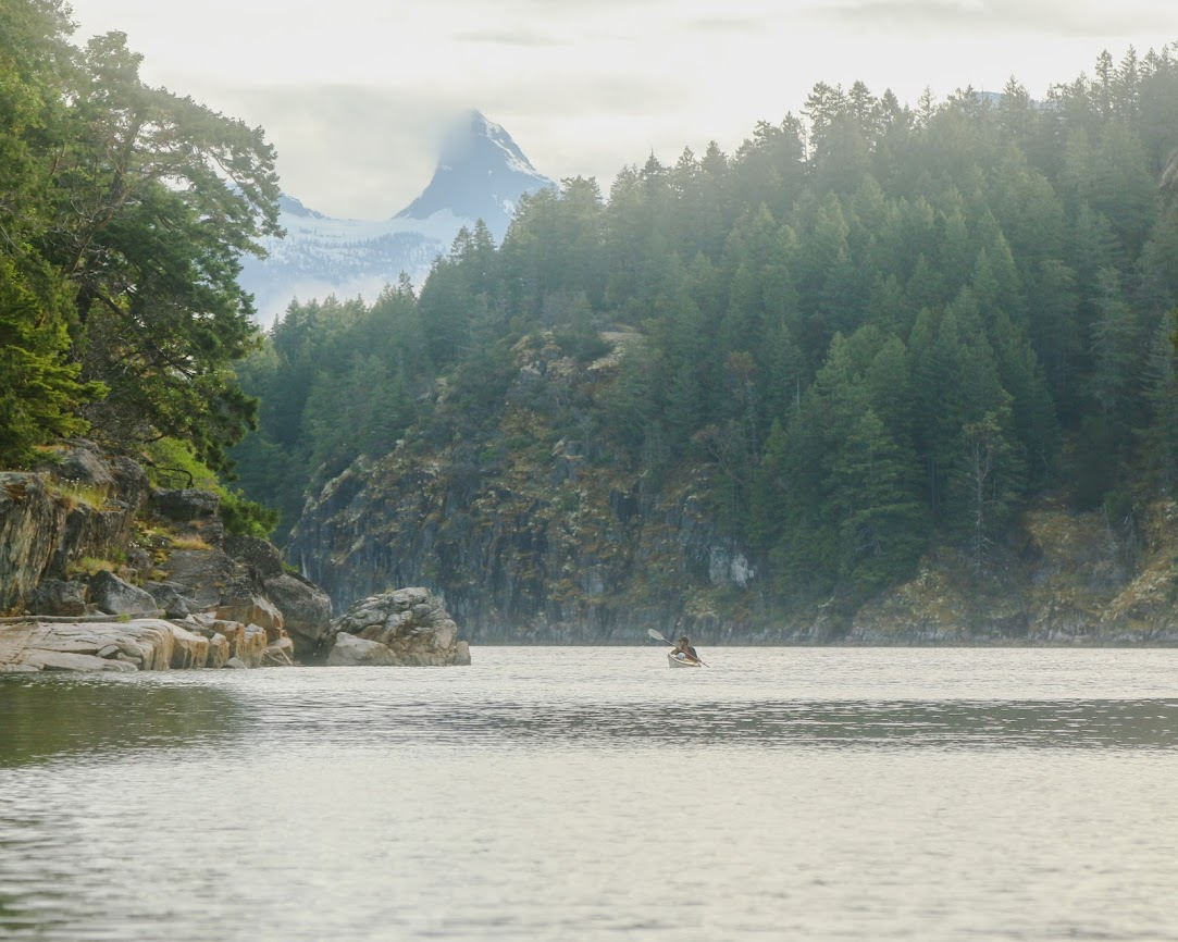
Lund, where we were getting into the water, lies 150km NW from Vancouver accessed via two ferries and the Sunshine Coast. Lund is the end of the road on the Malaspina Peninsula — this is where the Salish sea narrows and the islands of Desolation & Discovery begin (Quadra, Cortez, Savary, etc.) — as well as where the tides from N and S of Vancouver Island collide. Directly N of Malaspina are the Redonda Islands. Our route would take us up the narrow channel dividing West and East Redonda. On the far side of these impressive mountain-islands begins the Toba Inlet. This ‘short’ inlet tends NE back into the Coast Mountains for about 35km — at its head, the Tahumming, Klite, and Toba Rivers meet the sea.
That was still days away though, and for now we paddled out into the bay and waited for Tobias and Eloise to make their way over from the campground. Once back together, we crept our way up the shore towards Sarah Point, the northern tip of the Sunshine Coast. The sun was out and filled our crew with unwarranted optimism for the days to come. Within a few hours of paddling we pulled onto a nearby island for a lunch break. Mmmmmm, yummy falafel wraps.
Once back in the water we began heading again towards Sarah Point. As we paddled around the corner, we saw for the first time one of our main objectives.
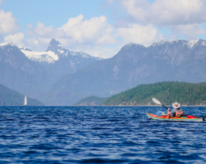 Mount Denman stood tall and proud back behind the hills of Desolation Sound. With a sheer bald face, we could see no indication of how we could manage a 4th class route to the top. The exposure made me shudder and I began questioning my chances of making it to the summit. As we paddled on by, we began discussing whether or not we should go up with avalanche gear. As we couldn’t see any snow on our expected route, we decided to push the issue back a week until we were actually preparing our way up. For now the rest of the Toba lay ahead of us, and Champion was waiting.
We pulled into Roscoe Bay, our campsite, at around 7 that evening. We had paddled 33 km that day and realized that our daily target of around 30 km a day was more than reasonable in fair weather. As soon as we unpacked, I dragged the boys back in the water to see if we couldn’t roll a couple of kayaks. Eloise stayed up on shore to relax and watch the going-ons in dry clothes.
I went first, tipping myself over and immediately self ejecting after struggling upside down for a couple of seconds. It had been several years since I had been in a kayak, and several more since childhood when I had actually learned the technique. After talking it through with Tobias and Simeon a couple of times, we nailed down the combination of paddle movement and knee pressure needed to pull the kayak back over. I managed to make it up a couple of times and let out a good holler across the bay. Simeon managed to get it through once, and Tobias just barely missed the mark. Would I actually be able to roll a filled kayak if I flipped out in the open ocean? Probably not. But it was good fun while the sun went down and helped boost my confidence on the water.
As Eloise contented herself with relaxing on the beach, the tide slipped her kayak from the shore and it drifted aimlessly across the bay. After much excitement and self ejects, we paddled back into camp and dragged Eloise’s kayak back up to shore.
We talked over the plan for the next day, made some food, and got into our beds. It was quite a nice first day out on the water.
DAY 2
Simeon woke up that morning at 5am. He was interested in getting up to the peak of our lonely island hideout and catching a good view of the mountains that lay ahead of us. Unfortunately for him, he took the wrong trail up and only made it a few kilometers before coming back to base.
The rest of us made our way lazily to the picnic bench around 7 and began work on our first backcountry breakfast, pancakes! We resolved to be ready to go in 3 hours, and so took turns cooking and eating the delicious pancakes as they came off the stove. It was nearly 11:30 by the time we packed up camp, but the pancakes were oh so good.
The sky was looking a lot gloomier that morning; Juneuary was upon us and was here to stay. On our way out from the bay we passed by some yachters that encouraged us to check out some pictographs along the west side of Waddington channel. As this was along our route, we made a note of it and began the long paddle north.
As we paddled further, the weather continued to sour. But as it began to drizzle, a wind picked up from the south and began to propel us up the channel. At that moment, we wished we had kept the tarp a little closer at hand. We made quick work going up Waddington, and made our way towards Walsh Cove for a quick lunch. We looked around for any sign of pictographs but found nothing. It wasn’t until after lunch when we got back into the water that we found a few faint symbols painted along the walls of the cove.
With a lil more wind and a few paddles more, we made it to our camp early. We found a nice spot to spend the night at a log dump in Hepburn Bay.
DAY 3
It was finally time to make our way up the Toba Inlet. The walls of the inlet rose steeply to either side of us and were adorned with dozens of waterfalls crashing into the banks below. We had studied the marine charts closely and knew that just a few meters from either side of the inlet the ground below us plunged several hundred meters below the water. Along the entire 40 km length of the fjord there were only a handful of spots that we could make an emergency landing. The wind was at our backs, and so we paddled on.
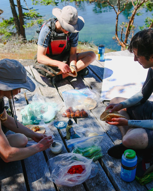
What started off as a light tailwind grew stronger and stronger until it was howling all around us. Simeon quickly took out the rain fly, and with Eloise’s help, he fashioned a makeshift sail. They began moving quickly away from me and I realized that this might just work. 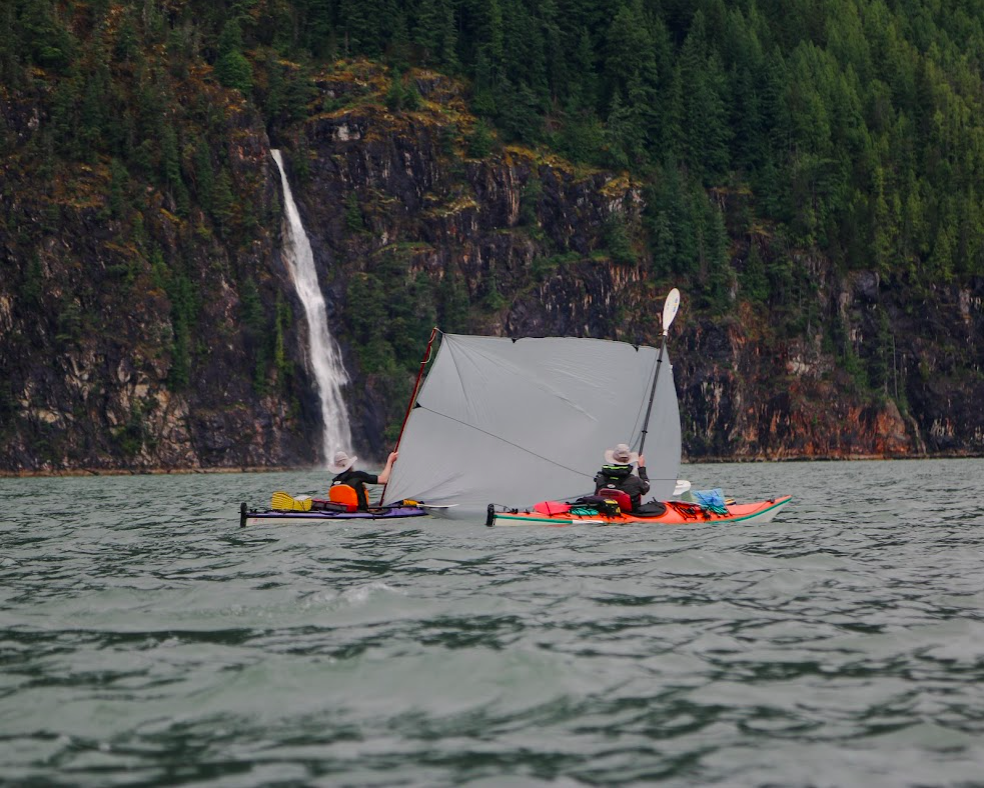 We decided to take the moment to grab a quick lunch as the wind continued pushing us deeper into the mountains. We racked up four of us alongside one another, with me and Simeon on the outside holding up a paddle and the sail. The middle two busied themselves preparing naan bites and feeding me and Simeon as we struggled to keep the sail high. In this way we cut out close to 8km of paddling for the day.
As we finished lunch and disbanded our makeshift sail raft, the winds were still strong and the water was getting dangerously choppy. All along the Toba huge curtains of rain rushed past overhead. We could see the wall of rain slowly catching up to us from behind, and then we would suddenly be thrown into a violent storm as the waves knocked our boat and wind and water blinded us. But then, just as quickly as it came, it moved on. We were suddenly in still water.
Despite the storms, the wind had brought us to our campsite by early afternoon. We decided to seize the daylight and push on to the end of the Toba.
When we came to the end of the Inlet, we were surprised to find an active logging operation. Trucks, people, and helicopters were busy at work in this outpost in the middle of nowhere. I think it took away some of the charm of the remote expedition we had hoped for. But if there’s one thing you can always count on in British Columbia is that wherever you go no matter how remote, a logging company has already beaten you to it.
We pulled up on a swamp along the edge of the Tahumming River and began stashing our gear. This land, along with the start of the trail up Mt. Denman, belongs to the Klahoose Nation from which we received permission to access. From here we would attempt our first main objective of the trip: Champion Mountain.
We set up camp and got out ingredients for backcountry pizza. I rolled out some dough and allowed everyone to customize their toppings. We turned the stove to low and took turns baking our pizzas one at a time. While we waited, we began joking about whether the logging operation had cut a nice road all the way to the alpine for us. We were excited at the prospect of an easy walk up, and so we set our alarms an hour later than usual, as a treat.
DAY 4
At about 5am I woke up to the sound of logging trucks making their way up the valley. I quietly wondered if we couldn’t hitch a ride to the alpine, and shortly fell back asleep.
In the morning proper, we slowly packed up camp and tied up our food high in a tree. We ensured our kayaks were safely stowed and climbed out of the swamp onto the road. The logging road was well maintained and we excitedly marched along at a rather quick pace. About an hour in, while we were discussing whether we could make it to the top that day, the road abruptly ended in a dense and deep forest. The trail seemed to continue on however, picking it’s way deeper down the valley along the remnants of a long abandoned logging road.
As we continued on, the trail became more and more overgrown until we were fully bushwhacking. This wasn’t going to be an easy jog up into the alpine as we had hoped. Our pace dropped dramatically, but we marched on.
By late morning we had reached a tricky to pass river that blocked our way forwards. I was bracing myself on a log while trying to hop across some rocks when the log broke and I dropped my backpack in the rushing water. It was quickly swept downstream and I leapt through the water trying to get a hold of it. Tobias managed to fish it out of the rapids, and I continued downstream trying to catch my hiking pole that was floating on down. When I finally made it to the other side with a soaked-through backpack and my hiking pole, I realized I had dropped my absolute dearest water bottle. It might sound silly to you, dear reader, but this bottle and I had been through hell and back all across the world, and I was pretty bummed out. I also felt pretty silly and pretty lame having fallen into a river and possibly jeopardized our peak attempt. Luckily, that morning I had stuffed my sleeping bag, bivy, and mattress in a large plastic bag and everything that needed to be dry stayed dry.
With a little excitement out of the way, we soldiered on. Soon we turned away from the river valley and began the slow ascent up and out towards the unnamed alpine lake below Champion Mountain. Our pace slowed considerably, and at times we were only moving a few hundred meters an hour. It was brutal work.
At one point we veered towards another old logging road marked on our map, hoping for easier travel. I was leading the pack, and completely missed the “logging road” as it was so overgrown. When the rest of the crew tried to tell me that I had walked right by, I very confidently proclaimed “This isn’t a logging road, y’all are way too optimistic.”
When the embarrassment passed, we tried following the derelict trail further up the mountain, but made very little progress. The bushes were thick and impassable, we couldn’t see our feet, and our arms and faces were bloody and red.
We grabbed lunch during a rare moment of sun, and Tobias explored a possible alternative path to get us some elevation. He reasoned that we could climb up a creek washout and gain a few hundred meters and try to cut out a few switchbacks of the overgrown road we had been following. He managed to convince us one by one, promising bars and some extra packets of apple cider if his path proved to be more miserable than the last.
Luckily, the washout was easier travel and we made it to about 600m of elevation by 3pm. We were planning on camping near 1100m. After the washout ended, we got back into the bushwhack for another few hours.
As we rose higher and higher, we entered a large valley. Perfectly smooth granite faces reached down and kissed the forests on either side of us. The boundary between valley forest and granite faces was littered with avalanche debris. After evaluating some overhead hazard, we jumped onto the debris field and out from under the oppressive bushwhack and quickly gained the remaining elevation towards the alpine lake.
Eloise
Bushwacking is not the right word to describe it, that conjures up the image of nicely walking through bush, with a couple of branches whacking you in the face every now and then. That is not what this was. It was full on bush-battling, bush-wrestling. As we made our way onto the debris field where we finally got a respite from the bush, I was pretty drained and beat up. I was plodding tiredly along, when I caught my foot on a rock, and my arms flailed to help me regain my balance. In doing so, my elbow hit the bear spray that was hanging from the side of my pack. Unbeknownst to me, the bear spray’s safety valve was broken, and I got a face full of bear spray in my eyes and nose. Everything started stinging. Yup folks, that’s the reality of the backcountry, things aren’t always idyllic.
Simeon
It was absurd.
Gabe
Towards 1000m the trees thinned out and the snowpack grew deeper. We found some bare ground and some trees to set up a tarp and cut out a tent pad. The alpine lake sat just about 5km east of Champion Mountain. A ridgeline encircled the lake from all sides. We figured we could access the ridge from the south side of the lake, follow it west towards a glaciated saddle, and pick out the final ridge that we could follow towards our summit.
With a plan in mind, we got to bed and set our alarms for 6am.
DAY 5
I awoke to the sound of rain. Soon after I heard Eloise yell out: “6:30?” “Sounds good,” I said and went back to sleep. A half hour later it was still raining, so we decided to not delay any longer and go with the weather we got. It was incredibly hazy and I could no longer see the lake below, let alone the ridge we were supposed to gain.
We ate breakfast quickly and began making our way to the south ridge. The snowpack thinned out a few times over the smooth granite faces, and so we carefully traversed these sections one at a time afraid of taking a ride down to the lake. We followed a GPS track closely as we aimed towards the glaciated saddle. The rain had lessened but the clouds did not, and we continued blindly circumventing the alpine lake below.
At this point I felt my knee begin to give me some trouble. I’ve always had some knee problems, but the grueling bushwhacking from the day before really set things off and I began to fear that it was only going to get worse through the snow. Once on the saddle I spotted a protected boulder field and I got Tobias to take a GPS waypoint. Although I could keep moving, I was worried about my ability to self-extricate as we moved into steeper and more dangerous terrain. In case I couldn’t go any further, we found a safe spot for me to wait out a summit attempt.
Only a half hour later, we came down a wide snow field and I could see up ahead that we were about to gain the proper ridge. With each step I could feel my kneecap screaming and so I told the crew that I was at the end of my attempt for that day. We stopped for lunch and discussed the plan moving forwards. We split up the Sat Phone and an Inreach between us and made a rendezvous plan. In case of delay, they would have to contact a third party through the Inreach which would then have to contact me on the phone. It wasn’t a great plan, but we had no way of direct peer-to-peer communication and so this would have to do. They would go on ahead without me, and I would follow our steps back to the pinned rocks and safely wait them out.
I felt pretty disappointed by the whole affair. I knew that I could push through the pain and continue making it up the ridge, but I was unwilling to push my luck in such a remote area. From where we stopped for lunch I knew I could very easily and safely make it back to our predetermined bivy spot. We were about to enter some more dangerous terrain, where turning back would require the entire crew to retreat alongside me. As the tag-along for the trip, I didn’t want to risk jeopardizing a summit attempt, or trying to push through the pain and consequently putting myself and my crew at risk.
As we wrapped up our lunch, I said goodbye to my friends and very slowly made my way back to the saddle. When I got to the rocks, I walked around to some standing dead trees and collected a couple twigs and branches. I figured that it might get cold sitting about for a few hours, and I had a fire starter kit in my first aid kit that could help later on. I found a perfect one-man wide cave among the rocks and began setting myself up to wait out the crew. I put my poles and axe outside the cave to mark my spot. I then emptied my pack and laid it down flat, put on all of my layers and lay upon my bag. I took my wet boots off and wrapped my feet in a t-shirt and then stuffed them in a dry-bag to keep them warm. Finally, I pulled out my emergency heat blanket and wrapped myself in an airtight cocoon. 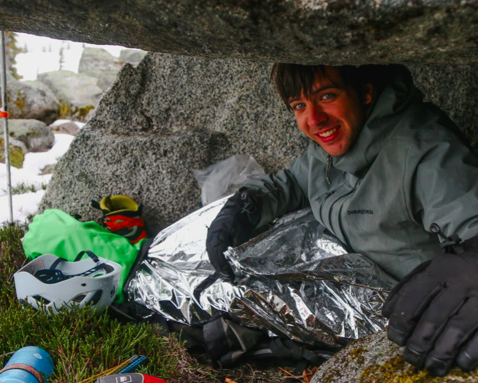
As soon as I was happy that I would stay warm and dry, I felt myself dozing off and gave in to the feeling. I awoke about an hour later, and wondered if the visibility had improved and if I’d be able to see more of the mountains around us. I got up and saw that the light rain had turned into a blizzard and snow was howling all around my cave. Inside was still toasty warm, and so I retreated back into my cocoon and chilled out for the next few hours.
Eloise
We were hesitant to leave Gabriel alone on the mountain, but he felt comfortable with the short route back to the hideout we had scoped out earlier, so we decided to give Champion a go. Right before we left, we checked the weather on the InReach and VHF one last time, and it was nothing but bad weather, with a potential for thunder and lightning. Although that wasn’t encouraging, we felt like we had to at least check out the ridge and see what it was like. From the GPS we could see we still had a couple mellower subsummits to go before the true summit.
As we trudged along, alternating who broke trail, it started snowing lightly. We made it up the first sub summit, then the next.
Simeon
For the most part a decadent plod, once you stopped thinking about the bizarreness of what we’d been through for this snow-globe, it was really a very atmospheric crest of land we were on. The thick silence held on, the late season cornices took on the appearance of decaying sandstone tectonics bleached by another world — for all we knew we were on the very edge of that world (where were we anyways?); white then black blended down to dull gray in the catatonic mists below. Yesterday we had come out of the rotting organica ‘to lay down and die for’; up here, the mind was brushed by visions of bare bones and absence, where materiality might finally broken down, dissolved, could be…
The crest rolled on like a frozen wave. Nothing now, but to sail on drunkenly and gloriously, up and down, up and up and up.
Eloise
The snow started coming down heavier as we made our way down to the col to the final ridge up to the summit. As I started going up the first steeper section, I triggered a small point release avalanche, which caused me to pause. We talked about it for a minute, then decided to keep going, saying that when you are walking in steep fresh snow, you are bound to release small stuff. Two minutes later I saw in front of me some snow fall down a chute that was further ahead and on the side of the ridge. This made me come to a full stop, and we decided we needed to have an actual discussion about the risks and whether we wanted to keep on going, instead of half talking about it, and then just keep on going because of group-think mentality where no one wants to be the one to say we should turn around.
So we talked about it. We listed the facts: a human-triggered point release had been set off, a non-human avalanche had been released, it was snowing, and conditions were deteriorating by the minute, the only forecast we had was for worsening weather and potential thunderstorm, we were in a remote area where help would be hard to come by, so the consequences of getting injured were worse. We also debated whether what we saw could actually be considered an avalanche, or if it was just snow falling from the ridge because it was steep (that specific steep couloir where the snow fell was not where we would be going). We discussed how we didn’t want to feel pressured to peak just because we had done a lot of work to get where we were (3 days of kayaking and a brutal bushwack).
In the end, Tobias brought up a seminar by Cody Townsend that he had watched on ‘the normalization of deviance’. He said that we could probably go up and be fine, but did we want to risk it on a probably? And even if we did make it up and back down alive, would that be the right decision? We didn’t want to normalize bad decisions just because we might come out alive afterwards. Finally after 10 minutes of talking in the thick snowfall, we decided to turn around. As we headed down in a whiteout, it felt like the right call.
Tobias
We shouldn’t be sad that we didn’t summit, but happy that we made the right decision and are alive.
Gabe
By 4pm the crew was back and we began heading back to camp. Along our way the clouds started parting and we finally got a view of the mountains down along the Toba.
Back at camp I used the InReach to communicate with my roommate back home and set up direct peer-to-peer communication between the SatPhone and InReach. Now we would be able to communicate with each other in the event that we needed to split up again.
DAY 6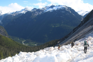
The next day we woke up to glorious sunshine. The irony was not lost on us, but we had no more food left and plenty more days ahead of us. We packed up our tents to begin the long bushwhack down.
As we navigated along the avalanche debris, a fridge sized ice block that I was leaning on came loose from the wall and fell on top of me, taking me for a bit of a slide on the granite. I caught myself and managed to get out from under the ice block without any injuries. Clearly I needed to be much more careful as the sun was weakening the snow.
Eloise
Gabe is summarizing this very casually, but I think this was the closest call on the whole trip, and could have led to debilitating injury if he had randomly been 30cm closer to the block. It was one of those things that was completely out of our control, and it was scary.
Simeon
At this point morale was low, so I suggested revamping our trip by a small but handy proposal. I put forward to rename our expeditionary force upon the unifying theme of J.O.H.N.; I was to be John Clarke because I liked long traverses, Tobias, John Baldwin because he was an extraordinary backcountry skier, Gabe, John Long because he went on all these crazy adventures, and Eloise, long johns because she always got cold too easily.
Gabe
The rest of the way down was much easier than we expected. We didn’t so much as hike down but slide and fall using the bushes to slow our descent. As we began cutting down to the valley bottom towards the Inlet, I asked the crew if we could make our way down to the river where I fell in for one last sanity search for my bottle. When we got down I threw down my pack and started heading downstream looking. I found it! Precariously pinned up against a rock in the middle of the water flow. I have no idea how it lasted 2 daysand a continuous drizzle, but Tobias reached over and grabbed it out of the water and I took a victory swig of still fresh water. 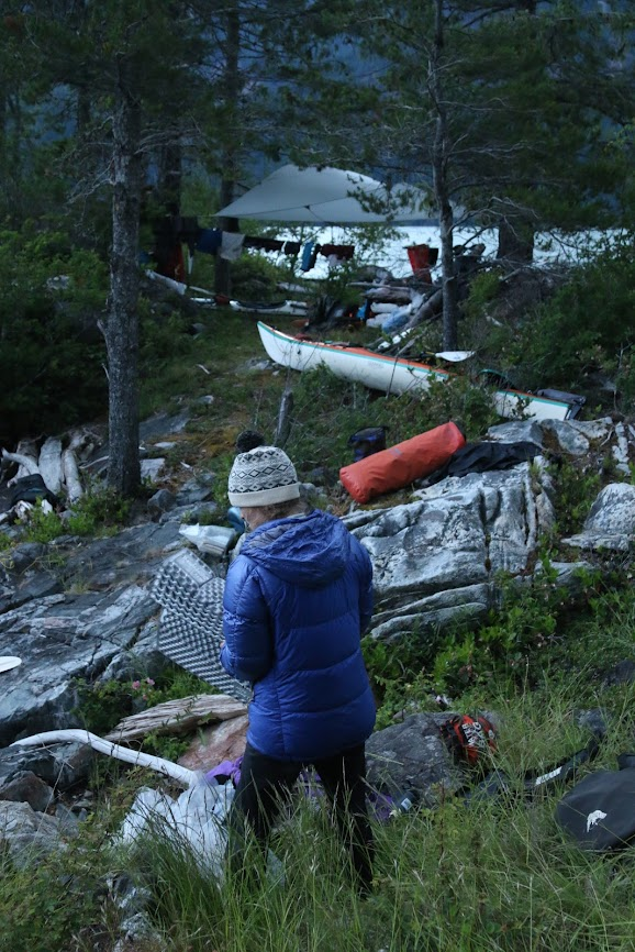 When we got back to our camp, we ate some lunch and began to transition into our water gear. We bade goodbye to our inlet end and began paddling towards a small islet about 10km along the bank. This rocky little island was only about 30m in diameter and only had space for one tent.
Along the way our beautiful sun disappeared and was replaced by the strongest winds we’ve encountered so far. Our tailwind was now a headwind and we made very little progress battling the waves down the Toba. Without any other beach at which to park and wait out the storm, we pushed on against the winds.
The islet had no beach on which we could easily dock our kayaks, and so we had to climb onto the bluffs and unload the kayaks while they floated beside us. It took us a while to safely get everything onto shore, but we were rewarded with an astoundingly cute little campsite. We tried to spot Champion up the valley, but the mountains disappeared into the clouds and we could see nothing.
DAY 7 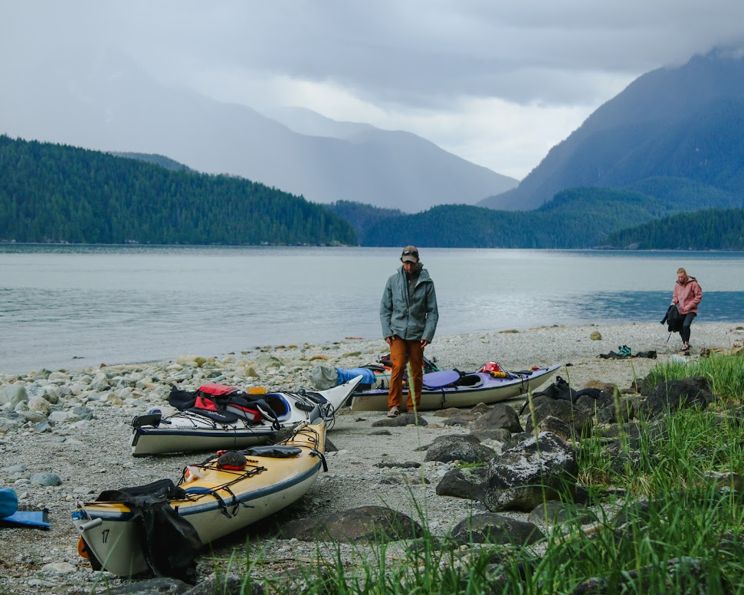 The next day we paddled up the remainder of the Toba and found a beautiful campsite right along the mouth of the Inlet. We got to the beach early and spread all of our stuff out to dry. We were only able to relax for about an hour before the tide began to come in and we realized that the entire beach and all of our gear was about to be submerged. We scrambled to get everything to a high point and resumed relaxing.
Eloise began reading us trip reports from the VOC Journal that she brought along. We were particularly jealous of a report in Desolation Sound that claimed to have beautiful weather and an abundance of whale spotting. We laughed at our luck, but enjoyed all of the trip reports nonetheless.
I was once again on dinner duty, and once again I was baking bread. This time, I fried potatoes with olive oil and an assortment of spices and then stuffed the medley into pockets of dough. I then fried the dough on the stove and enjoyed my backcountry version of Aloo Parathas.
DAY 8
Just another travel day. We had officially left Toba Inlet for good and we were now headed straight for Denman. The water was still, and we were happy to get out from under the Toba storms. We pulled up to Forbes Bay in the early afternoon and started to transition into our hiking gear.
Once again we stashed our kayaks and began the long bushwhack towards the alpine. There was no logging road this time around, but we managed to find some intermittent flagging that led us along the valley floor. There was much less bushwhacking on this approach, but the forest here was much older and so travel was still slow. The ground was covered in a thick layer of moss, and I continuously fell through random holes in the forest floor. We crawled over hundreds of rotting trees that just crumbled under our weight. It was weird being in a forest that felt so alive but also felt so very decayed.  It felt more like walking through snow than ground, but we continued following deer trails until 6 or 7pm when we found an acceptable camping spot. There were no flat spots, and everything was lumpy and covered in moss, so we made do with what we got. I was lucky to have a bivy that I could set up essentially anywhere, but the rest of the crew slept lopsided and all piled up on top of each other in their tent.
DAY 9
We continued hiking along Forbes Creek until we reached about 250m of elevation. From this point on we turned north and began the steep ascent towards the base of Denman. The moss was deep and steep, but the way up was much less bushy than Champion and so we made good time. A few sections required us to navigate around some cliffy bluffs, but we made it to the base of the ridge at 1260m by 2pm.
From here we decided to get onto the ridge and try to find a camp spot near 1600m from which we could make a summit attempt in the morning. Once on the ridge, we started encountering some 3rd and 4th class moves and began reevaluating the possibility of finding a camp spot further up. We were soon getting onto some 5th class terrain and we decided that it might be worth it to take a moment and scout out the route ahead before we committed ourselves to coming down more low-5th class moves with our large packs.
Eloise and I dropped our packs and went left around the west side of the ridge and to our surprise found a 3rd class route back down to where the terrain became 4th class. I was pretty anxious about having to come down what we had ascended, and so I was incredibly happy to find an easier way back down the ridge.
Simeon and Tobias continued up the ridge. The next section they described as a 5th class corner where you pulled yourself up along blueberry bushes while holding your boots flat against the wall. When they reached the top they found a rap sling. From there it looked like the route continued east around the ridge up some more 4th and 5th class scrambling.
We regrouped 15 min later and decided that it was unlikely that we could find a camp spot further up. We followed the route Eloise and I found back down to the start of the ridge to set up a camp for the night. Before packing it in, we decided to hike up the alpine bowl west of the ridge to see if we could find a safer way onto the face of Mt. Denman. We got to 1400m and found nothing [of the access Bivouac had reported at this elevation], and so we turned back to set up camp at the base of the ridge.
We checked the forecast for the next day and saw that it was supposed to rain all morning with a possibility of sun in the afternoon. At that point, I was well aware of my own scrambling limitations and decided that I was not comfortable with 4th and 5th class scrambling in wet weather and far from solid rock. Once again I felt a responsibility to my group to stay back while it was still safe to do so, so as to not prevent my partners from reaching their goals.
Once I decided that Denman was not for me, we began to discuss the rest of the plan. Now we had two devices that could communicate with one another, which made it much easier to alert each other to any cause for delay. The crew would wake up late tomorrow and try to catch a weather window and avoid scrambling on wet rock. Going up later in the day meant getting back to the kayaks a day later than we expected. We figured we had enough bars and extra snacks to ration out an extra meal and felt good about our plan for the day.
DAY 10
We slept in till 8am. I stayed in my bivy and listened as the others got out and started preparing for their day ahead. As they started towards the ridge, Tobias came by and we confirmed the plan with each other. They would be back by 1pm.
I listened to them leave and stayed in my tent a little while longer. It was still drizzling, and I felt happy to be safe and down.
I spent most of the day reading and just wandering about camp. Close to 1pm I got a message saying that they had made the summit, but that they’d be another 3 hours back down. I was pretty psyched to hear that they made it safe and was happy to hang out around camp for some more time.
Eloise
We left the campsite and started retracing our steps from the day before, up onto the ridge and past the location that Tobias and Simeon had scouted up to the day before. At 1550m we got to a shoulder that was flatter (a decent camp spot, future mountaineers) and from which we knew we would have to traverse up and climber’s right. We had read trip reports about this section, and heard of a fabled ‘sidewalk’ slab that, if found, made the ascent much easier. But everything we read had been rather vague, and as we looked around at the mass of rock and snow in front of us, we could see nothing that resembled a sidewalk at all. It was June, much earlier than any of the trip reports we had read, so we figured it must look different, and we would just have to figure our own way up the mountain, based on what looked best in front of us. The weather was a little drizzly, and looking at the rock that went up from where we were, I wasn’t too keen on downclimbing it if it was full-on raining. But the weather report we had looked at earlier said it was supposed to clear up, and so we figured worst case, if it was raining when we got back to the top of this section on the way back, we could huddle and wait out the rain.
We went slowly. Carefully placing one hand, before moving a foot, then the other hand. It was 4th, low 5th climbing, it was wet, and I didn’t want to fall. I fully expected that we wouldn’t make it, that we would be forced to turn around, like on Champion. The weather would clear up though, and we would get energized, and say that the window had come, so we continued forward. Clouds came in and out. We made it up to the next shoulder, from which we made steps up a snowy slope that led to a rock ridge. 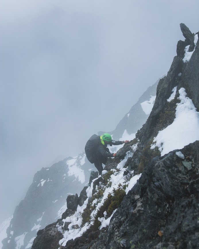 The moves were spicy, I was pretty nervous at this point, mostly because it was pretty sustained high class scrambling in wet conditions. I thought about how, if the weather soured, the return would be even sketchier. Simeon and Tobias were leading, and I slowly trailed behind them, having an internal debate whether I should stop and just wait for them to come back, or keep going. Suddenly Tobias yelled out from the white out in front of me. “The peak is 30m ahead of us, the rest of the way is an easy ridge walk to the top!” It was only then that I knew I would make it, and it was pretty exhilarating finally having a successful summit after having to turn around on Champion, though I was still nervous for the descent. On the summit we took some quick photos in the whiteout, and sent a quick message to Gabe that we would be late (we had gone much slower than anticipated). On the way back we decided to take some snow slopes down instead of the rocky ridge we had come up, and it proved much easier. We carefully down-climbed the traverse and I breathed deeply when we made it back to the first shoulder, finally able to relax, because I knew everything from there would be much easier. We had made it.
Simeon
She said it all. At this point I had zero expectations. Our pores were saturated. But that “weather window” was a fascinating detail. For now, though, all we had was each move as it came up before us. 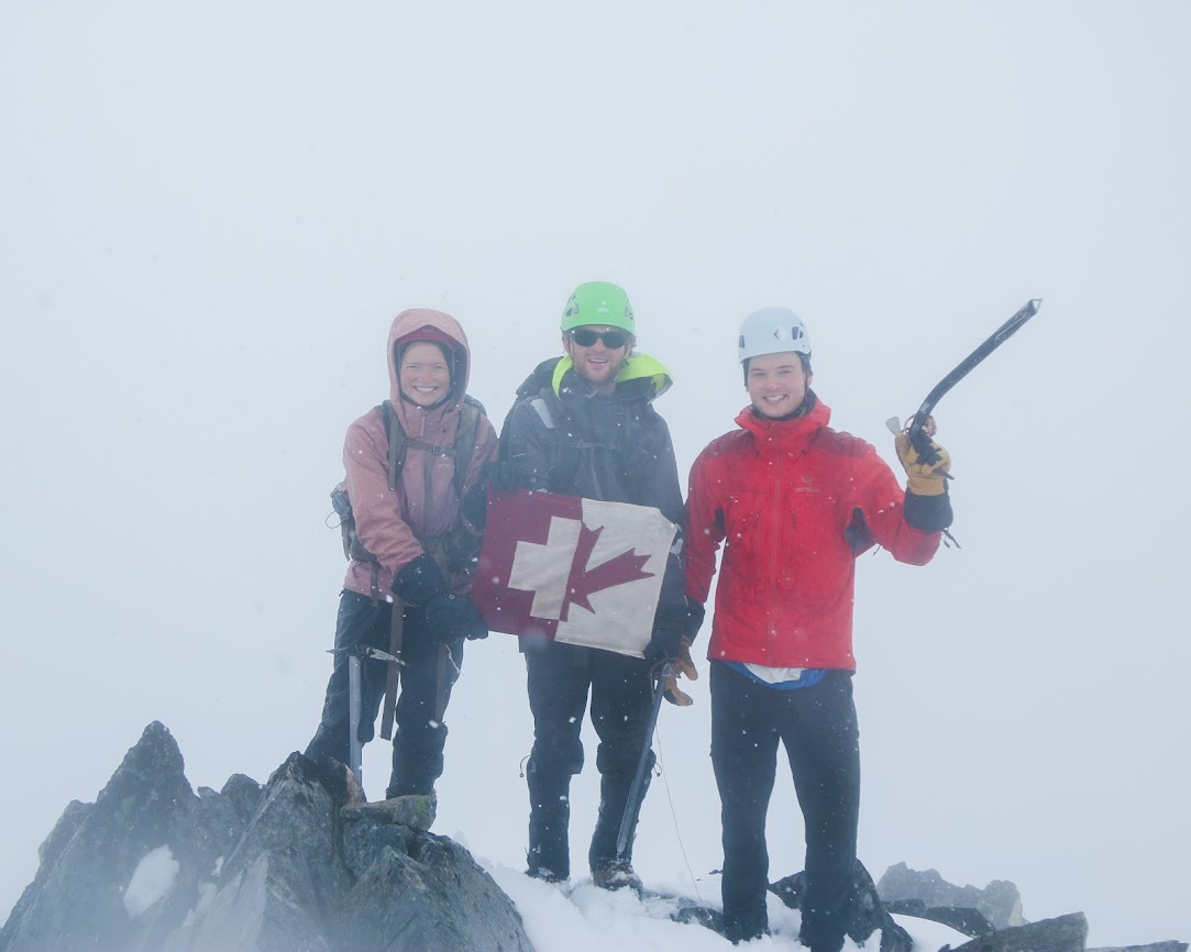 Gabe
Gabe
When they got back to camp, they excitedly told me about their adventure and I was glad to hear of their exploits. We packed up tents and started back down the valley. By about 8pm we made it to our campsite in the moss from the way up. We passed around our bars and prepped for another night under the trees.
DAY 11
Tired and hungry, we finished the last of our bushwhack. We took our time to enjoy walking under the giant trees and to snack on salmon berries along the way. Once we got out to the beach, we faffed around for a while. We dried our gear and soaked in the sun, which was cheekily poking its head out after a notable two week absence.
We kayaked for a short while to the Curme Islands, on which we were the only inhabitants for the night. We took the opportunity to take a group picture, during which was the only time any of us put our crampons on for the entire trip. During our photoshoot, the rain came in quickly, so we packed up our gear and made for our tents. I spent my final night swinging in my hammock, peaceful and dry under a tarp. 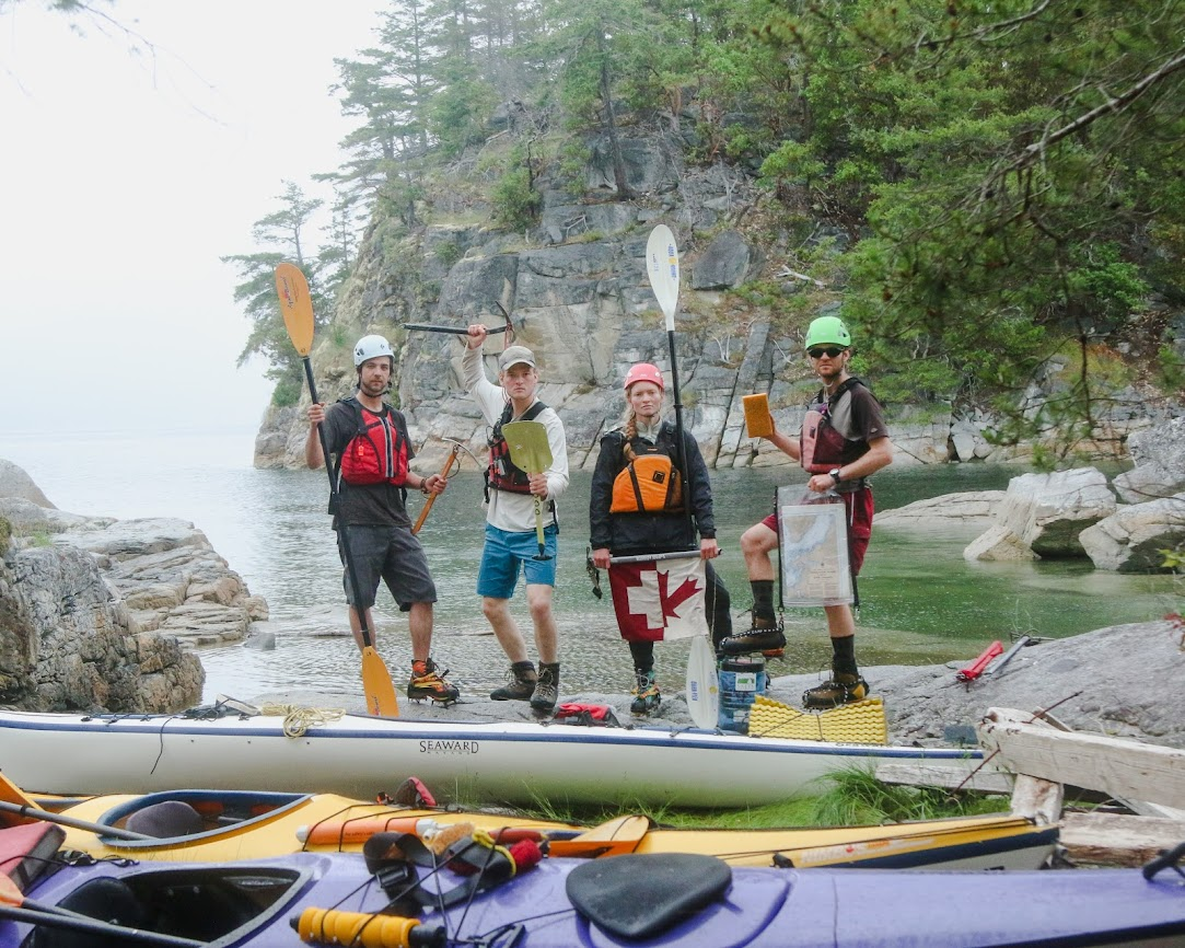 DAY 12
We woke up relatively early that morning to make a beeline for the ferry. As we were packing one of the boys noticed a water spout out in the distance towards Redonda Island. It was whales! I was elated. They had come to see us home.
By the time we were out on the water, they had moved north further up the bay. We turned south and said goodbye to the mountains that had graced us.
I split off from the group and returned my kayak in Lund while the others went a few kilometres further south to pick up the car. I grabbed some cinnamon buns for the crew in town and chatted with the outfitters while waiting for my pick up.
The ride home was easy. We made it to both of our ferries with very little trouble, and spent the time outlining the notes that would end up making this trip report. We chatted mindlessly about the trip, and trips to come. The Faendriches were figuring out how to get up the next inlet north.
I came home to an empty house. I pulled out all my gear onto my living room floor, took a shower, and crashed.
What an expedition it is!
Sounds like a great trip!
Nicely done! We had a go at Denman a few years back but that ended early enough (before we even got our kayaks wet) when we realized the plotted route around the Redondas was twice as long as intended. Judging from your report, this is best attempted later in the season but most parties :).
Awesome! Always had a soft spot for kayak approaches up inlets…
Excellent, best combo to explore the ‘Coastals’ range!