Me and Henrik were set to climb Mt Garibaldi via Brohm Ridge that weekend, thinking it would have been nice to sneak in some alpine action this late into the season. But the lack of up-to-date information on the Warren Glacier, snow (or ice…) conditions on the steeper Northeast face and the bergschrund, turned our heads further south, namely “Sky Pilot”.
Standing at 2031m, it’s the tallest mountain in the Britannia Range, sandwiched between the smaller yet more intimidating “Copilot” and “Ledge” mountains. Sitting in the backyard of Squamish, this mountain provides a great introduction to alpinism. It has a short approach (if you take the Gondola), a glacier traverse and some exposed scrambling, all of which can be done in under 7 hrs.
Since we didn’t have $50 and felt that backtracking on the return was a shame, we decided to leave from the Sea-to-Sky Parking and would return via the Mt Habrich ridge. This meant we needed to hike up to and camp somewhere near the end of the Shannon Creek Valley, so that we had plenty of time the following day to summit and traverse the ridge, in time for a cold one at the Lodge. Henrik and I opted for hammocks to keep it light whilst Noah brought his Canadian made, Taiga works ultra-light bivvy gear.

A view on Howe Sound from Sea-to-Summit trail
The trail follows the Lower Shannon Falls hiking route and then merges with the Stawamus Chief trail. After some steep couple hundred vertical metres up some stairs, we took a right turn to the Upper Shannon Falls trail where the route becomes much less popular. From there, the trail itself is standard and well maintained all the way to the Lodge.
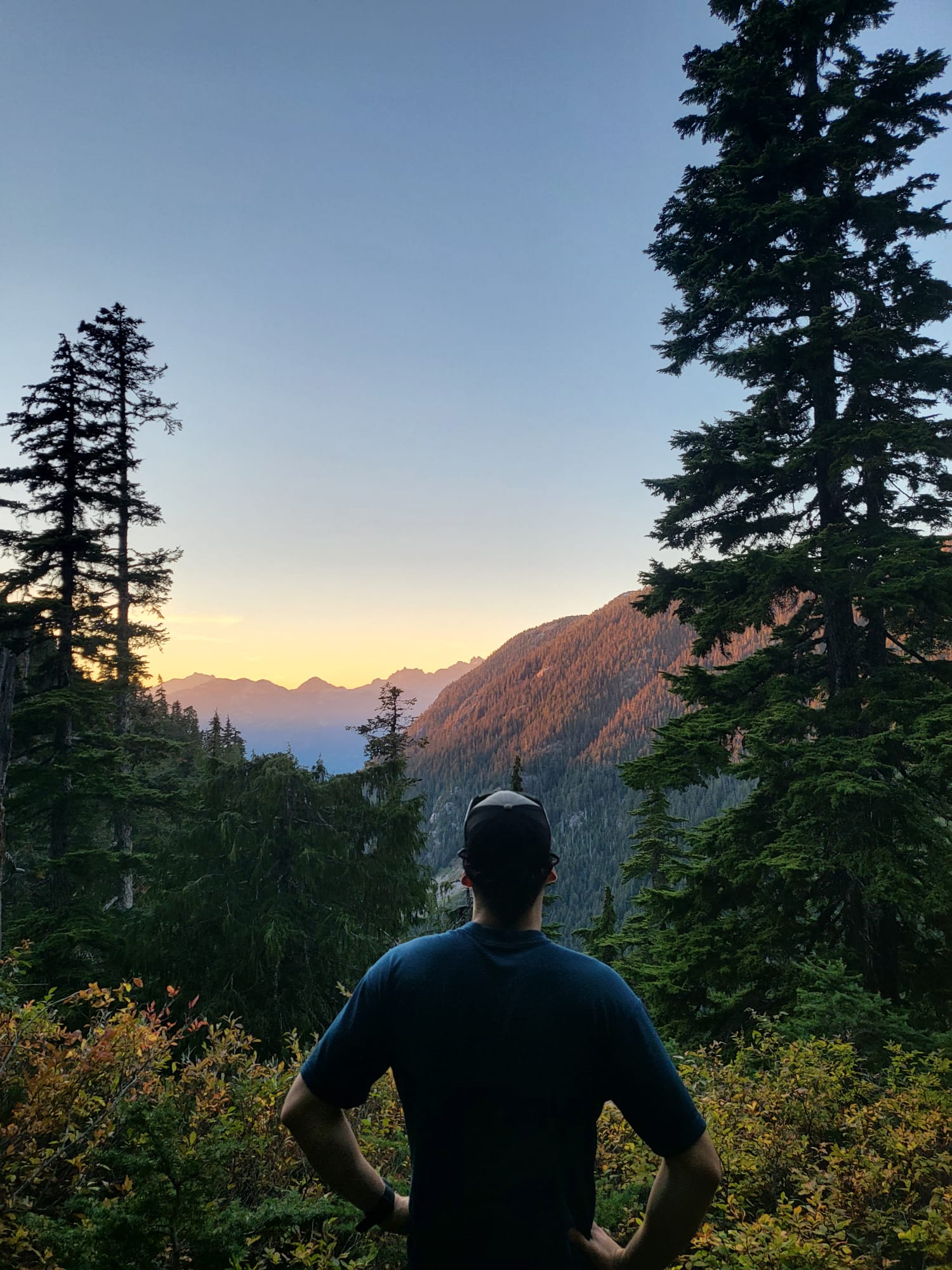
The view from the camp
You then take the Shannon Basin Loop trail, a logging road, which follows the Habrich Spur and abruptly ends on reaching steeper ground at the end of the valley. An older track continues into the old-growth forest and steeply climbs 150 metres to reach a perfect camping location. We ate some scrumptious food, including Noah’s special goat’s cheese and canned oyster pitta sandwich, and had an early night. We left in the morning at 6:40 and very quickly after left our camping gear at the turn off which leads to the top of the Habrich ridge.

Walking up the glacier runout which exits out onto the bowl
A steep section (300m of elevation over 1 km) leads you above the trees and up rocky terrain through a very wide couloir until you find yourself in the alpine bowl beneath Sky Pilot.
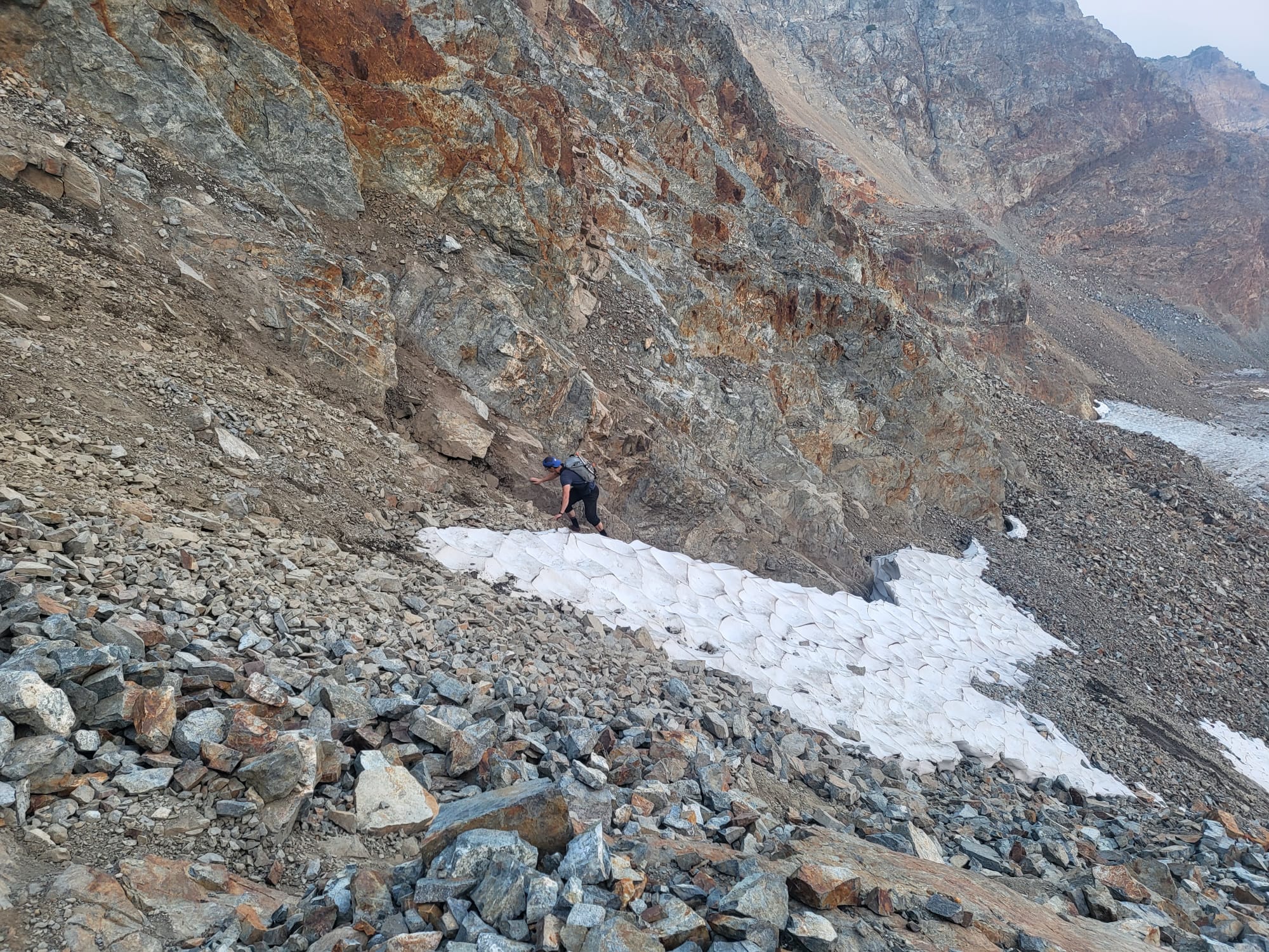
This year’s summer and autumn seasons were particularly dry for an unusually long amount of time. So the Stadium glacier did not look like much. It was covered not so much by crevasses but tons of debris frozen into the outer layer. We did not bring any crampons or rope, only one ice axe.

Really dry conditions. No need to walk up the glacier, simply traverse it.

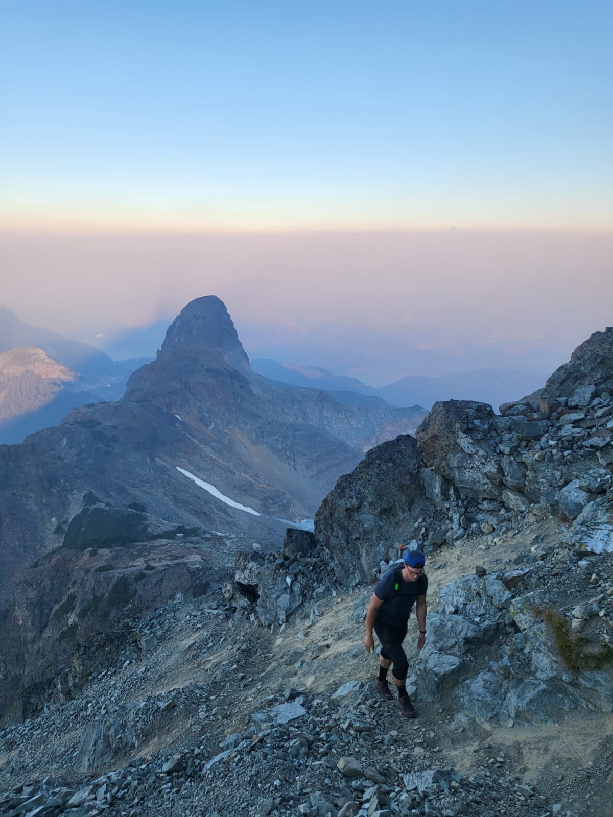
Sunrise with Mt Habrich in background

At the bottom of the glacier.
We traversed the tip and reached into a narrow gully. This was probably one of two cruxes of the trip. Lots of loose rocks and boulders on unstable slopes, you should not take too long climbing this, especially in such a concentrated rock fall zone…
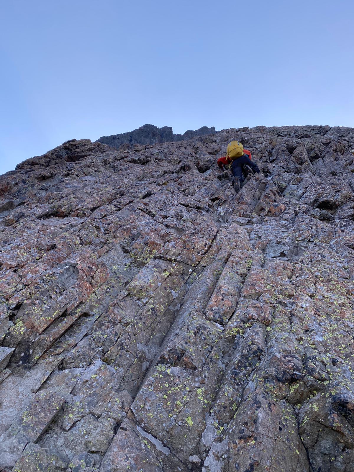
Noah climbing the gully
The infamous pink slabs followed. At a 45 degree angle, with great hand and foot holds, and perfect quality rock, this 50m section is really fine if you have previous scrambling experience. For the less initiated, there is some exposure but by sticking to climber’s left, you will reduce the risk fall from fatal to seriously injured… The slabs will get very wet and slippery after rainfall so make sure you consider this beforehand. Some bolted anchors have been set up at the top for rappels.
Henrik crimping those slabs
End of pink slabs
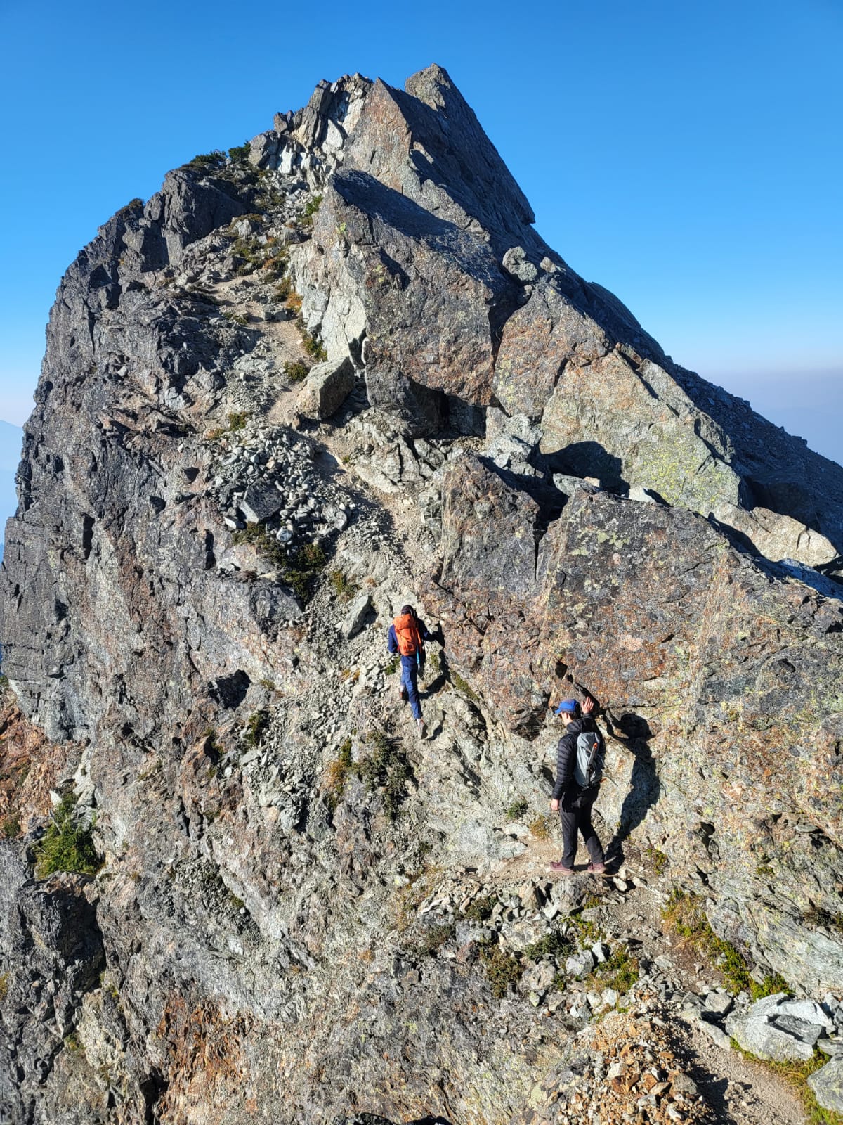
You then have a ridge walk to the first chimney. It has plenty of holds but is slightly exposed
Backtracking our wrong turn…
Don’t take the the path which leads right. It take a more direct route to the summit, bypassing the false one. It is however much more engaging and requires some serious climbing. We were not equipped…
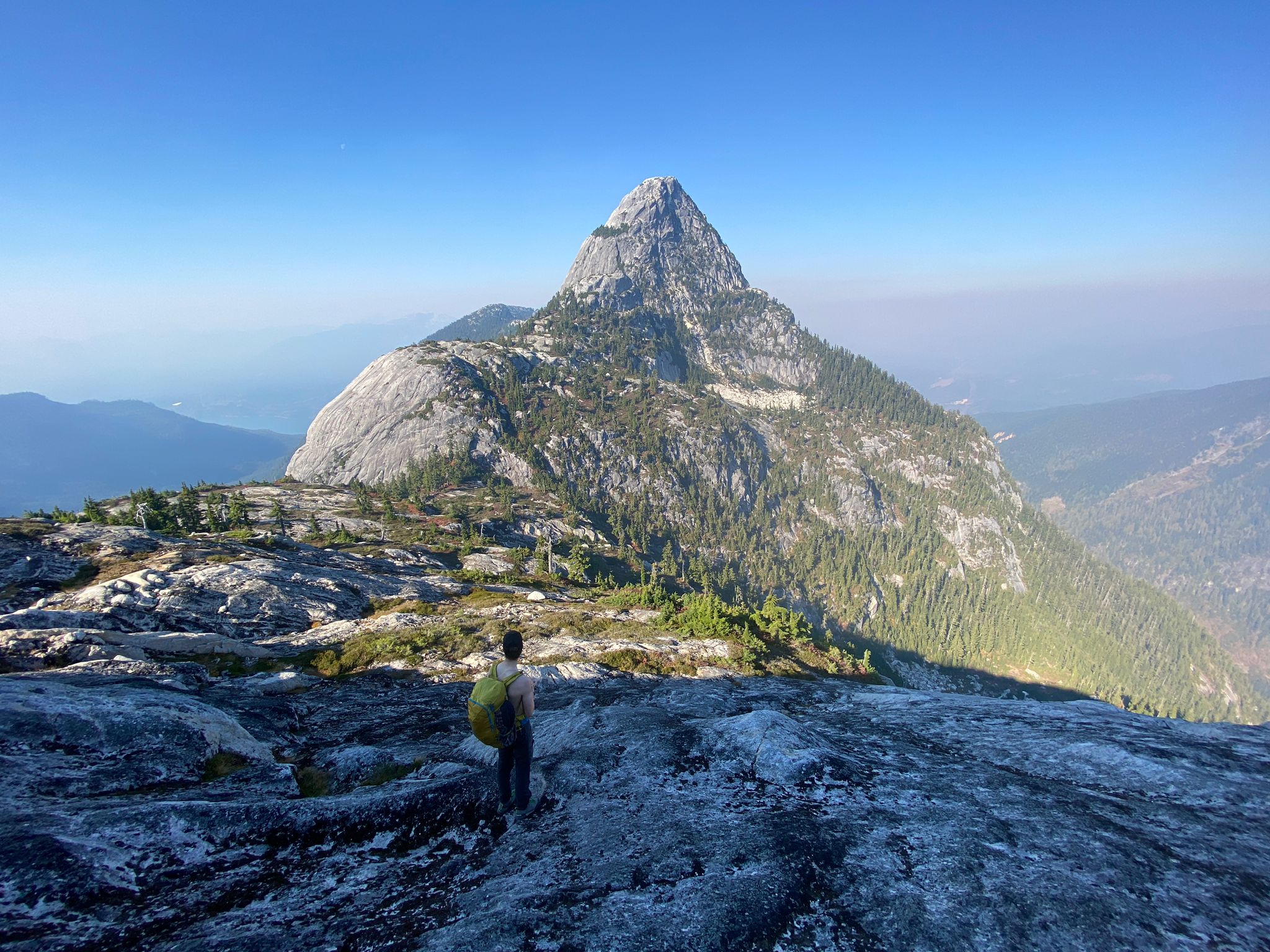
The false summit and the ridge which leads down to the last chimney
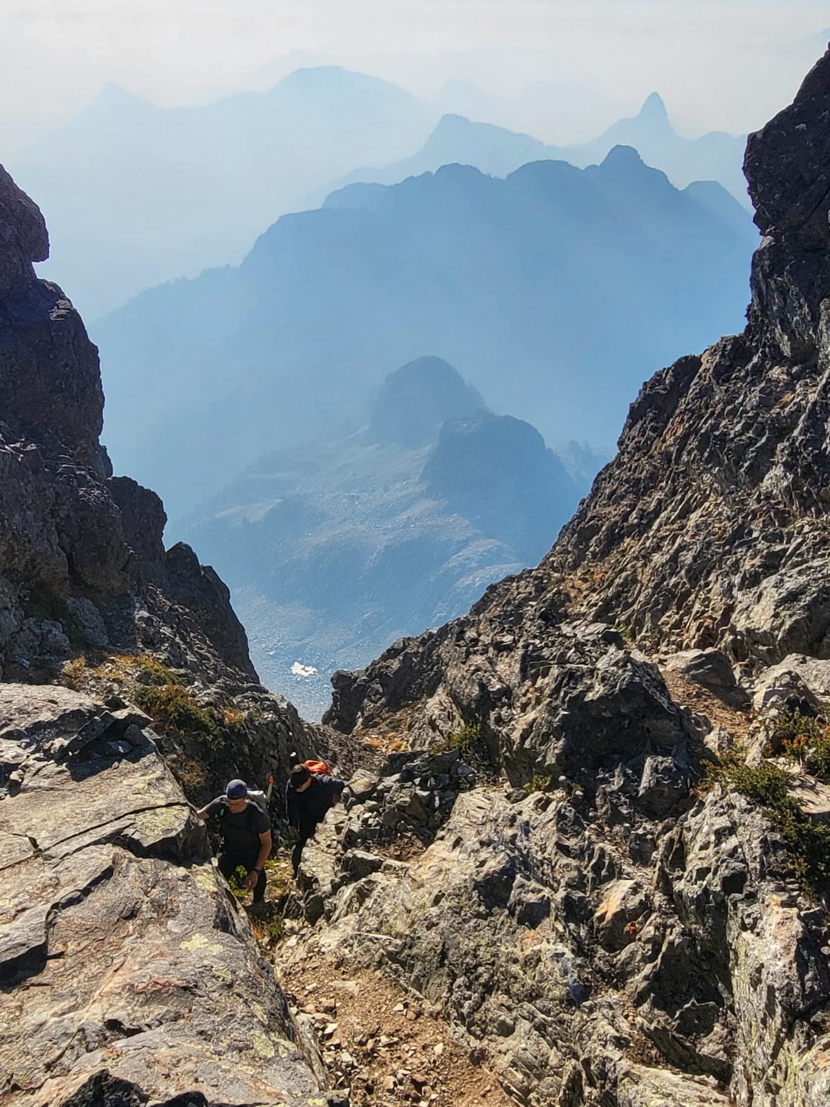
The final gulley before the summit
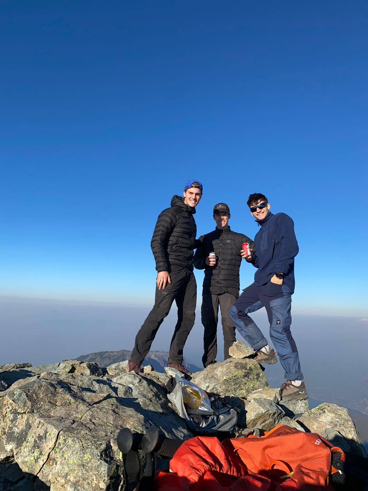
The summit reached by 9.20am. Comfort after effort…
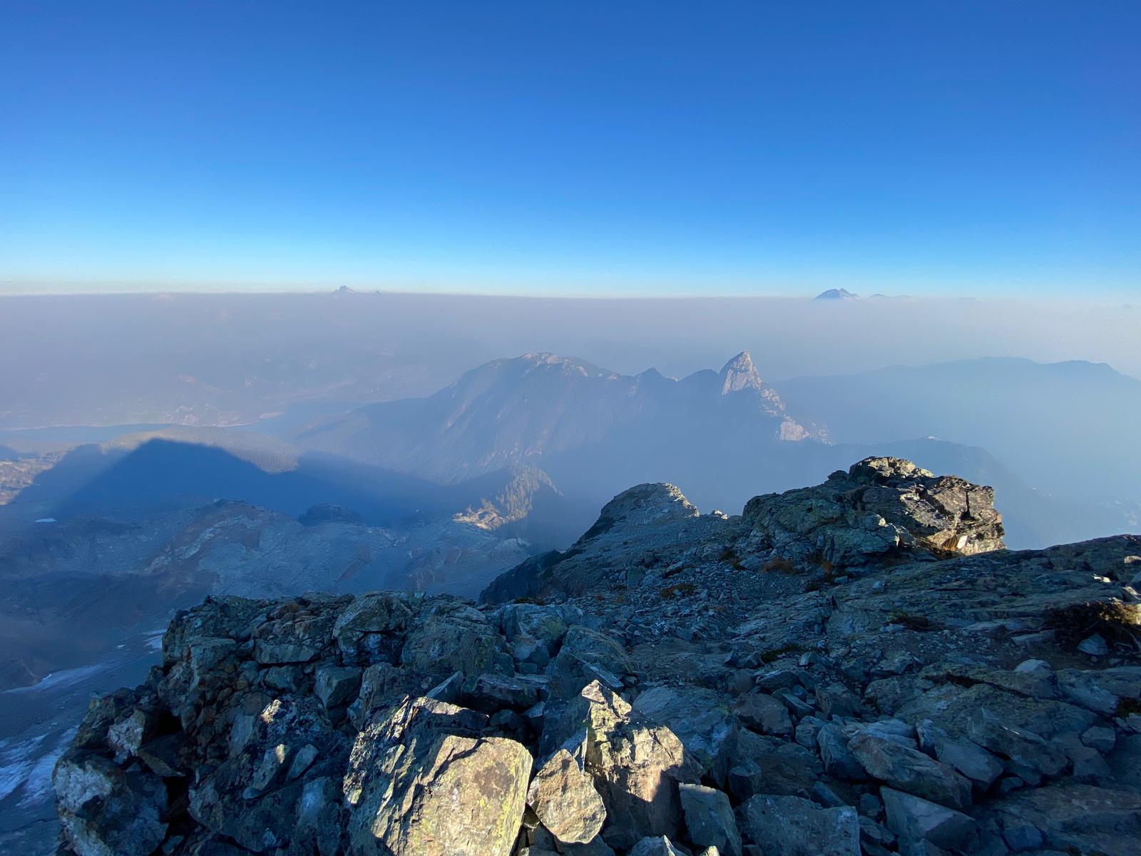
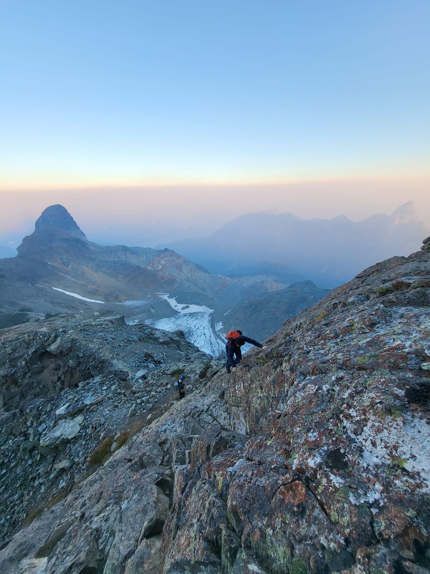
Second objective of the day as seen from summit.
After a well deserved hour break at the top, we attacked our second objective of the day. A couple cold ones and some sandos gave us the energy to climb down fairly quickly but cautiously.
We returned to where we had left our camping gear and put on the heavier load. Make sure to full up your bottles in the nearby creek. There is no future water points until the end of the ridge.
The trail to the ridge hugs the huge rock slide to arrive at the co. Count 300m of ascension.

Reaching the col between Mt Habrich and Sky Pilot. You can barely see it to the right of Ledge mountain

Not quite the season yet…
From there, route finding is fairly easy. It goes down and around the next cliff adjacent to Mt Habrich. A lot of fixed ropes are there to help you throughout the steep descents and climbs. Count a lot of this tiring but short meandering which accumulates a lot of elevation over short distances.
Ridge to South arete of Mt Habrich
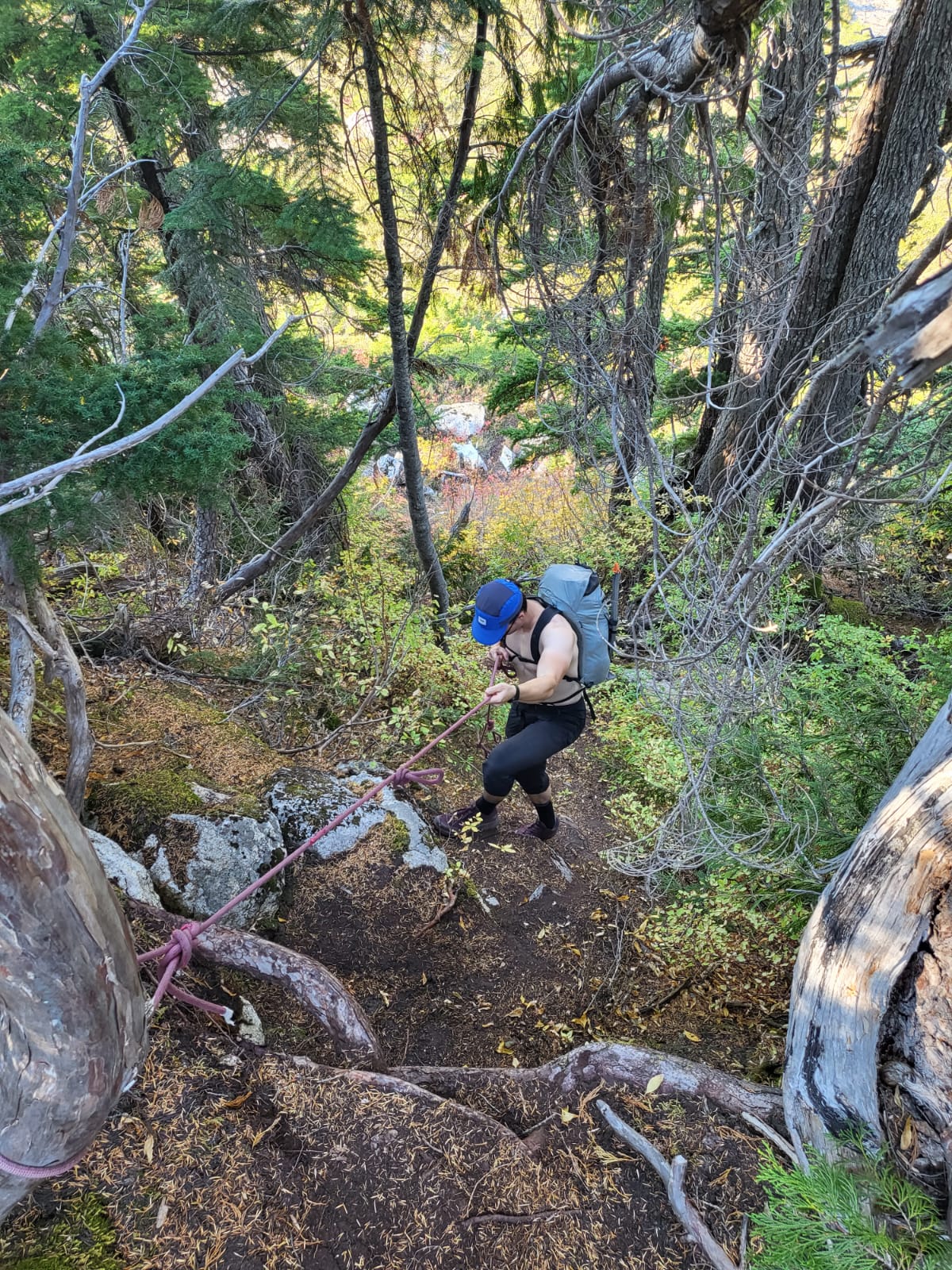
Plenty of fixed rope to ease the way

Climbing up only to go back down
The trial then takes a left turn before reaching the south arete of Mt Habrich. It is quite steep but well traced.
You circumnavigate the base of Mt Habrich where you can spot the start of “Life on Earth” and “Escape Velocity” rock climbs. Maybe for another day…
You do have an escape route to the left before a steep climb back onto the ridge. It leads back down to the Shannon Basin loop and is mostly used by climbers.
From there, a beautiful scenic route takes you up and down along the rest of the ridge to the end where you will make your descent towards the Gondola . Most of the difficulties end here but there is still some distance to go. Make sure you time yourself well, we only had 15minutes to spare before the last 6pm download.
All in all, a great couple days albeit tiring. Doing this across two days gives you plenty of time, the summit to yourselves and amazing views over the Britannia range, Tantalus and Alpha mountain, Mt Garibaldi, Mamquam Mountain. The list goes on…

A nice view of where we were that morning
N.B. We did not take any technical equipment for the Stadium glacier or scramble. We expected very dry conditions after such a dry period. Do make sure you have a good pair of approach/hiking shoes that have a good and sturdy grip on rock.
Here’s the GPX route with all the numbers:
https://www.gaiagps.com/map/?loc=13.9/-123.0907/49.6480&pubLink=06TWHmL64AuFJ4wKipybDxv5&trackId=8d1e8d7e-8ea1-4fbb-bdbd-8ad2cb23b494
Cool trip, legs are still feeling it after the Habrich traverse!! Noah’s infamous pita with goat cheese & canned oysters is not for the faint of heart.