Mt Albert Edward is a 2093 m peak on Vancouver Island. When you’re on any of the nearby mountains, it really looks like the place you want to be. My son, Devlin, and I had taken a swing at it a couple times as mid-winter, multi-day trips, and neither of those worked out. One was bottomless powder and it was too much of a slog, and the other was sufficiently icy on the three-kilometre ridge to the top that we backed off.
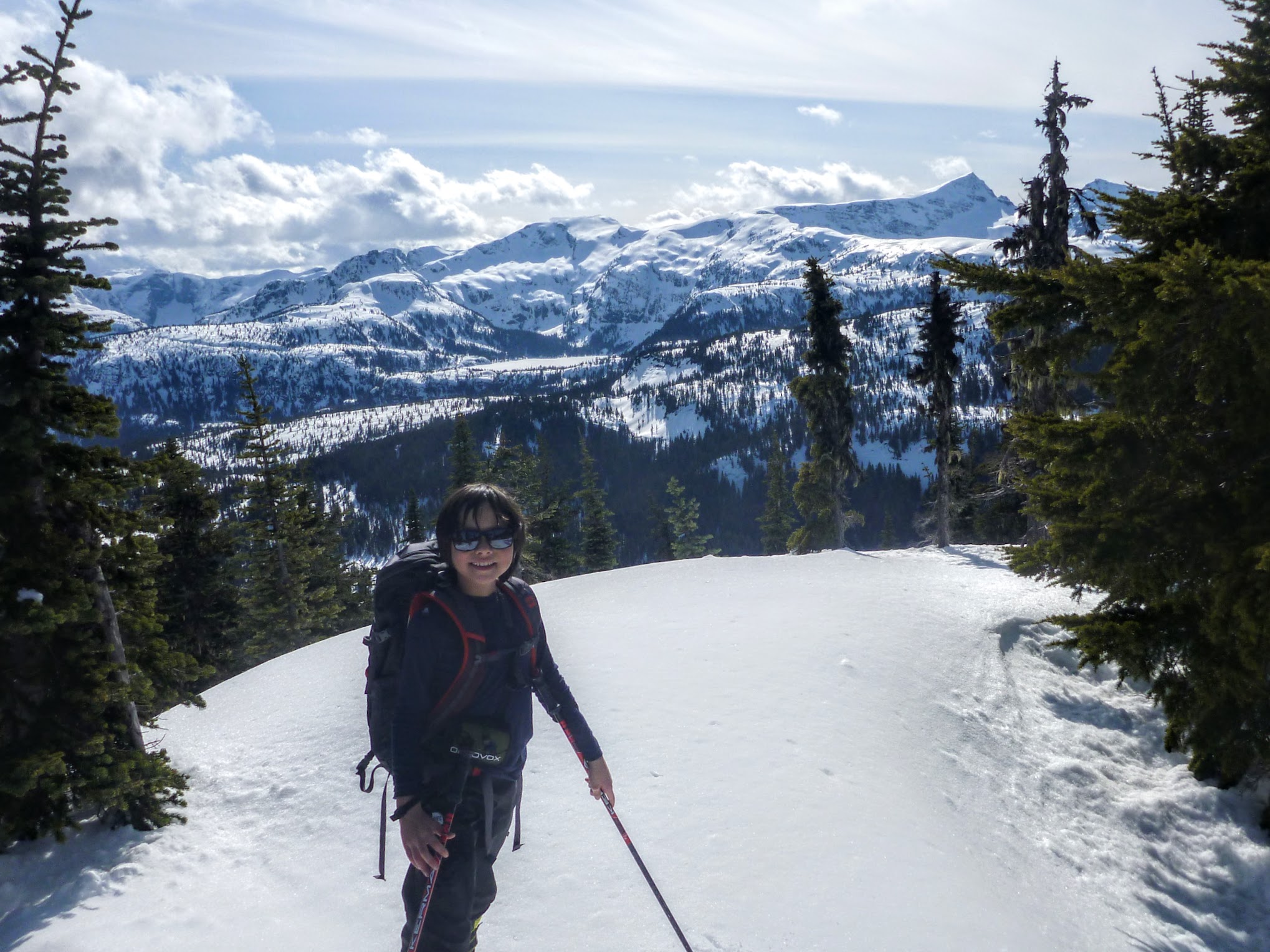
Younger Devlin on Mt. Brooks with Albert Edward in the background.
Before we get into the meat-and-potatoes, we’ll talk about gum grafts. Some people, including me, have their gums start to recede when they get around 40. If they’re allowed to recede indefinitely, teeth start falling out in your golden years. To nip that in the bud, the dentist can take a chunk of sturdy roof-of-mouth meat and use it to build up the gums.
I’d had my right side done a few years ago. At the time of the surgery, they told me no solid food and no exercise for a week, which was unfortunate because I was scheduled to go on the Bonnington Traverse in two days. I decided that it probably didn’t count as exercise and went anyway, and it was an experience.
This time, they did my left side. My dentist used this amazing product called an Optragate, which is a soft latex tube with a stiff wire loop at either end. The idea is that once they phenangle one of the loops behind the lips, the lips remain jacked open for the surgery. They give patients sunglasses so they don’t get blinded by the light. The Optragate plus shades is a good look.
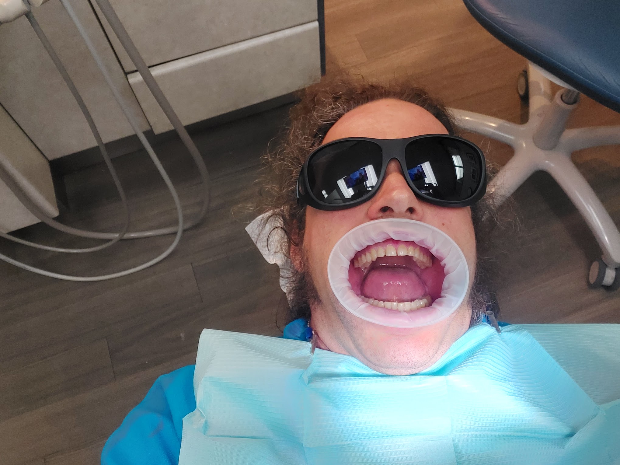
Optragate
The Optragate popped out three times. After the third instance, the dentist effectively accused the dental assistant of not putting it in properly. She replied “it’s not my fault. His lips are too flappy.”
After stitching things up, they mix up this two-part goo which has the appearance of chewing gum, but that sets hard. They call it packing, and it’s supposed to protect things until it heals. You’re supposed to only eat goo so that you don’t knock it out.
When daydreaming during the surgery, I started thinking about Albert Edward, and how it’d be nice to do it as a winter-conditions day trip, so now would be the time.
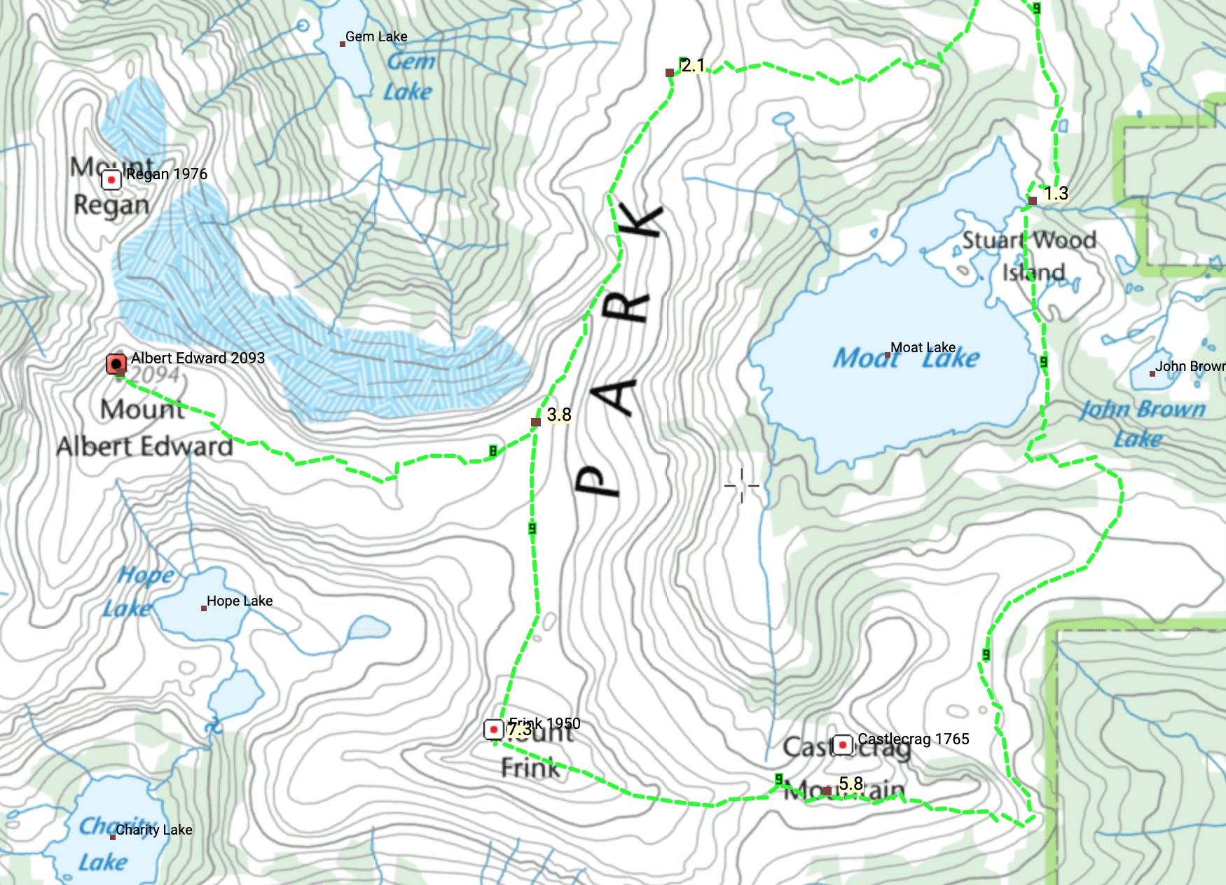
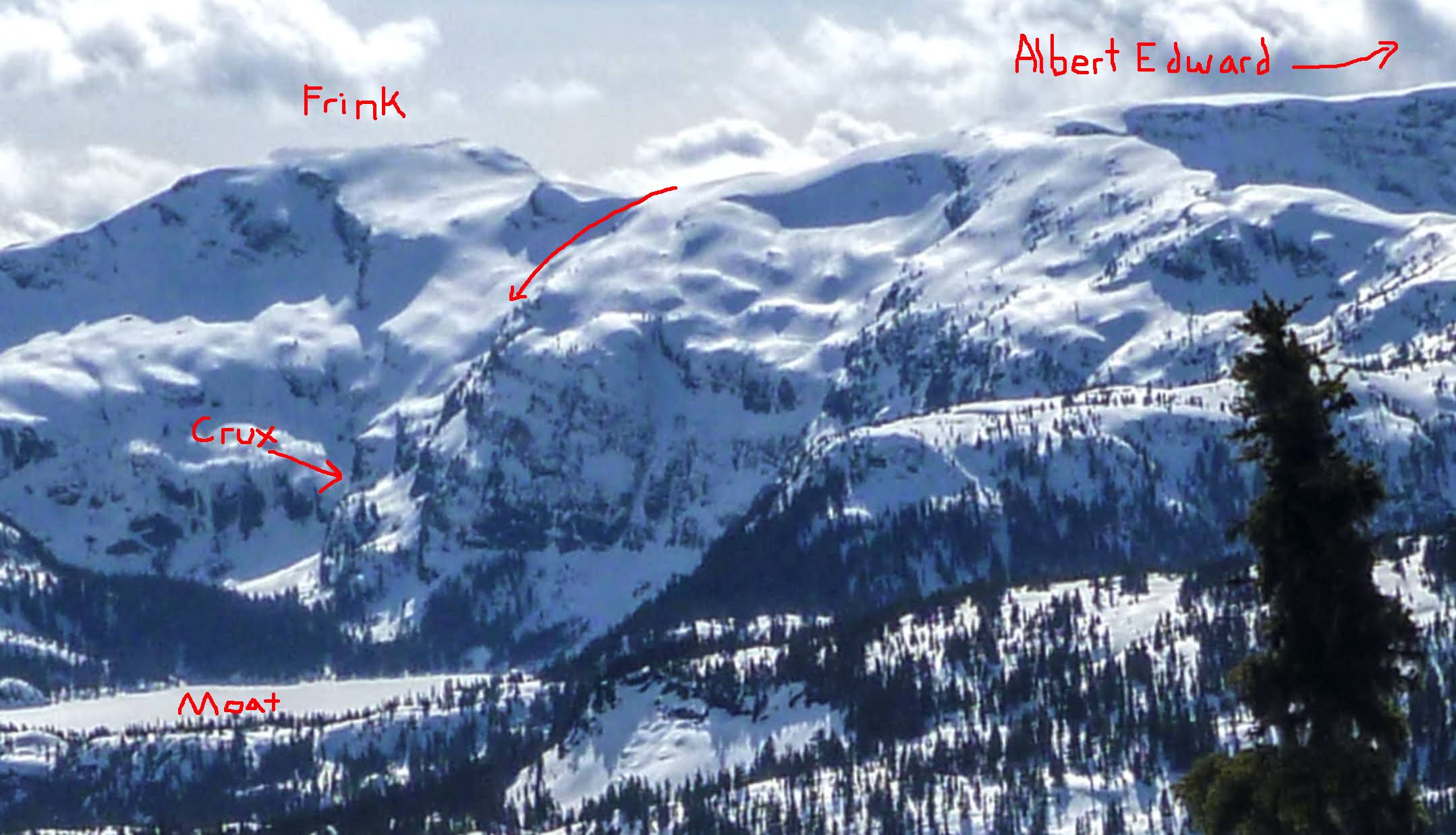
The summer trail is 32 km round trip. The elevation profile isn’t ideal for ski touring. There’s three kilometres of up-and-down from the Mt Washington cross country area to Helen McKenzie Lake, a flat slog across the take, a few hundred steep metres after the lake, then about ten more kilometres of up-and-down before the climb to the ridge, and three more along the ridge to the summit. All the up-and-down terrain is skinning both ways as all the hills are too short to justify a transition.
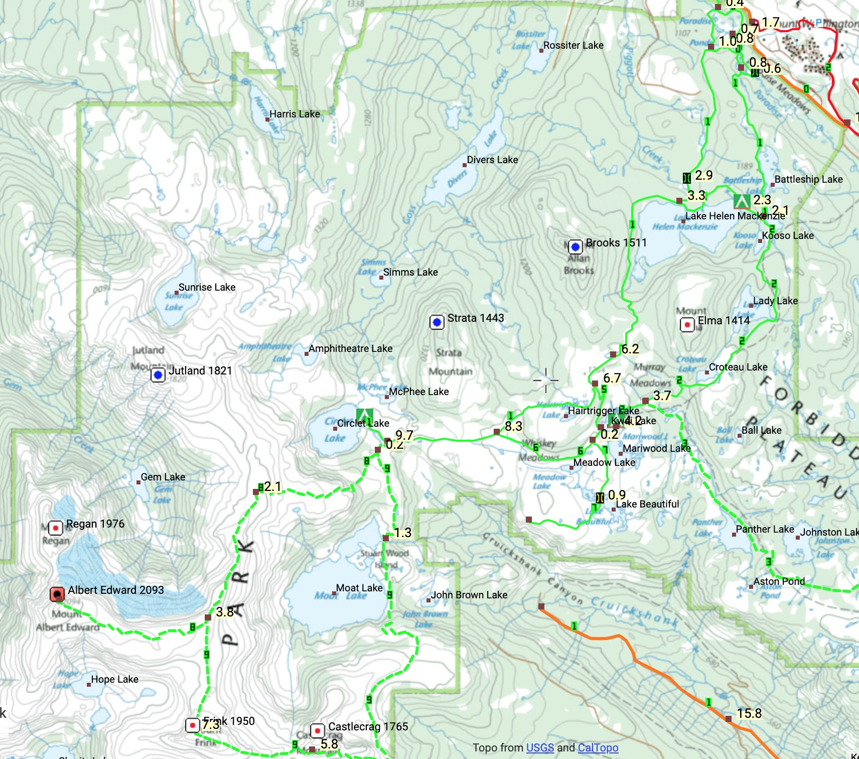
The trailhead is at the Mt. Washington XC area, slightly off the map to the northwest of ski resort. The top green line is the summer trail and the other green lines are GPS tracks that people have put up on Bivouac.
Everyone and their dog snowshoes to Helen McKenzie Lake, but past there, the skin tracks often stop. The usual ski-touring destination is Mt Brooks, immediately to the right of Helen McKenzie Lake, and those going further disperse relatively quickly. There weren’t any skin tracks near Albert Edward on any of our attempts.
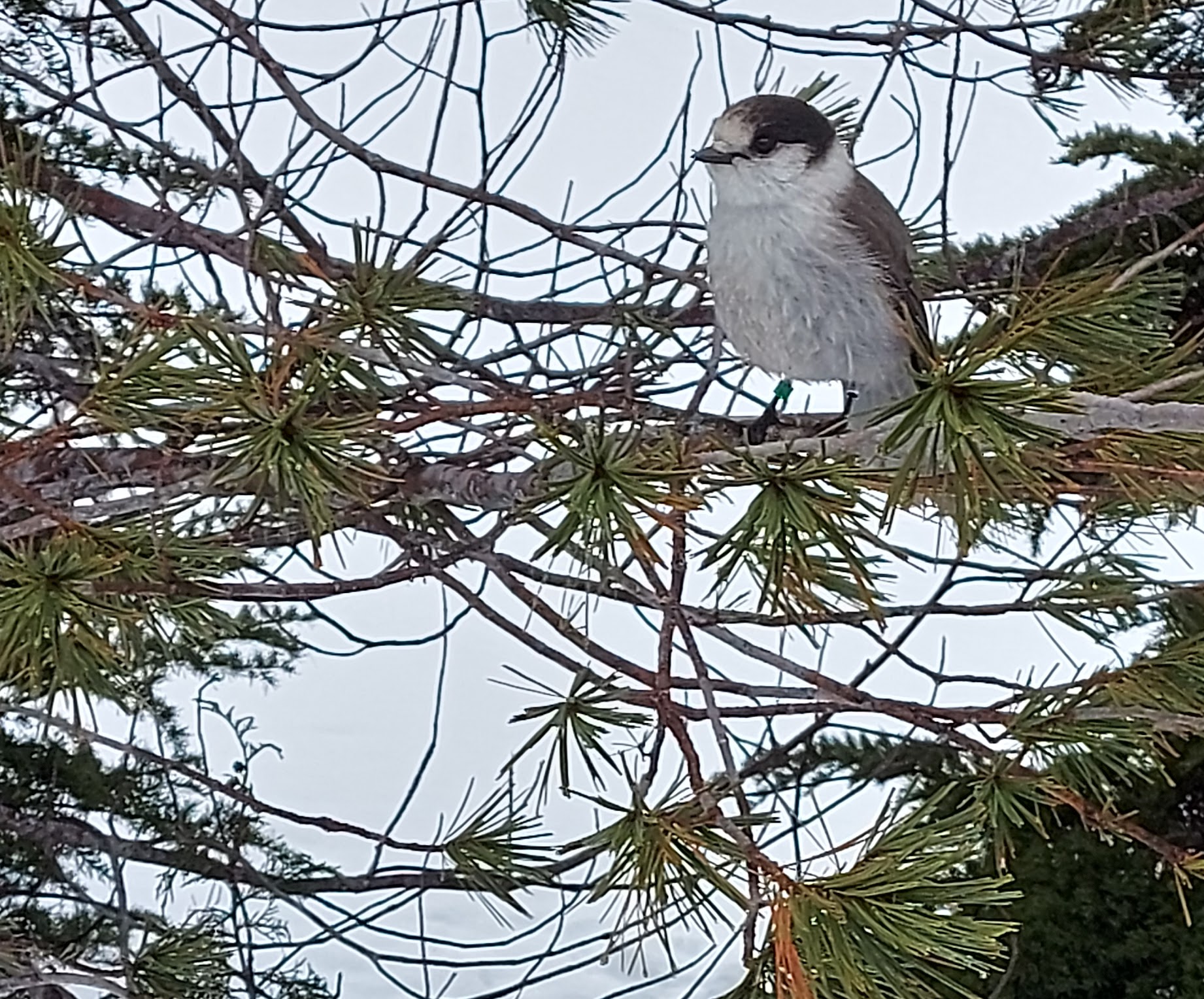
Whiskey jack supervising near Helen McKenzie Lake
The conditions were deep mashed potatoes. By the time we got to the ranger station before Hairtrigger Lake, it had started to snow fairly hard.
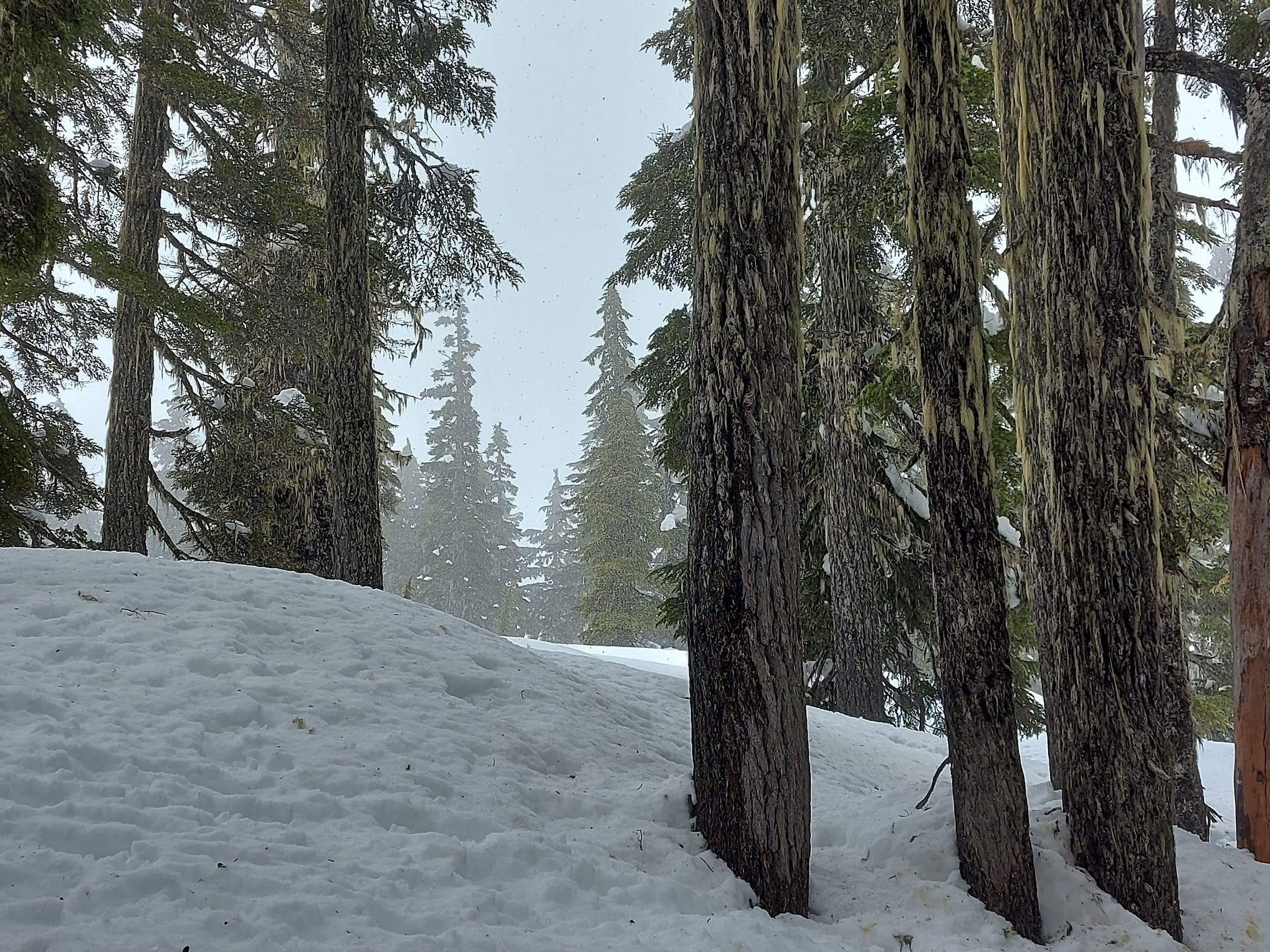
The start of the snow
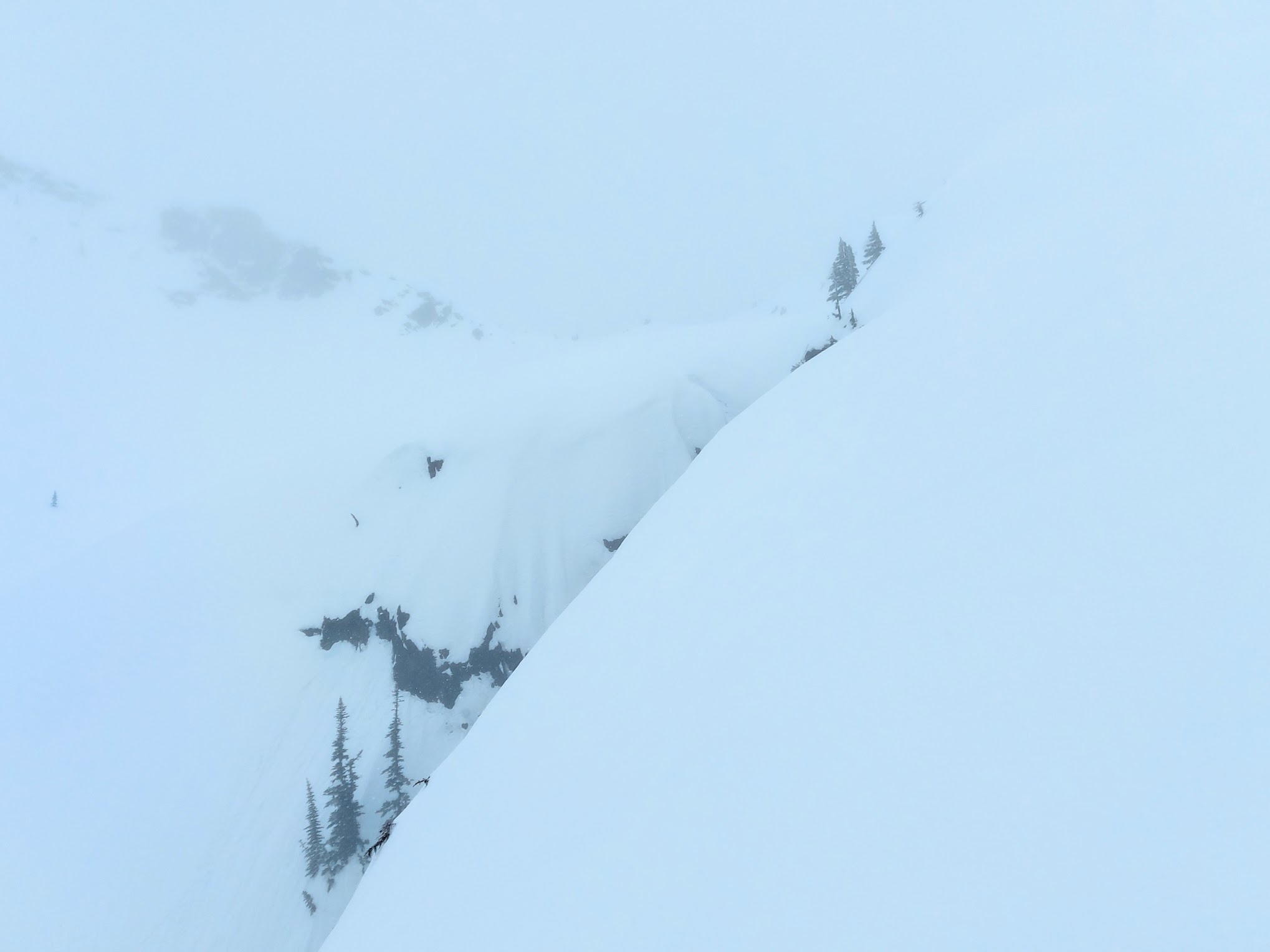
Visibility got steadily worse as we made our way up the ridge from the meadows. The light was really flat on the ridge. Sometimes we could see some things and sometimes we couldn’t. I was holding both my poles out in front of me tapping the ground to make sure I wasn’t skinning off a cornice. On the ridge top, the snow stopped being mashed potatoes and was alternating between wind slab and mostly-breakable-crust.
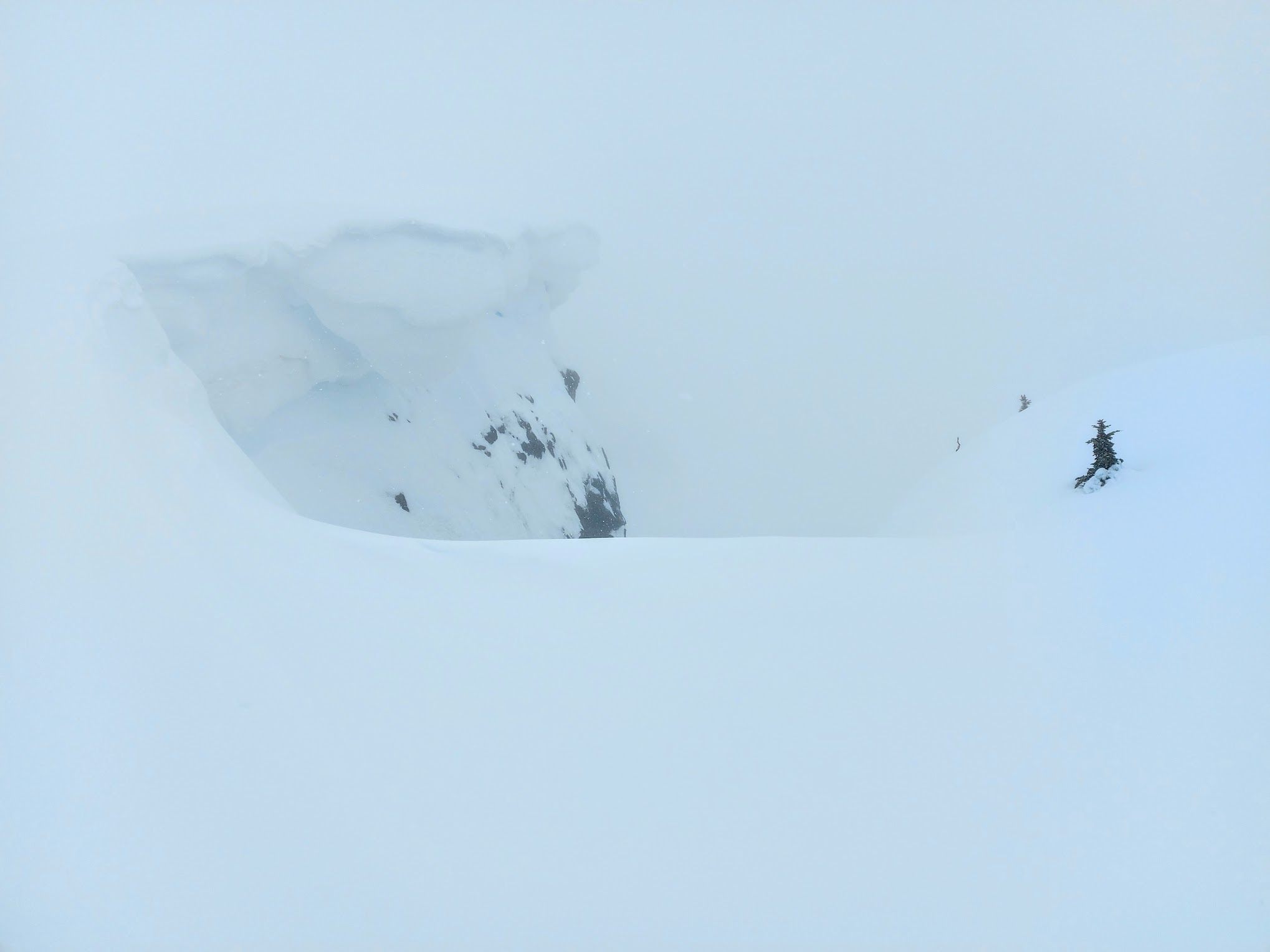
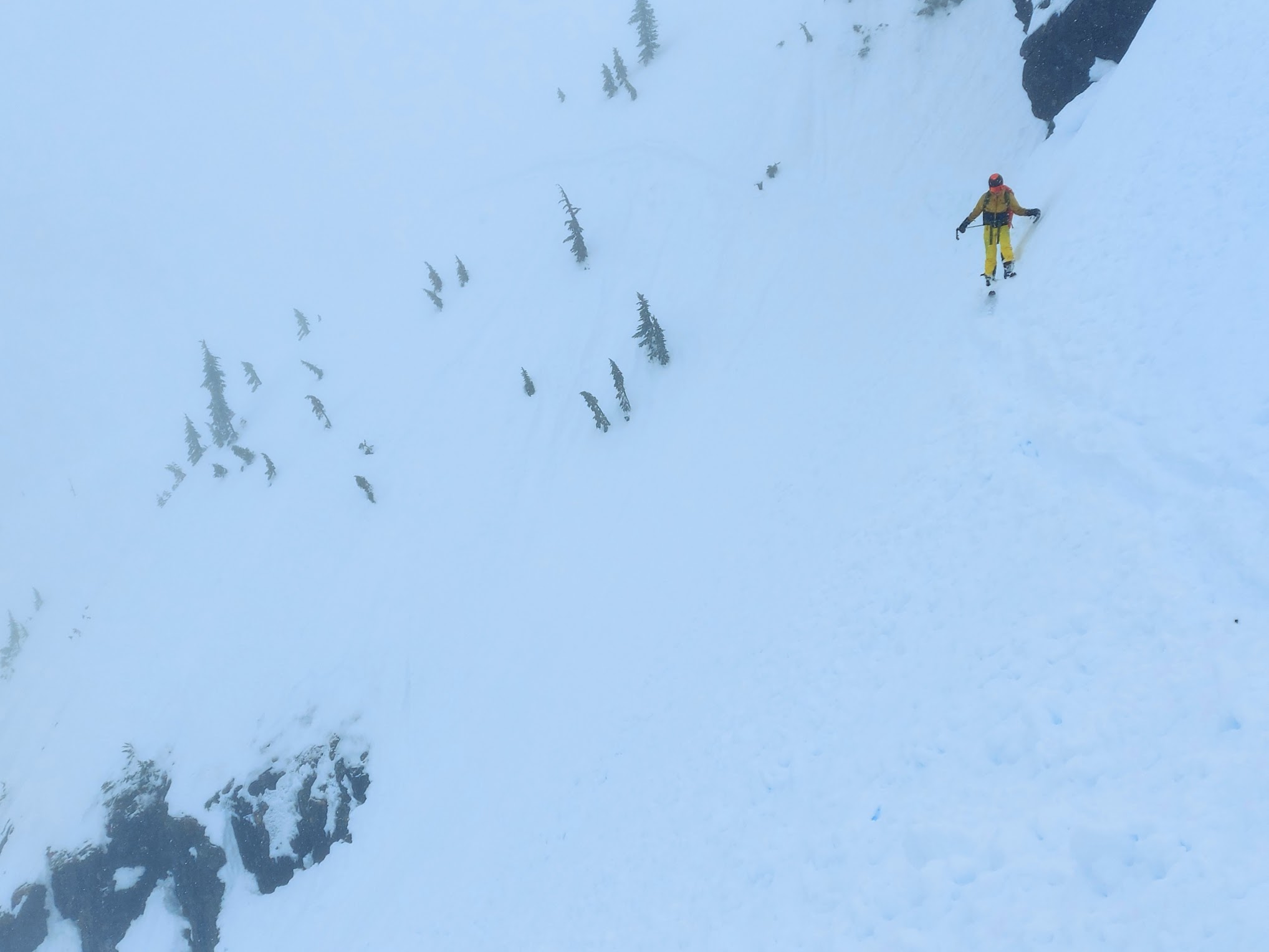
Sometimes we’d see stuff like this
Sometimes we’d see stuff like this. The edge of the ridge is only a few metres away, right through middle of the frame
The view from the summit was not particularly inspiring.
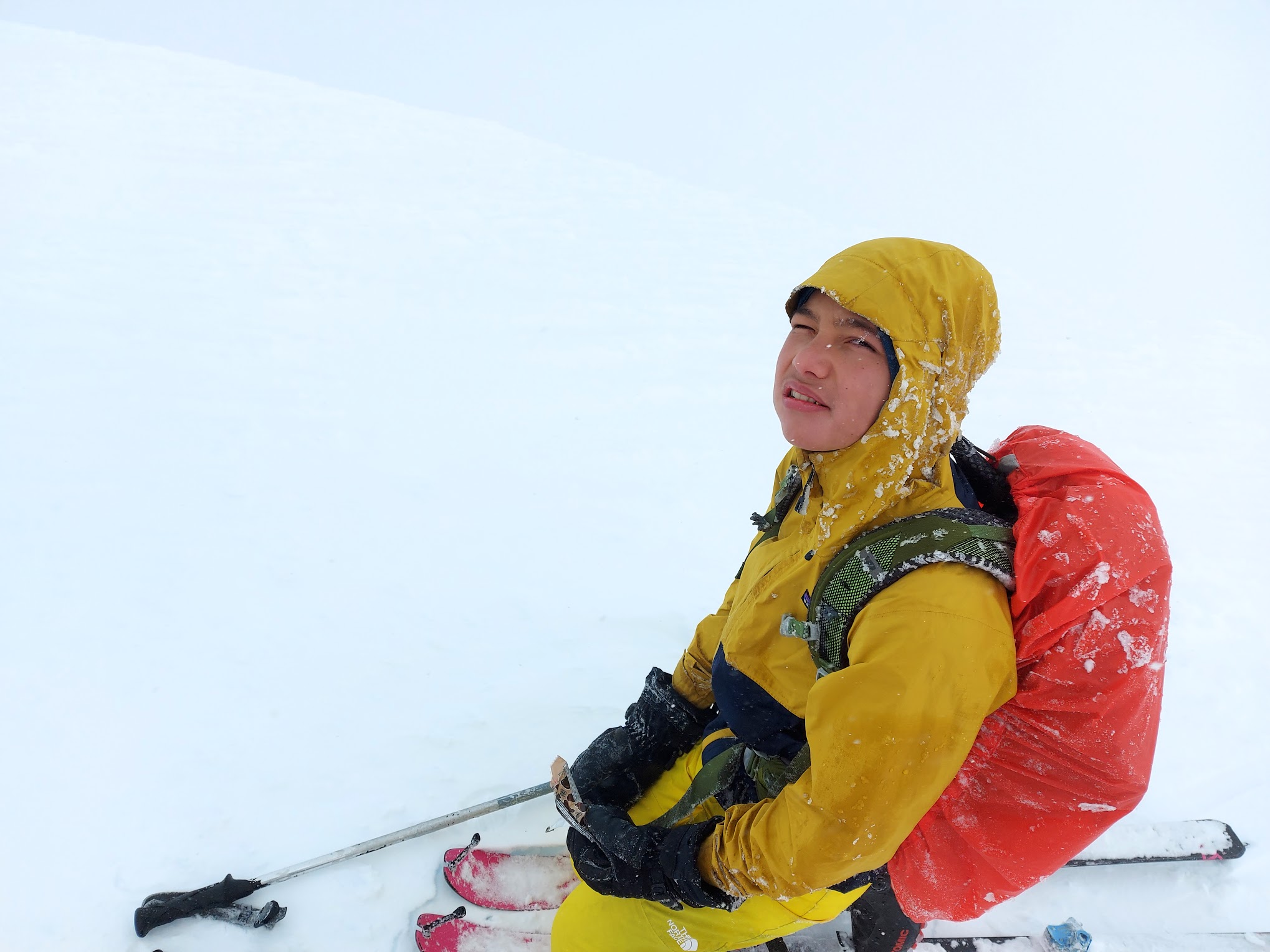
The wind is keeping Devlin from really opening his eyes. This does a good job of showing how quickly stuff could appear and disappear. The edge of the summit is a couple metees away over the whole image, and it’s easy to see in front of Devlin but not behind.
Coming down was both disturbing and tedious. The visibility was bad enough that it was easy to think you were side-sliding when you were actually going forwards or backwards pretty quickly. There was plenty of waiting for a change in the lighting to be able to see something that we could ski towards, and some inching along while tapping the ground in front of us. We got to a place where the ridge started going up again, which didn’t seem to make sense. The phone showed that we’d broken off the ridge we wanted to be on and were now headed to Mount Frink.
It wouldn’t have been a major effort to turn around and skin back up to where we missed the turn, but that would put us back in a disturbing situation, approaching the most cornicy, thin part of the ridge with visibility continuing to get worse and night coming. The other option would be to take advantage of being on a relatively rounded ridge top and getting down to Moat Lake.
Both options were fairly disturbing. The Garmin topo showed the descent to Moat being straightforward, but the Garmin topos are terrible. I remember looking at the descent to Moat on a decent topo years ago and decided back then it was a lousy idea. I’ve never heard of anyone doing it. It was definitely going to get dark if we hummed and hawed indefinitely.
We ended up dropping towards Moat lake. The first bit went okay. Once we were a couple hundred metres down, the snow was bottomless schmoo and the light was still very flat. I had my 162 cm light-and-skinny skis on, and every time I met a bump I couldn’t see I’d bury the tips and eject.
We were trying to head towards the creek coming from the Frink-Castlecrag col, but we got cliffed out and had to turn back north.
Cliffing out

We tried going for a bit, but it got steadily steeper until we reversed because we didn’t want to risk being avalanched off a cliff
We ended up with a convex slope in front of us, with some cliffy stuff above and below. I sidestepped to stay above where it really started to roll until I was past the cliffs and could see what was ahead of me.
The top of the bulge I was on tapered away to nothing; the cliff above met the top of the convexity. Beyond that, there was a relatively flat area with a gully disappearing over the edge. I stayed near the cliffs above so that there wasn’t much snow above me and tried to move straight and fast. I was thinking that it was for sure going to slide, and I was trying to be in a position where I wouldn’t get caught. It did let go. A bunch of loose, wet junk went around the flatter area and down the gully. We couldn’t see where it went, but we heard it go for a while.
It’s hard to see because the light is still kind of flat, but the area below the track behind Devlin took off down and to the left
We floundered around for a bit seeing if there was a way that avoided committing to the gully, but we couldn’t find one. Where we were, the gully had a short wall of exposed rock, so we grabbed onto an overhanging branch, swung out and dropped in. From there I could see that it was snow-continuous to the bottom, if you consider ice to be snow.
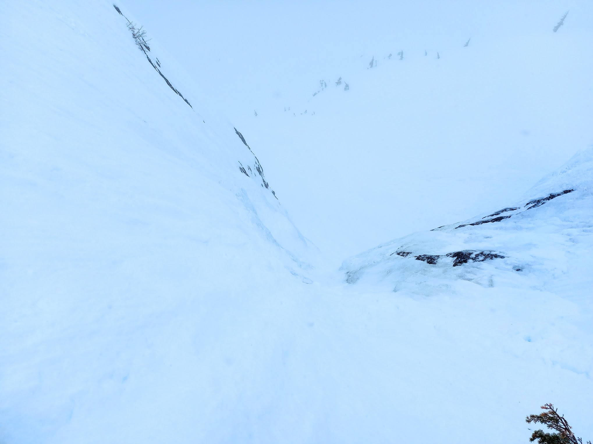
Usually when I take a picture of a descent that seems bad, it looks way more disturbing in real life than on the computer. I think this one is still fairly disturbing on a computer.

Devlin scraping down
If we had crampons, I would have for sure put them on, but we didn’t, so we ended up scraping down on skis. When we were both down, I told Devlin that I thought that was the most disgusting thing I’ve ever skied.
“What about Bombtram Mountain?”
“We didn’t ski that. We downclimbed it.”
“It was pretty disgusting afterwards in Box Canyon.”
“Not that disgusting.”
Here’s a zoom-in on the old photo of Albert Edward from Allan Brooks.
Past that, the descent to Moat Lake was straightforward. I buried the tips in a bump I didn’t see and ejected one more time. The packing that was protecting where the dentist had excavated my hard palate fell out.
I blame Mount Frink
Visibility still wasn’t great down at the lake. We spent a period skinning while looking at the compass because there wasn’t any land in sight. Although we were past the exciting part, we’d let the day slip away and we still had 9 km of skinning to go at 8:00 PM. We found our uptrack, a kilometre after the lake but there was lots of fresh goo filling them up. Fortunately for us, we met up with newer tracks from some party that started later and ended earlier than us near Kwai Lake. We celebrated by having instant noodles.
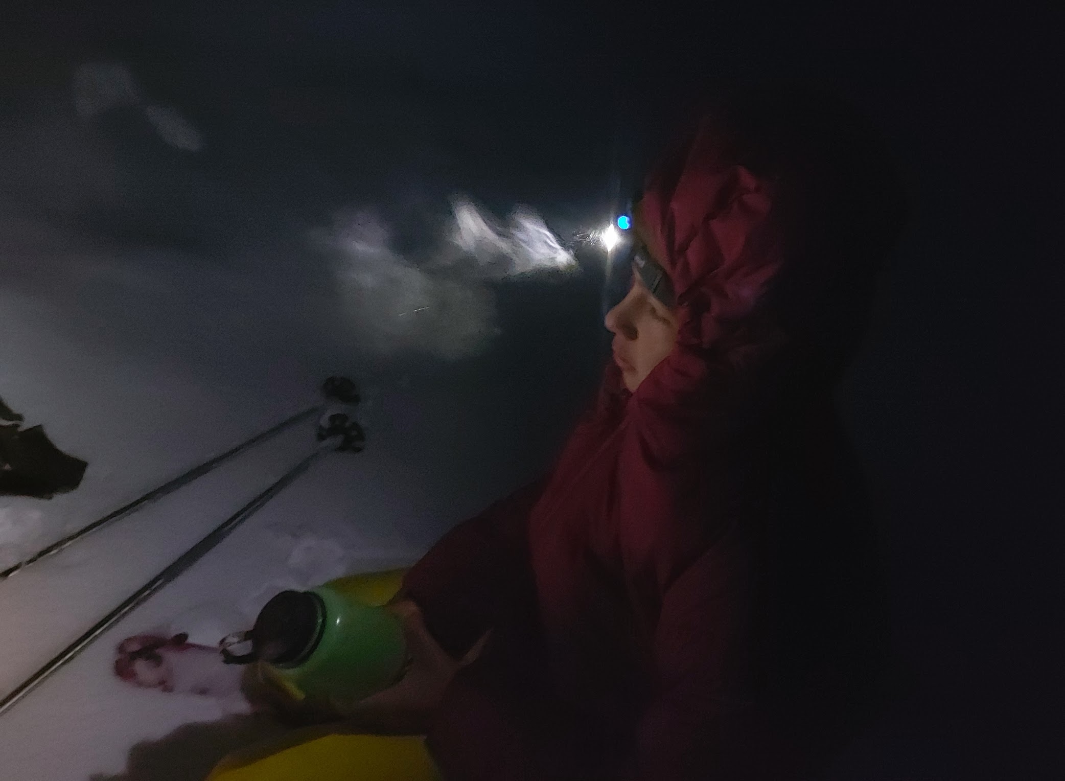
Waiting for noodles