Having talked about some amazing Sea To Sky objectives since first year, I had been very interested in getting into the mountaineering scene in Vancouver. With a favourable weather and avalanche window, I thought Mt Wedge would be a worthy objective.
Looking at the peak on CalTopo and reading the route, I wasn’t sure if the glacier or NE arete would be in yet. We decided there was only one way to find out. We underestimated the cold and difficulty of the route, planning to summit Saturday, spend the night on top and then scoot back to Vancouver before Whistler traffic on Sunday. Needless to say, we were overly ambitious.
In packing I discovered why my other camping gear had smelled rank, a mouse had found its way into my tent which hadn’t seen use since Rock Party and died. Having planned to bring my tent we had to scramble for a substitute. Luckily my partner for the trip Parker had one to use instead. Unfortunately it was a 3 season tent, which was quite cold.
We started with a pickup at 4am on Saturday, January 18 and sped off to the Wedgemount trailhead just past Whistler. With a combined three hours of sleep the night before we were both quite tired. To our disappointment, we discovered the road to the summer trailhead was plowed and we couldn’t skin. This resulted in 2km of carrying our skis, Jerry style. On this road Parker found a burn pile, exciting for him after spending the summer based in Burns Lake fighting fires.
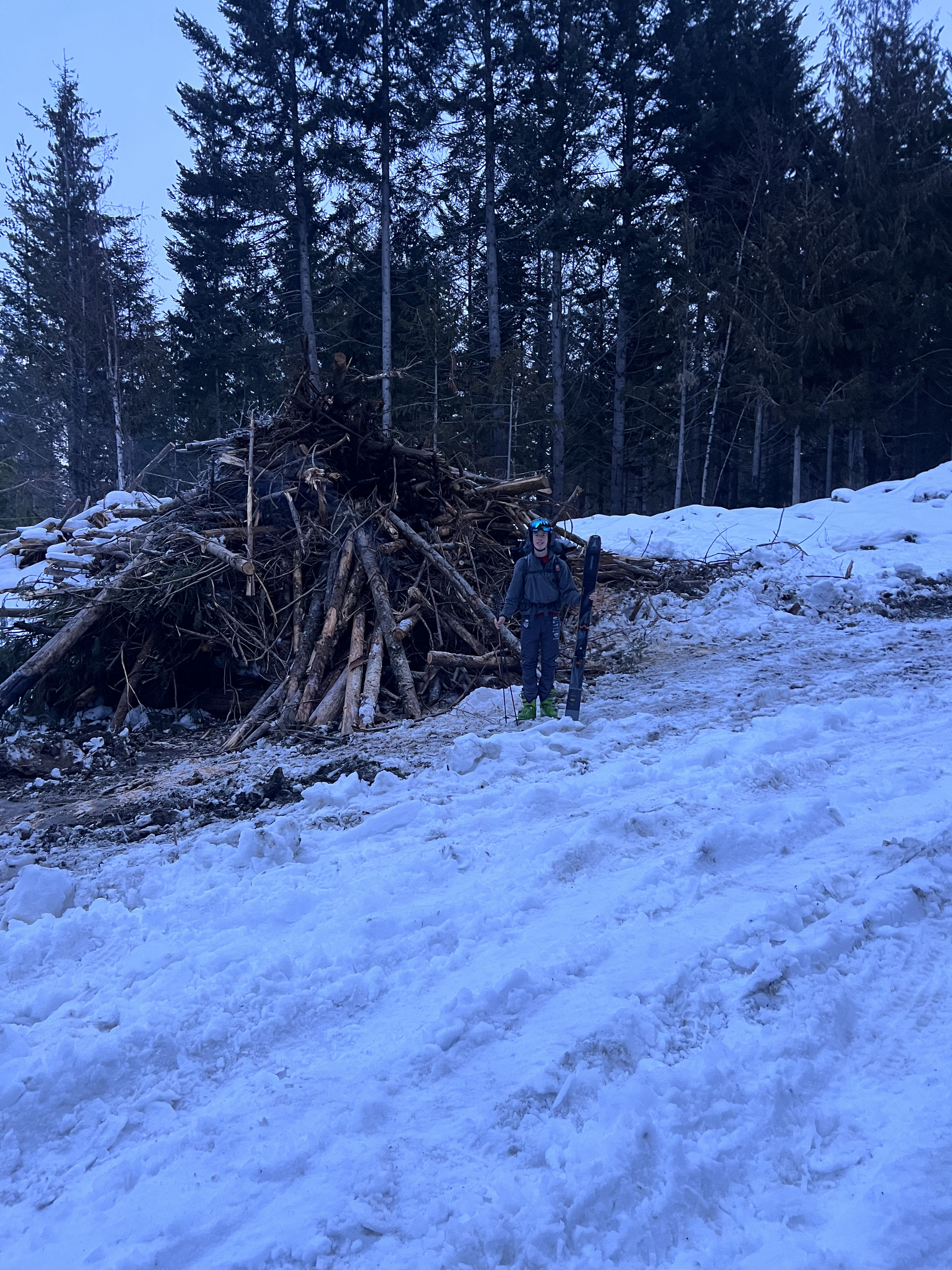
We reached the summer trailhead and realized we couldn’t skin up as expected either. Instead we had to a-frame the skis and carry them 1300m vertical and 9km up to the hut. Exhausting and uninteresting, this was certainly the worst part of the trip. At one point we stopped for snack time and I took a 10 minute power nap.
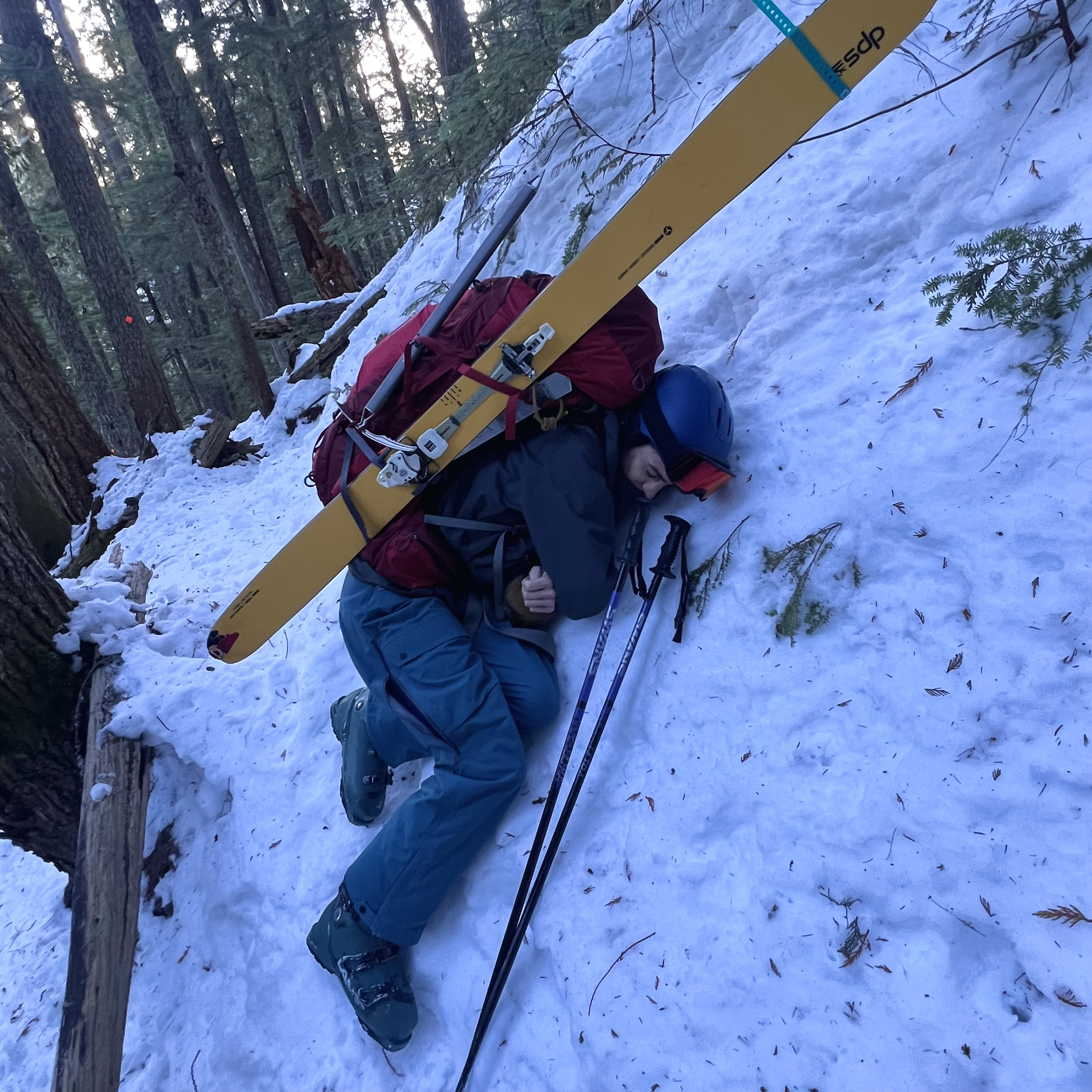
Nap time
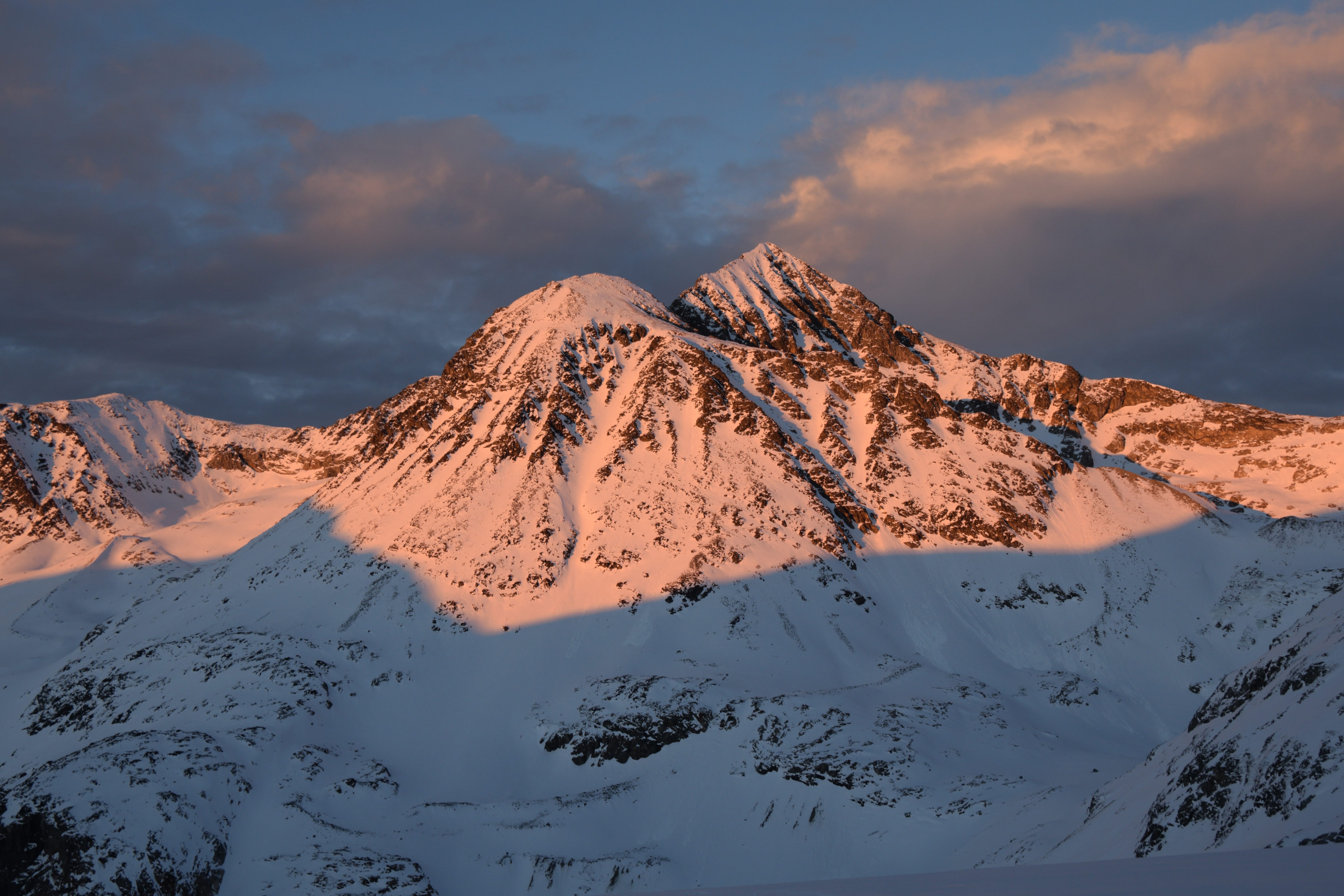
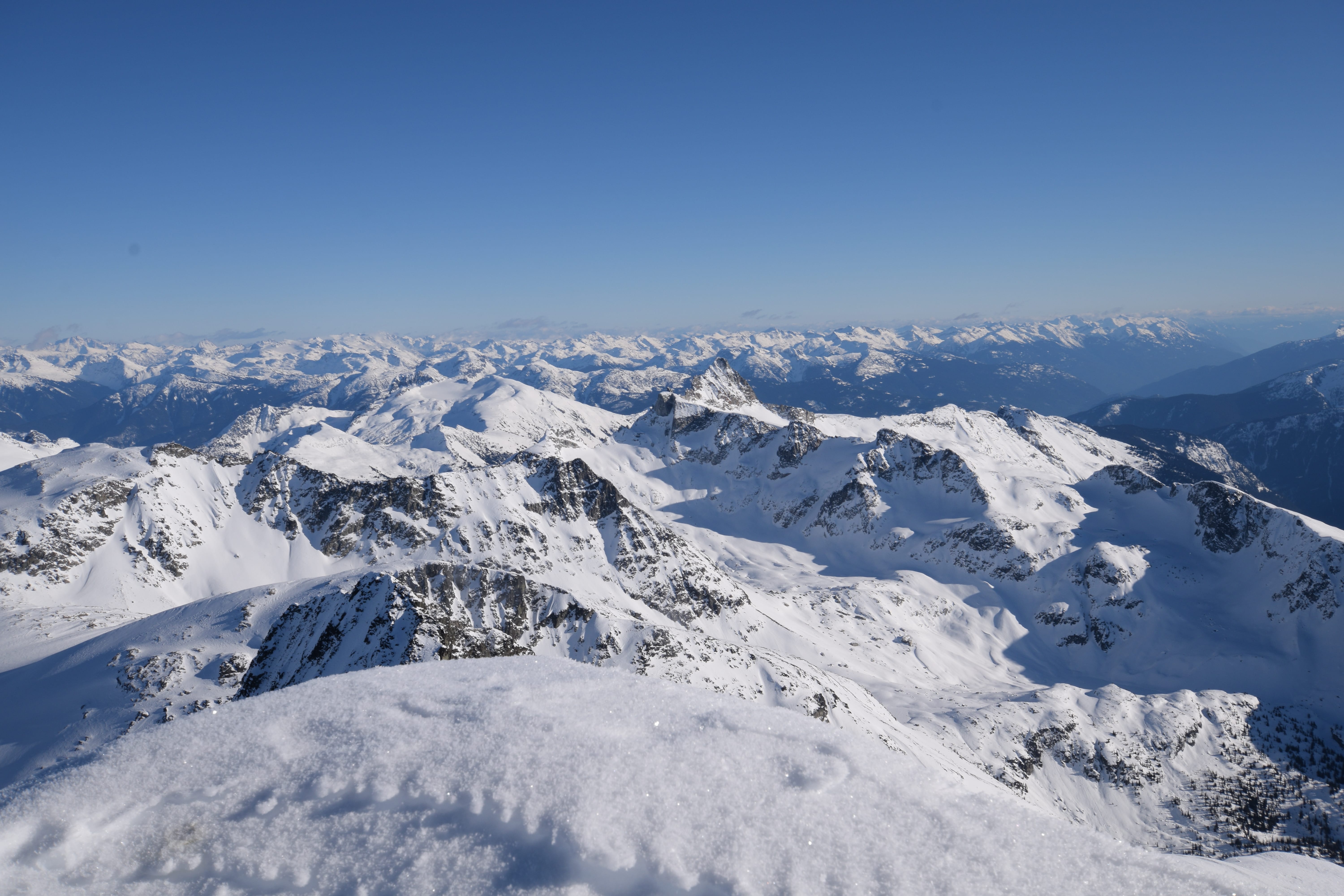
Finally arriving at Wedgemount Lake, we were welcomed with amazing views of Parkhurst, Wedge and Weart. Even better, the Wedge glacier looked pretty filled in. Moving much slower with heavy packs and needing to carry skis, we found it fairly unrealistic we would make the summit today. We continued on, passing Wedgemount Lake and the recently formed Tupper Lake, both frozen over. In just fifteen years the glacier has receded over 350m, exposing Tupper Lake, which used to be ice.
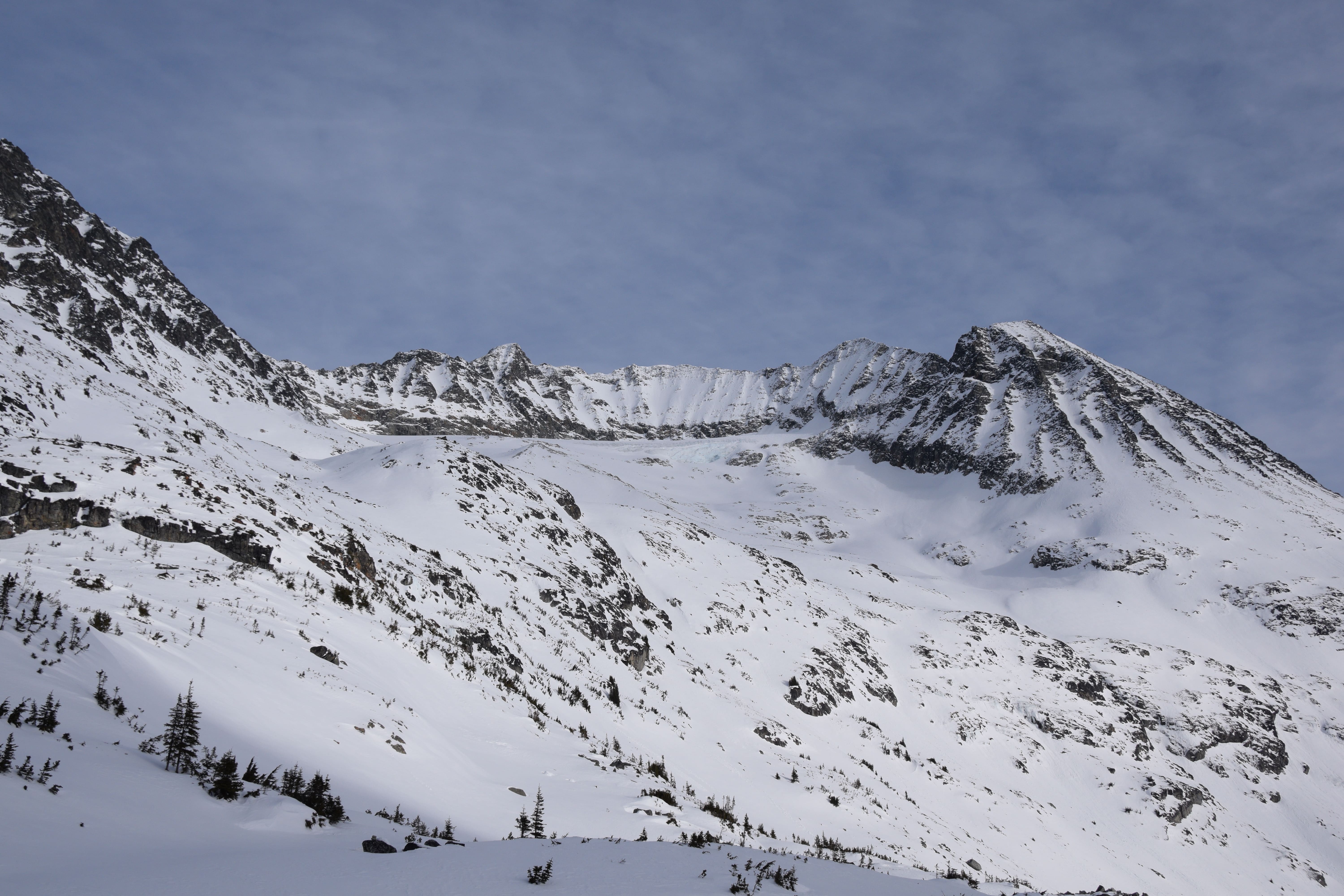
Looking at the Weart Cirque
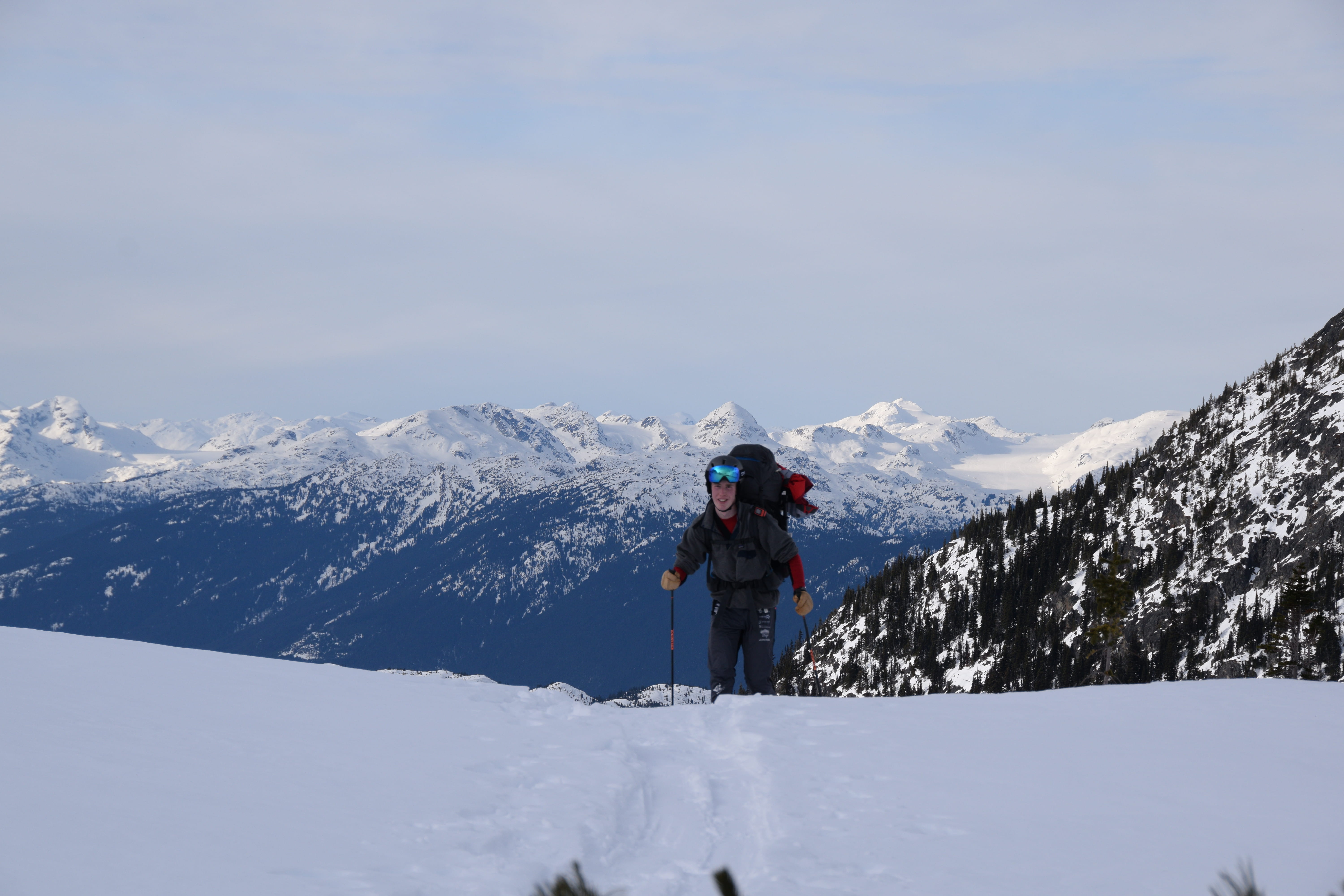
Parker coming up to the hut
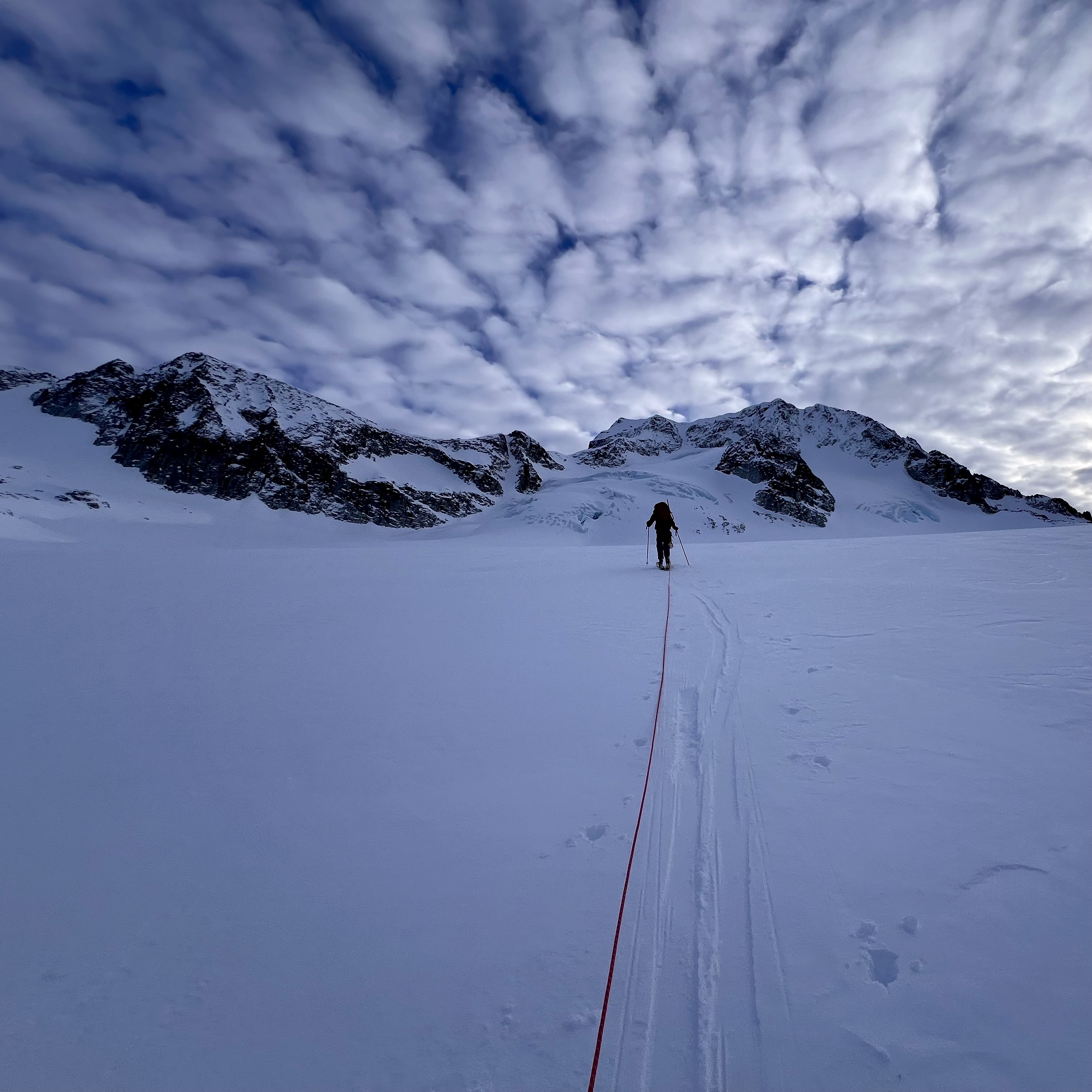
Just after Tupper, we roped up and continued on the glacier. By this point we were both feeling quite tired, especially noting sore hips and shoulders from our massive packs. We decided to stop for the day around 3pm and make camp at 2200m on the Wedge glacier. We watched the sunset and got in the tent, asleep by 5:30. It was very cold outside that night but putting on every layer I had (and using mittens as an extra pair of socks) we stayed fairly warm all night.
Sunset on Weart

Nice clouds on Parkhurst

Mitten-Socks
Waking up at 7:45 to Parker’s alarm, we both felt much better than the previous morning. Getting out of the sleeping bags into the cold was horrible and putting on the frozen ski boots was somehow worse, but we managed to get up and ran around trying to get warm. A somewhat slow morning followed and we broke camp, leaving some gear at the camp before continuing up the glacier. I saw some minor sagging of snow bridges but the glacier was almost entirely filled in. Very reassuring. We made it to the Wedge-Weart col around 10 and switched to crampons, ditching our skis.
Me leading up towards Wedge

Finally on the Arete!
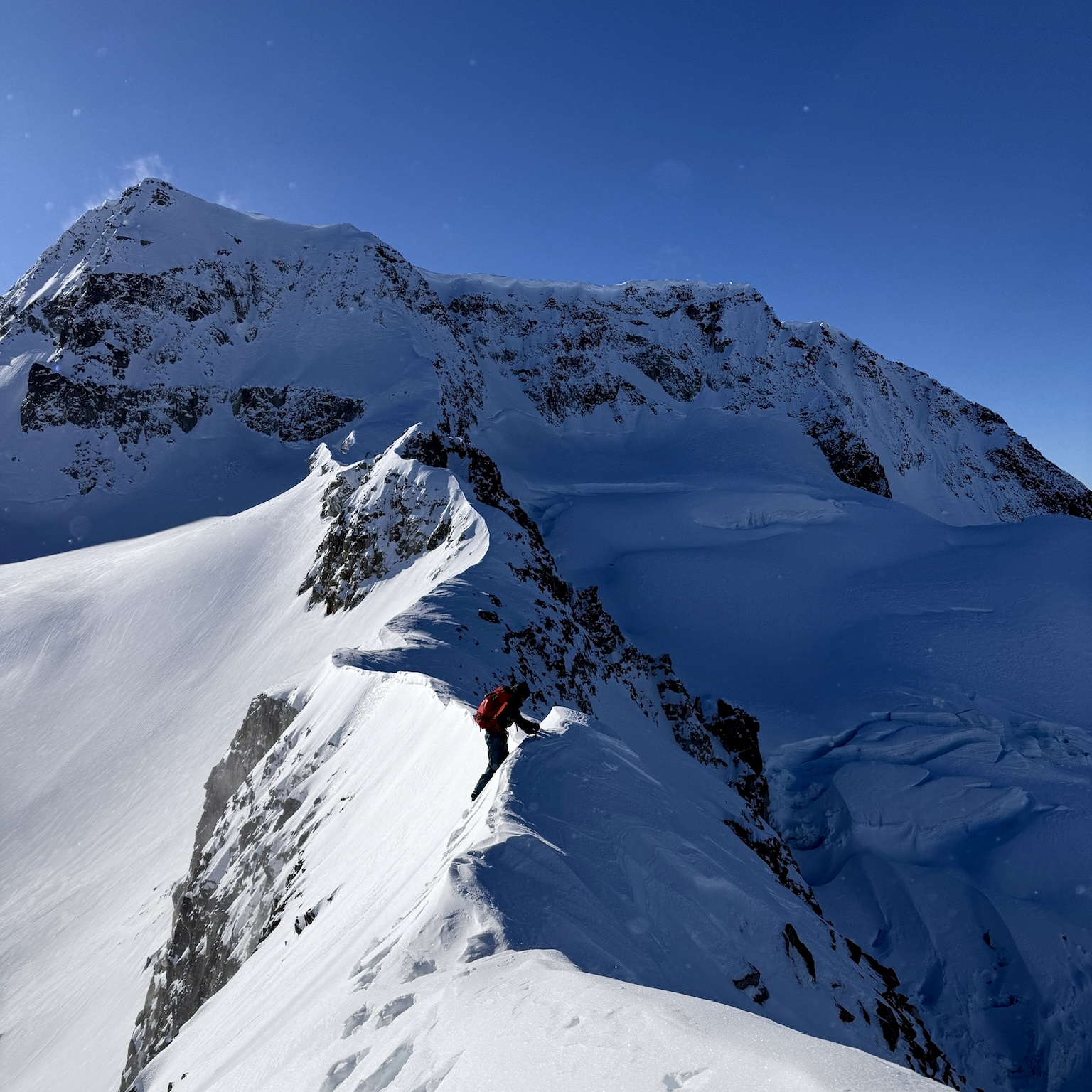
The snow was firm and supportive, a relief considering the considerable exposure on both sides of the arete. I led the first section, kicking steps as we traversed the arete. Later in the season it seems you can walk on the crest of the arete. We had no such luck this early.
Beginning the arete
Very slow progress put us about midway on the arete by noon and our hopes of making it back to the car in the light dwindled. Exhausted, underfueled and dehydrated made us slow, pushing up to the final headwall and to the summit. Leading up the headwall was steep and exposed but making the summit ridge felt amazing. We both wish we had two ice axes instead of one each. Another 30m of gentle grade led to the summit.

Almost there!
We took a lot of photos, had a snack and discussed how glad we were to not have camped here last night. Brrr. Supposedly it’s possible to ski the south face of Wedge all the way down to Wedge creek, some 1500m below us. It looks like quite an intense venture!
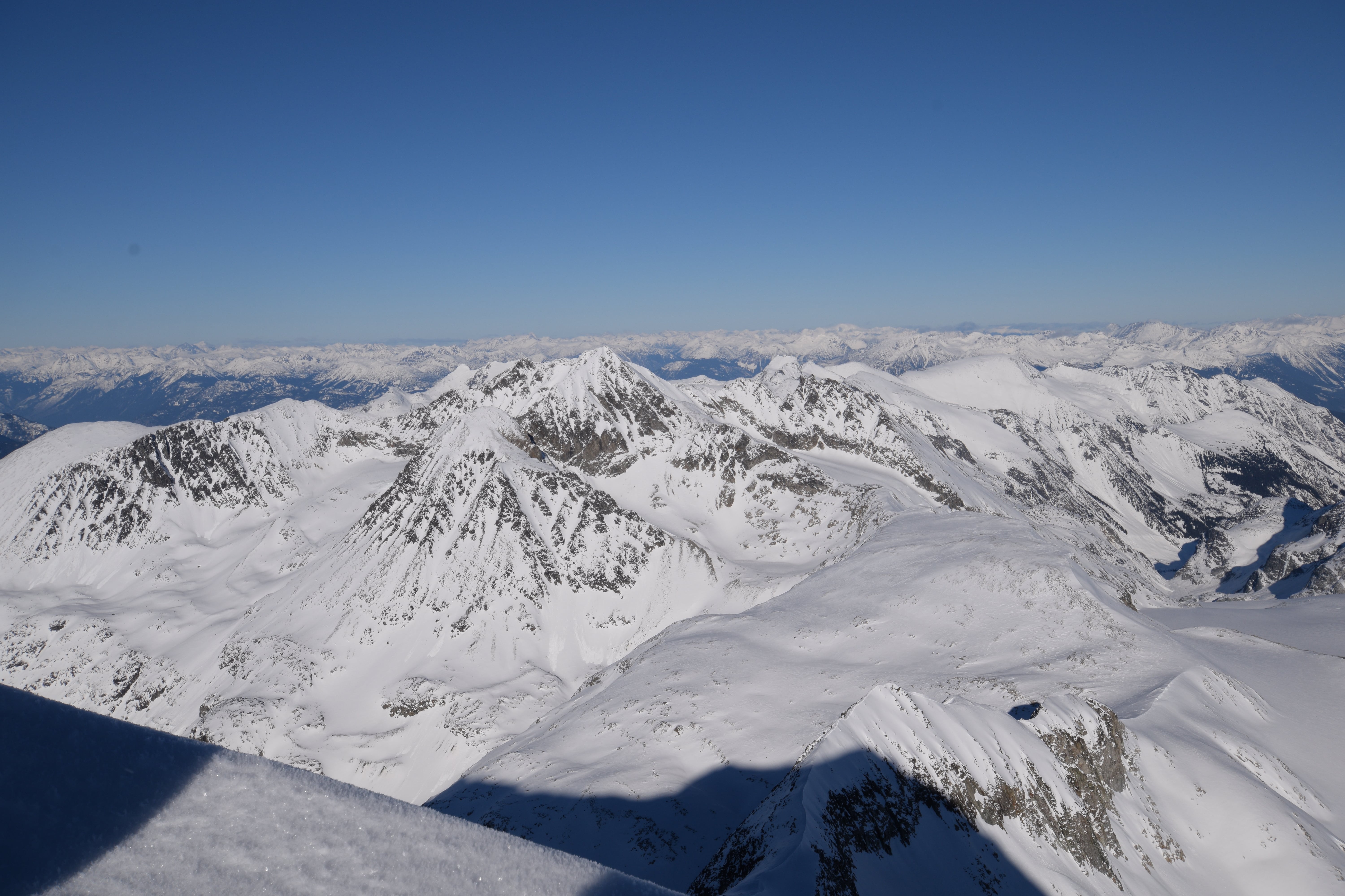
Since Wedge is the highest point in Garibaldi Provincial Park the views from the summit were incredible. White mountains in every direction. To the south, Garibaldi and Castle Towers merge into one, the entire Spearhead Range and the Sea To Sky below. In the southeast, Baker and the remote peaks of the Misty Icefields. Lesser Wedge, the McBride Range and Weart all in full view. Mt James Turner, the third highest point in Garibaldi behind Wedge and Weart is visible, a remote peak I would love to climb someday.
Looking back at Weart

The Spearhead Range
Mt James Turner and the McBride range
A cold wind roused us from the summit and a look at the time meant it was time to get going. A couple more looks at Lesser Wedge and the remote Mt James Turner and it was time to go back. Following our own tracks down the headwall was much easier than breaking trail like the way up. I followed Parker on the way back, having lead most of the way out, letting me turn my brain off a bit and trudge along back to the skis.

About to descend the steep headwall. Wouldn’t want to fall here!
We skied down the upper Wedge glacier back to our camp to discover that the crows had gotten into food Parker had left buried behind and had pecked through my partially frozen water bladder. Both dehydrated, we drank what water we could before skiing to Wedgemount Lake.
By now it was dark, just in time for the 1300m vertical of trees we needed to ski back to the car. I elected to hold my headlamp in my mouth while skiing, but Parker chose to go with the handheld light. The trees were incredibly icy after 6 days of cold and no snow and my touring skis haven’t had an edge in years. This made for classic backcountry “adventure skiing”.
We skied 2 hours in the icy trees, managing only 1 groove each from rocks we did our best to avoid. We skied down 700m to where all the ski tracks left the Wedgemount trail. Dubious, we followed the ski tracks, happy to avoid carrying our skis another 8km to the car. We discovered an access road that was unplowed.
This was clearly the way we should have come up from and would have avoided carrying our skis up. We were still very happy to have the ski out. Better than an average Whistler ski out even! It skied until 500m from the car when we carried them the last 10 minutes to the finish. We stopped in Whistler for non frozen water and did manage to miss all the ski traffic, although after 10pm there isn’t much traffic anyway.
Great story, thanks for sharing with us Liam!
I don’t think you can ever walk on top of the lower arete, it was just as sharp and exposed when I did it in June a few years ago. However, you can bypass this entire section on the glacier (half arete route) which I did last winter and is a much more direct route, I recommend this unless you want the challenge of the lower arete. The NW couloir makes for a good ski descent to avoid downclimbing and make it a linkup. The IPP road you discovered is definitely the way to go for access, and you can drive much higher than the standard trailhead in the spring. It’s good to go as long as snow bridges and there is no active work at the dam.
My partner and I had taken a look and we didn’t feel comfortable enough that we could safely navigate the broken upper glacier. It still looked quite saggy and we were happy to stick to the arete. I certainly wouldn’t want to take skis on the lower arete so we were stuck downclimbing it again. Although this part went much faster since we had already kicked in steps and didn’t need to gain so much elevation.
this is awesome and i’m glad a dead mouse didn’t ruin the trip!