Alex Barth, Thomas Morrissey, Ed Riley (author)
Trip Dates: April 13th – April 17th 2025
The portion of the Selkirk Mountains south of Rogers Pass, BC, is home to many remote peaks, vast glaciers and deep river valleys. Our plan was to leave the highway at Rogers Pass, head south until we reached the east end of the Purity Range at Mt Wheeler, traverse the Purity Range and finally exit via the Incomappleux River valley and back to the highway. The route was Alex Barth’s brainchild, and he had budgeted for 5 days to complete the traverse (with time for a side trip or two).
After several weeks of weather watching and planning, Thomas Morrissey and I left Vancouver on April 12th and made the long drive to Revelstoke to meet Alex, who has been living in Revelstoke for the winter. We spent Saturday evening packing our bags, repacking our bags and eating pizza. All that was left was to get some sleep before heading up to the Pass early the following morning.
Day 1
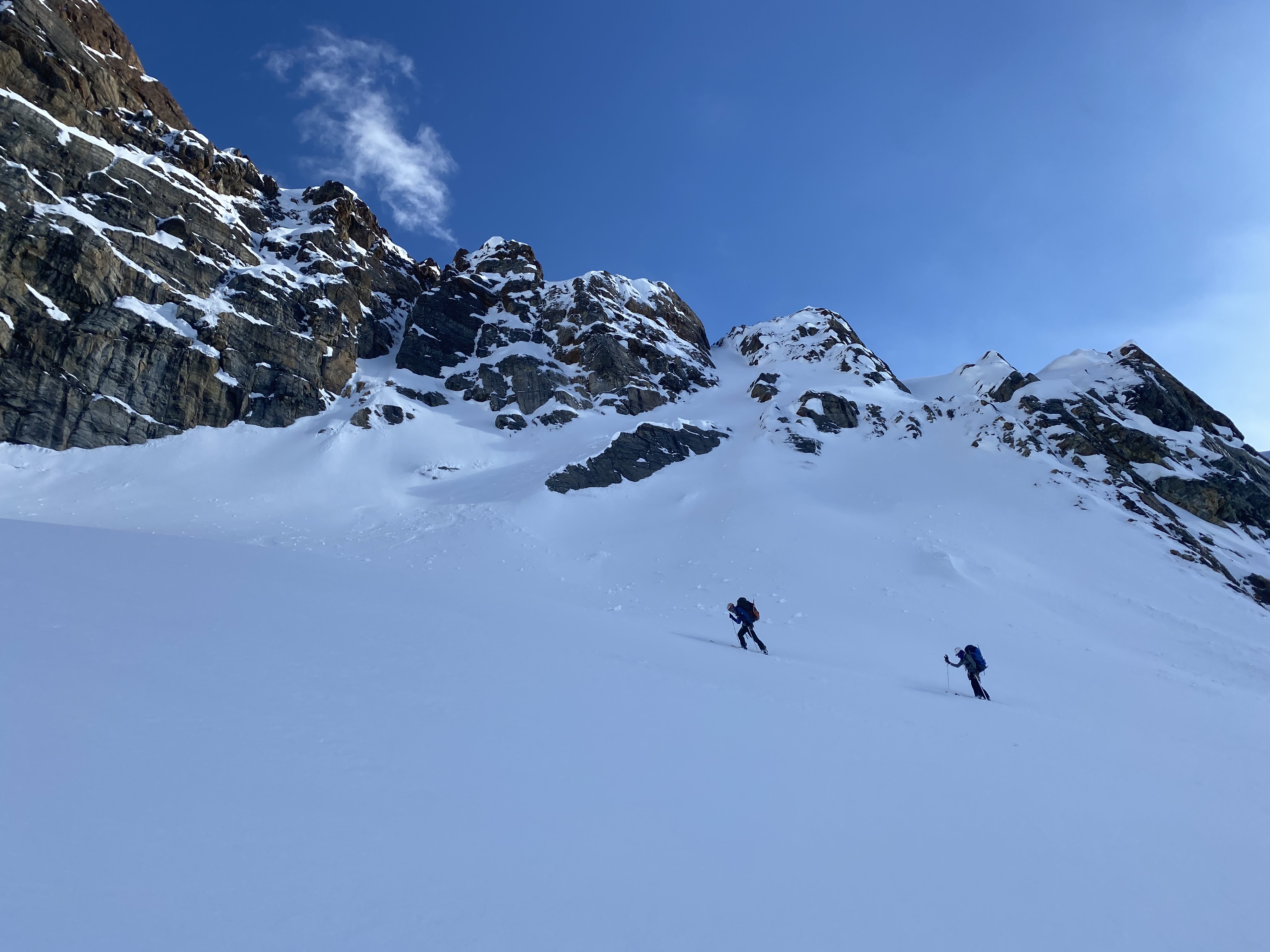
Packs fully laden, we departed the Illecillewaet parking lot and almost immediately reached the far steeper-than-necessary skin track leading to the toe of the Illecillewaet Glacier. Most groups we passed here were going to tour the ultra-classic Young’s Traverse and we stood out with our 60L packs. Progress was smooth over the long and relatively flat Illecillewaet Névé and soon we made it to the junction of the Névé and the Geikie Glacier. It was here that we were treated to our first views of the Dawson Range and the upcoming Deville Névé. Taking a breather, we contemplated the size of the terrain we were about to enter and spend the next 3.5 days in. Two peaks stood out for me in particular: Mt Fox and Mt Donkin. Fox for the sheer size of its dark and brooding N face which would guard our ski run into Glacier Circle, and Donkin for the grandeur of its Alaskan-esque NE face.

The view from the southern end of the Illecillewaet Névé towards the Dawson Range. Mt Fox is the peak centre-left with a large fissure running diagonally across it. Mt Donkin is in the background centre-right.
The first potential crux of the trip was presented by the Deville headwall. People have ascended the headwall in a variety of ways from a simple snow climb to a M4 mixed climb. All have considerable overhead avalanche hazard. Before leaving for the trip, Alex had posted on a Facebook group asking for headwall related beta and the man himself, Greg Hill, had assured Alex that it was going to be an easy snow bootpack. And indeed it was. Late in the day, we ascended a short chimney on the east end of the headwall and made it onto the Deville Névé with little trouble.

Skinning towards the Deville Headwall. We ascended a short snow gully on the left end of this picture. PC: Alex Barth
We ascended the obvious gully directly above Alex (Alex is the one leading the way in this photo)
We skinned a little further, to the junction of the Bishops and Deville Glacier, and set up camp in a prime location for our first side trip objective – Hasler Peak on Mt Dawson.
Day 2
Hasler Peak is the tallest summit in the Mt Dawson massif. From our camp we skinned up the low-angle Bishops glacier which led us quickly to the base of Dawson’s S face. From here, the grade steepened significantly and after a short sequence of kick turns, we transitioned to bootpacking to continue the ascent. Alex and I were mysteriously low on energy during the bootpack so we were thankful for Thomas who kicked steps all the way up. Around 100m short of the summit, the exposure increased dramatically as the fall line terminates in a series of massive cliffs. Alex and I decided to turn around at this point and transition to ski while Thomas nabbed the summit.

On the S face of Mt Dawson… not a bad spot for a bootpack! Eastern edge of the Bishops Range in foreground right. Deville Névé midground centre, Bugaboos background centre-right. PC: Alex
The ski down the S face was in decent condition for the large part and we made it down without incident.
While waiting for Thomas to summit, one of my hands got pretty cold. Halfway down the descent I developed the hot aches in the same hand. Wanting to give my hand some relief from the cold, damp glove, I pulled my hand out (to put it under my armpit) and was momentarily horrified to see my whole hand had turned a deep purple/black colour. How the hell is it possible to develop full hand frostbite from a mere 20 minutes of having cold hands? My hand was back to being pain-free quickly, though, and I concluded my wet glove’s dye had somehow seeped into my hand, despite having worn these gloves many times this winter while wet and never having this same issue.
Once back at camp, we took a break to eat and melt snow. Alex was clearly quite thirsty after our Dawson climb…!
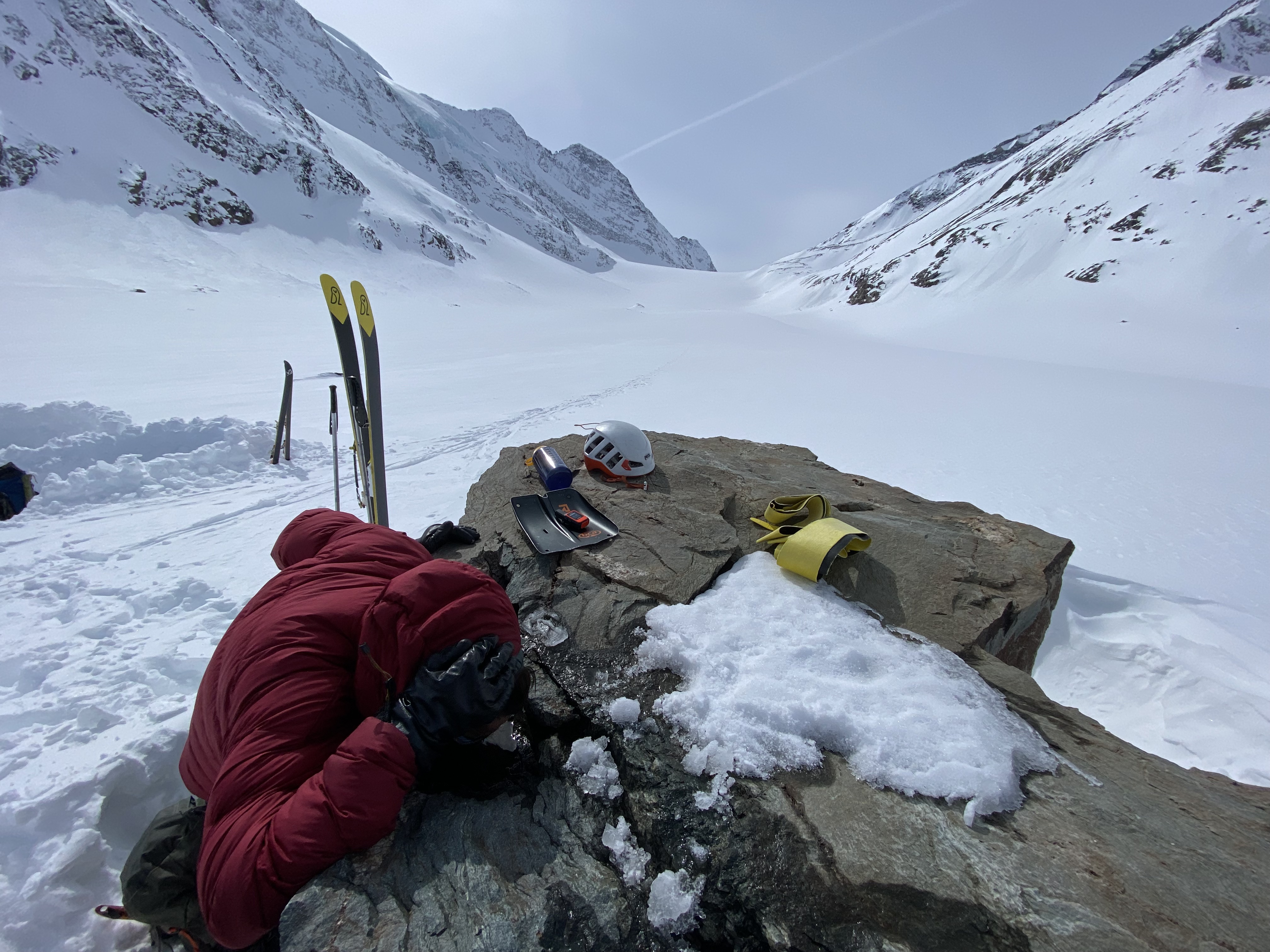
Alex sucking water from a rock.
With the tents packed up, we started skinning again and moved our camp to Black Pass at the base of Mt Wheeler.
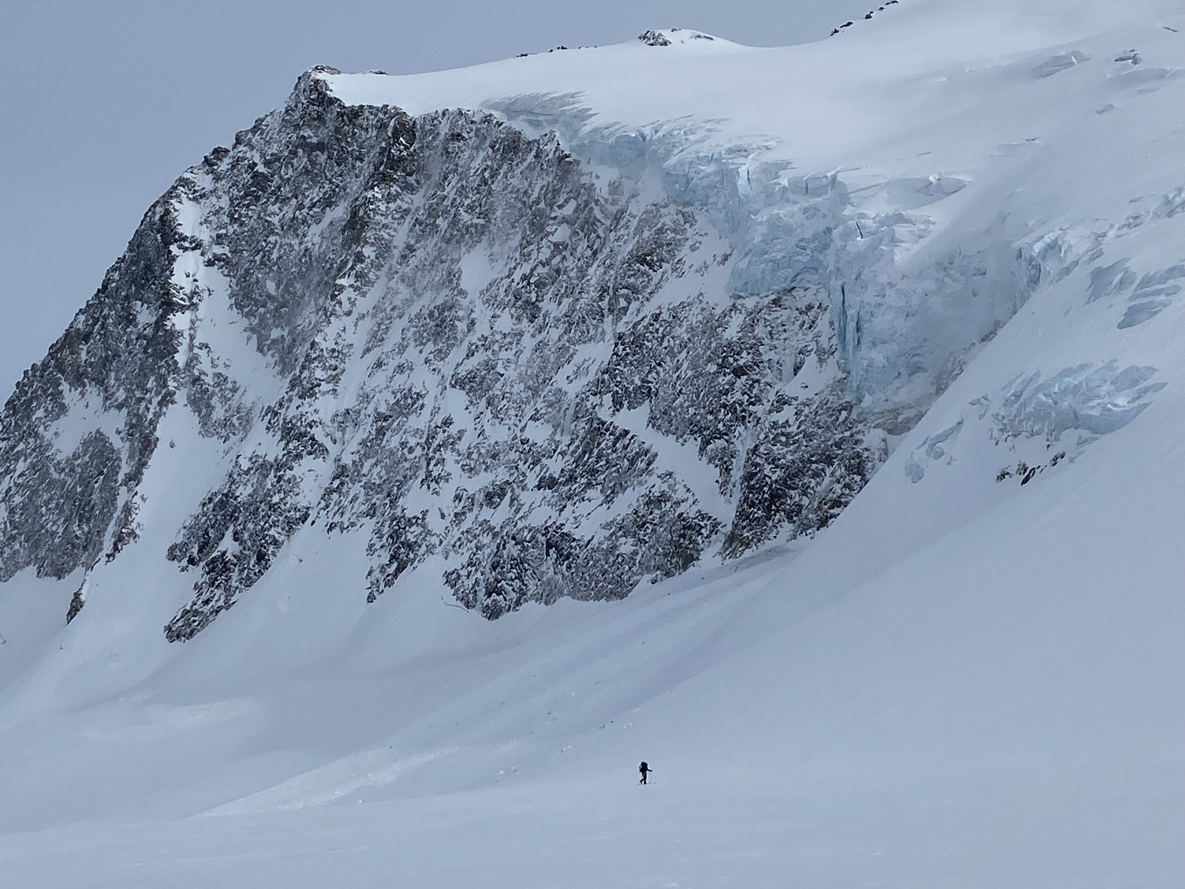
Thomas putting the size of Mt Wheeler’s hanging glacier into perspective.
Day 3
Prior to the trip, Tuesday and Wednesday were the days with the greatest uncertainty over the weather forecast with Tuesday’s visibility being potentially poor and Wednesday with potential precipitation.
Sure enough, when we awoke on Tuesday, clouds shrouded the summit of Wheeler. Pivoting our objective, we decided that the neighbouring Mt Kilpatrick (summit cloud free) could offer a worthwhile side trip and good ski descent. Kilpatrick was not without its own problems though, as its NE face (the one we wanted to ski) was on the leeward side of the mountain hence presenting us with potential windslab problems. Much to our disappointment, we weren’t satisfied with the results of our pit tests on either Kilpatrick’s NE face or the NW aspect on Wheeler so we didn’t manage to ski either peak. To rub salt in the wound, the majority of the aspects we had planned to ski in the Purity Range were also N facing and so the decision was made to pull the plug on the high traverse and drop down into Black Creek. Given the decent visibility, the descent of the Black Glacier was relatively simple, but could prove challenging in bad visibility due to a myriad of crevasses and blind rolls. Once in Black Creek, travel remained relatively straightforward if you’re the type of person who enjoys fording creeks, skiing avalanche debris and rappelling off trees when you get bluffed out.
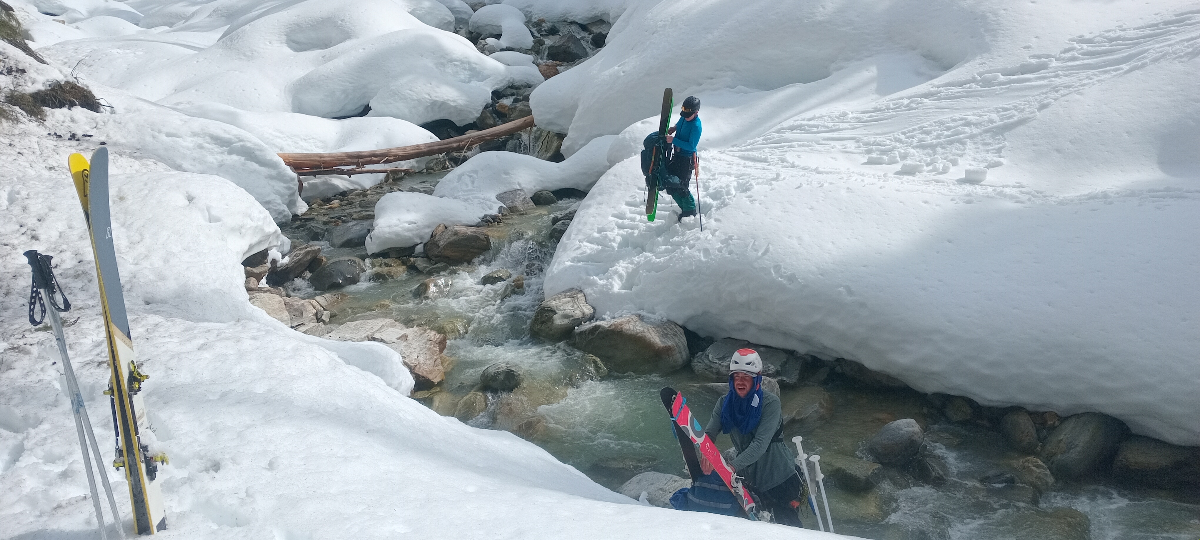
The first of three fords on day 3. This was the narrowest creek we had to ford. PC: Alex
Due to our retreat off the Purity Range, we now had a day in hand and wanted to find a satisfactory way to still fill our 5 days. Mt Bonney seemed like a reasonable objective to focus our efforts on. Instead of exiting via Lily Col or the Geikie, we would turn west when we reached the Incomappleux and attempt to ascend a basin under Stegosaurus.
When we reached the bottom of Van Horne Brook at the Incomappleux, we turned west along the Incomappleux for a short distance and set up camp next to the river. Our route from the east side of Van Horne Brook to the north side of the Incomappleux required two more fords. There were many fordable stretches of the brook and river around the confluence so the crossing of these should not be a major issue should one choose to travel through this specific area. Having running water at camp felt like a luxury.
Day 4
The day started by travelling through some beautiful old growth cedar trees on the east side of the creek.

Big trees! PC: Alex
As we crossed the creek onto the west side, snow began to fall for a short period, in line with what the forecast had been predicting. Along the creek there was a short passage of arduous travel, made worse for the fact that neither Thomas nor I had ski crampons with us. These difficulties were soon over though, and we reached the bottom of the drainage under Stegosaurus.
The ascent up to the shoulder of Mt Oliver had sustained steep and tight skinning, where oftentimes bootpacking may have been easier if it were not for the faff involved with transitioning. The snow had stopped by this point too, and at points the sun was on blast mode which made the already difficult skinning feel pretty arduous. Once out of the trees, Thomas and I donned crampons in order to traverse the icy sidehill underneath Mt Oliver.

Alex and Thomas with the Purity Range in the background.
Lethargic from the morning’s climbing we still had to ascend the final climb of the day up to the Bonney Névé. Thomas, reliable as ever, broke trail through the softening snow, making powerful* kick turns all the way to our camp on the glacier below Parsons Peak.
(* turns out ‘powerful’ is Alex’s favourite word.
“Guys, this climb is going to be powerful”
“That bootpack was powerful”
“Digging this tent pit will be powerful”
etc etc ![]()
)
The final night’s camp, at circa 2600m, was the coldest of the trip.

Sunset from our final night’s camp.
Day 5
Not wanting to hang around in the cold, we performed our quickest morning routine of the trip and started skinning up to Mt Bonney. Coming out of the shade was a welcome relief. Second time lucky (we stood on top of the section of ridge we thought was the highest but upon ‘summiting’ we realised the neighbouring piece of ridge was clearly higher) we summited Mt Bonney and skied some of the best turns of the trip down to the Clarke Glacier. With the sun and heat turned to max, we made the penultimate climb of the trip up to Mt Swanzy before descending onto the Swanzy Glacier before climbing up to Sapphire Col.
The views out to the Dawson Range from Swanzy were spectacular and put the severity of the Comstock Couloir into perspective. The thing just looks completely vertical and is peppered with rocks all the way down.
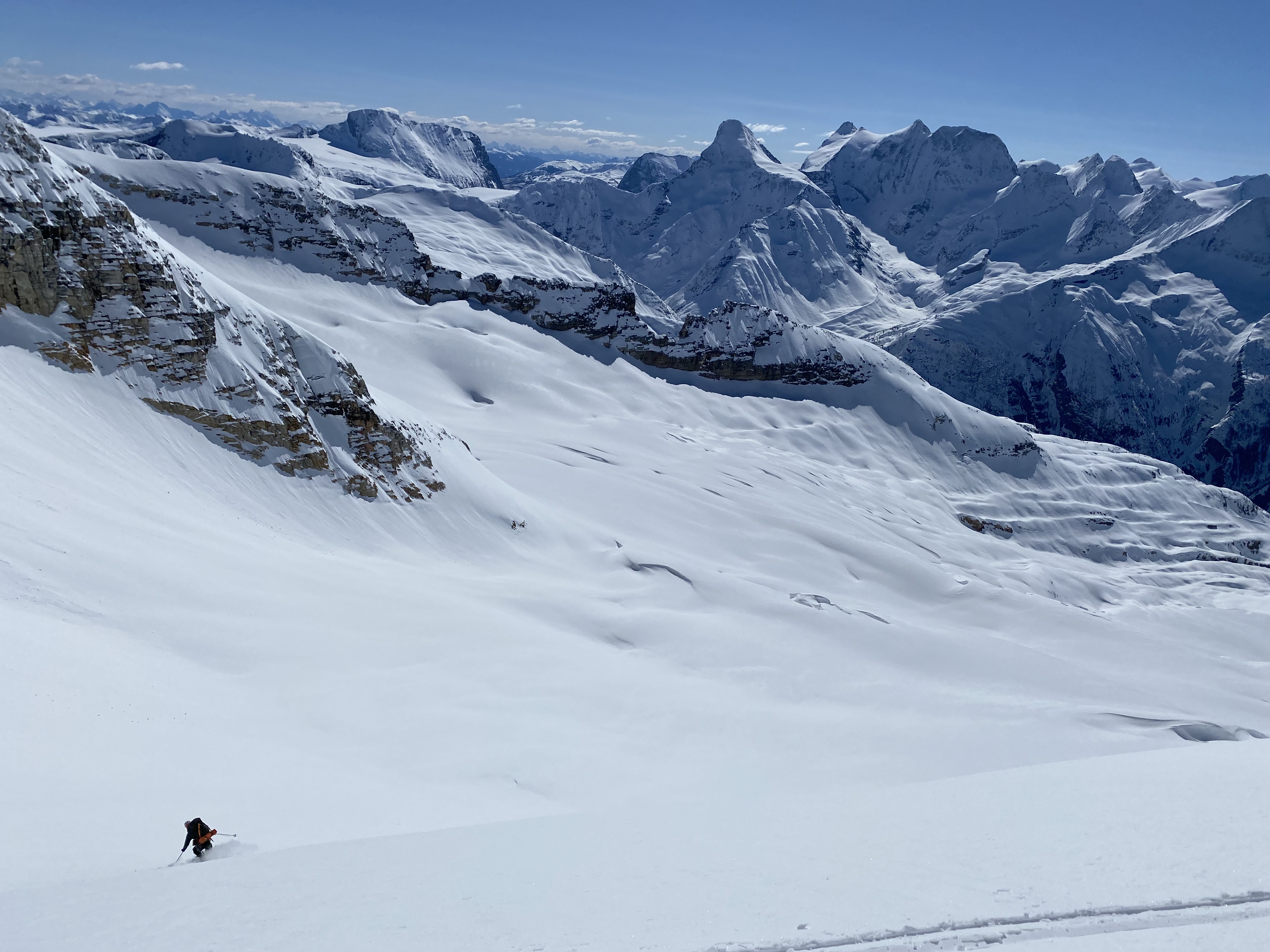
Alex making turns down to the Clarke Glacier off Mt Bonney. Mt Dawson (and the Comstock) are in the background.
Once we reached the matchbox-style bivouac at Sapphire Col I was pretty spent from the intense sun, but Thomas was still keen for a quick ascent of the adjacent Mt Jupiter. Alex and I enjoyed an hour and a half of snow-melting and relaxing while Thomas lengthened his all-important Peakbagger ticklist. When Thomas was back at Sapphire Col, we transitioned for one last time and skied back down to the car. Powder at the top turned into breakable crust lower down (breakable crust is really shit with a massive pack on), and luge track skiing down to the parking lot.
Back down in Revelstoke, Alex’s girlfriend, Maiya Callister (also a VOCer), cooked us a delicious lentil-based meal; just what was needed after 5 days of camping food!
Post-Trip
Thomas and I drove back to Vancouver after a night in Revelstoke, stopping to stretch the legs in Kamloops with a quick ascent of Mt Peter and Mt Paul.
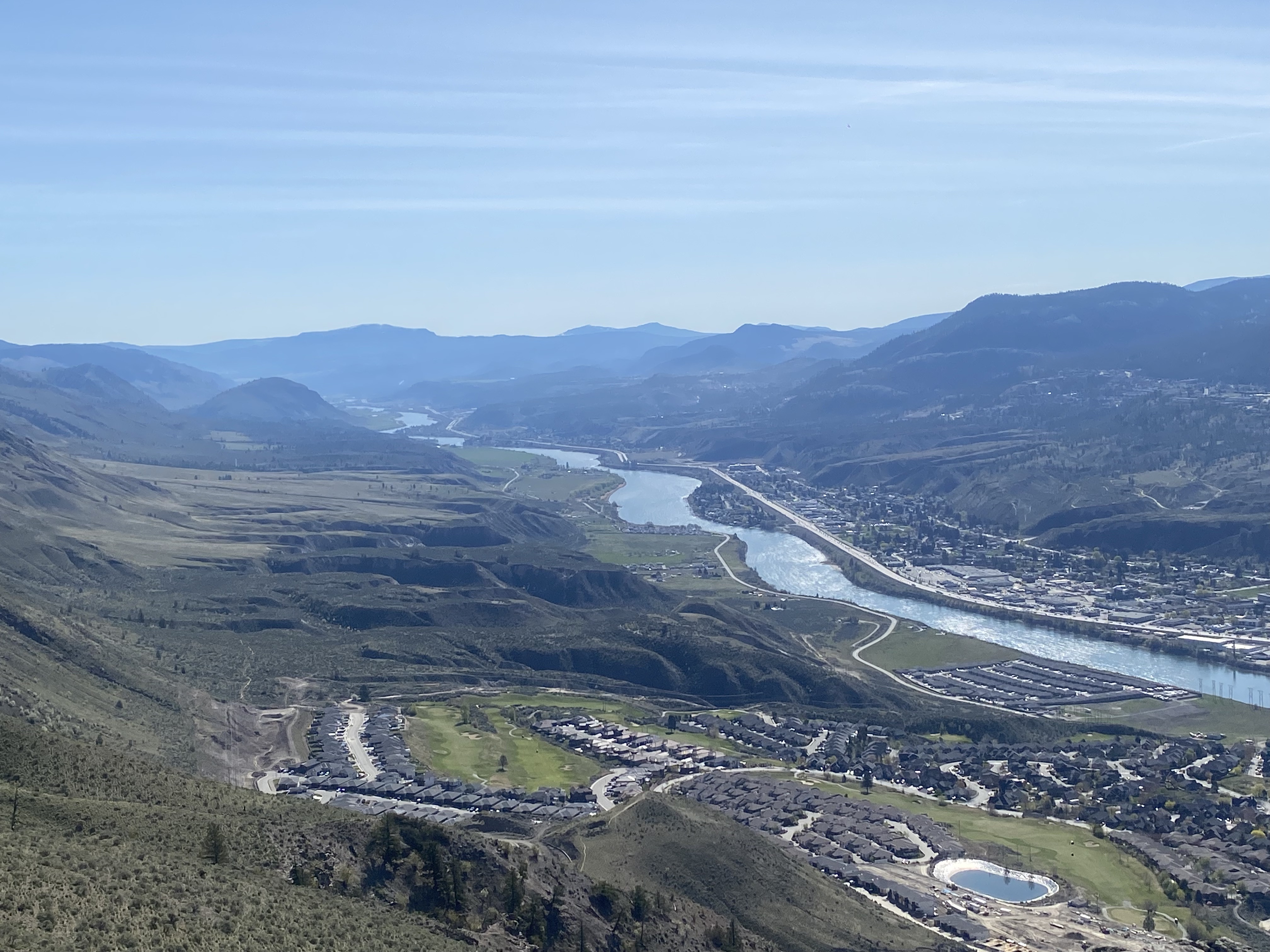
Views over Kamloops
Overall, the trip went very smoothly, and although we didn’t manage to traverse the Purity Range, we still managed a full 5-day traverse in good style and bagged a few peaks along the way. It didn’t feel like a failure in the slightest; especially when the initial objective was one as ambitious as the Puritys; and we managed to adapt our plans to include some other worthwhile summits on the way out.
I for one, was very grateful to be able to ski away from the coast at least once during my time in Vancouver. The terrain around Rogers Pass is incredible.
Additionally, I am now a devoted user of Leukotape; I applied it to my usual hotspots at the beginning of the trip, didn’t reapply once, and by the end I didn’t have a single bit of raw skin!
—
GPX traces These tracks are not particularly accurate or reliable, especially in forested areas, but give a good general picture of our route.
Day 1 GPX track (small glitch around Glacier Circle cabin):
Day 2 GPX track:
Day 3 GPX track:
Day 4 GPX track:
Day 5 GPX track (tracker ran out of charge at Sapphire Col. We exited down the well established route down the Asulkan Glacier):
Powerful words!
Wow, nice pictures!