Participants: Just Devlin and me, again.
Our plan was to fly into Chilko Lake, which extends into the Coast Mountains from Interior BC, and hack our way up into the alpine and then go from glacier to glacier until we got to the Homathko Icefield, cross to Mt. Bute, thrash down to the Southgate River, walk the logging road to Bute Inlet and take a water taxi back to civilization. The first day was going to be a float plane from Campbell River to Chilko Lake, leaving at 8:00, so that we’d have enough time to bushwhack up to the alpine (about 1,000 m gain over 4 km). We’d thought we could hack our way from valley to valley over small glaciers during days 2 to 5, move across the Homathko Icefield on days 6 and 7, and then spend day 8 flailing through the brush to the ocean.
Our planned route wasn’t a standard one; everything in John Baldwin’s guidebook looked fine for earlier in the spring but would have been a murderous bushwhack with the snow melted at lower elevations. I’d spent a lot of time looking at the topos and measuring angles to get a route that minimized the bush without having the go over anything with an average slope steeper than 35 degrees.
We ditched our car at my parents’ place on Quadra Island, took the 7:05 ferry over to Campbell River and got ourselves over to Corilair, the floatplane company we’d be using. Corilair is cool. They’re are the end of a spit at the mouth of the Campbell River (the river itself, not the town named after the river) and it’s a small enough operation that everyone knows everyone. There was a large puppy in the office and swallows living in the bay. We met our pilot, Bryce, and got the news that clouds were low and we’d need to wait for them to lift before we could take off. We casually loaded our gear onto the scale so he could make sure that we weren’t going to overload the plane, and it came in at 121 lbs.
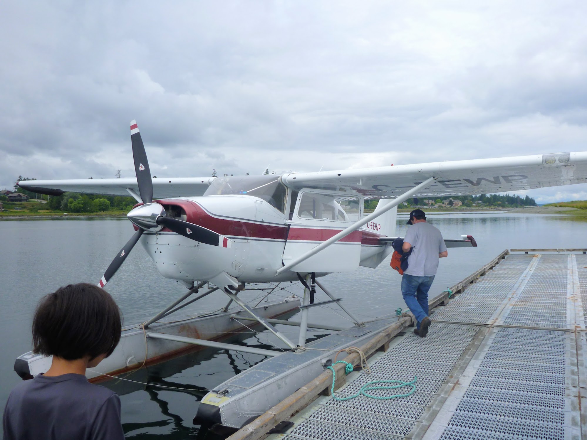
Bryce starting to get the plane ready.
Devlin and I spent the next four hours alternating between lying on the very comfy couches at the Corilair waiting room, looking at the float planes and wandering around the spit. Corilair has two Cessnas and two Beavers, which were initially all available to look at, but they disappeared one by one as they went to less cloudy destinations than ours.
At noon we got cleared to take off. The clouds were still low, so Bryce wasn’t able to fly the most direct route south of the icefield. We ended up going a long way north and almost circling the icefield and then flying back south along Chilko Lake to the drop-off point. There was fresh snow visible on the higher peaks on either side of us. It was occasionally spitting rain, and most of the time the clouds were a lot lower than the mountaintops. There’s no fancy navigation computer on the Cessna, so Bryce had a topo open on his lap and was constantly looking at it during the flight.

Why are you taking a picture, Dad?
For the first third of the flight there was this fly hanging onto the brace between the wing and the body of the plane. It was quite close to my window, and I watched it as its body and wings flapped around in the turbulence. If it had understood that it could have just let go, dropped back down to earth and everything would be back to normal again, then it would have been way smarter than a fly.

Flying above tidal rapids. The fly is still hanging onto the back of the brace, about three quarters of the way up.
We touched down at Chilko Lake and got to a quasi-beach-like place. There was a deciduous fiasco above the water, making it not ideal for us, and there were pontoon-denting rocks all over, making it not ideal for Bryce, but it was more or less the best compromise position we could find. Bryce used a wooden paddle to bunt onto shore. We unloaded the plane and Bryce took off, which was a weird feeling; we were really on our own in a much realer way than we ever had been before.

Bryce pushes off from shore.
Bryce’s picture of us.

The float plane leaves and we’re all alone.
We made a little attempt to get into the deciduous mess, but it was too thick for a big pack with two pairs of skis on it, so I just walked through the water along the shore until I got somewhere with well-mannered pines. Devlin kept his feet dry slithering through the underbrush.
It was past 3:00 by the time we got moving uphill. There had clearly been a fire a decade ago, and the areas that had been burnt now had lots of deadfall at odd angles and tons of closely spaced trees with branches all the way to the ground. We couldn’t see very far through the trees, so staying out of the burnt areas was a lot like doing a maze without being able to see, but we got reasonably lucky with our route choice. Although we’d only gone about 700 m before night fell, we we’d climbed enough that the trees were thinning.

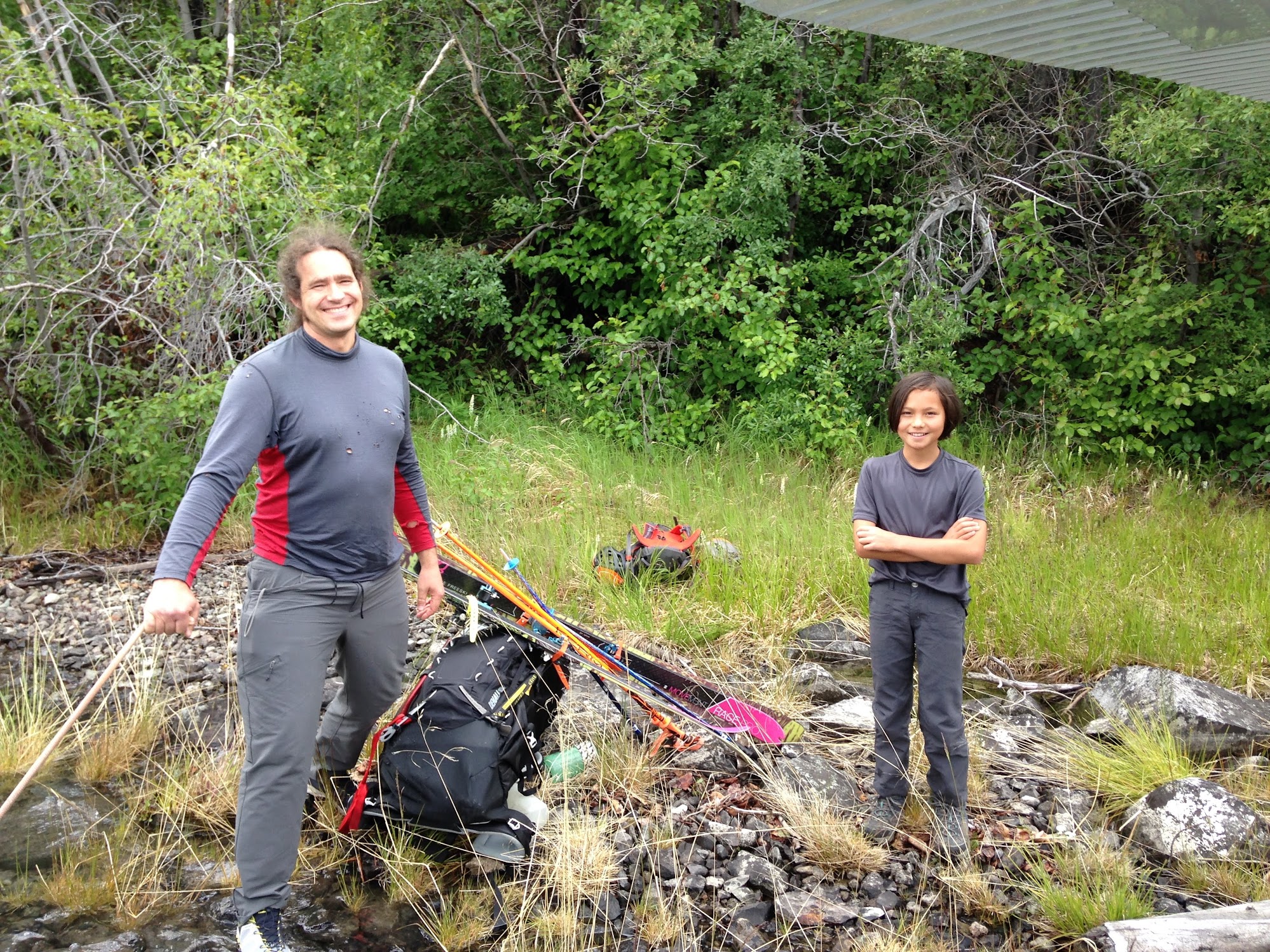
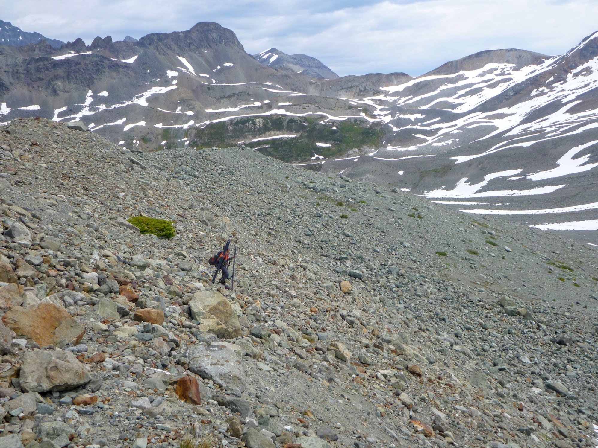
No one seems to make a big enough pack anymore.
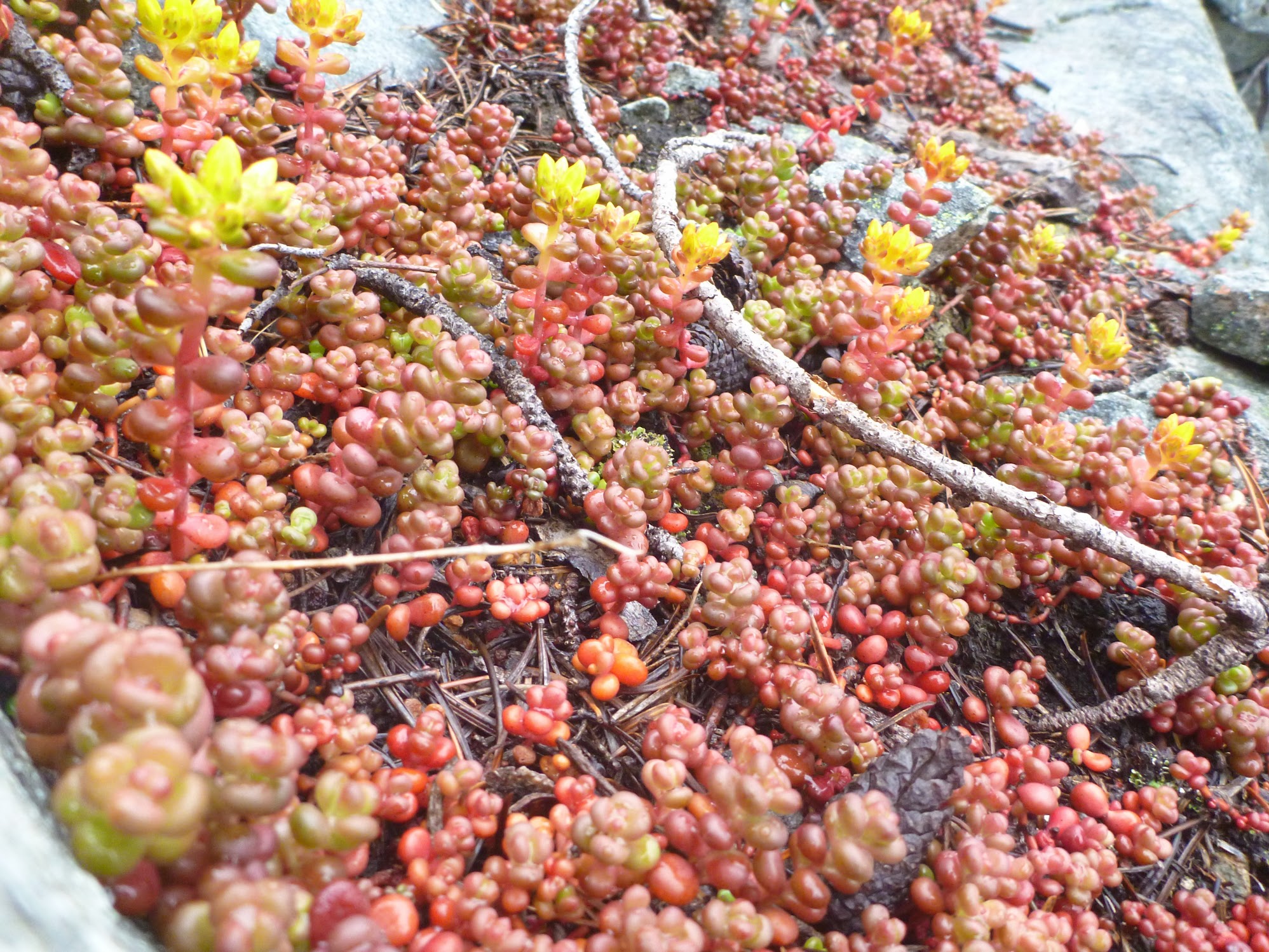
These little plants looked like spilled Nerds candy.
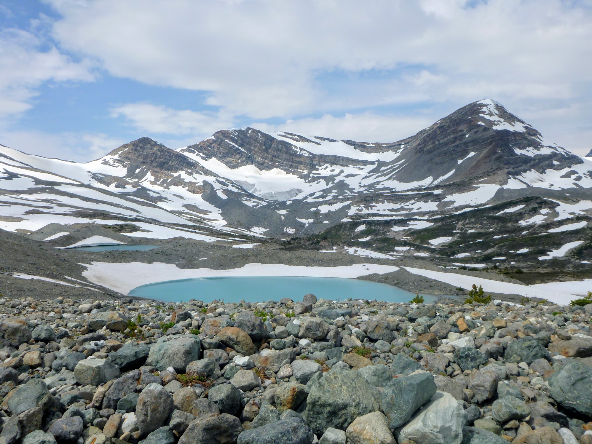
The next day we were able to ascend much more quickly and were at the col beside Farm Mountain by lunch time. There’s a Silo Tower on Farm Mountain, and not far off a Tickletoeteaser Tower, so I applaud whoever named the area. We dug out the ski boots, stashed the hikers, and skied down the other side of the ridge. The topo shows a series of blue sections, labelled “icefields,” along the ridge, with short passes in between them. The “icefields” are definitely glaciers. They’re clearly moving, as they have crevasses and the water coming out is filled with glacier flour.

The promenent peak slightly right of centre is Dartmouth, and Hamilton Glacier is immediately left of Dartmouth.
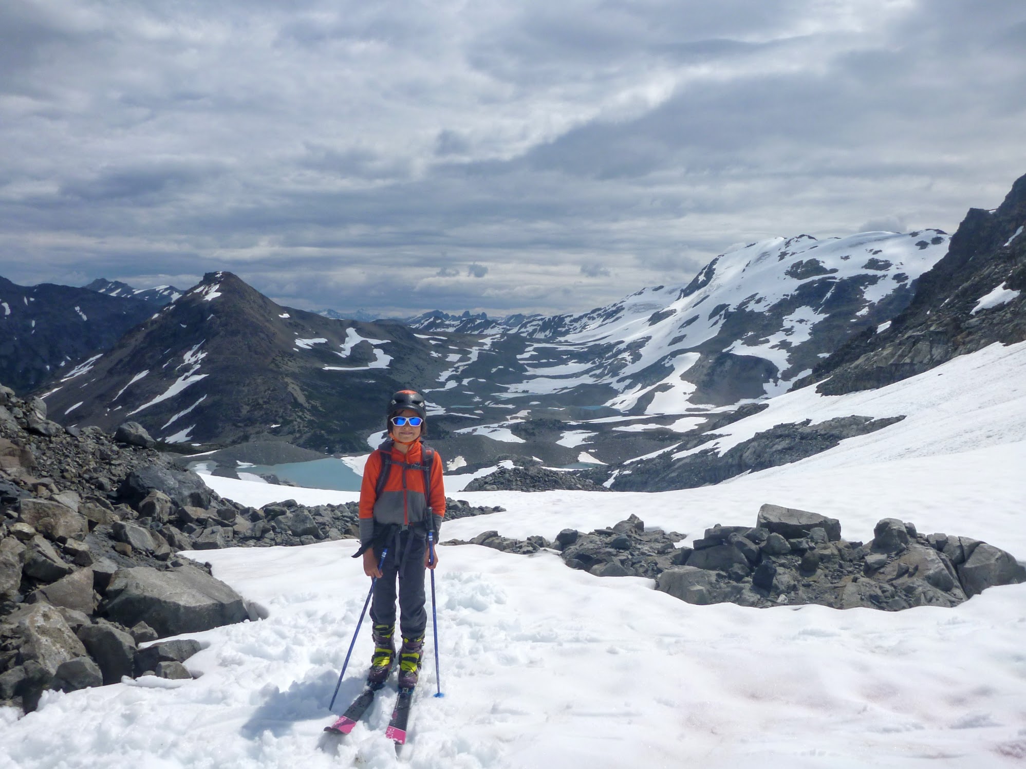
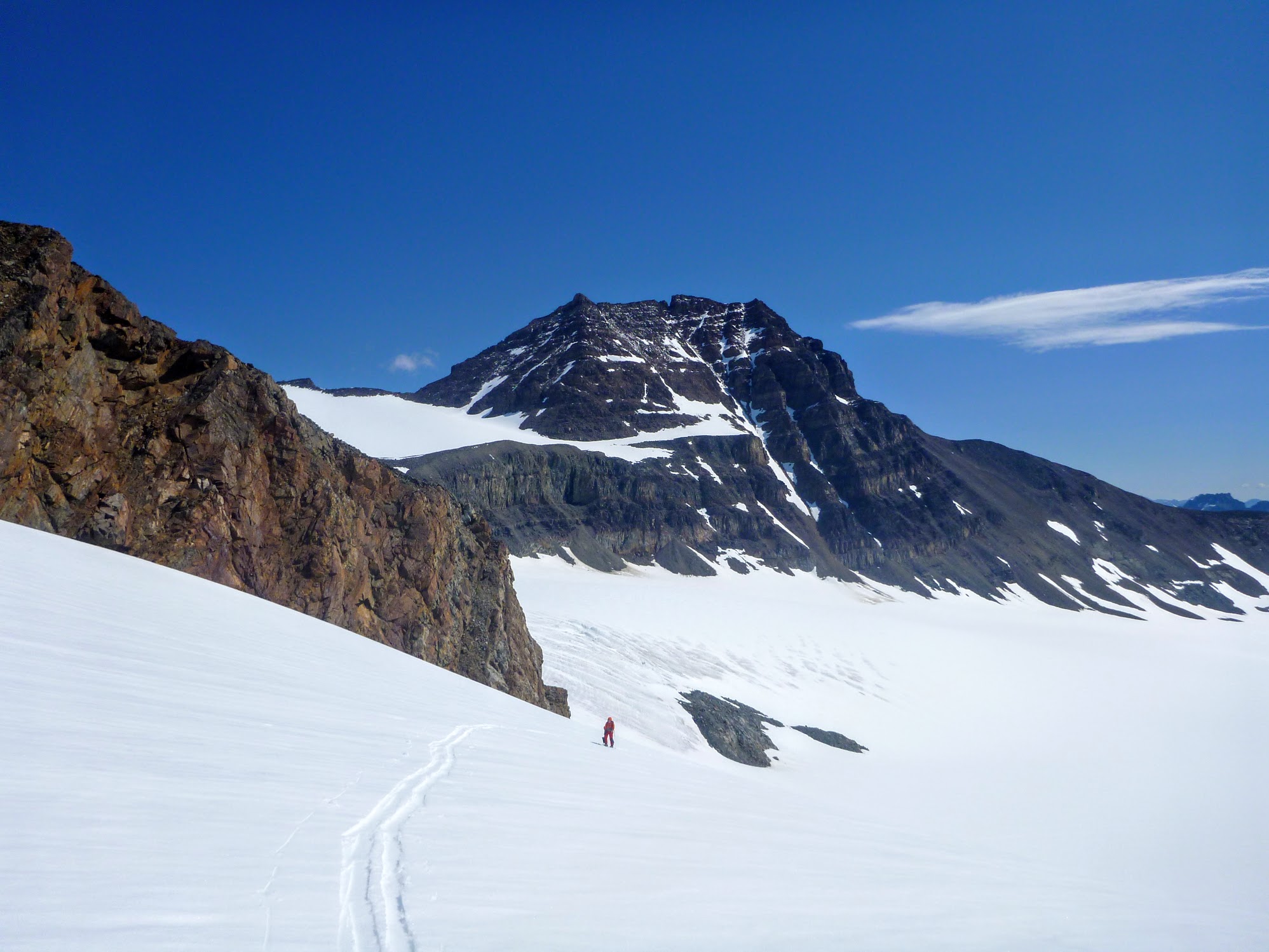
Progress from here on in was dramatically faster than in the forest but dramatically slower than normal skiing, as the snow wasn’t continuous. We’d skin a convoluted path to stay on the snow, meet a melted-out moraine ridge, carry the skis over and repeat. We made it 7.5 km that day, in an effort that felt like 25 or 30. In the distance we could see Majestic Peak and Mt. Dartmouth, two 2,900 m peaks we’d need to pass close by on our route.
It was nice to get on skis.
From our tent we could see that our planned route had a disturbing ascent up and a slope that alternated between slide paths and cliffs. Looking at the topo, we verified that it was supposed to be an average slope of 10 degrees or so, but it just wasn’t that at all. I checked using GPS that we were where we thought we were, and we were. In the morning we re-routed around down a valley and around this unnamed thing that totally would have a name starting with “Mt.” if we were in a popular area. We had to keep a considerable distance away from the wall, as there was a posse of goats trundling all sort of rocks off, and the rocks would make it a disturbing distance out before hitting the glacier we were on.
Google shows the approach to the centre-right col as steep, and the topo doesn’t.

Goats.
Farm Mountain (centre, on the horizon), which looked big from Chilko Lake, appears positively dinky.
After a circuitous descent down a steep glacier and a more circuitous skin up a steepish slope with a maze of melted-out ridges, we got to the other side of the ridge that the topo had lied about.
I found myself somewhat disoriented again and confirmed my position with the GPS. We were in the right valley, but the valley and the topo definitely didn’t agree on what shape each other was supposed to be. By the topo we should have been able to plod towards Mt. Dartmouth and exit by an open, obvious col. In real life we couldn’t see the col because there’s this intimidating ridge in front of it. We went along the glacier to the ridge and then skinned diagonally up it. In winter it would have been an absolute no-go on account of avalanche hazard, and now it required a stomp and a wait every step to avoid sliding sideways. I guess in the winter there’d be snow available to ski around it, though.
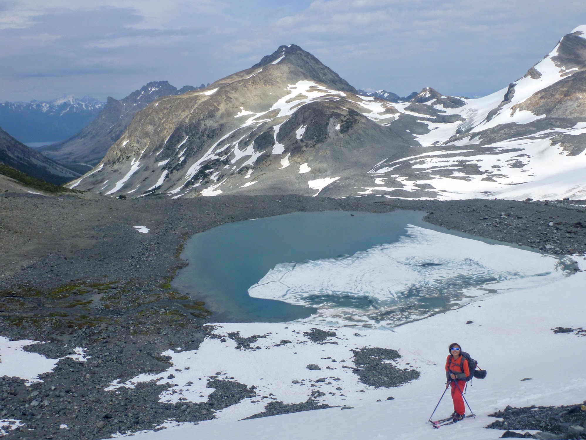
Nearing the top of the morraine ridge that the topo missed. A different part of Chilko Lake is visible down the valley.
On the other side of the moraine ridge we saw the col we were looking for and crossed over onto Hamilton Glacier. The weather, which had been a perfect mix of sun and cloud, started to get more ominous. While we were eating supper, a rainstorm hit and dropped an amazing amount of water. We were sitting on my pack as we ate, and we kept finding ourselves sitting in a puddle, sitting up to pour the water off the pack cover and then doing it again after a few more bites. After the storm subsided, the clouds lowered and the pass we were supposed to take to exit Hamilton Glacier was socked in. Measuring the topo gave an average slope of just over 35 degrees (500 feet drop over 210 m on a classic Canadian government topo with elevation in feet on a km grid). That was steep enough that it wasn’t safe to attempt in poor visibility, so we dug in behind a boulder and set up camp.
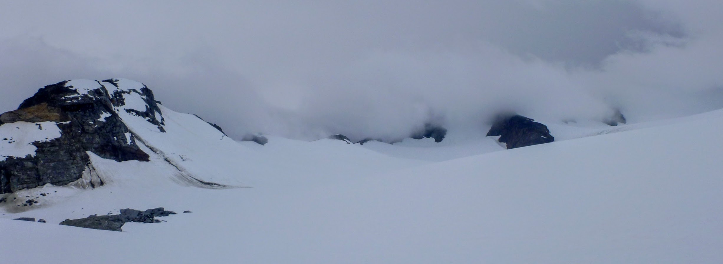
Our intended exit from Hamilton Glacier.
The relatively early set-up on camp gave me a chance to do something about my skins. The glue wasn’t great when I started the trip and had been getting rapidly worse as spring snow with debris in it kept getting under the skins and contaminating them more. It was getting clear that I wasn’t going to have any glue left by the time trip ended, so I resorted to remelting the skin glue over my camp stove. This would be a much better trip report if I’d ended up burning my skins down in the middle of nowhere, but I failed in that respect and managed to melt all the glue without anything bad happening. The skins weren’t the greatest of all time after that, but they worked well enough for the rest of the trip, with only minor instances of snow intrusion.
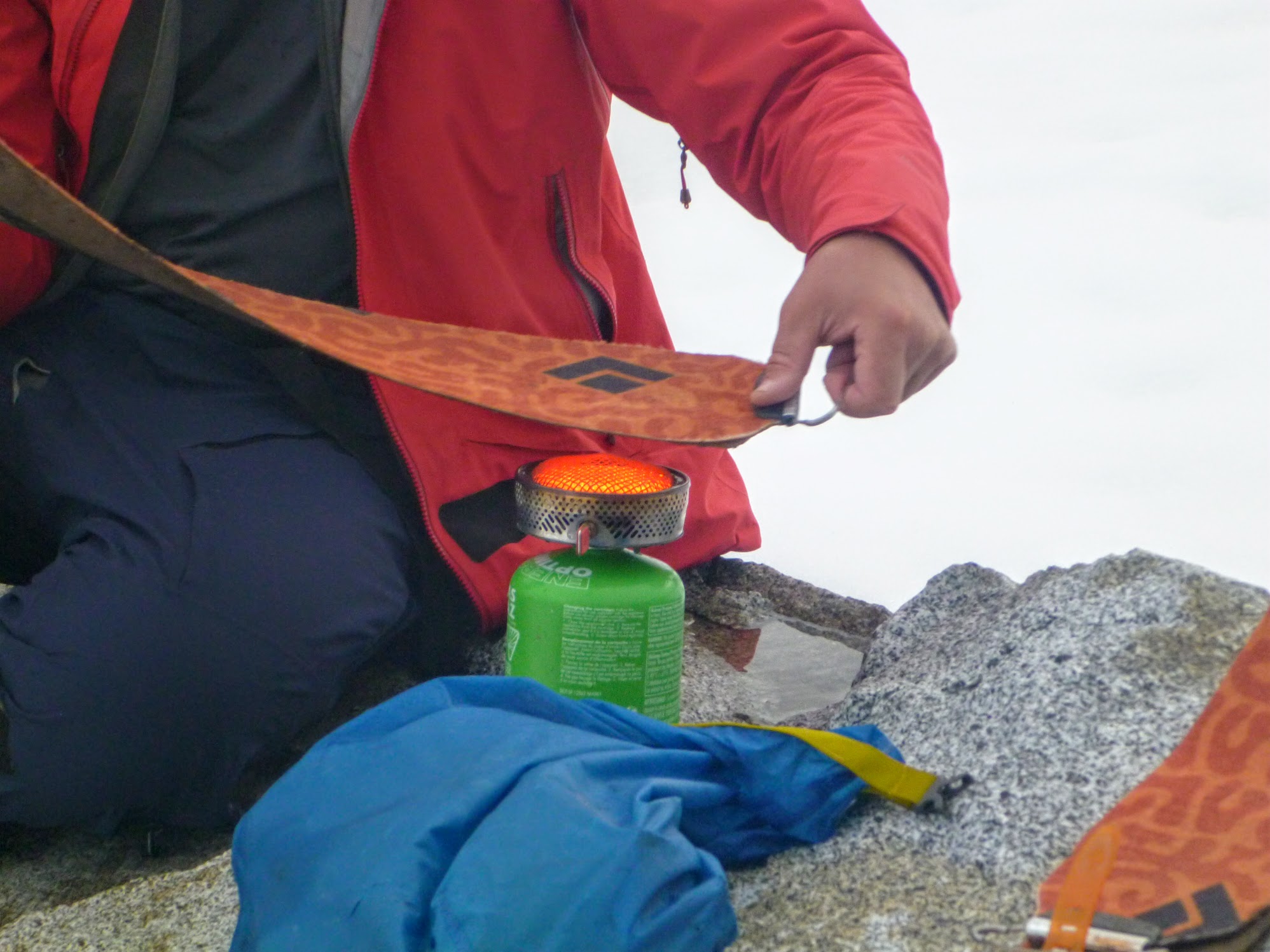
Roasting my skins.
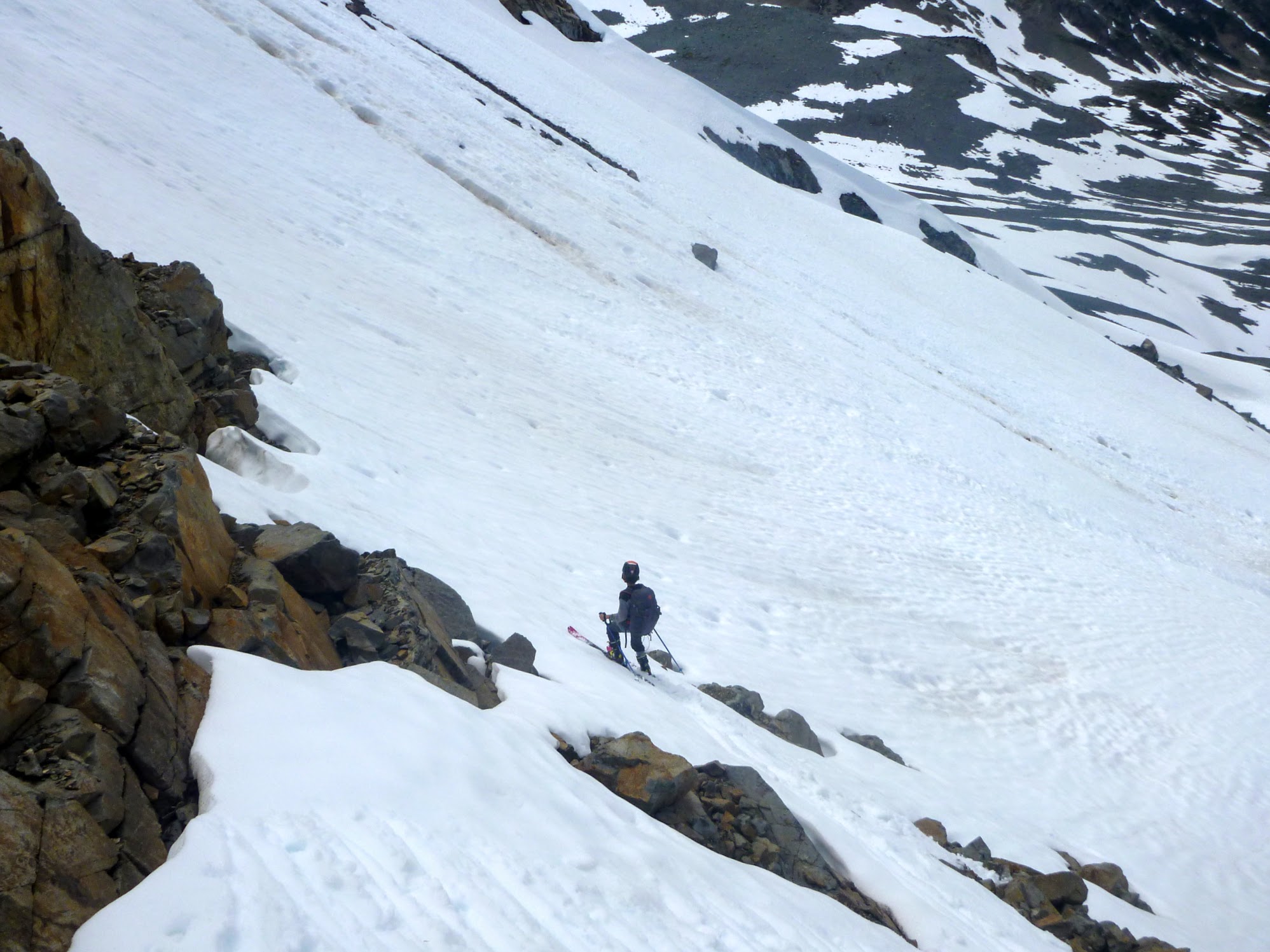
The next morning the clouds had lifted, and we went up to where we were going to exit Hamilton Glacier. Once again I resorted to GPS because what I was seeing on the topo wasn’t consistent with what I was seeing in real life. The topo thought we should be able to ski straight off the glacier without having to climb anything, but we were up against a steep ridge, with significant peaks and a bergschrund. The GPS showed our position on top of an image of the government topo, and we were where we thought we were, but reality was disagreeing with the topo. Devlin asked, if the topo was wrong on this side, didn’t it have to be wrong on the other side, too? I was having similar thoughts. We found our way up to a notch in the ridge where the bergschrund was conveniently filled in and peered over the edge.
Devlin approaching the ridge. The other side of Dartmouth is behind him.
Continuing further looked to be just bonkers. The average slope going down was clearly way more than the 35 degrees calculated from the topo, and to make things worse, it wasn’t evenly spaced. There were sections that had loose rock at the angle of repose with steeper, bare featureless rock in between. It didn’t look technically difficult to climb, but I’d be leery about doing it even with a full rack and climbing shoes thanks to a lack of protection and a high likelihood of squishing my belayer with a rock. Unlike the first time the topo lied to us, there was no alternate route.

View off Hamilton Glacier.
A few months ago Devlin had me searching for trip partners because he wanted a larger group. He turned to me and said “Dad, I’m actually glad no one went with us because what if they wanted to keep going?” I told him that any of our potential trip partners would have had the sense to turn around, too, but I’m glad that they weren’t stuck in this mess.
So now what? We were on day four of an eight-day trip, and we’d just reached the intended high point and now we had to turn around. There was a water taxi booked to pick us up in Bute Inlet and nothing to pick us up anywhere else. I had an old-school Spot tracker with me, which had the “OK” button, “Help” and “911”—and nothing else. We decided to go back to where the float plane dropped us off, hit the Help button and hope that my wife would intuit what we wanted, which was for her not to panic and to get us a float plane and cancel the water taxi.
We were at 2,630 m (coincidentally the highest point on our planned route) when we turned around, which was a ways above Chilko Lake at 1,173 m, and we were four days of food lighter, so we expected going down to be much faster than going up. At first it was. We skied from the high point down Hamilton Glacier and zipped past the day 3 campsite within a few minutes. Once off the glacier, things slowed down a fair bit, as we were doing lots of up-and-down and lots of carrying skis over talus, which isn’t much faster down than up. We got to the day 2 campsite before dark, and I hit the OK button on the Spot four times with the hope that my wife, Iva, would notice we were sending more OKs than normal, look at the map and have a heads-up that we’d turned around. I didn’t want to hit the Help button because that would probably cause a helicopter to come where we were.
Starting to head down.
There was lots of ski carrying.
Farm Mountain looking close again.
Iva did not notice. She’d defended her PhD that day and was happy to see the OK emails from Spot come through and just go to bed.
The next day Devlin and I were gung-ho to make it back to the lake. It had taken us a day and a half to get to where we were, packs were lighter, and we were going down a thousand metres. We reversed our route easily all the way through the alpine. Just as we got our skis off, it started to rain, and we got wet for a bit. We were relieved when it stopped raining but hadn’t anticipated the onslaught of mosquitos. Four days ago the mosquitos were there, but they weren’t ridiculous. We were swarmed, and despite wearing bug jackets and Devlin wearing gloves, we were getting bit constantly. Devlin’s hands were only out of his gloves when he was tying his laces, but he still ended up with enough bites on the back of his hands that they looked like a plucked chicken.
Things went really awry during the bushwhack. We tried to follow our path back down, but once we were slightly off line, we couldn’t get back on track. The forest had grown on old moraine ridges, and in the valleys between them it was an alder-fest, so getting over sideways just didn’t work. The line we were going down had large patches that had burned about ten years ago, and now the spars had mostly fallen over and there were densely packed ten-year-old trees everywhere. On the way up, there were numerous instances of deer poop, but here there were none, because deer aren’t dumb enough to go to such a terrible place. At 6:30 we were a little over a kilometre from shore and thought we had a chance of making it before dark. Night fell a few hours later, and we’d made it a couple hundred metres. We set up camp, and I sent out another OK signal on the Spot.

Setting up camp in the nasty-ass bushwhack.
This time Iva took a look at the map link on the Spot email and noticed that we were going backwards. Probably it’s for the best that she didn’t notice earlier because she didn’t sleep all that well that night.
The next morning Devlin and I resumed the mind-crushing bushwhack. I told him that he was a champion bushwhacker and he was incredulous. “I feel you’re having a much harder time.” It’s true that I had a monster pack with two pairs of skis on it, so I told him that I was a full-on Jedi bushwhacker, but he was still a champ. I got some serious side-eye for that.
Three hours and a couple hundred metres later, we broke out into an overgrown marsh, which was a blessing. It was soggy and had a fair bit of deciduous nonsense, but the lack of burnt spars tangled over each other and no closely packed trees made it way better. On the other side of the marsh we hit mature whitebark pine and cruised to the lake shore, amid a festival of deer poop. We got to a pleasant spit that had clearly been camped on, and some work had been done with an axe to make it more walkable. That was the first sign we’d seen since leaving the float plane that a person had ever been to where we were walking; everything before then appeared to be completely untouched.
We sent the help call on the Spot and noticed that the ceiling was pretty low. Even if there was a float plane ready to go it might have to wait for an arbitrary period to be able to land. That was no big deal, though, as we had 2.5 days of food left.
We hunkered down for a potential three-day wait for the float plane.
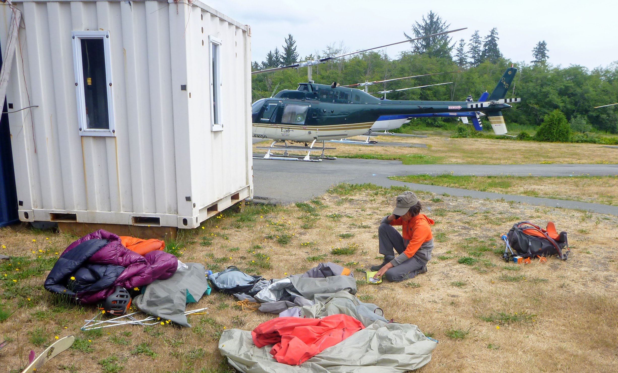
The Spot behaves differently when you send a help request instead of an OK. For OK messages, it makes three tries to call the satellite, but the system only sends one email home, even if it gets all three transmissions. For a help request, it calls the satellites twelve times, and the system attacks with an email on each receipt. Back at home, Iva was getting bombarded every five minutes and started to get riled up, as she didn’t know that the Spot worked this way. She attempted to get us a float plane, but Corilair said that the ceiling was too low for them to make it in and that she should call a helicopter, which she did.
Two hours later I heard a motor in the distance? Was it a float plane already? Or was it a helicopter? The prospect of a helicopter was very disturbing, as helicopters are much more efficient at turning time into dollars than float planes. I was relieved to see it fly past us. Then it went up to the ridge we came down from and started coming back towards where we were. It was clearly looking for us and would only end up being more expensive if we didn’t make ourselves visible, so I stood at the end of the spit and got its attention. A lady got out and asked if we called for a helicopter. I said definitely not, but that I suspected they were here for us. She pulled out an email from Iva asking about a help pickup, which mentioned Corilair recommending a helicopter.
The helicopter was half in the water, just barely able to land at the end of the spit, and couldn’t shut down. We rolled the tent up and jammed everything in without packing it properly. I lost an ice axe in this process, but considering the situation losing only that is actually pretty good.
We were in the air for a full hour flying back to Campbell River. I’m used to helicopters being $70 a minute, and with an hour to get to us and an hour to get back, that’d be 120 minutes, so $8,400. When we got to Campbell River I was flabbergasted to hear that it was only going to be $3,400. E&B helicopters out of Campbell River is stunningly economical, by helicopter standards. All told, it’s only $1,000 more than the float plane would have been.
Devlin calls home while I do the big gear faff where the helicopter landed in Campbell River.
I don’t remember the names of either the helicopter pilot or the assistant (who was also a licensed pilot), but they were rad. The dude had this T-shirt with a drawing of Tom Selleck on it, minus the nose and eyes. It was impressive how the moustache and eyebrows were all you needed.
I guess we’re getting into the weeds now, and this trip report is already too long. One big moral for me on this is to get either an InReach or a Spot X, so that I can send and receive real messages. They’re a few hundred dollars, but if I’d been able to tell Iva that we’re happy to wait for the weather to change and to bring in a float plane, it’d have paid for itself a few times over already. The other key learning is that when I got back to a computer and compared the Google terrain data to the topo, Google wins hands down. The first steep ridge we had to detour around is correctly depicted by Google and just isn’t in the government topo. The moraine ridge blocking a direct line of sight to the col leading to Hamilton Glacier is there on Google and isn’t on the topo. Most importantly, Google shows where we had to turn around dropping 200 m in 220 m horizontal, which steepens as it goes down, doing the last 100 m vertical drop in 90 m. That’s wicked steep, and consistent with what we saw. The government topo shows 150 m drop over 210 m horizontal, at a pretty uniform grade. That’s a bunch of baloney.
Was this trip worth it? I kind of think so. We wanted to cross the Homathko Icefield and we didn’t, but we did most of the hard part of the trip twice over, crossed a bunch of glaciers, got to our intended high point, and saw some beautiful scenery in a very wild place.
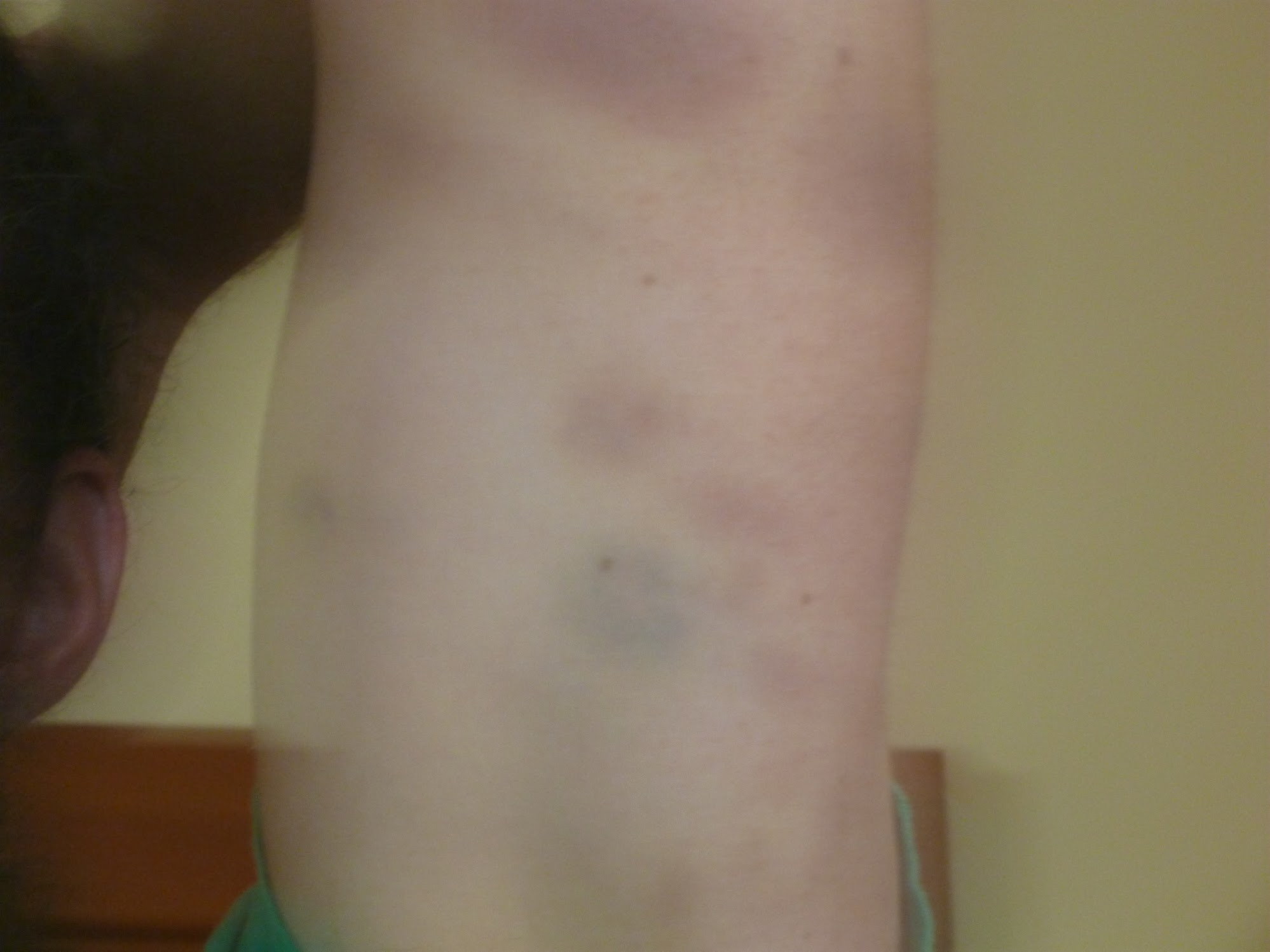
Post-bushwhack my limbs had a giraffe-inspired pattern.
Quite the adventure! I’m surprised you didn’t pack a paraglider for steep descents in that huge pack somewhere. Sounds like the classic VOC definition of fun…
On a side note; I’m considering selling my InReach Explorer (the version from a couple of years ago before Garmin bought Delorme), and buying the new one which has pre-loaded maps since I don’t have a GPS and therefore either rely on others to have one or on a physical map. Let me know if you’re interested.
Sounds like you are now certified BST2 – bushwack safety training. Great TR!
Sorry you got turned back but sounds like it was a mostly fun adventure anyway!
Wow, good effort guys, that is a solid trip!
Thanks for writing up the TR.
Too bad you got turned around but the mountains will still be there.
Incredible pictures! Minus the map lying, it sounds like quite a successful trip. I’m intrigued by the whitebark. Did they look dead?
Nice TR. I’m familiar with the fact that that generation of government topos for these remote areas is often more baloney than not. I don’t know whether it’s glacial recession, or just that they were (supposedly) simply drawn by hand from some stereoscopic sets of photos taken during a handful of flyovers… I imagine that it’s difficult to actually tell the topography of a featureless icefield using a few photos taken from the air. Those cartographers didn’t report uncertainty on the map, unfortunately, but they probably should have. Or maybe they should have just drawn a couple dragons, like the old days.
Also, if you repeat the trip, you should look into the Galleon Creek road / trail rather than bushwacking for your exit.
Erik (7) is inspired.
Daring trip by an amazing Dad&Son team! For the topo maps, I think that Christian is right and the actual pictures can be seen at the UBC Geography Department library. Thank you so much for the trip report!
Great story. Good work on getting Devlin to like suffering. TRIM maps (1:20,000) can be got for free.
https://www2.gov.bc.ca/gov/content/data/geographic-data-services/topographic-data/terrain/trim-enhanced-base-map