My first foray into the Bendor Range was a trip to Whitecap Mountain in 2015 (https://www.ubc-voc.com/2015/08/05/whitecap-mountain-and-the-bendor-range-alpine-bliss) that revealed stunning alpine meadows and broad valleys with a different flavor than that of the Coast Mountains closer to home. This year, while poring over maps as I tend to do, the northwestern section of the Bendor Range just north of Bralorne caught my eye as having great potential for a hiking traverse. I traced a route across the range through the passage of least resistance, which I inferred from contour elevations, and began armchair exploring on Google Earth and CalTopo.
Cue my colleague at work Alan, who has a longstanding love affair with Bralorne that has come out of many years working as an environmental consultant for Bralorne Mines. His several work trips to Bralorne have come with the added bonus of many skiing and hiking side-trips and he’s even written a couple of songs inspired by the area which I have learned during Friday-night jam sessions at work.
Although Al and I have entertained frequent banter about hiking and ski touring trips over the last few years, we hadn’t connected to get out on a trip yet. I emailed him with a .gpx overview of the route idea, also making reference to his love of all things Bralorne, and he very enthusiastically replied he was keen. Looking for a few other trips partners, we were soon joined by friends Declan and Milen. Declan is known to join Al for mega North Shore peak-bagging missions and Milen and I have enjoyed a few summer alpine traverse over the year and thus our crew was formed.
This trip being planned entirely during covid-days, we held a couple zoom trip planning meetings, which we are now all highly proficient with, and settled on the last week of July for our trip. Al was also able to get useful local beta on approach and exit trails from his friends in Bralorne. We settled on a route from Twinturn Creek up to the alpine, with a northwestward traverse through Truax Lake and exiting via the Steep Creek FSR, a route that totaled approximately 28 km in distance with 2,800 m of elevation gain.
We left the Sea to Sky on July 25, popping over the Hurley and into the dry pine forests of Bralorne. Al made sure to give us a tour of a few of the sights in the area – including a lovely trapper’s cabin and all of the old mine tailings and abandoned houses and infrastructure from the heydays of gold mining in the area.
One of the abandoned houses is reputed to be haunted and always knocks when you walk away from it. The guys went to check out the house. I stayed behind, not too keen on walking into a decrepit mold-pit. Declan got to within 50 cm of the hole where the basement back door used to be and a loud crashing was heard. He got totally spooked and jumped back, and a buck came crashing out of the house! It was pretty spooky. We were all convinced the myth was busted and Milen, Al, and Declan explored the wrecked structure. But then, on our way back to the car, we heard a really loud bang coming off the house. It sounded like a 2×4 falling a few feet onto a wooden floor. Everyone was within eyesight of one another and for sure no one saw anything, and the house was certainly devoid of its ungulate colonizers, yet we all heard the bang. . .
Declan, freaking out at the buck that just launched out of the haunted house a few cm from him as he was about to enter it. PC Milen Spivak.
Anyways, after these urban adventures we headed to Al’s friends Nigel and Carolyn’s house, where we were to camp for the night.
Our second adventure began with the car shuttle – Nigel and his daughter Pipa very kindly offered to help us shuttle our truck up to our exit point at the Steep Creek FSR, making use of their rugged 4×4 so that we could avoid the rougher driving with our second vehicle (a Subaru). Declan and I convoyed behind Nigel and Pipa, Pipa confidently proclaiming she knew exactly where the Steep Creek FSR was. After a short drive out of Bralorne we turned up a logging road and the confusion began.
At this point I started checking our location on our GPS, and it didn’t align with the Steep Creek FSR I had marked as our hiking exit point. We pulled over and I went to chat with Nigel and Pipa, who adamantly confirmed it was all good and we were on the Steep Creek road. When I pointed to our location on my phone GPS app, he mentioned something about not trusting ‘‘city devices’’ and insisted we were not off route. So we carried on driving higher up the road. About 10 minutes later, still following along on my GPS, it was quite clear to me we were definitely not on the Steep Creek FSR and not even in the Steep Creek drainage basin, but rather in McDonald Creek which was one drainage too far west. In fact, we had driven a few hundred meters higher than the bottom of Steep Creek road, and there was no way I could see how we would connect to Steep Creek from our present road system. So we pulled over a second time and once again I went to chat with Nigel and Pipa. This time, looking over our valley, Nigel definitely agreed we were above McDonald Lake, the outline of which we could make out to the west. I referred to my ‘city device’ once again, which also showed we were above McDonald Lake. Nigel still insisted that we should continue driving up the FSR, just to see how far it went. I pointed out that while we sure could drive to the end of the FSR for the heck of it, but I still wasn’t planning on leaving a truck at the top of it with no knowledge as to whether or not we could reasonably hike from the alpine down to this valley without encountering significant obstacles. The entire point of the Steep Creek FSR exit was that this road extended to above 2,000m, providing an easy egress at the end of the traverse. Anyways, it took a lot of back-and-forth but we finally agreed to turn around. Now taking a bit more proactive role in route finding on the logging roads, I led us to the desired road and we ditched the truck beside a patch of raspberries. We hopped in with Nigel and Pipa’s truck for the drive back to their house, during which Nigel regaled us with tales of skiing and backcountry rescues in the mountains above town. By the time we got back, it was after dark and we were all keen for bed to allow for an early start to the hike, so we briefly shared songs and ghost stories (haunted house!) by the campfire before hitting the hay.
Next morning, we said our goodbyes to our hosts and set off in Milen’s Subaru, driving up Kingdom Lake FSR until its intersection with Twinturn Creek. Let the hiking fun begin!
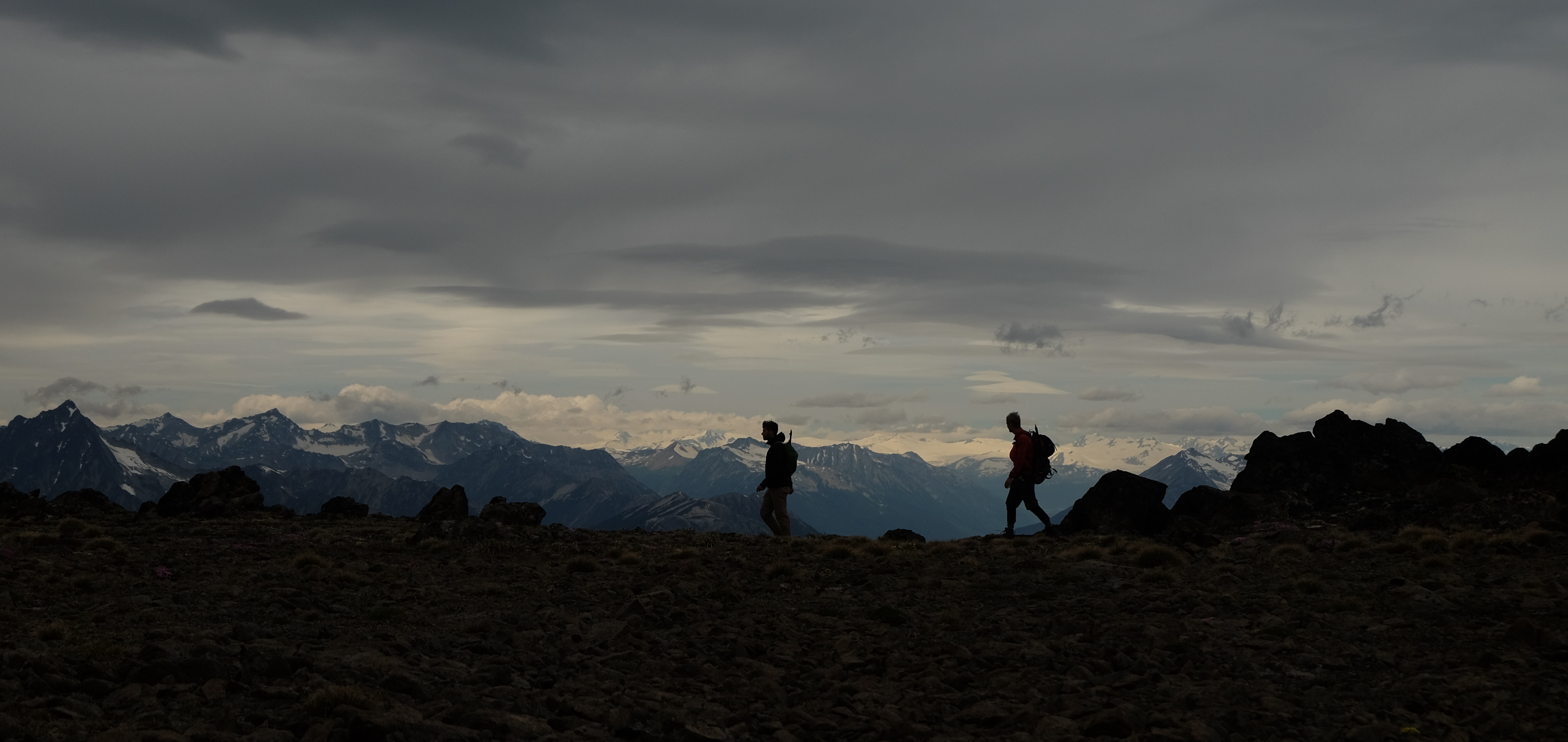
Our route began with a burly 1,000 m climb with heavy packs up steep south-facing slopes. Travel was generally easy enough with the exception of some blowdown. In parts there were occasional flags and chainsaw work indicating efforts to clear a route. My only concern was the heat and lack of water! Every time we intersected “creeks” that were labelled on our maps, they were completely dry. This was disconcerting as our approach to the alpine would take us to a south-facing ridge so our hopes for finding water decreased with elevation.
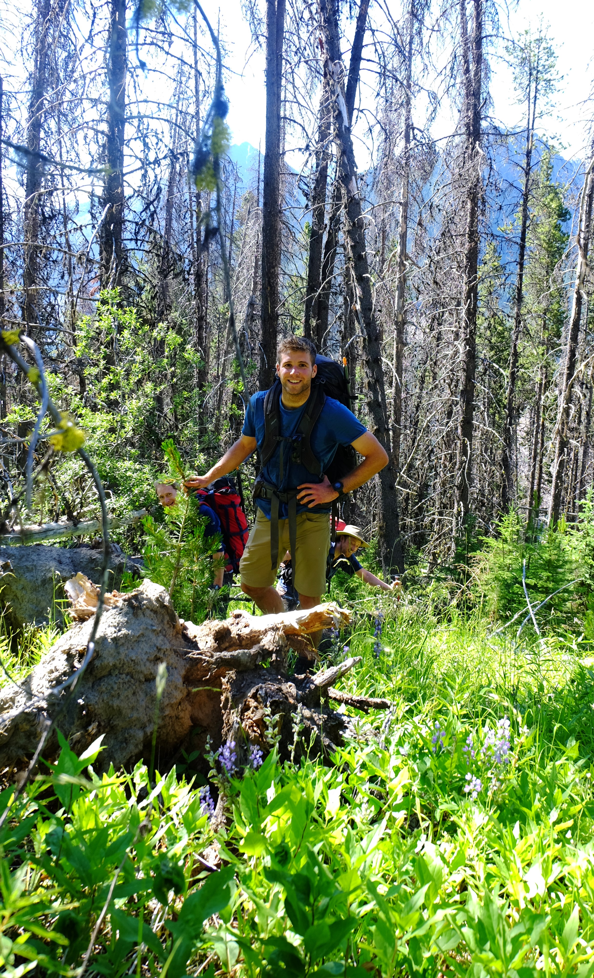
Still fresh on the bushwhack up Twinturn Creek. PC Elliott Skierszkan.
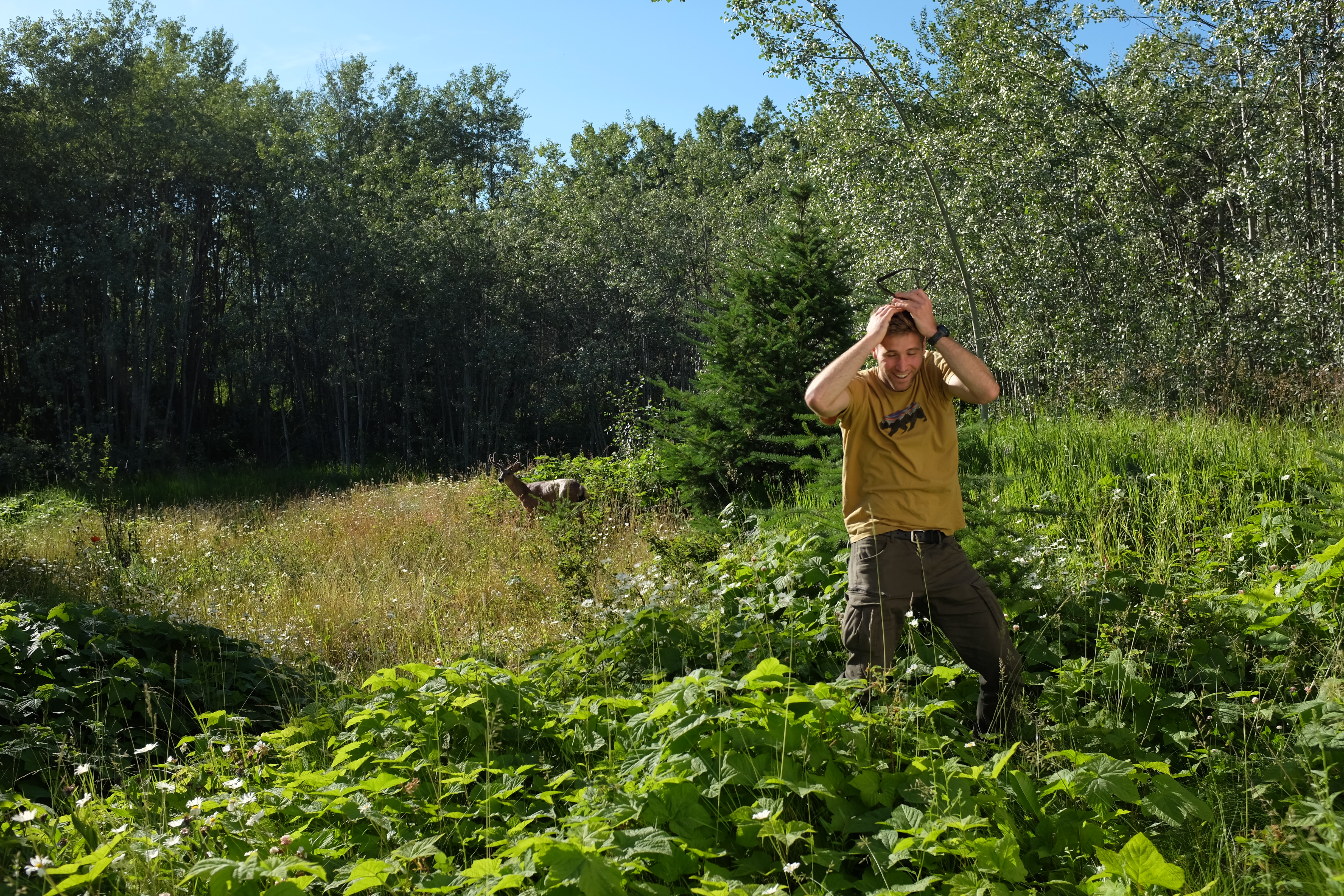
Just before breaking out of the treeline, we had our first incident: Declan’s bear mace got caught up in the bushes and accidentally set off. Fortunately, only his arm took the brunt of the hit but our noses and eyes were spared. We also found a spring running just as we gained the alpine, which provided much relief given the day’s heat and our empty bottles.
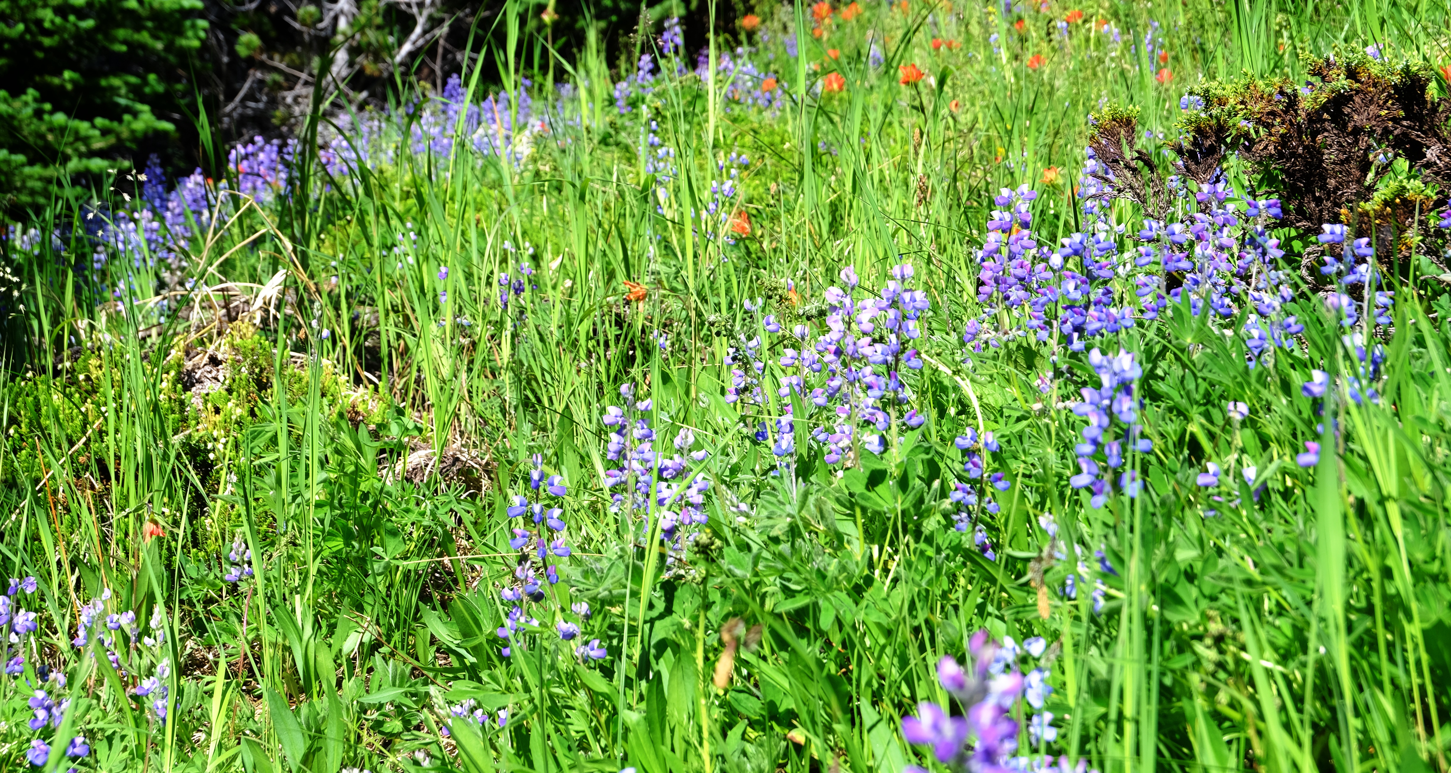
Lupine and Indian paintbrush in full bloom. PC Elliott Skierszkan.
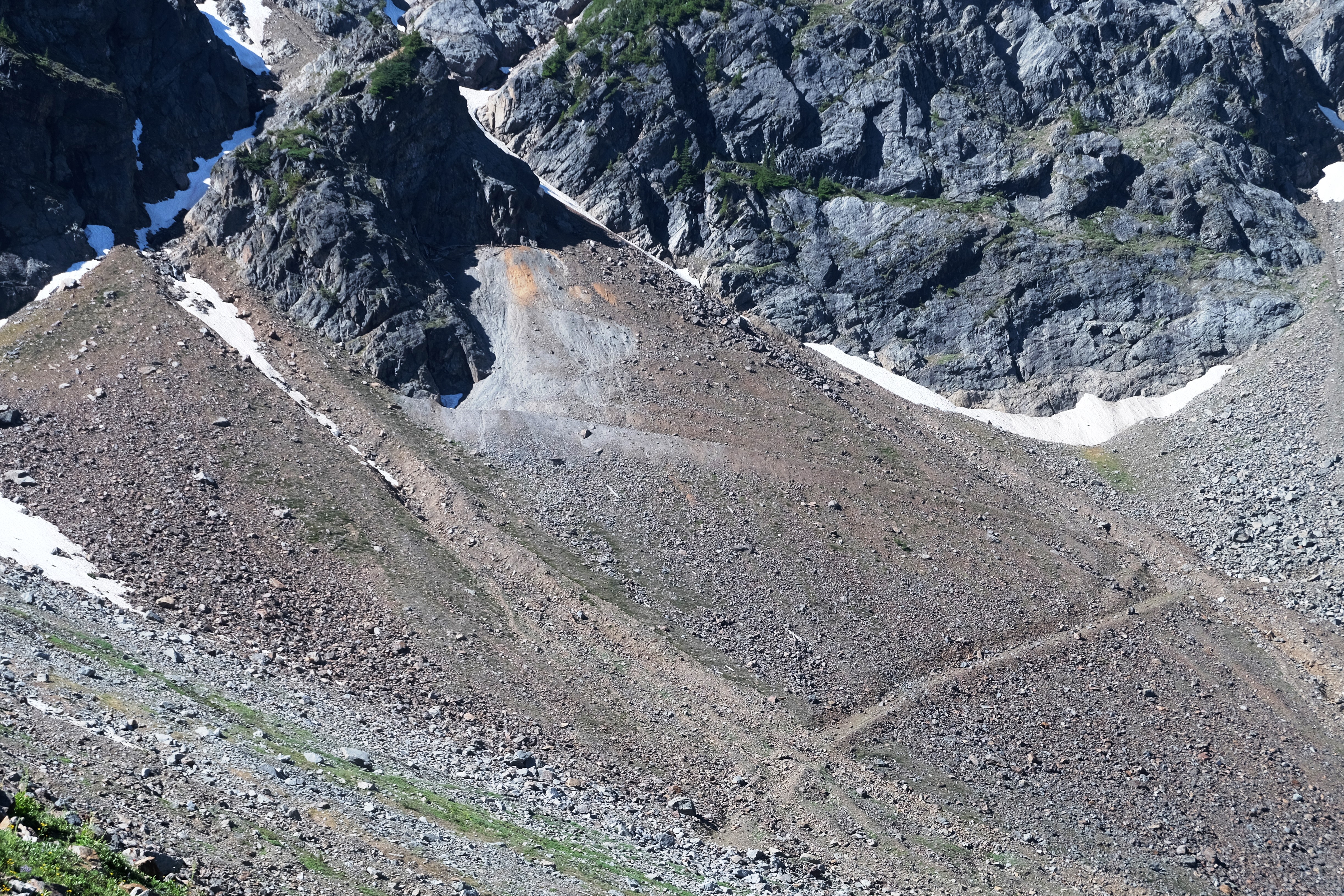
We gained our first high point of the day, an alpine ridge above upper Hawthorne Creek’s NW fork. Based on the topographic map, it seemed not too difficult to descend from the ridge into upper Hawthorne Creek drainage, yet we were quite dismayed by finding ourselves perched above sheer cliffs dropping 100 feet below. Pretty beat from the big climb, we settled on lunch first, routefinding second. A bit of poking around and we found a combination of snow and scree slopes that from a distance looked impossibly steep, but from a bit closer in turned out very walkable and so onwards we went.
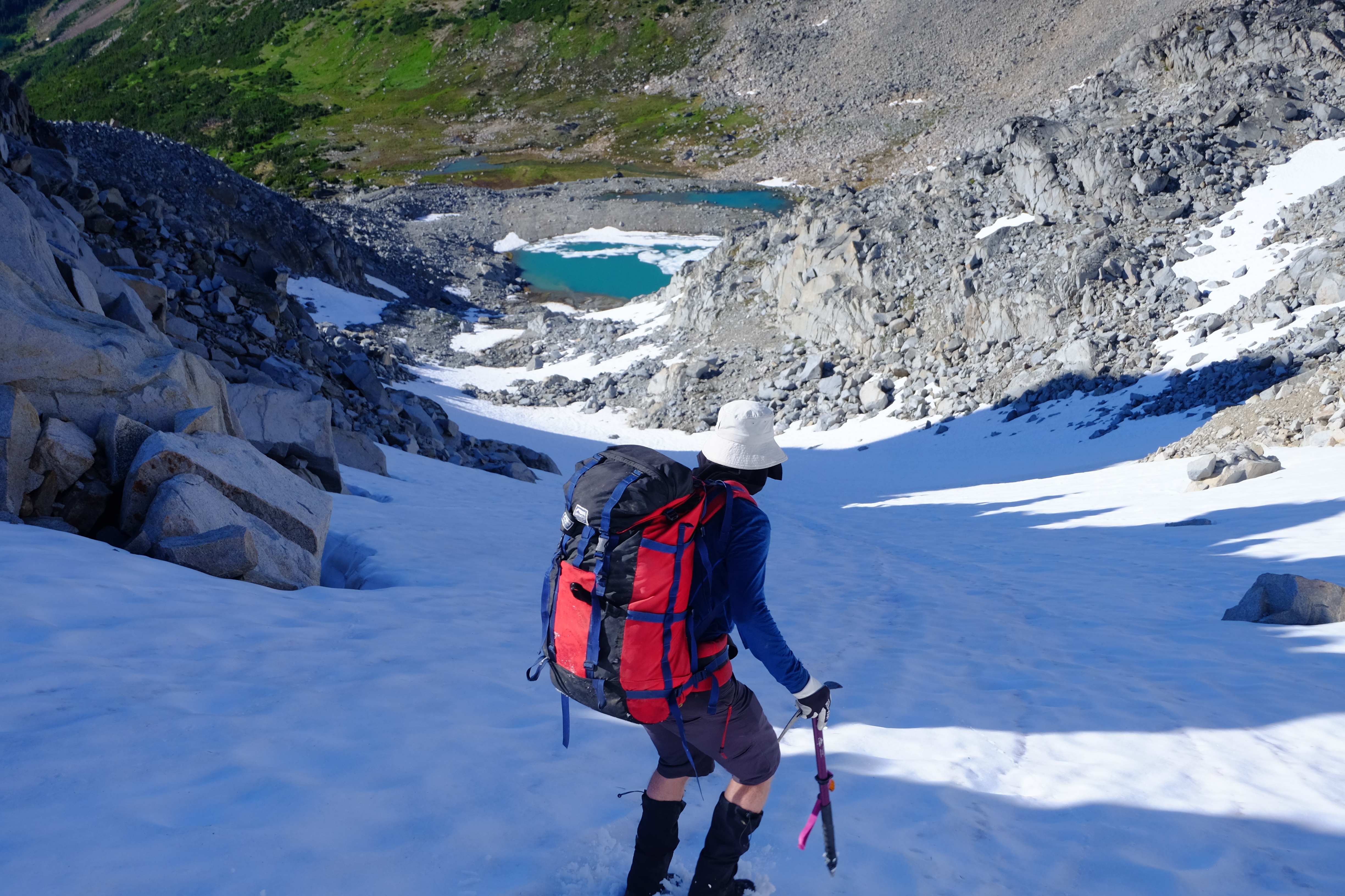
After some traversing in the broad valley, we passed a couple tarns and figured we had enough time to punch through a second high pass to make camp 1 in a pair of small lakes just SE of Truax Lake. However, upon reaching the pass we were once again dismayed by sheer cliffs on all sides—a pattern we learned would repeat itself quite a lot on the trip! A bit more routefinding and we founded a nice way around, which lead to a soft snow slope. It was quite the pleasant surprise to boot-ski 300m down to camp and enjoy a swim to rinse of the day’s sweat.
The bootski down to ‘upper Truax Lakes’’. PC Elliott Skierszkan.
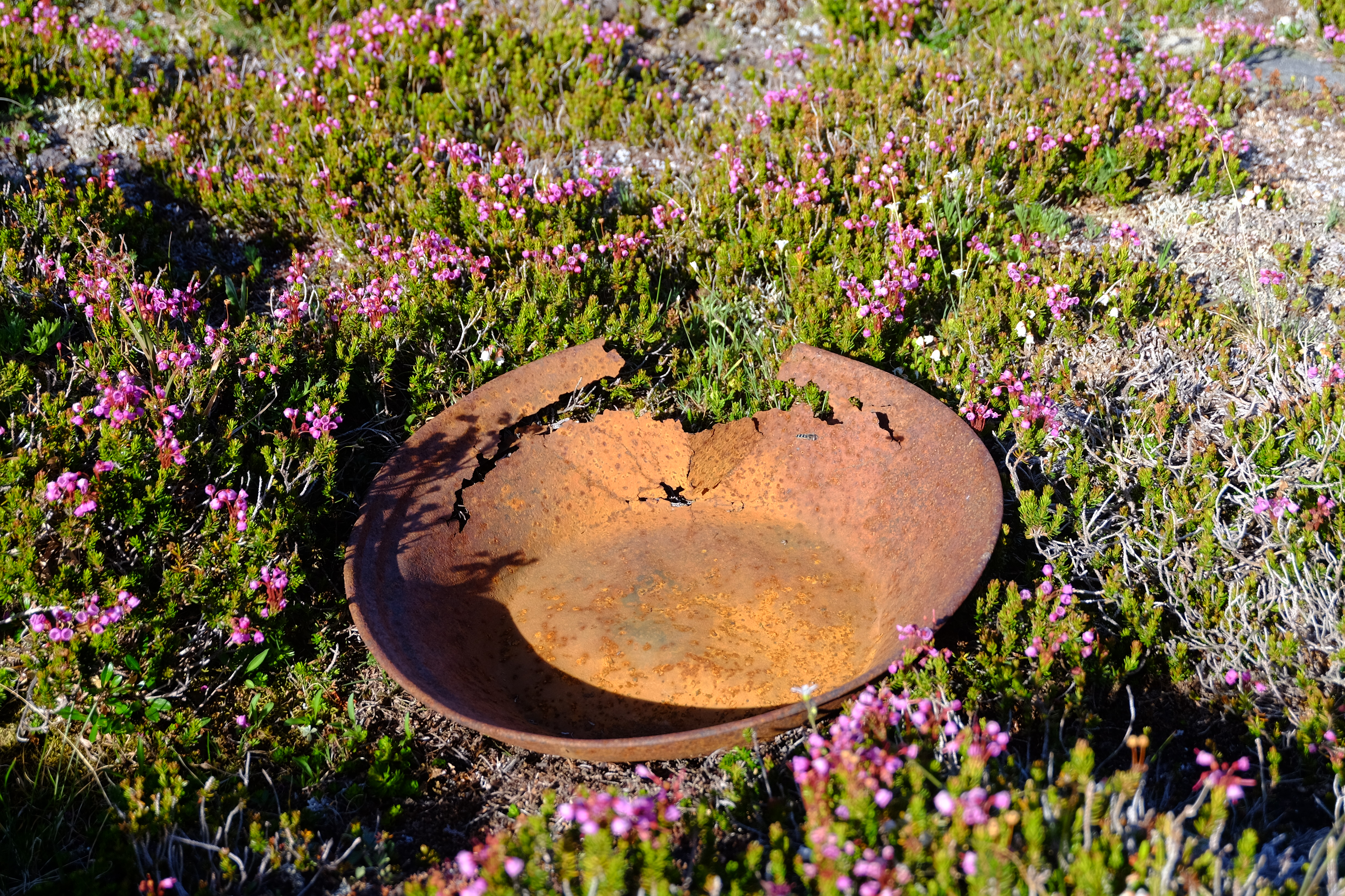
An abandoned gold pan at 2,000 m in elevation is a testament to the mining history of the area.
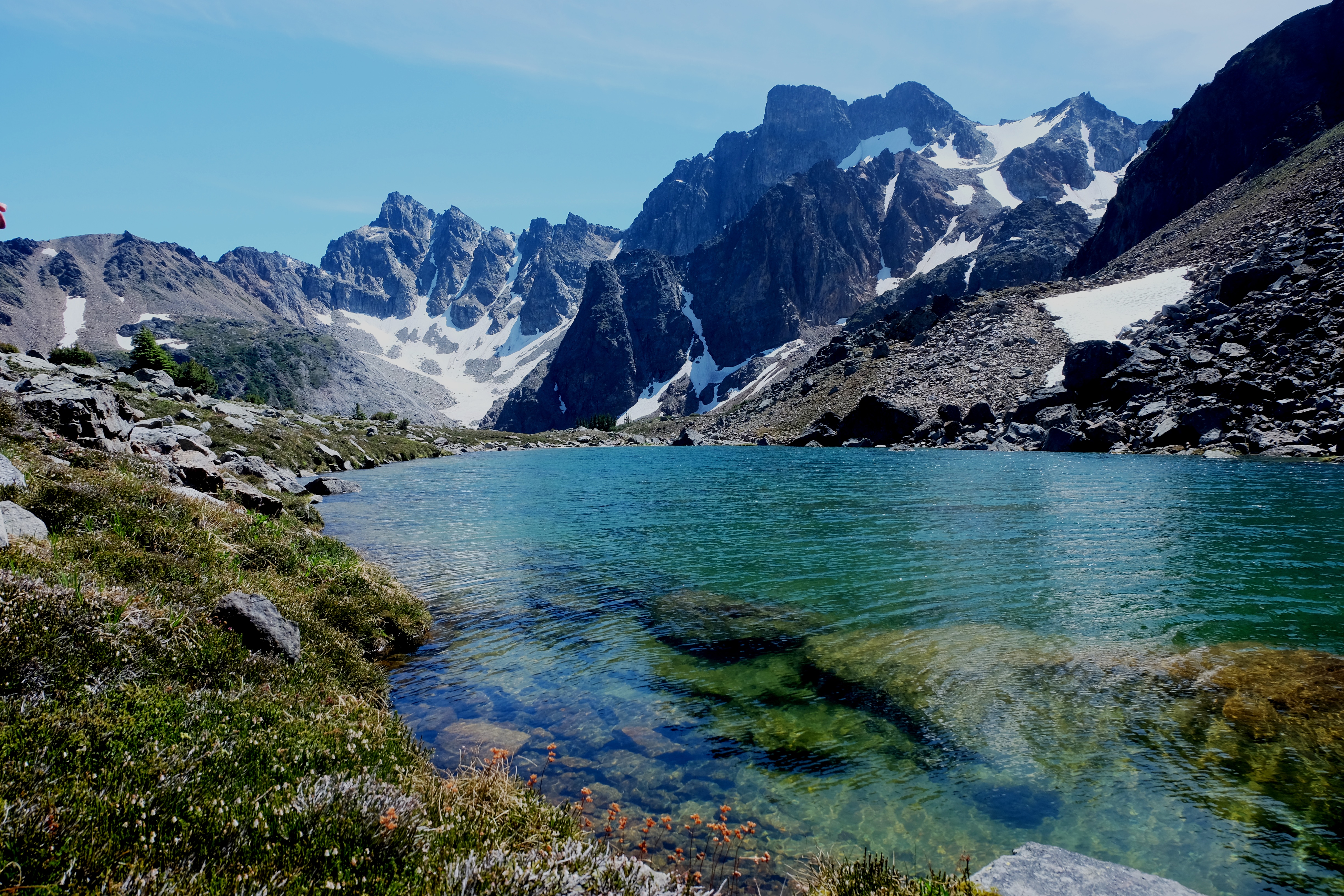
Next morning, we continued towards Truax Lake, which is a beautiful large body of water, and followed its eastern shore to treeline. We encountered a bit of a bluffy headwall through the trees at the lakes outlet, which we negotiated carefully and managed to make our way into upper Truax Creek. Here, a further testament to the mining legacy of the Bendor area, we came across an old mine waste pile below an adit that was dug at the base of steep cliffs on the N side of Goat’s Throne mountain. Later research revealed that a shaft more than 300m deep was pushed through the mountain while exploring the silver-antimony-lead orebody between 1948 and 1976, but it was abandoned due to its difficult location and hard-to-trace mineralization. It seemed a crazy spot for a mine, just beneath these cliffs!
Lake on the way up to Truax Mtn. PC Milen Spivak.
Abandoned mine workings in upper Truax Creek. PC Elliott Skierszkan.
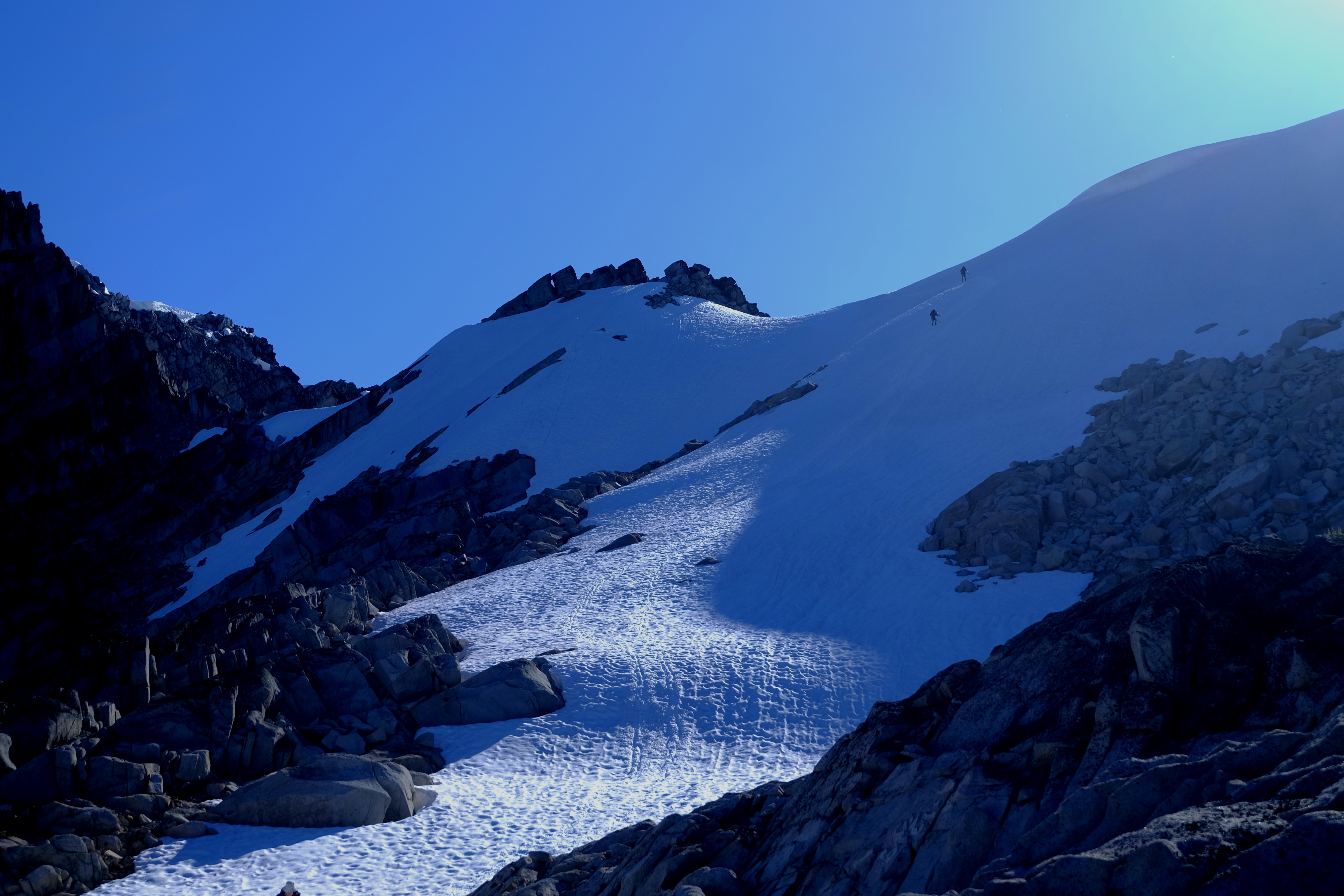
From here we followed Truax Creek upstream right to its tippy-top near 2,600m at a pass just west of Truax Mtn. This was the high point of the traverse and from my prior research I also thought it was the crux because Google Earth photos suggested that descending the pass might be a very steep drop onto a pocket glacier. I reached the pass first, huffing it somewhat nervously as I awaited to see how the descent looked in real life. It turned out to have a super mellow entry onto a gentle snow slope, which was quite the relief! From here, we could also look out to the last pass on the traverse, but in the dark light of the late afternoon it looked again like an impossibly steep loose slope. This left us somewhat nervous still at the prospect our exit wouldn’t go and we would face a massive bushwack and logging road walk out to regain the vehicle.
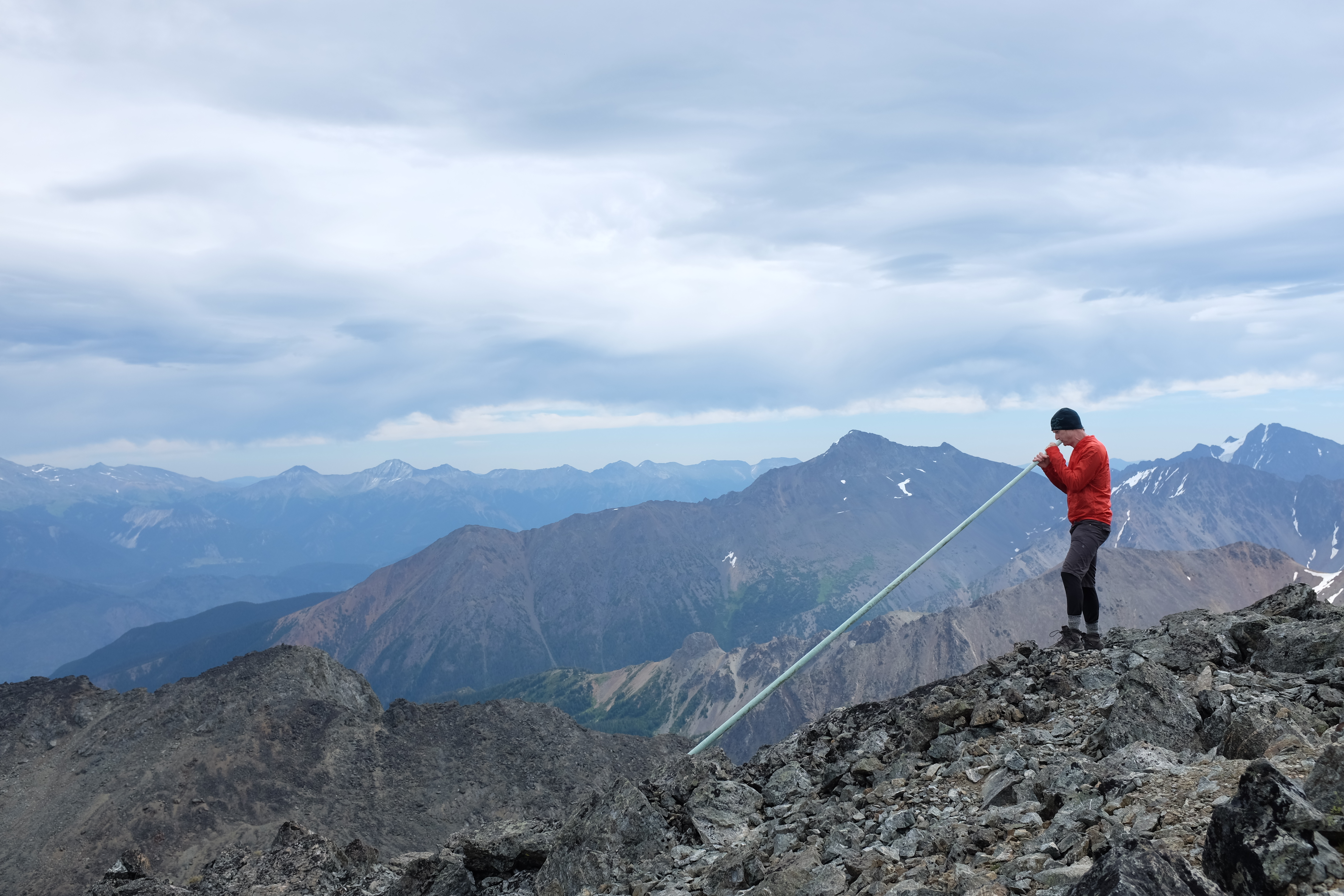
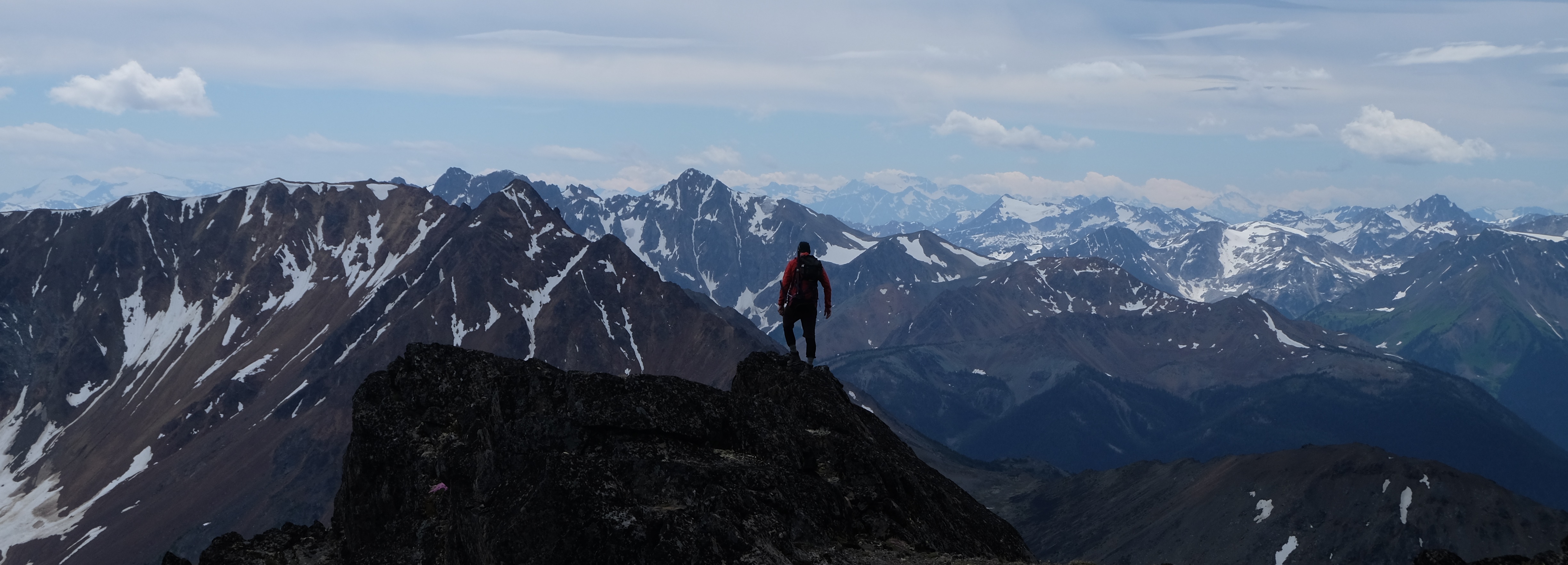
Being only a couple hundred meters below Truax’s summit, we dropped packs and hiked up easy scree to tag the 2,879 m tall peak, from which we had stunning views spanning from the familiar Joffre Group to the South out to the Shulaps and Chilcotin Ranges to the east and north, the Dickson Range, and the big peaks above the Hurley FSR to the west.
All totally stoked to be up here, we wanted to exchange high-fives or do a group hug or something but—covid physical distancing obliges—we instead did the awkward ‘elbow tap’ that people are using nowadays in lieu of handshakes and hugs. This elbow-tap degenerated into some spontaneous chicken-wing dancing and so we decided our crew would thereafter be known as the Mountain Chickens with our new secret handshake.
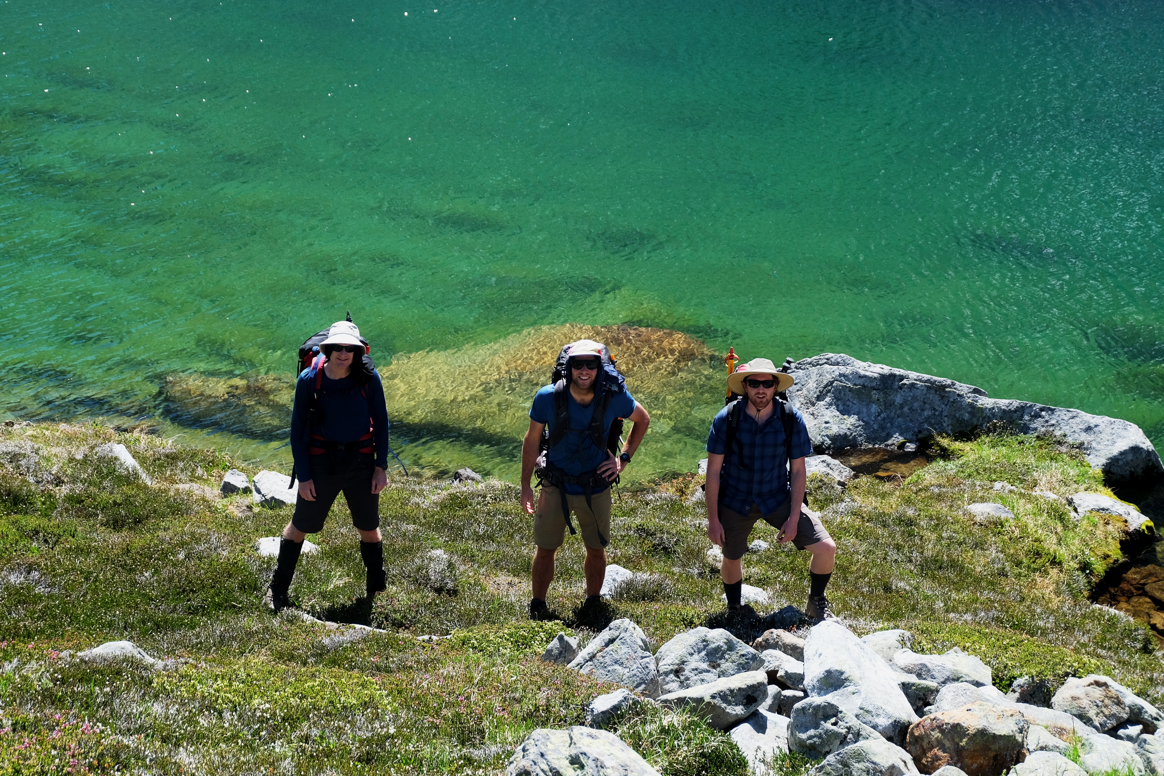
Lots of nice lakes. PC Elliott Skierszkan.
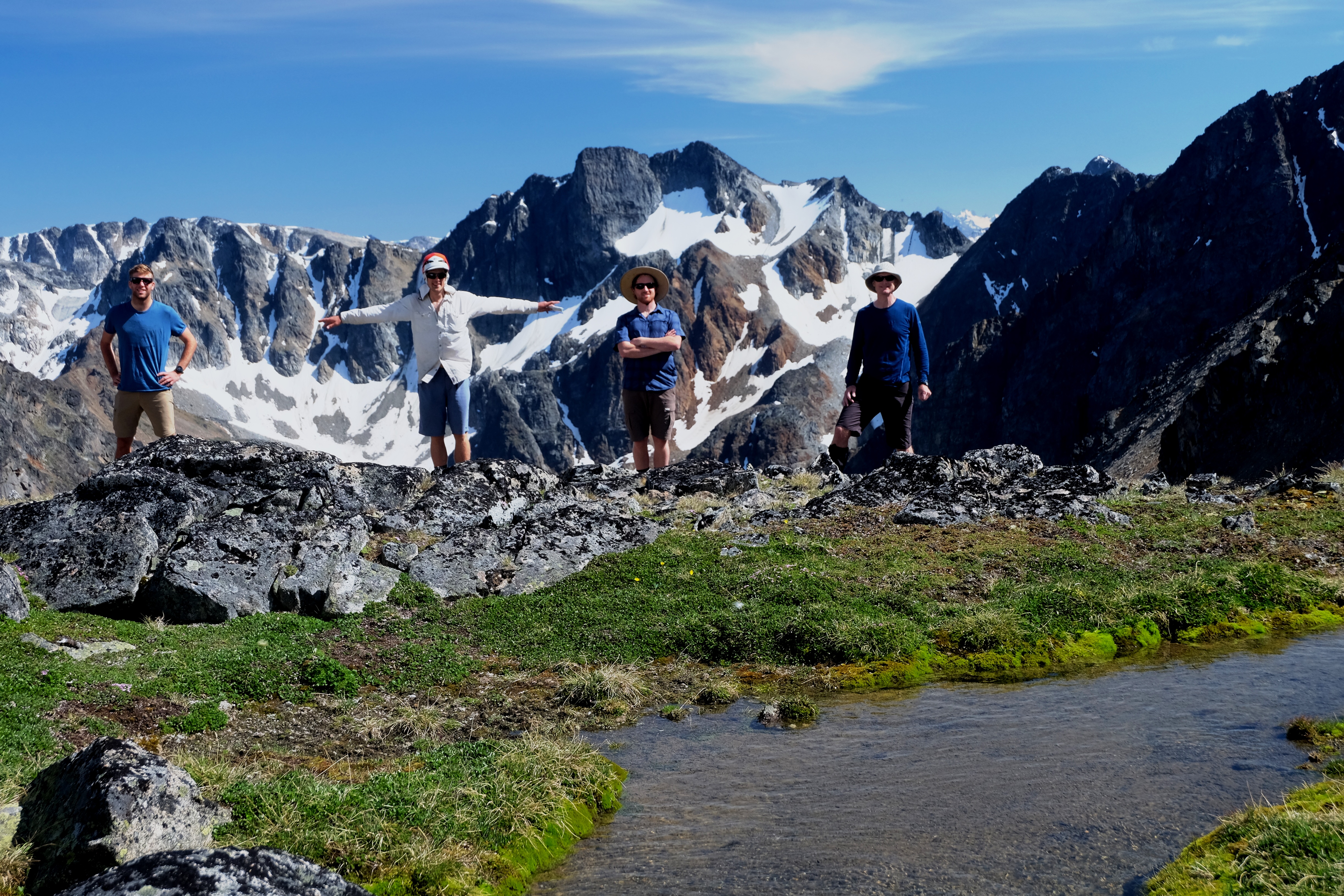
Social-distancing group photo. PC Elliott Skierszkan.
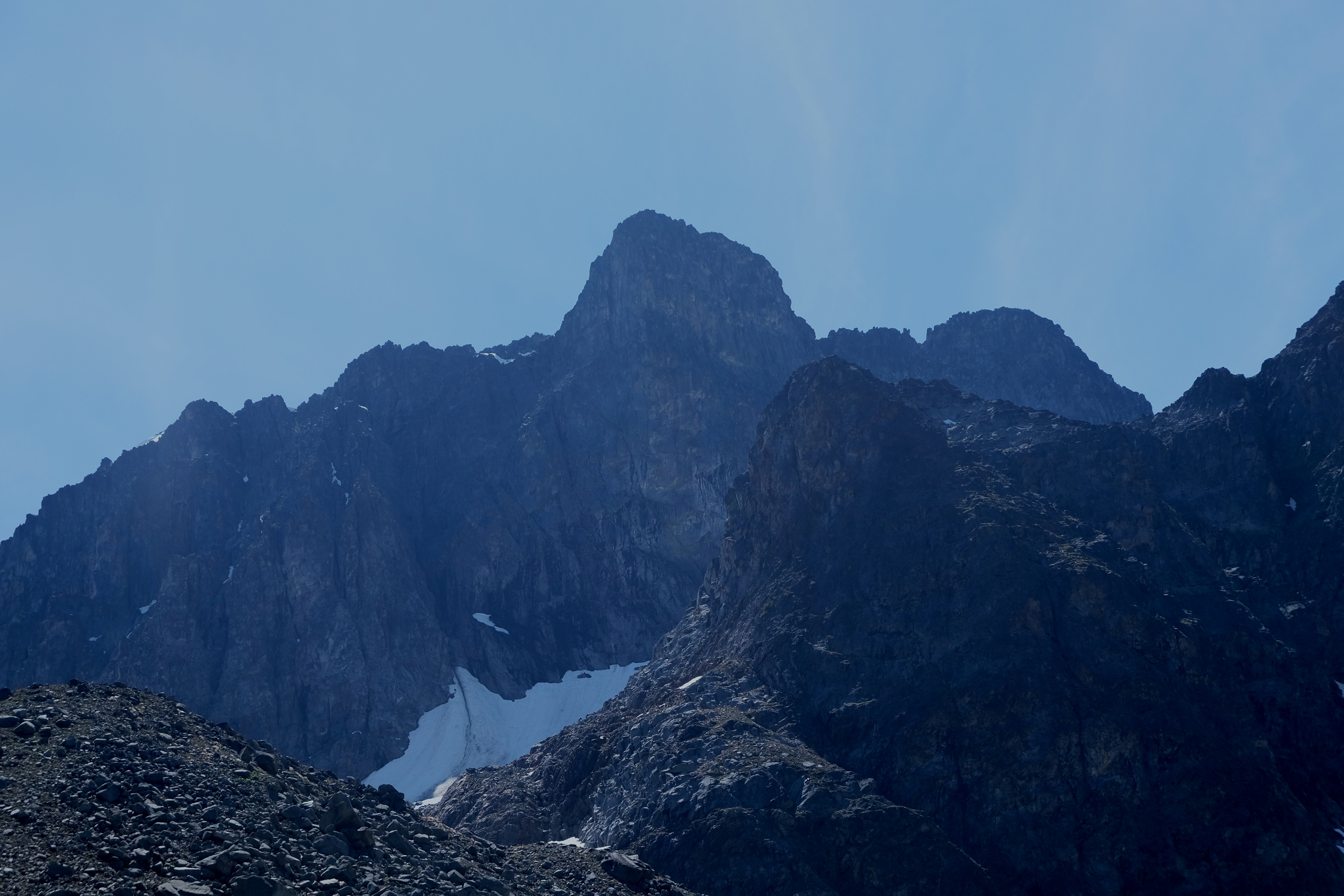
Steep terrain in the north faces. PC Elliott Skierszkan
Many nice lakes. PC Elliott Skierszkan.
On the way down, we also looked down to a herd of a dozen goats traversing near our packs left at the pass, which was a first for Milen, Declan, and Al.
Finally back at the pass, we re-donned our packs along with ice axes and microspikes for the descent down the glacier. Once again, we were ending our day with an awesome boot-ski/snow-walk combo which was a great way to finish, eventually ending the day at the trio of lakes NW of Truax Mtn.
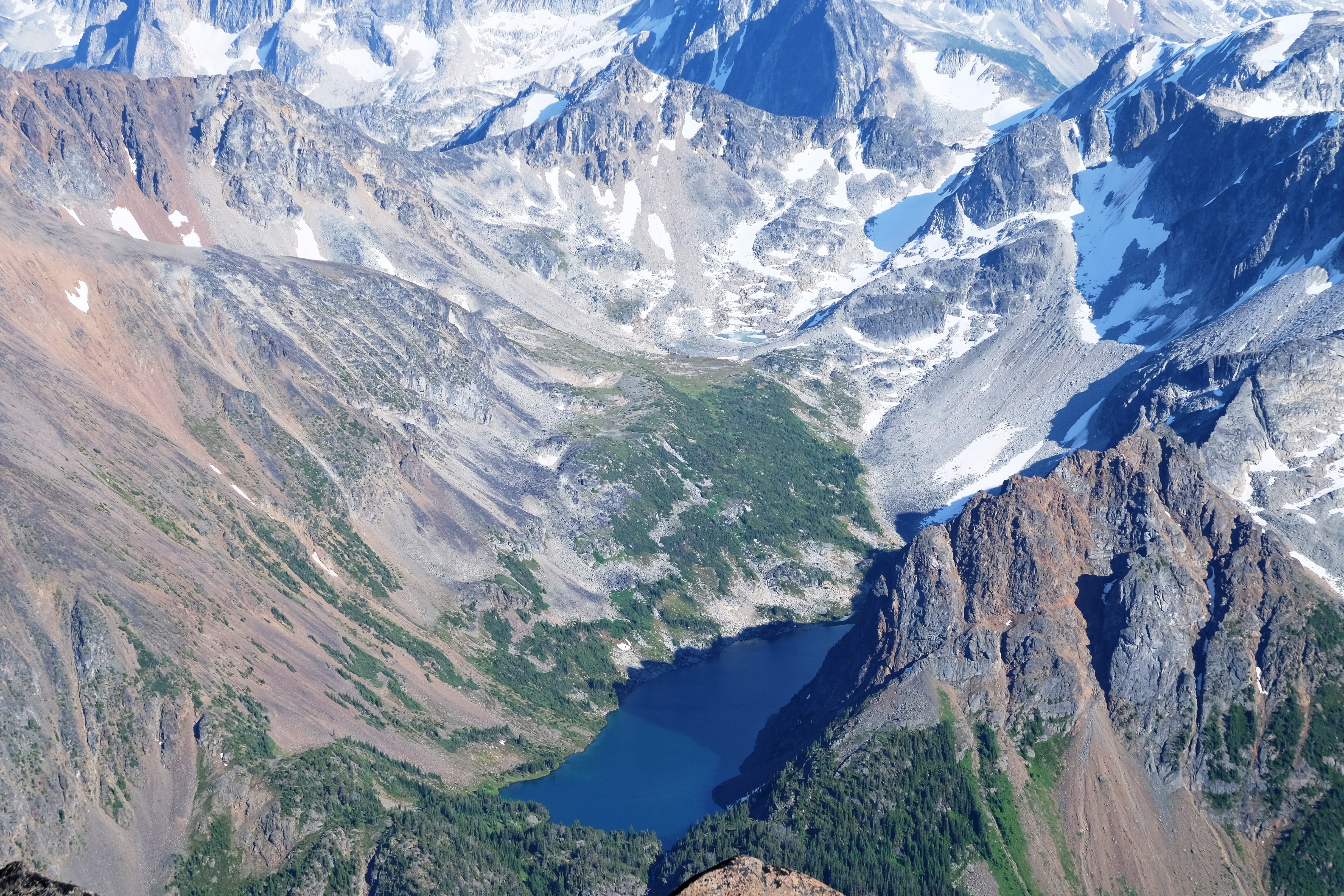
Looking 1,000m down to Truax Lake from the summit of Truax. PC Elliott Skierszkan.
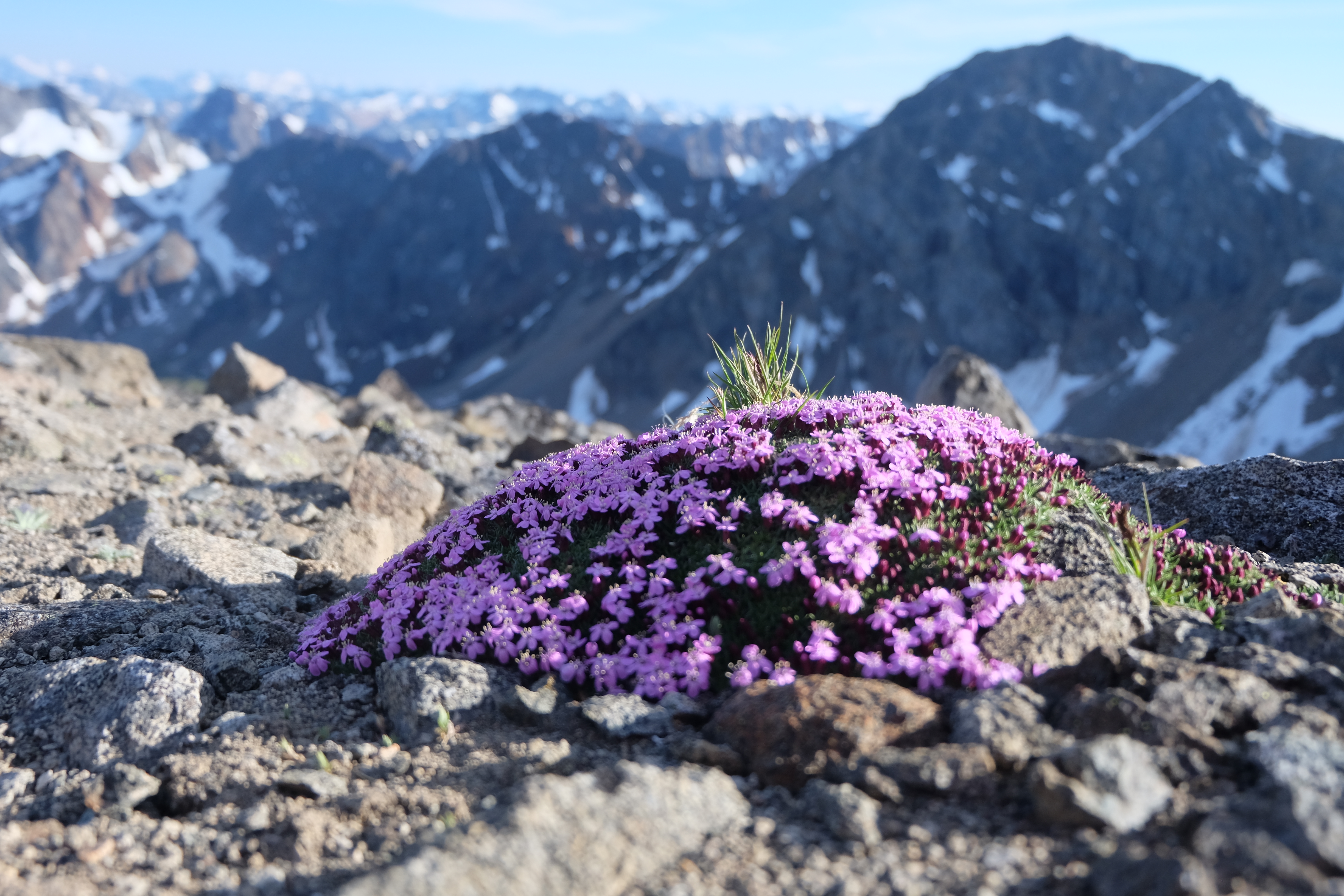
Flowers in a harsh environment. PC Elliott Skierszkan.
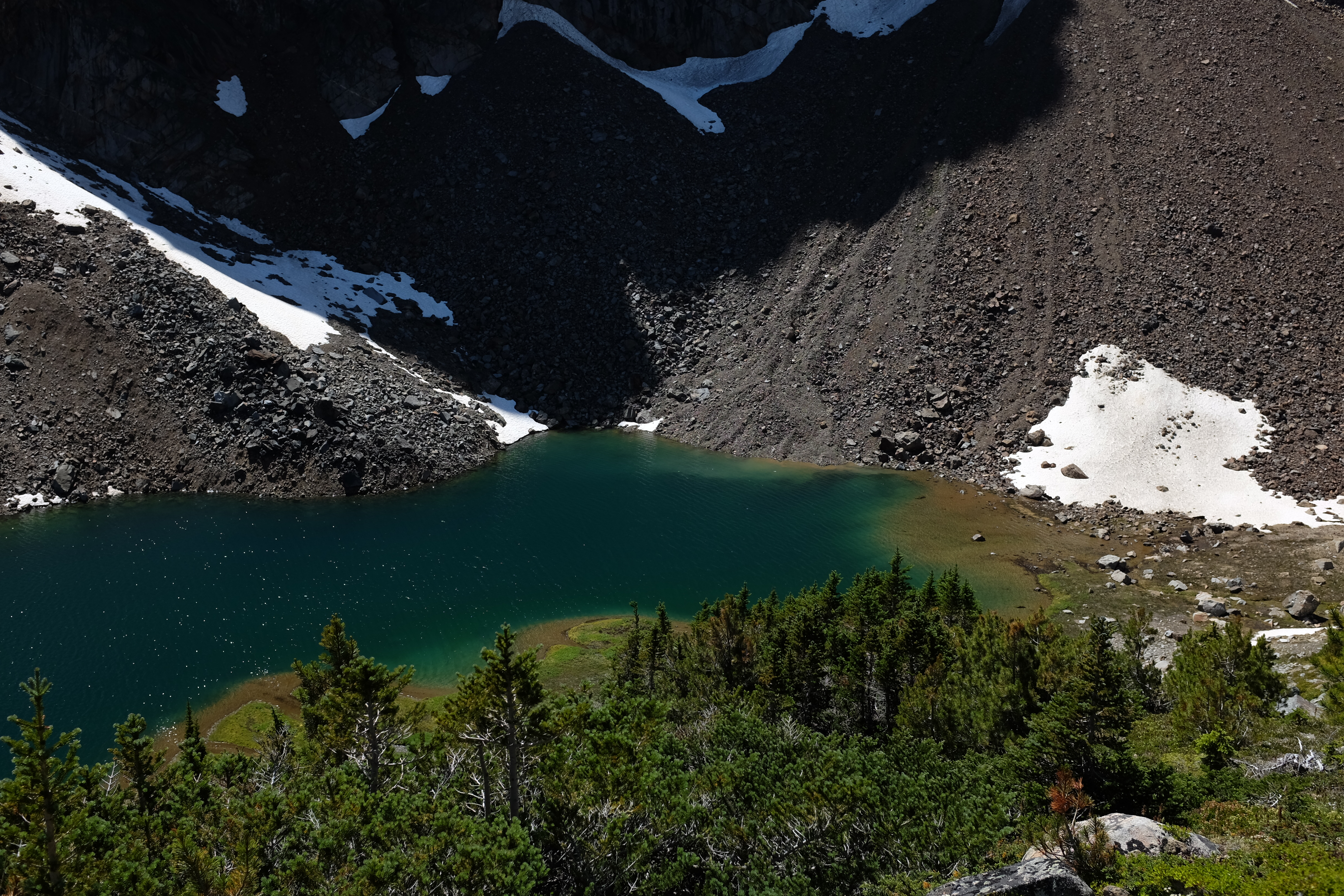
This basin was an interesting and barren jumbled pile of old glacial deposits—a glacier must have filled the entire cirque above the lakes until more recent times.
For our third day, we elected to leave our camp and heavy packs and Al had the wonderful suggestion to circumnavigate the trio of lakes via a ridge-line hike tagging all the peaks along the way. I was keen on the idea as it also would allow us to scout our exit route—we were all a bit nervous that it wouldn’t go and we would be faced with a heinous massive bushwhack and logging road detour to retrieve our vehicles.
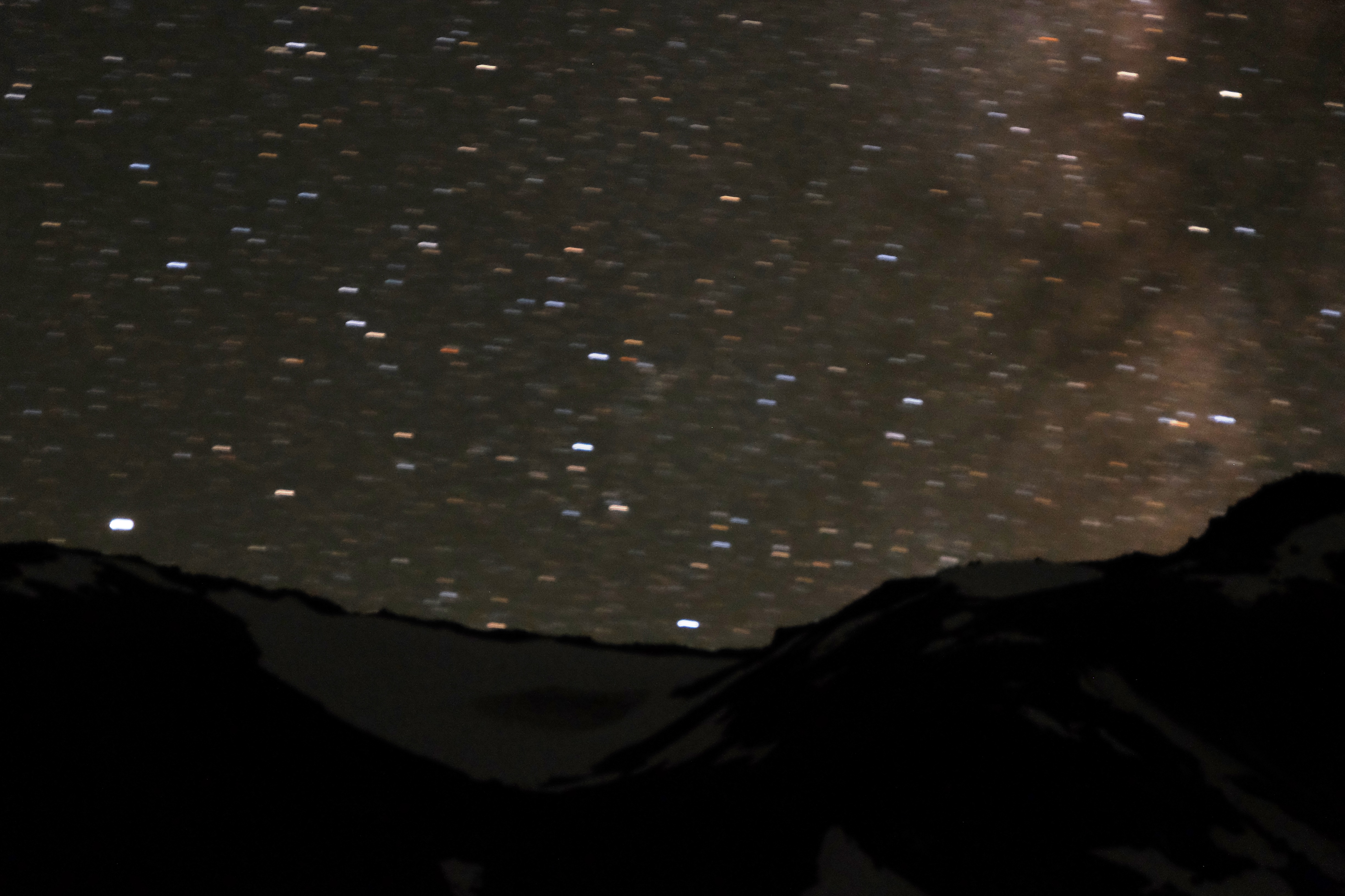
Milky Way. PC Elliott Skierszkan.
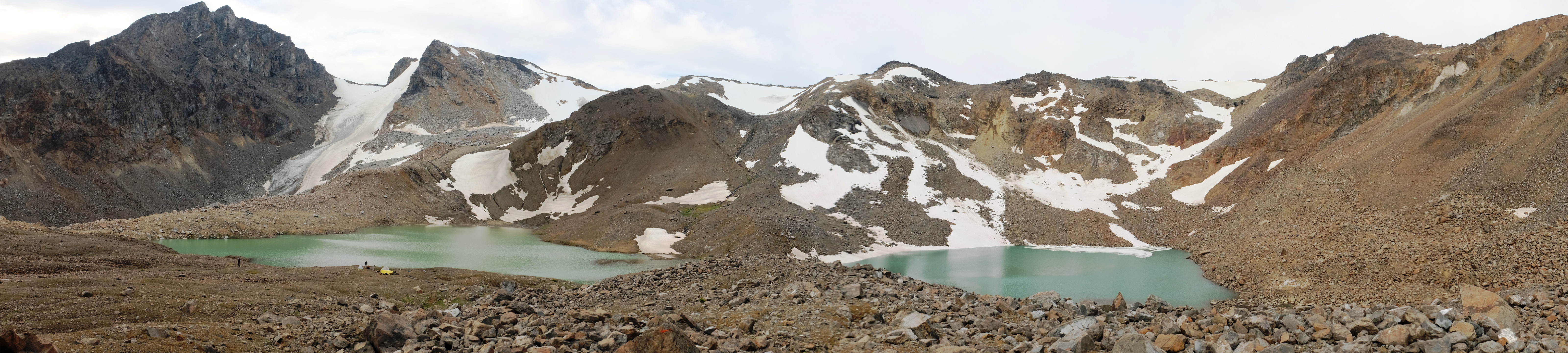
Camp at ‘Trio of Lakes’. PC Elliott Skierszkan.
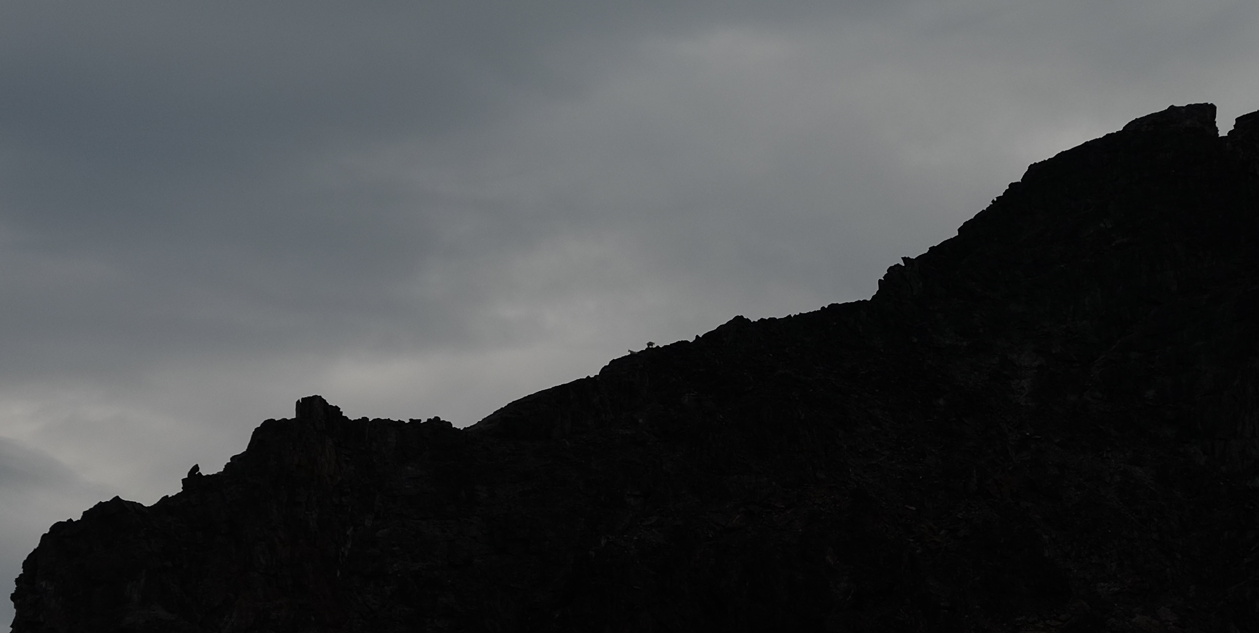
Mountain goats silhouetted on the ridge N of Truax.
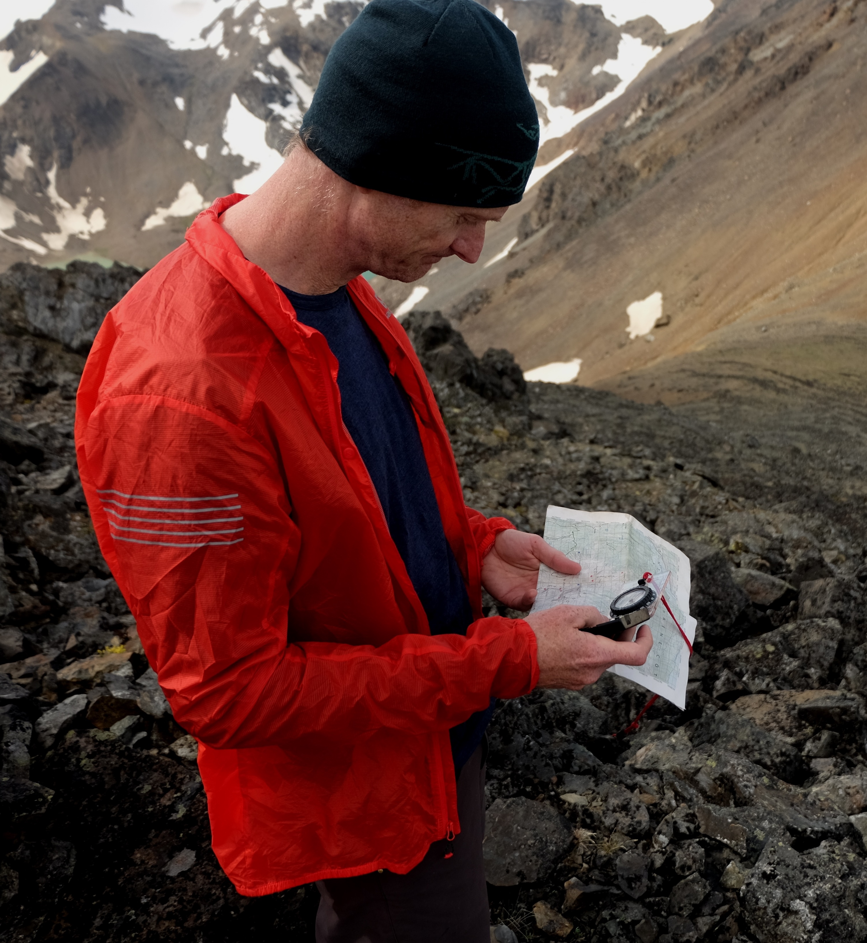
After breakfast we made quick work of the climb to the pass N of the lakes. From here we could see our exit road and to our relief it looked just fine to get there. Sitting on the summit of the 2,680 m peak to the east of the pass, I began fiddling with my compass to confirm the bearing to road was correct and became quite confused that my bearing was about 20 degrees west of where it should have be. We had totally clear skies and the map unambiguously confirmed that the road was where it should be, yet my compass was lying to me. I was quite perplexed (yes, the declination is correctly set on my compass). I’ve been confused by my compass a couple times in the past but have learned that the compass is always right and I am usually wrong when I’m a bit lost, yet here there was no doubt about where we were (on a peak E of the pass) and where the road was yet my compass was pointing in the wrong direction. I asked Al to shoot a bearing on his compass to the road, and he got something different. So I pulled out my GPS and we began a long-winded conversation to figure out what the hell was going on. After much deliberation, I lowered my compass towards the ground and saw the needle shoot even further of course. We were sitting on a pile of magnetic rocks! That was a first experience for me, and would have been quite unsettling if we were actually in need of the compass bearing to routefind!
Uncovering magnetic anomalies. PC Elliott Skierszkan.
Al finding his inner Bavarian. PC Milen Spivak.
Anyways, we continued on our way and enjoyed some more fine ridge walking with occasional scrambling sections. Milen turned around part-way because his boot sole was coming off and despite some excellent field repairs, he wanted to make sure he would be able to walk out the road on the last day. Towards the end of the traverse, clouds built that were followed by rain and hail started coming down. I was ready to head back down to camp, but Al was quite keen to make sure we summit every single peak on the ridge, including a peak just SE of our descent route back to camp. I obliged and we tagged the summit, but didn’t linger as it was starting to come down.
Tra
Scrambling the ridge above our Trio of Lakes camp. PC Elliott Skierszkan.
Once again, for the third consecutive day we ended with an amazing boot-ski back to camp. It turns out that summer alpine hiking traverses with north-facing descents are awesome for the way you always end the day with a boot-ski to camp!
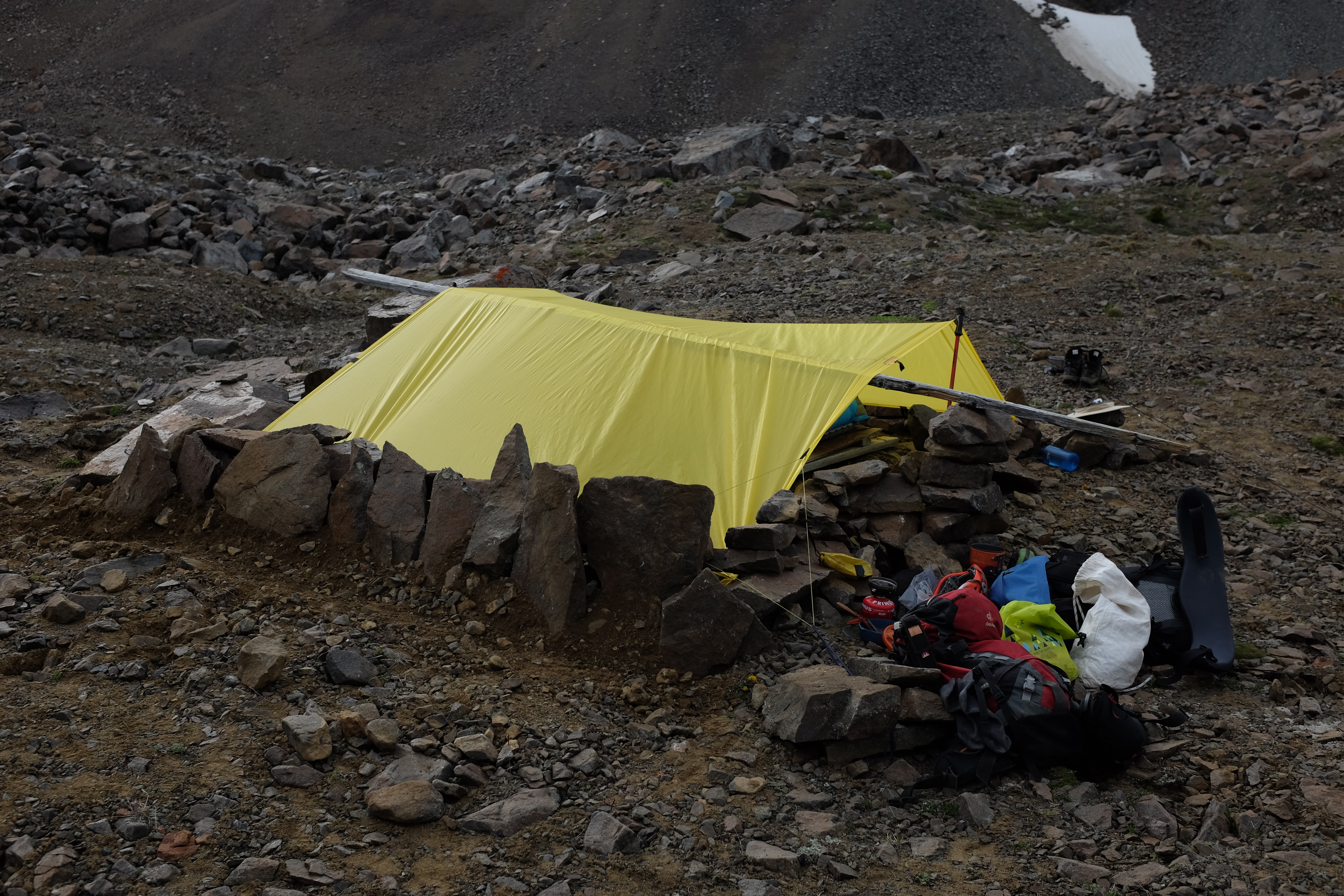
Back in camp, Milen had taken advantage of spare time to engineer an incredible wind-blocking fortress around our tarp. Yet unfortunately, a large gust came through and tore the outer seem of half of the tarp! By some miracle, the very last thing I had thrown in my pack before leaving home was some thread and a needle and I spent the afternoon stitching it up.
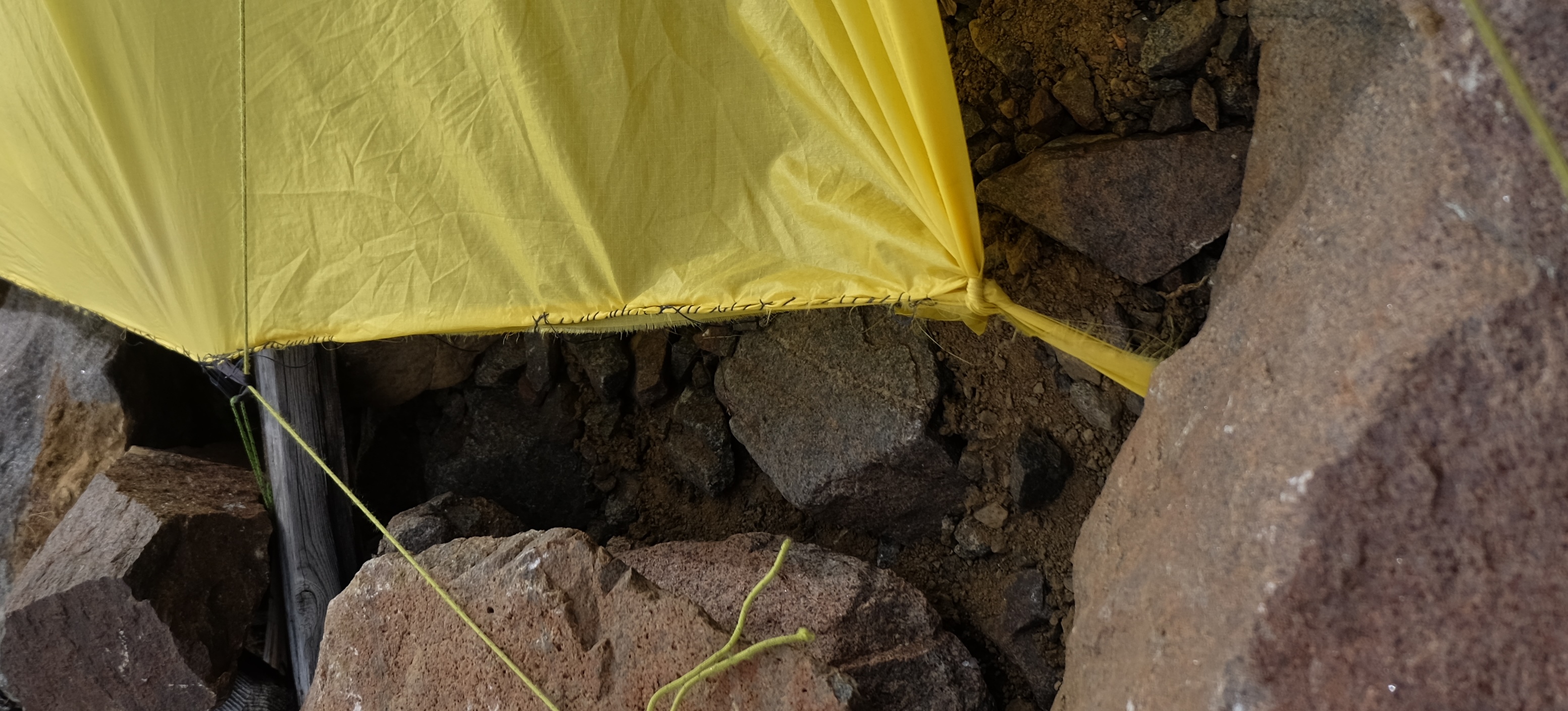
Field tarp-repair job. PC Elliott Skierszkan.
With a bit of daylight to spare, we enjoyed some alpine bocce and discovered that Al is a crack shot, while also occasionally looking up at the steep 5th class terrain above camp where the goats seemed happy to prance around.
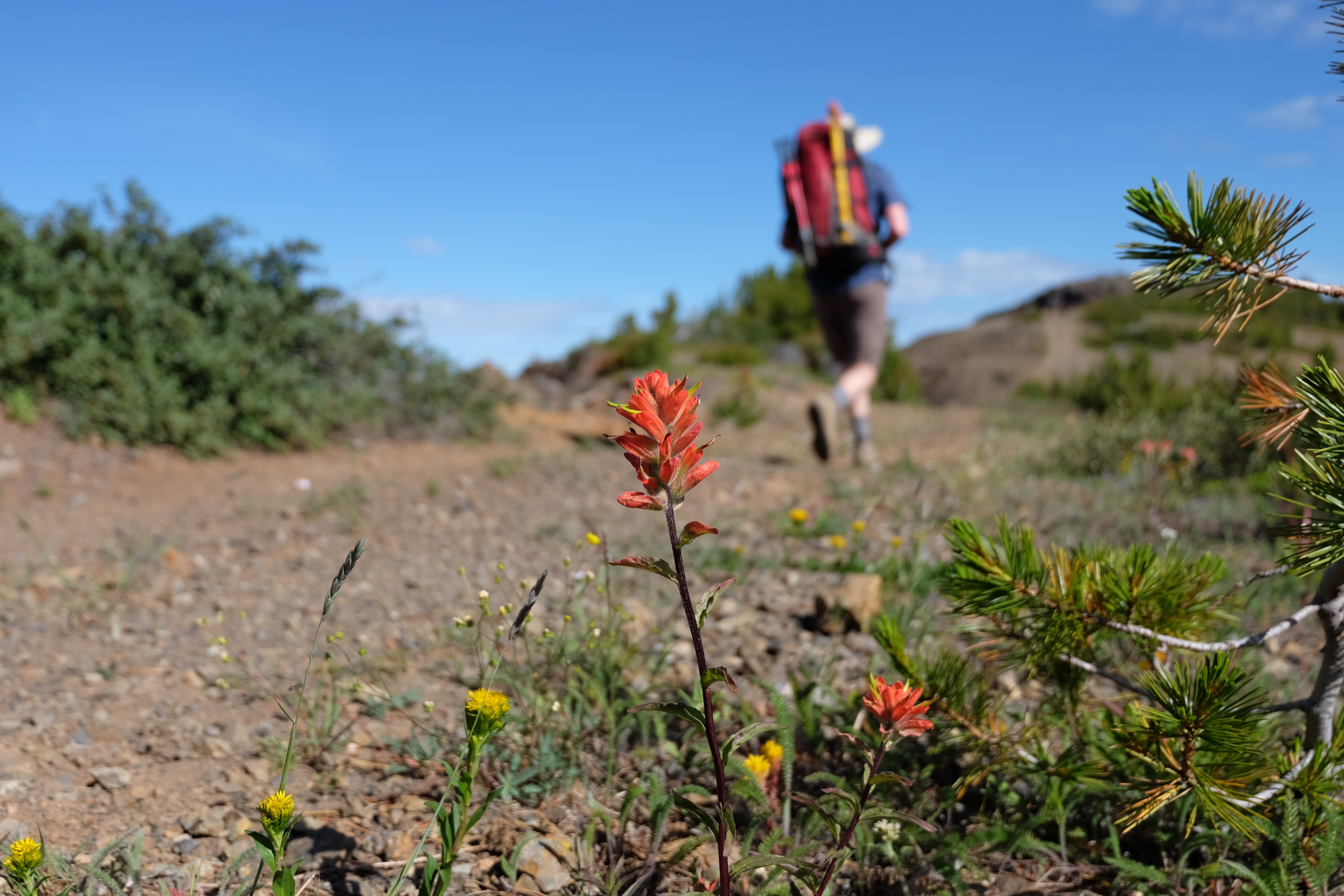
Day 4 came and it was sadly time to leave the alpine and begin the hike out. We came through the pass N of the Trio of Lakes for a second time, and then began our final descent, a long drop of 1,700 m down to the truck at the bottom of Steep Creek road. The road itself is more of an ATV track which I assume is an old mining exploration road (it climbs to the alpine, so there is no reason loggers would have built the road!). It follows a beautiful ridge with great views to the Chilcotin and to Carpenter Lake and there were stunning wildflowers on the way down.
We made short work of the road and ended up back at the truck in no time. We had parked in a full patch of raspberries which was very nice for the finish. With little fuss, we drove to retrieve the Subaru on Kingdom Lake road, stopped for a swim in the lake, and booted over the Hurley to Pemberton where Al treated us to a lovely dinner at Mile One in Pemberton to cap off the trip.
The hike out Steep Creek road. PC Elliott Skierszkan.
This was a memorable hiking traverse mostly because we felt the entire time we weren’t following a known route, but just picking our own way through the landscape based on careful map reading. It turns out that despite the broad valleys which are well suited to hiking, the passes in this region were all very steep and looking back, we felt it was quite miraculous that at every single crux we just managed to squeeze through and find a walkable path through what looked from afar to be impossibly steep terrain. It was also perfect to have ice axes and microspikes, just what we needed for a few snow slopes while leaving behind heavier mountaineering gear. The area has a ton of lovely lakes and high summits and it was quite a pleasure to have great weather and link a route that was almost entirely between 1,900 and 2,800 m in elevation except for the access and exit.
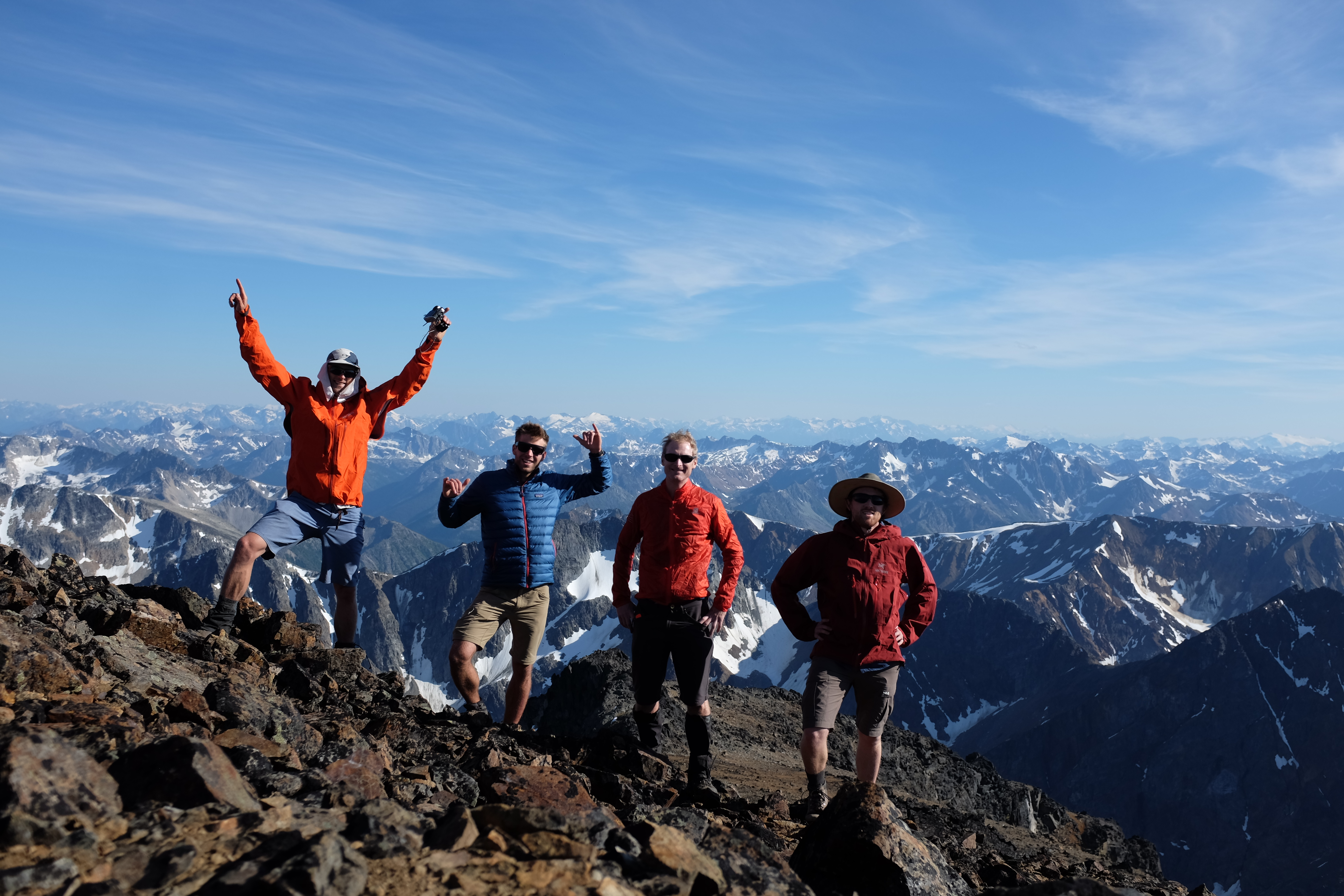 Truax Summit photo. Thanks for a great trip! PC Milen Spivak.
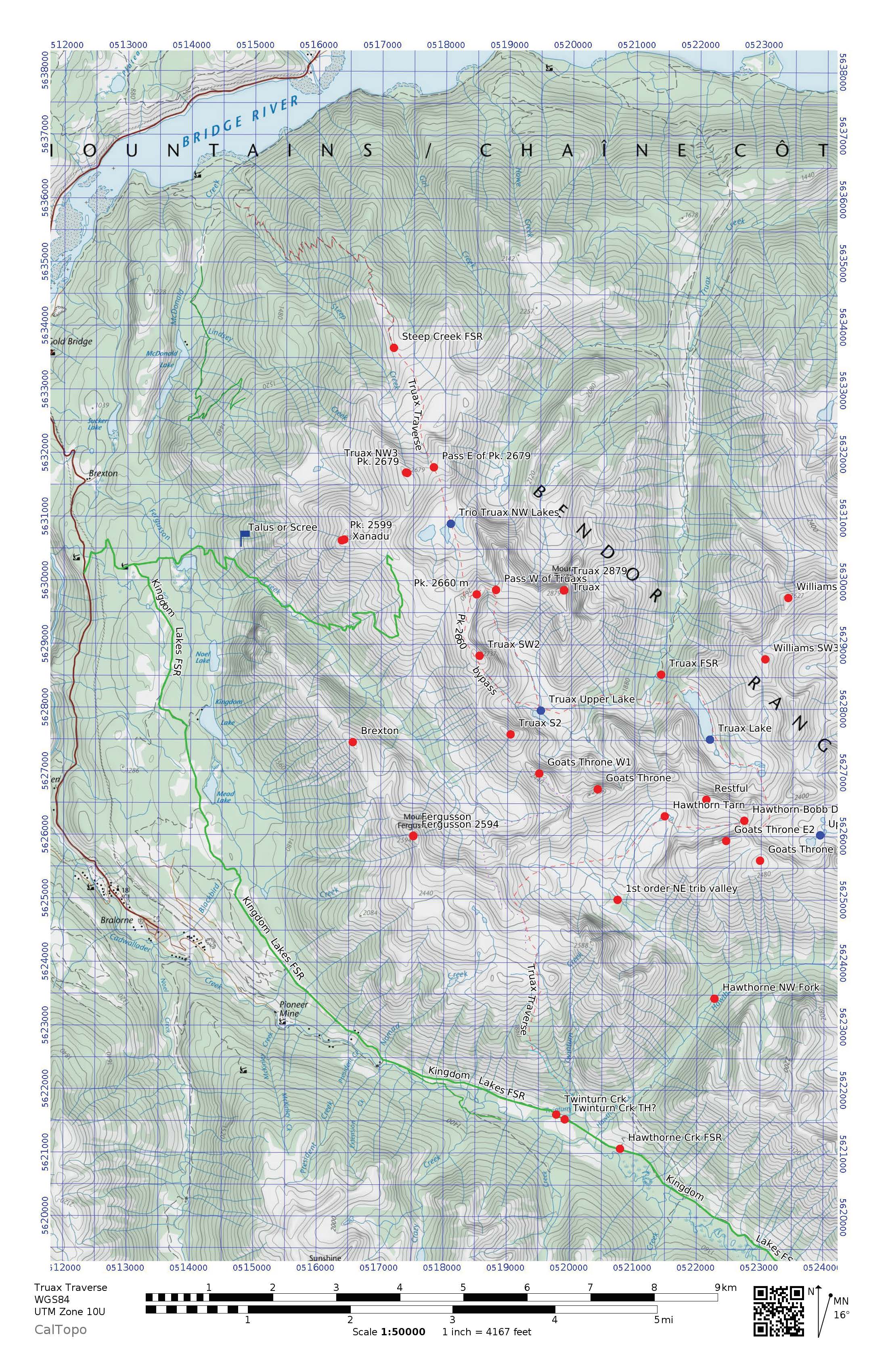
Route map by Elliott Skierszkan.
Seems like a fun area and a fun trip. I just googled Truax to figure out where it comes from, and stumbled across this crazy book review:
http://www.buildingalibrary.com/miscellany/this-book-actually-exists-the-truax-%E2%80%93-a-parody-of-the-lorax-from-the-national-oak-flooring-association/68
So the Truax is basically the nemesis of the Lorax—–seems relevant to your group!