Thank you, Isaac, for organizing this amazing trip! The plan for this Saturday was: Have a group of 6 VOCers meet at Deep Cove, kayak to Thwaytes landing, hike up Underhill Peak, come back and eat Honey’s donuts (of course).
Credits to Isaac Borrego
We met a Deep Cove. Two of us didn’t manage to borrow a kayak from their friend (as they had lost the storage space’s key), so they decide to go on do another trip of their own. Two of us borrowed the magnificent ORU kayak from the VOC, so we set that one up (huge thanks to Melissa for the video and extra tips). That kayak is a beauty. Two of us have proper kayaks. We are ready to go, just missing one paddle. We decide to use an emergency paddle instead, which is a miniature paddle that’s perfect for a 5-year-old.
Credits to Isaac Borrego
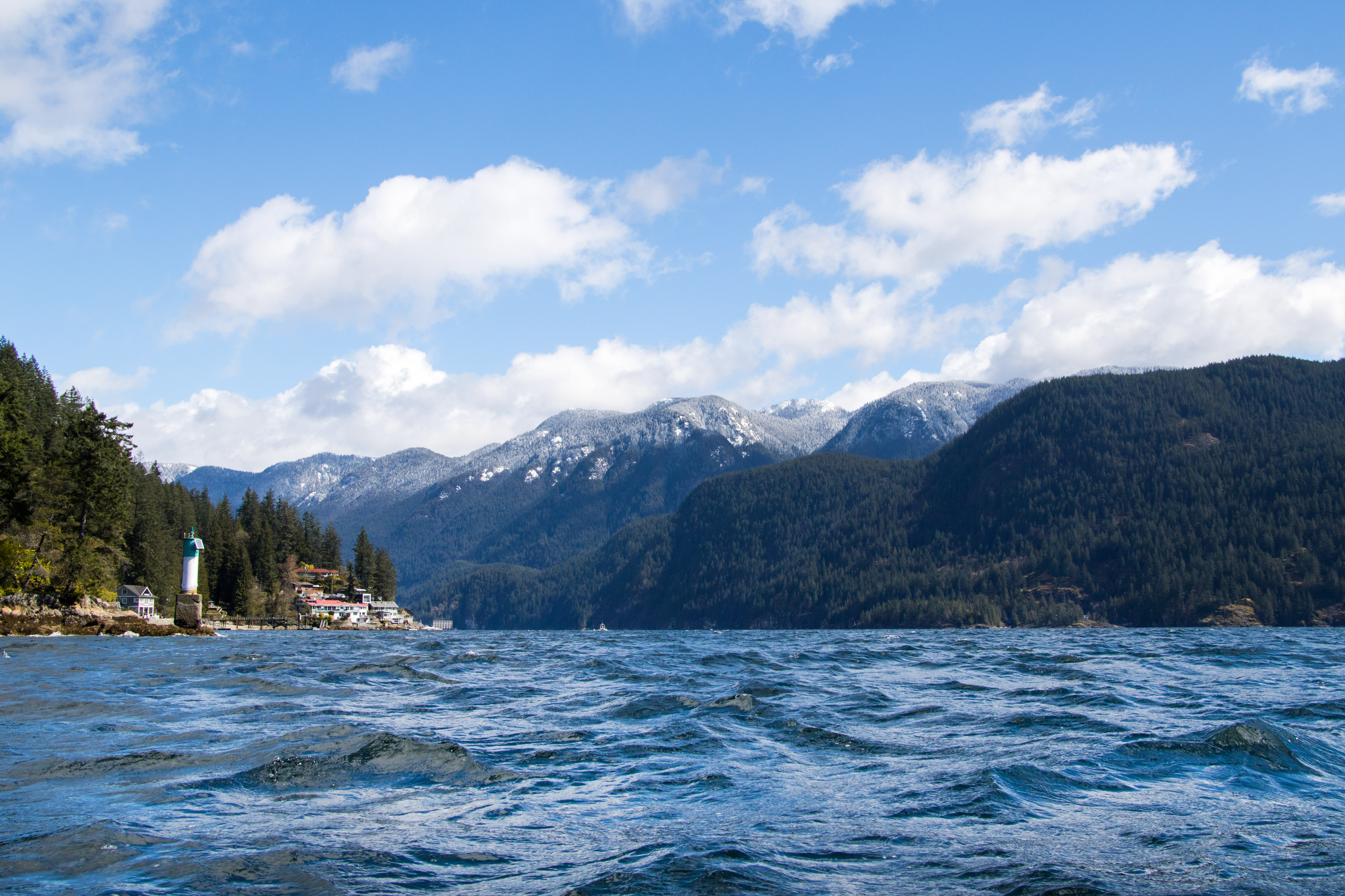
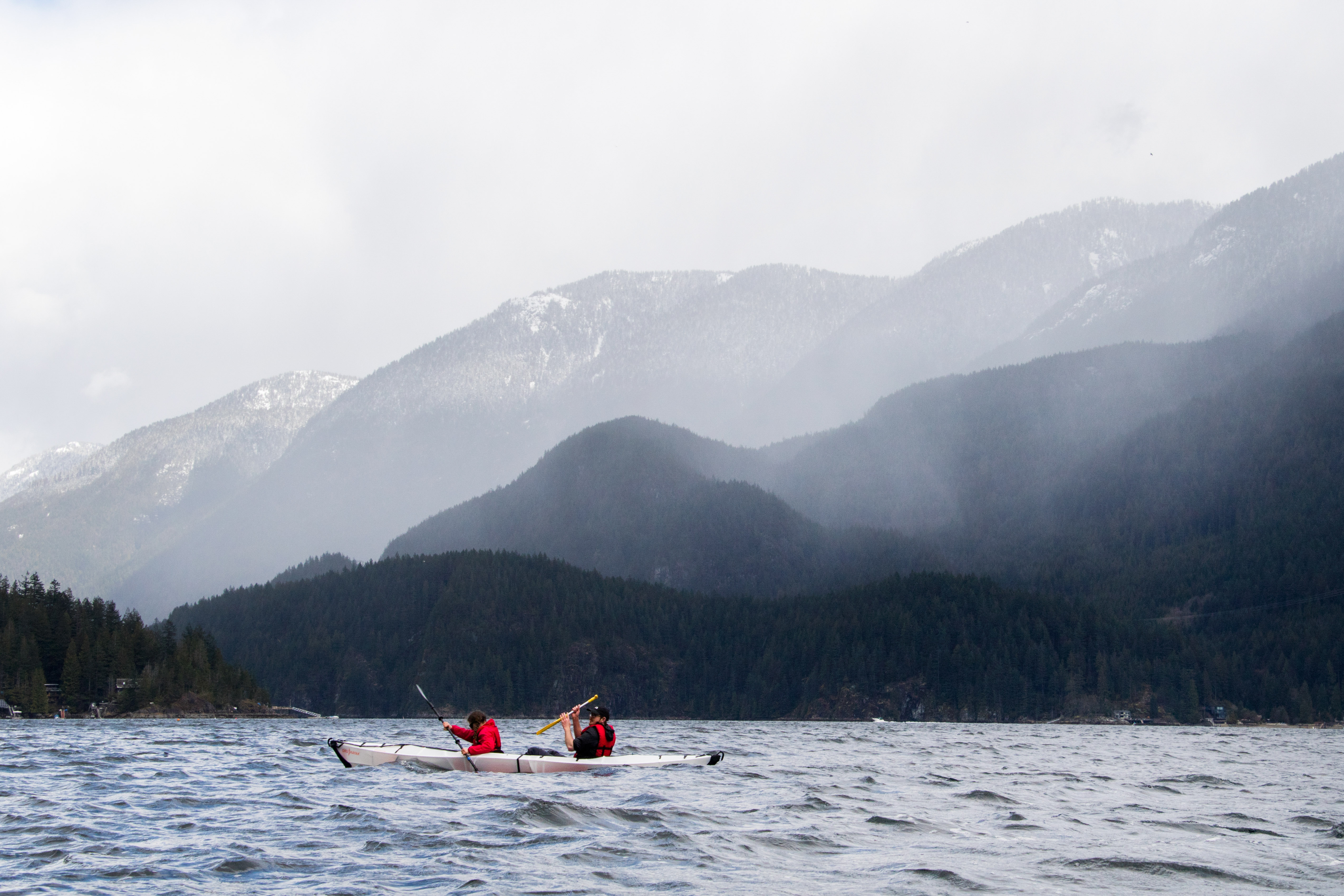
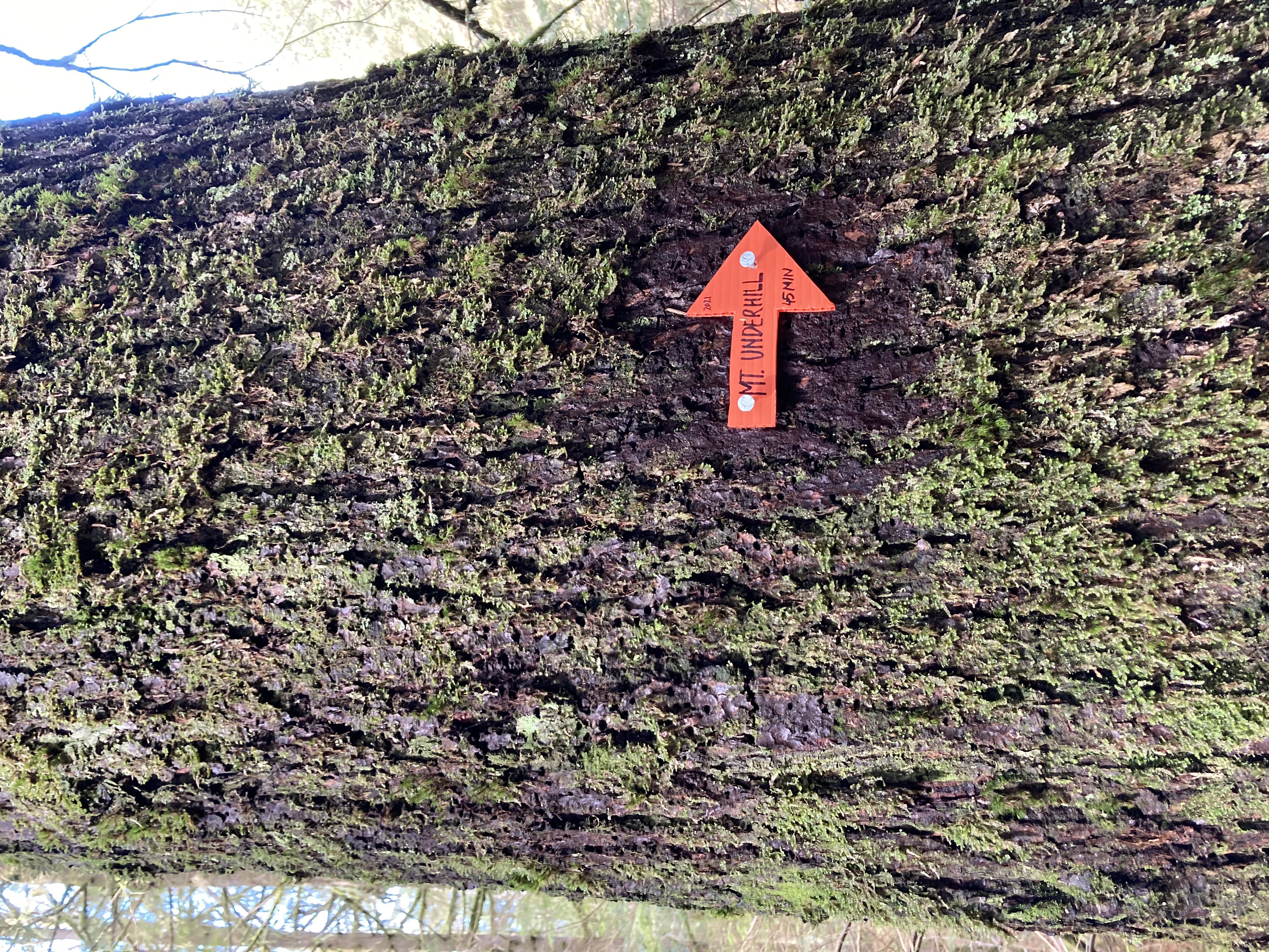
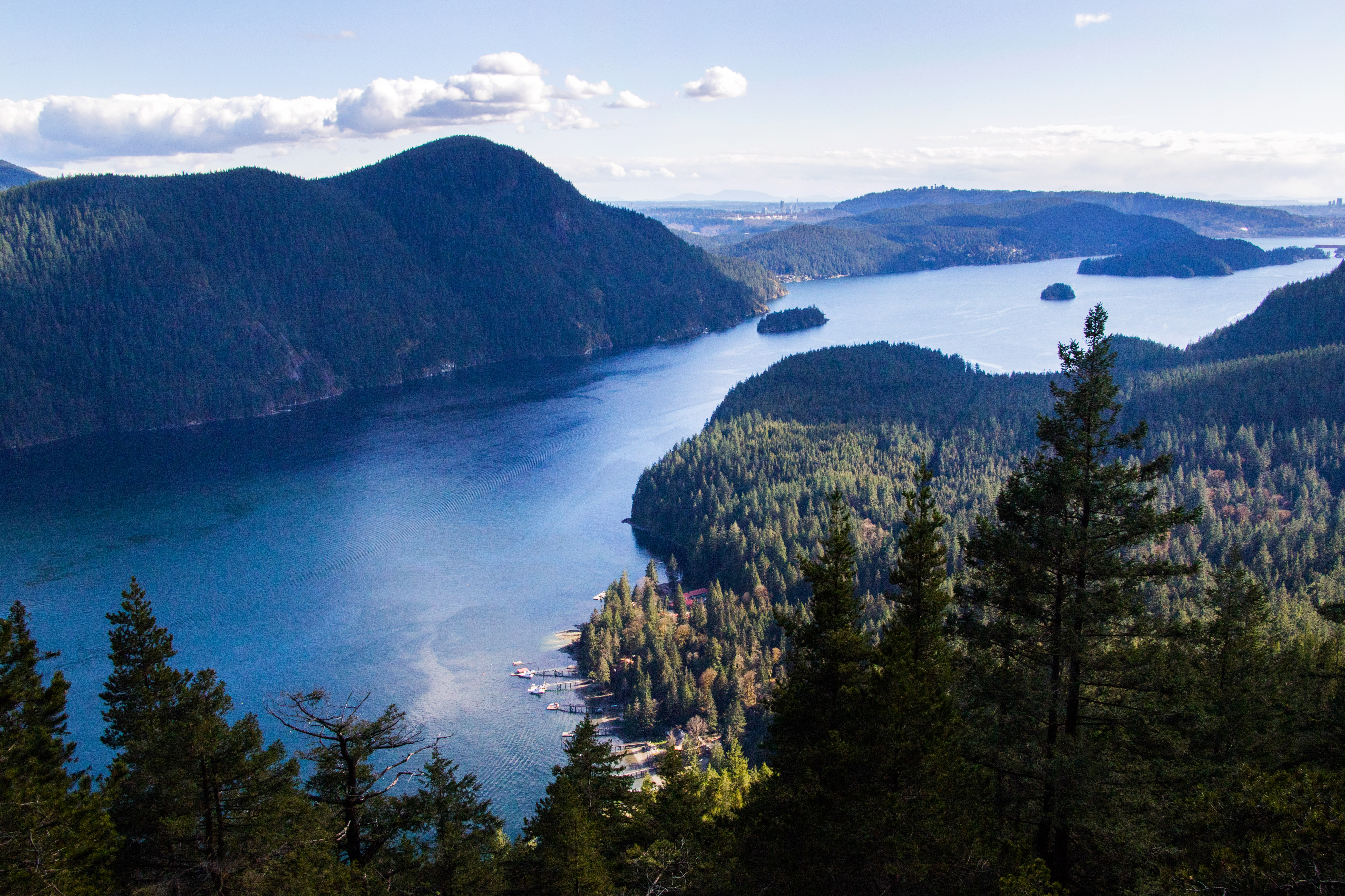
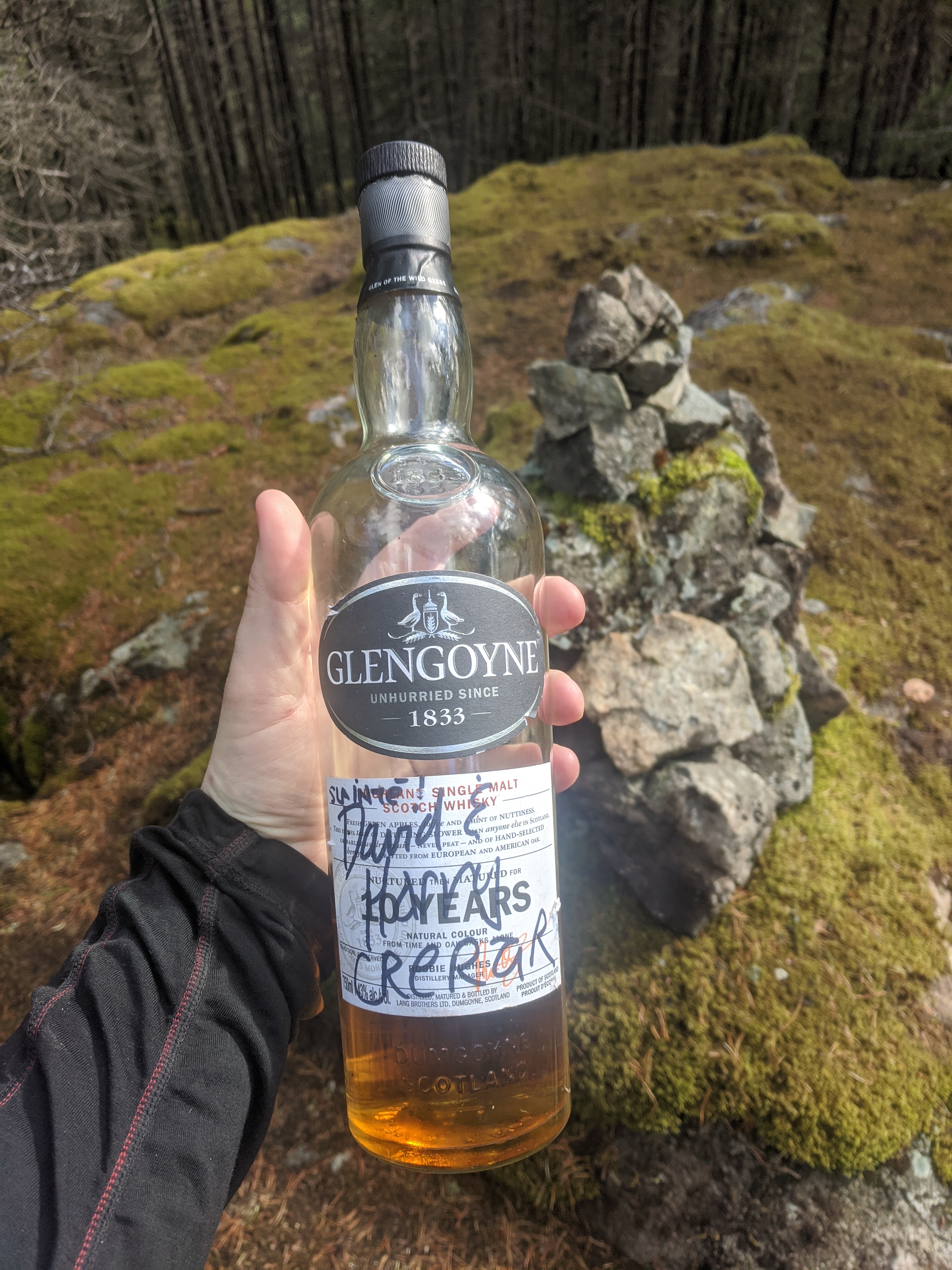
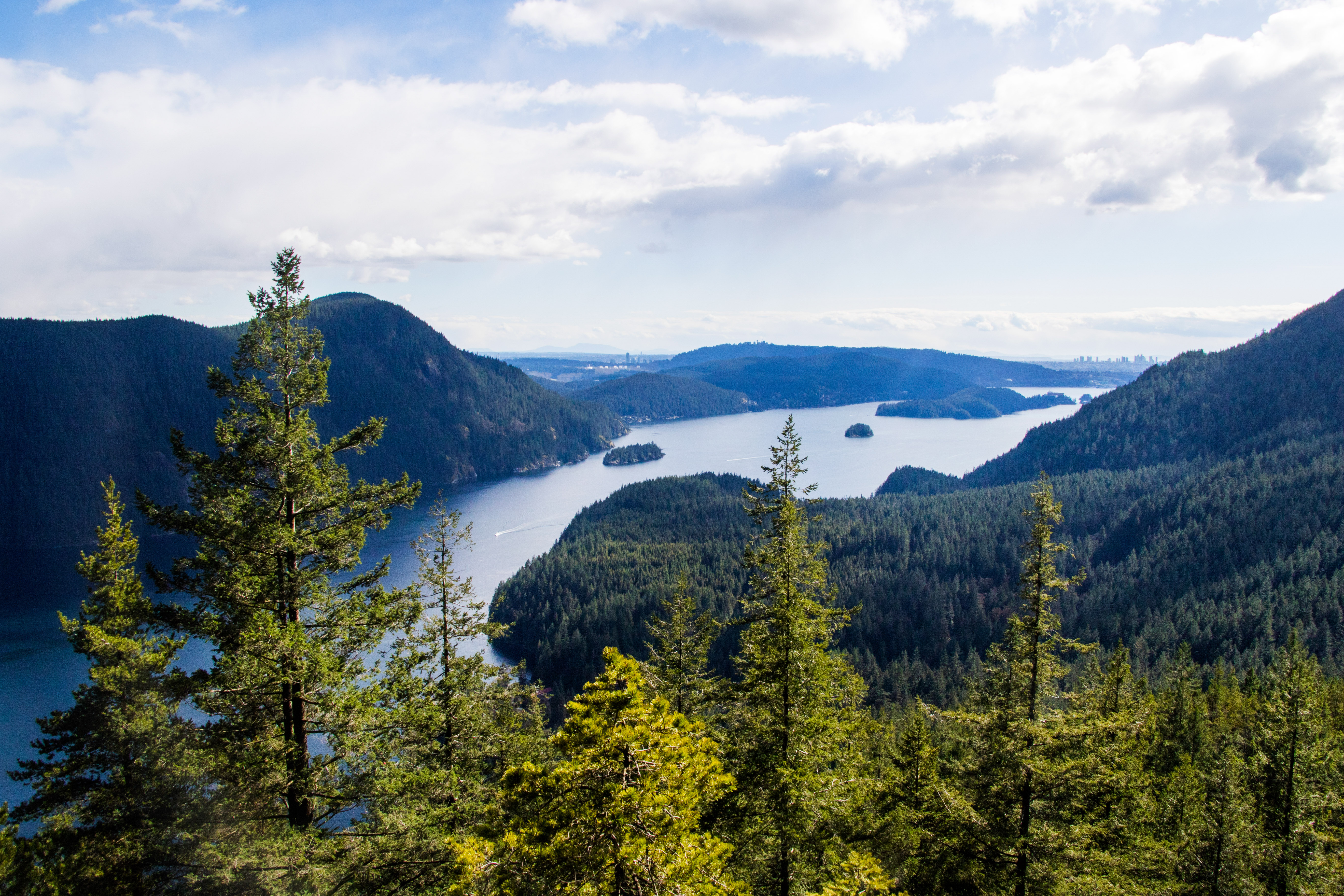
We start around 11 am. The weather is sunny at first but becomes windy, chilly, and rainy on the water. We are making slow progress, so why not stopping at a VOCer’s on the way to get a proper paddle? Well, we miss the house, so we continue with our cute baby paddle in these aggressive waves. By the time we reach Thwaytes landing, the sky is generously sending us some snowy hail. We are wet, cold, a bit tired, but still excited! After a good rest at the beach—during which one of us melts his sock in a magnificent attempt to warm his feet above his gas stove—we are ready to go. The way up is: walk up Shone creek for about 200 meters, join the trail on the right side of the creek just behind the houses, hike up the trail and come back the same way. That is what you would do if you knew where to go. But we didn’t. Here is our story. 1st attempt: We find a trail beginning on the right side of the beach, walk it up, reach a waterfall after 5 minutes, realize we aren’t on track, turn back. The map clearly says we must hike up a creek and then reach a trail. 2nd attempt: We walk up Holdmdem creek, which is a fun challenge of jumping from rock to rock, and…end up at the same waterfall. Dummies that we are. It was the next creek over. 3rd attempt: We start walking up the next creek, which isn’t as easy to cross. Seeing our struggle, one of the locals approaches and enquires about our plan. We explain our idea. He mentions that all land near Thwaytes landing that is not the beach or the creek is private. Higher up the nameless creek that we attempt to climb is a huge waterfall that some hikers have fallen in with deathly consequences. Hiking in the area is not always very safe as trails aren’t clearly marked. ‘We rescue about one person a month,’ he adds. He then indicates the best way to reach Underhill Peak. We are grateful for his help and must add that local private owners aren’t delighted to see hikers stump on their little paradise… 4th attempt: We walk along the public beach, hike up Shone creek, find a trail-ish on the left, cross the creek at the junction of Shone and Underhill Creek, bushwhack our way North, and find the correct trail. The trail-ish that we are coming from is blocked off with small logs. Not the correct way, obviously. The rest of the hike is well marked with pink flags. The sun is coming out intermittently. We reach a stunning viewpoint, from which we can admire Indian Arm and Burnaby. A few minutes later, after a steep scramble up slippery rocks, we reach the summit! It is about 400m up. One of our well-informed VOCers knows there is a whisky bottle hiding up there…and he finds it! So there we celebrate ![]()
Credits to Sebastian Gitt
Credits to Isaac Borrego
Credits to Sebastian Gitt
Around 4:15 pm, we head back down the muddy, rocky, mossy trail. The trail finishes behind private property, from which we walk to Shone Creek (on the right) and reach the beach further down. The tide is now at its highest (it’s 6 pm -ish), and our kayaks are still safe. We make our way back. The water is calm, the sun is out, no cloud on the horizon…what a treat! We all make it back to Deep Cove (although some had initially planned to camp on Twin Islands, but a few injuries and the cold convince them otherwise) and arrive around 8:30 pm, too late for Donuts. Snif. Time to go home then! So, fun trip! Everything you need in it: multiple sports, some route-finding, friendly interaction with the locals, hidden gems on the way (amazing viewpoint + fancy Irish whisky). Conclusion: fantastic trip, but remember that the locals don’t wanna see too many wanderers around… Thanks everyone for the adventure!
Credits to Isaac Borrego
If you are interested in a map that shoes the Private vs Public lands I made a caltopo for the area: https://caltopo.com/m/LSPG
Thanks for the great trip report, what a strange yet rewarding trip… Here’s some info I found on the history of the property in that area, including a house built by Dr. Frederick T. Underhill, after whom the peak is named. Turns out he was the top public health official for the city of Vancouver during the 1918 pandemic!
https://deepcoveheritage.com/wp-content/uploads/2017/12/Valer_Park_on_Indian_Arm.pdf
https://www.pressreader.com/canada/vancouver-sun/20170208/281535110731593
Thanks for the awesome trip report, Clementine!
Is there a GPS route of the final route you took?
Here’s a GPS route I made after the fact (so it’s not 100% but it’ll get you where you need to go!): https://www.gaiagps.com/map/?loc=14.6/-122.8955/49.3758&pubLink=AsZuNcZWc7a8XexAqeQZGtnr&trackId=17a05d2a-afd5-40d3-a949-3e918608e0e5