Sometimes there’s a trip eating away at your brain, and the only possible relief is to attempt it, fail, and drag a few other forlorn souls down with you. During the March 2020 lockdown, Birgit Rogalla and I improved our wall map of the Garibaldi Park area—made up of eight 1:50,000 topos arranged as a square with one corner missing—by drawing dashed lines where we had hiked (or biked) in green and purple markers. When we finished, it was painfully obvious that there was one entire map had no green or purple, representing the mountains east of the Lillooet River between Lillooet Lake and Harrison Lake, as well as Fire Mountain and the Terra Rosa area. Our longstanding obsession with the Lizzie area, one map north, tempted me to dream up a hiking traverse over the peaks surrounding Gowan Creek.
Ross Campbell joined us for the week of August 21-29, with crampons, ice axes, ice screws, a 70 m half rope, and 9 days of food each. We parked the car on Saturday at the end of a new logging spur 700 m above Gowan Creek and bushwhacked uphill until we reached a broad, mellow forested ridgetop. Convenient heather walkways led us past a few quiet lakes, nearly invisible inside the cloud, as well as many small dry tarns, whose mud preserved an impressive number and variety of animal tracks. There were small bears, medium bears, big bears, deer, deer, and more deer, mountain goats (later on), and what must have been a bobcat. It was days until we saw our first large mammals in the flesh (some goats running away on a ridge), but the area must have been teeming with them. The bears, at least, may have been attracted by the incredible blueberry and huckleberry crop.
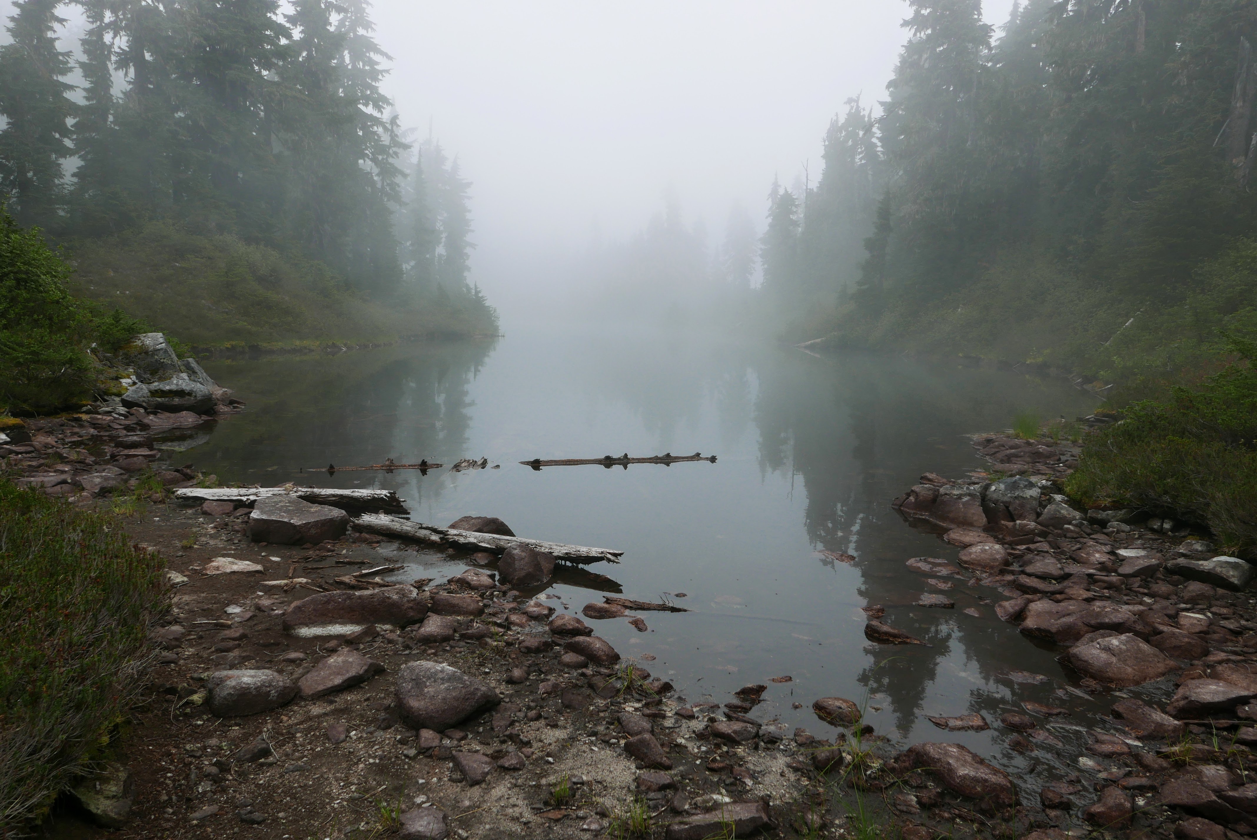
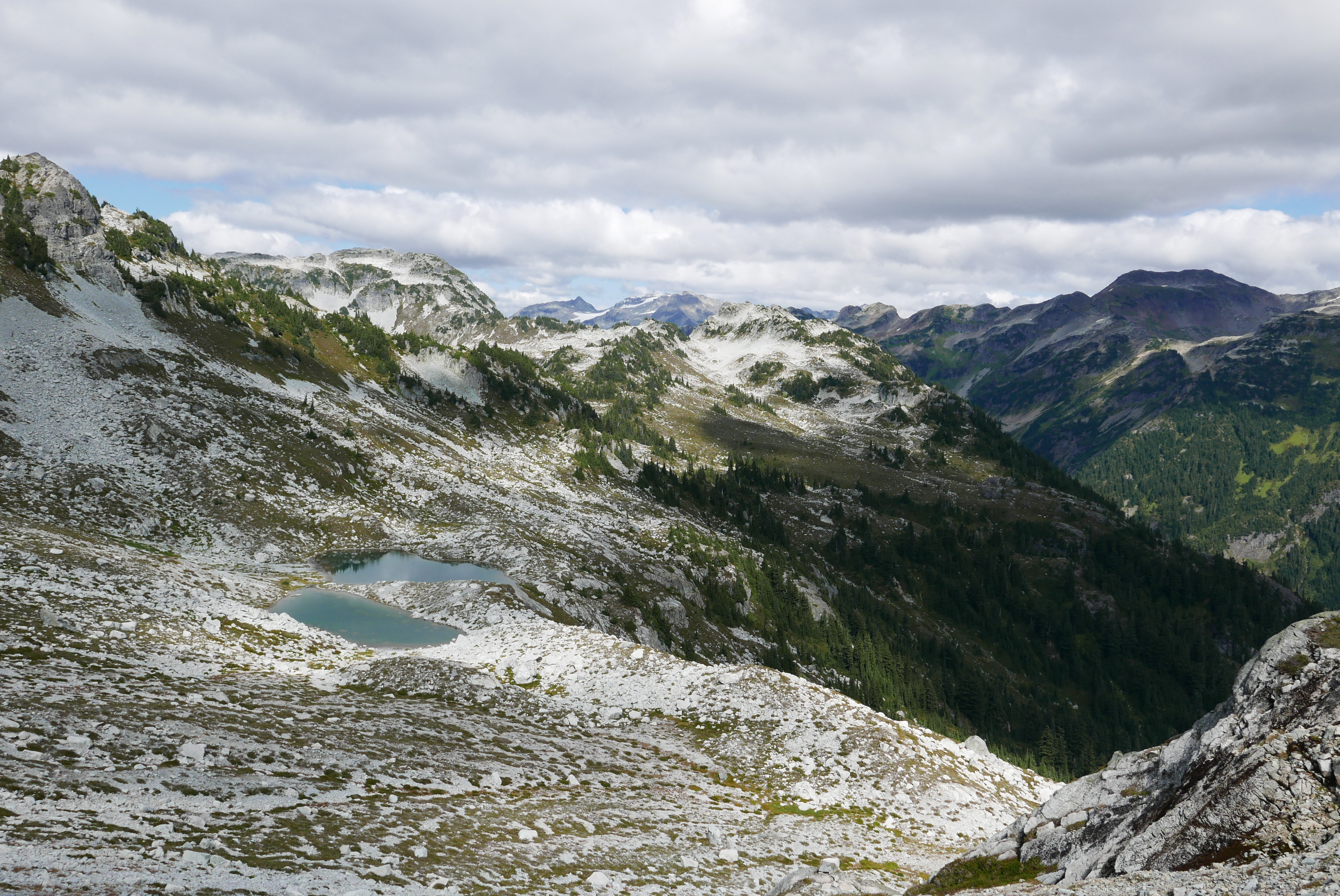
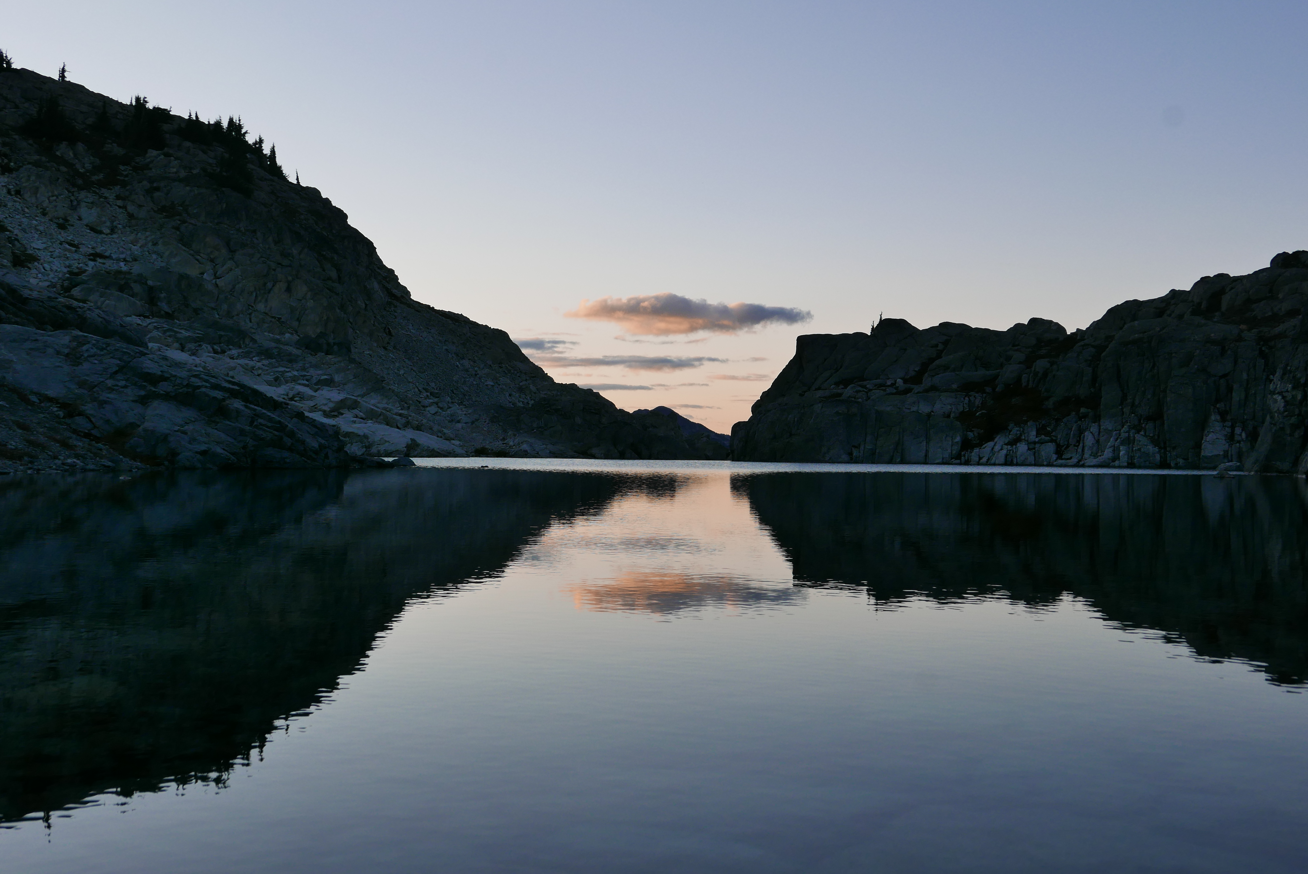
A misty lake on the ridgetop, a couple hours from the car.
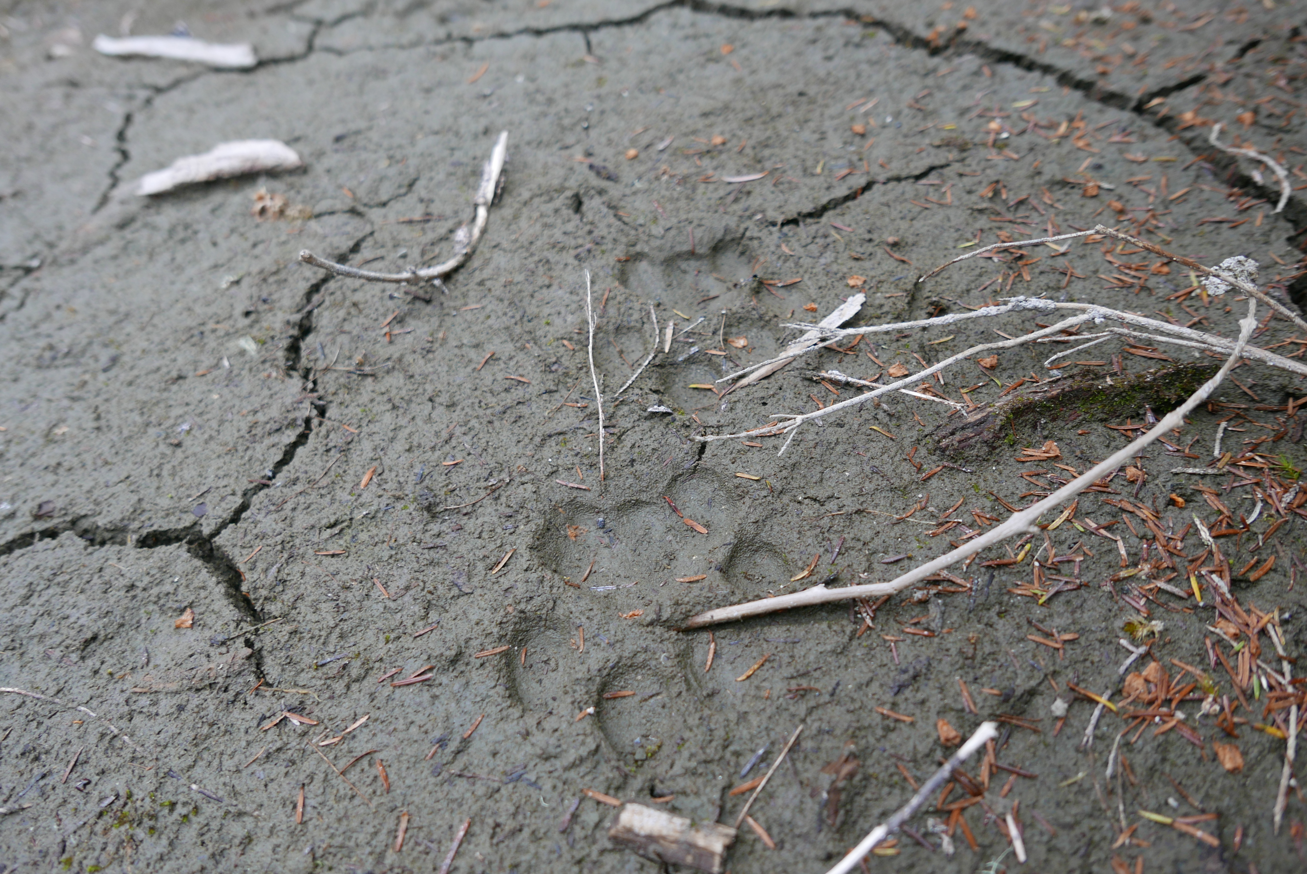
Bobcat prints (we think).
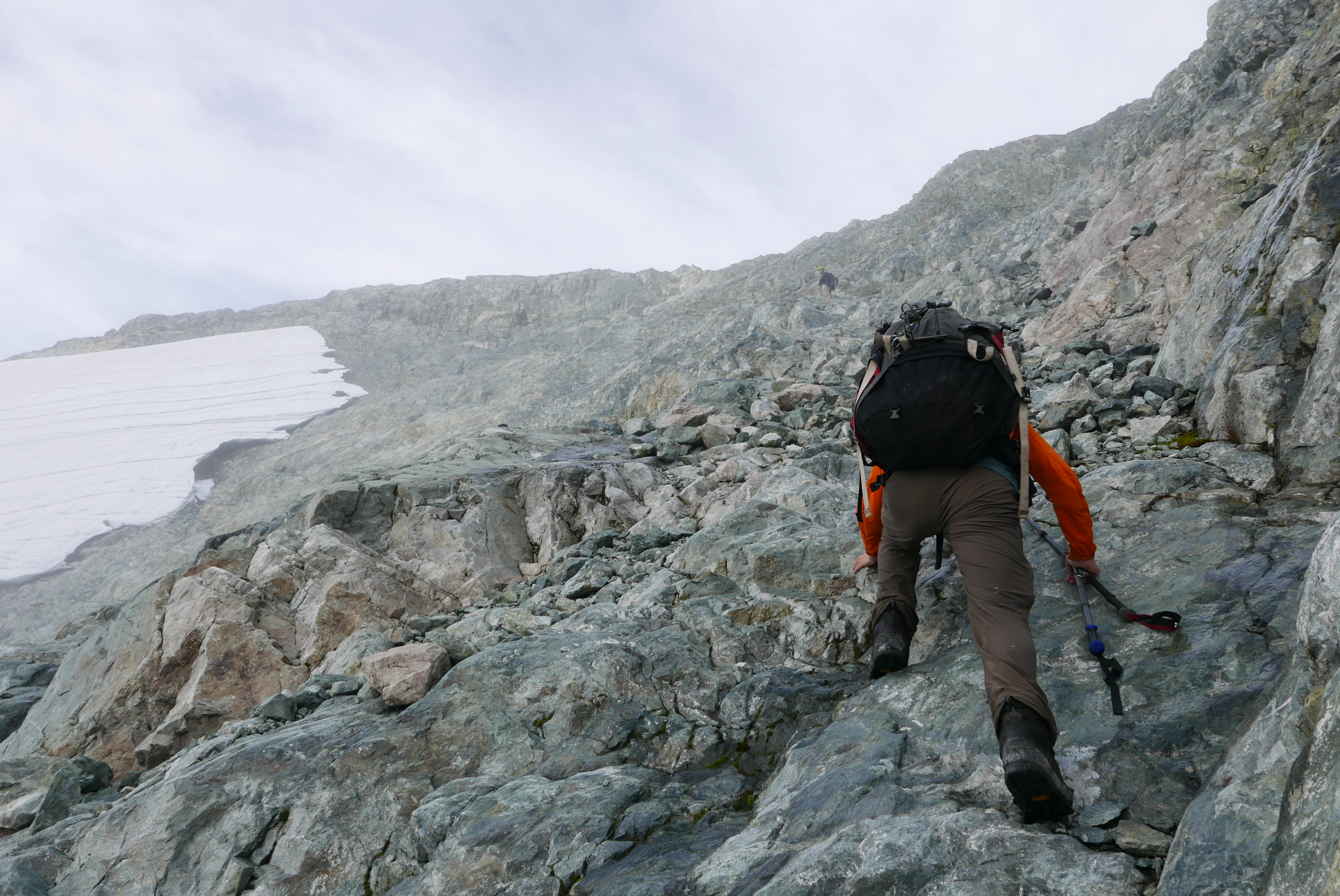
Walking this idyllic ridge until evening, we camped beside a small tarn just off the crest. It poured rain overnight. This was a little concerning, as the forecast (2 days cloud then 7 days sun) had called for less than 5 mm of precipitation in total, but we hoped the weather had got it out of its system. On Sunday morning, we traversed steep talus and heather to bypass a subpeak of what Bivouac calls Snow Pillow Peak (2235 m), a fortress of a mountain walled with cliffs on all sides. In a complete whiteout, Birgit found an uncomfortable class 3 ledge system that crossed the steep southeast ridge to a tarn east of the summit, where we set up camp early and shivered in the tent for a few hours as it drizzled and blasted wind outside. Overnight it poured rain again, and early Monday morning it snowed a couple centimeters.
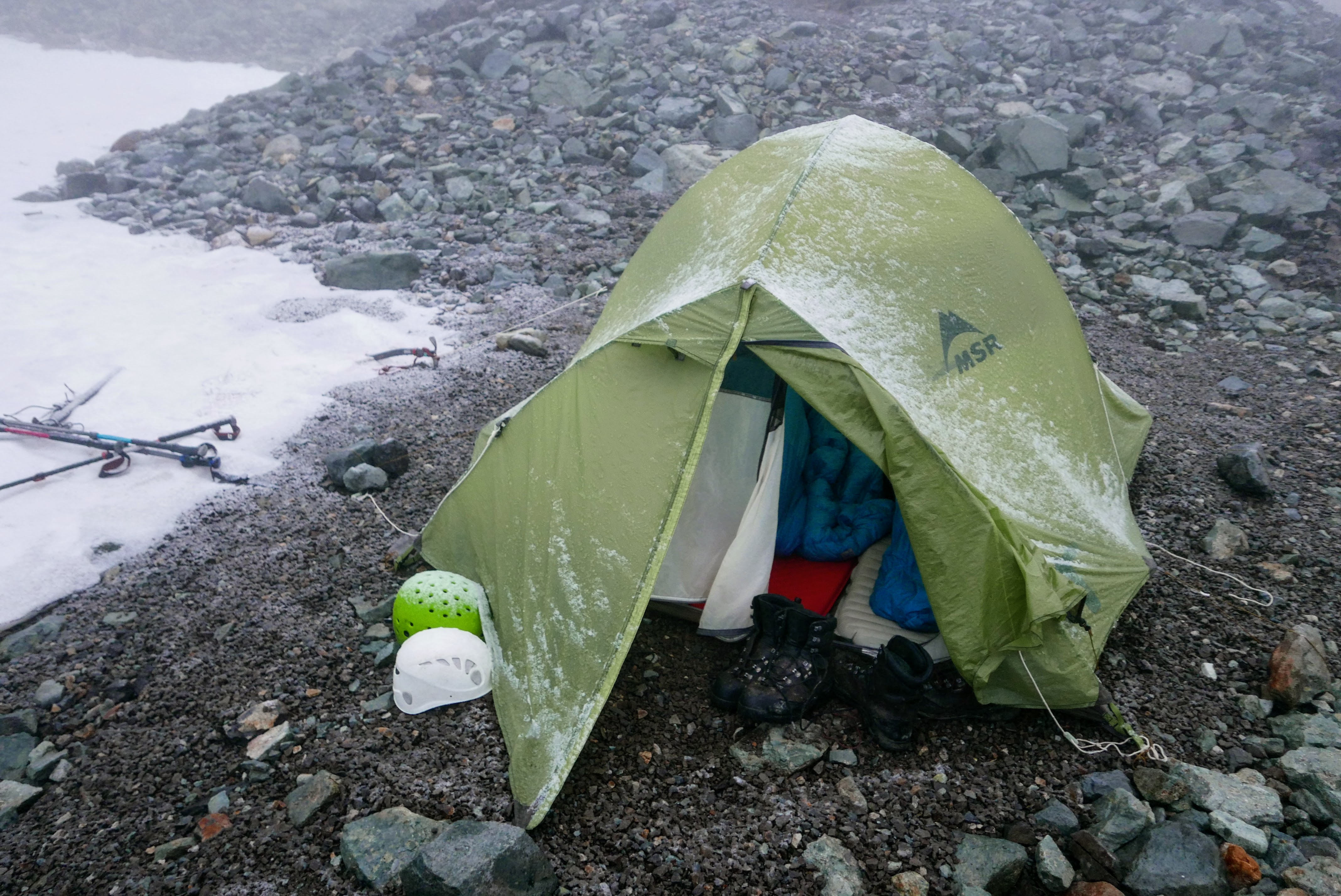
Rain, snow, wind, and cold.
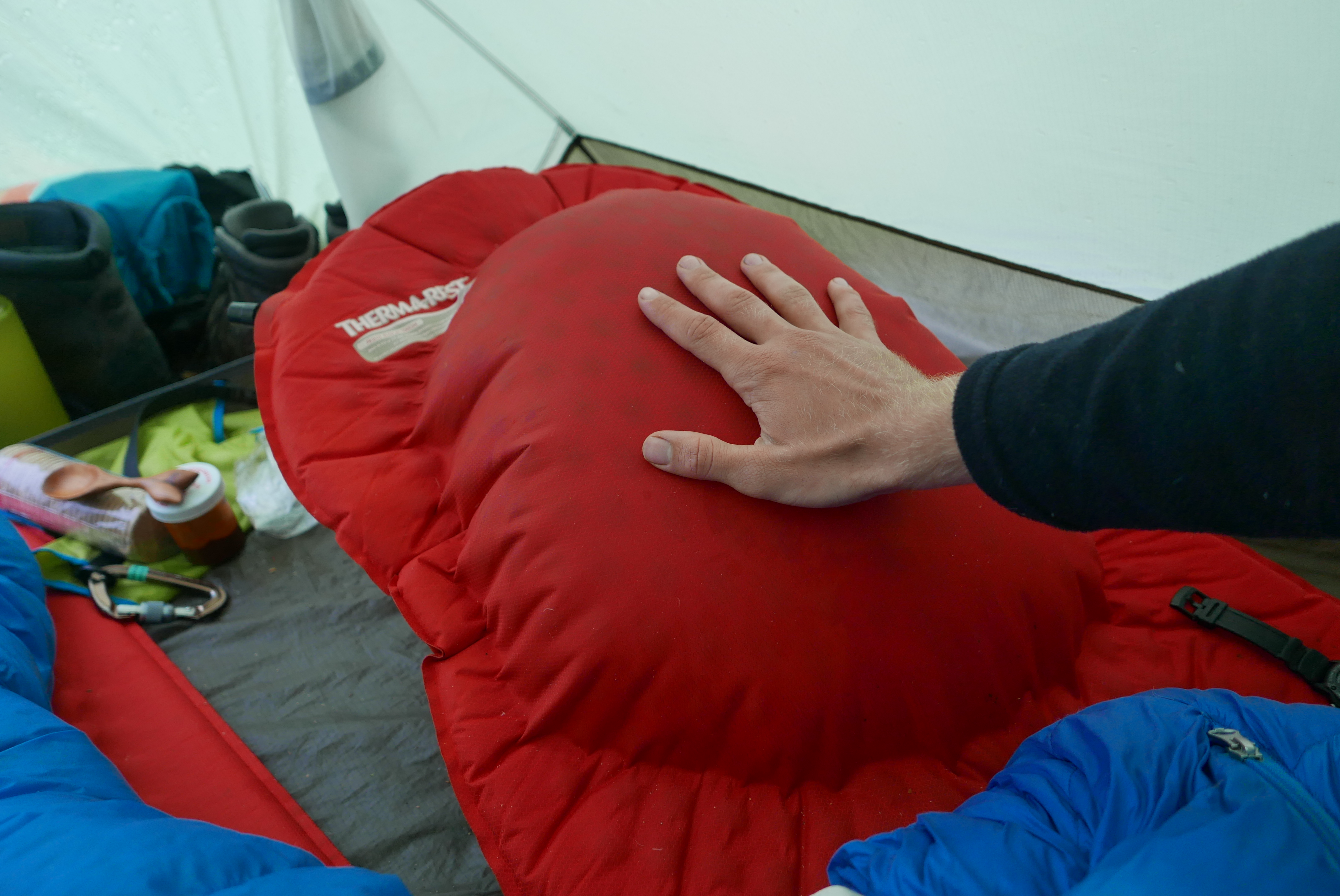
My mat started delaminating on the second night. By the end of the trip, one third of it was just a massive beachball, and I mostly slept on it deflated.
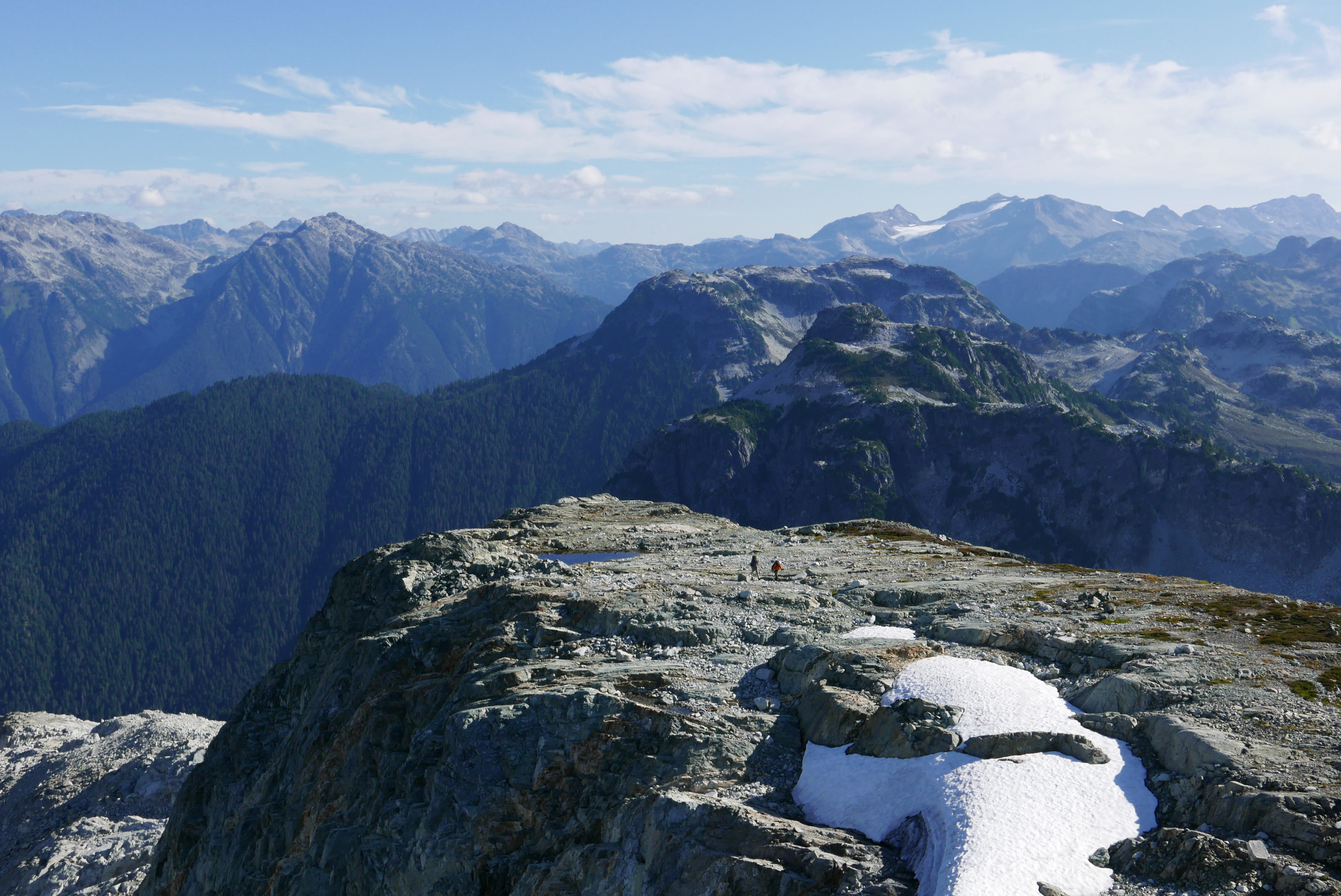
We woke up to better visibility: some sun, with clouds blowing in and out. We scrambled up Snow Pillow beside a dying glacier and enjoyed the first views of the area. The summit cairn, built by a party including John Clarke in the early 90s, was the only sign of other people that we saw the entire trip, aside from a few deflated helium balloons deposited by the wind. After taking down our camp, we scrambled slowly eastwards through surprisingly bluffy terrain, never flat but always up or down. Every time we sat down that day for a break, no matter how short, the skies discourteously provided a squall of rain or snow. Meanwhile, we were digesting a weather forecast we had got that morning from our emergency contact, Richard Shaw. Our 7 days of sun had evaporated, and now 1.5 days of rain or snow and then 2 days of cloud were predicted.
Ross scrambles up Snow Pillow.

It’s definitely not summer on the summit.
The last 800 m of the route for Monday was a bit of mellow ridgetop, followed by a steep descent to a tarn at a col. Or at least, the ridge was mellow on the map—-in reality, the mellow bits were just a massive cliff. Some kind of mapping error, I guess. We found a scrambly route over the ridge, only to find another cliff blocking the way down to the col! We set up camp on the spot and considered our options. On the one hand, we were equipped to rappel down into the col and continue on. We’d have to deal with the other side of the col (which looks suspiciously like a mini Mt Habrich), move quickly for two days, then do all the difficult parts of the trip (higher, more exposed alpine terrain, a couple kms of glacier travel) on Thursday morning right before the bad weather came in. On the other hand, our experience so far was that the weather was always a lot worse than predicted, and there was a good chance we’d be stuck with poor visibility and snow for the coolest area of the trip. We slept on it (it rained hard again), and on Tuesday morning we turned around, demoralized.
As a consolation prize, we decided to scramble up the highest nearby peak, at 50.056, -122.333, before retracing our steps. It stands out from the ridge a little into the Rogers Creek valley, and we’d been admiring the huge cliffs of the east face from camp the previous evening. After a short class 2 scramble, we walked across the flat slabs of the summit plateau to the high point, and found… no cairn? We knew that the great cairn-builder himself, John Clarke, had visited the Gowan Creek area twice, but we wondered whether he had overlooked this one. We cheered up a little at the idea that we might have done a first recorded ascent, even of a minor unnamed peak, and we spent half an hour or so basking in the sun (for once), admiring the views, and lovingly constructing our first summit cairn.
The cliffy E face of the peak we went up, from the camp where we turned around.
Walking the long S ridge to the peak.

Our summit cairn!
(Back at home the following week, I emailed Sandy Briggs asking about his trip with John Clarke to the Gowan Creek area. I also visited the library to look up John Clarke’s Canadian Alpine Journal article about his second trip to the area. Turns out neither of the trips went anywhere near the minor peak that Birgit, Ross, and I built a cairn on, although it’s always possible that there are records somewhere of other mountaineers, miners, surveyors, or First Nations people visiting the summit. The peak is about 2040 m high, with about 220 m of prominence—similar to, though a little less impressive than, Cypress Peak where the VOC does glacier school.)
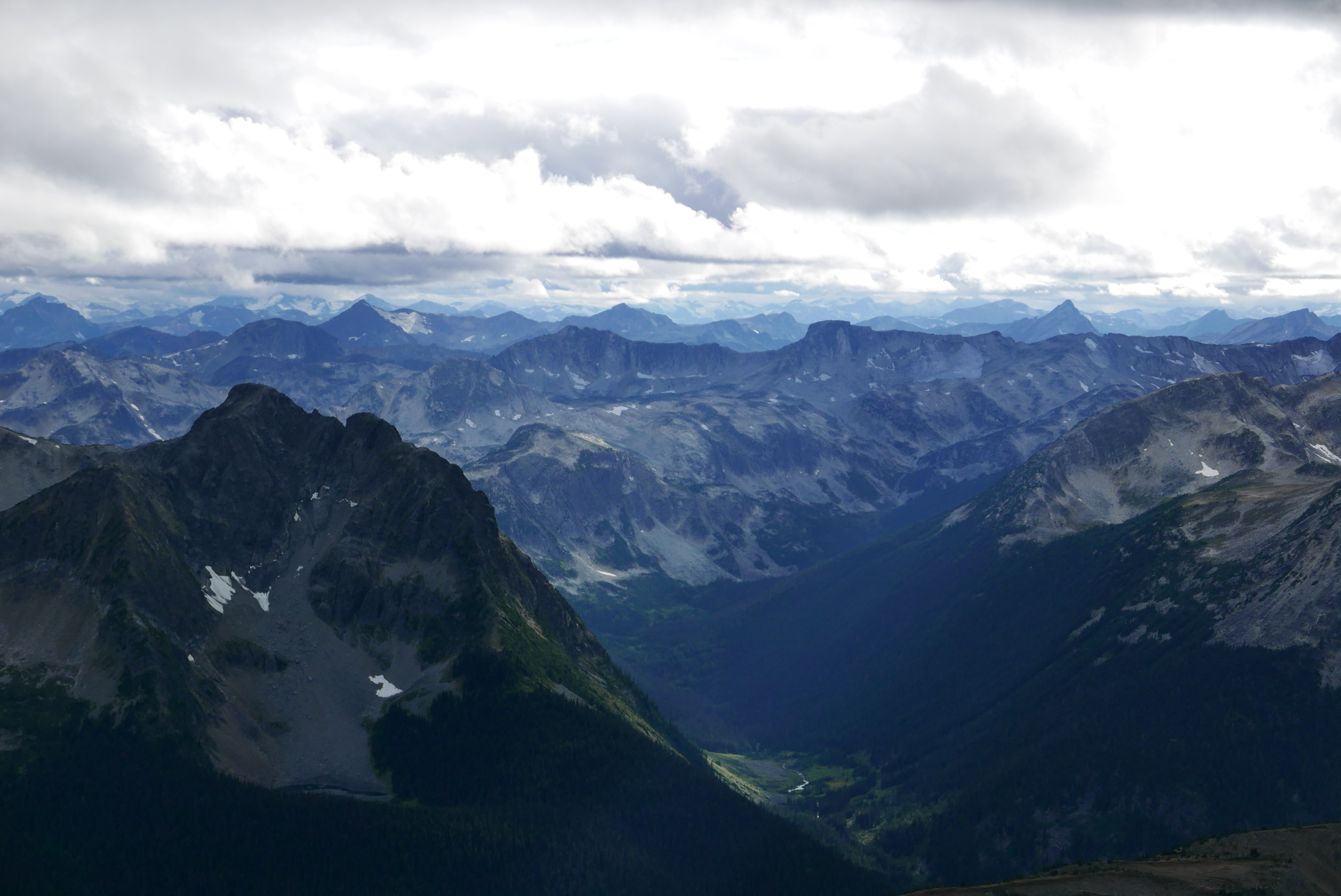
Anyway, returning to our packs, we walked back along our route to a pair of lakes that looked like lungs, swam in the east lung, and retreated to camp at a pretty lake that neither Birgit nor Ross had any memory of for some reason. On Wednesday morning, we walked all the way back to the tarn where we camped the first night. It was very interesting to finally see the terrain that we had traversed in a whiteout on the second day of our trip. Snow Pillow and its subpeaks were even more impressive, with vertical pinnacles that evidenced more mapping errors on the southwest ridge. We found out that Birgit’s uncomfortable class 3 scramble across the southeast ridge had been completely unnecessary, as there was a pleasant talus ramp just upslope of it.
Views to Livingston and Gowan—finally.
The pair of lungs.

Retracing our steps along the ridge, this time with good visibility.
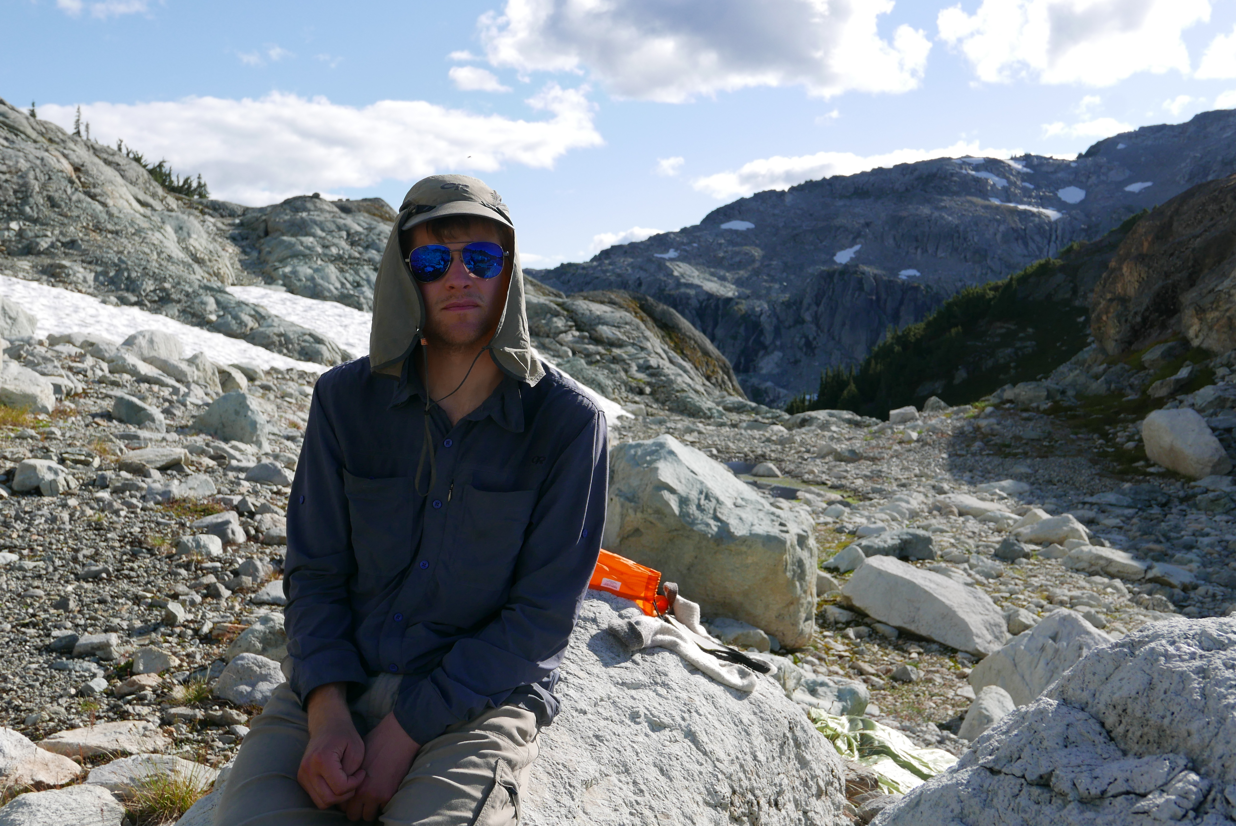
Actual attire. The glasses were cheap, ok?
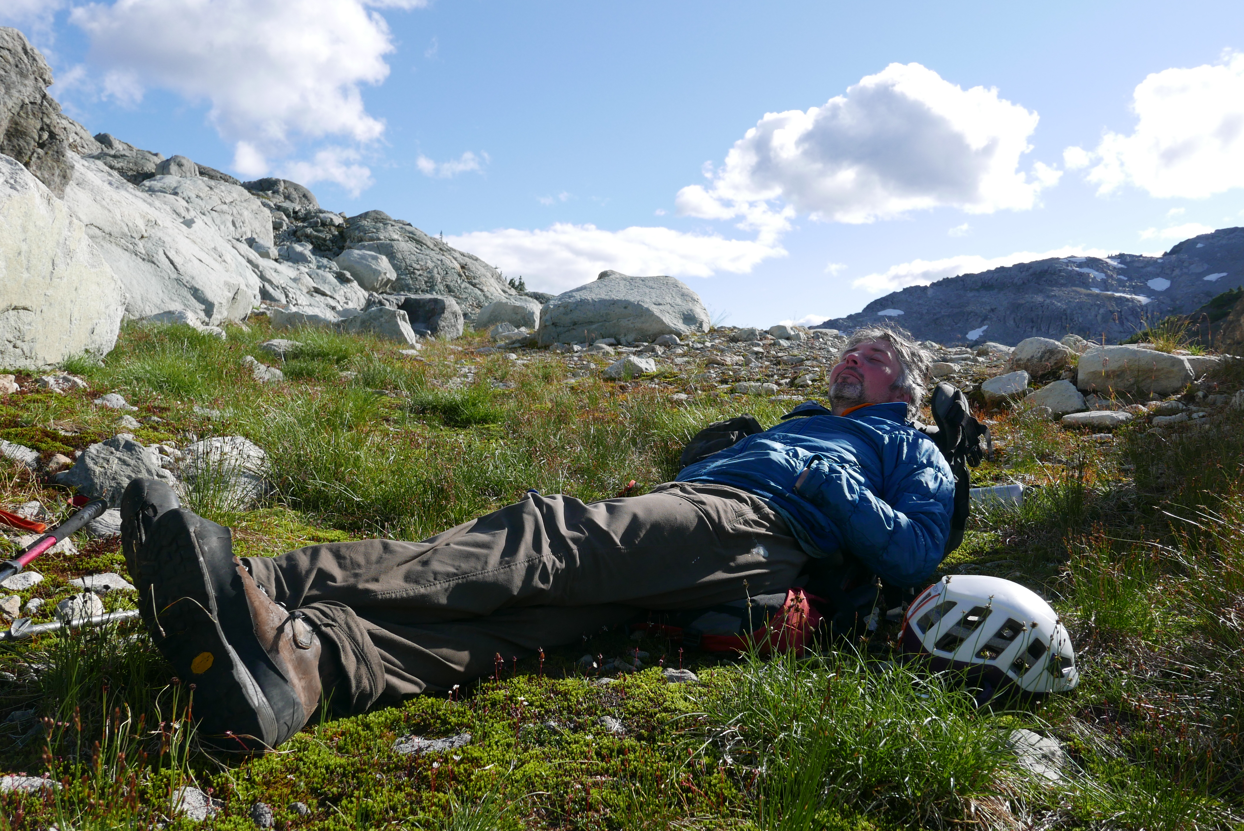
Some classic Ross.
Birgit took all the pictures here, except the few she’s in.
Sunset from our second-last camp.
Walking the ridge. The minor peak we went up is the flat-topped one in the middle, not quite on the horizon.

Fun lipstick lichen.
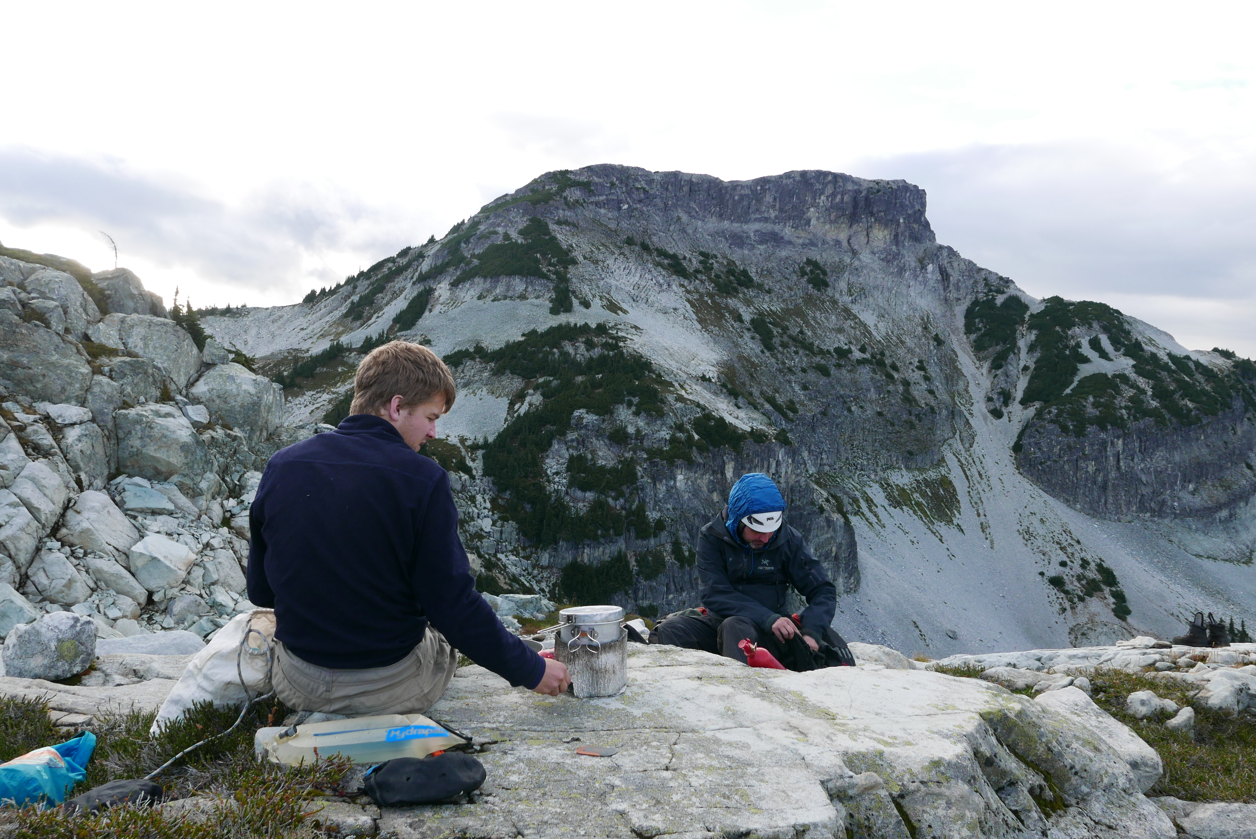
We felt vindicated on Thursday morning to find, at 7 am, the peaks wreathed in cloud. At 10 am we were in a whiteout again, and at 1 pm, back at the cars, it started raining, and it rained all the way back to Pemberton, where we had a coffee at MCC and a burger at Mile One. With Birgit’s dwindling phone battery, we searched for trip options in drier areas that would be a good use of our 3 remaining days. We settled on McGillivray Pass, which had a forecast of cloud, sun, and no rain for Friday and bluebird after that. Driving the Hurley through the rain, we looked longingly at the Bralorne pub as we passed by, but instead camped in the pouring rain at the trailhead, 2 hours or so out of Pemberton.
It’s a very short hike in to McGillivray Pass. Three hours, not going particularly quickly, brings you up a logging road, through a swamp, and along your choice of a couple indistinct trails to the height of the pass. With such easy access it’s incredible that Whitecap Lodge charges $650 a night to helicopter you in a for a few days of summer hiking. The rain overnight meant the bushes soaked us chest-high, and we got off route in the swampy section in knee-deep mud just as it started raining again. We soon gave up and huddled in an abandoned mining cabin, made some tea, and waited out the rain before continuing on to the Star-McGillivray col above the pass, where we set up camp. We had planned to go up Mt. McGillivray that afternoon in the sun, but instead it rained steadily (not in the @%$^$ forecast!!!).
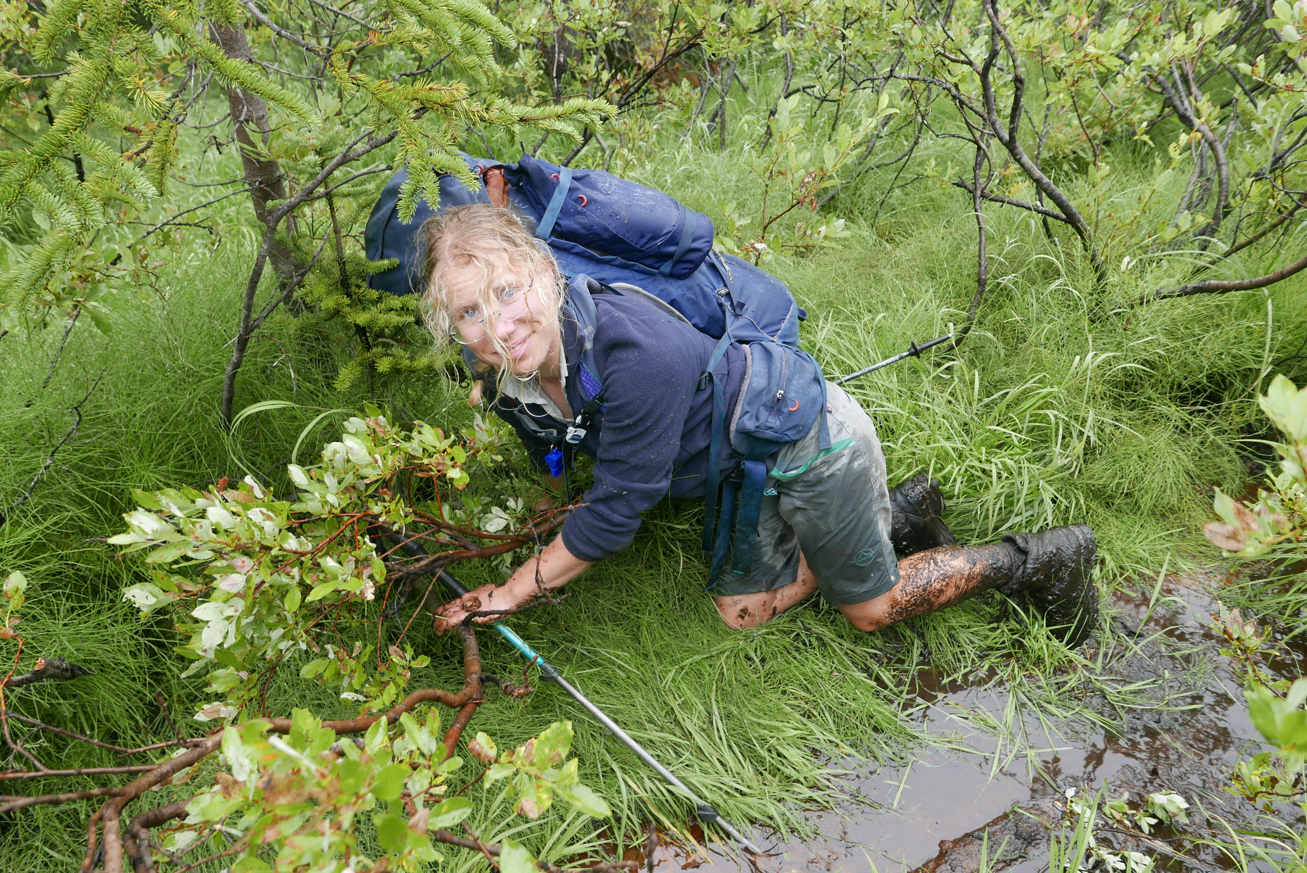
Birgit in the swamp.

Making tea in the collapsing cabin.
The pass.

Sunset on Friday
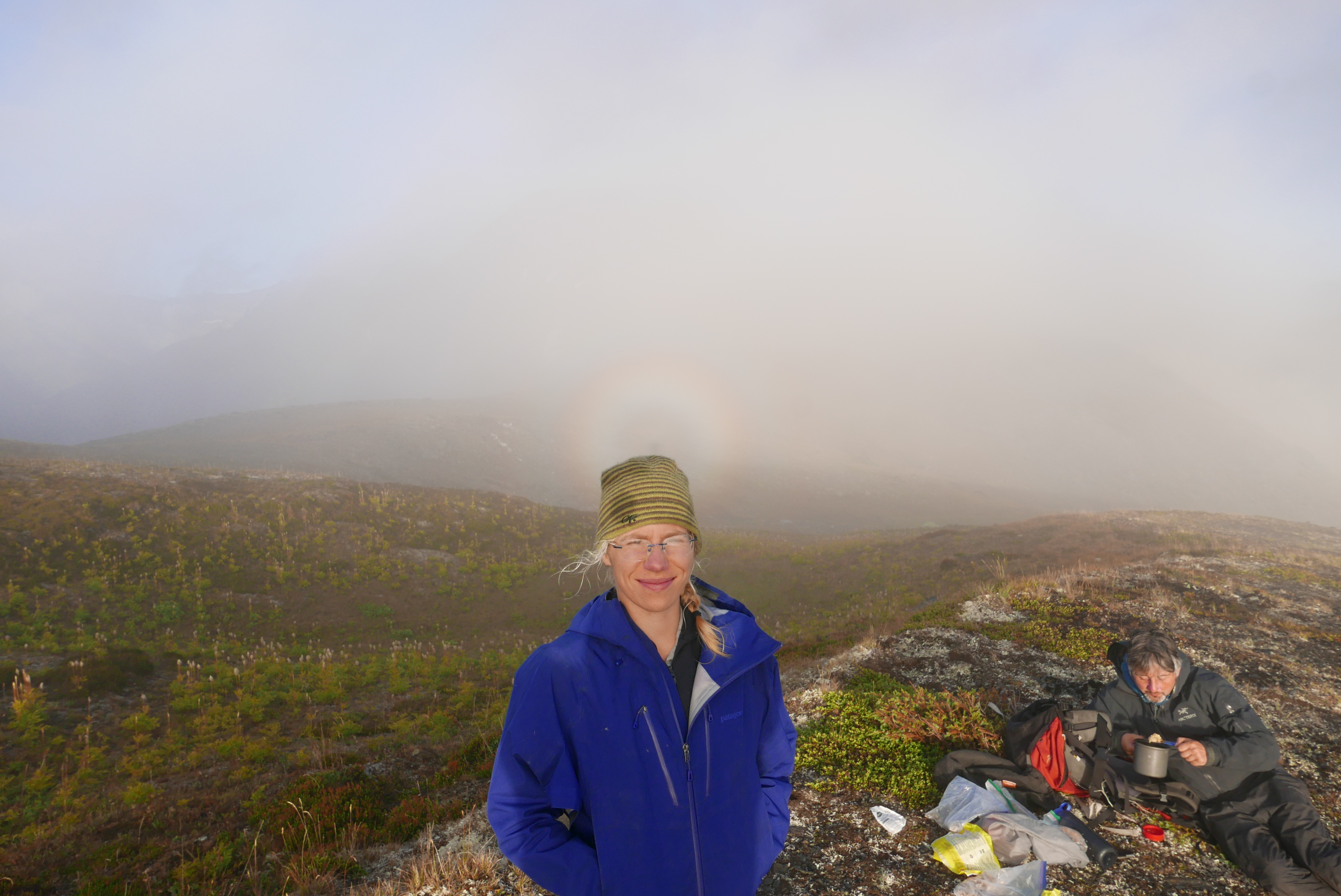
Saint Birgit! The little rainbow thing is her halo.
On Saturday morning we awoke to an ice-covered tent, and at 7 am we started towards Whitecap Mountain (2918 m), now fittingly dusted with snow. As we walked up the lower slopes of the mountain from the Connell Creek valley, I saw something move in the bushes. “A … something!” I said. We hadn’t seen many moving somethings, human or animal, during the whole week.
Vincent: “Maybe it’s a moose?”
Birgit: “Or a bear!”
Ross: “I could be convinced it’s a large marmot…”
It ran away a little. It was pretty clear from the way it ran that it was not a moose but an enormous grizzly. We looked over our shoulders a lot after that.

Whitecap from a distance.
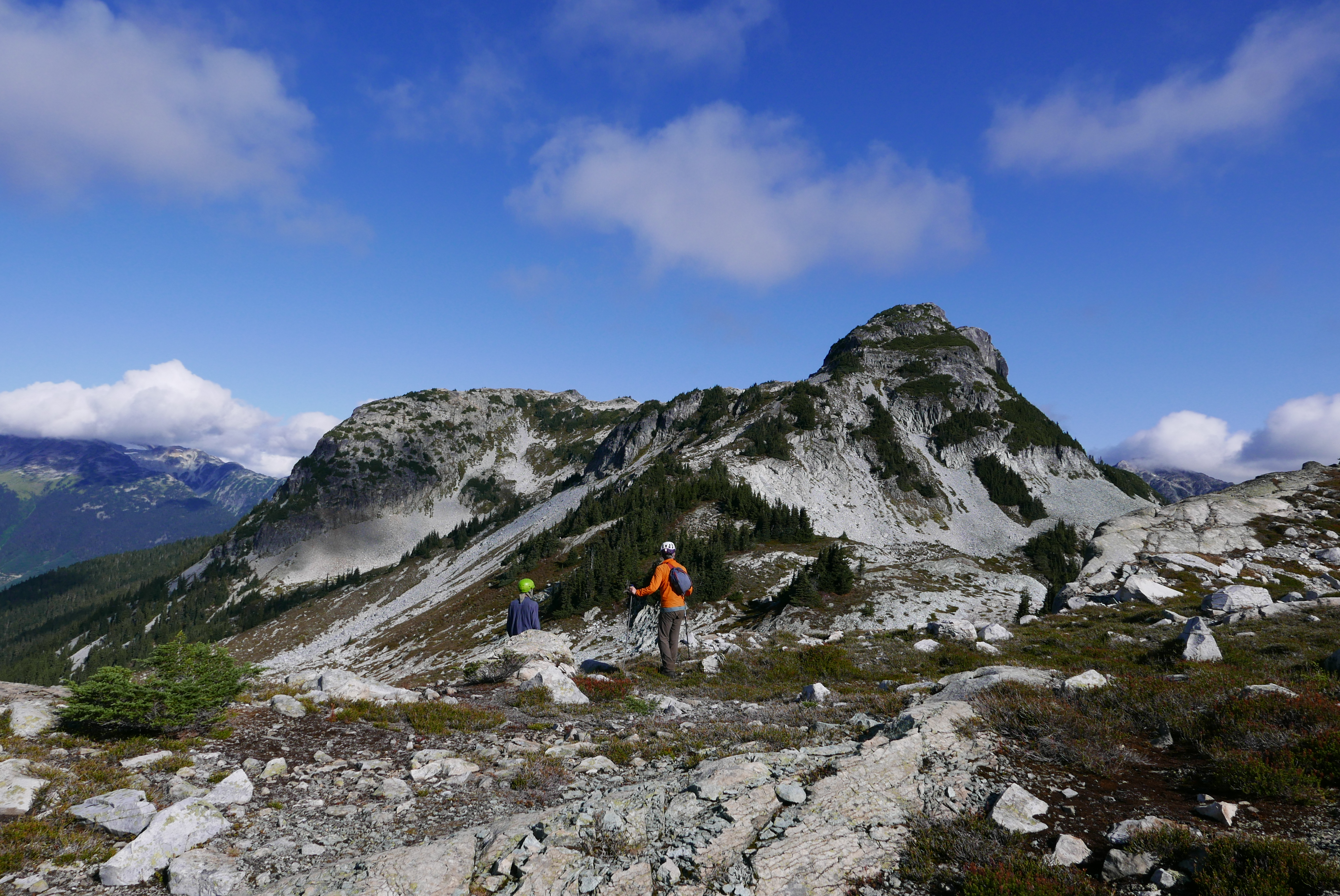
Whitecap Peak is a real slog, but from the summit the views were incredible. We could see the Black Tusk, the Duffy, the Phelix area, Tinniswood, the Chilcotins, Truax, the Lillooet Icefield—-everything. But it was blasting wind and freezing, so we soon wandered away downhill and then back up to camp, following some interesting prints we figured were from a wolf, of all things. Just before camp, I convinced Ross and Birgit to make a sidetrip up mount McGillivray. We trudged up, trudged down, and collapsed at camp just before 7 pm.
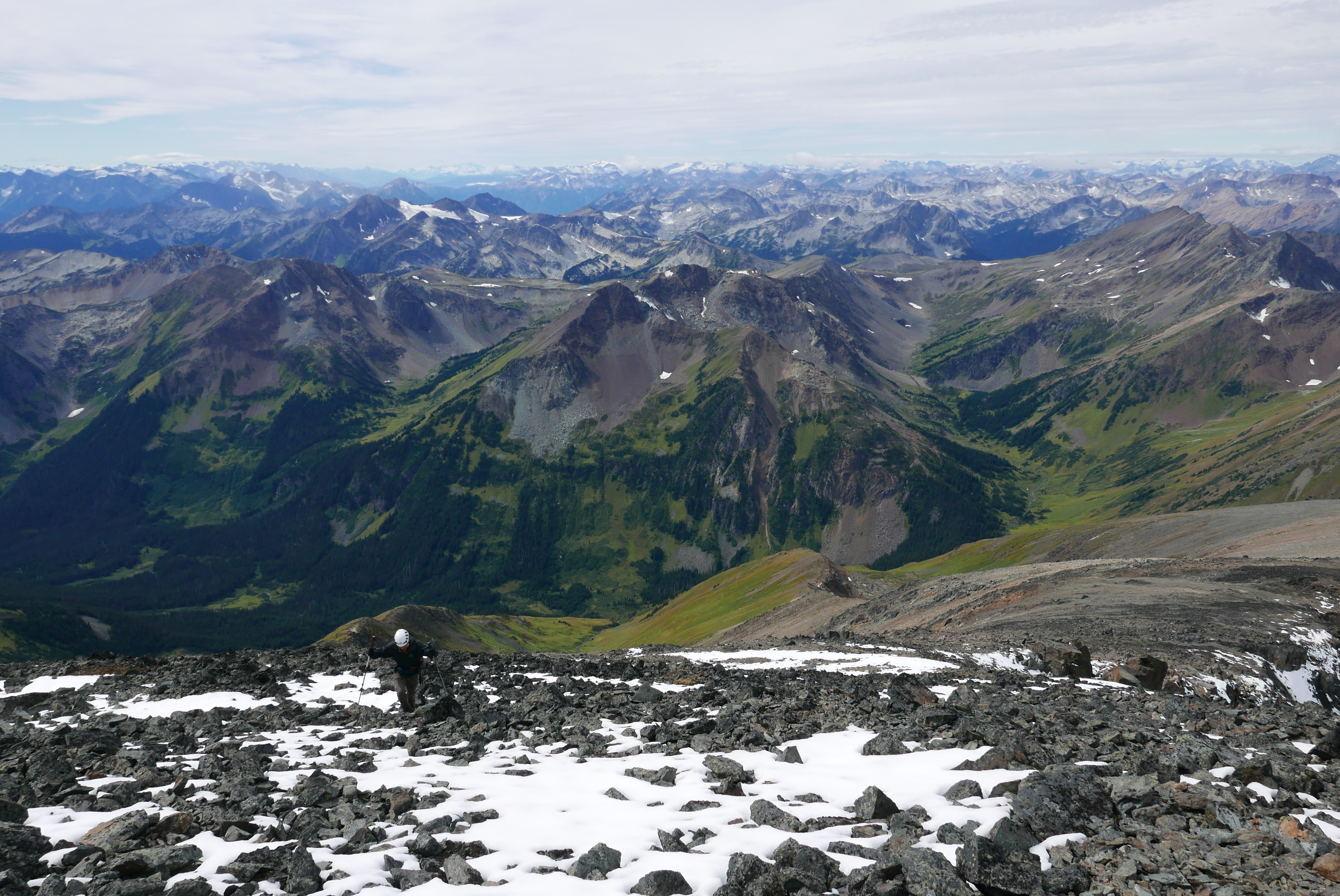
Nearing the top of Whitecap.
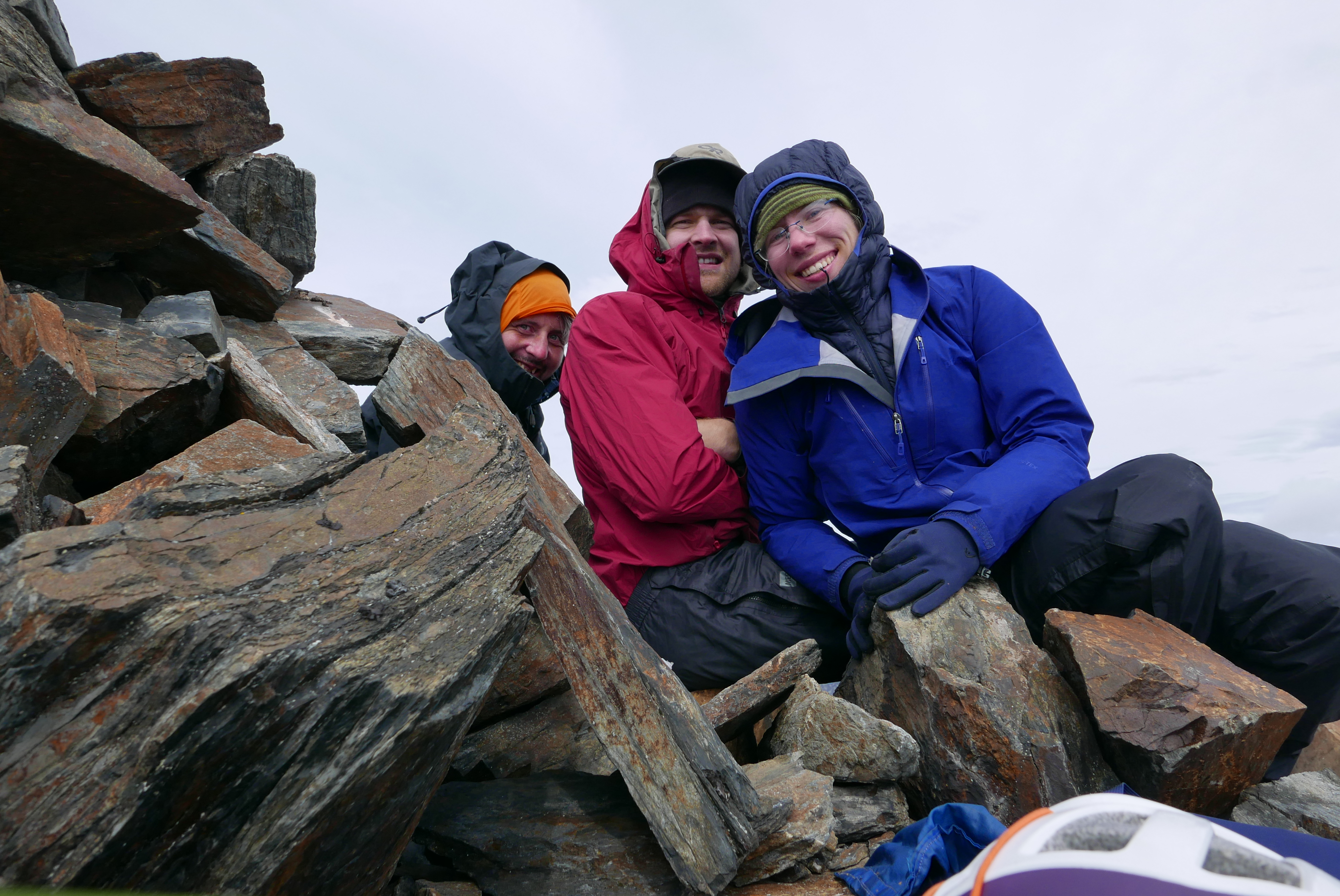
You can’t see how absolutely freezing it was at the summit… we were hiding behind the cairn to stay out of the wind and wearing all our layers.
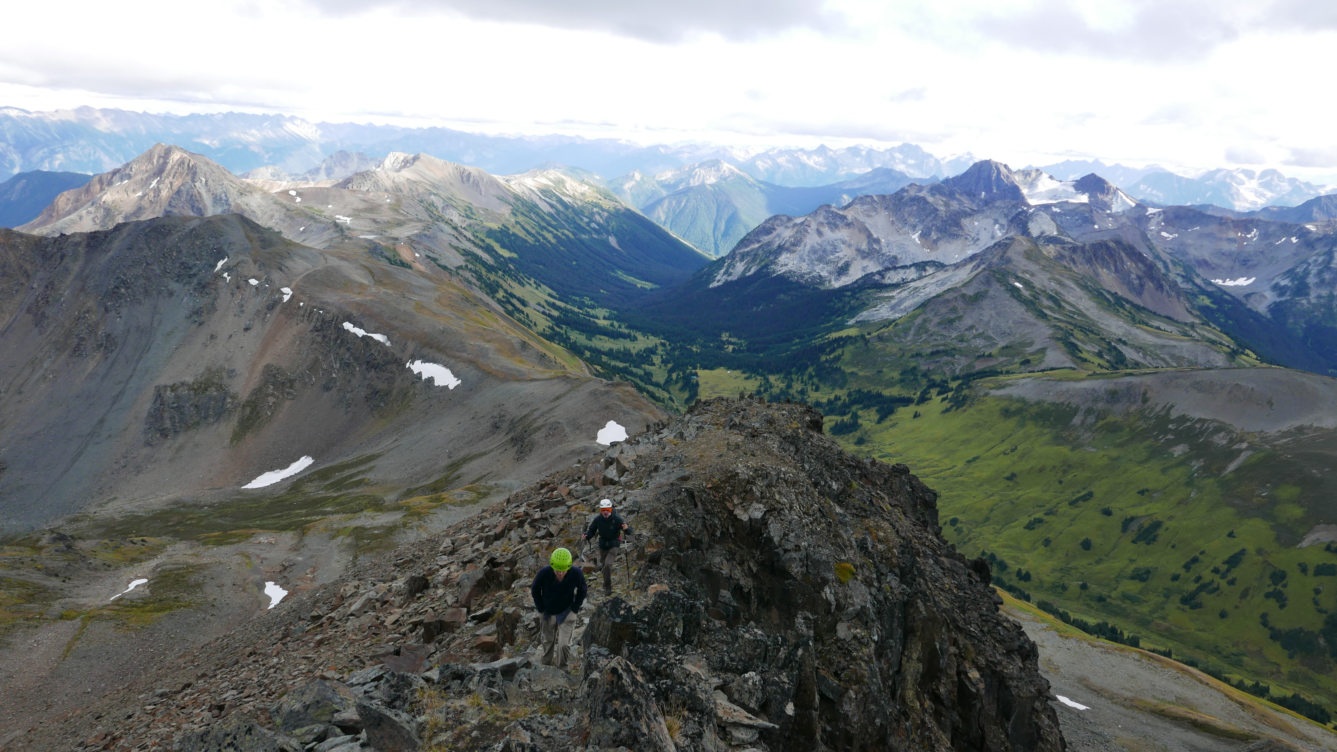
Scrambling up Mt. McGillivray.
Aragorn and the Phelix area from the summit of McGillivray
Then, suddenly, we saw a dark shape across the col. A black bear? Or wait, no, it was too skinny… maybe it was a wolf! The three of us stood shoulder-to-shoulder, staring across the col, trying to figure out what it was. Birgit took some high-res pictures with her camera, then tried zooming in. We saw… a collar, and a wagging tail—-it was a dog! Eventually we realized that we had also been staring, for about 15 minutes, directly at two people in beige who had been invisible against a large rock (first and only people sighting of our 9 day trip, outside of roads and towns!). I think they must have been pretty weirded out, because even though their tent was only a minute or so from ours they never came to say hi.

We stare ominously across at the two people and their dog.
We hiked down directly to the car the following morning (Sunday) after shaking the ice off the tent. We managed to keep out of the swamp, and we got a good look across at the old mining cabin that the VOC used for Christmas ski trips back in the 80s, when you could take the train to the other side of McGillivray Pass. Then we bumped down the road towards Bralorne, swam in Kingdom Lake while Birgit caught frogs, then drove to Bisla Sweets in Squamish. Our welcome to Vancouver consisted of 2 hours in gridlock at the Murrin merge and on Taylor Way, in traffic so slow that Birgit jumped out of the car, ran down to Blaze Pizza at the corner of Marine Dr to pee, and still had far too long to nap and chat when back in the car. But we were very happy to be home anyway.

This cabin was very popular with VOCers in the 70s and 80s. Wouldn’t want to be in there now with a few feet of snow on the roof…
Route description for the Snow Pillow trip (copied from the Bivouac.com TR):
From the end of new logging spur at 1000 m on the NW side of Gowan Creek, Birgit Rogalla, Ross Campbell, and I bushwhacked uphill (light or moderate bush) to a broad forested ridge crest with some lakes and some convenient open heather corridors through the trees. Following the ridge towards Snow Pillow peak, we set up camp that evening at a small unmarked tarn (50.00288, -122.39980) with no visibility. The next day, also with poor visibility, we contoured around the SE side of the cliffy S subpeak of Snow Pillow, then crossed Snow Pillow’s SE ridge (class 2-3) and descended to a tarn at the col just E of the Snow Pillow, where we camped early in the wind and rain.
Snow Pillow’s SW ridge has cliffs and pinnacles that don’t appear on the map, but the SE and NE ridges both seem like straightforward class 2-3 routes to the summit. Snow Pillow could probably be done as a 2-3 day trip from the cars following the same ridge as we did. We chose the NE ridge, and the next day we scrambled up beside a small glacier to the summit plateau. The summit itself is not glaciated, and we found a cairn there, presumably built by John Clarke.
We packed up and continued eastwards along the ridge through very bluffy terrain. Travel was somewhat slow (class 2). We went up and over a 2000 m bump on the ridge (50.02817, -122.36976), descended to a lake, and continued on, bypassing a cliffy bump (50.03380, -122.34873) on the W side. From there, it was 2 km of easy walking past a pair of lung-shaped lakes. We regained the ridge, only to find large cliffs blocking our intended route (50.04978, -122.32495), which we could have rappelled. Beyond, the other side of the notch also seemed to be barred with cliffs, although it was perhaps possible to contour through steep terrain on one side of the ridge or the other. That day we had found the mapping for the ridge to be quite unreliable, so it’s hard to tell what the rest of the ridge would be like. With more bad weather coming in later in the week, we turned around and abandoned our plan to visit Gowan and Livingston peaks.
We had two days of sun to retrace our steps, and along the way we went up a minor peak at (50.05568, -122.33294) that didn’t have a summit cairn. Neither of the two recorded trips to the area went anywhere near the peak, so it’s possible that this was the first recorded ascent, although perhaps other mountaineers, surveyors, miners, or First Nations people had been and just hadn’t bothered with the cairn.
On the sixth day of our trip, in cloud, we made it back to the cars just as the skies opened up, not to let up for two days.
Swampmonster Birgit! Great TR, even if I now have boomer music stuck in my head.
Great photos! Glad you could capture a classic Ross moment.
This is such an amazing trip report. Top-notch photographies and detailed technical details, thank you Vincent for showing us how to properly archive a trip!