The Sea to Sky Highway has been the main connection between those of us living in the Vancouver Lower Mainland to access many destinations in the great outdoor that British Columbia offers. Every time I sit in a car going up that beautiful highway, I always wondered if there is a way to experience this journey self-propelled. After a bit of research, I came across the Sea to Sky Trail.
The Sea to Sky Trail is a 103 km non-motorized, multi-use trail connecting Squamish, Whistler, and Pemberton. It goes through the unceded territory of the Squamish Nation and Lil’wat Nation. Being on the same corridor as the scenic highway, this trail ought to feature some amazing views and landscapes.
The Squamish-Lillooet Regional District’s website features a few basic maps for the trail but the GPS coordinates links just take you to dead pages. There is also little information on the actual trail surfaces and conditions, as well as which sections are completed. Fortunately, the OpenStreetMap Cycle Map has the Squamish to Whistler section mapped out in detail. With this in mind, I wanted to set out on a scouting trip to see if a transit-friendly and beginner-friendly bikepacking trip is feasible.
After having everyone who signed up bail on the trip, I managed to drag Elvira along on this adventure over the Victoria Day long weekend. It did take me a bit of convincing and reassuring her that her bike won’t get dinged being mounted behind a bus. We packed our gravel bikes and rode from Squamish to almost Pemberton before turning around to catch the bus home. It was perhaps the best gravel ride I have done to date. This trip report outlines what we learned and recommendations for future trips.
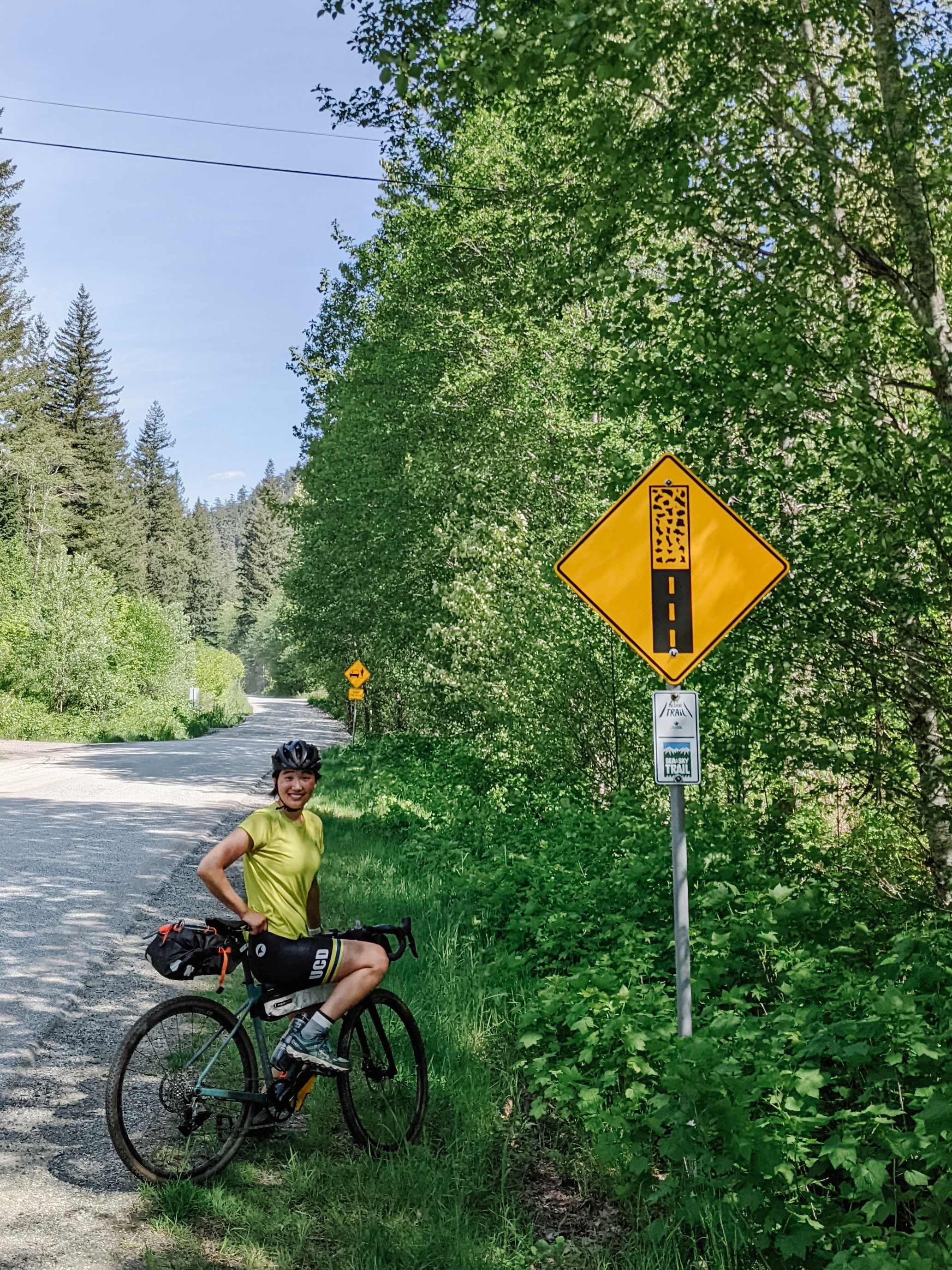
This is the sign for you to get a gravel bike
Squamish – Brandywine Falls: 44 km, ↑ 710 m, ↓ 240 m
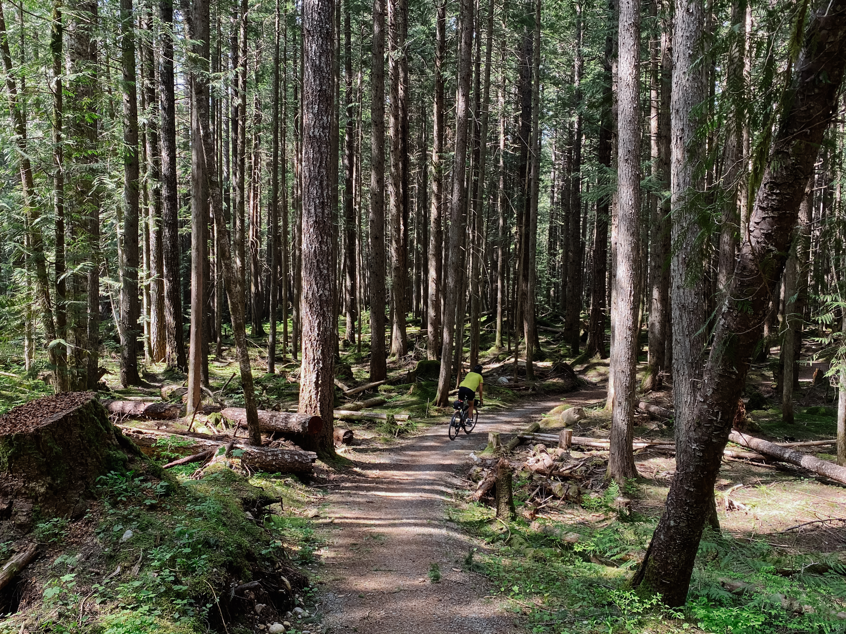
Despite being perhaps the most challenging section, the Squamish to Brandywine Falls section of the trail features some breathtaking scenery that you don’t get on the highway. This first 19 km takes you on separated bike paths, quiet roads, and gravel roads through the Paradise Valley and along the Cheakamus River.
There are many campgrounds, hotels, and recreation sites in Squamish, all of which are significantly less expensive than Whistler. The Paradise Valley Campground is directly on the trail, costing $45 per site.
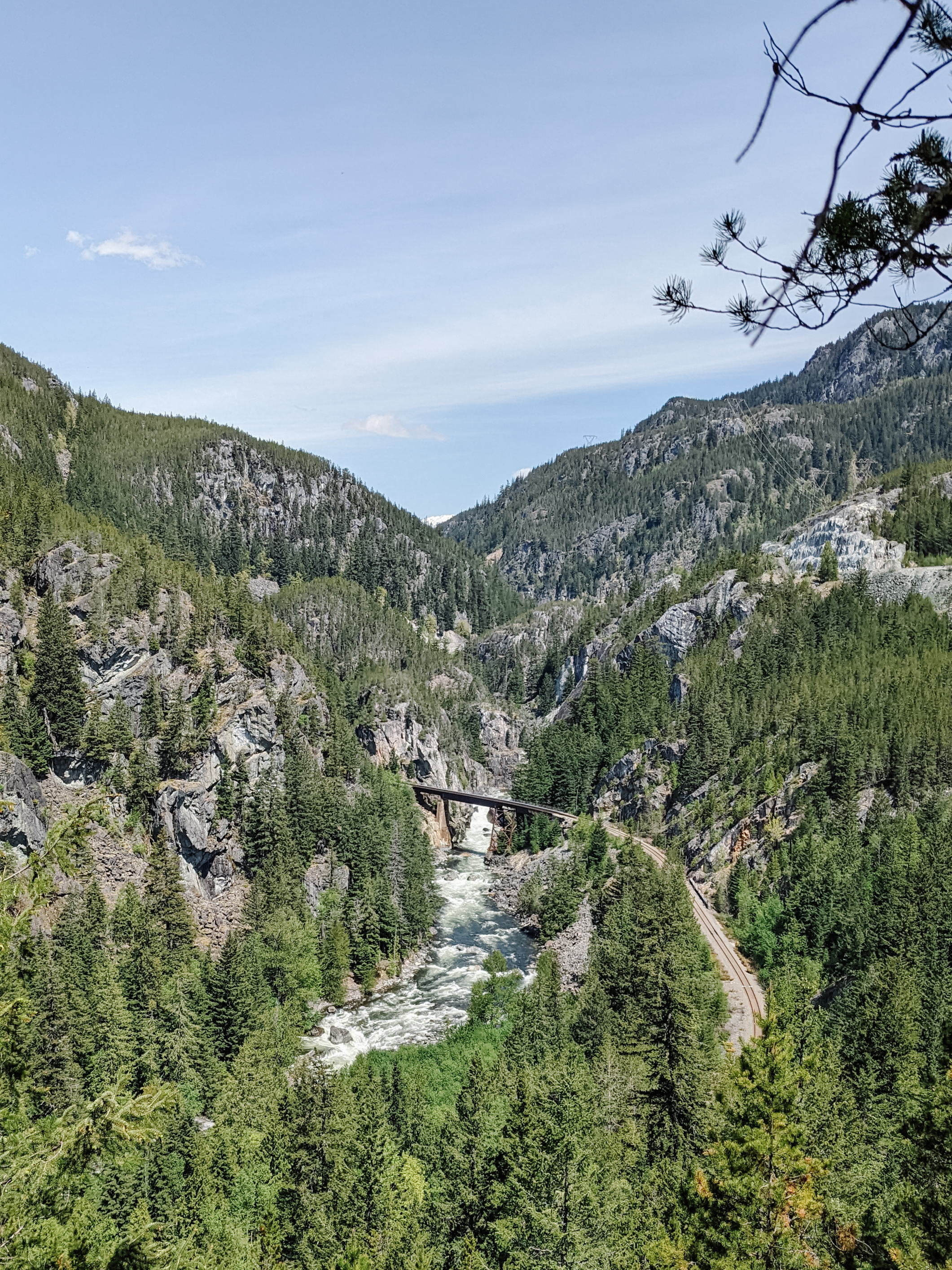
One of many gorgeous lookouts on the Sea to Sky Trail
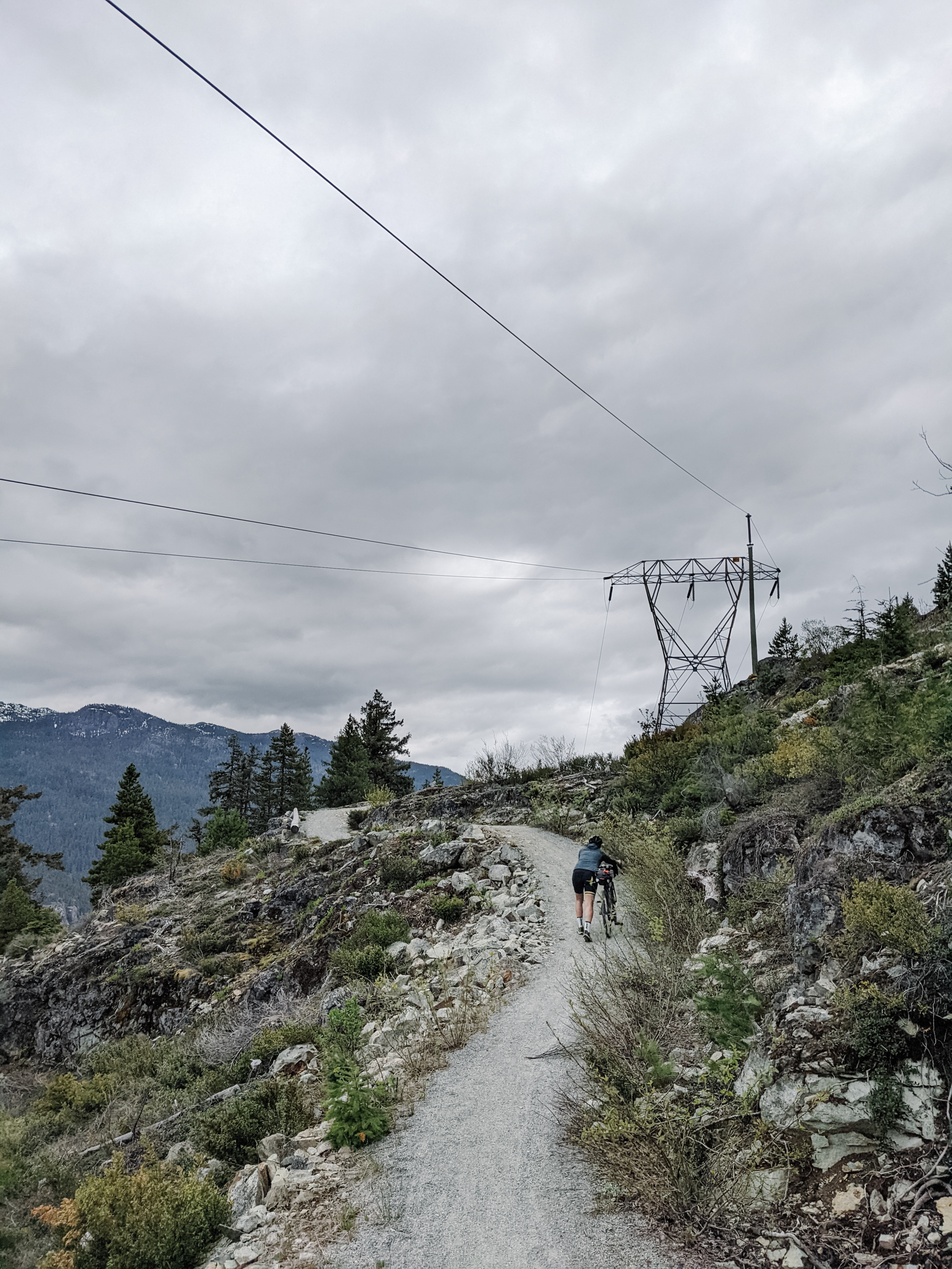
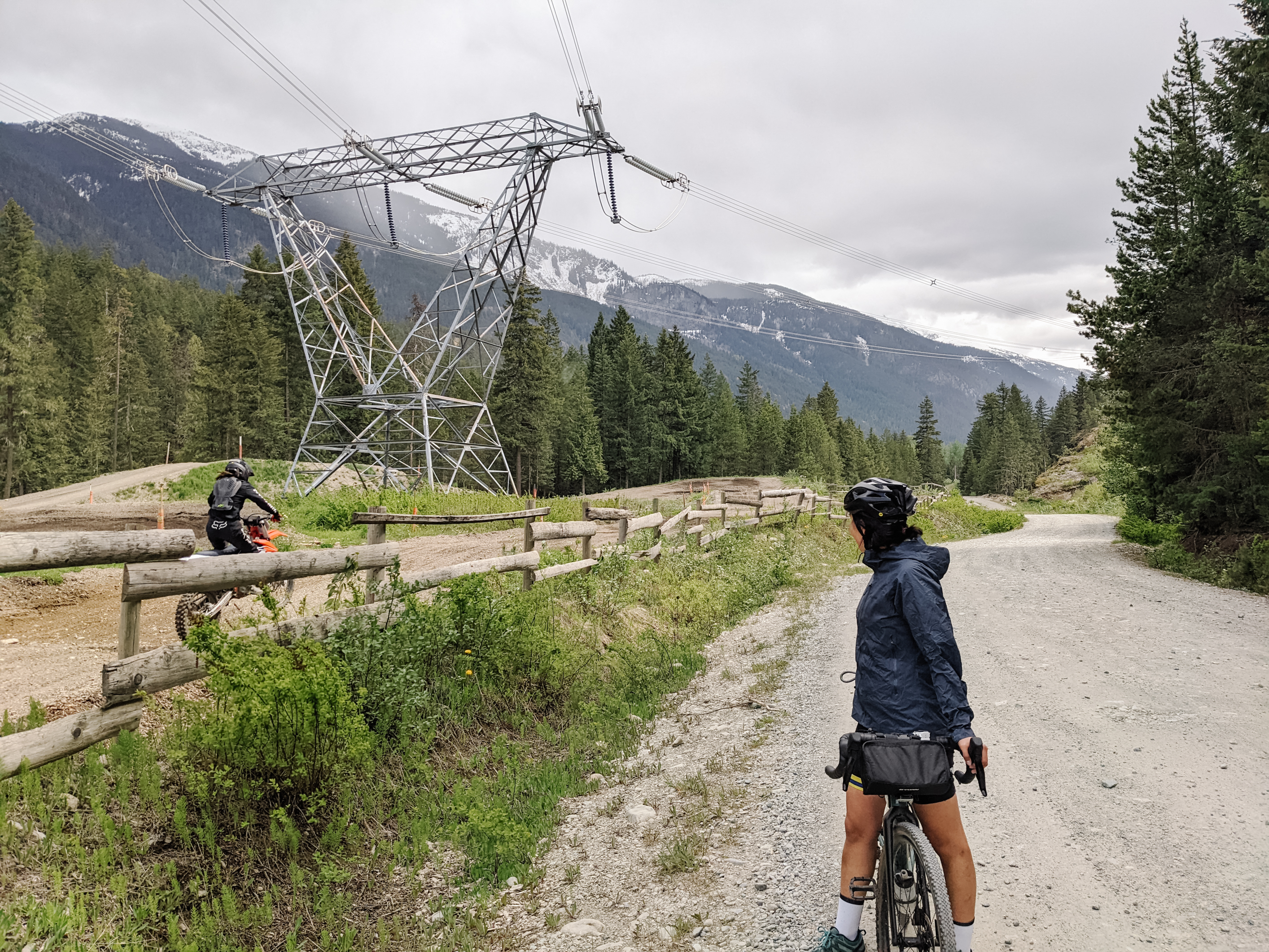
At km 24, you will the most unpleasant and difficult part of the entire trail, a rocky, steep, and long single-track gravel climb. You will likely have to hike your bike, especially if loaded with gear. At the top of the 400 m climb, you are rewarded with an amazing view of the river and railway track down below. The whole section might be better done in reverse on a mountain bike due to this climb.
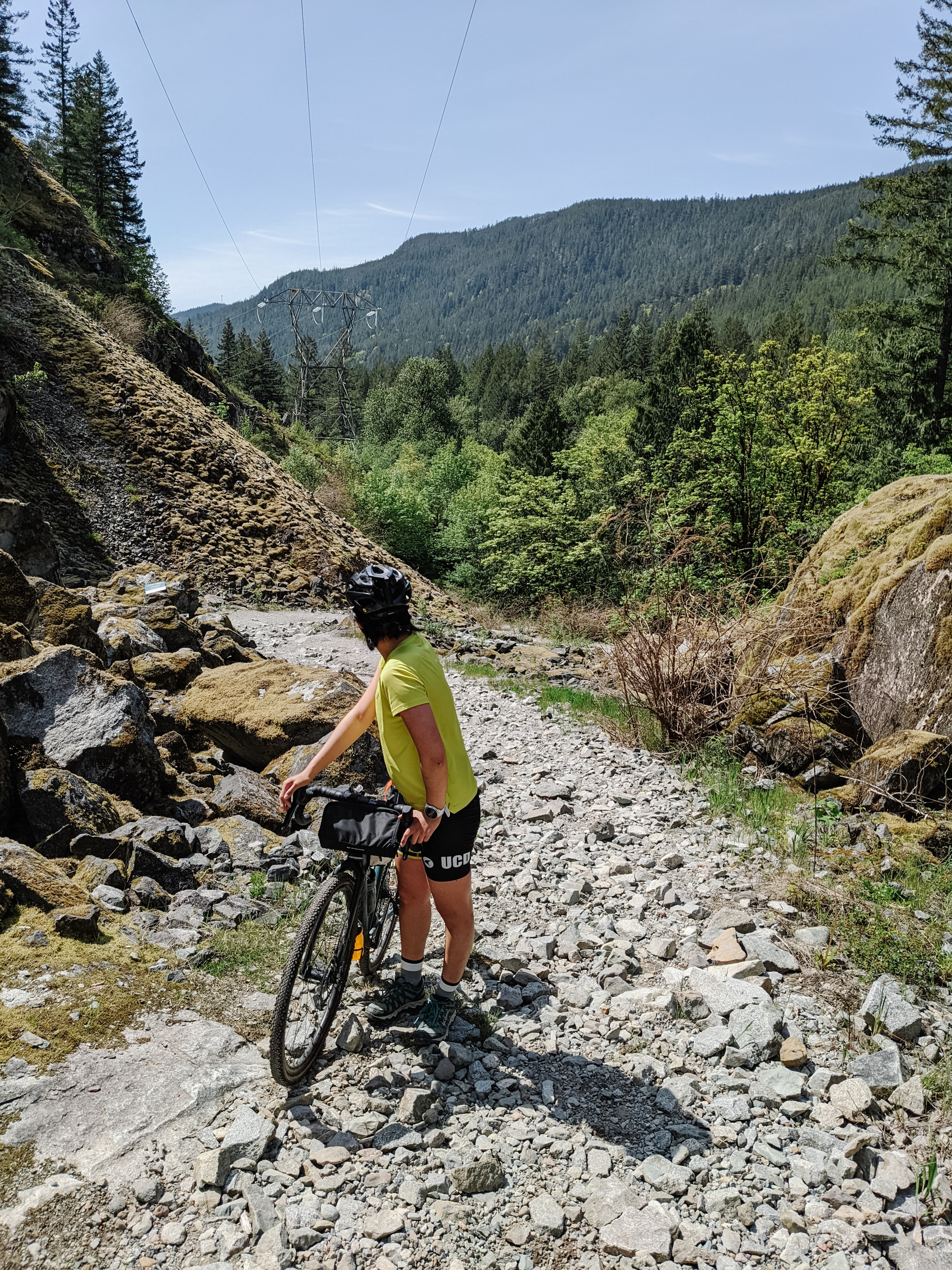
The “gravel” climb from the Cheakamus River to the highway involved lots of hike-a-bike
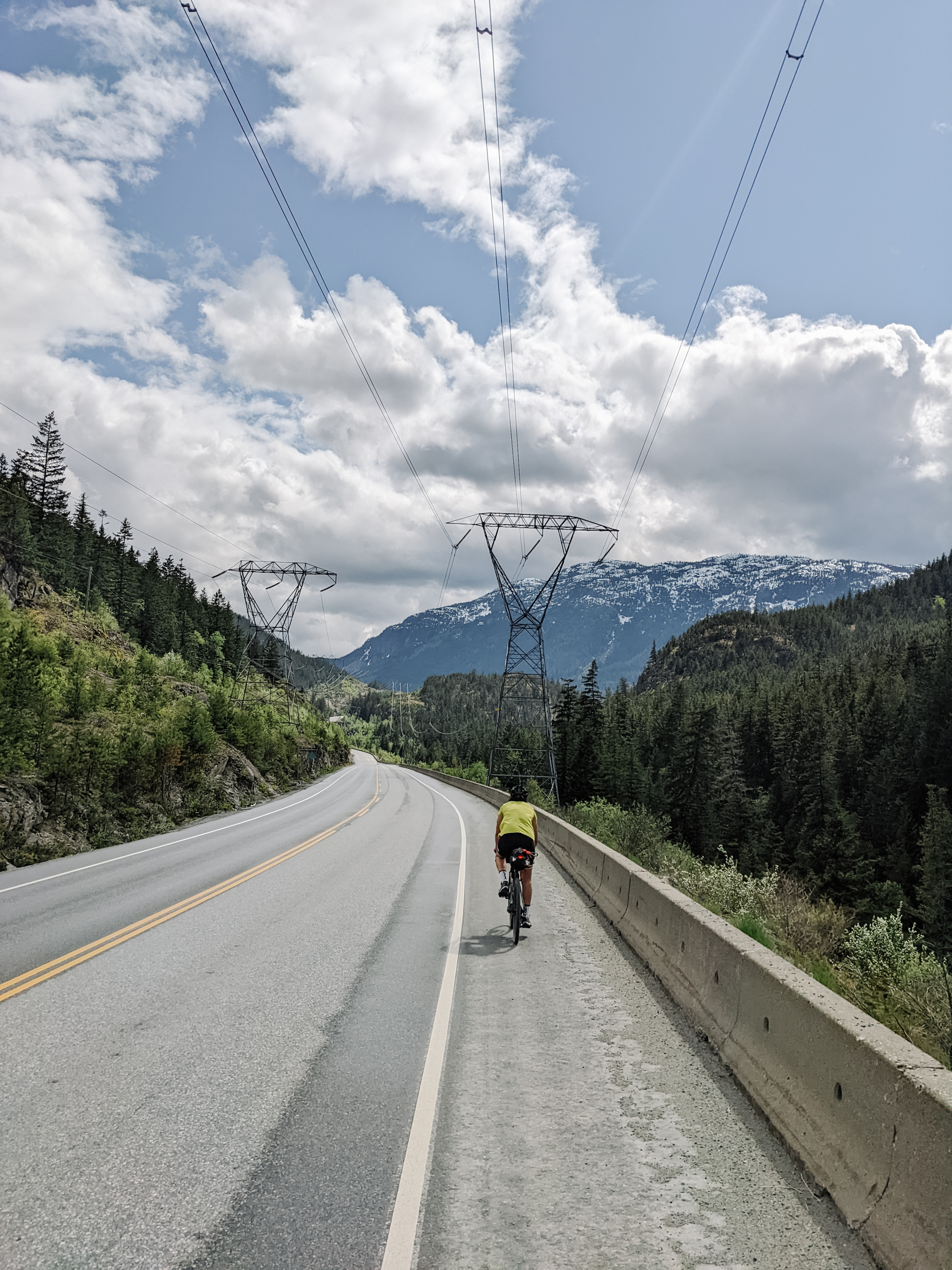
As the trail is incomplete, you will have to ride 9 km on the Sea to Sky Highway, but this part is flat and the shoulder is wide, so it felt relatively safe to cycle on.
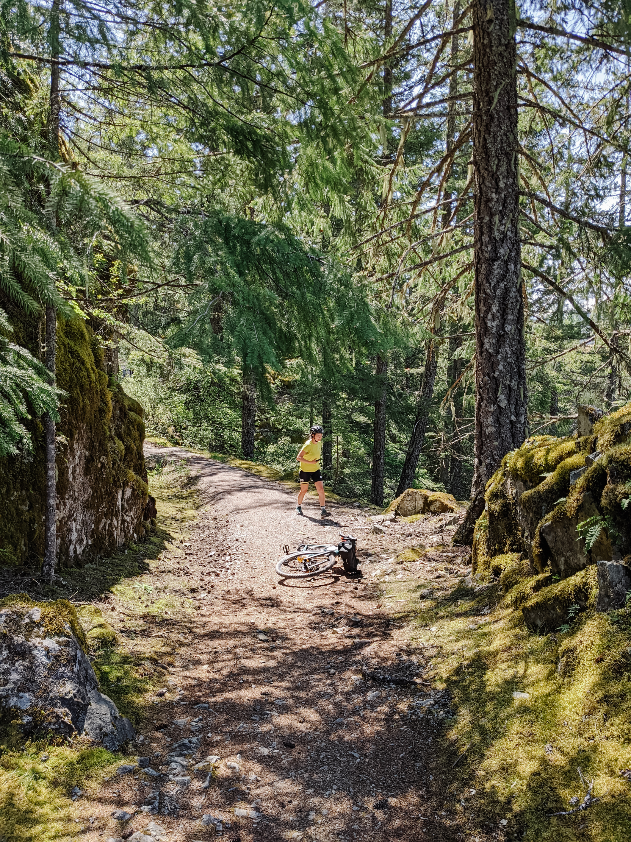
Stopping to take photos is a good way to catch your breath
There is no water supply between Squamish and Whistler, not even at Brandywine Falls Provincial Park so make sure you carry enough or bring a filter to drink from the creeks.
Brandywine Falls – Whistler: 23 km, ↑ 390 m, ↓ 190 m
This short section takes you to the resort town of Whistler through the beautiful Brandywine Falls Provincial Park. The gravel in this section is compact, fine, and much easier to ride on compared to the previous. The section between Cheakamus Crossing and Whistler is paved and separated. Take extra caution as the trails are busy with hikers and bears.
The trails between Brandywine Falls and Whistler are beginner-friendly
There are many options for camping, and lodging around Whistler:
- Calcheak Recreational Site – $15 per site, first-come-first-served
- Cheakamus Lake Provincial Campground – $10 per person, reservation required
- HI Whistler hostel at Cheakamus Crossing – $38 per person
- Whistler Lodge Hostel – $45 per person
- Creekside Village
- Whistler

The network of paved cycle paths around Whistler is amazing!
This area would be ideal for a beginner-friendly gravel cycling day trip or bikepacking overnighter starting from Whistler.
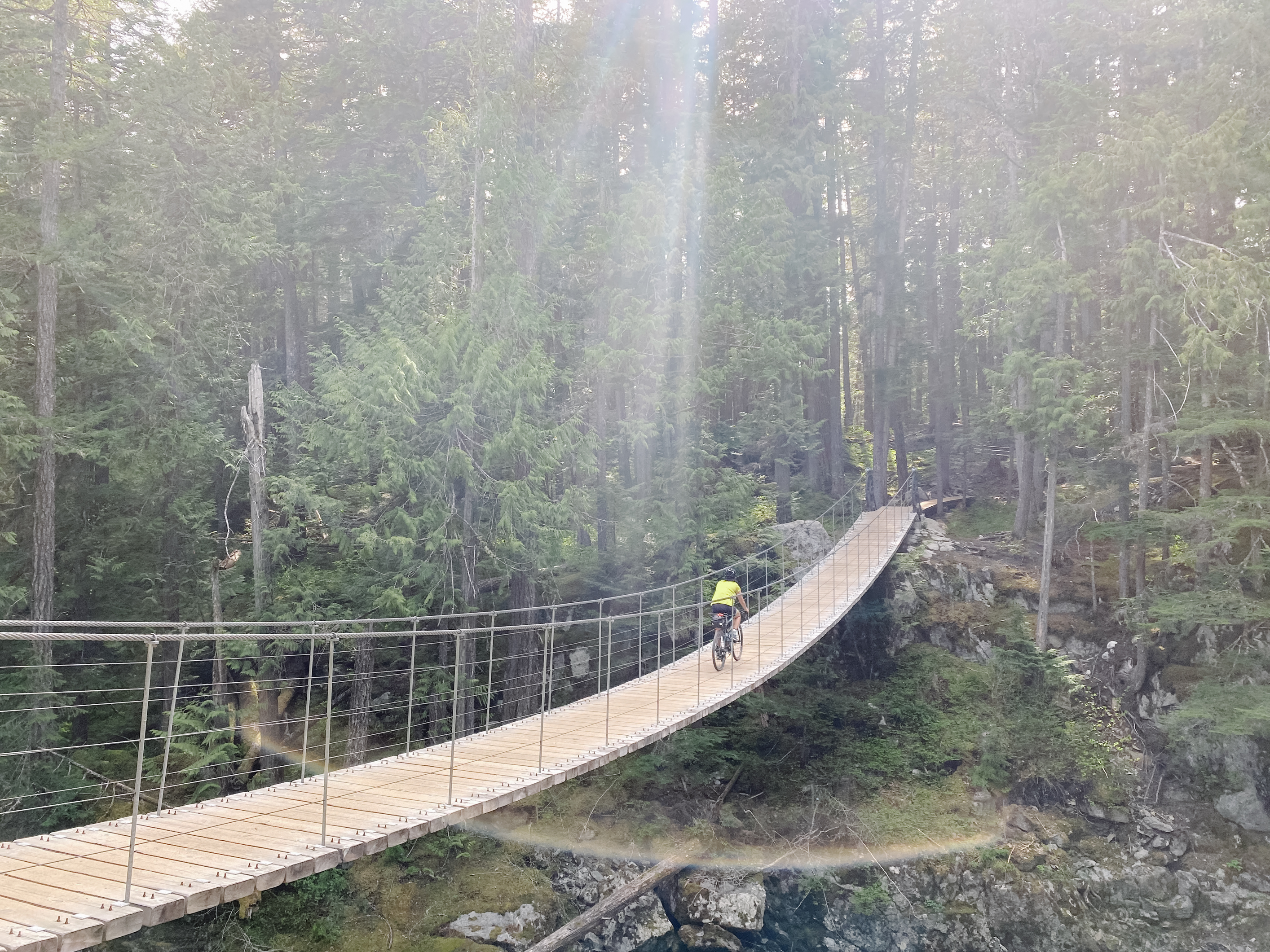
The suspension bridge toward Train Wreck after all the hikers are gone
Whistler – Pemberton: 35 km, ↑ 350 m ↓ 810 m
This might be the best gravel ride you could do within 2 hours drive from Vancouver. It takes you up and down flowy switchbacks, through mossy forests, over rocky ridges, and alongside rushing rivers. The gravel here is also fine, well maintained, and is 99% ridable, but the occasional rocks and technical descent might be somewhat challenging for beginners, previous mountain or gravel biking experience is definitely required.
Almost touching the “Sky” in the “Sea to Sky”
The last 10 km of the gravel trail is not yet available on online maps, but the signage on the entire Sea to Sky Trail is great at telling you where to go.
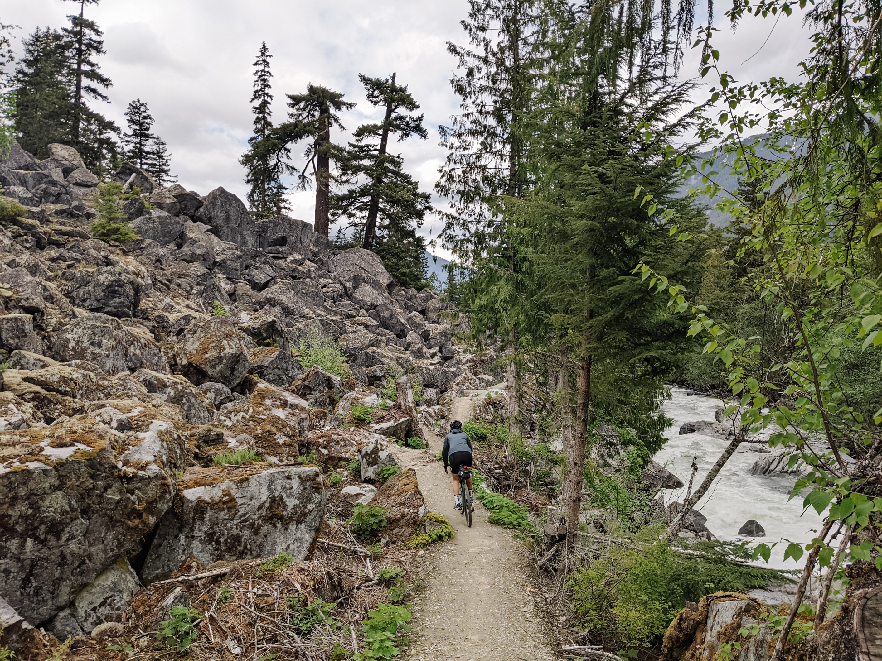
This off-grid segment is possibly the best part of the entire route
Currently, the trail ends 10 km short of Pemberton. However, there is little traffic on the highway after Whistler, so the road ride is surprisingly safe and pleasant. Going back to Whistler from Pemberton on the highway is a nice option to avoid the gravel climbs.
Elvira’s thinking about getting a different kind of bike
The Nairn Falls Provincial Park near Pemberton has campgrounds available for $22 per party. The village itself also has hotels for lodging and shops for resupply.
It felt as if we got the entire highway to ourselves
If you push for another 10 km, you will arrive at North Arm Farm near Mt Currie, a popular stop for VOCers returning from their trips to grab a bite.
How to get there:
Squamish Connector – Vancouver to Squamish bus
- One way: $25
- Round trip: $38
- Bike on the rack at the back or in a box
Epic Rides – Vancouver to Whistler bus
- One way: $24
- Round trip: $35
- Bike on the rack at the back or in a box

Bikes are mounted behind the bus like this
Recommendations:
Ideal bike:
- The entire route has a difficulty rating of green, though fitness is required.
- The route is best done on a gravel bike with at least 38mm tires so you can go fast on both the trail and on the road.
- Hardtails and full suspension bikes would be nice for the rocky climb out of Squamish but would be overkill otherwise.
Food and drink:
- Bring sufficient food and drink as there are no shops or water taps between Squamish and Whistler.
- There are plenty of natural water sources en route, bring a filter.
- Whistler is very expensive
Camping:
- There are many provincial park campgrounds, private campgrounds, and recreation sites on and near the route.
- Credit card touring is a nice option if you want to travel light and stay in hotels. Again, Whistler is very expensive
Potential Trips:
- Beginner gravel cycling day trip from Whistler to Brandywine Falls – 50 km, ↑ 580 m (round trip) (Trail bikes rental is also available in Whistler)
- Beginner bikepacking trip from Whistler to Calcheak or Cheakamus Lake - 36 km, ↑ 460 m (round trip)
- Intermediate gravel cycling day trip from Whistler to Squamish - 66 km, ↑ 430 m ↓ 1,090 m
- Intermediate gravel cycling day trip from Whistler to Pemberton or bikepacking trip from Whistler to Nairn Falls - 68 km, ↑ 940 m (round trip)
- Advanced gravel touring or bikepacking trip from Squamish to Pemberton and back – 206 km, ↑ 2,670m (round trip)
- Advanced multi-day gravel touring or bikepacking trip from Vancouver to Pemberton
- Via Sea to Sky Highway (not yet tested)
- Via Indian Arm and Indian River FSR (not yet tested)
Resources:
Sea to Sky Trail Squamish – Pemberton route on Komoot
Squamish-Lillooet Regional District: Sea to Sky Trail
OpenCycleMap.org – the OpenStreetMap Cycle Map
Hello BC: Sea to Sky Highway Route
Conclusion:
While Elvira and I can not agree on whether the Sea to Sky Trail is beginner-friendly or not, it is definitely a scenic and fast-rolling gravel ride that Vancouver cyclists and bikepackers should not miss. It is a surprise that this route is not on bikepacking.com. 9/10 would try again. Keep an eye out for future trips later this summer!
“In conclusion, not beginner-friendly” – Elvira
This is a killer trip report, thank you! (rare to see an actually informative trip report around here lol)
Incredible report Thanky! Glad you and Elvira got out and enjoyed it. I’d personally prefer to go the other direction, but glad to see you two had a fun time I’m down to go later in the summer!
super raddddd
Wow this was actually such a useful read thanks for sharing all this info (and those epic-looking photos)!