People seem to think that Garibaldi Lake being frozen is a prerequisite for doing the Neve. This seems like more of a convenience than a requirement, since people do sometimes circle Garibaldi Lake. You could argue that if one were doing the Neve in October, one should budget more than a day, since the Neve-in-a-day is a fairly long trip in good conditions and I’ve never heard of anyone circling Garibaldi Lake in a day.
“You miss 100% of the shots you don’t take.”
–Wayne Gretzky
I started from the Diamond Head trailhead at 5:15 and got to Elfin just as the sun started to light up the very top of Garibaldi. A few of the elves had emerged from the hut to stretch their legs, but none of them had gotten themselves organized, so I had the trail to myself. By 10:30 I had cramponed 40% of the way across the Neve and felt my prospects looked pretty good for a mid-afternoon exit.

Garibaldi pre-dawn

Elfin ranger station. Opal Cone is directly behind the station, and to the left of Opal Cone, the lower part of the Neve is visible, and it doesn’t appear to connect to the upper part.
The normal route goes up a fairly steep snow slope. All the route descriptions show the snow slope as part of the glacier, and maybe it was a few years ago, but it was loose glacial till. I decided I didn’t want to deal with it and tried to take a lower line. This involved a bit of crevasse mazes but was mostly pretty straightforward. I ended up about level with the Shark Fin, but about 2 km east on South Pitt Glacier. When I got to the high point, I could see where I needed to connect back up to the standard route, and it looked like it’d take a lot of time. Contouring around would be sidehilling on loose and steep glacial till, followed by a crevasse party, and just going to the valley bottom would be a big detour, so I turned back.
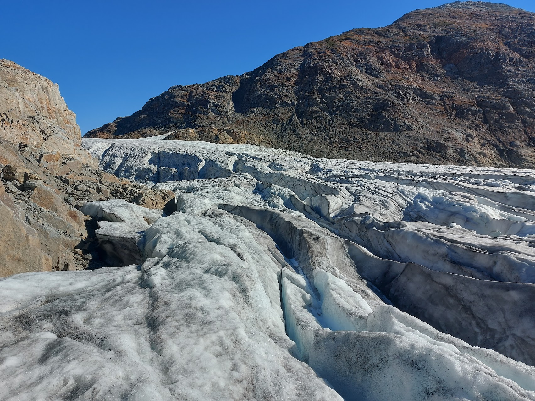
The trickiest part of South Pitt Glacier
Upon reinspection, the standard route still looked annoying, so I climbed up this island of solid rock between the standard route and South Pitt to gain the elevation and followed the ridge from there to join the standard route.
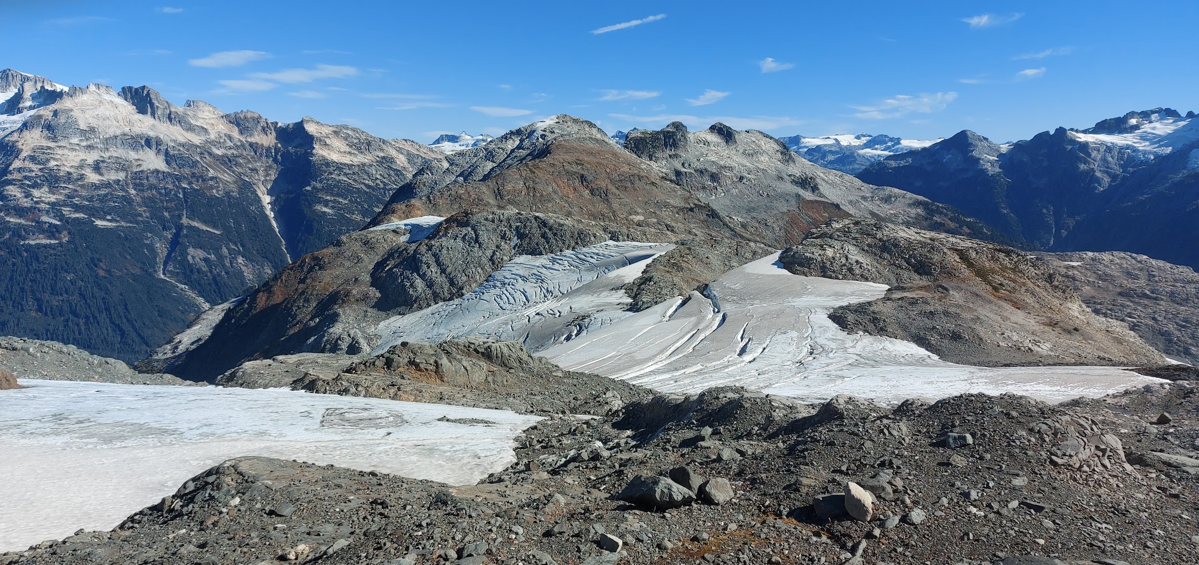
The view from the bump of solid rock. South Pitt Glacier is just barely visible, behind the crevasse party glacier, with Viking Apex rising behind and it.
Looking the other way from the rock bump. The band of rock centre-left leads to the standard route, and the loose stuff I didn’t want to deal with is out of the frame, to the left.
Back in the ’70s, the VOC built the Neve Hut. It didn’t last particularly long. It was on a slope and got a ton of snow, so if left unattended, snow creep would push it over. For a few years the VOC managed to be pretty diligent about getting up there and shovelling out the uphill side of the hut, but it only took one year of laziness to demolish the hut. The first-aid kit from the hut was moved to the Harrison Hut, and, as far as I knew, that was the only thing that remained of the Neve Hut.
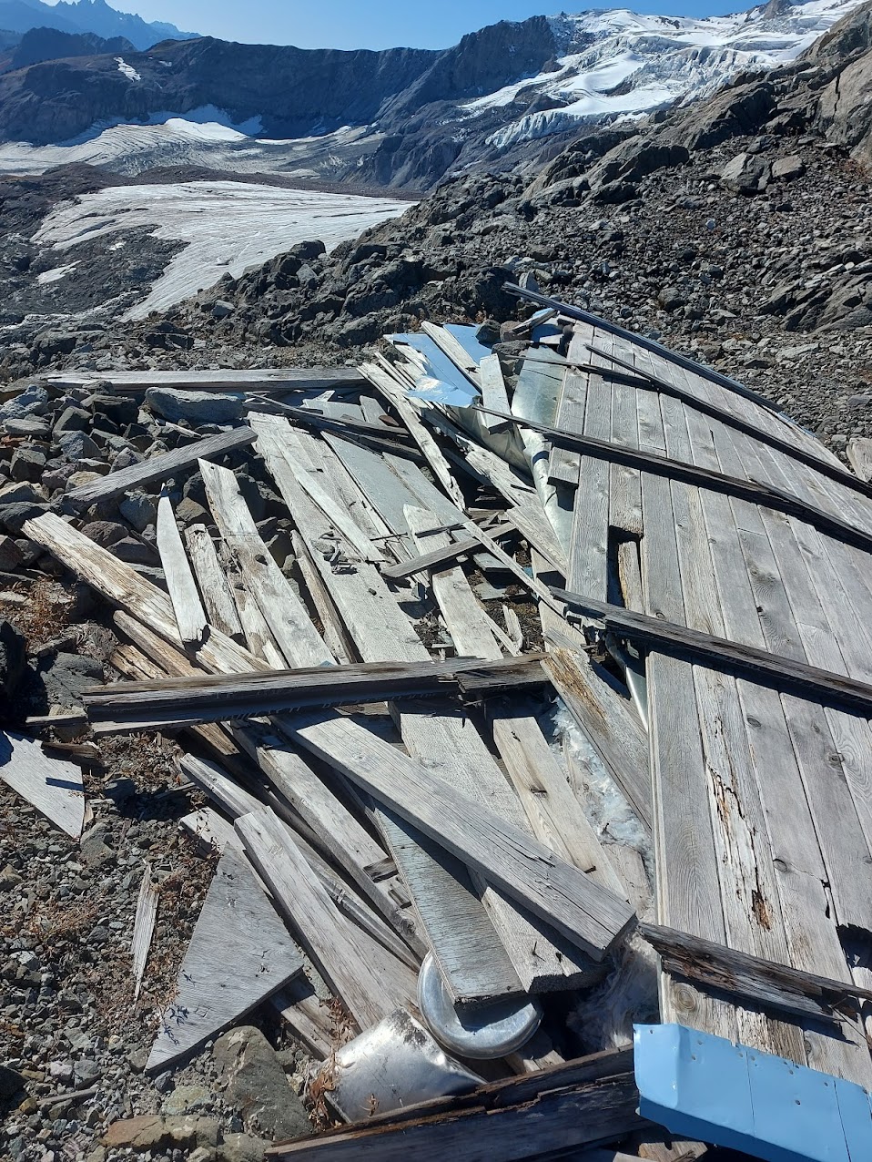
RIP Neve Hut
Winter visitors to the Neve would never see the remains of the Neve Hut because the snow is very deep and the hut is very flat, but I bumped right into it. Finding it isn’t as fluky as it might first sound, since I was on the only solid rock around, and I’m sure they wanted the hut on something kind of solid.
The weight of the snow did an impressive job of turning the hut into a conformal coating of the rock.

The roof was impressively squished
Once I got back onto ice, there was patchy snow. I’d assumed that the warm weather of the past week would have been enough to get rid of it, but it was still there, hiding crevasses. I’d intended to avoid crevasses by seeing them, but wherever there was snow, I had to probe with my pole. This was time consuming, as the new snow had a pretty solid crust, and breaking the basket of the pole through it required a firm stab. I proved to myself that the effort was necessary more times than I could count. Sometimes I found a crevasse where I suspected there might be one, but I did find a few thin-but-deep crevasses that were a total surprise.
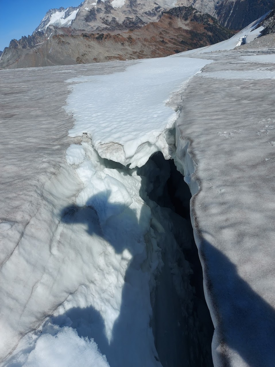
This shows how it doesn’t take much snow to totally hide a crevasse. Blowing snow can quickly bridge, and if there was another inch, the back half of the crevasse would be hidden

There was a small crevasse field to cross before rejoining the standard route.
As I got towards the Shark Fin, the crevasse situation got very circuitous.
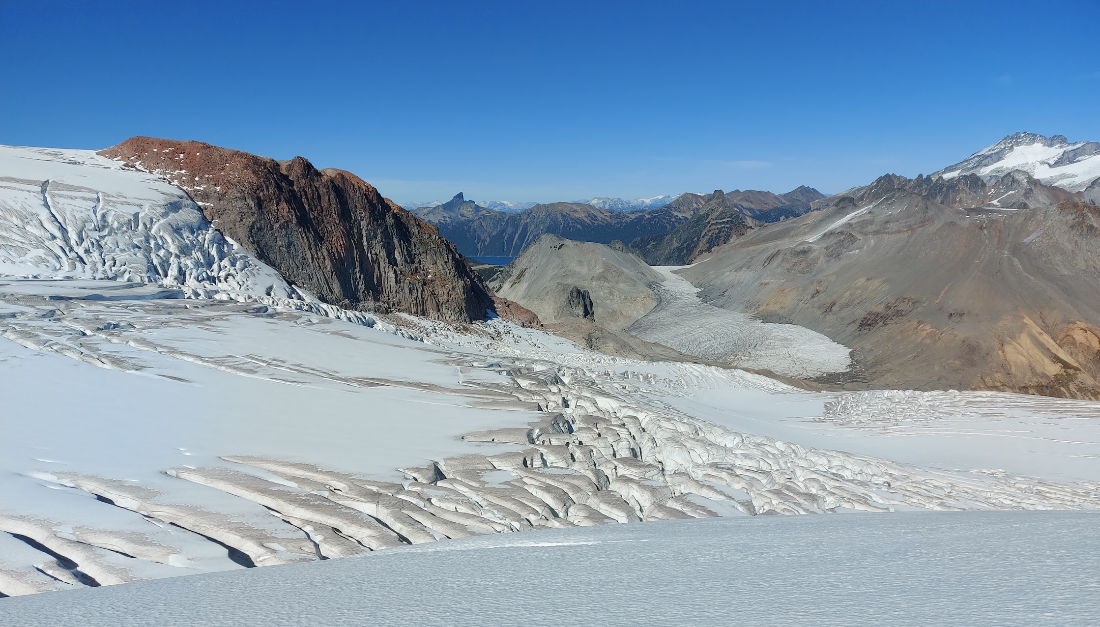
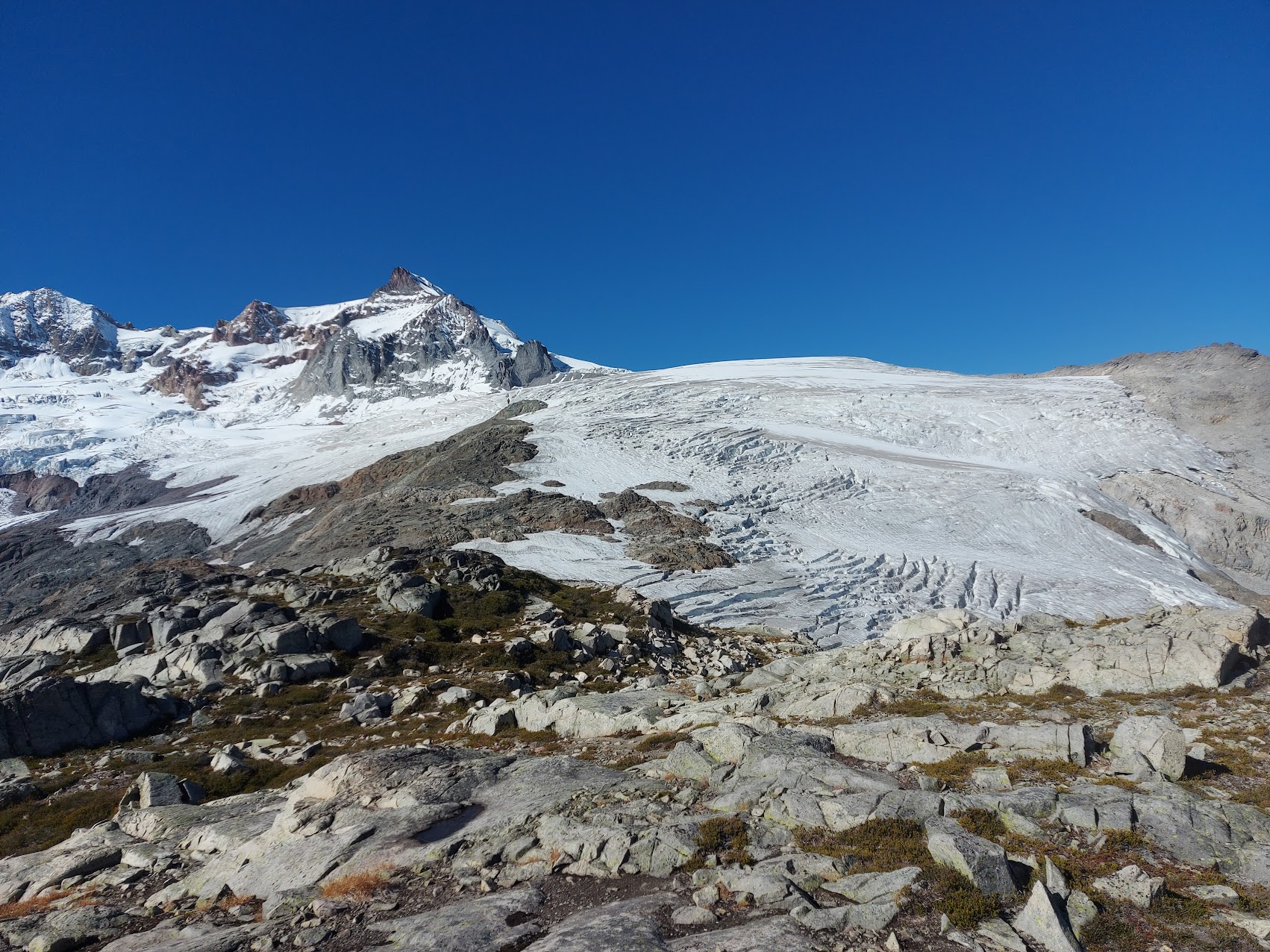
Past the Shark Fin, you can see Warren Glacier gently rolling over the col beside Glacier Pikes. On the other side, it drops off quickly, and the standard route contours right around Glacier Pikes to descend a gentler line.

One of many dead-ends in the maze to the Shark Fin
Looking back from the other side, it’s not obvious that it even goes without rappelling. Navigating the crevasses wasted a few hours, so I was starting to get antsy about getting around the lake. In retrospect, continuing off the end of South Pitt Glacier and cutting across the valley would have been easier.

Looking back at the tricky bit. The Shark Fin is just out of view to the right.
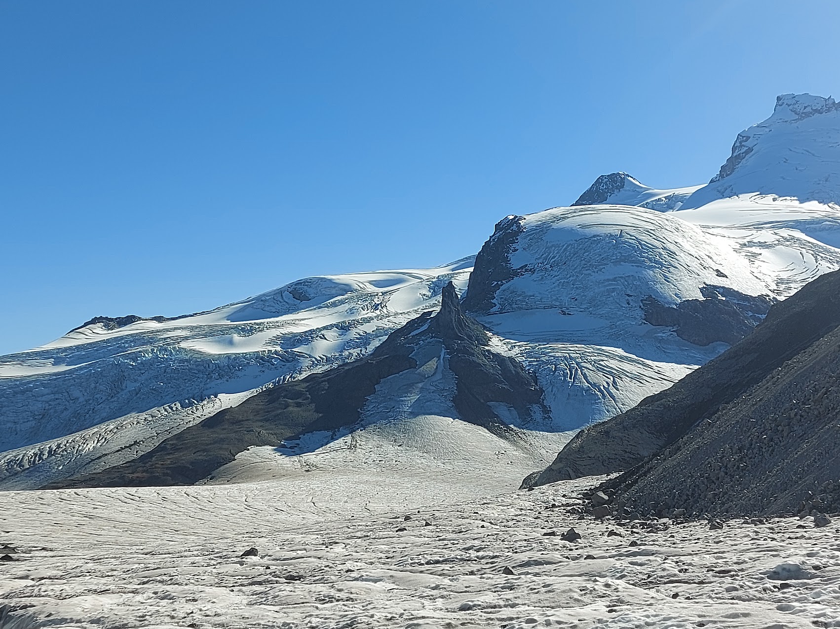
A bit more zoomed-out, showing Garibaldi and the Shark Fin.

The Table with its giant arch
I made another departure from the standard route after Glacier Pikes. The route goes right over the ridge and descends one of the two shallower glaciers. The snow was all melted out, and ascending the loose rock looked terrible. I’d skied the direct, steeper line with Devlin, and it didn’t seem like much then, so I stayed straight and on the ice until the glacier ended. After the glacier, there were some sections that were well over the angle of repose and loose. Anything I dislodged bounced down, so picking down that took a while.

One of the decrepit glaciology huts. In the winter, the snow hides how delicately balanced it is
I had been planning to cut between Guard and Deception, across Sphinx Bay, and then out across Gentian Pass, because I was familiar with the route from Sphinx onwards, but the ascent between Guard and Deception looked like it might be terrible, so I headed left. This was another point where I could have imagined doing something smarter if I had a do-over. Before Glacier Pikes, if I had already decided to go left around the lake, I could have dropped right into the volcanic field and made it mostly around the lake without bushwhacking.
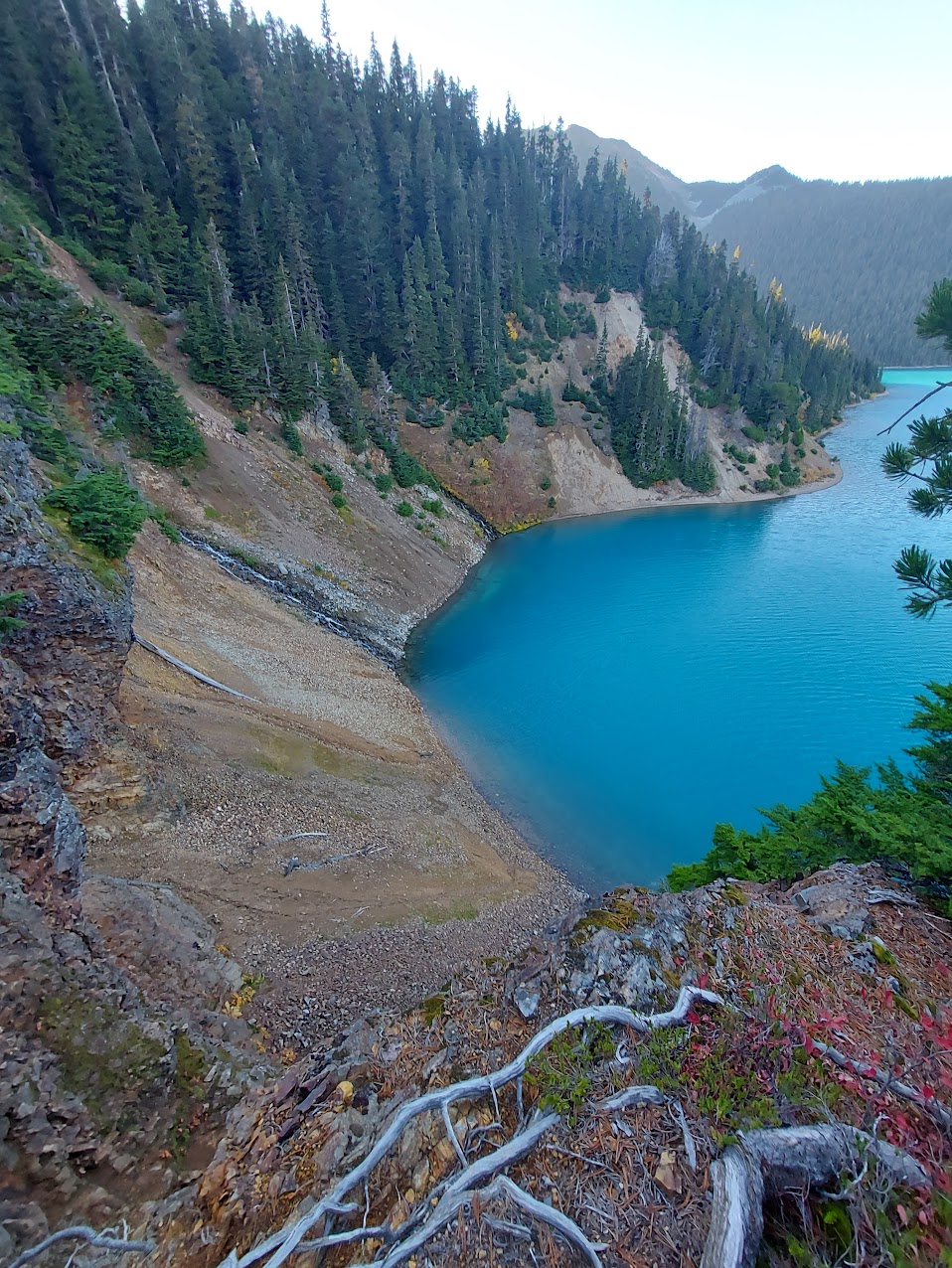
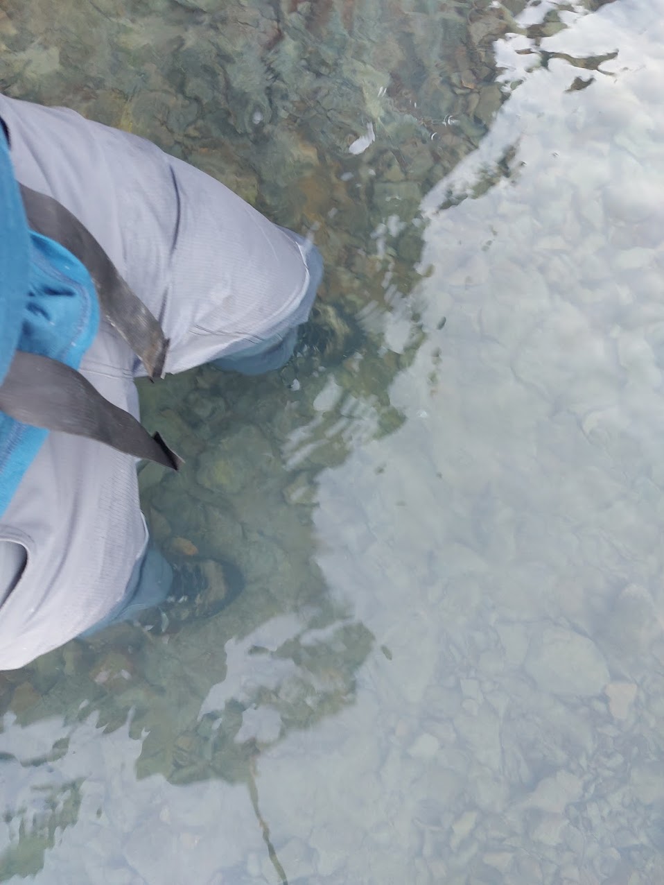
Following the shore of the lake was time consuming because I was regularly bumping into things I needed to climb up and around. I spent a fair bit of time picking my way up some technical mud to get around this cliff and discovered that there wasn’t a descent on the other side. It was time to do some wading. I thought about stripping down and keeping everything dry, but being as water-logged as I could possibly get would help me make better decisions. I’d no longer be tempted to waste time going around things on the shore if I was already soaked.
I couldn’t go down, and going up looked like it was going to have a similar impasse, so I turned back
Embracing sogginess
Looking back at the cliff
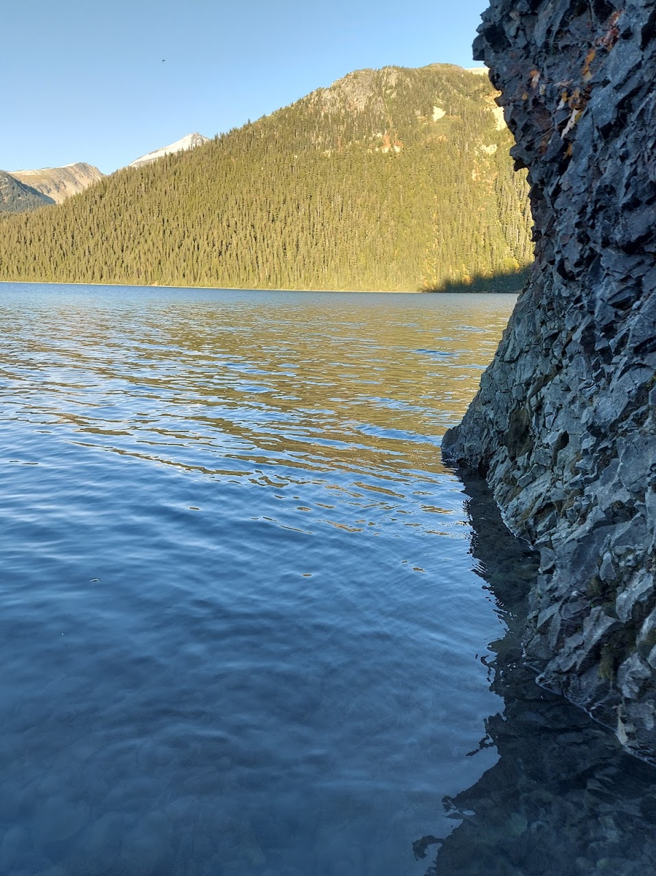
Once waterlogged, I made good progress for about halfway around the lake, until I met a cliff that continued too far into the water to be wadeable without wrecking my phone. Getting around required a steep climb up loose volcanic debris that was steeper than the angle of repose. Anything I dislodged made a sploosh in the lake. It got dark on the way up, and I decided to contour over to the lava river that formed the Barrier.
A bit of background, which real geologists will likely find problems with but is close enough:
Back in the day, Garibaldi Park was an icefield with only the tops of mountains sticking out. All kinds of stuff erupted. There were rivers of lava all over the place, including one from Mt. Price to what is now the Garibaldi Barrier. Because the lava was flowing under ice, it solidified in a similar manner to lava flows into water. Big clumps break off and have their surfaces rapidly solidified and roll down, creating an underwater or under-ice steep, rough deposit. This is why Hawaii drops off much more steeply underwater than you’d guess by looking at the above-water portion.
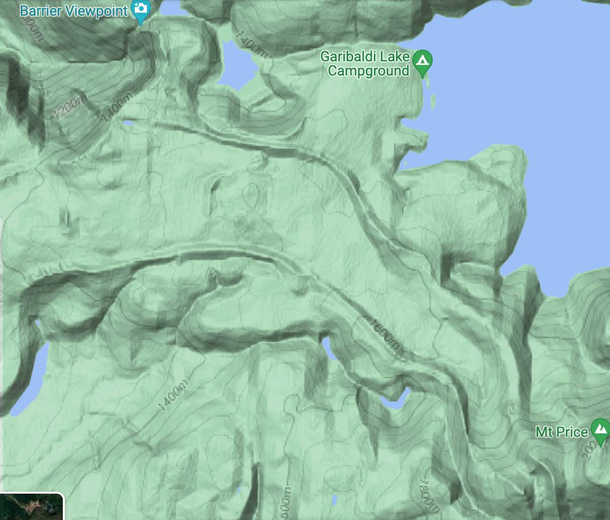
The lava river that formed the Barrier runs diagonally to the northwest. Another river goes southwest from the same vent.
If you look at the topographic map of Garibaldi, you can see numerous lava rivers: they come from volcanoes and have distinct ridges at their edges. In my mind all I had to do was make it to the lava river, and then I could walk down the middle of it on continuous volcanic rock with minimal vegetation. When I got there, I realized my assumptions weren’t the best. It had clearly been tormented by ice or water as it flowed and was filled with zillions of ridges of sharp, irregular volcanic boulders. I had to keep an eye on the stars to stay oriented as the ridges weren’t even vaguely parallel. Hoping from pointy rock to pointy rock wasn’t great for my soggy feet. After about 1.5 km and several hours of that junk, I bailed on the lava river and bushwhacked back to the lake. I got to Garibaldi Lake Campground at midnight and had my last lunch.
In retrospect, it would have been easier to get across to Sphinx Bay, even if the ascent between Guard and Deception was bad.
The 9.5 km on the trail was pretty slow because my feet were somewhat blistered. It was 3:15 when I got to the parking lot. The Neve’s supposed to be 35 km, but with all the bonus material I was at 57.
I had planned on bumming a ride back to Squamish, but there wasn’t anyone in the parking lot, so I called a cab to take me back to the Diamond Head trailhead. This is when I discovered that Squamish Taxi has a policy that they don’t go past the mountain bike parking lot, which would leave me with a long way to walk back to the car. I tried bribing the driver, and he totally wanted to, but the cabs have GPS monitoring and the owner doesn’t allow it, so I got taken to the McDonald’s. I picked the McDonald’s not because I wanted McDonald’s food but because it has a big “24 Hrs” sign. It turns out that sign refers to the drive-in only, so my keeping-warm strategy failed. I called Howe Sound Taxi, but they only had one car on duty and it had just left for Vancouver. The dispatch wasn’t willing to schedule anything until it got back. I downloaded Uber and couldn’t get a driver. I saw a Kimber Cab drive by, so I called their dispatch and it went straight to the answering machine. My phone was running out of batteries and I was getting cold.
Out of options, I started walking from the McDonald’s parking lot at 5:45. In retrospect, it would have been way better to just get dropped off at the mountain bike parking lot. The sun came up as I was passing Quest University. I’d made it about halfways up the gravel before I managed to hitch a ride, which was very much appreciated.
Nice. Last time I went looking for the Neve Hilton I found a toilet seat but the rest was probably covered with snow.
I suggested to Jeff that he might have been able to make things easier by portaging a canoe over the neve.
What about just swimming across the lake?