Date: March 24th, 2024
Participants: Noah Macdonald, Alex Beauchemin, Ine Østmo, Maiya Callister, Sean McKay
TRIP REPORT:
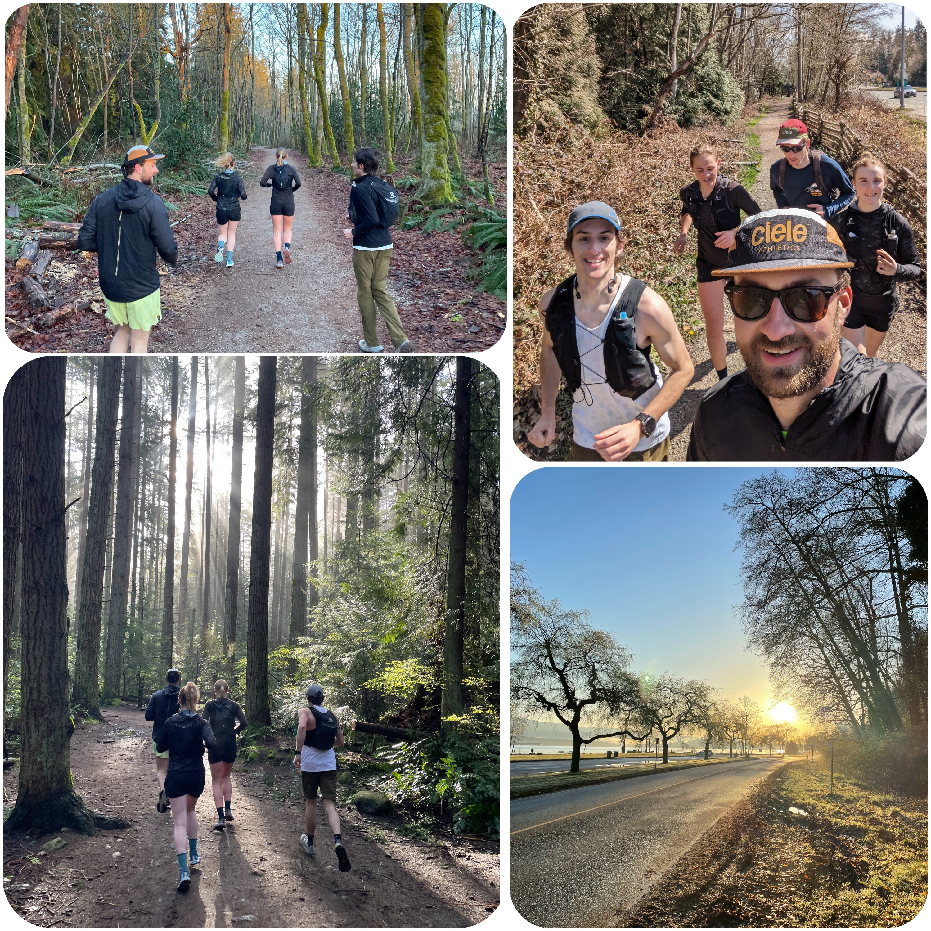
On March 24th, 2024, five VOCers set out to cover every trail in Pacific Spirit Park in a single push. No one in the group other than me had run an ultramarathon before (though with our pre-mapped route clocking in at 64km, it would also be my longest-ever run), making this a particularly special occasion.
The run itself makes for a rather straightforward story. We decided to run as a group, and set a slow but steady pace; we had no intentions of setting a speed record or genuinely racing, and instead aimed to simply cover as much ground as possible (without getting injured). Highlights included seeing a beautiful sunrise and hundreds of dogs.
The details notable enough for a trip report:
1. At the start, Alex’s Strava did not start recording. In an impressive display of enthusiasm and energy, he (a) took a detour when we ran back near the start to re-cover some ground, so as to paint in the map on his GPS recording, and (b) went back again to really cover everything properly after everyone else finished running.
2. Near the beginning, we managed to go down the wrong path for ~500m before realizing we were off-route and doubling-back. This helped extend our final numbers.
3. We took every chance we could to go beyond the original GPX. There are a few (for lack of a better term) “corrals” in Pacific Spirit that consist of a vaguely circular space where you can sit on logs off of the main trail. We ran into and around the edge of each of these. With the exception of Maiya, we also did a lap around the Camosun Park running track, adding an extra 400m.
4. There were a very small number of short paths that were either permanently closed, or simply did not exist in real life despite showing up on the map. Similarly, there were a few paths that were not on the GPX file that we went and ran anyway. This never proved to be a problem for our overall routefinding.
5. The general consensus of the group is that Sword Fern trail and the Camosun bog are the best parts of Pacific Spirit park.
The final distances recorded:
Noah: 67.0km
Maiya: 65.2km
Ine: 67.0km
Sean: 67.7km
Total time: 8hrs 53min
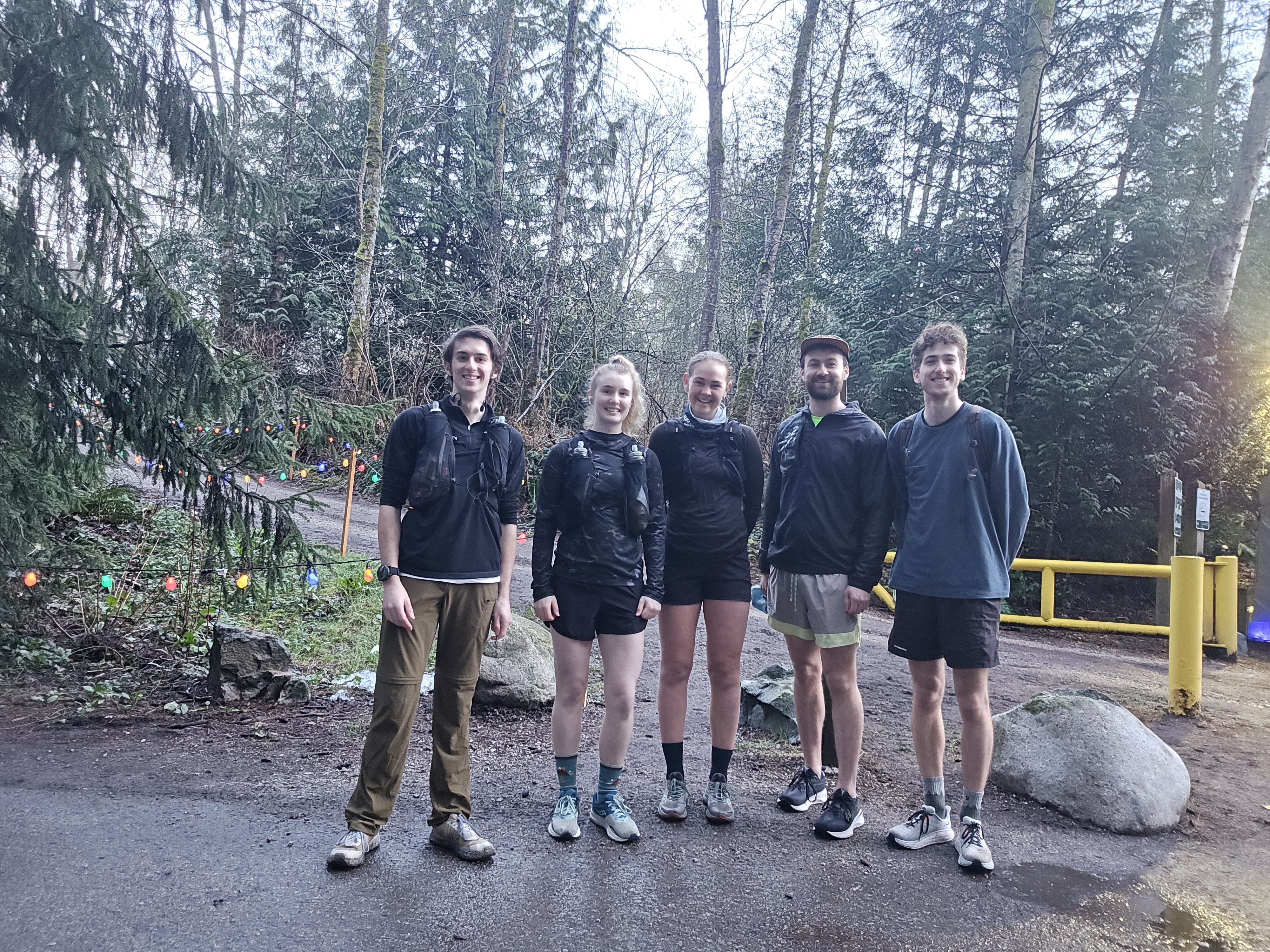
Before the run
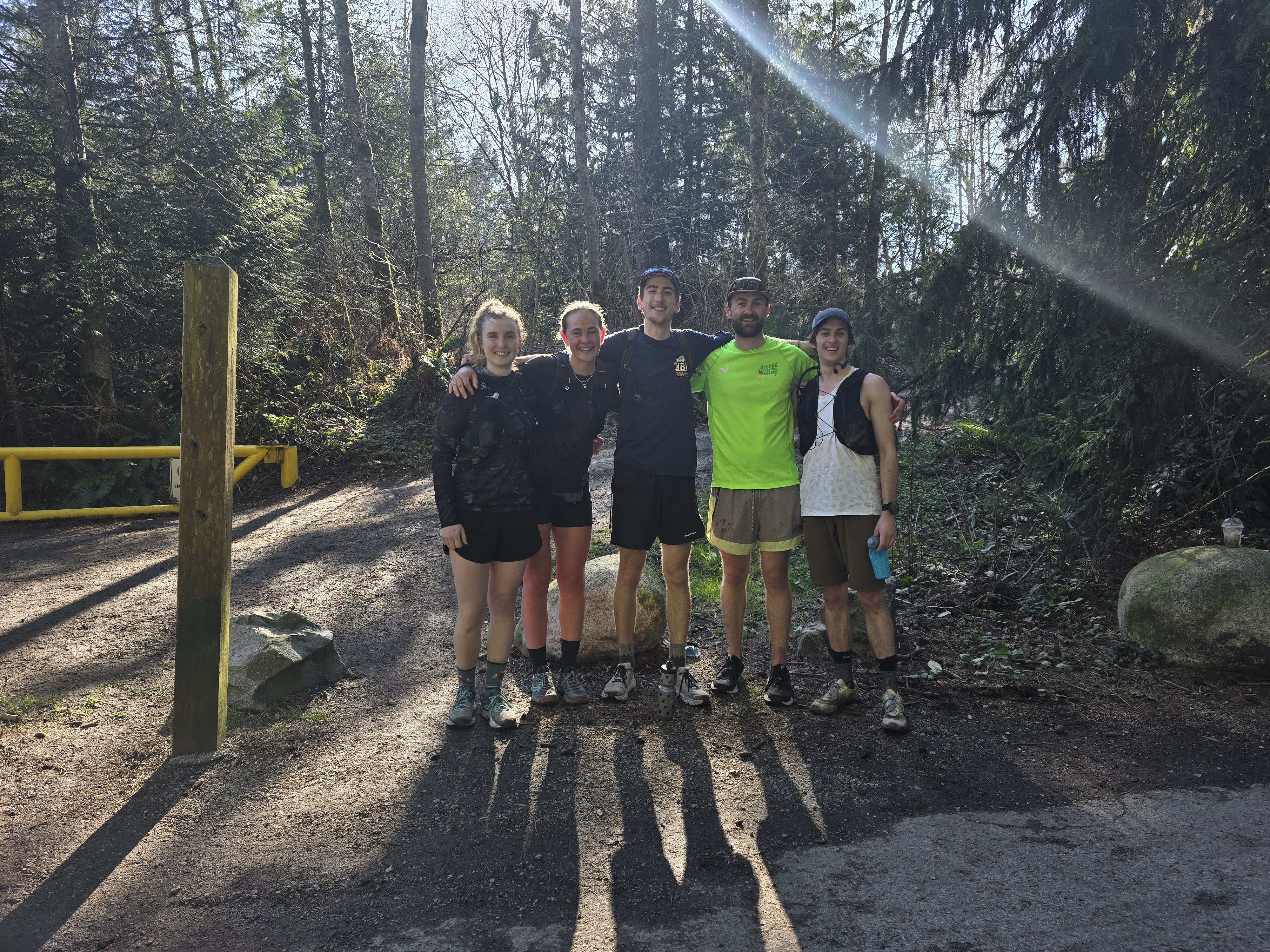
After the run
COMMENTS ON ROUTE PLANNING:
The original route was created by some non-VOC friends of Thomas Morrisey for their event — “The February 50” — back in 2023. They used a modified traveling salesman algorithm, then made a few manual tweaks.
I later realized that this isn’t a travelling salesman problem; it is a rural Chinese Postman problem. That is, the goal was not to cover all vertices while minimizing the distance of edges travelled, but instead to traverse every edge in the least distance, vertices be damned. What makes it a “rural” variant is that there were some “edges” that didn’t need to be included, but could be included if needed to reduce distance travelled by avoiding inefficient doubling-up on certain trails. Imperial Drive, or any of the pathways/sidewalks around the park were usable but not required.
All that said, I ultimately decided to just further modify the original February 50 GPX. Since modifying such a large route is rather difficult, my process was painfully slow. I used Caltopo to insert labels every 200m on the February 50 GPX file, so that I could follow along the direction of the route (which was otherwise inscrutable, given how often tracks double up or cross over each other). I then made a new track in Gaia that I could edit. Unfortunately, I realized the day before our run that my new track was still missing a small number of trails, and went in to edit it. Gaia threw a fit, and would not let me modify the track. So back to the drawing board — I used Caltopo this time and re-traced the original route, adding modifications to cover every possible pathway that I could see. I would not recommend this process to anyone; Caltopo was rather slow and glitchy with such a large route.
Ultimately, the giant route on a single GPX was a bit of a problem; figuring out where to go by loading the file to Gaia or Caltopo might have been rather difficult, given the complexities of the route. Luckily, Sean split the route into 8 sections on FatMap making navigation easier. Maiya also traced the map by hand, with colour-coded segments and arrows. My Garmin watch also had turn-by-turn navigation, which made things easier, especially near the end when we felt like zombies.
If you plan on repeating this run:
1. Consider making a new course with a better algorithm; it may be possible to run the park with less total distance.
2. Be mindful that having a system to interpret directions is key to pulling this off.
3. As a corollary to (2), consider splitting the GPX into segments.
Awesome! Neat to see the Travelling Salesman and Chinese Postman problems mentioned
Four out of five wore shorts. It did not rain. No cars were required. No avalanche training needed. Wreck Beach stairs were not mentioned.
Decided to optimize the route a bit, shaving off about 5km. Hopefully this helps anyone else that wants to run it later! (can send the GPX)
https://medium.com/@sean.mckay.314/rural-chinese-postman-problem-ultra-optimization-using-networkx-and-osmnx-b245764db2b2