When I envisioned my Castle Towers backpack early this summer I had no idea that we would also be summiting the Black Tusk on the same trip. I definitely didn’t expect to get back to the trailhead at 2am, after a solid 19 hours of hiking, either. But with a peak as committing as Castle Towers I now realize this was bound to happen.
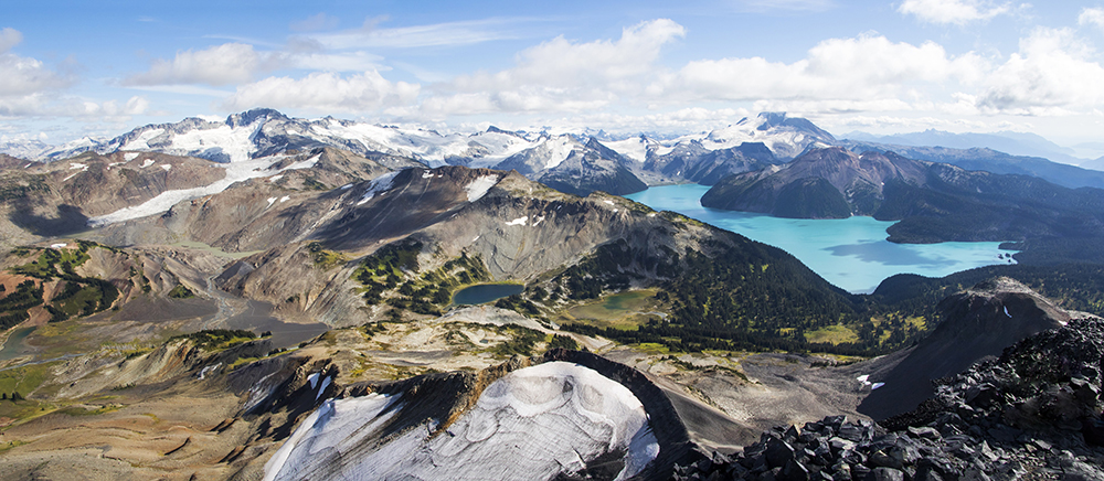
A panorama from the summit of Black Tusk. Castle Towers is the prominent peak on the left.
The story begins with some unanswered emails to BC Parks. “Hey, can we get a permit to camp near Gentian Pass so we don’t have to do the whole damn thing as a day trip from Helm Creek?” Their silence was both deafening and unsurprising. So I took what I could get and booked a random Sunday night in late August and hoped for the best. The best was not what I ended up getting. Shortly after our pre-trip meeting I finally got an email from BC Parks, but just to say that by the way, the entire Cheakamus Lake area is closed because of bears, so you’ve gotta go from Rubble Creek now. This was not ideal, and sparked an extensive email discussion about how to salvage the trip. Options included getting up stupid early the first day and trying to summit Castle Towers before getting to Helm Creek (a very unrealistic scenario I would soon learn), saying screw it and just camping at Gentian Pass anyway, or hiking to Helm Creek on day one and summiting after an alpine start the next day. We eventually opted for plan #3, but with a twist. Somewhere along the way I became fixated on also bagging the Tusk, since hey, it’s pretty much on the way anyway, right? I hadn’t gotten the chance to get up there yet, and the trip leader generally gets to call the shots (not that anyone really objected). So that became part of the plan.
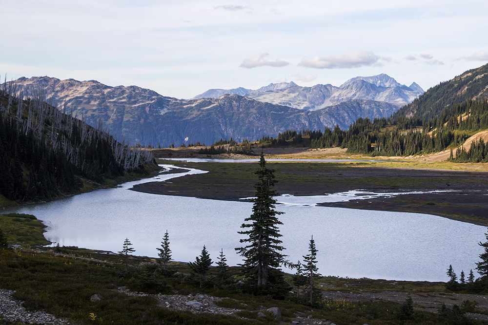
We attempted to meet up at Tim’s in Squamish by 8, but a google maps error led to my car arriving a half hour late (Kitsilano, it turns out, is in a very different location than East Van). Like they say: “a VOC trip leader is never late, nor are they early, they arrive precisely when they mean to.” Luckily our less-than-alpine start didn’t derail our plans at all. We arrived at the very full Rubble Creek parking lot around mid-morning, eventually settled for parking on the side of the road, and got moving quickly up the trail with full packs. Our group of 10 included myself, Jessica, Hassan, Simeon, Philippe, MJ, David, Chrisel, Louise, and Charlotte. There were a lot of other hikers out, but most groups seemed courteous and happy to be outside. Before we knew it we were up the switchbacks and approaching Taylor Meadows.
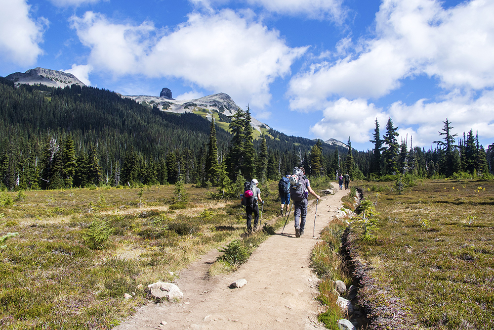
Our group making their way through the meadows. Black Tusk, our first destination, is visible on the left.
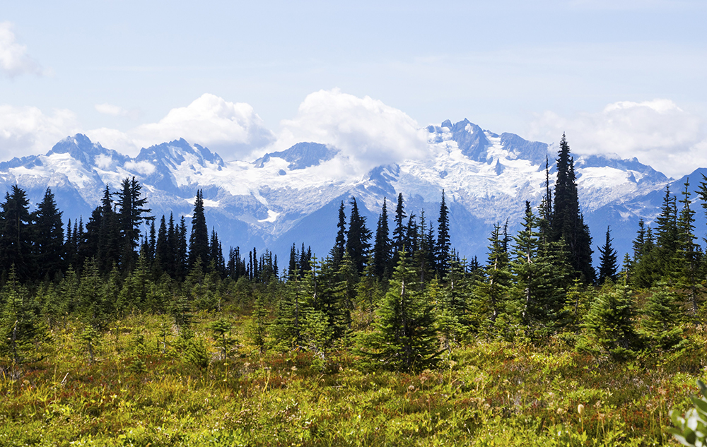
Looking behind us we got a great view of the Tantalus Range.
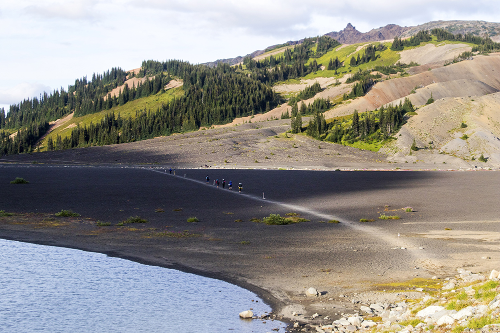
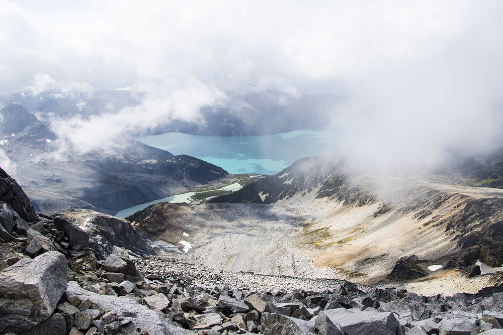
Along the way we had a couple of “berry breaks” which is exactly what it sounds like. There was some grazing along the way as well, with abundant blueberries in the sub-alpine. Our next debate was over where to drop our packs to go up the Black Tusk. Turns out there is a trade-off between the most efficient place to drop packs and the place where packs won’t get ripped apart by bears in search of food. So we opted to avoid the latter as much as possible and carried the heavy packs quite high into the alpine below the Tusk. At some point we figured a bear wouldn’t venture that high, especially with all the humans passing through, so dropped our packs and started the cinder slog to the saddle below the Tusk. I watched some groups as they made their way up and down the scramble near the top, it looked somewhat like a traffic jam. As we neared the base of the Tusk we ran into some familiar faces. Melissa and some other VOCers (I can no longer recall who else was there, sorry) were making their way down after a successful summit. They greeted us and offered some beta which was much appreciated (take the further gully on the left, not the first one you come to). We all then carried on our separate ways, and soon we were navigating the crumbly terrain at the bottom of the dramatic Black Tusk.
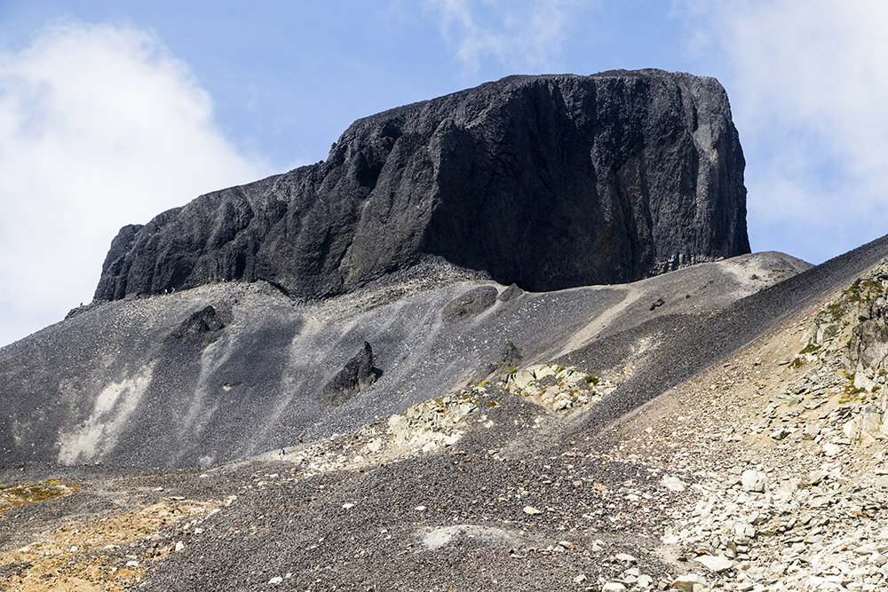
The cinder-y landscape on the approach to the Tusk. You can see people on the left (some of whom turned out to be VOCers!).
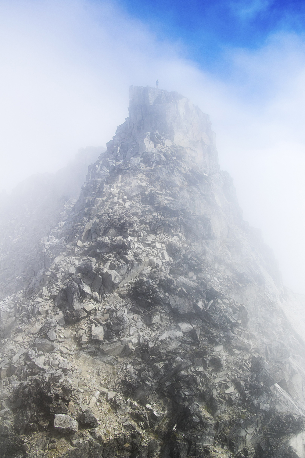
We traversed around to the left, finding the correct ascent gully. Carefully, each of us scrambled up, making sure to space apart in the fairly likely case of rockfall.
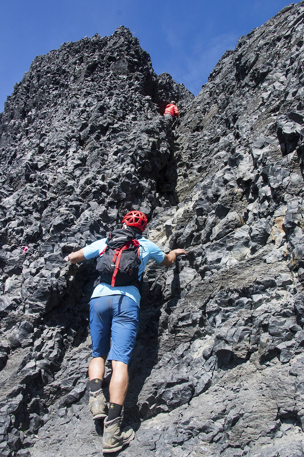
The scramble on the Tusk. More fun and not quite as loose as I expected, though care is still needed.
The crux of the scramble is the narrowest part of the gully near the top, and I had a lot of fun stemming this part. From there it’s a walk up to the “summit” of Black Tusk. Summit is in quotes because it’s not the true high point. The real high point is substantially more dangerous and difficult, not worth it for the extra few feet of height in my opinion. So we settled for this false summit and had a late lunch while enjoying the fantastic views and sunny weather.
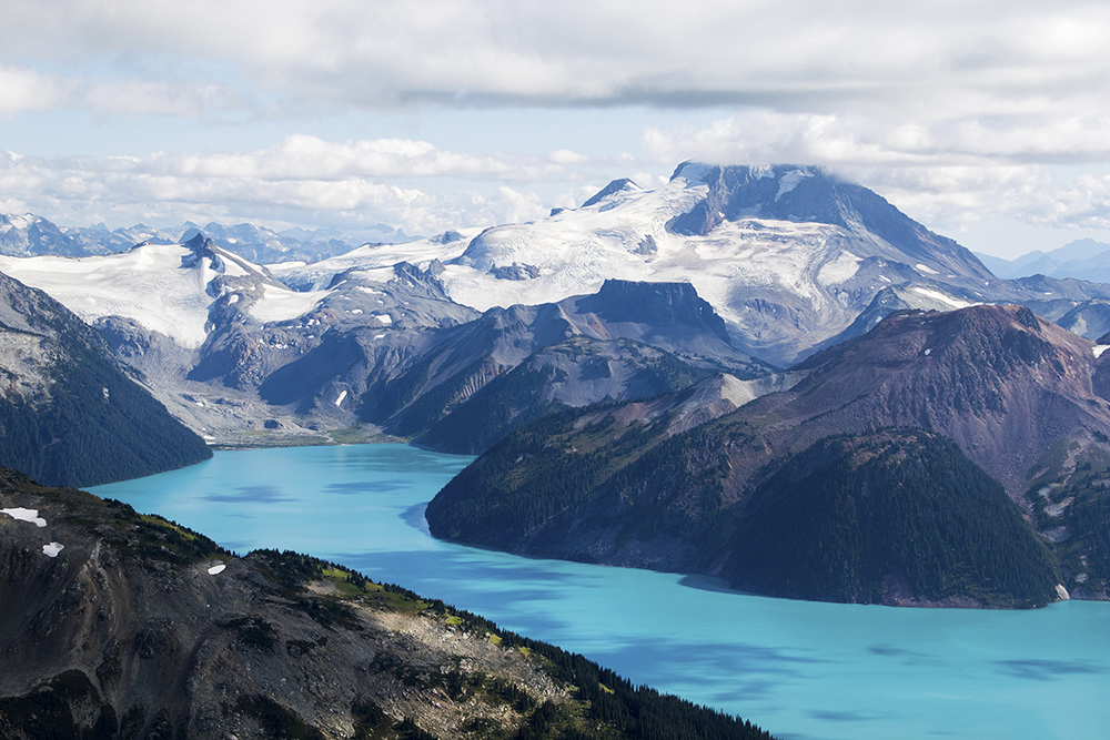
Vivid blues of Garibaldi Lake, as seen from the Black Tusk.
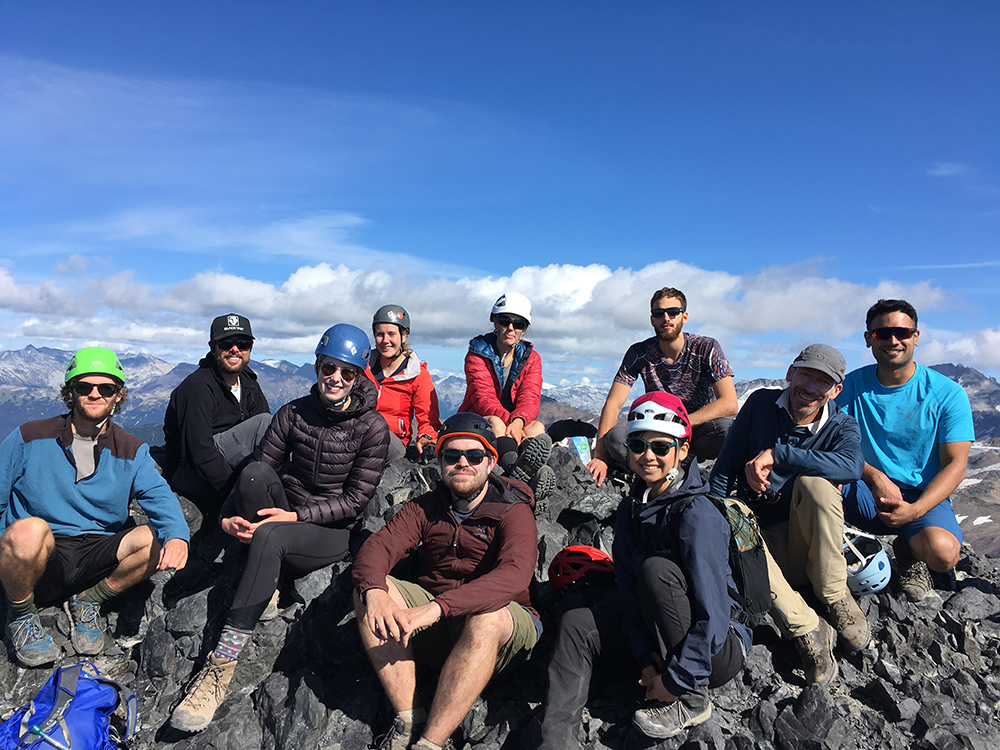
From left to right: Simeon, David, Louise, MJ, Isaac, Charlotte, Jessica, Hassan, Philippe, and Chrisel
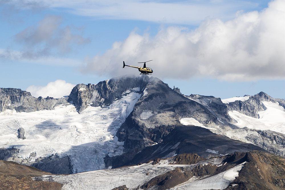
A helicopter seemingly perched right atop our next objective – Castle Towers.
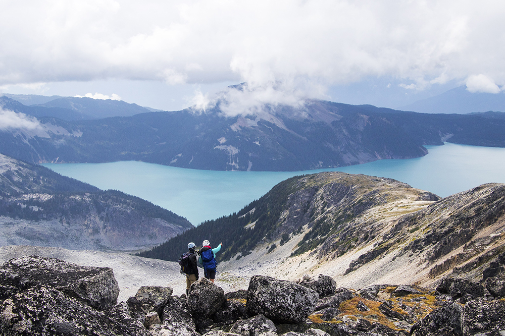
From a distance Castle Towers didn’t look too crazy. We could see our whole route before us, and set off from Black Tusk with a game plan for the next day. The descent was fast and our bags were still in the same place we left them, so we continued on our way to Helm Creek. Instead of backtracking we opted to go cross country back to the trail, which worked out quite well and provided further opportunities for berry breaks.
Evening at Helm Lake, just below Helm Pass.
Our group making their way across the almost unnaturally flat terrain beyond Helm Pass.
The last few km of trail was a slog, but before sunset we arrived at the Helm Creek campsite. I had 3 tent pads booked, but there were so many open ones that we were easily able to spread out. Not as many people were willing to make the trek from Rubble Creek I suppose. We had dinner and hung out for a while before calling it an early night. The plan called for an alpine start the next day.
We arose before sunrise, but a bit of faff around eating breakfast and packing up meant we got started at about 7am. As had happened the day before, we opted to carry our bags with us a fair ways to find a safe place to leave them. After only a few km we veered off of the main trail and started the long trail-less journey to Castle Towers. Our approach took us up the more easterly drainage from the Helm Glacier (note that this is a fairly different route than some other trip reports). The terrain was mellow and soon we dropped our packs at the base of the ridge below Helm Peak. The plan was to climb steeply up to the ridge and then contour our way along it to Gentian Pass. All of this was to avoid Helm Glacier, a major obstacle as we had no desire to bring along heavy glacier gear. For the most part, this route worked quite well. There were some steep slide-y parts, and some bushwhacking through small sub-alpine trees, but after that the going was fairly easy and quite scenic. We even found a marmot skull on the way, which was neat to see. I still want to make a marmot-tooth necklace (way cooler than a shark-tooth necklace FYI).
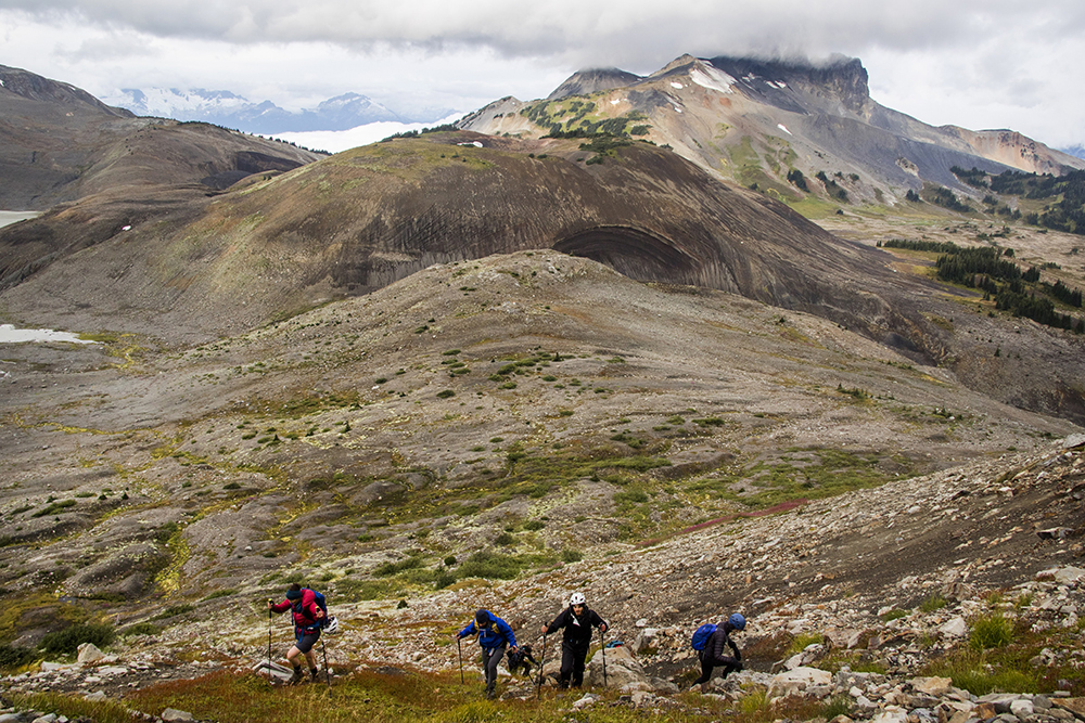
Our group starting the steep ascent up the ridge.
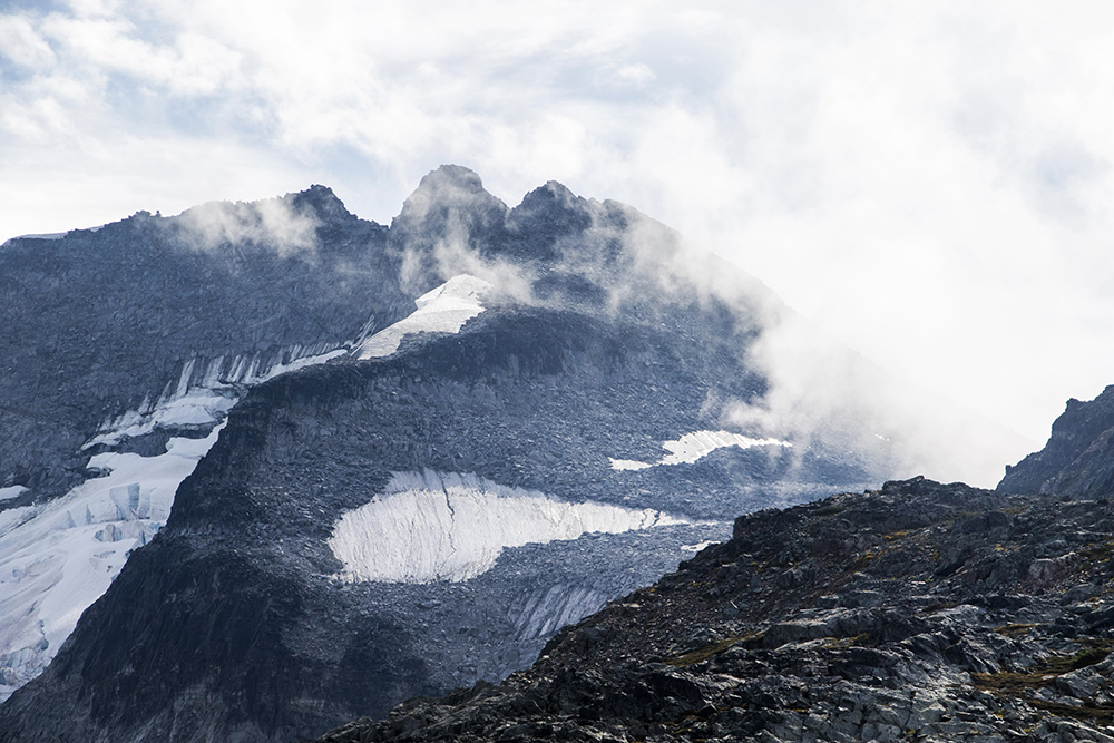
Black Tusk made some appearances through the clouds. We weren’t as lucky with the weather this day.
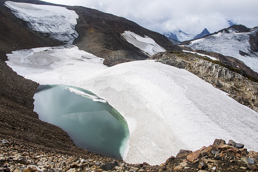
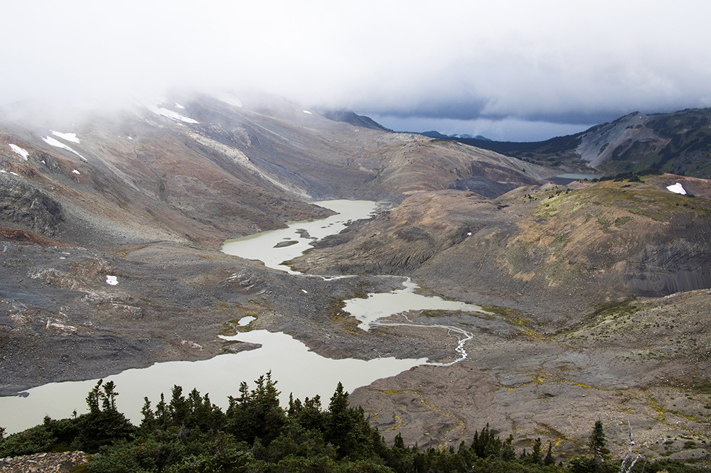
A neat tarn as we approached the top of Helm Glacier.
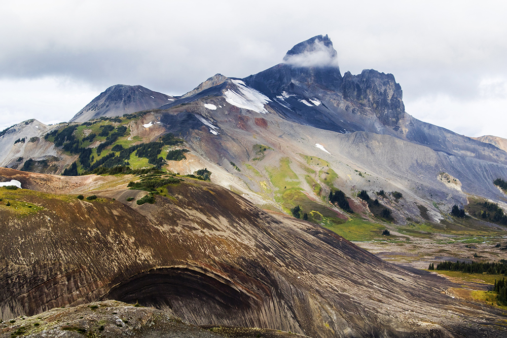
It wasn’t until we looked down on Gentian Pass that I realized how serious an objective this truly was. We now had to descend a steep 300-400 meters, regain that elevation plus a lot more to get to the summit, and then, to cap it off, regain the saddle above Gentian Pass on the return. It’s one thing to see it on the map, another to look at it in person after already having hiked a substantial distance. Castle Towers looked truly intimidating at this point.
This peak is not to be underestimated.
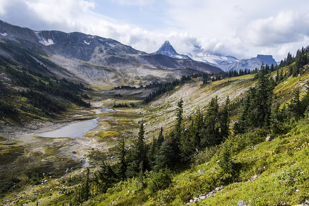
At least Gentian Pass looked like a beautiful alpine paradise.
Fortunately, I had a great group with a lot of collective experience with me. If anyone else was concerned they didn’t show it, and without much hesitation we all began the descent down to Gentian Pass. I made sure to keep a close watch on how I was feeling – I needed to make sure I had the energy not just to summit, but to return safely. Bonking or getting injured here would have made for a bad situation so far from our packs.
As we made our way up Polemonium Ridge everything seemed to be going great. The peak was more out of the clouds than in, and the terrain up the ridge was not bad at all. We had set a turnaround time at 3pm and looked to be well within that limit.
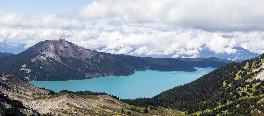
Not your usual view of Garibaldi Lake and Mount Price.
As we neared the top of Polemonium Ridge, we made our first real “mistake” of the trip. This is all in hindsight of course, and we were going off of the best information available to us. As we approached a small saddle someone mentioned that we needed to descend into the gully. That didn’t sound right to me, but looking at the gpx file I had gotten from Steven Song’s site, it indeed showed them dropping slightly below the ridgeline and contouring around that way. Though my instinct said to remain on the ridge, that group had both ascended and descended that way, so we figured there must be some nasty terrain or some other obstacle over there. Unfortunately that was kind of what we ran into below the ridge, as the terrain became very steep and loose. What we thought would be a short detour ended up taking an annoying amount of time as we carefully made our way across. Sure, I’ve seen worse in the mountains, but we would later find out that the ridge is much faster and more pleasant. Sometimes it’s not worth contouring to avoid a little bit of extra elevation gain!

The nasty terrain we found below Polemonium Ridge. Not recommended, and it could have derailed our summit plans.
Past the nasty section we were able to pick up some speed again, and the last few hundred meters were through fairly solid blocky talus.
Partially in the clouds near the summit of Castle Towers.
We arrived at the summit in a full fog, having had our weather window slam shut en route. Like the Black Tusk the day before, this wasn’t the true summit, but at that point we were beyond caring. At least most of us, as Simeon suddenly appeared on the actual summit amid the fog.
At least one of us made it to the true summit!
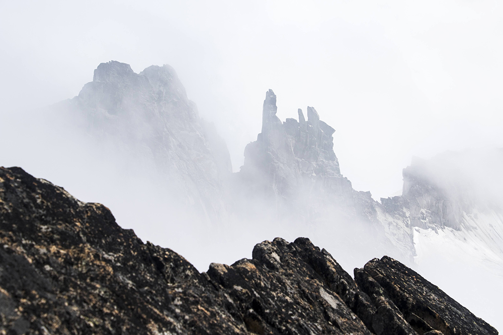
Despite the fog we got occasional glimpses of the incredible nearby peaks.
After everyone made it to the false summit, we lingered for a few minutes before heading down. We still had a lot of distance left to cover.
Route finding on the way down.
Having a good view of the ridge line, we decided to give that a try rather than deal with the loose stuff. It turned out to be much better, with bit of minor scrambling and a gentle walk off the ridge on the other side. I don’t have plans to return to this peak, but if I were to do it again I would 100% stay on the ridge.
The rest of the return trip was fairly uneventful. Climbing back over Gentian Pass sucked as much as we expected, but it was survivable and soon it was mostly downhill the rest of the way.
Lakes below Helm Glacier on our return. The dark clouds portended an incoming storm.
We arrived back at our packs around sunset. I had carried our stove the whole but had no time to use it, so I took advantage of this break and made some nice caffeinated tea. At that point we knew it would be a long night. Most of us were out of food at this point so we distributed what we had remaining and set off for the parking lot. After only a half hour we had to put on headlamps. For some reason the group in front waited to put theirs on, so we lost sight of them and got separated before finally finding them back on the main trail. This would become a theme, with the leading group disappearing into the night for the most part. We stayed behind to make sure those in the back didn’t fall too far behind or miss any important junctions. As we approached Helm Pass the rain began to fall, but at least it wasn’t a downpour at any point.
There was one last bit of excitement as we descended the switchbacks to Rubble Creek. I took my phone off of airplane mode and was surprised to find I had signal, including a text from someone’s emergency contact asking if we were okay. In my tired state I assumed that the other group was at the trailhead already and the situation would be taken care of, until I got another text that said quite clearly that if they didn’t hear from me in 10 minutes they would call 911. So that immediately spurred on a phone call to make sure they knew we were safe and just really really behind schedule.
After all that we finally arrived at the trailhead around 2am. I found the others passed out in their car and had to rudely wake them so we could go home. We had been on our feet for basically 19 hours with only a few short breaks – easily my longest day yet in the mountains. The total distance was not huge, but the terrain and elevation gain/loss/regain made for a big and committing day. Castle Towers is no joke. If I had to do it again, I would definitely camp out by Gentian pass, maybe even for a couple nights to make for a more pleasant trip. But it’s good to push your boundaries, and this trip certainly did that. Now at least I know I can spend 19 hours on one objective and get back in one piece!
What a great summer’s day
Another excellent trip report as always!
I think this quote is especially important as we push ourselves to do long days:
“I made sure to keep a close watch on how I was feeling – I needed to make sure I had the energy not just to summit, but to return safely. Bonking or getting injured here would have made for a bad situation so far from our packs.”
Isaac, do you have any idea to why BC Parks didn’t grant your group a wilderness permit at Gentian Pass? Did they not have enough time to respond, maybe?
I’m told that it is pretty common for BC Parks to ignore wilderness permit requests. It’s not right, but unfortunately it’s not all that unusual. I sent in the request over a month (maybe even two) before the trip so they had ample time to respond. If I had known the access to Cheakamus would be cut off I would have pushed the issue with them more, but at the time I was okay with going from Helm Creek…