Some quick background knowledge:
Ruby Mountain is a mountain in the North Cascades, about 3.5 hours southwest across the border in Washington. It is possible to camp around the top of the mountain in the ‘Ruby Cross Country Zone’ although a permit for this must be gotten from the Wilderness Information Center in Marblemount (this is what I did). There are also campsites along the way in Ross Lake National Recreation Area, a part of the North Cascades National Park Complex. Starting from the parking lot at the Colonel Creek Campground, the hike up is about 13.5km with about 2000m elevation gain.
The trip:
I Left the house this morning at 7:30 am and drove down across the US border (thankfully very little border traffic!) and eventually rolled up at the ranger station at around 10 to get my overnight permit for the Ruby Cross Country Zone, and borrow a bear canister since there’d be no trees to hang a bear bag off of on top of the mountain. I reached the trailhead and started hiking around 11:20ish.
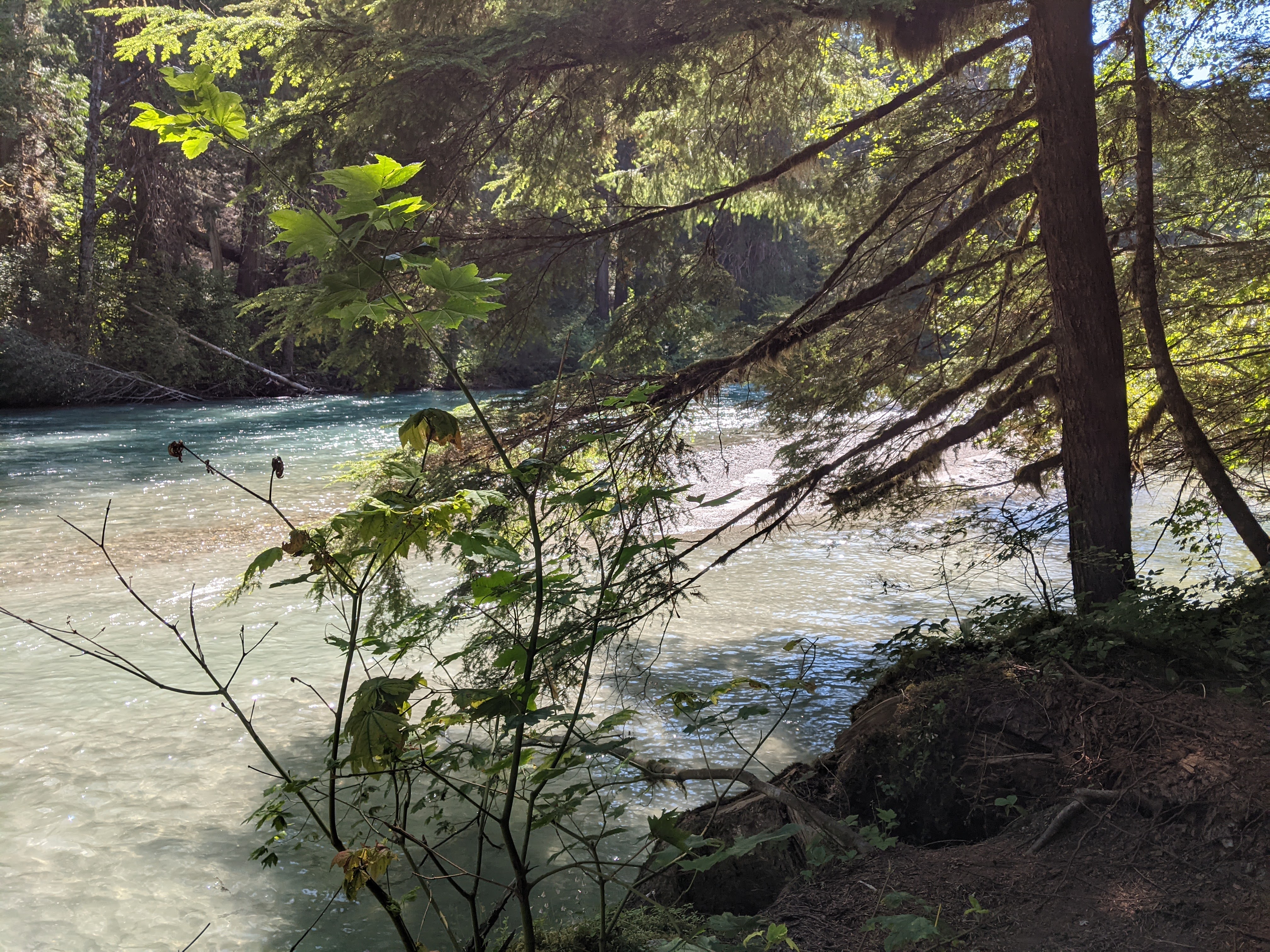
The first bit of this hike is pretty tame, with zero elevation gain. It begins by following alongside Thunder Creek after passing through a car campground. I was relaxed and thankful to be hearing the quiet sloshing of a river, smelling the damp humus and pine needles, and seeing a beautiful evergreen forest instead of driving down the highway or sitting in front of my computer screen.
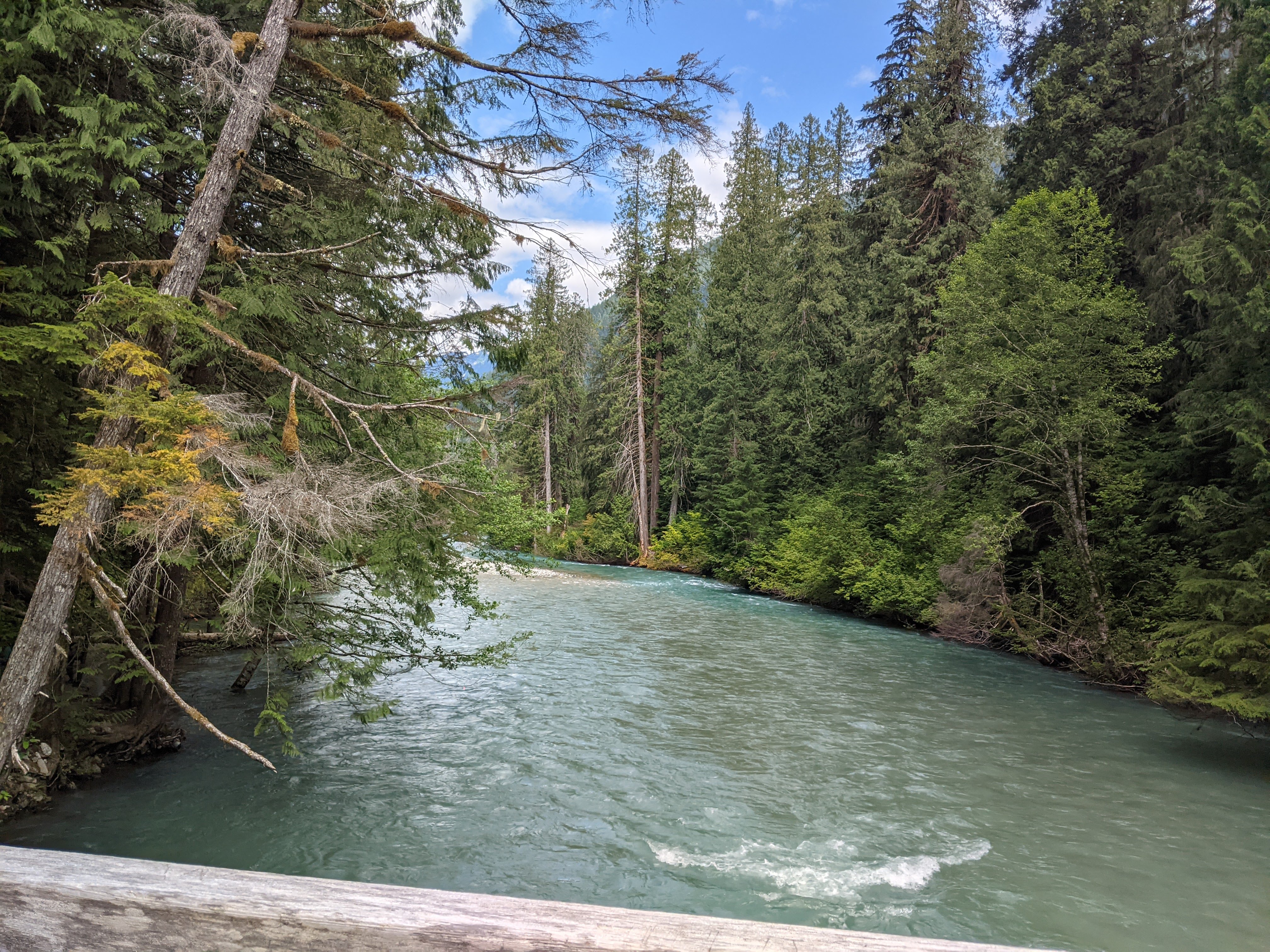
Crossing Thunder Creek Bridge
The rest of the hike was not to be as easy as it began however, this is a mountain, after all, so sooner or later I would have to start hiking up. After crossing Thunder Creek at the bridge, the trail got very steep, steep enough to gain roughly 2000 m over 10 km. Thankfully though – while there weren’t many views – the forest stayed open, sunny, and pleasant instead of terrible and overgrown.
I passed a couple of campsites making my way up to the turnoff for the Ruby Mountain Trail, which I eventually reached at around 1:40. This trail has some blowdowns since it is no longer maintained, and once I turned onto it I saw no more hikers until the following morning. Thankfully though the trail was easy enough to follow, although there were a couple of points where I was happy to have my gps as the path of least resistance through a large swath of blowdowns was evidently not the same as the trail. On my way back down I didn’t have this problem, so maybe the trail is just easier to follow heading down, or maybe I needed to open my eyes a bit more on the way up.
For a while, I had been continuously teased with tiny glimpses of glorious views through the trees. They were nice trees, and I liked looking at them, but I was really here for the massive glaciated peaks and wildflower meadows. At about 1500m though, the forest opened up for a little bit and I got my first real view, I had to take a moment to appreciate the beauty of these mountains, photographs don’t do it justice.
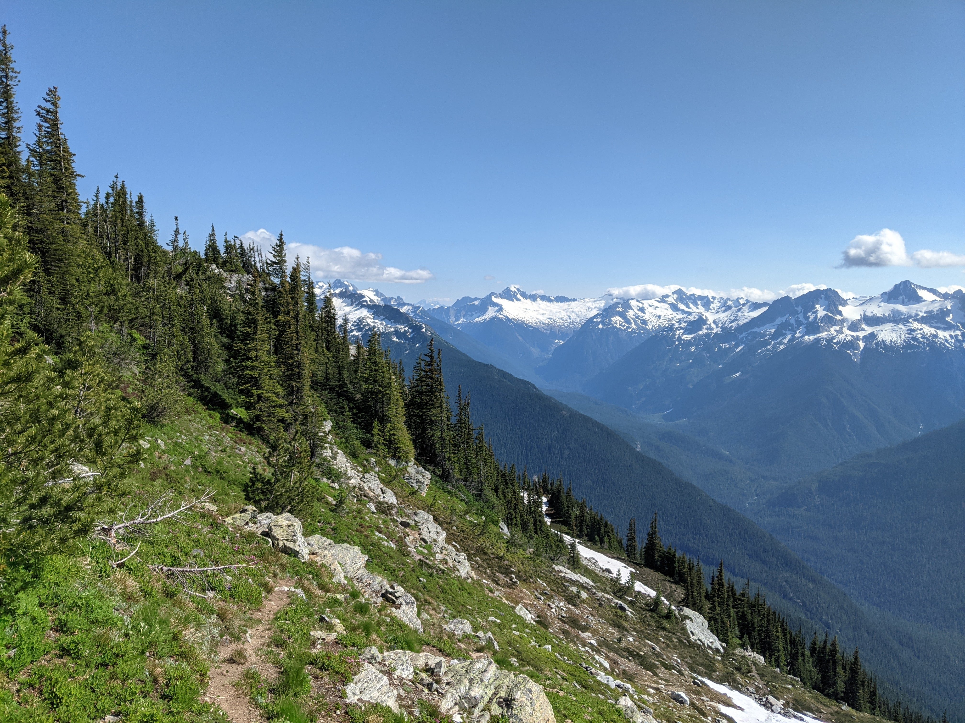
Facing east from the trail to look at some mountains
The views never really stopped from then on as the trees thinned out, and I eventually reached the ridge that leads to the summit at 4:30 after a brutal final 200m of elevation. Thankfully, though my map didn’t show it near the top, there always seemed to be somewhat of a trail to follow. Before continuing along the ridge, I was greeted by a lonely raven from on top of a rock before taking off. I then proceeded to faff around for altogether too long trying to find a proper spot for my tent. While setting up my tent I heard some baaing and turned to see a couple of mountain goats lookin’ at me funny, although they quickly lost interest – they probably have better things to do on a Friday night…
I eventually got my stuff sorted and made my way to the summit with my food, stove, and a bear canister full of snow. I figured after hiking all that way I didn’t want to have to do laps between the nearest snow patch and the summit for snow to melt for water. I was way too proud of myself for discovering this bear canister maneuver.

Looking north from the peak – Jack Mountain in the center right, Ross Lake in the center left with the double peak at the end of the lake being Hozomeen Mountain
I basked in the sun, made my dinner, and managed to read a little bit before catching the sunset and going to bed. I woke up early the next morning to have my breakfast with sunrise.
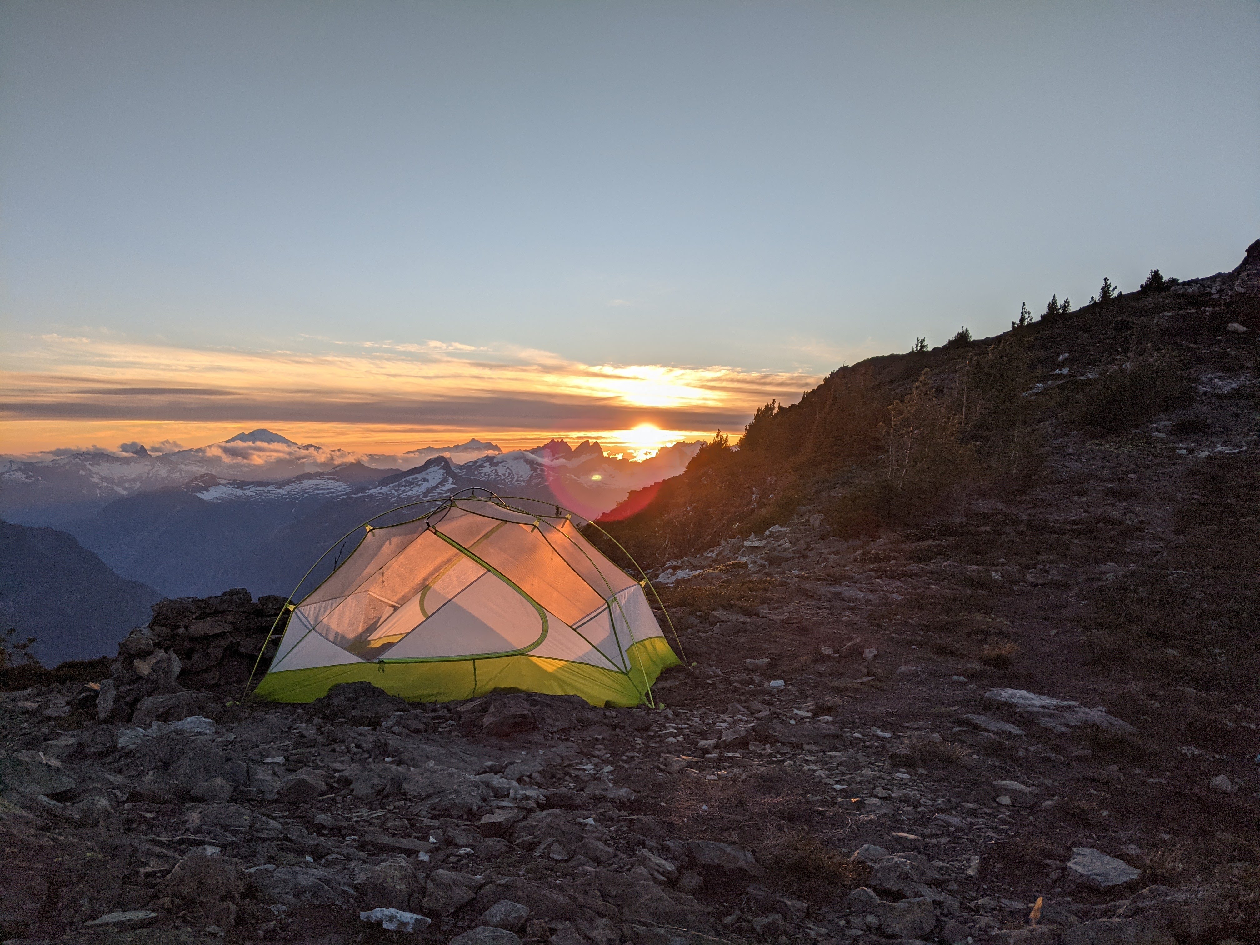
Sunset from my tent, pretty sure the big mountain on the left is Baker

Sunrise over Jackita Ridge with the clouds looking like a carpet at a lower elevation than me
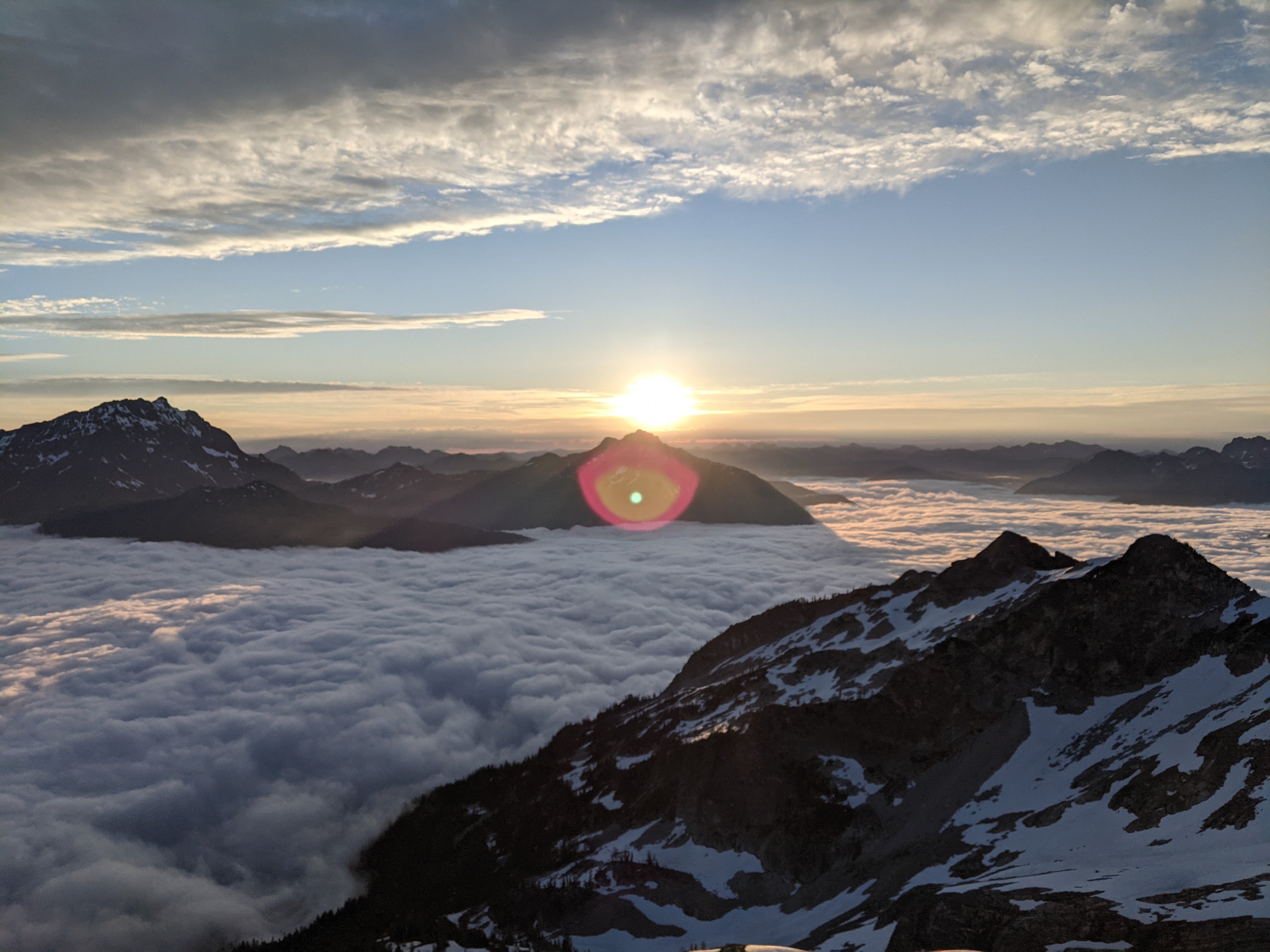
Another sunrise photo taken a bit later
The hike back was relatively uneventful, just the same as the way up but in reverse. I saw a couple of trail runners on the unmaintained trail early in the morning and some other backpackers later into the day.
Once I got back along Thunder Creek, I couldn’t resist taking a cheeky (pun intended) skinny dip before hiking the rest of the way out. Thankfully I managed to pull up my pants before an unsuspecting family walked by on the trail.
skinny dipping spot
Overall it was a fantastic trip, I would recommend if the 3.5 hour drive and border crossing doesn’t bother you. I had to stop on the way back for some diner food before making my way back into Canada!