Trip Date: May 7th-10th, 2024
Participants: Noah Macdonald, Charles-Antoine Leblanc
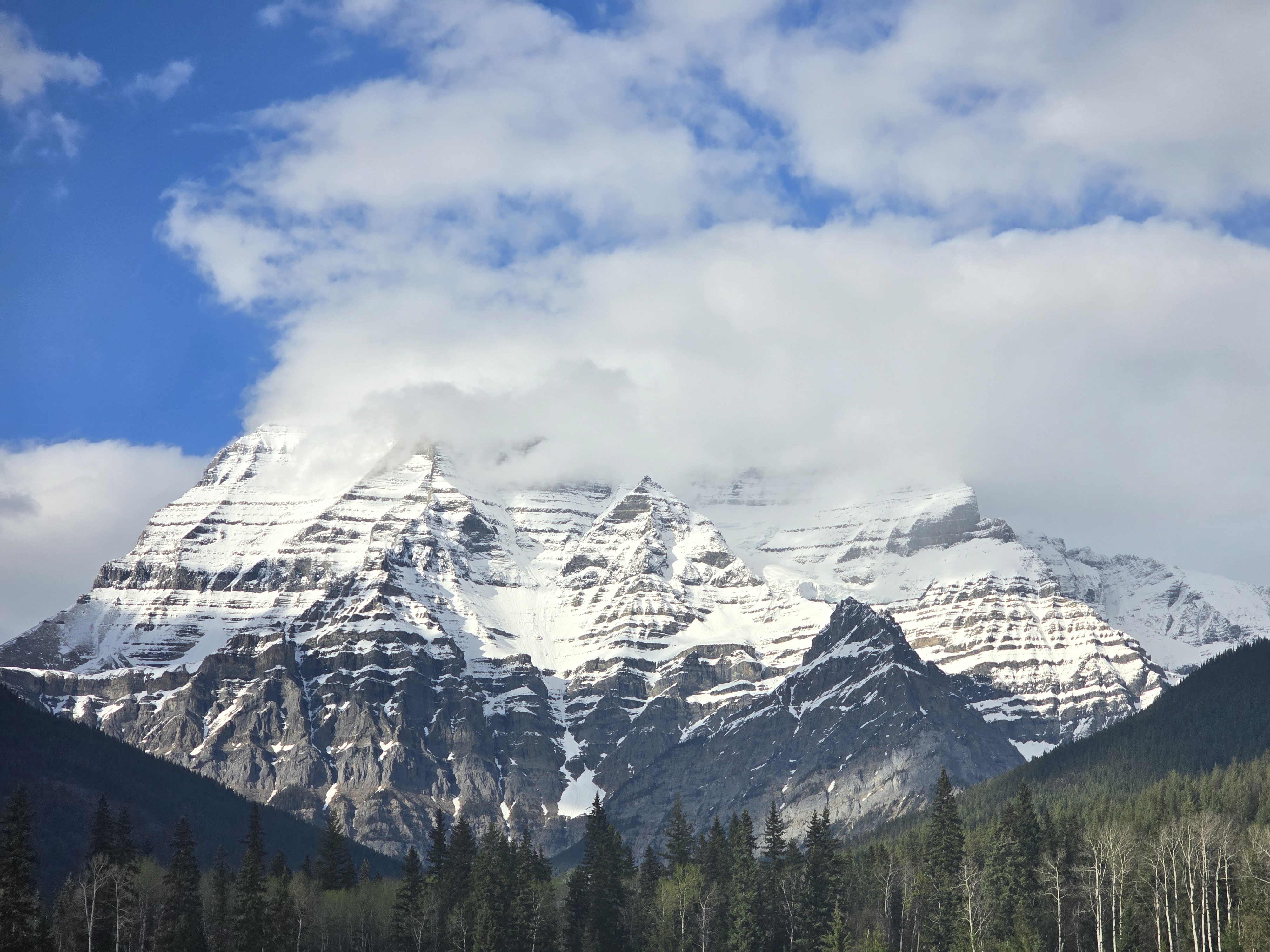
Summitting and skiing Mount Robson has been a dream of mine for longer than I can remember. On May 9th, I finally made that dream come true.
Yexyexéscen (Yuh-hai-has-kun)
The Mountain of the Spiral Road
Brevity is a virtue for most trip reports. This report lacks that particular virtue. Hopefully, I can compensate by organizing it effectively.
- Section 1 will provide useful background on the Kain Face and its various approaches; this is useful if you ever want to climb/ski Robson.
- Section 2 covers boring details like gear choices.
- Section 3 is the actual “trip report.”
- Section 4 has my comments on safety.
If you plan to repeat our line, please read section 4. There is remarkably little beta online about the Patterson couloir. I would hate to popularize this line without doing my duty to stress the incredibly high level of danger it poses.
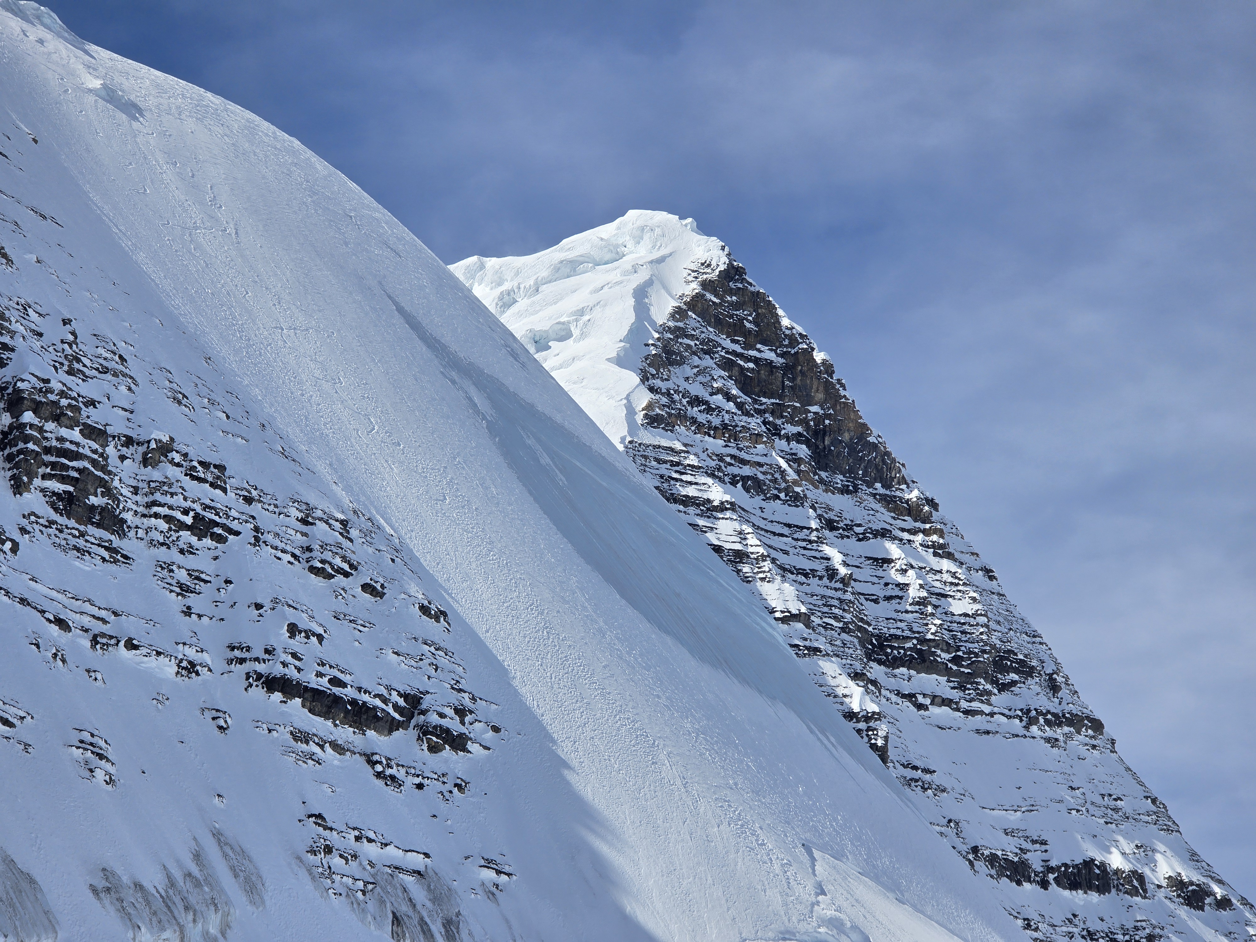
1 | Background: The Patterson Couloir

The Patterson Couloir. The lower couloir is hidden from view, and descends much lower.
Historically, the Kain Face has been approached by circling around Mt Robson via the Berg Lake trail and ascending the Robson glacier. That glacier has become increasingly sketchy with climate change and glacial recession. For this reason (and because circling Robson makes for an incredibly long approach) the Patterson Spur is now the standard approach. The spur is a more direct route branching off from Kinney Lake; it involves traversing around the south side of the mountain, then up a steep and ledgy scramble (up to 4th class) to a bench at around 2100m. The route then traverses west (climber’s left) across the bench, then up the “Patterson Spur,” which involves 4th (/low-fifth) class scrambling on loose rock until you gain the Robson-Resplendent col. You then traverse a ridgeline made of a series of towers towards Robson (low-fifth) until you can descend a steep snow slope to the glacier near the base of the Kain Face.
For clarity, I will refer to the first steep section of the approach—which ascends from the creek at around 1450m to the bench at 2100m—as the lower scramble. This then leads into the upper section from the 2100m bench, which I will refer to as the Patterson Spur. When I talk about the spur, I’m only referring to the section above the bench, to the col, and across the towers; this might be confusing since others often refer to the whole approach as the Patterson Spur route.
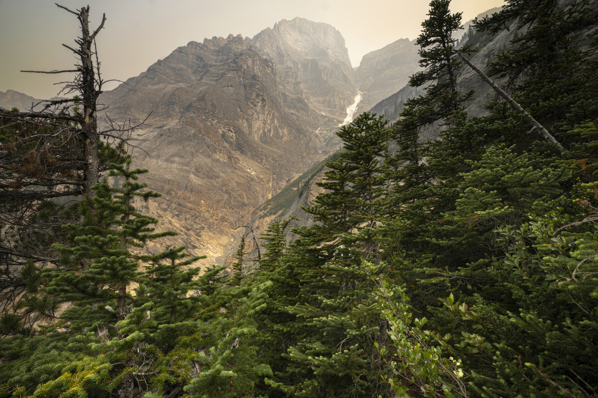
It’s worth noting that the Patterson Spur is becoming less attractive even in the summer. Last July, I attempted to climb the Kain Face with Christopher Candela, Katie Graham, and Oakley Werenka. One of the sections on the final ridge before the glacier had melted out; where there used to be a snow climb, there was now a loose 5.7. Other recent trip reports have observed sections of the towers entirely falling off. I suspect passage will become increasingly difficult as glaciers continue to melt; bring rock gear and a dynamic rope if you choose to do it in the summer. The spur and towers are steep and sketchy enough that I would be worried about climbing it in snowy conditions. I entirely ruled out ascending/descending the spur in the spring while planning this trip. That said, this is based entirely on speculation; I’ve never heard from someone who has tried to climb it in proper winter/spring conditions.
Since the standard route—the Patterson Spur—is best reserved for summer ascents, this leaves skiers with 3 alternatives.
- Approach via the Robson Glacier. Every trip report of skiing the Kain Face I could find used this approach. Unfortunately, flooding in July 2021 damaged the Berg Lake Trail, meaning it is closed beyond Kinney Lake until 2025. As a consequence, this option was not available to us.
- Fly to the Dome (the flat spot on the glacier near the base of the Kain Face) in a helicopter.
- Approach via the Patterson Couloir.
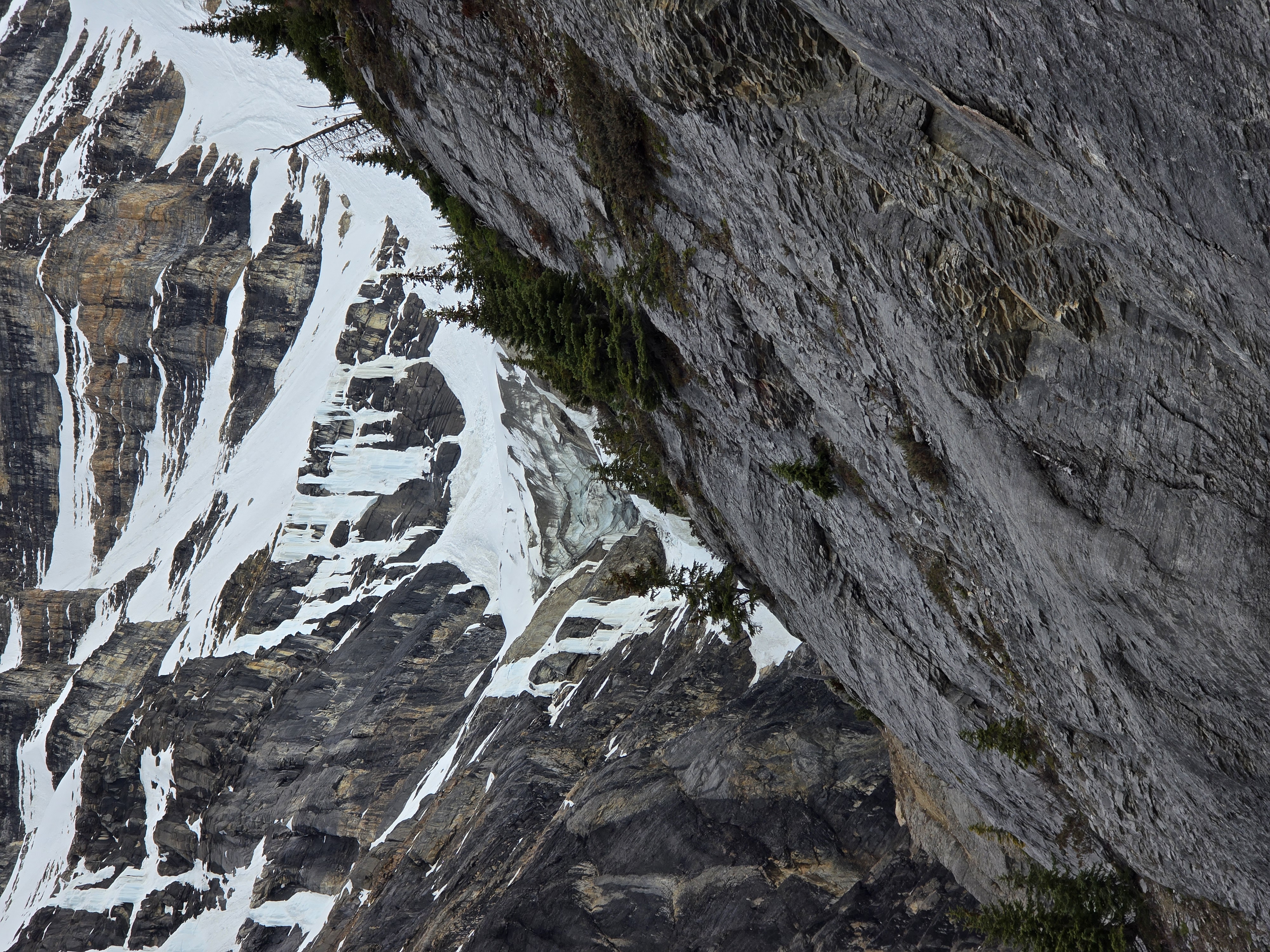
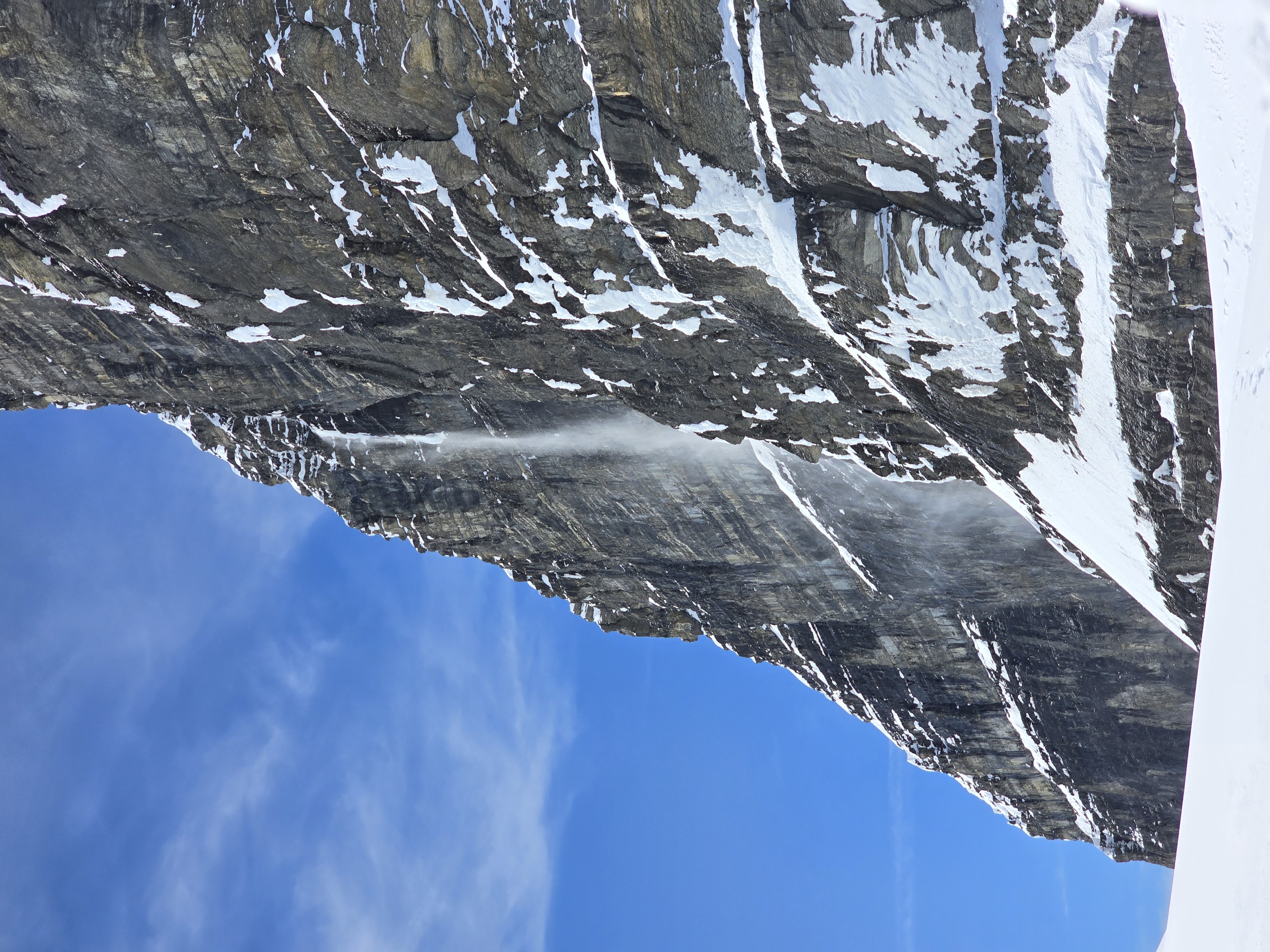
Like the summer route, the couloir extends all the way down to the creek at 1450m, making it a proud >1600m line shooting straight up the south aspect of Robson. For this reason, it’s worth differentiation between the upper and lower couloir. The lower couloir is 700m and deposits you at the 2150m bench if and only if an exit is present (see section 3 for the details). The overhead hazard in the lower couloir is mind-boggling; the entire east-facing wall empties into it, there is a serac hanging above it at the 2100m bench, and if you punch through the snow, you’ll probably die in the meltwater raging through below. Most of the lower couloir isn’t particularly steep, though.
Since the lower couloir is a terrible place that no one should ever be, when I talk about the Patterson Couloir in general terms, I’m mostly talking about the upper couloir. This line is a few hundred meters to the west of the spur (climber’s left) where the east-facing wall of a giant buttress meets the south-facing wall that holds the spur. It climbs >900m and ends on the glacier above, entirely skipping the need to traverse the towers from the RR Col. It is also threatened by overhead hazard from the walls on either side (avalanches, ice, and rock), but it is not topped with an overhanging serac like the lower couloir. Luckily, the 2100m bench allows you to skip the lower couloir and connect the lower scramble into the upper couloir; this combo is (in my view) the best spring approach to the Kain Face.
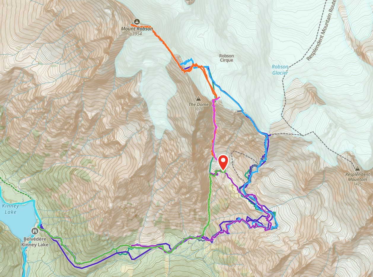
– The green line is the lower couloir.
- The pink is the upper couloir.
- The many lines shooting out to the right show the lower scramble.
- The blue/purple higher up shows the spur.
- The pin is our camp from this trip.
The couloir is decidedly not a summer route. A photo from Christopher Candela from when we tried the spur in July of 2023:
2 | Background, Logistics, and Planning
I entered the spring injured and overworked. I dislocated + fractured my finger on the approach to Nursery Peak with Steven Song et al. back in February (and promptly stopped gym climbing), then pushed myself a bit too hard skiing Colfax Peak after running an ultramarathon in March and tweaked my knee. I used this as an excuse to sit down and focus on finishing my Master’s degree in April and proceeded to be almost entirely sedentary for the entire month. In May, I came back to Calgary, had a chill day climbing/skiing Mt Hector with Seton Kriese (who has also experienced much that the Patterson couloir has to offer), and figured that I would ease my way back into bigger days over the next couple of weeks. Then, I saw the best-looking weather window I had ever seen for Robson and threw my responsible plans away.
The window opened on the evening of May 7th and continued for several days. My one worry was freezing levels; it looked like there would be a solid freeze on the nights of the 7th and the 8th, but freezing levels were projected to keep rising beyond that. For obvious reasons, a solid overnight freeze is needed for this route; all-melt no-freeze conditions does not mix with 50 degree ski lines in no-fall terrain (or with obscene overhead hazard).
With this in mind, I decided the best course of action was to drive up on the 7th, sleep in the parking lot, then get moving around midnight. Day one (or should I say night/morning one?) would get us to camp, then an alpine start on day two would let us summit and descend. If we needed to, we could take at most a third night. Spoiler: we needed the third night.
Finding partners last minute, mid-week, for hard & dangerous test-piece ski mountaineering lines is not an easy task. Luckily, Charles-Antoine Leblanc happened to be free. I pitched the idea, and he agreed to come almost instantly.
Our gear:
- I chose to use my skinny ski mountaineering skis since they would be nice and light for the insane elevation gain. I have Dynafit Blacklight Pros, which are 80mm underfoot. Charles was on a splitboard (I’m not sure which one, unfortunately).
- I brought a whippet attachment for my pole and one Petzl Gulley ice axe. I loaned Charles my other Gulley and he brought a lightweight ice axe of his own. We both found that this was the perfect combination of axes for each of us respectively.
- I packed a light rock rack that I left at our 2150m camp — I didn’t know how gnarly the 4th class on the lower scramble was going to be in spring conditions, and wanted the option to rappel it on the descent if needed. None of this was ever used.
- We brought 3 ice screws between us and a 65m pur’line (6mm dyneema). We never used the rope.
- Charles packed ski crampons, but I did not. I have no regrets since there is not much skinning on this trip.
- We brought a Black Diamond Beta Light 2 person tent; it worked quite well. We also packed -20°c sleeping bags, which were probably overkill for the temperatures we experienced (especially since we spent a lot of time sleeping during the day)
- Our stove setup consisted of my BRS-3000T stove and a 750ml titanium pot. It weighed practically nothing and I love it, but I did have to bend one of the stove’s arms back into place since it got banged up in my backpack. We also melted water with body heat and the sun.
- We brought bikes for the Kinney Lake approach/descent. This is well worth the effort.
3 | The Actual Trip Report
DAY 1: Tuesday, May 7th
I met up with Charles near the Mosquito Creek Hostel at roughly 3:30pm Mountain Time and I drove us to the Berg Lake trailhead. We sorted out gear, got our bikes set up, and did a crevasse rescue practice session where I helped teach him some more advanced 2-person glacier travel skills. We slept in my car at 8pm, and woke at 11pm.

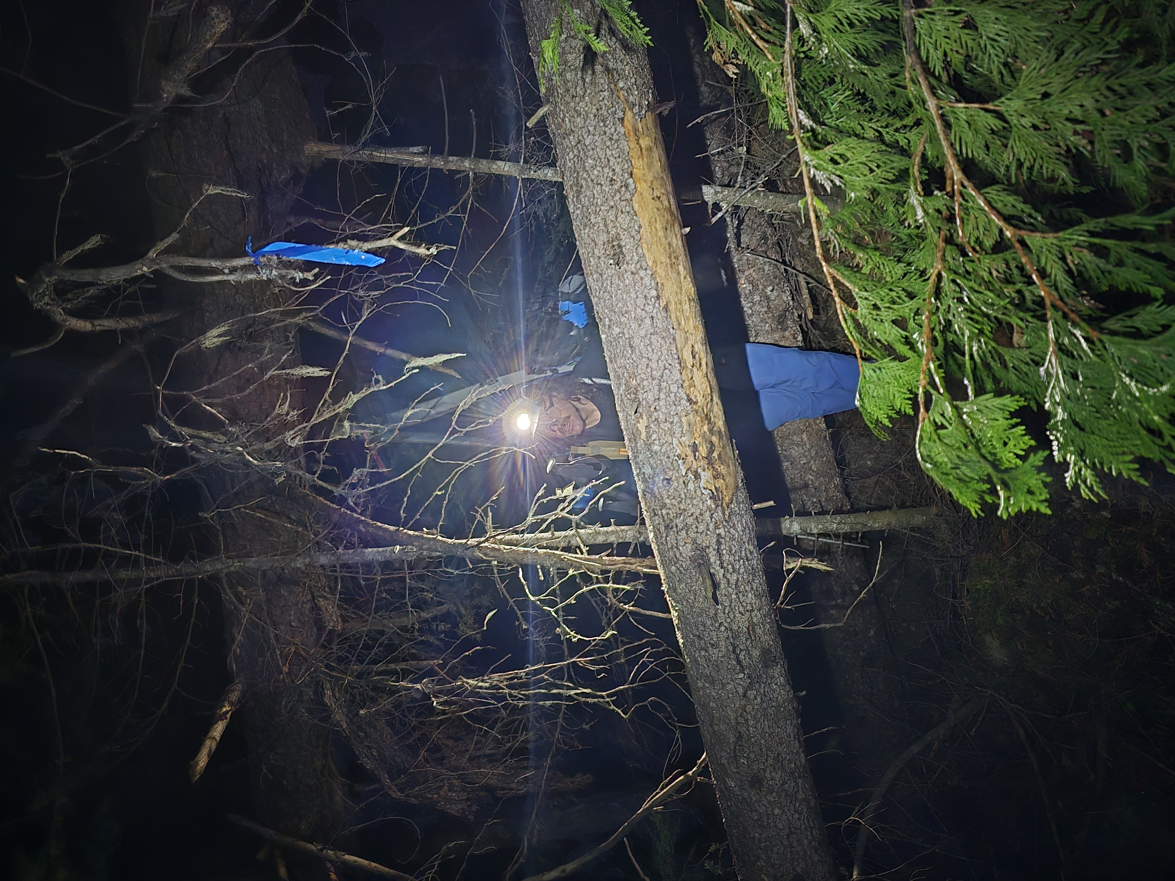
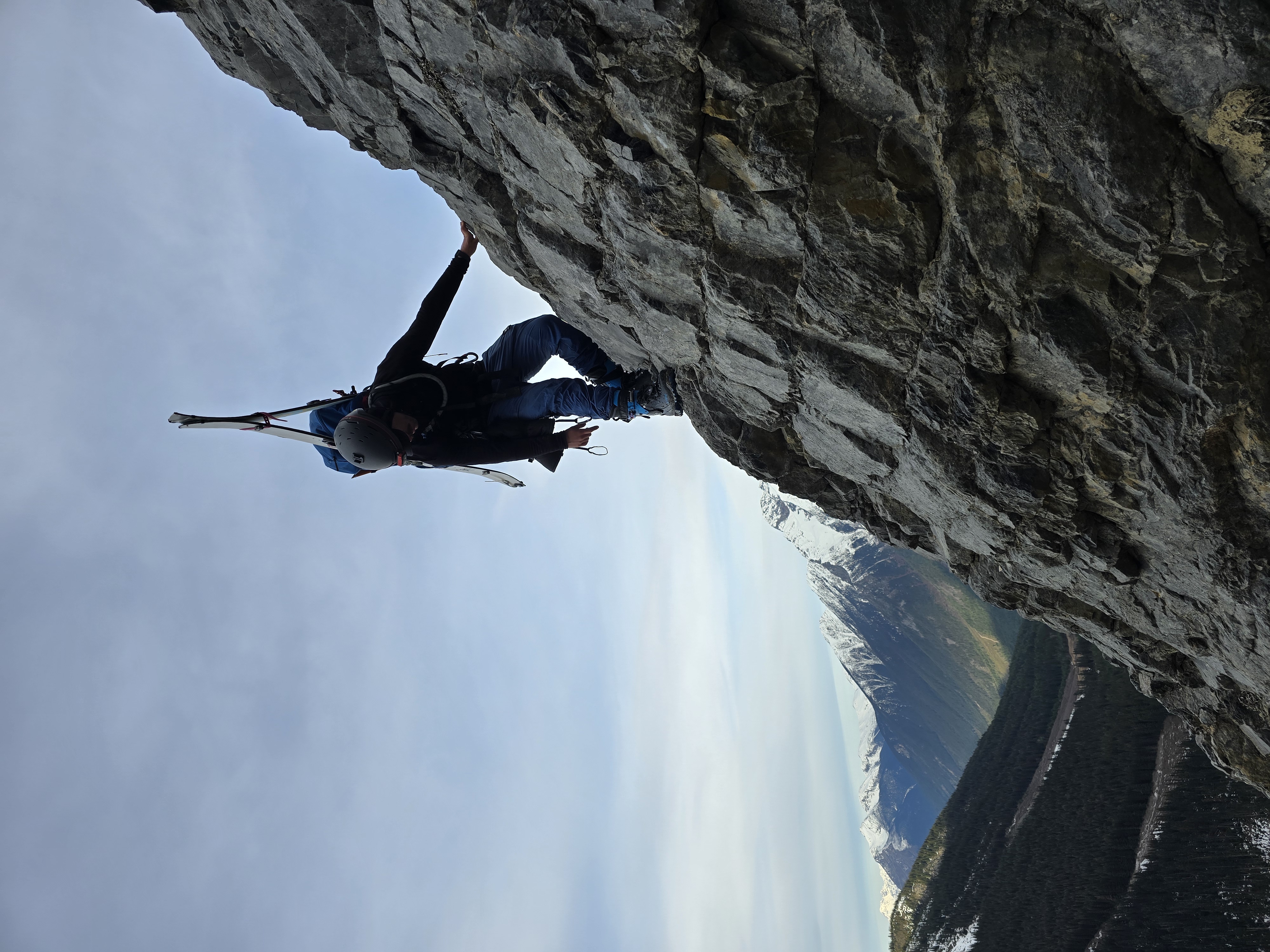
Charles tests his setup
DAY 2: Wednesday, May 8th
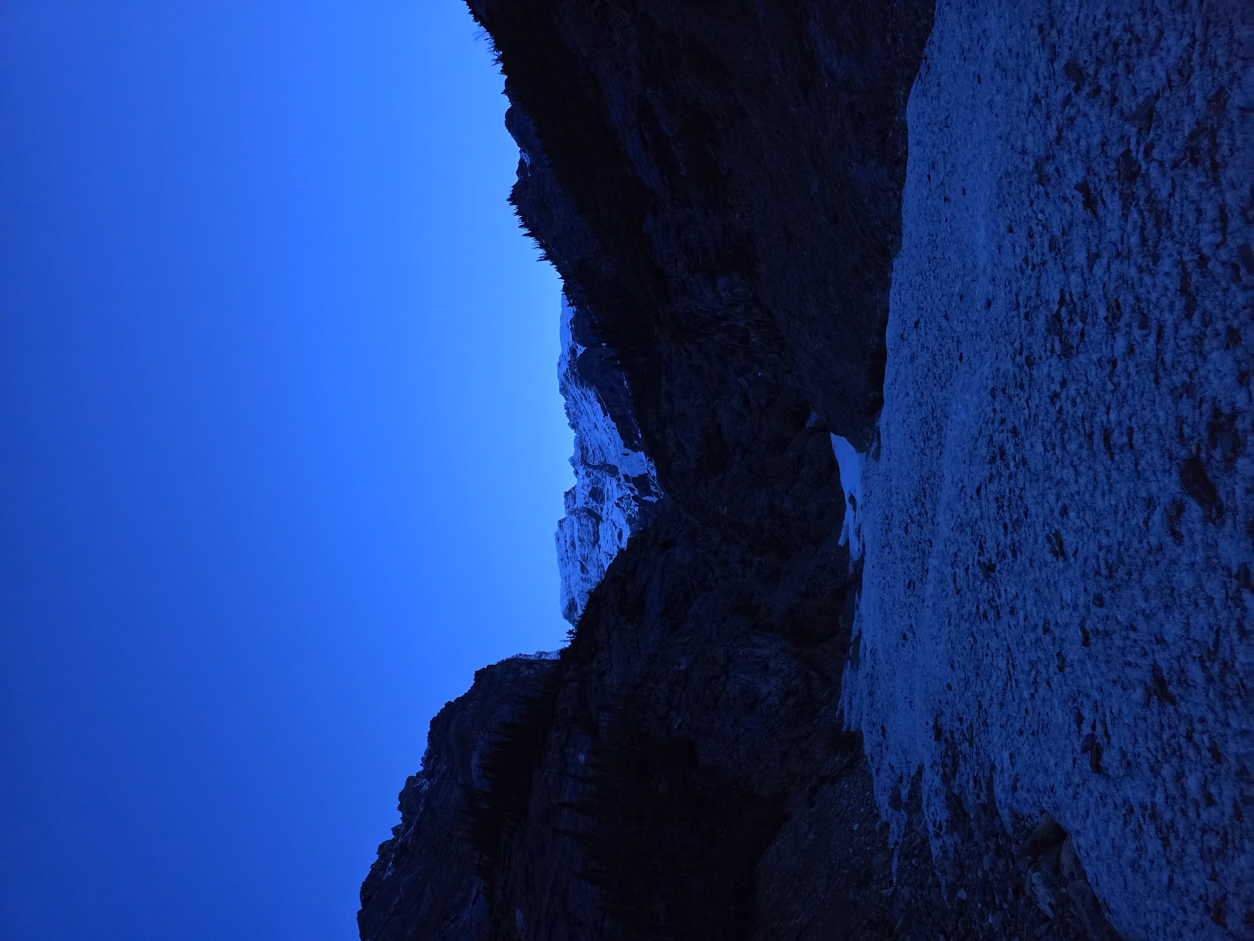
The turnoff to get to the Patterson Spur area approach is not obvious. Despite having my previous GPX of the route, I still chose a suboptimal entrance and spent some energy negotiating fallen trees with skis on my backpack. Once through, the going is (mostly) easy; it’s very well flagged and obvious, but branches kept stopping me in my tracks and forcing me to tilt or lean back to free my skis. Despite this we made quick progress and soon found ourselves at the base of the lower couloir.
Is this skiing?
At this point, we chose to ascend the lovely-looking lower couloir to the bench instead of investigating the decidedly more convoluted lower scramble on the summer route. This was a serious mistake. It was only when we had ascended a considerable portion of the couloir that I noticed the serac looming above us in the dark. I sped up and urged Charles to do the same, figuring it was faster to go up than down at this point. As we got closer I became increasingly horrified at the thought that the serac was actively blocking the exit to the bench; it was not obvious that there was an escape from the steep walls of the couloir that didn’t involve climbing any of the (rather aesthetic) frozen waterfalls that lined the sides. Luckily, a ramp appeared as we neared the seracs and we escaped out to the right. When we went to observe the route later in the trip, we saw that the ramp had been obliterated by rockfall, and now involved traversing across ~35° glacier ice above a cliff for 30 meters or so, which might be tough depending on your crampon choice and experience level. Ascending the lower couloir was my biggest regret of the trip. In hindsight, that line is unjustifiably risky when the summer route is right beside it and manageable even with snow.
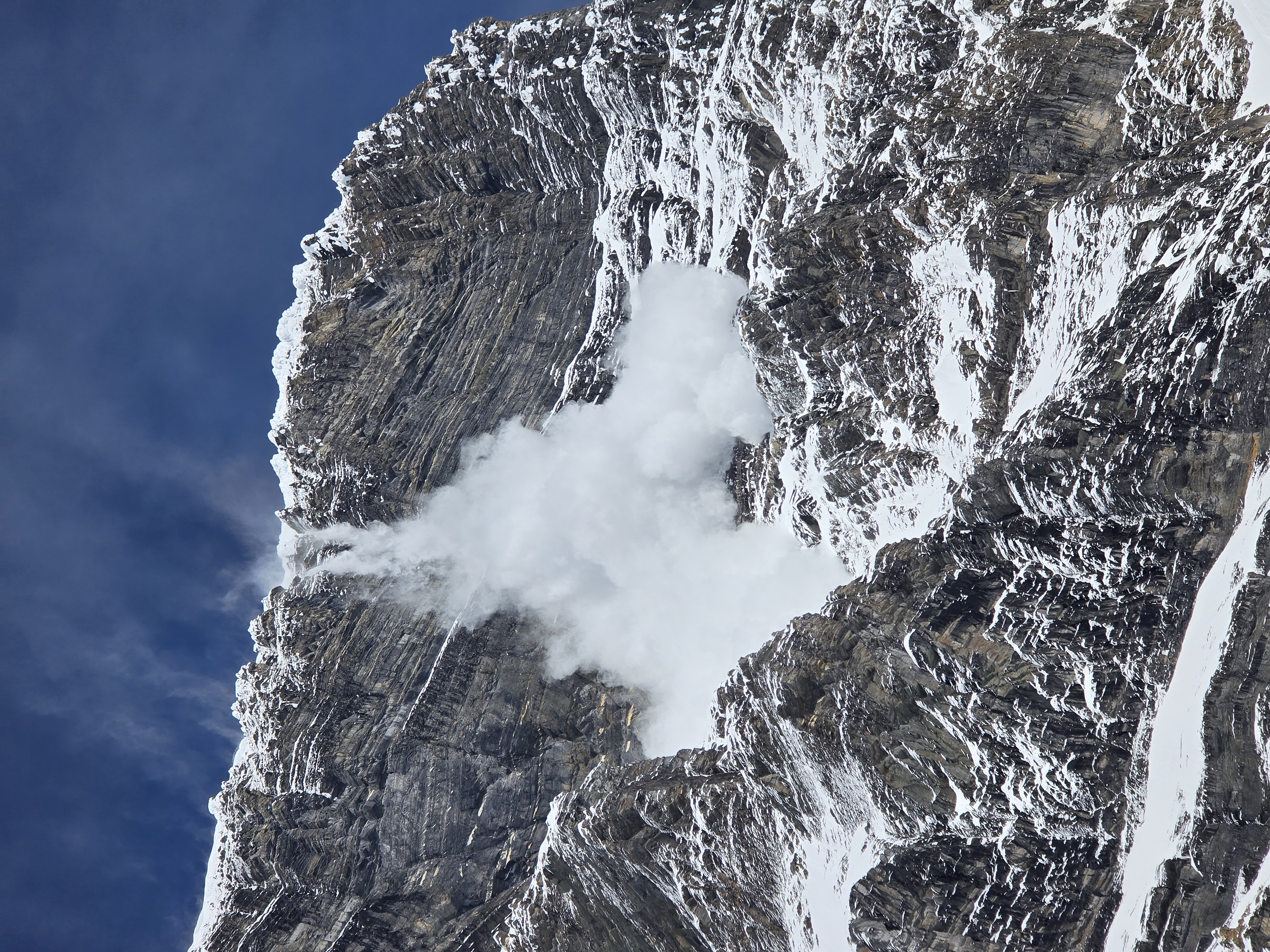
Overhead? What overhead?
This overhead.

This is what it feels like to chew 5 gum. Or play Russian Roulette.
By 7am, we chose a campsite on the ridge of a small moraine that was well away from any possible avalanche hazard. By 8am, avalanches began to rock down the east-facing wall, and we enjoyed the spectacle as we ate, rested, and skied some laps of perfect corn snow near our camp.
Free live entertainment from camp. What could be better?
DAY 3: Thursday, May 9th
I had planned to wake up at 8pm to give us ample time to ascend; I figured we could always wait for sunrise, but could only rush so much to catch up. Unfortunately, our camp was too comfortable, and we slept through our alarms. We woke up at 11:17pm and rushed to get going, soon setting off towards the fan of avalanche debris at the base of the couloir. Since I had declined to take ski crampons, I was struggling on the icy crust and switched to post-holing my way up. Charles made it a bit further with ski crampons, but not enough to justify the pack weight in my view. The deep avalanche runnels made for high-quality climbing. When these ended, I kicked steps the rest of the way up on snow that was less avalanche-stricken.
The couloir was much steeper than it looks from afar, which was strange; I find it’s usually the opposite. Charles, having recently skied Aemmer Couloir on Mt Temple, said that the Patterson Couloir is definitely the harder of the two.
Upon topping out, we quickly crossed the glacier to the base of the Kain Face. We skinned as far as we could, pausing as gusts of wind up to ~70km/hr tried their hardest to knock us down the face. Soon, we transitioned and made quick work of the face. I was starting to get tired from having kicked steps the whole way up Patterson, so we began to take turns. This worked well and we reached the ridge in about an hour of climbing.

Mt Resplendent

Charles leading the way

The upper SE Ridge. Very foreshortened (and much steeper than it looks in this photo)
Charles led the way as we traversed to the base of the steep climbing on the upper Southeast ridge. As he continued to break trail ahead of me, he did not lose enough elevation with his chosen line and stepped too close to the edge, causing the cornice to his right to break off at the tip of his ice axe. We took a moment to calm our shaken nerves and continued (further from the edge this time). That ridge holds some of the biggest cornices we have ever seen; be careful, and remember that they break much further back from the edge than you think.
When we got to the base of the Southeast ridge, Charles, seeing the icy and wind-blown conditions, decided that he would not attempt to ride the line and left his splitboard at the base. We took turns as we climbed again, this time with Charles taking on the majority of the work. The biggest risk with the ridge would probably be all the crevasses. I kicked through a snow bridge low down (but didn’t fall in). Charles kicked through a different one higher up and somehow didn’t even notice; I saw the hole as I was climbing up beneath him. We weren’t roped up, but if conditions had been any worse, I certainly would have wanted to be.

Beneath the Gargoyles
The most unfortunate thing about the ridge is how it ends with yet another traverse; the true summit is further on. We trudged our way through snow, fighting 80km/hr gusts of wind, and took turns standing on the true summit while the other took photos. Other than the wind, the conditions were perfect; it was a bluebird day which is fairly rare on Robson.
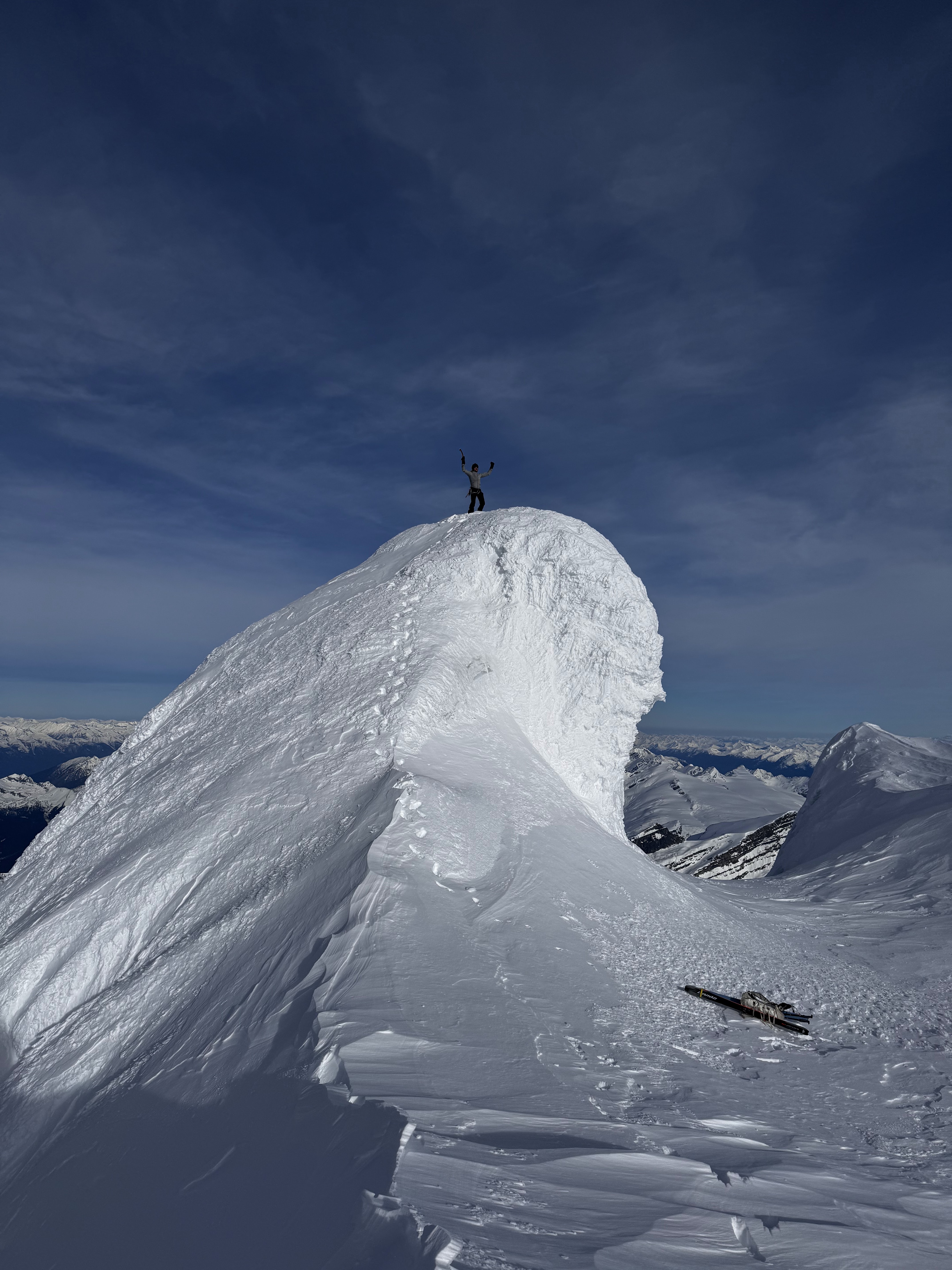
Charles set off down the ridge in crampons (punching a leg through snow bridges at least twice near the bottom of the ridge). Meanwhile, I took shelter from the wind beneath one of the highest Gargoyles on the ridge and transitioned into ski mode. Unfortunately, the sun had not yet softened the upper ridge, and I could not afford to wait for that to happen. My descent of the ridge was not particularly graceful and I sideslipped more than I care to admit. I think skiing the upper ridge is more significant than skiing the Kain face proper. The cruxes are just as steep, but the exposure makes the line feel much more serious, and the texture/variability in the terrain with the Gargoyles makes it feel more otherworldly.
I skied back to the top of the Kain Face while Charles transitioned on the ridge. I dropped first, cutting across the top of the face. Conditions were prime; the snow was soft enough to hold an edge nicely, but not so soft that there was a problem with sluff. We alternated linking turns down the face, and crossed over the well-bridge bergschrund at the bottom. The descent was remarkably pleasant and straightforward; I can imagine no better way to descend the Kain Face.
The Kain Face
We then ripped across the glacier to the top of the Patterson Couloir. We were somewhat behind schedule and I wanted to rush; I knew that the east-facing wall would soon start falling apart on top of us based on my observations the previous day. What I didn’t realize was just how shaded the couloir was; I started down the couloir only to realize, in horror, that the ~55° crux at the top was still icy. To make matters worse, what had felt like a faint breeze on the glacier was now becoming a vicious wind that felt like it was pushing me down the couloir, while also sending a steady stream of spindrift down on top of me. I made a single turn, then sideslipped for some distance. Soon enough, I gave up and punched a platform in the snow for me to transition back to crampons; conditions were unsafe to ski. I moved down a few steps before noticing the increasing volume of spindrift and rocks rocking down the couloir. I checked the time and decided that we wouldn’t be able to downclimb nearly fast enough to get out before it was too late. I switched to ascending and told Charles to do the same. Going down means death.
Death, probably.
At the top of the couloir, conditions felt noticeably less extreme. We walked ~50m away and I dug a pit sheltered from the wind and then used his snowboard and my skis to make a dry bench for us to sit on. We stayed here until the evening, napping, chatting, and melting water with our body heat and the sun until the evening when the sounds of avalanches and rock/ice fall stopped. I was keen to wait until nightfall proper and downclimb in crampons, since I was worried the snow would be isothermal. Charles convinced me that it was worthwhile to at least check it out, and see if the snow was any good near the top of the couloir. So, we did; he set off first down the couloir on surprisingly reasonable snow.

When in doubt, sit it out.
About a third of the way down the descent, we reached the avi debris and runnels. Unfortunately, my skinny skimo skis (or perhaps my skimo skills) were insufficient for the job; after a few horrifying jump turns I capitulated and switched to walking down the couloir. At first it was fine, but as I got lower and the snow became softer, the post-holing was atrocious. To solve the problem, I tried to glissade sitting down, with my skis on my backpack cutting into the snow behind me and adding drag. This was highly effective, but surprisingly core-intensive.
Back at camp, we set back up our camping arrangements and decided to leave the next morning.
DAY 4: Friday, May 10th
We slept, woke up at 2:05am, and descended the lower scramble (instead of the lower couloir). It certainly takes longer when snowy and with the ski setup on our backs, but it’s more manageable than I had feared.

A quick hike and bike ride later, and we were back at the car. We had some food in Jasper (I insisted on pancakes) and stopped at the Columbia Icefields on the drive back to review GoPro footage and sort out our gear.
4 | Safety Considerations
In my view, “safely” completing this route requires that you:
- Feel comfortable skiing up to 55° no-fall terrain in variable conditions;
- Feel comfortable climbing/downclimbing loose 4th-class limestone in ski boots, with a heavy backpack (to which skis are attached);
- Can efficiently climb/downclimb steep, icy snow;
- Can evaluate spring avalanche/rockfall hazard, with good terrain awareness (e.g. noticing that the upper slopes of the east-facing wall far above you gets sun and threatens you with avalanches/rocks even when the line itself is still frozen solid);
- Have a good understanding of safe glacier travel/rescue techniques.
Perhaps more importantly—even by Rockies standards—this route takes on considerable objective hazard. I do not think that it can be done in a way that is remotely “safe,” in that even when well-mitigated, the risk is still fairly high. It is hard to adequately stress the danger in the Patterson couloir; the amount of exposure to overhead hazards is significant and hard to mitigate. Getting the timing and conditions right is incredibly difficult. We were lucky that our weather window let us wait at the top of the couloir for conditions to improve; if that option had not been available to us, I would have insisted we turn around long before making the summit. Just moving faster is not a particularly realistic solution to this problem, especially if you want to enjoy the skiing like we did. This is a serious route on a serious mountain; just because it is “technically” quite easy (e.g. a climbing crux of 55° snow) it does not follow that it can be taken lightly.
That is a proud effort, thank you for sharing and also including your decision making process.
I am glad that the snow softened enough on the Kain Face, those tracks look great!
It is interesting to hear about the condition of the summer route and the ridge scramble. 9 years ago I was up there and it seemed fine. That being said, I can definitely imagine it being much sketchier and difficult when the glacier recedes. With not much info online, this is a great resource for people contemplating this line. Thanks again for writing this.
Be sure to link the video once you get it uploaded.
Take care and be safe!